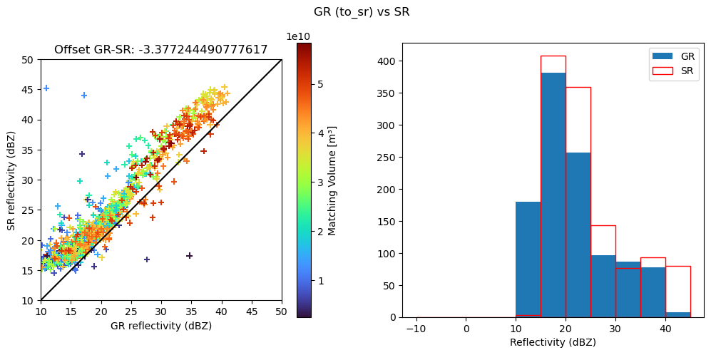
Match spaceborn SR (GPM/TRMM) with ground radars GR#
The idea is to match ground radar (GR) and space-born radar (SR) measurements in order to create spatially and temporally coicident samples without interpolation. The procedure had been suggested by Schwaller and Morris (2011) and is based on the adaption by Warren, et. al. (2017).
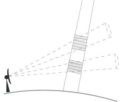
The basic principle is illustrated in Fig. 2 of the original paper of Schwaller and Morris (2011):
Quote Warren, et.al: “[…] In this approach, intersections between indi vidual SR beams and GR elevation sweeps are identified and the reflectivity values from both instruments are averaged within a spatial neighborhood around the intersection. Specifically, SR data are averaged in range over the width of the GR beam at the GR range of the intersection, while GR data are averaged in the range–azimuth plane within the footprint of the SR beam. The result is a pair of reflectivity measurements corresponding to approximately the same volume of atmosphere. […]”.
This becomes clearer in Fig. 3: 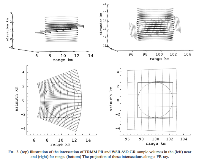
Schwaller, MR, and Morris, KR. 2011. A ground validation network for the Global Precipitation Measurement mission. J. Atmos. Oceanic Technol., 28, 301-319.
Warren, R.A., A. Protat, S.T. Siems, H.A. Ramsay, V. Louf, M.J. Manton, and T.A. Kane, 0: Calibrating ground-based radars against TRMM and GPM. J. Atmos. Oceanic Technol., 0,
Conventions#
This code is based on the following conventions:
grindicates ground radarsrindicates space-born precipitation radar (TRMM or GPM)
The base routines are designed to process one GR sweep at a time. If a full GR volume with nelev of sweeps is available, you can iterate over each sweep. In this code, ee is an index that points to one of the nelev sweeps/elevation angles. Accordingly, a GR data set will be organised as an array of shape (nelev_gr, nray_gr, ngate_gr).
A SR data set is typically organised as arrays with dimensions (nscan_sr, nray_sr, ngate_sr).
[1]:
import warnings

#warnings.filterwarnings("ignore")
import wradlib as wrl
import matplotlib.pyplot as plt
import matplotlib as mpl

try:
    get_ipython().run_line_magic("matplotlib inline")
except:
    plt.ion()

import numpy as np
import datetime as dt
from osgeo import osr
import xarray as xr
import xradar as xd
/home/runner/micromamba/envs/wradlib-tests/lib/python3.11/site-packages/h5py/__init__.py:36: UserWarning: h5py is running against HDF5 1.14.3 when it was built against 1.14.2, this may cause problems
  _warn(("h5py is running against HDF5 {0} when it was built against {1}, "
Acquire datafiles#
[2]:
# define GPM data set
gpm_file = wrl.util.get_wradlib_data_file(
    "gpm/2A-CS-151E24S154E30S.GPM.Ku.V7-20170308.20141206-S095002-E095137.004383.V05A.HDF5"
)
# define matching ground radar file
gr2gpm_file = wrl.util.get_wradlib_data_file("hdf5/IDR66_20141206_094829.vol.h5")

# define TRMM data sets
trmm_2a23_file = wrl.util.get_wradlib_data_file(
    "trmm/2A-CS-151E24S154E30S.TRMM.PR.2A23.20100206-S111425-E111526.069662.7.HDF"
)
trmm_2a25_file = wrl.util.get_wradlib_data_file(
    "trmm/2A-CS-151E24S154E30S.TRMM.PR.2A25.20100206-S111425-E111526.069662.7.HDF"
)

# define matching ground radar file
gr2trmm_file = wrl.util.get_wradlib_data_file("hdf5/IDR66_20100206_111233.vol.h5")
Downloading file 'gpm/2A-CS-151E24S154E30S.GPM.Ku.V7-20170308.20141206-S095002-E095137.004383.V05A.HDF5' from 'https://github.com/wradlib/wradlib-data/raw/pooch/data/gpm/2A-CS-151E24S154E30S.GPM.Ku.V7-20170308.20141206-S095002-E095137.004383.V05A.HDF5' to '/home/runner/work/wradlib/wradlib/wradlib-data'.
Downloading file 'hdf5/IDR66_20141206_094829.vol.h5' from 'https://github.com/wradlib/wradlib-data/raw/pooch/data/hdf5/IDR66_20141206_094829.vol.h5' to '/home/runner/work/wradlib/wradlib/wradlib-data'.
Downloading file 'trmm/2A-CS-151E24S154E30S.TRMM.PR.2A23.20100206-S111425-E111526.069662.7.HDF' from 'https://github.com/wradlib/wradlib-data/raw/pooch/data/trmm/2A-CS-151E24S154E30S.TRMM.PR.2A23.20100206-S111425-E111526.069662.7.HDF' to '/home/runner/work/wradlib/wradlib/wradlib-data'.
Downloading file 'trmm/2A-CS-151E24S154E30S.TRMM.PR.2A25.20100206-S111425-E111526.069662.7.HDF' from 'https://github.com/wradlib/wradlib-data/raw/pooch/data/trmm/2A-CS-151E24S154E30S.TRMM.PR.2A25.20100206-S111425-E111526.069662.7.HDF' to '/home/runner/work/wradlib/wradlib/wradlib-data'.
Downloading file 'hdf5/IDR66_20100206_111233.vol.h5' from 'https://github.com/wradlib/wradlib-data/raw/pooch/data/hdf5/IDR66_20100206_111233.vol.h5' to '/home/runner/work/wradlib/wradlib/wradlib-data'.
Set SR and GR parameters#
[3]:
# Space-born precipitation radar parameters
sr_pars = {
    "trmm": {
        "zt": 402500.0,  # orbital height of TRMM (post boost)   APPROXIMATION!
        "dr": 250.0,  # gate spacing of TRMM
        "gr_file": gr2trmm_file,
    },
    "gpm": {
        "zt": 407000.0,  # orbital height of GPM                 APPROXIMATION!
        "dr": 125.0,  # gate spacing of GPM
        "gr_file": gr2gpm_file,
    },
}
[4]:
# Set parameters for this procedure
bw_sr = 0.71  # SR beam width
platf = "gpm"  # SR platform/product: one out of ["gpm", "trmm"]
zt = sr_pars[platf]["zt"]  # SR orbit height (meters)
dr_sr = sr_pars[platf]["dr"]  # SR gate length (meters)
gr_file = sr_pars[platf]["gr_file"]
ee = 2  # Index that points to the GR elevation angle to be used
Data Input#
Ground Radar GR#
Read GR data into datatree using xradar#
The following code reads data in ODIM H5 format. If your GR data is in some other format respective adaptions are needed.
[5]:
gr_data = xd.io.open_odim_datatree(gr_file)
display(gr_data)
<xarray.DatasetView>
Dimensions:              ()
Data variables:
    volume_number        int64 0
    platform_type        <U5 'fixed'
    instrument_type      <U5 'radar'
    time_coverage_start  <U20 '2014-12-06T09:48:29Z'
    time_coverage_end    <U20 '2014-12-06T09:53:15Z'
    longitude            float64 153.2
    altitude             float64 175.0
    latitude             float64 -27.72
Attributes:
    Conventions:      None
    version:          None
    title:            None
    institution:      None
    references:       None
    source:           None
    history:          None
    comment:          im/exported using xradar
instrument_name: None- azimuth: 360
- range: 600
- elevation(azimuth)float32...
- standard_name :
- ray_elevation_angle
- long_name :
- elevation_angle_from_horizontal_plane
- units :
- degrees
- axis :
- radial_elevation_coordinate
[360 values with dtype=float32]
- time(azimuth)datetime64[ns]2014-12-06T09:48:29.044444672 .....
- standard_name :
- time
array(['2014-12-06T09:48:29.044444672', '2014-12-06T09:48:29.133333504', '2014-12-06T09:48:29.222222336', ..., '2014-12-06T09:49:00.777776128', '2014-12-06T09:49:00.866664960', '2014-12-06T09:49:00.955553792'], dtype='datetime64[ns]') - range(range)float32125.0 375.0 ... 1.496e+05 1.499e+05
- units :
- meters
- standard_name :
- projection_range_coordinate
- long_name :
- range_to_measurement_volume
- axis :
- radial_range_coordinate
- meters_between_gates :
- 250.0
- spacing_is_constant :
- true
- meters_to_center_of_first_gate :
- 125.0
array([1.25000e+02, 3.75000e+02, 6.25000e+02, ..., 1.49375e+05, 1.49625e+05, 1.49875e+05], dtype=float32) - longitude()float64...
- long_name :
- longitude
- units :
- degrees_east
- standard_name :
- longitude
[1 values with dtype=float64]
- latitude()float64...
- long_name :
- latitude
- units :
- degrees_north
- positive :
- up
- standard_name :
- latitude
[1 values with dtype=float64]
- altitude()float64...
- long_name :
- altitude
- units :
- meters
- standard_name :
- altitude
[1 values with dtype=float64]
- azimuth(azimuth)float320.5 1.5 2.5 ... 357.5 358.5 359.5
- standard_name :
- ray_azimuth_angle
- long_name :
- azimuth_angle_from_true_north
- units :
- degrees
- axis :
- radial_azimuth_coordinate
array([ 0.5, 1.5, 2.5, ..., 357.5, 358.5, 359.5], dtype=float32)
- DBZH(azimuth, range)float32...
- _Undetect :
- 0.0
- units :
- dBZ
- standard_name :
- radar_equivalent_reflectivity_factor_h
- long_name :
- Equivalent reflectivity factor H
[216000 values with dtype=float32]
- sweep_mode()<U20...
[1 values with dtype=<U20]
- sweep_number()int64...
[1 values with dtype=int64]
- prt_mode()<U7...
[1 values with dtype=<U7]
- follow_mode()<U7...
[1 values with dtype=<U7]
- sweep_fixed_angle()float64...
[1 values with dtype=float64]
<xarray.DatasetView> Dimensions: (azimuth: 360, range: 600) Coordinates: elevation (azimuth) float32 ... time (azimuth) datetime64[ns] 2014-12-06T09:48:29.044444672... * range (range) float32 125.0 375.0 625.0 ... 1.496e+05 1.499e+05 longitude float64 ... latitude float64 ... altitude float64 ... * azimuth (azimuth) float32 0.5 1.5 2.5 3.5 ... 357.5 358.5 359.5 Data variables: DBZH (azimuth, range) float32 ... sweep_mode <U20 ... sweep_number int64 ... prt_mode <U7 ... follow_mode <U7 ... sweep_fixed_angle float64 ...sweep_0- azimuth: 360
- range: 600
- elevation(azimuth)float32...
- standard_name :
- ray_elevation_angle
- long_name :
- elevation_angle_from_horizontal_plane
- units :
- degrees
- axis :
- radial_elevation_coordinate
[360 values with dtype=float32]
- time(azimuth)datetime64[ns]2014-12-06T09:49:02.038888960 .....
- standard_name :
- time
array(['2014-12-06T09:49:02.038888960', '2014-12-06T09:49:02.116666880', '2014-12-06T09:49:02.194444544', ..., '2014-12-06T09:49:29.805585920', '2014-12-06T09:49:29.883363840', '2014-12-06T09:49:29.961141504'], dtype='datetime64[ns]') - range(range)float32125.0 375.0 ... 1.496e+05 1.499e+05
- units :
- meters
- standard_name :
- projection_range_coordinate
- long_name :
- range_to_measurement_volume
- axis :
- radial_range_coordinate
- meters_between_gates :
- 250.0
- spacing_is_constant :
- true
- meters_to_center_of_first_gate :
- 125.0
array([1.25000e+02, 3.75000e+02, 6.25000e+02, ..., 1.49375e+05, 1.49625e+05, 1.49875e+05], dtype=float32) - longitude()float64...
- long_name :
- longitude
- units :
- degrees_east
- standard_name :
- longitude
[1 values with dtype=float64]
- latitude()float64...
- long_name :
- latitude
- units :
- degrees_north
- positive :
- up
- standard_name :
- latitude
[1 values with dtype=float64]
- altitude()float64...
- long_name :
- altitude
- units :
- meters
- standard_name :
- altitude
[1 values with dtype=float64]
- azimuth(azimuth)float320.5 1.5 2.5 ... 357.5 358.5 359.5
- standard_name :
- ray_azimuth_angle
- long_name :
- azimuth_angle_from_true_north
- units :
- degrees
- axis :
- radial_azimuth_coordinate
array([ 0.5, 1.5, 2.5, ..., 357.5, 358.5, 359.5], dtype=float32)
- DBZH(azimuth, range)float32...
- _Undetect :
- 0.0
- units :
- dBZ
- standard_name :
- radar_equivalent_reflectivity_factor_h
- long_name :
- Equivalent reflectivity factor H
[216000 values with dtype=float32]
- sweep_mode()<U20...
[1 values with dtype=<U20]
- sweep_number()int64...
[1 values with dtype=int64]
- prt_mode()<U7...
[1 values with dtype=<U7]
- follow_mode()<U7...
[1 values with dtype=<U7]
- sweep_fixed_angle()float64...
[1 values with dtype=float64]
<xarray.DatasetView> Dimensions: (azimuth: 360, range: 600) Coordinates: elevation (azimuth) float32 ... time (azimuth) datetime64[ns] 2014-12-06T09:49:02.038888960... * range (range) float32 125.0 375.0 625.0 ... 1.496e+05 1.499e+05 longitude float64 ... latitude float64 ... altitude float64 ... * azimuth (azimuth) float32 0.5 1.5 2.5 3.5 ... 357.5 358.5 359.5 Data variables: DBZH (azimuth, range) float32 ... sweep_mode <U20 ... sweep_number int64 ... prt_mode <U7 ... follow_mode <U7 ... sweep_fixed_angle float64 ...sweep_1- azimuth: 360
- range: 600
- elevation(azimuth)float32...
- standard_name :
- ray_elevation_angle
- long_name :
- elevation_angle_from_horizontal_plane
- units :
- degrees
- axis :
- radial_elevation_coordinate
[360 values with dtype=float32]
- time(azimuth)datetime64[ns]2014-12-06T09:49:31.036111104 .....
- standard_name :
- time
array(['2014-12-06T09:49:31.036111104', '2014-12-06T09:49:31.108333312', '2014-12-06T09:49:31.180555520', ..., '2014-12-06T09:49:56.819448320', '2014-12-06T09:49:56.891670528', '2014-12-06T09:49:56.963892736'], dtype='datetime64[ns]') - range(range)float32125.0 375.0 ... 1.496e+05 1.499e+05
- units :
- meters
- standard_name :
- projection_range_coordinate
- long_name :
- range_to_measurement_volume
- axis :
- radial_range_coordinate
- meters_between_gates :
- 250.0
- spacing_is_constant :
- true
- meters_to_center_of_first_gate :
- 125.0
array([1.25000e+02, 3.75000e+02, 6.25000e+02, ..., 1.49375e+05, 1.49625e+05, 1.49875e+05], dtype=float32) - longitude()float64...
- long_name :
- longitude
- units :
- degrees_east
- standard_name :
- longitude
[1 values with dtype=float64]
- latitude()float64...
- long_name :
- latitude
- units :
- degrees_north
- positive :
- up
- standard_name :
- latitude
[1 values with dtype=float64]
- altitude()float64...
- long_name :
- altitude
- units :
- meters
- standard_name :
- altitude
[1 values with dtype=float64]
- azimuth(azimuth)float320.5 1.5 2.5 ... 357.5 358.5 359.5
- standard_name :
- ray_azimuth_angle
- long_name :
- azimuth_angle_from_true_north
- units :
- degrees
- axis :
- radial_azimuth_coordinate
array([ 0.5, 1.5, 2.5, ..., 357.5, 358.5, 359.5], dtype=float32)
- DBZH(azimuth, range)float32...
- _Undetect :
- 0.0
- units :
- dBZ
- standard_name :
- radar_equivalent_reflectivity_factor_h
- long_name :
- Equivalent reflectivity factor H
[216000 values with dtype=float32]
- sweep_mode()<U20...
[1 values with dtype=<U20]
- sweep_number()int64...
[1 values with dtype=int64]
- prt_mode()<U7...
[1 values with dtype=<U7]
- follow_mode()<U7...
[1 values with dtype=<U7]
- sweep_fixed_angle()float64...
[1 values with dtype=float64]
<xarray.DatasetView> Dimensions: (azimuth: 360, range: 600) Coordinates: elevation (azimuth) float32 ... time (azimuth) datetime64[ns] 2014-12-06T09:49:31.036111104... * range (range) float32 125.0 375.0 625.0 ... 1.496e+05 1.499e+05 longitude float64 ... latitude float64 ... altitude float64 ... * azimuth (azimuth) float32 0.5 1.5 2.5 3.5 ... 357.5 358.5 359.5 Data variables: DBZH (azimuth, range) float32 ... sweep_mode <U20 ... sweep_number int64 ... prt_mode <U7 ... follow_mode <U7 ... sweep_fixed_angle float64 ...sweep_2- azimuth: 360
- range: 600
- elevation(azimuth)float32...
- standard_name :
- ray_elevation_angle
- long_name :
- elevation_angle_from_horizontal_plane
- units :
- degrees
- axis :
- radial_elevation_coordinate
[360 values with dtype=float32]
- time(azimuth)datetime64[ns]2014-12-06T09:49:58.029166592 .....
- standard_name :
- time
array(['2014-12-06T09:49:58.029166592', '2014-12-06T09:49:58.087500032', '2014-12-06T09:49:58.145833472', ..., '2014-12-06T09:50:18.854189312', '2014-12-06T09:50:18.912522752', '2014-12-06T09:50:18.970856192'], dtype='datetime64[ns]') - range(range)float32125.0 375.0 ... 1.496e+05 1.499e+05
- units :
- meters
- standard_name :
- projection_range_coordinate
- long_name :
- range_to_measurement_volume
- axis :
- radial_range_coordinate
- meters_between_gates :
- 250.0
- spacing_is_constant :
- true
- meters_to_center_of_first_gate :
- 125.0
array([1.25000e+02, 3.75000e+02, 6.25000e+02, ..., 1.49375e+05, 1.49625e+05, 1.49875e+05], dtype=float32) - longitude()float64...
- long_name :
- longitude
- units :
- degrees_east
- standard_name :
- longitude
[1 values with dtype=float64]
- latitude()float64...
- long_name :
- latitude
- units :
- degrees_north
- positive :
- up
- standard_name :
- latitude
[1 values with dtype=float64]
- altitude()float64...
- long_name :
- altitude
- units :
- meters
- standard_name :
- altitude
[1 values with dtype=float64]
- azimuth(azimuth)float320.5 1.5 2.5 ... 357.5 358.5 359.5
- standard_name :
- ray_azimuth_angle
- long_name :
- azimuth_angle_from_true_north
- units :
- degrees
- axis :
- radial_azimuth_coordinate
array([ 0.5, 1.5, 2.5, ..., 357.5, 358.5, 359.5], dtype=float32)
- DBZH(azimuth, range)float32...
- _Undetect :
- 0.0
- units :
- dBZ
- standard_name :
- radar_equivalent_reflectivity_factor_h
- long_name :
- Equivalent reflectivity factor H
[216000 values with dtype=float32]
- sweep_mode()<U20...
[1 values with dtype=<U20]
- sweep_number()int64...
[1 values with dtype=int64]
- prt_mode()<U7...
[1 values with dtype=<U7]
- follow_mode()<U7...
[1 values with dtype=<U7]
- sweep_fixed_angle()float64...
[1 values with dtype=float64]
<xarray.DatasetView> Dimensions: (azimuth: 360, range: 600) Coordinates: elevation (azimuth) float32 ... time (azimuth) datetime64[ns] 2014-12-06T09:49:58.029166592... * range (range) float32 125.0 375.0 625.0 ... 1.496e+05 1.499e+05 longitude float64 ... latitude float64 ... altitude float64 ... * azimuth (azimuth) float32 0.5 1.5 2.5 3.5 ... 357.5 358.5 359.5 Data variables: DBZH (azimuth, range) float32 ... sweep_mode <U20 ... sweep_number int64 ... prt_mode <U7 ... follow_mode <U7 ... sweep_fixed_angle float64 ...sweep_3- azimuth: 360
- range: 600
- elevation(azimuth)float32...
- standard_name :
- ray_elevation_angle
- long_name :
- elevation_angle_from_horizontal_plane
- units :
- degrees
- axis :
- radial_elevation_coordinate
[360 values with dtype=float32]
- time(azimuth)datetime64[ns]2014-12-06T09:50:20.022222336 .....
- standard_name :
- time
array(['2014-12-06T09:50:20.022222336', '2014-12-06T09:50:20.066666752', '2014-12-06T09:50:20.111111424', ..., '2014-12-06T09:50:35.888930560', '2014-12-06T09:50:35.933375232', '2014-12-06T09:50:35.977819648'], dtype='datetime64[ns]') - range(range)float32125.0 375.0 ... 1.496e+05 1.499e+05
- units :
- meters
- standard_name :
- projection_range_coordinate
- long_name :
- range_to_measurement_volume
- axis :
- radial_range_coordinate
- meters_between_gates :
- 250.0
- spacing_is_constant :
- true
- meters_to_center_of_first_gate :
- 125.0
array([1.25000e+02, 3.75000e+02, 6.25000e+02, ..., 1.49375e+05, 1.49625e+05, 1.49875e+05], dtype=float32) - longitude()float64...
- long_name :
- longitude
- units :
- degrees_east
- standard_name :
- longitude
[1 values with dtype=float64]
- latitude()float64...
- long_name :
- latitude
- units :
- degrees_north
- positive :
- up
- standard_name :
- latitude
[1 values with dtype=float64]
- altitude()float64...
- long_name :
- altitude
- units :
- meters
- standard_name :
- altitude
[1 values with dtype=float64]
- azimuth(azimuth)float320.5 1.5 2.5 ... 357.5 358.5 359.5
- standard_name :
- ray_azimuth_angle
- long_name :
- azimuth_angle_from_true_north
- units :
- degrees
- axis :
- radial_azimuth_coordinate
array([ 0.5, 1.5, 2.5, ..., 357.5, 358.5, 359.5], dtype=float32)
- DBZH(azimuth, range)float32...
- _Undetect :
- 0.0
- units :
- dBZ
- standard_name :
- radar_equivalent_reflectivity_factor_h
- long_name :
- Equivalent reflectivity factor H
[216000 values with dtype=float32]
- sweep_mode()<U20...
[1 values with dtype=<U20]
- sweep_number()int64...
[1 values with dtype=int64]
- prt_mode()<U7...
[1 values with dtype=<U7]
- follow_mode()<U7...
[1 values with dtype=<U7]
- sweep_fixed_angle()float64...
[1 values with dtype=float64]
<xarray.DatasetView> Dimensions: (azimuth: 360, range: 600) Coordinates: elevation (azimuth) float32 ... time (azimuth) datetime64[ns] 2014-12-06T09:50:20.022222336... * range (range) float32 125.0 375.0 625.0 ... 1.496e+05 1.499e+05 longitude float64 ... latitude float64 ... altitude float64 ... * azimuth (azimuth) float32 0.5 1.5 2.5 3.5 ... 357.5 358.5 359.5 Data variables: DBZH (azimuth, range) float32 ... sweep_mode <U20 ... sweep_number int64 ... prt_mode <U7 ... follow_mode <U7 ... sweep_fixed_angle float64 ...sweep_4- azimuth: 360
- range: 600
- elevation(azimuth)float32...
- standard_name :
- ray_elevation_angle
- long_name :
- elevation_angle_from_horizontal_plane
- units :
- degrees
- axis :
- radial_elevation_coordinate
[360 values with dtype=float32]
- time(azimuth)datetime64[ns]2014-12-06T09:50:37.022222336 .....
- standard_name :
- time
array(['2014-12-06T09:50:37.022222336', '2014-12-06T09:50:37.066666752', '2014-12-06T09:50:37.111111424', ..., '2014-12-06T09:50:52.888930560', '2014-12-06T09:50:52.933375232', '2014-12-06T09:50:52.977819648'], dtype='datetime64[ns]') - range(range)float32125.0 375.0 ... 1.496e+05 1.499e+05
- units :
- meters
- standard_name :
- projection_range_coordinate
- long_name :
- range_to_measurement_volume
- axis :
- radial_range_coordinate
- meters_between_gates :
- 250.0
- spacing_is_constant :
- true
- meters_to_center_of_first_gate :
- 125.0
array([1.25000e+02, 3.75000e+02, 6.25000e+02, ..., 1.49375e+05, 1.49625e+05, 1.49875e+05], dtype=float32) - longitude()float64...
- long_name :
- longitude
- units :
- degrees_east
- standard_name :
- longitude
[1 values with dtype=float64]
- latitude()float64...
- long_name :
- latitude
- units :
- degrees_north
- positive :
- up
- standard_name :
- latitude
[1 values with dtype=float64]
- altitude()float64...
- long_name :
- altitude
- units :
- meters
- standard_name :
- altitude
[1 values with dtype=float64]
- azimuth(azimuth)float320.5 1.5 2.5 ... 357.5 358.5 359.5
- standard_name :
- ray_azimuth_angle
- long_name :
- azimuth_angle_from_true_north
- units :
- degrees
- axis :
- radial_azimuth_coordinate
array([ 0.5, 1.5, 2.5, ..., 357.5, 358.5, 359.5], dtype=float32)
- DBZH(azimuth, range)float32...
- _Undetect :
- 0.0
- units :
- dBZ
- standard_name :
- radar_equivalent_reflectivity_factor_h
- long_name :
- Equivalent reflectivity factor H
[216000 values with dtype=float32]
- sweep_mode()<U20...
[1 values with dtype=<U20]
- sweep_number()int64...
[1 values with dtype=int64]
- prt_mode()<U7...
[1 values with dtype=<U7]
- follow_mode()<U7...
[1 values with dtype=<U7]
- sweep_fixed_angle()float64...
[1 values with dtype=float64]
<xarray.DatasetView> Dimensions: (azimuth: 360, range: 600) Coordinates: elevation (azimuth) float32 ... time (azimuth) datetime64[ns] 2014-12-06T09:50:37.022222336... * range (range) float32 125.0 375.0 625.0 ... 1.496e+05 1.499e+05 longitude float64 ... latitude float64 ... altitude float64 ... * azimuth (azimuth) float32 0.5 1.5 2.5 3.5 ... 357.5 358.5 359.5 Data variables: DBZH (azimuth, range) float32 ... sweep_mode <U20 ... sweep_number int64 ... prt_mode <U7 ... follow_mode <U7 ... sweep_fixed_angle float64 ...sweep_5- azimuth: 360
- range: 600
- elevation(azimuth)float32...
- standard_name :
- ray_elevation_angle
- long_name :
- elevation_angle_from_horizontal_plane
- units :
- degrees
- axis :
- radial_elevation_coordinate
[360 values with dtype=float32]
- time(azimuth)datetime64[ns]2014-12-06T09:50:54.022222336 .....
- standard_name :
- time
array(['2014-12-06T09:50:54.022222336', '2014-12-06T09:50:54.066666752', '2014-12-06T09:50:54.111111424', ..., '2014-12-06T09:51:09.888930560', '2014-12-06T09:51:09.933375232', '2014-12-06T09:51:09.977819648'], dtype='datetime64[ns]') - range(range)float32125.0 375.0 ... 1.496e+05 1.499e+05
- units :
- meters
- standard_name :
- projection_range_coordinate
- long_name :
- range_to_measurement_volume
- axis :
- radial_range_coordinate
- meters_between_gates :
- 250.0
- spacing_is_constant :
- true
- meters_to_center_of_first_gate :
- 125.0
array([1.25000e+02, 3.75000e+02, 6.25000e+02, ..., 1.49375e+05, 1.49625e+05, 1.49875e+05], dtype=float32) - longitude()float64...
- long_name :
- longitude
- units :
- degrees_east
- standard_name :
- longitude
[1 values with dtype=float64]
- latitude()float64...
- long_name :
- latitude
- units :
- degrees_north
- positive :
- up
- standard_name :
- latitude
[1 values with dtype=float64]
- altitude()float64...
- long_name :
- altitude
- units :
- meters
- standard_name :
- altitude
[1 values with dtype=float64]
- azimuth(azimuth)float320.5 1.5 2.5 ... 357.5 358.5 359.5
- standard_name :
- ray_azimuth_angle
- long_name :
- azimuth_angle_from_true_north
- units :
- degrees
- axis :
- radial_azimuth_coordinate
array([ 0.5, 1.5, 2.5, ..., 357.5, 358.5, 359.5], dtype=float32)
- DBZH(azimuth, range)float32...
- _Undetect :
- 0.0
- units :
- dBZ
- standard_name :
- radar_equivalent_reflectivity_factor_h
- long_name :
- Equivalent reflectivity factor H
[216000 values with dtype=float32]
- sweep_mode()<U20...
[1 values with dtype=<U20]
- sweep_number()int64...
[1 values with dtype=int64]
- prt_mode()<U7...
[1 values with dtype=<U7]
- follow_mode()<U7...
[1 values with dtype=<U7]
- sweep_fixed_angle()float64...
[1 values with dtype=float64]
<xarray.DatasetView> Dimensions: (azimuth: 360, range: 600) Coordinates: elevation (azimuth) float32 ... time (azimuth) datetime64[ns] 2014-12-06T09:50:54.022222336... * range (range) float32 125.0 375.0 625.0 ... 1.496e+05 1.499e+05 longitude float64 ... latitude float64 ... altitude float64 ... * azimuth (azimuth) float32 0.5 1.5 2.5 3.5 ... 357.5 358.5 359.5 Data variables: DBZH (azimuth, range) float32 ... sweep_mode <U20 ... sweep_number int64 ... prt_mode <U7 ... follow_mode <U7 ... sweep_fixed_angle float64 ...sweep_6- azimuth: 360
- range: 600
- elevation(azimuth)float32...
- standard_name :
- ray_elevation_angle
- long_name :
- elevation_angle_from_horizontal_plane
- units :
- degrees
- axis :
- radial_elevation_coordinate
[360 values with dtype=float32]
- time(azimuth)datetime64[ns]2014-12-06T09:51:11.022222336 .....
- standard_name :
- time
array(['2014-12-06T09:51:11.022222336', '2014-12-06T09:51:11.066666752', '2014-12-06T09:51:11.111111424', ..., '2014-12-06T09:51:26.888930560', '2014-12-06T09:51:26.933375232', '2014-12-06T09:51:26.977819648'], dtype='datetime64[ns]') - range(range)float32125.0 375.0 ... 1.496e+05 1.499e+05
- units :
- meters
- standard_name :
- projection_range_coordinate
- long_name :
- range_to_measurement_volume
- axis :
- radial_range_coordinate
- meters_between_gates :
- 250.0
- spacing_is_constant :
- true
- meters_to_center_of_first_gate :
- 125.0
array([1.25000e+02, 3.75000e+02, 6.25000e+02, ..., 1.49375e+05, 1.49625e+05, 1.49875e+05], dtype=float32) - longitude()float64...
- long_name :
- longitude
- units :
- degrees_east
- standard_name :
- longitude
[1 values with dtype=float64]
- latitude()float64...
- long_name :
- latitude
- units :
- degrees_north
- positive :
- up
- standard_name :
- latitude
[1 values with dtype=float64]
- altitude()float64...
- long_name :
- altitude
- units :
- meters
- standard_name :
- altitude
[1 values with dtype=float64]
- azimuth(azimuth)float320.5 1.5 2.5 ... 357.5 358.5 359.5
- standard_name :
- ray_azimuth_angle
- long_name :
- azimuth_angle_from_true_north
- units :
- degrees
- axis :
- radial_azimuth_coordinate
array([ 0.5, 1.5, 2.5, ..., 357.5, 358.5, 359.5], dtype=float32)
- DBZH(azimuth, range)float32...
- _Undetect :
- 0.0
- units :
- dBZ
- standard_name :
- radar_equivalent_reflectivity_factor_h
- long_name :
- Equivalent reflectivity factor H
[216000 values with dtype=float32]
- sweep_mode()<U20...
[1 values with dtype=<U20]
- sweep_number()int64...
[1 values with dtype=int64]
- prt_mode()<U7...
[1 values with dtype=<U7]
- follow_mode()<U7...
[1 values with dtype=<U7]
- sweep_fixed_angle()float64...
[1 values with dtype=float64]
<xarray.DatasetView> Dimensions: (azimuth: 360, range: 600) Coordinates: elevation (azimuth) float32 ... time (azimuth) datetime64[ns] 2014-12-06T09:51:11.022222336... * range (range) float32 125.0 375.0 625.0 ... 1.496e+05 1.499e+05 longitude float64 ... latitude float64 ... altitude float64 ... * azimuth (azimuth) float32 0.5 1.5 2.5 3.5 ... 357.5 358.5 359.5 Data variables: DBZH (azimuth, range) float32 ... sweep_mode <U20 ... sweep_number int64 ... prt_mode <U7 ... follow_mode <U7 ... sweep_fixed_angle float64 ...sweep_7- azimuth: 360
- range: 600
- elevation(azimuth)float32...
- standard_name :
- ray_elevation_angle
- long_name :
- elevation_angle_from_horizontal_plane
- units :
- degrees
- axis :
- radial_elevation_coordinate
[360 values with dtype=float32]
- time(azimuth)datetime64[ns]2014-12-06T09:51:28.022222336 .....
- standard_name :
- time
array(['2014-12-06T09:51:28.022222336', '2014-12-06T09:51:28.066666752', '2014-12-06T09:51:28.111111424', ..., '2014-12-06T09:51:43.888930560', '2014-12-06T09:51:43.933375232', '2014-12-06T09:51:43.977819648'], dtype='datetime64[ns]') - range(range)float32125.0 375.0 ... 1.496e+05 1.499e+05
- units :
- meters
- standard_name :
- projection_range_coordinate
- long_name :
- range_to_measurement_volume
- axis :
- radial_range_coordinate
- meters_between_gates :
- 250.0
- spacing_is_constant :
- true
- meters_to_center_of_first_gate :
- 125.0
array([1.25000e+02, 3.75000e+02, 6.25000e+02, ..., 1.49375e+05, 1.49625e+05, 1.49875e+05], dtype=float32) - longitude()float64...
- long_name :
- longitude
- units :
- degrees_east
- standard_name :
- longitude
[1 values with dtype=float64]
- latitude()float64...
- long_name :
- latitude
- units :
- degrees_north
- positive :
- up
- standard_name :
- latitude
[1 values with dtype=float64]
- altitude()float64...
- long_name :
- altitude
- units :
- meters
- standard_name :
- altitude
[1 values with dtype=float64]
- azimuth(azimuth)float320.5 1.5 2.5 ... 357.5 358.5 359.5
- standard_name :
- ray_azimuth_angle
- long_name :
- azimuth_angle_from_true_north
- units :
- degrees
- axis :
- radial_azimuth_coordinate
array([ 0.5, 1.5, 2.5, ..., 357.5, 358.5, 359.5], dtype=float32)
- DBZH(azimuth, range)float32...
- _Undetect :
- 0.0
- units :
- dBZ
- standard_name :
- radar_equivalent_reflectivity_factor_h
- long_name :
- Equivalent reflectivity factor H
[216000 values with dtype=float32]
- sweep_mode()<U20...
[1 values with dtype=<U20]
- sweep_number()int64...
[1 values with dtype=int64]
- prt_mode()<U7...
[1 values with dtype=<U7]
- follow_mode()<U7...
[1 values with dtype=<U7]
- sweep_fixed_angle()float64...
[1 values with dtype=float64]
<xarray.DatasetView> Dimensions: (azimuth: 360, range: 600) Coordinates: elevation (azimuth) float32 ... time (azimuth) datetime64[ns] 2014-12-06T09:51:28.022222336... * range (range) float32 125.0 375.0 625.0 ... 1.496e+05 1.499e+05 longitude float64 ... latitude float64 ... altitude float64 ... * azimuth (azimuth) float32 0.5 1.5 2.5 3.5 ... 357.5 358.5 359.5 Data variables: DBZH (azimuth, range) float32 ... sweep_mode <U20 ... sweep_number int64 ... prt_mode <U7 ... follow_mode <U7 ... sweep_fixed_angle float64 ...sweep_8- azimuth: 360
- range: 600
- elevation(azimuth)float32...
- standard_name :
- ray_elevation_angle
- long_name :
- elevation_angle_from_horizontal_plane
- units :
- degrees
- axis :
- radial_elevation_coordinate
[360 values with dtype=float32]
- time(azimuth)datetime64[ns]2014-12-06T09:51:45.022222336 .....
- standard_name :
- time
array(['2014-12-06T09:51:45.022222336', '2014-12-06T09:51:45.066666752', '2014-12-06T09:51:45.111111424', ..., '2014-12-06T09:52:00.888930560', '2014-12-06T09:52:00.933375232', '2014-12-06T09:52:00.977819648'], dtype='datetime64[ns]') - range(range)float32125.0 375.0 ... 1.496e+05 1.499e+05
- units :
- meters
- standard_name :
- projection_range_coordinate
- long_name :
- range_to_measurement_volume
- axis :
- radial_range_coordinate
- meters_between_gates :
- 250.0
- spacing_is_constant :
- true
- meters_to_center_of_first_gate :
- 125.0
array([1.25000e+02, 3.75000e+02, 6.25000e+02, ..., 1.49375e+05, 1.49625e+05, 1.49875e+05], dtype=float32) - longitude()float64...
- long_name :
- longitude
- units :
- degrees_east
- standard_name :
- longitude
[1 values with dtype=float64]
- latitude()float64...
- long_name :
- latitude
- units :
- degrees_north
- positive :
- up
- standard_name :
- latitude
[1 values with dtype=float64]
- altitude()float64...
- long_name :
- altitude
- units :
- meters
- standard_name :
- altitude
[1 values with dtype=float64]
- azimuth(azimuth)float320.5 1.5 2.5 ... 357.5 358.5 359.5
- standard_name :
- ray_azimuth_angle
- long_name :
- azimuth_angle_from_true_north
- units :
- degrees
- axis :
- radial_azimuth_coordinate
array([ 0.5, 1.5, 2.5, ..., 357.5, 358.5, 359.5], dtype=float32)
- DBZH(azimuth, range)float32...
- _Undetect :
- 0.0
- units :
- dBZ
- standard_name :
- radar_equivalent_reflectivity_factor_h
- long_name :
- Equivalent reflectivity factor H
[216000 values with dtype=float32]
- sweep_mode()<U20...
[1 values with dtype=<U20]
- sweep_number()int64...
[1 values with dtype=int64]
- prt_mode()<U7...
[1 values with dtype=<U7]
- follow_mode()<U7...
[1 values with dtype=<U7]
- sweep_fixed_angle()float64...
[1 values with dtype=float64]
<xarray.DatasetView> Dimensions: (azimuth: 360, range: 600) Coordinates: elevation (azimuth) float32 ... time (azimuth) datetime64[ns] 2014-12-06T09:51:45.022222336... * range (range) float32 125.0 375.0 625.0 ... 1.496e+05 1.499e+05 longitude float64 ... latitude float64 ... altitude float64 ... * azimuth (azimuth) float32 0.5 1.5 2.5 3.5 ... 357.5 358.5 359.5 Data variables: DBZH (azimuth, range) float32 ... sweep_mode <U20 ... sweep_number int64 ... prt_mode <U7 ... follow_mode <U7 ... sweep_fixed_angle float64 ...sweep_9- azimuth: 360
- range: 600
- elevation(azimuth)float32...
- standard_name :
- ray_elevation_angle
- long_name :
- elevation_angle_from_horizontal_plane
- units :
- degrees
- axis :
- radial_elevation_coordinate
[360 values with dtype=float32]
- time(azimuth)datetime64[ns]2014-12-06T09:52:02.023611136 .....
- standard_name :
- time
array(['2014-12-06T09:52:02.023611136', '2014-12-06T09:52:02.070833152', '2014-12-06T09:52:02.118055424', ..., '2014-12-06T09:52:18.881914112', '2014-12-06T09:52:18.929136384', '2014-12-06T09:52:18.976358400'], dtype='datetime64[ns]') - range(range)float32125.0 375.0 ... 1.496e+05 1.499e+05
- units :
- meters
- standard_name :
- projection_range_coordinate
- long_name :
- range_to_measurement_volume
- axis :
- radial_range_coordinate
- meters_between_gates :
- 250.0
- spacing_is_constant :
- true
- meters_to_center_of_first_gate :
- 125.0
array([1.25000e+02, 3.75000e+02, 6.25000e+02, ..., 1.49375e+05, 1.49625e+05, 1.49875e+05], dtype=float32) - longitude()float64...
- long_name :
- longitude
- units :
- degrees_east
- standard_name :
- longitude
[1 values with dtype=float64]
- latitude()float64...
- long_name :
- latitude
- units :
- degrees_north
- positive :
- up
- standard_name :
- latitude
[1 values with dtype=float64]
- altitude()float64...
- long_name :
- altitude
- units :
- meters
- standard_name :
- altitude
[1 values with dtype=float64]
- azimuth(azimuth)float320.5 1.5 2.5 ... 357.5 358.5 359.5
- standard_name :
- ray_azimuth_angle
- long_name :
- azimuth_angle_from_true_north
- units :
- degrees
- axis :
- radial_azimuth_coordinate
array([ 0.5, 1.5, 2.5, ..., 357.5, 358.5, 359.5], dtype=float32)
- DBZH(azimuth, range)float32...
- _Undetect :
- 0.0
- units :
- dBZ
- standard_name :
- radar_equivalent_reflectivity_factor_h
- long_name :
- Equivalent reflectivity factor H
[216000 values with dtype=float32]
- sweep_mode()<U20...
[1 values with dtype=<U20]
- sweep_number()int64...
[1 values with dtype=int64]
- prt_mode()<U7...
[1 values with dtype=<U7]
- follow_mode()<U7...
[1 values with dtype=<U7]
- sweep_fixed_angle()float64...
[1 values with dtype=float64]
<xarray.DatasetView> Dimensions: (azimuth: 360, range: 600) Coordinates: elevation (azimuth) float32 ... time (azimuth) datetime64[ns] 2014-12-06T09:52:02.023611136... * range (range) float32 125.0 375.0 625.0 ... 1.496e+05 1.499e+05 longitude float64 ... latitude float64 ... altitude float64 ... * azimuth (azimuth) float32 0.5 1.5 2.5 3.5 ... 357.5 358.5 359.5 Data variables: DBZH (azimuth, range) float32 ... sweep_mode <U20 ... sweep_number int64 ... prt_mode <U7 ... follow_mode <U7 ... sweep_fixed_angle float64 ...sweep_10- azimuth: 360
- range: 600
- elevation(azimuth)float32...
- standard_name :
- ray_elevation_angle
- long_name :
- elevation_angle_from_horizontal_plane
- units :
- degrees
- axis :
- radial_elevation_coordinate
[360 values with dtype=float32]
- time(azimuth)datetime64[ns]2014-12-06T09:52:20.023611136 .....
- standard_name :
- time
array(['2014-12-06T09:52:20.023611136', '2014-12-06T09:52:20.070833152', '2014-12-06T09:52:20.118055424', ..., '2014-12-06T09:52:36.881914112', '2014-12-06T09:52:36.929136384', '2014-12-06T09:52:36.976358400'], dtype='datetime64[ns]') - range(range)float32125.0 375.0 ... 1.496e+05 1.499e+05
- units :
- meters
- standard_name :
- projection_range_coordinate
- long_name :
- range_to_measurement_volume
- axis :
- radial_range_coordinate
- meters_between_gates :
- 250.0
- spacing_is_constant :
- true
- meters_to_center_of_first_gate :
- 125.0
array([1.25000e+02, 3.75000e+02, 6.25000e+02, ..., 1.49375e+05, 1.49625e+05, 1.49875e+05], dtype=float32) - longitude()float64...
- long_name :
- longitude
- units :
- degrees_east
- standard_name :
- longitude
[1 values with dtype=float64]
- latitude()float64...
- long_name :
- latitude
- units :
- degrees_north
- positive :
- up
- standard_name :
- latitude
[1 values with dtype=float64]
- altitude()float64...
- long_name :
- altitude
- units :
- meters
- standard_name :
- altitude
[1 values with dtype=float64]
- azimuth(azimuth)float320.5 1.5 2.5 ... 357.5 358.5 359.5
- standard_name :
- ray_azimuth_angle
- long_name :
- azimuth_angle_from_true_north
- units :
- degrees
- axis :
- radial_azimuth_coordinate
array([ 0.5, 1.5, 2.5, ..., 357.5, 358.5, 359.5], dtype=float32)
- DBZH(azimuth, range)float32...
- _Undetect :
- 0.0
- units :
- dBZ
- standard_name :
- radar_equivalent_reflectivity_factor_h
- long_name :
- Equivalent reflectivity factor H
[216000 values with dtype=float32]
- sweep_mode()<U20...
[1 values with dtype=<U20]
- sweep_number()int64...
[1 values with dtype=int64]
- prt_mode()<U7...
[1 values with dtype=<U7]
- follow_mode()<U7...
[1 values with dtype=<U7]
- sweep_fixed_angle()float64...
[1 values with dtype=float64]
<xarray.DatasetView> Dimensions: (azimuth: 360, range: 600) Coordinates: elevation (azimuth) float32 ... time (azimuth) datetime64[ns] 2014-12-06T09:52:20.023611136... * range (range) float32 125.0 375.0 625.0 ... 1.496e+05 1.499e+05 longitude float64 ... latitude float64 ... altitude float64 ... * azimuth (azimuth) float32 0.5 1.5 2.5 3.5 ... 357.5 358.5 359.5 Data variables: DBZH (azimuth, range) float32 ... sweep_mode <U20 ... sweep_number int64 ... prt_mode <U7 ... follow_mode <U7 ... sweep_fixed_angle float64 ...sweep_11- azimuth: 360
- range: 600
- elevation(azimuth)float32...
- standard_name :
- ray_elevation_angle
- long_name :
- elevation_angle_from_horizontal_plane
- units :
- degrees
- axis :
- radial_elevation_coordinate
[360 values with dtype=float32]
- time(azimuth)datetime64[ns]2014-12-06T09:52:38.023611136 .....
- standard_name :
- time
array(['2014-12-06T09:52:38.023611136', '2014-12-06T09:52:38.070833152', '2014-12-06T09:52:38.118055424', ..., '2014-12-06T09:52:54.881914112', '2014-12-06T09:52:54.929136384', '2014-12-06T09:52:54.976358400'], dtype='datetime64[ns]') - range(range)float32125.0 375.0 ... 1.496e+05 1.499e+05
- units :
- meters
- standard_name :
- projection_range_coordinate
- long_name :
- range_to_measurement_volume
- axis :
- radial_range_coordinate
- meters_between_gates :
- 250.0
- spacing_is_constant :
- true
- meters_to_center_of_first_gate :
- 125.0
array([1.25000e+02, 3.75000e+02, 6.25000e+02, ..., 1.49375e+05, 1.49625e+05, 1.49875e+05], dtype=float32) - longitude()float64...
- long_name :
- longitude
- units :
- degrees_east
- standard_name :
- longitude
[1 values with dtype=float64]
- latitude()float64...
- long_name :
- latitude
- units :
- degrees_north
- positive :
- up
- standard_name :
- latitude
[1 values with dtype=float64]
- altitude()float64...
- long_name :
- altitude
- units :
- meters
- standard_name :
- altitude
[1 values with dtype=float64]
- azimuth(azimuth)float320.5 1.5 2.5 ... 357.5 358.5 359.5
- standard_name :
- ray_azimuth_angle
- long_name :
- azimuth_angle_from_true_north
- units :
- degrees
- axis :
- radial_azimuth_coordinate
array([ 0.5, 1.5, 2.5, ..., 357.5, 358.5, 359.5], dtype=float32)
- DBZH(azimuth, range)float32...
- _Undetect :
- 0.0
- units :
- dBZ
- standard_name :
- radar_equivalent_reflectivity_factor_h
- long_name :
- Equivalent reflectivity factor H
[216000 values with dtype=float32]
- sweep_mode()<U20...
[1 values with dtype=<U20]
- sweep_number()int64...
[1 values with dtype=int64]
- prt_mode()<U7...
[1 values with dtype=<U7]
- follow_mode()<U7...
[1 values with dtype=<U7]
- sweep_fixed_angle()float64...
[1 values with dtype=float64]
<xarray.DatasetView> Dimensions: (azimuth: 360, range: 600) Coordinates: elevation (azimuth) float32 ... time (azimuth) datetime64[ns] 2014-12-06T09:52:38.023611136... * range (range) float32 125.0 375.0 625.0 ... 1.496e+05 1.499e+05 longitude float64 ... latitude float64 ... altitude float64 ... * azimuth (azimuth) float32 0.5 1.5 2.5 3.5 ... 357.5 358.5 359.5 Data variables: DBZH (azimuth, range) float32 ... sweep_mode <U20 ... sweep_number int64 ... prt_mode <U7 ... follow_mode <U7 ... sweep_fixed_angle float64 ...sweep_12- azimuth: 360
- range: 600
- elevation(azimuth)float32...
- standard_name :
- ray_elevation_angle
- long_name :
- elevation_angle_from_horizontal_plane
- units :
- degrees
- axis :
- radial_elevation_coordinate
[360 values with dtype=float32]
- time(azimuth)datetime64[ns]2014-12-06T09:52:56.027777792 .....
- standard_name :
- time
array(['2014-12-06T09:52:56.027777792', '2014-12-06T09:52:56.083333376', '2014-12-06T09:52:56.138888960', ..., '2014-12-06T09:53:15.861120512', '2014-12-06T09:53:15.916676096', '2014-12-06T09:53:15.972231680'], dtype='datetime64[ns]') - range(range)float32125.0 375.0 ... 1.496e+05 1.499e+05
- units :
- meters
- standard_name :
- projection_range_coordinate
- long_name :
- range_to_measurement_volume
- axis :
- radial_range_coordinate
- meters_between_gates :
- 250.0
- spacing_is_constant :
- true
- meters_to_center_of_first_gate :
- 125.0
array([1.25000e+02, 3.75000e+02, 6.25000e+02, ..., 1.49375e+05, 1.49625e+05, 1.49875e+05], dtype=float32) - longitude()float64...
- long_name :
- longitude
- units :
- degrees_east
- standard_name :
- longitude
[1 values with dtype=float64]
- latitude()float64...
- long_name :
- latitude
- units :
- degrees_north
- positive :
- up
- standard_name :
- latitude
[1 values with dtype=float64]
- altitude()float64...
- long_name :
- altitude
- units :
- meters
- standard_name :
- altitude
[1 values with dtype=float64]
- azimuth(azimuth)float320.5 1.5 2.5 ... 357.5 358.5 359.5
- standard_name :
- ray_azimuth_angle
- long_name :
- azimuth_angle_from_true_north
- units :
- degrees
- axis :
- radial_azimuth_coordinate
array([ 0.5, 1.5, 2.5, ..., 357.5, 358.5, 359.5], dtype=float32)
- DBZH(azimuth, range)float32...
- _Undetect :
- 0.0
- units :
- dBZ
- standard_name :
- radar_equivalent_reflectivity_factor_h
- long_name :
- Equivalent reflectivity factor H
[216000 values with dtype=float32]
- sweep_mode()<U20...
[1 values with dtype=<U20]
- sweep_number()int64...
[1 values with dtype=int64]
- prt_mode()<U7...
[1 values with dtype=<U7]
- follow_mode()<U7...
[1 values with dtype=<U7]
- sweep_fixed_angle()float64...
[1 values with dtype=float64]
<xarray.DatasetView> Dimensions: (azimuth: 360, range: 600) Coordinates: elevation (azimuth) float32 ... time (azimuth) datetime64[ns] 2014-12-06T09:52:56.027777792... * range (range) float32 125.0 375.0 625.0 ... 1.496e+05 1.499e+05 longitude float64 ... latitude float64 ... altitude float64 ... * azimuth (azimuth) float32 0.5 1.5 2.5 3.5 ... 357.5 358.5 359.5 Data variables: DBZH (azimuth, range) float32 ... sweep_mode <U20 ... sweep_number int64 ... prt_mode <U7 ... follow_mode <U7 ... sweep_fixed_angle float64 ...sweep_13- volume_number()int640
array(0)
- platform_type()<U5'fixed'
array('fixed', dtype='<U5') - instrument_type()<U5'radar'
array('radar', dtype='<U5') - time_coverage_start()<U20'2014-12-06T09:48:29Z'
array('2014-12-06T09:48:29Z', dtype='<U20') - time_coverage_end()<U20'2014-12-06T09:53:15Z'
array('2014-12-06T09:53:15Z', dtype='<U20') - longitude()float64153.2
- long_name :
- longitude
- units :
- degrees_east
- standard_name :
- longitude
array(153.24000549)
- altitude()float64175.0
- long_name :
- altitude
- units :
- meters
- standard_name :
- altitude
array(174.99999702)
- latitude()float64-27.72
- long_name :
- latitude
- units :
- degrees_north
- positive :
- up
- standard_name :
- latitude
array(-27.71809959)
- Conventions :
- None
- version :
- None
- title :
- None
- institution :
- None
- references :
- None
- source :
- None
- history :
- None
- comment :
- im/exported using xradar
- instrument_name :
- None
Extract relevant GR data and meta-data#
[6]:
swp = gr_data[f"sweep_{ee}"].ds
swp = swp.set_coords("sweep_mode")
display(swp)
print(swp.sweep_fixed_angle.values)
<xarray.Dataset>
Dimensions: (azimuth: 360, range: 600)
Coordinates:
elevation (azimuth) float32 ...
time (azimuth) datetime64[ns] 2014-12-06T09:49:31.036111104...
* range (range) float32 125.0 375.0 625.0 ... 1.496e+05 1.499e+05
sweep_mode <U20 ...
longitude float64 ...
latitude float64 ...
altitude float64 ...
* azimuth (azimuth) float32 0.5 1.5 2.5 3.5 ... 357.5 358.5 359.5
Data variables:
DBZH (azimuth, range) float32 ...
sweep_number int64 ...
prt_mode <U7 ...
follow_mode <U7 ...
sweep_fixed_angle float64 ...- azimuth: 360
- range: 600
- elevation(azimuth)float32...
- standard_name :
- ray_elevation_angle
- long_name :
- elevation_angle_from_horizontal_plane
- units :
- degrees
- axis :
- radial_elevation_coordinate
[360 values with dtype=float32]
- time(azimuth)datetime64[ns]2014-12-06T09:49:31.036111104 .....
- standard_name :
- time
array(['2014-12-06T09:49:31.036111104', '2014-12-06T09:49:31.108333312', '2014-12-06T09:49:31.180555520', ..., '2014-12-06T09:49:56.819448320', '2014-12-06T09:49:56.891670528', '2014-12-06T09:49:56.963892736'], dtype='datetime64[ns]') - range(range)float32125.0 375.0 ... 1.496e+05 1.499e+05
- units :
- meters
- standard_name :
- projection_range_coordinate
- long_name :
- range_to_measurement_volume
- axis :
- radial_range_coordinate
- meters_between_gates :
- 250.0
- spacing_is_constant :
- true
- meters_to_center_of_first_gate :
- 125.0
array([1.25000e+02, 3.75000e+02, 6.25000e+02, ..., 1.49375e+05, 1.49625e+05, 1.49875e+05], dtype=float32) - sweep_mode()<U20...
[1 values with dtype=<U20]
- longitude()float64...
- long_name :
- longitude
- units :
- degrees_east
- standard_name :
- longitude
[1 values with dtype=float64]
- latitude()float64...
- long_name :
- latitude
- units :
- degrees_north
- positive :
- up
- standard_name :
- latitude
[1 values with dtype=float64]
- altitude()float64...
- long_name :
- altitude
- units :
- meters
- standard_name :
- altitude
[1 values with dtype=float64]
- azimuth(azimuth)float320.5 1.5 2.5 ... 357.5 358.5 359.5
- standard_name :
- ray_azimuth_angle
- long_name :
- azimuth_angle_from_true_north
- units :
- degrees
- axis :
- radial_azimuth_coordinate
array([ 0.5, 1.5, 2.5, ..., 357.5, 358.5, 359.5], dtype=float32)
- DBZH(azimuth, range)float32...
- _Undetect :
- 0.0
- units :
- dBZ
- standard_name :
- radar_equivalent_reflectivity_factor_h
- long_name :
- Equivalent reflectivity factor H
[216000 values with dtype=float32]
- sweep_number()int64...
[1 values with dtype=int64]
- prt_mode()<U7...
[1 values with dtype=<U7]
- follow_mode()<U7...
[1 values with dtype=<U7]
- sweep_fixed_angle()float64...
[1 values with dtype=float64]
- rangePandasIndex
PandasIndex(Index([ 125.0, 375.0, 625.0, 875.0, 1125.0, 1375.0, 1625.0, 1875.0, 2125.0, 2375.0, ... 147625.0, 147875.0, 148125.0, 148375.0, 148625.0, 148875.0, 149125.0, 149375.0, 149625.0, 149875.0], dtype='float32', name='range', length=600)) - azimuthPandasIndex
PandasIndex(Index([ 0.5, 1.5, 2.5, 3.5, 4.5, 5.5, 6.5, 7.5, 8.5, 9.5, ... 350.5, 351.5, 352.5, 353.5, 354.5, 355.5, 356.5, 357.5, 358.5, 359.5], dtype='float32', name='azimuth', length=360))
1.2999999523162842
Georeference GR (AEQD)#
[7]:
swp = swp.wrl.georef.georeference()
display(swp)
<xarray.Dataset>
Dimensions: (azimuth: 360, range: 600)
Coordinates: (12/15)
elevation (azimuth) float32 1.3 1.3 1.3 1.3 1.3 ... 1.3 1.3 1.3 1.3
time (azimuth) datetime64[ns] 2014-12-06T09:49:31.036111104...
* range (range) float32 125.0 375.0 625.0 ... 1.496e+05 1.499e+05
sweep_mode <U20 'azimuth_surveillance'
longitude float64 153.2
latitude float64 -27.72
... ...
y (azimuth, range) float32 125.0 374.9 ... 1.498e+05
z (azimuth, range) float32 178.0 183.0 ... 4.895e+03
gr (azimuth, range) float32 125.0 374.9 ... 1.498e+05
rays (azimuth, range) float32 0.5 0.5 0.5 ... 359.5 359.5
bins (azimuth, range) float32 125.0 375.0 ... 1.499e+05
crs_wkt int64 0
Data variables:
DBZH (azimuth, range) float32 ...
sweep_number int64 ...
prt_mode <U7 ...
follow_mode <U7 ...
sweep_fixed_angle float64 1.3- azimuth: 360
- range: 600
- elevation(azimuth)float321.3 1.3 1.3 1.3 ... 1.3 1.3 1.3 1.3
- standard_name :
- ray_elevation_angle
- long_name :
- elevation_angle_from_horizontal_plane
- units :
- degrees
- axis :
- radial_elevation_coordinate
array([1.3, 1.3, 1.3, ..., 1.3, 1.3, 1.3], dtype=float32)
- time(azimuth)datetime64[ns]2014-12-06T09:49:31.036111104 .....
- standard_name :
- time
array(['2014-12-06T09:49:31.036111104', '2014-12-06T09:49:31.108333312', '2014-12-06T09:49:31.180555520', ..., '2014-12-06T09:49:56.819448320', '2014-12-06T09:49:56.891670528', '2014-12-06T09:49:56.963892736'], dtype='datetime64[ns]') - range(range)float32125.0 375.0 ... 1.496e+05 1.499e+05
- units :
- meters
- standard_name :
- projection_range_coordinate
- long_name :
- range_to_measurement_volume
- axis :
- radial_range_coordinate
- meters_between_gates :
- 250.0
- spacing_is_constant :
- true
- meters_to_center_of_first_gate :
- 125.0
array([1.25000e+02, 3.75000e+02, 6.25000e+02, ..., 1.49375e+05, 1.49625e+05, 1.49875e+05], dtype=float32) - sweep_mode()<U20'azimuth_surveillance'
array('azimuth_surveillance', dtype='<U20') - longitude()float64153.2
- long_name :
- longitude
- units :
- degrees_east
- standard_name :
- longitude
array(153.240005)
- latitude()float64-27.72
- long_name :
- latitude
- units :
- degrees_north
- positive :
- up
- standard_name :
- latitude
array(-27.7181)
- altitude()float64175.0
- long_name :
- altitude
- units :
- meters
- standard_name :
- altitude
array(174.999997)
- azimuth(azimuth)float320.5 1.5 2.5 ... 357.5 358.5 359.5
- standard_name :
- ray_azimuth_angle
- long_name :
- azimuth_angle_from_true_north
- units :
- degrees
- axis :
- radial_azimuth_coordinate
array([ 0.5, 1.5, 2.5, ..., 357.5, 358.5, 359.5], dtype=float32)
- x(azimuth, range)float321.091 3.272 ... -1.307e+03
- standard_name :
- east_west_distance_from_radar
- units :
- meters
array([[ 1.0905166e+00, 3.2715478e+00, 5.4525766e+00, ..., 1.3025145e+03, 1.3046931e+03, 1.3068716e+03], [ 3.2712135e+00, 9.8136349e+00, 1.6356049e+01, ..., 3.9071423e+03, 3.9136770e+03, 3.9202119e+03], [ 5.4509144e+00, 1.6352734e+01, 2.7254539e+01, ..., 6.5105796e+03, 6.5214688e+03, 6.5323579e+03], ..., [-5.4509335e+00, -1.6352791e+01, -2.7254635e+01, ..., -6.5106025e+03, -6.5214917e+03, -6.5323809e+03], [-3.2711880e+00, -9.8135586e+00, -1.6355921e+01, ..., -3.9071116e+03, -3.9136465e+03, -3.9201812e+03], [-1.0905056e+00, -3.2715151e+00, -5.4525218e+00, ..., -1.3025015e+03, -1.3046799e+03, -1.3068585e+03]], dtype=float32) - y(azimuth, range)float32125.0 374.9 ... 1.495e+05 1.498e+05
- standard_name :
- north_south_distance_from_radar
- units :
- meters
array([[1.24960449e+02, 3.74881134e+02, 6.24801514e+02, ..., 1.49252938e+05, 1.49502578e+05, 1.49752203e+05], [1.24922386e+02, 3.74766937e+02, 6.24611206e+02, ..., 1.49207484e+05, 1.49457031e+05, 1.49706594e+05], [1.24846275e+02, 3.74538605e+02, 6.24230652e+02, ..., 1.49116562e+05, 1.49365969e+05, 1.49615375e+05], ..., [1.24846275e+02, 3.74538605e+02, 6.24230652e+02, ..., 1.49116562e+05, 1.49365969e+05, 1.49615375e+05], [1.24922386e+02, 3.74766937e+02, 6.24611206e+02, ..., 1.49207484e+05, 1.49457031e+05, 1.49706594e+05], [1.24960449e+02, 3.74881134e+02, 6.24801514e+02, ..., 1.49252938e+05, 1.49502578e+05, 1.49752203e+05]], dtype=float32) - z(azimuth, range)float32178.0 183.0 ... 4.885e+03 4.895e+03
- standard_name :
- height_above_ground
- units :
- meters
array([[ 178., 183., 189., ..., 4875., 4885., 4895.], [ 178., 183., 189., ..., 4875., 4885., 4895.], [ 178., 183., 189., ..., 4875., 4885., 4895.], ..., [ 178., 183., 189., ..., 4875., 4885., 4895.], [ 178., 183., 189., ..., 4875., 4885., 4895.], [ 178., 183., 189., ..., 4875., 4885., 4895.]], dtype=float32) - gr(azimuth, range)float32125.0 374.9 ... 1.495e+05 1.498e+05
- standard_name :
- distance_from_radar
- units :
- meters
array([[1.2496521e+02, 3.7489542e+02, 6.2482532e+02, ..., 1.4925862e+05, 1.4950827e+05, 1.4975791e+05], [1.2496521e+02, 3.7489542e+02, 6.2482532e+02, ..., 1.4925864e+05, 1.4950827e+05, 1.4975792e+05], [1.2496522e+02, 3.7489542e+02, 6.2482538e+02, ..., 1.4925862e+05, 1.4950827e+05, 1.4975792e+05], ..., [1.2496522e+02, 3.7489542e+02, 6.2482538e+02, ..., 1.4925862e+05, 1.4950828e+05, 1.4975792e+05], [1.2496520e+02, 3.7489542e+02, 6.2482532e+02, ..., 1.4925864e+05, 1.4950827e+05, 1.4975792e+05], [1.2496521e+02, 3.7489542e+02, 6.2482532e+02, ..., 1.4925862e+05, 1.4950827e+05, 1.4975791e+05]], dtype=float32) - rays(azimuth, range)float320.5 0.5 0.5 ... 359.5 359.5 359.5
- standard_name :
- ray_azimuth_angle
- long_name :
- azimuth_angle_from_true_north
- units :
- degrees
- axis :
- radial_azimuth_coordinate
array([[ 0.5, 0.5, 0.5, ..., 0.5, 0.5, 0.5], [ 1.5, 1.5, 1.5, ..., 1.5, 1.5, 1.5], [ 2.5, 2.5, 2.5, ..., 2.5, 2.5, 2.5], ..., [357.5, 357.5, 357.5, ..., 357.5, 357.5, 357.5], [358.5, 358.5, 358.5, ..., 358.5, 358.5, 358.5], [359.5, 359.5, 359.5, ..., 359.5, 359.5, 359.5]], dtype=float32) - bins(azimuth, range)float32125.0 375.0 ... 1.496e+05 1.499e+05
- units :
- meters
- standard_name :
- projection_range_coordinate
- long_name :
- range_to_measurement_volume
- axis :
- radial_range_coordinate
- meters_between_gates :
- 250.0
- spacing_is_constant :
- true
- meters_to_center_of_first_gate :
- 125.0
array([[1.25000e+02, 3.75000e+02, 6.25000e+02, ..., 1.49375e+05, 1.49625e+05, 1.49875e+05], [1.25000e+02, 3.75000e+02, 6.25000e+02, ..., 1.49375e+05, 1.49625e+05, 1.49875e+05], [1.25000e+02, 3.75000e+02, 6.25000e+02, ..., 1.49375e+05, 1.49625e+05, 1.49875e+05], ..., [1.25000e+02, 3.75000e+02, 6.25000e+02, ..., 1.49375e+05, 1.49625e+05, 1.49875e+05], [1.25000e+02, 3.75000e+02, 6.25000e+02, ..., 1.49375e+05, 1.49625e+05, 1.49875e+05], [1.25000e+02, 3.75000e+02, 6.25000e+02, ..., 1.49375e+05, 1.49625e+05, 1.49875e+05]], dtype=float32) - crs_wkt()int640
- crs_wkt :
- PROJCRS["unknown",BASEGEOGCRS["unknown",DATUM["World Geodetic System 1984",ELLIPSOID["WGS 84",6378137,298.257223563,LENGTHUNIT["metre",1]],ID["EPSG",6326]],PRIMEM["Greenwich",0,ANGLEUNIT["degree",0.0174532925199433],ID["EPSG",8901]]],CONVERSION["unknown",METHOD["Modified Azimuthal Equidistant",ID["EPSG",9832]],PARAMETER["Latitude of natural origin",-27.7181,ANGLEUNIT["degree",0.0174532925199433],ID["EPSG",8801]],PARAMETER["Longitude of natural origin",153.240005,ANGLEUNIT["degree",0.0174532925199433],ID["EPSG",8802]],PARAMETER["False easting",0,LENGTHUNIT["metre",1],ID["EPSG",8806]],PARAMETER["False northing",0,LENGTHUNIT["metre",1],ID["EPSG",8807]]],CS[Cartesian,2],AXIS["(E)",east,ORDER[1],LENGTHUNIT["metre",1,ID["EPSG",9001]]],AXIS["(N)",north,ORDER[2],LENGTHUNIT["metre",1,ID["EPSG",9001]]]]
- semi_major_axis :
- 6378137.0
- semi_minor_axis :
- 6356752.314245179
- inverse_flattening :
- 298.257223563
- reference_ellipsoid_name :
- WGS 84
- longitude_of_prime_meridian :
- 0.0
- prime_meridian_name :
- Greenwich
- geographic_crs_name :
- unknown
- horizontal_datum_name :
- World Geodetic System 1984
- projected_crs_name :
- unknown
- grid_mapping_name :
- azimuthal_equidistant
- latitude_of_projection_origin :
- -27.7181
- longitude_of_projection_origin :
- 153.240005
- false_easting :
- 0.0
- false_northing :
- 0.0
array(0)
- DBZH(azimuth, range)float32...
- _Undetect :
- 0.0
- units :
- dBZ
- standard_name :
- radar_equivalent_reflectivity_factor_h
- long_name :
- Equivalent reflectivity factor H
[216000 values with dtype=float32]
- sweep_number()int64...
[1 values with dtype=int64]
- prt_mode()<U7...
[1 values with dtype=<U7]
- follow_mode()<U7...
[1 values with dtype=<U7]
- sweep_fixed_angle()float641.3
array(1.3)
- rangePandasIndex
PandasIndex(Index([ 125.0, 375.0, 625.0, 875.0, 1125.0, 1375.0, 1625.0, 1875.0, 2125.0, 2375.0, ... 147625.0, 147875.0, 148125.0, 148375.0, 148625.0, 148875.0, 149125.0, 149375.0, 149625.0, 149875.0], dtype='float32', name='range', length=600)) - azimuthPandasIndex
PandasIndex(Index([ 0.5, 1.5, 2.5, 3.5, 4.5, 5.5, 6.5, 7.5, 8.5, 9.5, ... 350.5, 351.5, 352.5, 353.5, 354.5, 355.5, 356.5, 357.5, 358.5, 359.5], dtype='float32', name='azimuth', length=360))
Assign lonlat coords to GR#
[8]:
ll = swp.wrl.georef.spherical_to_proj()
swp = swp.assign_coords(lon=ll[..., 0], lat=ll[..., 1])
display(swp)
<xarray.Dataset>
Dimensions: (azimuth: 360, range: 600)
Coordinates: (12/17)
elevation (azimuth) float32 1.3 1.3 1.3 1.3 1.3 ... 1.3 1.3 1.3 1.3
time (azimuth) datetime64[ns] 2014-12-06T09:49:31.036111104...
* range (range) float32 125.0 375.0 625.0 ... 1.496e+05 1.499e+05
sweep_mode <U20 'azimuth_surveillance'
longitude float64 153.2
latitude float64 -27.72
... ...
gr (azimuth, range) float32 125.0 374.9 ... 1.498e+05
rays (azimuth, range) float32 0.5 0.5 0.5 ... 359.5 359.5
bins (azimuth, range) float32 125.0 375.0 ... 1.499e+05
crs_wkt int64 0
lon (azimuth, range) float64 153.2 153.2 ... 153.2 153.2
lat (azimuth, range) float64 -27.72 -27.71 ... -26.37 -26.37
Data variables:
DBZH (azimuth, range) float32 ...
sweep_number int64 ...
prt_mode <U7 ...
follow_mode <U7 ...
sweep_fixed_angle float64 1.3- azimuth: 360
- range: 600
- elevation(azimuth)float321.3 1.3 1.3 1.3 ... 1.3 1.3 1.3 1.3
array([1.3, 1.3, 1.3, 1.3, 1.3, 1.3, 1.3, 1.3, 1.3, 1.3, 1.3, 1.3, 1.3, 1.3, 1.3, 1.3, 1.3, 1.3, 1.3, 1.3, 1.3, 1.3, 1.3, 1.3, 1.3, 1.3, 1.3, 1.3, 1.3, 1.3, 1.3, 1.3, 1.3, 1.3, 1.3, 1.3, 1.3, 1.3, 1.3, 1.3, 1.3, 1.3, 1.3, 1.3, 1.3, 1.3, 1.3, 1.3, 1.3, 1.3, 1.3, 1.3, 1.3, 1.3, 1.3, 1.3, 1.3, 1.3, 1.3, 1.3, 1.3, 1.3, 1.3, 1.3, 1.3, 1.3, 1.3, 1.3, 1.3, 1.3, 1.3, 1.3, 1.3, 1.3, 1.3, 1.3, 1.3, 1.3, 1.3, 1.3, 1.3, 1.3, 1.3, 1.3, 1.3, 1.3, 1.3, 1.3, 1.3, 1.3, 1.3, 1.3, 1.3, 1.3, 1.3, 1.3, 1.3, 1.3, 1.3, 1.3, 1.3, 1.3, 1.3, 1.3, 1.3, 1.3, 1.3, 1.3, 1.3, 1.3, 1.3, 1.3, 1.3, 1.3, 1.3, 1.3, 1.3, 1.3, 1.3, 1.3, 1.3, 1.3, 1.3, 1.3, 1.3, 1.3, 1.3, 1.3, 1.3, 1.3, 1.3, 1.3, 1.3, 1.3, 1.3, 1.3, 1.3, 1.3, 1.3, 1.3, 1.3, 1.3, 1.3, 1.3, 1.3, 1.3, 1.3, 1.3, 1.3, 1.3, 1.3, 1.3, 1.3, 1.3, 1.3, 1.3, 1.3, 1.3, 1.3, 1.3, 1.3, 1.3, 1.3, 1.3, 1.3, 1.3, 1.3, 1.3, 1.3, 1.3, 1.3, 1.3, 1.3, 1.3, 1.3, 1.3, 1.3, 1.3, 1.3, 1.3, 1.3, 1.3, 1.3, 1.3, 1.3, 1.3, 1.3, 1.3, 1.3, 1.3, 1.3, 1.3, 1.3, 1.3, 1.3, 1.3, 1.3, 1.3, 1.3, 1.3, 1.3, 1.3, 1.3, 1.3, 1.3, 1.3, 1.3, 1.3, 1.3, 1.3, 1.3, 1.3, 1.3, 1.3, 1.3, 1.3, 1.3, 1.3, 1.3, 1.3, 1.3, 1.3, 1.3, 1.3, 1.3, 1.3, 1.3, 1.3, 1.3, 1.3, 1.3, 1.3, 1.3, 1.3, 1.3, 1.3, 1.3, 1.3, 1.3, 1.3, 1.3, 1.3, 1.3, 1.3, 1.3, 1.3, 1.3, 1.3, 1.3, 1.3, 1.3, 1.3, 1.3, 1.3, 1.3, 1.3, 1.3, 1.3, 1.3, 1.3, 1.3, 1.3, 1.3, 1.3, 1.3, 1.3, 1.3, 1.3, 1.3, 1.3, 1.3, 1.3, 1.3, 1.3, 1.3, 1.3, 1.3, 1.3, 1.3, 1.3, 1.3, 1.3, 1.3, 1.3, 1.3, 1.3, 1.3, 1.3, 1.3, 1.3, 1.3, 1.3, 1.3, 1.3, 1.3, 1.3, 1.3, 1.3, 1.3, 1.3, 1.3, 1.3, 1.3, 1.3, 1.3, 1.3, 1.3, 1.3, 1.3, 1.3, 1.3, 1.3, 1.3, 1.3, 1.3, 1.3, 1.3, 1.3, 1.3, 1.3, 1.3, 1.3, 1.3, 1.3, 1.3, 1.3, 1.3, 1.3, 1.3, 1.3, 1.3, 1.3, 1.3, 1.3, 1.3, 1.3, 1.3, 1.3, 1.3, 1.3, 1.3, 1.3, 1.3, 1.3, 1.3, 1.3, 1.3, 1.3, 1.3, 1.3, 1.3, 1.3, 1.3, 1.3, 1.3, 1.3, 1.3, 1.3, 1.3, 1.3], dtype=float32) - time(azimuth)datetime64[ns]2014-12-06T09:49:31.036111104 .....
array(['2014-12-06T09:49:31.036111104', '2014-12-06T09:49:31.108333312', '2014-12-06T09:49:31.180555520', '2014-12-06T09:49:31.252777728', '2014-12-06T09:49:31.324999936', '2014-12-06T09:49:31.397222400', '2014-12-06T09:49:31.469444608', '2014-12-06T09:49:31.541666816', '2014-12-06T09:49:31.613889024', '2014-12-06T09:49:31.686111232', '2014-12-06T09:49:31.758333440', '2014-12-06T09:49:31.830555648', '2014-12-06T09:49:31.902777856', '2014-12-06T09:49:31.975000064', '2014-12-06T09:49:32.047222272', '2014-12-06T09:49:32.119444736', '2014-12-06T09:49:32.191666944', '2014-12-06T09:49:32.263889152', '2014-12-06T09:49:32.336111360', '2014-12-06T09:49:32.408333568', '2014-12-06T09:49:32.480555776', '2014-12-06T09:49:32.552777984', '2014-12-06T09:49:32.625000192', '2014-12-06T09:49:32.697222400', '2014-12-06T09:49:32.769444608', '2014-12-06T09:49:32.841666816', '2014-12-06T09:49:32.913889280', '2014-12-06T09:49:32.986111488', '2014-12-06T09:49:33.058333696', '2014-12-06T09:49:33.130555904', '2014-12-06T09:49:33.202778112', '2014-12-06T09:49:33.275000320', '2014-12-06T09:49:33.347222528', '2014-12-06T09:49:33.419444736', '2014-12-06T09:49:33.491666944', '2014-12-06T09:49:33.563889152', '2014-12-06T09:49:33.636111616', '2014-12-06T09:49:33.708333824', '2014-12-06T09:49:33.780556032', '2014-12-06T09:49:33.852778240', ... '2014-12-06T09:49:54.291670016', '2014-12-06T09:49:54.363892224', '2014-12-06T09:49:54.436114432', '2014-12-06T09:49:54.508336896', '2014-12-06T09:49:54.580559104', '2014-12-06T09:49:54.652781312', '2014-12-06T09:49:54.725003520', '2014-12-06T09:49:54.797225728', '2014-12-06T09:49:54.869447936', '2014-12-06T09:49:54.941670144', '2014-12-06T09:49:55.013892352', '2014-12-06T09:49:55.086114560', '2014-12-06T09:49:55.158336768', '2014-12-06T09:49:55.230559232', '2014-12-06T09:49:55.302781440', '2014-12-06T09:49:55.375003648', '2014-12-06T09:49:55.447225856', '2014-12-06T09:49:55.519448064', '2014-12-06T09:49:55.591670272', '2014-12-06T09:49:55.663892480', '2014-12-06T09:49:55.736114688', '2014-12-06T09:49:55.808336896', '2014-12-06T09:49:55.880559104', '2014-12-06T09:49:55.952781312', '2014-12-06T09:49:56.025003776', '2014-12-06T09:49:56.097225984', '2014-12-06T09:49:56.169448192', '2014-12-06T09:49:56.241670400', '2014-12-06T09:49:56.313892608', '2014-12-06T09:49:56.386114816', '2014-12-06T09:49:56.458337024', '2014-12-06T09:49:56.530559232', '2014-12-06T09:49:56.602781440', '2014-12-06T09:49:56.675003648', '2014-12-06T09:49:56.747226112', '2014-12-06T09:49:56.819448320', '2014-12-06T09:49:56.891670528', '2014-12-06T09:49:56.963892736'], dtype='datetime64[ns]') - range(range)float32125.0 375.0 ... 1.496e+05 1.499e+05
array([1.25000e+02, 3.75000e+02, 6.25000e+02, ..., 1.49375e+05, 1.49625e+05, 1.49875e+05], dtype=float32) - sweep_mode()<U20'azimuth_surveillance'
array('azimuth_surveillance', dtype='<U20') - longitude()float64153.2
array(153.24000549)
- latitude()float64-27.72
array(-27.71809959)
- altitude()float64175.0
array(174.99999702)
- azimuth(azimuth)float320.5 1.5 2.5 ... 357.5 358.5 359.5
array([ 0.5, 1.5, 2.5, ..., 357.5, 358.5, 359.5], dtype=float32)
- x(azimuth, range)float321.091 3.272 ... -1.307e+03
- standard_name :
- east_west_distance_from_radar
- units :
- meters
array([[ 1.0905166e+00, 3.2715478e+00, 5.4525766e+00, ..., 1.3025145e+03, 1.3046931e+03, 1.3068716e+03], [ 3.2712135e+00, 9.8136349e+00, 1.6356049e+01, ..., 3.9071423e+03, 3.9136770e+03, 3.9202119e+03], [ 5.4509144e+00, 1.6352734e+01, 2.7254539e+01, ..., 6.5105796e+03, 6.5214688e+03, 6.5323579e+03], ..., [-5.4509335e+00, -1.6352791e+01, -2.7254635e+01, ..., -6.5106025e+03, -6.5214917e+03, -6.5323809e+03], [-3.2711880e+00, -9.8135586e+00, -1.6355921e+01, ..., -3.9071116e+03, -3.9136465e+03, -3.9201812e+03], [-1.0905056e+00, -3.2715151e+00, -5.4525218e+00, ..., -1.3025015e+03, -1.3046799e+03, -1.3068585e+03]], dtype=float32) - y(azimuth, range)float32125.0 374.9 ... 1.495e+05 1.498e+05
- standard_name :
- north_south_distance_from_radar
- units :
- meters
array([[1.24960449e+02, 3.74881134e+02, 6.24801514e+02, ..., 1.49252938e+05, 1.49502578e+05, 1.49752203e+05], [1.24922386e+02, 3.74766937e+02, 6.24611206e+02, ..., 1.49207484e+05, 1.49457031e+05, 1.49706594e+05], [1.24846275e+02, 3.74538605e+02, 6.24230652e+02, ..., 1.49116562e+05, 1.49365969e+05, 1.49615375e+05], ..., [1.24846275e+02, 3.74538605e+02, 6.24230652e+02, ..., 1.49116562e+05, 1.49365969e+05, 1.49615375e+05], [1.24922386e+02, 3.74766937e+02, 6.24611206e+02, ..., 1.49207484e+05, 1.49457031e+05, 1.49706594e+05], [1.24960449e+02, 3.74881134e+02, 6.24801514e+02, ..., 1.49252938e+05, 1.49502578e+05, 1.49752203e+05]], dtype=float32) - z(azimuth, range)float32178.0 183.0 ... 4.885e+03 4.895e+03
- standard_name :
- height_above_ground
- units :
- meters
array([[ 178., 183., 189., ..., 4875., 4885., 4895.], [ 178., 183., 189., ..., 4875., 4885., 4895.], [ 178., 183., 189., ..., 4875., 4885., 4895.], ..., [ 178., 183., 189., ..., 4875., 4885., 4895.], [ 178., 183., 189., ..., 4875., 4885., 4895.], [ 178., 183., 189., ..., 4875., 4885., 4895.]], dtype=float32) - gr(azimuth, range)float32125.0 374.9 ... 1.495e+05 1.498e+05
- standard_name :
- distance_from_radar
- units :
- meters
array([[1.2496521e+02, 3.7489542e+02, 6.2482532e+02, ..., 1.4925862e+05, 1.4950827e+05, 1.4975791e+05], [1.2496521e+02, 3.7489542e+02, 6.2482532e+02, ..., 1.4925864e+05, 1.4950827e+05, 1.4975792e+05], [1.2496522e+02, 3.7489542e+02, 6.2482538e+02, ..., 1.4925862e+05, 1.4950827e+05, 1.4975792e+05], ..., [1.2496522e+02, 3.7489542e+02, 6.2482538e+02, ..., 1.4925862e+05, 1.4950828e+05, 1.4975792e+05], [1.2496520e+02, 3.7489542e+02, 6.2482532e+02, ..., 1.4925864e+05, 1.4950827e+05, 1.4975792e+05], [1.2496521e+02, 3.7489542e+02, 6.2482532e+02, ..., 1.4925862e+05, 1.4950827e+05, 1.4975791e+05]], dtype=float32) - rays(azimuth, range)float320.5 0.5 0.5 ... 359.5 359.5 359.5
- standard_name :
- ray_azimuth_angle
- long_name :
- azimuth_angle_from_true_north
- units :
- degrees
- axis :
- radial_azimuth_coordinate
array([[ 0.5, 0.5, 0.5, ..., 0.5, 0.5, 0.5], [ 1.5, 1.5, 1.5, ..., 1.5, 1.5, 1.5], [ 2.5, 2.5, 2.5, ..., 2.5, 2.5, 2.5], ..., [357.5, 357.5, 357.5, ..., 357.5, 357.5, 357.5], [358.5, 358.5, 358.5, ..., 358.5, 358.5, 358.5], [359.5, 359.5, 359.5, ..., 359.5, 359.5, 359.5]], dtype=float32) - bins(azimuth, range)float32125.0 375.0 ... 1.496e+05 1.499e+05
- units :
- meters
- standard_name :
- projection_range_coordinate
- long_name :
- range_to_measurement_volume
- axis :
- radial_range_coordinate
- meters_between_gates :
- 250.0
- spacing_is_constant :
- true
- meters_to_center_of_first_gate :
- 125.0
array([[1.25000e+02, 3.75000e+02, 6.25000e+02, ..., 1.49375e+05, 1.49625e+05, 1.49875e+05], [1.25000e+02, 3.75000e+02, 6.25000e+02, ..., 1.49375e+05, 1.49625e+05, 1.49875e+05], [1.25000e+02, 3.75000e+02, 6.25000e+02, ..., 1.49375e+05, 1.49625e+05, 1.49875e+05], ..., [1.25000e+02, 3.75000e+02, 6.25000e+02, ..., 1.49375e+05, 1.49625e+05, 1.49875e+05], [1.25000e+02, 3.75000e+02, 6.25000e+02, ..., 1.49375e+05, 1.49625e+05, 1.49875e+05], [1.25000e+02, 3.75000e+02, 6.25000e+02, ..., 1.49375e+05, 1.49625e+05, 1.49875e+05]], dtype=float32) - crs_wkt()int640
array(0)
- lon(azimuth, range)float64153.2 153.2 153.2 ... 153.2 153.2
array([[153.24001606, 153.24003817, 153.24006029, ..., 153.25305491, 153.25307648, 153.25309805], [153.24003817, 153.24010451, 153.24017085, ..., 153.27915086, 153.27921556, 153.27928026], [153.24006027, 153.24017082, 153.24028135, ..., 153.3052353 , 153.30534311, 153.30545092], ..., [153.23994973, 153.23983918, 153.23972864, ..., 153.17477447, 153.17466666, 153.17455885], [153.23997183, 153.23990549, 153.23983915, ..., 153.20085945, 153.20079475, 153.20073005], [153.23999394, 153.23997183, 153.23994971, ..., 153.22695522, 153.22693365, 153.22691208]]) - lat(azimuth, range)float64-27.72 -27.71 ... -26.37 -26.37
array([[-27.71697235, -27.71471705, -27.71246175, ..., -26.37110291, -26.36884971, -26.36659665], [-27.71697269, -27.71471808, -27.71246347, ..., -26.37150826, -26.36925588, -26.36700337], [-27.71697338, -27.71472014, -27.71246691, ..., -26.37231909, -26.37006796, -26.36781682], ..., [-27.71697338, -27.71472014, -27.71246691, ..., -26.37231909, -26.37006796, -26.36781682], [-27.71697269, -27.71471808, -27.71246347, ..., -26.37150826, -26.36925588, -26.36700337], [-27.71697235, -27.71471705, -27.71246175, ..., -26.37110291, -26.36884971, -26.36659665]])
- DBZH(azimuth, range)float32...
- _Undetect :
- 0.0
- units :
- dBZ
- standard_name :
- radar_equivalent_reflectivity_factor_h
- long_name :
- Equivalent reflectivity factor H
[216000 values with dtype=float32]
- sweep_number()int64...
[1 values with dtype=int64]
- prt_mode()<U7...
[1 values with dtype=<U7]
- follow_mode()<U7...
[1 values with dtype=<U7]
- sweep_fixed_angle()float641.3
array(1.3)
- rangePandasIndex
PandasIndex(Index([ 125.0, 375.0, 625.0, 875.0, 1125.0, 1375.0, 1625.0, 1875.0, 2125.0, 2375.0, ... 147625.0, 147875.0, 148125.0, 148375.0, 148625.0, 148875.0, 149125.0, 149375.0, 149625.0, 149875.0], dtype='float32', name='range', length=600)) - azimuthPandasIndex
PandasIndex(Index([ 0.5, 1.5, 2.5, 3.5, 4.5, 5.5, 6.5, 7.5, 8.5, 9.5, ... 350.5, 351.5, 352.5, 353.5, 354.5, 355.5, 356.5, 357.5, 358.5, 359.5], dtype='float32', name='azimuth', length=360))
Get GR Grid Polygons#
[9]:
# todo: move to wradlib function
def get_grid_polygons(ds):
x = ds.x
for i in reversed(range(x.ndim)):
x = xr.plot.utils._infer_interval_breaks(x, axis=i)
y = ds.y
for i in reversed(range(y.ndim)):
y = xr.plot.utils._infer_interval_breaks(y, axis=i)
coords = np.stack([x, y], axis=-1)
ll = np.dstack([coords[0:-1, 0:-1], ds.z.values[..., None]])
ul = np.dstack([coords[0:-1, 1:], ds.z.values[..., None]])
ur = np.dstack([coords[1:, 1:], ds.z.values[..., None]])
lr = np.dstack([coords[1:, 0:-1], ds.z.values[..., None]])
return np.stack([ll, ul, ur, lr, ll], axis=-2)
[10]:
gr_poly = get_grid_polygons(swp)
Calculate GR Bounding Box#
[11]:
bbox = wrl.zonalstats.get_bbox(swp.lon, swp.lat)
print(
"Radar bounding box:\n\t%.2f\n%.2f %.2f\n\t%.2f"
% (bbox["top"], bbox["left"], bbox["right"], bbox["bottom"])
)
Radar bounding box:
-26.37
151.72 154.76
-29.07
Satellite data SR#
Read GPM data#
[12]:
# read spaceborn SR data
if platf == "gpm":
sr_data = wrl.io.open_gpm_dataset(gpm_file, group="NS")
sr_data = sr_data.set_coords(["Longitude", "Latitude"])
sr_data = xr.decode_cf(sr_data)
sr_data.attrs["platform"] = "GPM"
# sr_data = wrl.io.read_gpm(gpm_file, bbox=bbox)
elif platf == "trmm":
sr_data = wrl.io.read_trmm(trmm_2a23_file, trmm_2a25_file, bbox=bbox)
dvars = {
"pflag": "flagPrecip",
"ptype": "typePrecip",
"zbb": "heightBB",
"bbwidth": "widthBB",
"sfc": None,
"quality": "qualityBB",
"zenith": "localZenithAngle",
"refl": "zFactorCorrected",
"date": "time",
"lon": "Longitude",
"lat": "Latitude",
}
dims = ["nscan", "nray", "nbin"]
data_vars = {
dvars[k] if dvars[k] is not None else k: (dims[: v.ndim], v)
for k, v in sr_data.items()
if k in dvars
}
sr_data = xr.Dataset(data_vars=data_vars)
# sr_data = sr_data.rename_vars(date="time")
sr_data = sr_data.set_coords(["time", "Longitude", "Latitude"])
sr_data["zFactorCorrected"] = sr_data["zFactorCorrected"][..., ::-1]
sr_data["dprAlt"] = sr_pars["trmm"]["zt"]
sr_data.attrs["platform"] = "TRMM"
else:
raise ("Invalid platform")
display(sr_data)
<xarray.Dataset>
Dimensions: (nswath: 1, nscan: 136, nray: 49, XYZ: 3,
nbin: 176, nNP: 4, method: 6, foreBack: 2,
nearFar: 2, nNode: 5, nbinSZP: 7, nDSD: 2,
nNUBF: 3, LS: 2)
Coordinates:
Latitude (nscan, nray) float32 ...
Longitude (nscan, nray) float32 ...
date (nscan) datetime64[ns] 2014-12-06T09:50:02.0...
Dimensions without coordinates: nswath, nscan, nray, XYZ, nbin, nNP, method,
foreBack, nearFar, nNode, nbinSZP, nDSD, nNUBF,
LS
Data variables: (12/96)
AlgorithmRuntimeInfo (nswath) |S929 ...
dataQuality (nscan) float32 ...
dataWarning (nscan) float32 ...
missing (nscan) float32 ...
modeStatus (nscan) float32 ...
geoError (nscan) float32 ...
... ...
phaseNearSurface (nscan, nray) float32 ...
epsilon (nscan, nray, nbin) float32 ...
flagEcho (nscan, nray, nbin) float32 ...
qualityData (nscan, nray) float64 ...
qualityFlag (nscan, nray) float32 ...
flagSensor (nscan) float32 ...
Attributes:
FileHeader: DOI=10.5067/GPM/DPR/Ku/2A/05;\nDOIauthority=http://dx....
InputRecord: InputFileNames=GPMCOR_KUR_1412060833_1006_004383_1BS_D...
NavigationRecord: LongitudeOnEquator=-27.312063;\nUTCDateTimeOnEquator=2...
FileInfo: DataFormatVersion=cn;\nTKCodeBuildVersion=1;\nMetadata...
JAXAInfo: GranuleFirstScanUTCDateTime=2014-12-06T08:33:33.292Z;\...
platform: GPM- nswath: 1
- nscan: 136
- nray: 49
- XYZ: 3
- nbin: 176
- nNP: 4
- method: 6
- foreBack: 2
- nearFar: 2
- nNode: 5
- nbinSZP: 7
- nDSD: 2
- nNUBF: 3
- LS: 2
- Latitude(nscan, nray)float32...
- DimensionNames :
- nscan,nray
- Units :
- degrees
- units :
- degrees
- CodeMissingValue :
- -9999.9
[6664 values with dtype=float32]
- Longitude(nscan, nray)float32...
- DimensionNames :
- nscan,nray
- Units :
- degrees
- units :
- degrees
- CodeMissingValue :
- -9999.9
[6664 values with dtype=float32]
- date(nscan)datetime64[ns]2014-12-06T09:50:02.000500 ... 2...
array(['2014-12-06T09:50:02.000500000', '2014-12-06T09:50:03.000200000', '2014-12-06T09:50:03.000900000', '2014-12-06T09:50:04.000600000', '2014-12-06T09:50:05.000300000', '2014-12-06T09:50:06.000000000', '2014-12-06T09:50:06.000700000', '2014-12-06T09:50:07.000400000', '2014-12-06T09:50:08.000100000', '2014-12-06T09:50:08.000800000', '2014-12-06T09:50:09.000500000', '2014-12-06T09:50:10.000200000', '2014-12-06T09:50:10.000900000', '2014-12-06T09:50:11.000600000', '2014-12-06T09:50:12.000300000', '2014-12-06T09:50:13.000000000', '2014-12-06T09:50:13.000700000', '2014-12-06T09:50:14.000400000', '2014-12-06T09:50:15.000100000', '2014-12-06T09:50:15.000800000', '2014-12-06T09:50:16.000500000', '2014-12-06T09:50:17.000200000', '2014-12-06T09:50:17.000900000', '2014-12-06T09:50:18.000600000', '2014-12-06T09:50:19.000300000', '2014-12-06T09:50:20.000000000', '2014-12-06T09:50:20.000700000', '2014-12-06T09:50:21.000400000', '2014-12-06T09:50:22.000100000', '2014-12-06T09:50:22.000800000', '2014-12-06T09:50:23.000500000', '2014-12-06T09:50:24.000200000', '2014-12-06T09:50:24.000900000', '2014-12-06T09:50:25.000600000', '2014-12-06T09:50:26.000300000', '2014-12-06T09:50:27.000000000', '2014-12-06T09:50:27.000700000', '2014-12-06T09:50:28.000400000', '2014-12-06T09:50:29.000100000', '2014-12-06T09:50:29.000800000', ... '2014-12-06T09:51:11.000100000', '2014-12-06T09:51:11.000800000', '2014-12-06T09:51:12.000500000', '2014-12-06T09:51:13.000200000', '2014-12-06T09:51:13.000900000', '2014-12-06T09:51:14.000600000', '2014-12-06T09:51:15.000300000', '2014-12-06T09:51:16.000000000', '2014-12-06T09:51:16.000700000', '2014-12-06T09:51:17.000400000', '2014-12-06T09:51:18.000100000', '2014-12-06T09:51:18.000800000', '2014-12-06T09:51:19.000500000', '2014-12-06T09:51:20.000200000', '2014-12-06T09:51:20.000900000', '2014-12-06T09:51:21.000600000', '2014-12-06T09:51:22.000300000', '2014-12-06T09:51:23.000000000', '2014-12-06T09:51:23.000700000', '2014-12-06T09:51:24.000400000', '2014-12-06T09:51:25.000100000', '2014-12-06T09:51:25.000800000', '2014-12-06T09:51:26.000500000', '2014-12-06T09:51:27.000200000', '2014-12-06T09:51:27.000900000', '2014-12-06T09:51:28.000600000', '2014-12-06T09:51:29.000300000', '2014-12-06T09:51:30.000000000', '2014-12-06T09:51:30.000700000', '2014-12-06T09:51:31.000400000', '2014-12-06T09:51:32.000100000', '2014-12-06T09:51:32.000800000', '2014-12-06T09:51:33.000500000', '2014-12-06T09:51:34.000200000', '2014-12-06T09:51:34.000900000', '2014-12-06T09:51:35.000600000', '2014-12-06T09:51:36.000300000', '2014-12-06T09:51:37.000000000'], dtype='datetime64[ns]')
- AlgorithmRuntimeInfo(nswath)|S929...
[1 values with dtype=|S929]
- dataQuality(nscan)float32...
- DimensionNames :
- nscan
- CodeMissingValue :
- -99
[136 values with dtype=float32]
- dataWarning(nscan)float32...
- DimensionNames :
- nscan
- CodeMissingValue :
- -99
[136 values with dtype=float32]
- missing(nscan)float32...
- DimensionNames :
- nscan
- CodeMissingValue :
- -99
[136 values with dtype=float32]
- modeStatus(nscan)float32...
- DimensionNames :
- nscan
- CodeMissingValue :
- -99
[136 values with dtype=float32]
- geoError(nscan)float32...
- DimensionNames :
- nscan
- CodeMissingValue :
- -9999
[136 values with dtype=float32]
- geoWarning(nscan)float32...
- DimensionNames :
- nscan
- CodeMissingValue :
- -9999
[136 values with dtype=float32]
- SCorientation(nscan)float32...
- DimensionNames :
- nscan
- Units :
- degrees
- units :
- degrees
- CodeMissingValue :
- -9999
[136 values with dtype=float32]
- pointingStatus(nscan)float32...
- DimensionNames :
- nscan
- CodeMissingValue :
- -9999
[136 values with dtype=float32]
- acsModeMidScan(nscan)float32...
- DimensionNames :
- nscan
- CodeMissingValue :
- -99
[136 values with dtype=float32]
- targetSelectionMidScan(nscan)float32...
- DimensionNames :
- nscan
- CodeMissingValue :
- -99
[136 values with dtype=float32]
- operationalMode(nscan)float32...
- DimensionNames :
- nscan
- CodeMissingValue :
- -99
[136 values with dtype=float32]
- limitErrorFlag(nscan)float32...
- DimensionNames :
- nscan
- CodeMissingValue :
- -99
[136 values with dtype=float32]
- FractionalGranuleNumber(nscan)float64...
- DimensionNames :
- nscan
- CodeMissingValue :
- -9999.9
[136 values with dtype=float64]
- scPos(nscan, XYZ)float32...
- DimensionNames :
- nscan,XYZ
- Units :
- m
- units :
- m
- CodeMissingValue :
- -9999.9
[408 values with dtype=float32]
- scVel(nscan, XYZ)float32...
- DimensionNames :
- nscan,XYZ
- Units :
- m/s
- units :
- m/s
- CodeMissingValue :
- -9999.9
[408 values with dtype=float32]
- scLat(nscan)float32...
- DimensionNames :
- nscan
- Units :
- degrees
- units :
- degrees
- CodeMissingValue :
- -9999.9
[136 values with dtype=float32]
- scLon(nscan)float32...
- DimensionNames :
- nscan
- Units :
- degrees
- units :
- degrees
- CodeMissingValue :
- -9999.9
[136 values with dtype=float32]
- scAlt(nscan)float32...
- DimensionNames :
- nscan
- Units :
- m
- units :
- m
- CodeMissingValue :
- -9999.9
[136 values with dtype=float32]
- dprAlt(nscan)float32...
- DimensionNames :
- nscan
- Units :
- m
- units :
- m
- CodeMissingValue :
- -9999.9
[136 values with dtype=float32]
- scAttRollGeoc(nscan)float32...
- DimensionNames :
- nscan
- Units :
- degrees
- units :
- degrees
- CodeMissingValue :
- -9999.9
[136 values with dtype=float32]
- scAttPitchGeoc(nscan)float32...
- DimensionNames :
- nscan
- Units :
- degrees
- units :
- degrees
- CodeMissingValue :
- -9999.9
[136 values with dtype=float32]
- scAttYawGeoc(nscan)float32...
- DimensionNames :
- nscan
- Units :
- degrees
- units :
- degrees
- CodeMissingValue :
- -9999.9
[136 values with dtype=float32]
- scAttRollGeod(nscan)float32...
- DimensionNames :
- nscan
- Units :
- degrees
- units :
- degrees
- CodeMissingValue :
- -9999.9
[136 values with dtype=float32]
- scAttPitchGeod(nscan)float32...
- DimensionNames :
- nscan
- Units :
- degrees
- units :
- degrees
- CodeMissingValue :
- -9999.9
[136 values with dtype=float32]
- scAttYawGeod(nscan)float32...
- DimensionNames :
- nscan
- Units :
- degrees
- units :
- degrees
- CodeMissingValue :
- -9999.9
[136 values with dtype=float32]
- greenHourAng(nscan)float32...
- DimensionNames :
- nscan
- Units :
- degrees
- units :
- degrees
- CodeMissingValue :
- -9999.9
[136 values with dtype=float32]
- timeMidScan(nscan)float64...
- DimensionNames :
- nscan
- Units :
- s
- units :
- s
- CodeMissingValue :
- -9999.9
[136 values with dtype=float64]
- timeMidScanOffset(nscan)float64...
- DimensionNames :
- nscan
- Units :
- s
- units :
- s
- CodeMissingValue :
- -9999.9
[136 values with dtype=float64]
- elevation(nscan, nray)float32...
- DimensionNames :
- nscan,nray
- Units :
- m
- units :
- m
- CodeMissingValue :
- -9999.9
[6664 values with dtype=float32]
- landSurfaceType(nscan, nray)float64...
- DimensionNames :
- nscan,nray
- CodeMissingValue :
- -9999
[6664 values with dtype=float64]
- localZenithAngle(nscan, nray)float32...
- DimensionNames :
- nscan,nray
- Units :
- degree
- units :
- degree
- CodeMissingValue :
- -9999.9
[6664 values with dtype=float32]
- flagPrecip(nscan, nray)float64...
- DimensionNames :
- nscan,nray
- CodeMissingValue :
- -9999
[6664 values with dtype=float64]
- flagSigmaZeroSaturation(nscan, nray)float32...
- DimensionNames :
- nscan,nray
- CodeMissingValue :
- 99
[6664 values with dtype=float32]
- binRealSurface(nscan, nray)float32...
- DimensionNames :
- nscan,nray
- CodeMissingValue :
- -9999
[6664 values with dtype=float32]
- binStormTop(nscan, nray)float32...
- DimensionNames :
- nscan,nray
- CodeMissingValue :
- -9999
[6664 values with dtype=float32]
- heightStormTop(nscan, nray)float32...
- DimensionNames :
- nscan,nray
- Units :
- m
- units :
- m
- CodeMissingValue :
- -9999.9
[6664 values with dtype=float32]
- binClutterFreeBottom(nscan, nray)float32...
- DimensionNames :
- nscan,nray
- CodeMissingValue :
- -9999
[6664 values with dtype=float32]
- sigmaZeroMeasured(nscan, nray)float32...
- DimensionNames :
- nscan,nray
- Units :
- dB
- units :
- dB
- CodeMissingValue :
- -9999.9
[6664 values with dtype=float32]
- zFactorMeasured(nscan, nray, nbin)float32...
- DimensionNames :
- nscan,nray,nbin
- Units :
- dBZ
- units :
- dBZ
- CodeMissingValue :
- -9999.9
[1172864 values with dtype=float32]
- ellipsoidBinOffset(nscan, nray)float32...
- DimensionNames :
- nscan,nray
- Units :
- m
- units :
- m
- CodeMissingValue :
- -9999.9
[6664 values with dtype=float32]
- snRatioAtRealSurface(nscan, nray)float32...
- DimensionNames :
- nscan,nray
- CodeMissingValue :
- -9999.9
[6664 values with dtype=float32]
- adjustFactor(nscan, nray)float32...
- DimensionNames :
- nscan,nray
- Units :
- dB
- units :
- dB
- CodeMissingValue :
- -9999.9
[6664 values with dtype=float32]
- snowIceCover(nscan, nray)float32...
- DimensionNames :
- nscan,nray
- CodeMissingValue :
- -99
[6664 values with dtype=float32]
- binZeroDeg(nscan, nray)float32...
- DimensionNames :
- nscan,nray
- CodeMissingValue :
- -9999
[6664 values with dtype=float32]
- attenuationNP(nscan, nray, nbin)float32...
- DimensionNames :
- nscan,nray,nbin
- Units :
- dB/km
- units :
- dB/km
- CodeMissingValue :
- -9999.9
[1172864 values with dtype=float32]
- piaNP(nscan, nray, nNP)float32...
- DimensionNames :
- nscan,nray,nNP
- Units :
- dB
- units :
- dB
- CodeMissingValue :
- -9999.9
[26656 values with dtype=float32]
- sigmaZeroNPCorrected(nscan, nray)float32...
- DimensionNames :
- nscan,nray
- Units :
- dB
- units :
- dB
- CodeMissingValue :
- -9999.9
[6664 values with dtype=float32]
- heightZeroDeg(nscan, nray)float32...
- DimensionNames :
- nscan,nray
- Units :
- m
- units :
- m
- CodeMissingValue :
- -9999.9
[6664 values with dtype=float32]
- flagBB(nscan, nray)float64...
- DimensionNames :
- nscan,nray
- CodeMissingValue :
- -9999
[6664 values with dtype=float64]
- binBBPeak(nscan, nray)float32...
- DimensionNames :
- nscan,nray
- CodeMissingValue :
- -9999
[6664 values with dtype=float32]
- binBBTop(nscan, nray)float32...
- DimensionNames :
- nscan,nray
- CodeMissingValue :
- -9999
[6664 values with dtype=float32]
- binBBBottom(nscan, nray)float32...
- DimensionNames :
- nscan,nray
- CodeMissingValue :
- -9999
[6664 values with dtype=float32]
- heightBB(nscan, nray)float32...
- DimensionNames :
- nscan,nray
- Units :
- m
- units :
- m
- CodeMissingValue :
- -9999.9
[6664 values with dtype=float32]
- widthBB(nscan, nray)float32...
- DimensionNames :
- nscan,nray
- Units :
- m
- units :
- m
- CodeMissingValue :
- -9999.9
[6664 values with dtype=float32]
- qualityBB(nscan, nray)float64...
- DimensionNames :
- nscan,nray
- CodeMissingValue :
- -9999
[6664 values with dtype=float64]
- typePrecip(nscan, nray)float64...
- DimensionNames :
- nscan,nray
- CodeMissingValue :
- -9999
[6664 values with dtype=float64]
- qualityTypePrecip(nscan, nray)float64...
- DimensionNames :
- nscan,nray
- CodeMissingValue :
- -9999
[6664 values with dtype=float64]
- flagShallowRain(nscan, nray)float64...
- DimensionNames :
- nscan,nray
- CodeMissingValue :
- -9999
[6664 values with dtype=float64]
- flagHeavyIcePrecip(nscan, nray)float32...
- DimensionNames :
- nscan,nray
- CodeMissingValue :
- -99
[6664 values with dtype=float32]
- flagAnvil(nscan, nray)float32...
- DimensionNames :
- nscan,nray
- CodeMissingValue :
- -99
[6664 values with dtype=float32]
- PIAalt(nscan, nray, method)float32...
- DimensionNames :
- nscan,nray,method
- Units :
- dB
- units :
- dB
- CodeMissingValue :
- -9999.9
[39984 values with dtype=float32]
- RFactorAlt(nscan, nray, method)float32...
- DimensionNames :
- nscan,nray,method
- CodeMissingValue :
- -9999.9
[39984 values with dtype=float32]
- PIAweight(nscan, nray, method)float32...
- DimensionNames :
- nscan,nray,method
- CodeMissingValue :
- -9999.9
[39984 values with dtype=float32]
- pathAtten(nscan, nray)float32...
- DimensionNames :
- nscan,nray
- Units :
- dB
- units :
- dB
- CodeMissingValue :
- -9999.9
[6664 values with dtype=float32]
- reliabFactor(nscan, nray)float32...
- DimensionNames :
- nscan,nray
- CodeMissingValue :
- -9999.9
[6664 values with dtype=float32]
- reliabFlag(nscan, nray)float32...
- DimensionNames :
- nscan,nray
- CodeMissingValue :
- -9999
[6664 values with dtype=float32]
- refScanID(nscan, nray, foreBack, nearFar)float32...
- DimensionNames :
- nscan,nray,foreBack,nearFar
- CodeMissingValue :
- -9999
[26656 values with dtype=float32]
- phase(nscan, nray, nbin)float32...
- DimensionNames :
- nscan,nray,nbin
- CodeMissingValue :
- 255
[1172864 values with dtype=float32]
- binNode(nscan, nray, nNode)float32...
- DimensionNames :
- nscan,nray,nNode
- CodeMissingValue :
- -9999
[33320 values with dtype=float32]
- precipRateESurface2(nscan, nray)float32...
- DimensionNames :
- nscan,nray
- Units :
- mm/hr
- units :
- mm/hr
- CodeMissingValue :
- -9999.9
[6664 values with dtype=float32]
- precipRateESurface2Status(nscan, nray)float32...
- DimensionNames :
- nscan,nray
- CodeMissingValue :
- 255
[6664 values with dtype=float32]
- sigmaZeroProfile(nscan, nray, nbinSZP)float32...
- DimensionNames :
- nscan,nray,nbinSZP
- Units :
- dB
- units :
- dB
- CodeMissingValue :
- -9999.9
[46648 values with dtype=float32]
- binDEML2(nscan, nray)float32...
- DimensionNames :
- nscan,nray
- CodeMissingValue :
- -9999
[6664 values with dtype=float32]
- seaIceConcentration(nscan, nray)float32...
- DimensionNames :
- nscan,nray
- Units :
- percent
- units :
- percent
- CodeMissingValue :
- -9999.9
[6664 values with dtype=float32]
- flagSLV(nscan, nray, nbin)float32...
- DimensionNames :
- nscan,nray,nbin
- CodeMissingValue :
- -99
[1172864 values with dtype=float32]
- paramDSD(nscan, nray, nbin, nDSD)float32...
- DimensionNames :
- nscan,nray,nbin,nDSD
- CodeMissingValue :
- -9999.9
[2345728 values with dtype=float32]
- binEchoBottom(nscan, nray)float32...
- DimensionNames :
- nscan,nray
- CodeMissingValue :
- -9999
[6664 values with dtype=float32]
- piaFinal(nscan, nray)float32...
- DimensionNames :
- nscan,nray
- Units :
- dB
- units :
- dB
- CodeMissingValue :
- -9999.9
[6664 values with dtype=float32]
- sigmaZeroCorrected(nscan, nray)float32...
- DimensionNames :
- nscan,nray
- Units :
- dB
- units :
- dB
- CodeMissingValue :
- -9999.9
[6664 values with dtype=float32]
- zFactorCorrected(nscan, nray, nbin)float32...
- DimensionNames :
- nscan,nray,nbin
- Units :
- dBZ
- units :
- dBZ
- CodeMissingValue :
- -9999.9
[1172864 values with dtype=float32]
- zFactorCorrectedESurface(nscan, nray)float32...
- DimensionNames :
- nscan,nray
- Units :
- dBZ
- units :
- dBZ
- CodeMissingValue :
- -9999.9
[6664 values with dtype=float32]
- zFactorCorrectedNearSurface(nscan, nray)float32...
- DimensionNames :
- nscan,nray
- Units :
- dBZ
- units :
- dBZ
- CodeMissingValue :
- -9999.9
[6664 values with dtype=float32]
- paramNUBF(nscan, nray, nNUBF)float32...
- DimensionNames :
- nscan,nray,nNUBF
- CodeMissingValue :
- -9999.9
[19992 values with dtype=float32]
- precipRate(nscan, nray, nbin)float32...
- DimensionNames :
- nscan,nray,nbin
- Units :
- mm/hr
- units :
- mm/hr
- CodeMissingValue :
- -9999.9
[1172864 values with dtype=float32]
- precipWaterIntegrated(nscan, nray, LS)float32...
- DimensionNames :
- nscan,nray,LS
- Units :
- g/m^2
- units :
- g/m^2
- CodeMissingValue :
- -9999.9
[13328 values with dtype=float32]
- qualitySLV(nscan, nray)float64...
- DimensionNames :
- nscan,nray
- CodeMissingValue :
- -9999
[6664 values with dtype=float64]
- precipRateNearSurface(nscan, nray)float32...
- DimensionNames :
- nscan,nray
- Units :
- mm/hr
- units :
- mm/hr
- CodeMissingValue :
- -9999.9
[6664 values with dtype=float32]
- precipRateESurface(nscan, nray)float32...
- DimensionNames :
- nscan,nray
- Units :
- mm/hr
- units :
- mm/hr
- CodeMissingValue :
- -9999.9
[6664 values with dtype=float32]
- precipRateAve24(nscan, nray)float32...
- DimensionNames :
- nscan,nray
- Units :
- mm/hr
- units :
- mm/hr
- CodeMissingValue :
- -9999.9
[6664 values with dtype=float32]
- phaseNearSurface(nscan, nray)float32...
- DimensionNames :
- nscan,nray
- CodeMissingValue :
- 255
[6664 values with dtype=float32]
- epsilon(nscan, nray, nbin)float32...
- DimensionNames :
- nscan,nray,nbin
- CodeMissingValue :
- -9999.9
[1172864 values with dtype=float32]
- flagEcho(nscan, nray, nbin)float32...
- DimensionNames :
- nscan,nray,nbin
- CodeMissingValue :
- -99
[1172864 values with dtype=float32]
- qualityData(nscan, nray)float64...
- DimensionNames :
- nscan,nray
- CodeMissingValue :
- -9999
[6664 values with dtype=float64]
- qualityFlag(nscan, nray)float32...
- DimensionNames :
- nscan,nray
- CodeMissingValue :
- -99
[6664 values with dtype=float32]
- flagSensor(nscan)float32...
- DimensionNames :
- nscan
- CodeMissingValue :
- -99
[136 values with dtype=float32]
- FileHeader :
- DOI=10.5067/GPM/DPR/Ku/2A/05; DOIauthority=http://dx.doi/org/; DOIshortName=2AKu; AlgorithmID=2AKu; AlgorithmVersion=7.20170308; FileName=2A.GPM.Ku.V7-20170308.20141206-S083332-E100603.004383.V05A.HDF5_geo; SatelliteName=GPM; InstrumentName=DPR; GenerationDateTime=2018-02-02T08:13:55.000Z; StartGranuleDateTime=2014-12-06T09:50:02.500Z; StopGranuleDateTime=2014-12-06T09:51:37.0Z; GranuleNumber=4383; NumberOfSwaths=1; NumberOfGrids=0; GranuleStart=SOUTHERNMOST_LATITUDE; TimeInterval=ORBIT; ProcessingSystem=PPS; ProductVersion=V05A; EmptyGranule=NOT_EMPTY; MissingData=0;
- InputRecord :
- InputFileNames=GPMCOR_KUR_1412060833_1006_004383_1BS_DUB_05A.h5; InputAlgorithmVersions=7.20; InputGenerationDateTimes=2017-05-15T01:41:48.000Z;
- NavigationRecord :
- LongitudeOnEquator=-27.312063; UTCDateTimeOnEquator=2014-12-06T08:56:40.045Z; MeanSolarBetaAngle=-72.401636; EphemerisFileName=; AttitudeFileName=; GeoControlFileName=; EphemerisSource=7_PVT_WITH_FALLBACK_AS_FLAGGED; AttitudeSource=1_ON_BOARD_CALCULATED_PITCH_ROLL_YAW; GeoToolkitVersion=V4.4 9.27.2016 TRMM ATTITUDE FLAG ; SensorAlignmentFirstRotationAngle=3.798850; SensorAlignmentSecondRotationAngle=0.027340; SensorAlignmentThirdRotationAngle=0.006270; SensorAlignmentFirstRotationAxis=2; SensorAlignmentSecondRotationAxis=1; SensorAlignmentThirdRotationAxis=3;
- FileInfo :
- DataFormatVersion=cn; TKCodeBuildVersion=1; MetadataVersion=cn; FormatPackage=HDF5-1.8.9; BlueprintFilename=GPM.V1.2AKu.blueprint.xml; BlueprintVersion=BV_54; TKIOVersion=3.80.26; MetadataStyle=PVL; EndianType=LITTLE_ENDIAN;
- JAXAInfo :
- GranuleFirstScanUTCDateTime=2014-12-06T08:33:33.292Z; GranuleLastScanUTCDateTime=2014-12-06T10:06:04.302Z; TotalQualityCode=Good; FirstScanLat=-65.140816; FirstScanLon=-111.389732; LastScanLat=-65.139572; LastScanLon=-134.931000; NumberOfRainPixelsNS=29990; NumberOfRainPixelsMS=-9999; NumberOfRainPixelsHS=-9999; ProcessingSubSystem=ALGORITHM; ProcessingMode=STD; LightSpeed=299792458; DielectricConstantKa=0.898900; DielectricConstantKu=0.925500;
- platform :
- GPM
[13]:
sr_data["dprAlt"].values
[13]:
array([404030., 404040., 404040., 404060., 404070., 404070., 404080.,
404090., 404090., 404100., 404110., 404130., 404130., 404140.,
404150., 404150., 404160., 404170., 404170., 404180., 404200.,
404210., 404210., 404220., 404230., 404230., 404250., 404260.,
404260., 404270., 404280., 404290., 404290., 404310., 404320.,
404320., 404330., 404340., 404340., 404350., 404370., 404380.,
404380., 404390., 404400., 404400., 404410., 404430., 404430.,
404440., 404450., 404460., 404460., 404470., 404490., 404490.,
404500., 404510., 404510., 404530., 404540., 404550., 404550.,
404560., 404580., 404580., 404590., 404600., 404600., 404610.,
404630., 404640., 404640., 404650., 404660., 404660., 404670.,
404690., 404690., 404700., 404720., 404730., 404730., 404740.,
404750., 404750., 404770., 404780., 404780., 404790., 404800.,
404810., 404810., 404830., 404840., 404840., 404860., 404870.,
404870., 404880., 404890., 404910., 404910., 404920., 404930.,
404930., 404940., 404960., 404960., 404970., 404990., 405000.,
405000., 405010., 405020., 405020., 405030., 405050., 405050.,
405060., 405070., 405090., 405090., 405100., 405110., 405110.,
405130., 405140., 405140., 405150., 405170., 405180., 405180.,
405190., 405210., 405210.], dtype=float32)
[14]:
# Todo: make height level parameterizable via keyword argument
# Todo: plot gr radar domain and satellite swath outlines
import cmweather
def plot_unmatched_refl(sr_data, swp, level=-5):
"""
Plotting unmatched SR and GR Reflectivity
# Input:
# ------
swp ::: graund radar sweep data
sr_data ::: satellite data
# Output:
# ------
Plot of SR Refl. and GR Refl.
"""
plt.figure(figsize=(12, 4))
ax1 = plt.subplot(1, 2, 1)
# pm = sr_data.zFactorFinal[:, :, -5, 0].plot(x="Longitude", y="Latitude", cmap='jet', vmin=0, vmax=40, add_labels=False, add_colorbar=False)
pm = sr_data.zFactorCorrected[:, :, level].plot(
x="Longitude",
y="Latitude",
cmap="HomeyerRainbow",
vmin=0,
vmax=40,
add_labels=False,
add_colorbar=False,
)
cbar = plt.colorbar(pm, ax=ax1, ticks=np.arange(0, 42, 2))
cbar.set_label("SR Reflectivity (dBz)", fontsize=12)
cbar.ax.tick_params(labelsize=12)
ax1.set_xlabel("Longitude (°)", fontsize=12)
ax1.set_ylabel("Latitude (°)", fontsize=12)
ax1.tick_params(axis="both", labelsize=12)
ax1.set_title(sr_data.attrs["platform"], fontsize=12, loc="left")
ax1.grid(lw=0.25, color="grey")
ax1.set_xlim(sr_data.Longitude.min(), sr_data.Longitude.max())
ax1.set_ylim(sr_data.Latitude.min(), sr_data.Latitude.max())
ax2 = plt.subplot(1, 2, 2)
pm = swp.DBZH.plot(
x="lon",
y="lat",
vmin=0,
vmax=40,
ax=ax2,
cmap="HomeyerRainbow",
add_labels=False,
add_colorbar=False,
)
cbar = plt.colorbar(pm, ax=ax2, ticks=np.arange(0, 42, 2))
cbar.set_label("GR Reflectivity (dBz)", fontsize=12)
cbar.ax.tick_params(labelsize=12)
ax2.set_xlabel("Longitude (°)", fontsize=12)
ax2.set_ylabel("Latitude (°)", fontsize=12)
ax2.tick_params(axis="both", labelsize=12)
ax2.set_title("Ground Radar", fontsize=12, loc="left")
ax2.grid(lw=0.25, color="grey")
ax2.set_xlim(sr_data.Longitude.min(), sr_data.Longitude.max())
ax2.set_ylim(sr_data.Latitude.min(), sr_data.Latitude.max())
plt.tight_layout()
[15]:
if platf == "trmm":
level = 75
else:
level = 171
plot_unmatched_refl(sr_data, swp, level=level)
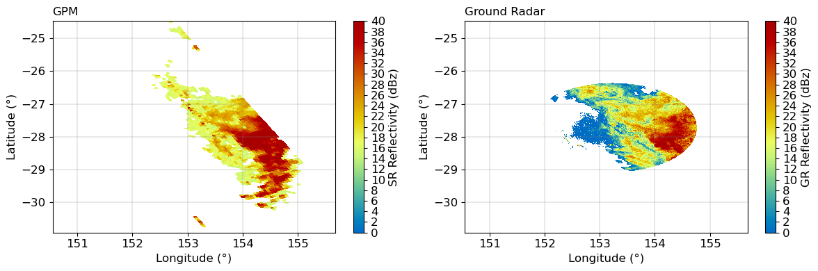
Georeference SR data#
add radar AEQD coords to the SR Dataset
Set fundamental georeferencing parameters#
[16]:
# Todo: only keep one method
# Calculate equivalent earth radius
wgs84 = wrl.georef.get_default_projection()
# lon0_gr = gr_data.latitude.values
re1 = gr_data.ds.wrl.georef.get_earth_radius(sr=wgs84)
print("Earth radius 1:", re1)
a = wgs84.GetSemiMajor()
b = wgs84.GetSemiMinor()
print("SemiMajor, SemiMinor:", a, b)
# Set up aeqd-projection gr-centered
rad = wrl.georef.projstr_to_osr(
("+proj=aeqd +lon_0={lon:f} " + "+lat_0={lat:f} +a={a:f} " + "+b={b:f}").format(
lon=gr_data.ds.longitude.values, lat=gr_data.ds.latitude.values, a=a, b=b
)
)
re2 = gr_data.ds.wrl.georef.get_earth_radius(sr=rad)
print("Earth radius 2:", re2)
Earth radius 1: 6373541.039814419
SemiMajor, SemiMinor: 6378137.0 6356752.314245179
Earth radius 2: 6373541.039814381
[17]:
# todo: use dpr altitude instead fix valued zt
[18]:
sr_data = sr_data.wrl.georef.reproject(
coords=dict(x="Longitude", y="Latitude"), src_crs=wgs84, trg_crs=rad
)
sr_data
/tmp/ipykernel_5605/337899289.py:1: UserWarning: `src_crs`-kwarg is overriding `crs_wkt`-coordinate'
sr_data = sr_data.wrl.georef.reproject(
[18]:
<xarray.Dataset>
Dimensions: (nswath: 1, nscan: 136, nray: 49, XYZ: 3,
nbin: 176, nNP: 4, method: 6, foreBack: 2,
nearFar: 2, nNode: 5, nbinSZP: 7, nDSD: 2,
nNUBF: 3, LS: 2)
Coordinates:
Latitude (nscan, nray) float32 ...
Longitude (nscan, nray) float32 ...
date (nscan) datetime64[ns] 2014-12-06T09:50:02.0...
x (nscan, nray) float64 -2.706e+05 ... 2.36e+05
y (nscan, nray) float64 2.446e+05 ... -2.394e+05
crs_wkt int64 0
Dimensions without coordinates: nswath, nscan, nray, XYZ, nbin, nNP, method,
foreBack, nearFar, nNode, nbinSZP, nDSD, nNUBF,
LS
Data variables: (12/96)
AlgorithmRuntimeInfo (nswath) |S929 ...
dataQuality (nscan) float32 ...
dataWarning (nscan) float32 ...
missing (nscan) float32 ...
modeStatus (nscan) float32 ...
geoError (nscan) float32 ...
... ...
phaseNearSurface (nscan, nray) float32 ...
epsilon (nscan, nray, nbin) float32 ...
flagEcho (nscan, nray, nbin) float32 ...
qualityData (nscan, nray) float64 ...
qualityFlag (nscan, nray) float32 ...
flagSensor (nscan) float32 ...
Attributes:
FileHeader: DOI=10.5067/GPM/DPR/Ku/2A/05;\nDOIauthority=http://dx....
InputRecord: InputFileNames=GPMCOR_KUR_1412060833_1006_004383_1BS_D...
NavigationRecord: LongitudeOnEquator=-27.312063;\nUTCDateTimeOnEquator=2...
FileInfo: DataFormatVersion=cn;\nTKCodeBuildVersion=1;\nMetadata...
JAXAInfo: GranuleFirstScanUTCDateTime=2014-12-06T08:33:33.292Z;\...
platform: GPM- nswath: 1
- nscan: 136
- nray: 49
- XYZ: 3
- nbin: 176
- nNP: 4
- method: 6
- foreBack: 2
- nearFar: 2
- nNode: 5
- nbinSZP: 7
- nDSD: 2
- nNUBF: 3
- LS: 2
- Latitude(nscan, nray)float32...
- DimensionNames :
- nscan,nray
- Units :
- degrees
- units :
- degrees
- CodeMissingValue :
- -9999.9
[6664 values with dtype=float32]
- Longitude(nscan, nray)float32...
- DimensionNames :
- nscan,nray
- Units :
- degrees
- units :
- degrees
- CodeMissingValue :
- -9999.9
[6664 values with dtype=float32]
- date(nscan)datetime64[ns]2014-12-06T09:50:02.000500 ... 2...
array(['2014-12-06T09:50:02.000500000', '2014-12-06T09:50:03.000200000', '2014-12-06T09:50:03.000900000', '2014-12-06T09:50:04.000600000', '2014-12-06T09:50:05.000300000', '2014-12-06T09:50:06.000000000', '2014-12-06T09:50:06.000700000', '2014-12-06T09:50:07.000400000', '2014-12-06T09:50:08.000100000', '2014-12-06T09:50:08.000800000', '2014-12-06T09:50:09.000500000', '2014-12-06T09:50:10.000200000', '2014-12-06T09:50:10.000900000', '2014-12-06T09:50:11.000600000', '2014-12-06T09:50:12.000300000', '2014-12-06T09:50:13.000000000', '2014-12-06T09:50:13.000700000', '2014-12-06T09:50:14.000400000', '2014-12-06T09:50:15.000100000', '2014-12-06T09:50:15.000800000', '2014-12-06T09:50:16.000500000', '2014-12-06T09:50:17.000200000', '2014-12-06T09:50:17.000900000', '2014-12-06T09:50:18.000600000', '2014-12-06T09:50:19.000300000', '2014-12-06T09:50:20.000000000', '2014-12-06T09:50:20.000700000', '2014-12-06T09:50:21.000400000', '2014-12-06T09:50:22.000100000', '2014-12-06T09:50:22.000800000', '2014-12-06T09:50:23.000500000', '2014-12-06T09:50:24.000200000', '2014-12-06T09:50:24.000900000', '2014-12-06T09:50:25.000600000', '2014-12-06T09:50:26.000300000', '2014-12-06T09:50:27.000000000', '2014-12-06T09:50:27.000700000', '2014-12-06T09:50:28.000400000', '2014-12-06T09:50:29.000100000', '2014-12-06T09:50:29.000800000', ... '2014-12-06T09:51:11.000100000', '2014-12-06T09:51:11.000800000', '2014-12-06T09:51:12.000500000', '2014-12-06T09:51:13.000200000', '2014-12-06T09:51:13.000900000', '2014-12-06T09:51:14.000600000', '2014-12-06T09:51:15.000300000', '2014-12-06T09:51:16.000000000', '2014-12-06T09:51:16.000700000', '2014-12-06T09:51:17.000400000', '2014-12-06T09:51:18.000100000', '2014-12-06T09:51:18.000800000', '2014-12-06T09:51:19.000500000', '2014-12-06T09:51:20.000200000', '2014-12-06T09:51:20.000900000', '2014-12-06T09:51:21.000600000', '2014-12-06T09:51:22.000300000', '2014-12-06T09:51:23.000000000', '2014-12-06T09:51:23.000700000', '2014-12-06T09:51:24.000400000', '2014-12-06T09:51:25.000100000', '2014-12-06T09:51:25.000800000', '2014-12-06T09:51:26.000500000', '2014-12-06T09:51:27.000200000', '2014-12-06T09:51:27.000900000', '2014-12-06T09:51:28.000600000', '2014-12-06T09:51:29.000300000', '2014-12-06T09:51:30.000000000', '2014-12-06T09:51:30.000700000', '2014-12-06T09:51:31.000400000', '2014-12-06T09:51:32.000100000', '2014-12-06T09:51:32.000800000', '2014-12-06T09:51:33.000500000', '2014-12-06T09:51:34.000200000', '2014-12-06T09:51:34.000900000', '2014-12-06T09:51:35.000600000', '2014-12-06T09:51:36.000300000', '2014-12-06T09:51:37.000000000'], dtype='datetime64[ns]') - x(nscan, nray)float64-2.706e+05 -2.658e+05 ... 2.36e+05
array([[-270593.39897982, -265783.91889763, -260975.47713143, ..., -60437.08467107, -55521.28018666, -50595.9621522 ], [-268486.34840989, -263676.66910667, -258868.02090681, ..., -58327.69752118, -53411.61115462, -48486.01274362], [-266377.49531948, -261566.08065995, -256758.76146721, ..., -56216.58759608, -51301.76818441, -46374.34227641], ..., [ 11457.54200551, 16276.64998668, 21095.12814332, ..., 221882.13862793, 226801.84170699, 231731.10931228], [ 13596.06030391, 18415.20998761, 23232.27290154, ..., 224017.16795758, 228937.02327715, 233866.44377249], [ 15729.93582669, 20550.58618211, 25367.69402384, ..., 226156.19637389, 231076.20145238, 236005.77235519]]) - y(nscan, nray)float642.446e+05 2.473e+05 ... -2.394e+05
array([[ 244638.23751601, 247257.61219484, 249870.60414502, ..., 353759.76100847, 356198.52947527, 358637.55694177], [ 240196.53995647, 242816.04198751, 245428.94921235, ..., 349317.88012609, 351756.50857607, 354195.81602243], [ 235753.09463396, 238372.54251825, 240985.33157499, ..., 344876.49912004, 347315.40211559, 349754.57128868], ..., [-345598.77040985, -342963.48081389, -340334.24745287, ..., -235518.45343964, -233050.82541286, -230582.42632224], [-350035.27452153, -347399.39669485, -344769.57288466, ..., -239934.11352865, -237466.16440433, -234997.44698319], [-354467.76474637, -351831.5121266 , -349201.52345107, ..., -244355.62695514, -241887.3597756 , -239418.32707085]]) - crs_wkt()int640
- crs_wkt :
- PROJCRS["unknown",BASEGEOGCRS["unknown",DATUM["Unknown based on WGS 84 ellipsoid",ELLIPSOID["WGS 84",6378137,298.25722356049,LENGTHUNIT["metre",1,ID["EPSG",9001]]]],PRIMEM["Greenwich",0,ANGLEUNIT["degree",0.0174532925199433],ID["EPSG",8901]]],CONVERSION["unknown",METHOD["Modified Azimuthal Equidistant",ID["EPSG",9832]],PARAMETER["Latitude of natural origin",-27.7181,ANGLEUNIT["degree",0.0174532925199433],ID["EPSG",8801]],PARAMETER["Longitude of natural origin",153.240005,ANGLEUNIT["degree",0.0174532925199433],ID["EPSG",8802]],PARAMETER["False easting",0,LENGTHUNIT["metre",1],ID["EPSG",8806]],PARAMETER["False northing",0,LENGTHUNIT["metre",1],ID["EPSG",8807]]],CS[Cartesian,2],AXIS["(E)",east,ORDER[1],LENGTHUNIT["metre",1,ID["EPSG",9001]]],AXIS["(N)",north,ORDER[2],LENGTHUNIT["metre",1,ID["EPSG",9001]]]]
- semi_major_axis :
- 6378137.0
- semi_minor_axis :
- 6356752.314245
- inverse_flattening :
- 298.25722356049
- reference_ellipsoid_name :
- WGS 84
- longitude_of_prime_meridian :
- 0.0
- prime_meridian_name :
- Greenwich
- geographic_crs_name :
- unknown
- horizontal_datum_name :
- Unknown based on WGS 84 ellipsoid
- projected_crs_name :
- unknown
- grid_mapping_name :
- azimuthal_equidistant
- latitude_of_projection_origin :
- -27.7181
- longitude_of_projection_origin :
- 153.240005
- false_easting :
- 0.0
- false_northing :
- 0.0
array(0)
- AlgorithmRuntimeInfo(nswath)|S929...
[1 values with dtype=|S929]
- dataQuality(nscan)float32...
- DimensionNames :
- nscan
- CodeMissingValue :
- -99
[136 values with dtype=float32]
- dataWarning(nscan)float32...
- DimensionNames :
- nscan
- CodeMissingValue :
- -99
[136 values with dtype=float32]
- missing(nscan)float32...
- DimensionNames :
- nscan
- CodeMissingValue :
- -99
[136 values with dtype=float32]
- modeStatus(nscan)float32...
- DimensionNames :
- nscan
- CodeMissingValue :
- -99
[136 values with dtype=float32]
- geoError(nscan)float32...
- DimensionNames :
- nscan
- CodeMissingValue :
- -9999
[136 values with dtype=float32]
- geoWarning(nscan)float32...
- DimensionNames :
- nscan
- CodeMissingValue :
- -9999
[136 values with dtype=float32]
- SCorientation(nscan)float32...
- DimensionNames :
- nscan
- Units :
- degrees
- units :
- degrees
- CodeMissingValue :
- -9999
[136 values with dtype=float32]
- pointingStatus(nscan)float32...
- DimensionNames :
- nscan
- CodeMissingValue :
- -9999
[136 values with dtype=float32]
- acsModeMidScan(nscan)float32...
- DimensionNames :
- nscan
- CodeMissingValue :
- -99
[136 values with dtype=float32]
- targetSelectionMidScan(nscan)float32...
- DimensionNames :
- nscan
- CodeMissingValue :
- -99
[136 values with dtype=float32]
- operationalMode(nscan)float32...
- DimensionNames :
- nscan
- CodeMissingValue :
- -99
[136 values with dtype=float32]
- limitErrorFlag(nscan)float32...
- DimensionNames :
- nscan
- CodeMissingValue :
- -99
[136 values with dtype=float32]
- FractionalGranuleNumber(nscan)float64...
- DimensionNames :
- nscan
- CodeMissingValue :
- -9999.9
[136 values with dtype=float64]
- scPos(nscan, XYZ)float32...
- DimensionNames :
- nscan,XYZ
- Units :
- m
- units :
- m
- CodeMissingValue :
- -9999.9
[408 values with dtype=float32]
- scVel(nscan, XYZ)float32...
- DimensionNames :
- nscan,XYZ
- Units :
- m/s
- units :
- m/s
- CodeMissingValue :
- -9999.9
[408 values with dtype=float32]
- scLat(nscan)float32...
- DimensionNames :
- nscan
- Units :
- degrees
- units :
- degrees
- CodeMissingValue :
- -9999.9
[136 values with dtype=float32]
- scLon(nscan)float32...
- DimensionNames :
- nscan
- Units :
- degrees
- units :
- degrees
- CodeMissingValue :
- -9999.9
[136 values with dtype=float32]
- scAlt(nscan)float32...
- DimensionNames :
- nscan
- Units :
- m
- units :
- m
- CodeMissingValue :
- -9999.9
[136 values with dtype=float32]
- dprAlt(nscan)float32...
- DimensionNames :
- nscan
- Units :
- m
- units :
- m
- CodeMissingValue :
- -9999.9
[136 values with dtype=float32]
- scAttRollGeoc(nscan)float32...
- DimensionNames :
- nscan
- Units :
- degrees
- units :
- degrees
- CodeMissingValue :
- -9999.9
[136 values with dtype=float32]
- scAttPitchGeoc(nscan)float32...
- DimensionNames :
- nscan
- Units :
- degrees
- units :
- degrees
- CodeMissingValue :
- -9999.9
[136 values with dtype=float32]
- scAttYawGeoc(nscan)float32...
- DimensionNames :
- nscan
- Units :
- degrees
- units :
- degrees
- CodeMissingValue :
- -9999.9
[136 values with dtype=float32]
- scAttRollGeod(nscan)float32...
- DimensionNames :
- nscan
- Units :
- degrees
- units :
- degrees
- CodeMissingValue :
- -9999.9
[136 values with dtype=float32]
- scAttPitchGeod(nscan)float32...
- DimensionNames :
- nscan
- Units :
- degrees
- units :
- degrees
- CodeMissingValue :
- -9999.9
[136 values with dtype=float32]
- scAttYawGeod(nscan)float32...
- DimensionNames :
- nscan
- Units :
- degrees
- units :
- degrees
- CodeMissingValue :
- -9999.9
[136 values with dtype=float32]
- greenHourAng(nscan)float32...
- DimensionNames :
- nscan
- Units :
- degrees
- units :
- degrees
- CodeMissingValue :
- -9999.9
[136 values with dtype=float32]
- timeMidScan(nscan)float64...
- DimensionNames :
- nscan
- Units :
- s
- units :
- s
- CodeMissingValue :
- -9999.9
[136 values with dtype=float64]
- timeMidScanOffset(nscan)float64...
- DimensionNames :
- nscan
- Units :
- s
- units :
- s
- CodeMissingValue :
- -9999.9
[136 values with dtype=float64]
- elevation(nscan, nray)float32...
- DimensionNames :
- nscan,nray
- Units :
- m
- units :
- m
- CodeMissingValue :
- -9999.9
[6664 values with dtype=float32]
- landSurfaceType(nscan, nray)float64...
- DimensionNames :
- nscan,nray
- CodeMissingValue :
- -9999
[6664 values with dtype=float64]
- localZenithAngle(nscan, nray)float32...
- DimensionNames :
- nscan,nray
- Units :
- degree
- units :
- degree
- CodeMissingValue :
- -9999.9
[6664 values with dtype=float32]
- flagPrecip(nscan, nray)float64...
- DimensionNames :
- nscan,nray
- CodeMissingValue :
- -9999
[6664 values with dtype=float64]
- flagSigmaZeroSaturation(nscan, nray)float32...
- DimensionNames :
- nscan,nray
- CodeMissingValue :
- 99
[6664 values with dtype=float32]
- binRealSurface(nscan, nray)float32...
- DimensionNames :
- nscan,nray
- CodeMissingValue :
- -9999
[6664 values with dtype=float32]
- binStormTop(nscan, nray)float32...
- DimensionNames :
- nscan,nray
- CodeMissingValue :
- -9999
[6664 values with dtype=float32]
- heightStormTop(nscan, nray)float32...
- DimensionNames :
- nscan,nray
- Units :
- m
- units :
- m
- CodeMissingValue :
- -9999.9
[6664 values with dtype=float32]
- binClutterFreeBottom(nscan, nray)float32...
- DimensionNames :
- nscan,nray
- CodeMissingValue :
- -9999
[6664 values with dtype=float32]
- sigmaZeroMeasured(nscan, nray)float32...
- DimensionNames :
- nscan,nray
- Units :
- dB
- units :
- dB
- CodeMissingValue :
- -9999.9
[6664 values with dtype=float32]
- zFactorMeasured(nscan, nray, nbin)float32...
- DimensionNames :
- nscan,nray,nbin
- Units :
- dBZ
- units :
- dBZ
- CodeMissingValue :
- -9999.9
[1172864 values with dtype=float32]
- ellipsoidBinOffset(nscan, nray)float32...
- DimensionNames :
- nscan,nray
- Units :
- m
- units :
- m
- CodeMissingValue :
- -9999.9
[6664 values with dtype=float32]
- snRatioAtRealSurface(nscan, nray)float32...
- DimensionNames :
- nscan,nray
- CodeMissingValue :
- -9999.9
[6664 values with dtype=float32]
- adjustFactor(nscan, nray)float32...
- DimensionNames :
- nscan,nray
- Units :
- dB
- units :
- dB
- CodeMissingValue :
- -9999.9
[6664 values with dtype=float32]
- snowIceCover(nscan, nray)float32...
- DimensionNames :
- nscan,nray
- CodeMissingValue :
- -99
[6664 values with dtype=float32]
- binZeroDeg(nscan, nray)float32...
- DimensionNames :
- nscan,nray
- CodeMissingValue :
- -9999
[6664 values with dtype=float32]
- attenuationNP(nscan, nray, nbin)float32...
- DimensionNames :
- nscan,nray,nbin
- Units :
- dB/km
- units :
- dB/km
- CodeMissingValue :
- -9999.9
[1172864 values with dtype=float32]
- piaNP(nscan, nray, nNP)float32...
- DimensionNames :
- nscan,nray,nNP
- Units :
- dB
- units :
- dB
- CodeMissingValue :
- -9999.9
[26656 values with dtype=float32]
- sigmaZeroNPCorrected(nscan, nray)float32...
- DimensionNames :
- nscan,nray
- Units :
- dB
- units :
- dB
- CodeMissingValue :
- -9999.9
[6664 values with dtype=float32]
- heightZeroDeg(nscan, nray)float32...
- DimensionNames :
- nscan,nray
- Units :
- m
- units :
- m
- CodeMissingValue :
- -9999.9
[6664 values with dtype=float32]
- flagBB(nscan, nray)float64...
- DimensionNames :
- nscan,nray
- CodeMissingValue :
- -9999
[6664 values with dtype=float64]
- binBBPeak(nscan, nray)float32...
- DimensionNames :
- nscan,nray
- CodeMissingValue :
- -9999
[6664 values with dtype=float32]
- binBBTop(nscan, nray)float32...
- DimensionNames :
- nscan,nray
- CodeMissingValue :
- -9999
[6664 values with dtype=float32]
- binBBBottom(nscan, nray)float32...
- DimensionNames :
- nscan,nray
- CodeMissingValue :
- -9999
[6664 values with dtype=float32]
- heightBB(nscan, nray)float32...
- DimensionNames :
- nscan,nray
- Units :
- m
- units :
- m
- CodeMissingValue :
- -9999.9
[6664 values with dtype=float32]
- widthBB(nscan, nray)float32...
- DimensionNames :
- nscan,nray
- Units :
- m
- units :
- m
- CodeMissingValue :
- -9999.9
[6664 values with dtype=float32]
- qualityBB(nscan, nray)float64...
- DimensionNames :
- nscan,nray
- CodeMissingValue :
- -9999
[6664 values with dtype=float64]
- typePrecip(nscan, nray)float64...
- DimensionNames :
- nscan,nray
- CodeMissingValue :
- -9999
[6664 values with dtype=float64]
- qualityTypePrecip(nscan, nray)float64...
- DimensionNames :
- nscan,nray
- CodeMissingValue :
- -9999
[6664 values with dtype=float64]
- flagShallowRain(nscan, nray)float64...
- DimensionNames :
- nscan,nray
- CodeMissingValue :
- -9999
[6664 values with dtype=float64]
- flagHeavyIcePrecip(nscan, nray)float32...
- DimensionNames :
- nscan,nray
- CodeMissingValue :
- -99
[6664 values with dtype=float32]
- flagAnvil(nscan, nray)float32...
- DimensionNames :
- nscan,nray
- CodeMissingValue :
- -99
[6664 values with dtype=float32]
- PIAalt(nscan, nray, method)float32...
- DimensionNames :
- nscan,nray,method
- Units :
- dB
- units :
- dB
- CodeMissingValue :
- -9999.9
[39984 values with dtype=float32]
- RFactorAlt(nscan, nray, method)float32...
- DimensionNames :
- nscan,nray,method
- CodeMissingValue :
- -9999.9
[39984 values with dtype=float32]
- PIAweight(nscan, nray, method)float32...
- DimensionNames :
- nscan,nray,method
- CodeMissingValue :
- -9999.9
[39984 values with dtype=float32]
- pathAtten(nscan, nray)float32...
- DimensionNames :
- nscan,nray
- Units :
- dB
- units :
- dB
- CodeMissingValue :
- -9999.9
[6664 values with dtype=float32]
- reliabFactor(nscan, nray)float32...
- DimensionNames :
- nscan,nray
- CodeMissingValue :
- -9999.9
[6664 values with dtype=float32]
- reliabFlag(nscan, nray)float32...
- DimensionNames :
- nscan,nray
- CodeMissingValue :
- -9999
[6664 values with dtype=float32]
- refScanID(nscan, nray, foreBack, nearFar)float32...
- DimensionNames :
- nscan,nray,foreBack,nearFar
- CodeMissingValue :
- -9999
[26656 values with dtype=float32]
- phase(nscan, nray, nbin)float32...
- DimensionNames :
- nscan,nray,nbin
- CodeMissingValue :
- 255
[1172864 values with dtype=float32]
- binNode(nscan, nray, nNode)float32...
- DimensionNames :
- nscan,nray,nNode
- CodeMissingValue :
- -9999
[33320 values with dtype=float32]
- precipRateESurface2(nscan, nray)float32...
- DimensionNames :
- nscan,nray
- Units :
- mm/hr
- units :
- mm/hr
- CodeMissingValue :
- -9999.9
[6664 values with dtype=float32]
- precipRateESurface2Status(nscan, nray)float32...
- DimensionNames :
- nscan,nray
- CodeMissingValue :
- 255
[6664 values with dtype=float32]
- sigmaZeroProfile(nscan, nray, nbinSZP)float32...
- DimensionNames :
- nscan,nray,nbinSZP
- Units :
- dB
- units :
- dB
- CodeMissingValue :
- -9999.9
[46648 values with dtype=float32]
- binDEML2(nscan, nray)float32...
- DimensionNames :
- nscan,nray
- CodeMissingValue :
- -9999
[6664 values with dtype=float32]
- seaIceConcentration(nscan, nray)float32...
- DimensionNames :
- nscan,nray
- Units :
- percent
- units :
- percent
- CodeMissingValue :
- -9999.9
[6664 values with dtype=float32]
- flagSLV(nscan, nray, nbin)float32...
- DimensionNames :
- nscan,nray,nbin
- CodeMissingValue :
- -99
[1172864 values with dtype=float32]
- paramDSD(nscan, nray, nbin, nDSD)float32...
- DimensionNames :
- nscan,nray,nbin,nDSD
- CodeMissingValue :
- -9999.9
[2345728 values with dtype=float32]
- binEchoBottom(nscan, nray)float32...
- DimensionNames :
- nscan,nray
- CodeMissingValue :
- -9999
[6664 values with dtype=float32]
- piaFinal(nscan, nray)float32...
- DimensionNames :
- nscan,nray
- Units :
- dB
- units :
- dB
- CodeMissingValue :
- -9999.9
[6664 values with dtype=float32]
- sigmaZeroCorrected(nscan, nray)float32...
- DimensionNames :
- nscan,nray
- Units :
- dB
- units :
- dB
- CodeMissingValue :
- -9999.9
[6664 values with dtype=float32]
- zFactorCorrected(nscan, nray, nbin)float32...
- DimensionNames :
- nscan,nray,nbin
- Units :
- dBZ
- units :
- dBZ
- CodeMissingValue :
- -9999.9
[1172864 values with dtype=float32]
- zFactorCorrectedESurface(nscan, nray)float32...
- DimensionNames :
- nscan,nray
- Units :
- dBZ
- units :
- dBZ
- CodeMissingValue :
- -9999.9
[6664 values with dtype=float32]
- zFactorCorrectedNearSurface(nscan, nray)float32...
- DimensionNames :
- nscan,nray
- Units :
- dBZ
- units :
- dBZ
- CodeMissingValue :
- -9999.9
[6664 values with dtype=float32]
- paramNUBF(nscan, nray, nNUBF)float32...
- DimensionNames :
- nscan,nray,nNUBF
- CodeMissingValue :
- -9999.9
[19992 values with dtype=float32]
- precipRate(nscan, nray, nbin)float32...
- DimensionNames :
- nscan,nray,nbin
- Units :
- mm/hr
- units :
- mm/hr
- CodeMissingValue :
- -9999.9
[1172864 values with dtype=float32]
- precipWaterIntegrated(nscan, nray, LS)float32...
- DimensionNames :
- nscan,nray,LS
- Units :
- g/m^2
- units :
- g/m^2
- CodeMissingValue :
- -9999.9
[13328 values with dtype=float32]
- qualitySLV(nscan, nray)float64...
- DimensionNames :
- nscan,nray
- CodeMissingValue :
- -9999
[6664 values with dtype=float64]
- precipRateNearSurface(nscan, nray)float32...
- DimensionNames :
- nscan,nray
- Units :
- mm/hr
- units :
- mm/hr
- CodeMissingValue :
- -9999.9
[6664 values with dtype=float32]
- precipRateESurface(nscan, nray)float32...
- DimensionNames :
- nscan,nray
- Units :
- mm/hr
- units :
- mm/hr
- CodeMissingValue :
- -9999.9
[6664 values with dtype=float32]
- precipRateAve24(nscan, nray)float32...
- DimensionNames :
- nscan,nray
- Units :
- mm/hr
- units :
- mm/hr
- CodeMissingValue :
- -9999.9
[6664 values with dtype=float32]
- phaseNearSurface(nscan, nray)float32...
- DimensionNames :
- nscan,nray
- CodeMissingValue :
- 255
[6664 values with dtype=float32]
- epsilon(nscan, nray, nbin)float32...
- DimensionNames :
- nscan,nray,nbin
- CodeMissingValue :
- -9999.9
[1172864 values with dtype=float32]
- flagEcho(nscan, nray, nbin)float32...
- DimensionNames :
- nscan,nray,nbin
- CodeMissingValue :
- -99
[1172864 values with dtype=float32]
- qualityData(nscan, nray)float64...
- DimensionNames :
- nscan,nray
- CodeMissingValue :
- -9999
[6664 values with dtype=float64]
- qualityFlag(nscan, nray)float32...
- DimensionNames :
- nscan,nray
- CodeMissingValue :
- -99
[6664 values with dtype=float32]
- flagSensor(nscan)float32...
- DimensionNames :
- nscan
- CodeMissingValue :
- -99
[136 values with dtype=float32]
- FileHeader :
- DOI=10.5067/GPM/DPR/Ku/2A/05; DOIauthority=http://dx.doi/org/; DOIshortName=2AKu; AlgorithmID=2AKu; AlgorithmVersion=7.20170308; FileName=2A.GPM.Ku.V7-20170308.20141206-S083332-E100603.004383.V05A.HDF5_geo; SatelliteName=GPM; InstrumentName=DPR; GenerationDateTime=2018-02-02T08:13:55.000Z; StartGranuleDateTime=2014-12-06T09:50:02.500Z; StopGranuleDateTime=2014-12-06T09:51:37.0Z; GranuleNumber=4383; NumberOfSwaths=1; NumberOfGrids=0; GranuleStart=SOUTHERNMOST_LATITUDE; TimeInterval=ORBIT; ProcessingSystem=PPS; ProductVersion=V05A; EmptyGranule=NOT_EMPTY; MissingData=0;
- InputRecord :
- InputFileNames=GPMCOR_KUR_1412060833_1006_004383_1BS_DUB_05A.h5; InputAlgorithmVersions=7.20; InputGenerationDateTimes=2017-05-15T01:41:48.000Z;
- NavigationRecord :
- LongitudeOnEquator=-27.312063; UTCDateTimeOnEquator=2014-12-06T08:56:40.045Z; MeanSolarBetaAngle=-72.401636; EphemerisFileName=; AttitudeFileName=; GeoControlFileName=; EphemerisSource=7_PVT_WITH_FALLBACK_AS_FLAGGED; AttitudeSource=1_ON_BOARD_CALCULATED_PITCH_ROLL_YAW; GeoToolkitVersion=V4.4 9.27.2016 TRMM ATTITUDE FLAG ; SensorAlignmentFirstRotationAngle=3.798850; SensorAlignmentSecondRotationAngle=0.027340; SensorAlignmentThirdRotationAngle=0.006270; SensorAlignmentFirstRotationAxis=2; SensorAlignmentSecondRotationAxis=1; SensorAlignmentThirdRotationAxis=3;
- FileInfo :
- DataFormatVersion=cn; TKCodeBuildVersion=1; MetadataVersion=cn; FormatPackage=HDF5-1.8.9; BlueprintFilename=GPM.V1.2AKu.blueprint.xml; BlueprintVersion=BV_54; TKIOVersion=3.80.26; MetadataStyle=PVL; EndianType=LITTLE_ENDIAN;
- JAXAInfo :
- GranuleFirstScanUTCDateTime=2014-12-06T08:33:33.292Z; GranuleLastScanUTCDateTime=2014-12-06T10:06:04.302Z; TotalQualityCode=Good; FirstScanLat=-65.140816; FirstScanLon=-111.389732; LastScanLat=-65.139572; LastScanLon=-134.931000; NumberOfRainPixelsNS=29990; NumberOfRainPixelsMS=-9999; NumberOfRainPixelsHS=-9999; ProcessingSubSystem=ALGORITHM; ProcessingMode=STD; LightSpeed=299792458; DielectricConstantKa=0.898900; DielectricConstantKu=0.925500;
- platform :
- GPM
Subset relevant SR data#
Calculate distance of each SR bin to the ground radar location and select only locations within the GR range.
[19]:
# calculate range and mask srdata
r = np.sqrt(sr_data.x**2 + sr_data.y**2)
sr_cut = sr_data.where(r < swp.gr.max(), drop=True)
sr_cut.zFactorCorrected[..., level].plot(x="x", y="y", vmin=-32, vmax=50)
[19]:
<matplotlib.collections.QuadMesh at 0x7f473424cf10>
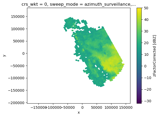
Subset relevant SR data with precip flag#
[20]:
precip_mask = xr.where(sr_cut.flagPrecip > 0, 1, 0)
precip_mask.plot(x="x", y="y")
[20]:
<matplotlib.collections.QuadMesh at 0x7f473411d350>
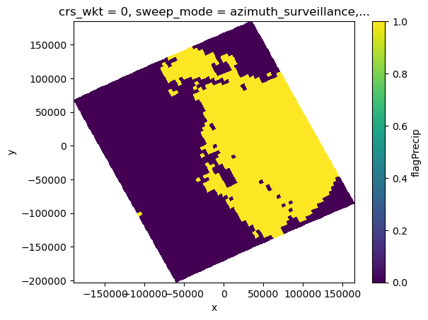
SR Parallax Correction#
Correct for parallax, get 3D-XYZ-Array
[21]:
# dr_sr = 125.
# todo: make this available from wradlib
sr_cut = sr_cut.wrl.georef.correct_parallax(dr_sr)
display(sr_cut)
/home/runner/micromamba/envs/wradlib-tests/lib/python3.11/site-packages/xarray/core/utils.py:494: FutureWarning: The return type of `Dataset.dims` will be changed to return a set of dimension names in future, in order to be more consistent with `DataArray.dims`. To access a mapping from dimension names to lengths, please use `Dataset.sizes`.
warnings.warn(
<xarray.Dataset>
Dimensions: (nswath: 1, nscan: 61, nray: 49, XYZ: 3,
nbin: 176, nNP: 4, method: 6, foreBack: 2,
nearFar: 2, nNode: 5, nbinSZP: 7, nDSD: 2,
nNUBF: 3, LS: 2)
Coordinates: (12/14)
Latitude (nscan, nray) float32 -27.1 -27.08 ... -28.47
Longitude (nscan, nray) float32 151.4 151.4 ... 154.9
date (nscan) datetime64[ns] 2014-12-06T09:50:30.0...
x (nscan, nray) float64 -1.861e+05 ... 1.613e+05
y (nscan, nray) float64 6.695e+04 ... -8.461e+04
crs_wkt int64 0
... ...
latitude float64 -27.72
altitude float64 175.0
xp (nscan, nray, nbin) float64 nan nan ... nan nan
yp (nscan, nray, nbin) float64 nan nan ... nan nan
zp (nscan, nray, nbin) float64 nan nan ... nan nan
sr_range (nbin) float64 2.188e+04 2.175e+04 ... 0.0
Dimensions without coordinates: nswath, nscan, nray, XYZ, nbin, nNP, method,
foreBack, nearFar, nNode, nbinSZP, nDSD, nNUBF,
LS
Data variables: (12/96)
AlgorithmRuntimeInfo (nswath, nscan, nray) object nan nan ... nan
dataQuality (nscan, nray) float32 nan nan nan ... nan nan
dataWarning (nscan, nray) float32 nan nan nan ... nan nan
missing (nscan, nray) float32 nan nan nan ... nan nan
modeStatus (nscan, nray) float32 nan nan nan ... nan nan
geoError (nscan, nray) float32 nan nan nan ... nan nan
... ...
phaseNearSurface (nscan, nray) float32 nan nan nan ... nan nan
epsilon (nscan, nray, nbin) float32 nan nan ... nan nan
flagEcho (nscan, nray, nbin) float32 nan nan ... nan nan
qualityData (nscan, nray) float64 nan nan nan ... nan nan
qualityFlag (nscan, nray) float32 nan nan nan ... nan nan
flagSensor (nscan, nray) float32 nan nan nan ... nan nan
Attributes:
FileHeader: DOI=10.5067/GPM/DPR/Ku/2A/05;\nDOIauthority=http://dx....
InputRecord: InputFileNames=GPMCOR_KUR_1412060833_1006_004383_1BS_D...
NavigationRecord: LongitudeOnEquator=-27.312063;\nUTCDateTimeOnEquator=2...
FileInfo: DataFormatVersion=cn;\nTKCodeBuildVersion=1;\nMetadata...
JAXAInfo: GranuleFirstScanUTCDateTime=2014-12-06T08:33:33.292Z;\...
platform: GPM- nswath: 1
- nscan: 61
- nray: 49
- XYZ: 3
- nbin: 176
- nNP: 4
- method: 6
- foreBack: 2
- nearFar: 2
- nNode: 5
- nbinSZP: 7
- nDSD: 2
- nNUBF: 3
- LS: 2
- Latitude(nscan, nray)float32-27.1 -27.08 ... -28.49 -28.47
- DimensionNames :
- nscan,nray
- Units :
- degrees
- units :
- degrees
- CodeMissingValue :
- -9999.9
array([[-27.101166, -27.078152, -27.05518 , ..., -26.126842, -26.104671, -26.082481], [-27.141512, -27.11849 , -27.095507, ..., -26.166826, -26.144648, -26.122446], [-27.181885, -27.158855, -27.135864, ..., -26.206799, -26.18461 , -26.1624 ], ..., [-29.43486 , -29.41136 , -29.3879 , ..., -28.437897, -28.415165, -28.392406], [-29.474983, -29.451473, -29.428001, ..., -28.477577, -28.454834, -28.432068], [-29.515072, -29.491552, -29.468073, ..., -28.517286, -28.494534, -28.471756]], dtype=float32) - Longitude(nscan, nray)float32151.4 151.4 151.5 ... 154.8 154.9
- DimensionNames :
- nscan,nray
- Units :
- degrees
- units :
- degrees
- CodeMissingValue :
- -9999.9
array([[151.36314, 151.41205, 151.4609 , ..., 153.48042, 153.52951, 153.57869], [151.3838 , 151.43272, 151.4816 , ..., 153.50168, 153.55077, 153.59996], [151.4045 , 151.45343, 151.50232, ..., 153.52295, 153.57205, 153.62126], ..., [152.58981, 152.63957, 152.68929, ..., 154.74254, 154.7924 , 154.84236], [152.61151, 152.66129, 152.71101, ..., 154.76485, 154.81473, 154.86469], [152.63318, 152.68297, 152.73271, ..., 154.78717, 154.83707, 154.88705]], dtype=float32) - date(nscan)datetime64[ns]2014-12-06T09:50:30.000500 ... 2...
array(['2014-12-06T09:50:30.000500000', '2014-12-06T09:50:31.000200000', '2014-12-06T09:50:31.000900000', '2014-12-06T09:50:32.000600000', '2014-12-06T09:50:33.000300000', '2014-12-06T09:50:34.000000000', '2014-12-06T09:50:34.000700000', '2014-12-06T09:50:35.000400000', '2014-12-06T09:50:36.000100000', '2014-12-06T09:50:36.000800000', '2014-12-06T09:50:37.000500000', '2014-12-06T09:50:38.000200000', '2014-12-06T09:50:38.000900000', '2014-12-06T09:50:39.000600000', '2014-12-06T09:50:40.000300000', '2014-12-06T09:50:41.000000000', '2014-12-06T09:50:41.000700000', '2014-12-06T09:50:42.000400000', '2014-12-06T09:50:43.000100000', '2014-12-06T09:50:43.000800000', '2014-12-06T09:50:44.000500000', '2014-12-06T09:50:45.000200000', '2014-12-06T09:50:45.000900000', '2014-12-06T09:50:46.000600000', '2014-12-06T09:50:47.000300000', '2014-12-06T09:50:48.000000000', '2014-12-06T09:50:48.000700000', '2014-12-06T09:50:49.000400000', '2014-12-06T09:50:50.000100000', '2014-12-06T09:50:50.000800000', '2014-12-06T09:50:51.000500000', '2014-12-06T09:50:52.000200000', '2014-12-06T09:50:52.000900000', '2014-12-06T09:50:53.000600000', '2014-12-06T09:50:54.000300000', '2014-12-06T09:50:55.000000000', '2014-12-06T09:50:55.000700000', '2014-12-06T09:50:56.000400000', '2014-12-06T09:50:57.000100000', '2014-12-06T09:50:57.000800000', '2014-12-06T09:50:58.000500000', '2014-12-06T09:50:59.000200000', '2014-12-06T09:50:59.000900000', '2014-12-06T09:51:00.000600000', '2014-12-06T09:51:01.000300000', '2014-12-06T09:51:02.000000000', '2014-12-06T09:51:02.000700000', '2014-12-06T09:51:03.000400000', '2014-12-06T09:51:04.000100000', '2014-12-06T09:51:04.000800000', '2014-12-06T09:51:05.000500000', '2014-12-06T09:51:06.000200000', '2014-12-06T09:51:06.000900000', '2014-12-06T09:51:07.000600000', '2014-12-06T09:51:08.000300000', '2014-12-06T09:51:09.000000000', '2014-12-06T09:51:09.000700000', '2014-12-06T09:51:10.000400000', '2014-12-06T09:51:11.000100000', '2014-12-06T09:51:11.000800000', '2014-12-06T09:51:12.000500000'], dtype='datetime64[ns]') - x(nscan, nray)float64-1.861e+05 -1.813e+05 ... 1.613e+05
array([[-186117.16968603, -181305.28030804, -176495.82165648, ..., 24047.25052569, 28962.67647159, 33889.14933934], [-184002.07209363, -179190.03391088, -174380.42887443, ..., 26164.19651736, 31078.33323847, 36005.04339036], [-181885.32234517, -177073.13766802, -172263.38253896, ..., 28281.18514283, 33195.55875011, 38122.50511547], ..., [ -63096.0693707 , -58280.57133685, -53467.29685492, ..., 147190.35761426, 152107.26441435, 157035.21211942], [ -60966.90277686, -56151.32532165, -51337.96859382, ..., 149320.27054283, 154237.35920682, 159163.98843144], [ -58842.32030271, -54026.66419738, -49213.22410927, ..., 151449.96341515, 156367.22861008, 161295.53182215]]) - y(nscan, nray)float646.695e+04 6.958e+04 ... -8.461e+04
array([[ 66954.186556 , 69576.76471264, 72192.70009704, ..., 176292.00877297, 178737.95818865, 181184.06782741], [ 62514.32843802, 65136.98493917, 67753.420854 , ..., 171857.94004293, 174303.91519634, 176750.46715308], [ 58071.19537879, 60693.92841949, 63310.4403647 , ..., 167424.74984815, 169870.95728909, 172317.73840756], ..., [-190436.25557751, -187806.41895225, -185183.04044706, ..., -80673.26872774, -78215.0122177 , -75755.91099028], [-194872.49152306, -192242.44091716, -189618.63750756, ..., -85098.0633245 , -82639.43830613, -80180.37445039], [-199305.34041805, -196675.07521151, -194051.26911153, ..., -89526.47535637, -87067.69442881, -84608.28612928]]) - crs_wkt()int640
- crs_wkt :
- PROJCRS["unknown",BASEGEOGCRS["unknown",DATUM["Unknown based on WGS 84 ellipsoid",ELLIPSOID["WGS 84",6378137,298.25722356049,LENGTHUNIT["metre",1,ID["EPSG",9001]]]],PRIMEM["Greenwich",0,ANGLEUNIT["degree",0.0174532925199433],ID["EPSG",8901]]],CONVERSION["unknown",METHOD["Modified Azimuthal Equidistant",ID["EPSG",9832]],PARAMETER["Latitude of natural origin",-27.7181,ANGLEUNIT["degree",0.0174532925199433],ID["EPSG",8801]],PARAMETER["Longitude of natural origin",153.240005,ANGLEUNIT["degree",0.0174532925199433],ID["EPSG",8802]],PARAMETER["False easting",0,LENGTHUNIT["metre",1],ID["EPSG",8806]],PARAMETER["False northing",0,LENGTHUNIT["metre",1],ID["EPSG",8807]]],CS[Cartesian,2],AXIS["(E)",east,ORDER[1],LENGTHUNIT["metre",1,ID["EPSG",9001]]],AXIS["(N)",north,ORDER[2],LENGTHUNIT["metre",1,ID["EPSG",9001]]]]
- semi_major_axis :
- 6378137.0
- semi_minor_axis :
- 6356752.314245
- inverse_flattening :
- 298.25722356049
- reference_ellipsoid_name :
- WGS 84
- longitude_of_prime_meridian :
- 0.0
- prime_meridian_name :
- Greenwich
- geographic_crs_name :
- unknown
- horizontal_datum_name :
- Unknown based on WGS 84 ellipsoid
- projected_crs_name :
- unknown
- grid_mapping_name :
- azimuthal_equidistant
- latitude_of_projection_origin :
- -27.7181
- longitude_of_projection_origin :
- 153.240005
- false_easting :
- 0.0
- false_northing :
- 0.0
array(0)
- sweep_mode()<U20'azimuth_surveillance'
array('azimuth_surveillance', dtype='<U20') - longitude()float64153.2
array(153.24000549)
- latitude()float64-27.72
array(-27.71809959)
- altitude()float64175.0
array(174.99999702)
- xp(nscan, nray, nbin)float64nan nan nan nan ... nan nan nan nan
array([[[nan, nan, nan, ..., nan, nan, nan], [nan, nan, nan, ..., nan, nan, nan], [nan, nan, nan, ..., nan, nan, nan], ..., [nan, nan, nan, ..., nan, nan, nan], [nan, nan, nan, ..., nan, nan, nan], [nan, nan, nan, ..., nan, nan, nan]], [[nan, nan, nan, ..., nan, nan, nan], [nan, nan, nan, ..., nan, nan, nan], [nan, nan, nan, ..., nan, nan, nan], ..., [nan, nan, nan, ..., nan, nan, nan], [nan, nan, nan, ..., nan, nan, nan], [nan, nan, nan, ..., nan, nan, nan]], [[nan, nan, nan, ..., nan, nan, nan], [nan, nan, nan, ..., nan, nan, nan], [nan, nan, nan, ..., nan, nan, nan], ..., ... ..., [nan, nan, nan, ..., nan, nan, nan], [nan, nan, nan, ..., nan, nan, nan], [nan, nan, nan, ..., nan, nan, nan]], [[nan, nan, nan, ..., nan, nan, nan], [nan, nan, nan, ..., nan, nan, nan], [nan, nan, nan, ..., nan, nan, nan], ..., [nan, nan, nan, ..., nan, nan, nan], [nan, nan, nan, ..., nan, nan, nan], [nan, nan, nan, ..., nan, nan, nan]], [[nan, nan, nan, ..., nan, nan, nan], [nan, nan, nan, ..., nan, nan, nan], [nan, nan, nan, ..., nan, nan, nan], ..., [nan, nan, nan, ..., nan, nan, nan], [nan, nan, nan, ..., nan, nan, nan], [nan, nan, nan, ..., nan, nan, nan]]]) - yp(nscan, nray, nbin)float64nan nan nan nan ... nan nan nan nan
array([[[nan, nan, nan, ..., nan, nan, nan], [nan, nan, nan, ..., nan, nan, nan], [nan, nan, nan, ..., nan, nan, nan], ..., [nan, nan, nan, ..., nan, nan, nan], [nan, nan, nan, ..., nan, nan, nan], [nan, nan, nan, ..., nan, nan, nan]], [[nan, nan, nan, ..., nan, nan, nan], [nan, nan, nan, ..., nan, nan, nan], [nan, nan, nan, ..., nan, nan, nan], ..., [nan, nan, nan, ..., nan, nan, nan], [nan, nan, nan, ..., nan, nan, nan], [nan, nan, nan, ..., nan, nan, nan]], [[nan, nan, nan, ..., nan, nan, nan], [nan, nan, nan, ..., nan, nan, nan], [nan, nan, nan, ..., nan, nan, nan], ..., ... ..., [nan, nan, nan, ..., nan, nan, nan], [nan, nan, nan, ..., nan, nan, nan], [nan, nan, nan, ..., nan, nan, nan]], [[nan, nan, nan, ..., nan, nan, nan], [nan, nan, nan, ..., nan, nan, nan], [nan, nan, nan, ..., nan, nan, nan], ..., [nan, nan, nan, ..., nan, nan, nan], [nan, nan, nan, ..., nan, nan, nan], [nan, nan, nan, ..., nan, nan, nan]], [[nan, nan, nan, ..., nan, nan, nan], [nan, nan, nan, ..., nan, nan, nan], [nan, nan, nan, ..., nan, nan, nan], ..., [nan, nan, nan, ..., nan, nan, nan], [nan, nan, nan, ..., nan, nan, nan], [nan, nan, nan, ..., nan, nan, nan]]]) - zp(nscan, nray, nbin)float64nan nan nan nan ... nan nan nan nan
array([[[nan, nan, nan, ..., nan, nan, nan], [nan, nan, nan, ..., nan, nan, nan], [nan, nan, nan, ..., nan, nan, nan], ..., [nan, nan, nan, ..., nan, nan, nan], [nan, nan, nan, ..., nan, nan, nan], [nan, nan, nan, ..., nan, nan, nan]], [[nan, nan, nan, ..., nan, nan, nan], [nan, nan, nan, ..., nan, nan, nan], [nan, nan, nan, ..., nan, nan, nan], ..., [nan, nan, nan, ..., nan, nan, nan], [nan, nan, nan, ..., nan, nan, nan], [nan, nan, nan, ..., nan, nan, nan]], [[nan, nan, nan, ..., nan, nan, nan], [nan, nan, nan, ..., nan, nan, nan], [nan, nan, nan, ..., nan, nan, nan], ..., ... ..., [nan, nan, nan, ..., nan, nan, nan], [nan, nan, nan, ..., nan, nan, nan], [nan, nan, nan, ..., nan, nan, nan]], [[nan, nan, nan, ..., nan, nan, nan], [nan, nan, nan, ..., nan, nan, nan], [nan, nan, nan, ..., nan, nan, nan], ..., [nan, nan, nan, ..., nan, nan, nan], [nan, nan, nan, ..., nan, nan, nan], [nan, nan, nan, ..., nan, nan, nan]], [[nan, nan, nan, ..., nan, nan, nan], [nan, nan, nan, ..., nan, nan, nan], [nan, nan, nan, ..., nan, nan, nan], ..., [nan, nan, nan, ..., nan, nan, nan], [nan, nan, nan, ..., nan, nan, nan], [nan, nan, nan, ..., nan, nan, nan]]]) - sr_range(nbin)float642.188e+04 2.175e+04 ... 125.0 0.0
array([21875., 21750., 21625., 21500., 21375., 21250., 21125., 21000., 20875., 20750., 20625., 20500., 20375., 20250., 20125., 20000., 19875., 19750., 19625., 19500., 19375., 19250., 19125., 19000., 18875., 18750., 18625., 18500., 18375., 18250., 18125., 18000., 17875., 17750., 17625., 17500., 17375., 17250., 17125., 17000., 16875., 16750., 16625., 16500., 16375., 16250., 16125., 16000., 15875., 15750., 15625., 15500., 15375., 15250., 15125., 15000., 14875., 14750., 14625., 14500., 14375., 14250., 14125., 14000., 13875., 13750., 13625., 13500., 13375., 13250., 13125., 13000., 12875., 12750., 12625., 12500., 12375., 12250., 12125., 12000., 11875., 11750., 11625., 11500., 11375., 11250., 11125., 11000., 10875., 10750., 10625., 10500., 10375., 10250., 10125., 10000., 9875., 9750., 9625., 9500., 9375., 9250., 9125., 9000., 8875., 8750., 8625., 8500., 8375., 8250., 8125., 8000., 7875., 7750., 7625., 7500., 7375., 7250., 7125., 7000., 6875., 6750., 6625., 6500., 6375., 6250., 6125., 6000., 5875., 5750., 5625., 5500., 5375., 5250., 5125., 5000., 4875., 4750., 4625., 4500., 4375., 4250., 4125., 4000., 3875., 3750., 3625., 3500., 3375., 3250., 3125., 3000., 2875., 2750., 2625., 2500., 2375., 2250., 2125., 2000., 1875., 1750., 1625., 1500., 1375., 1250., 1125., 1000., 875., 750., 625., 500., 375., 250., 125., 0.])
- AlgorithmRuntimeInfo(nswath, nscan, nray)objectnan nan nan nan ... nan nan nan nan
array([[[nan, nan, nan, ..., nan, nan, nan], [nan, nan, nan, ..., nan, nan, nan], [nan, nan, nan, ..., nan, nan, nan], ..., [nan, nan, nan, ..., nan, nan, nan], [nan, nan, nan, ..., nan, nan, nan], [nan, nan, nan, ..., nan, nan, nan]]], dtype=object) - dataQuality(nscan, nray)float32nan nan nan nan ... nan nan nan nan
- DimensionNames :
- nscan
- CodeMissingValue :
- -99
array([[nan, nan, nan, ..., nan, nan, nan], [nan, nan, nan, ..., nan, nan, nan], [nan, nan, nan, ..., nan, nan, nan], ..., [nan, nan, nan, ..., nan, nan, nan], [nan, nan, nan, ..., nan, nan, nan], [nan, nan, nan, ..., nan, nan, nan]], dtype=float32) - dataWarning(nscan, nray)float32nan nan nan nan ... nan nan nan nan
- DimensionNames :
- nscan
- CodeMissingValue :
- -99
array([[nan, nan, nan, ..., nan, nan, nan], [nan, nan, nan, ..., nan, nan, nan], [nan, nan, nan, ..., nan, nan, nan], ..., [nan, nan, nan, ..., nan, nan, nan], [nan, nan, nan, ..., nan, nan, nan], [nan, nan, nan, ..., nan, nan, nan]], dtype=float32) - missing(nscan, nray)float32nan nan nan nan ... nan nan nan nan
- DimensionNames :
- nscan
- CodeMissingValue :
- -99
array([[nan, nan, nan, ..., nan, nan, nan], [nan, nan, nan, ..., nan, nan, nan], [nan, nan, nan, ..., nan, nan, nan], ..., [nan, nan, nan, ..., nan, nan, nan], [nan, nan, nan, ..., nan, nan, nan], [nan, nan, nan, ..., nan, nan, nan]], dtype=float32) - modeStatus(nscan, nray)float32nan nan nan nan ... nan nan nan nan
- DimensionNames :
- nscan
- CodeMissingValue :
- -99
array([[nan, nan, nan, ..., nan, nan, nan], [nan, nan, nan, ..., nan, nan, nan], [nan, nan, nan, ..., nan, nan, nan], ..., [nan, nan, nan, ..., nan, nan, nan], [nan, nan, nan, ..., nan, nan, nan], [nan, nan, nan, ..., nan, nan, nan]], dtype=float32) - geoError(nscan, nray)float32nan nan nan nan ... nan nan nan nan
- DimensionNames :
- nscan
- CodeMissingValue :
- -9999
array([[nan, nan, nan, ..., nan, nan, nan], [nan, nan, nan, ..., nan, nan, nan], [nan, nan, nan, ..., nan, nan, nan], ..., [nan, nan, nan, ..., nan, nan, nan], [nan, nan, nan, ..., nan, nan, nan], [nan, nan, nan, ..., nan, nan, nan]], dtype=float32) - geoWarning(nscan, nray)float32nan nan nan nan ... nan nan nan nan
- DimensionNames :
- nscan
- CodeMissingValue :
- -9999
array([[nan, nan, nan, ..., nan, nan, nan], [nan, nan, nan, ..., nan, nan, nan], [nan, nan, nan, ..., nan, nan, nan], ..., [nan, nan, nan, ..., nan, nan, nan], [nan, nan, nan, ..., nan, nan, nan], [nan, nan, nan, ..., nan, nan, nan]], dtype=float32) - SCorientation(nscan, nray)float32nan nan nan nan ... nan nan nan nan
- DimensionNames :
- nscan
- Units :
- degrees
- units :
- degrees
- CodeMissingValue :
- -9999
array([[nan, nan, nan, ..., nan, nan, nan], [nan, nan, nan, ..., nan, nan, nan], [nan, nan, nan, ..., nan, nan, nan], ..., [nan, nan, nan, ..., nan, nan, nan], [nan, nan, nan, ..., nan, nan, nan], [nan, nan, nan, ..., nan, nan, nan]], dtype=float32) - pointingStatus(nscan, nray)float32nan nan nan nan ... nan nan nan nan
- DimensionNames :
- nscan
- CodeMissingValue :
- -9999
array([[nan, nan, nan, ..., nan, nan, nan], [nan, nan, nan, ..., nan, nan, nan], [nan, nan, nan, ..., nan, nan, nan], ..., [nan, nan, nan, ..., nan, nan, nan], [nan, nan, nan, ..., nan, nan, nan], [nan, nan, nan, ..., nan, nan, nan]], dtype=float32) - acsModeMidScan(nscan, nray)float32nan nan nan nan ... nan nan nan nan
- DimensionNames :
- nscan
- CodeMissingValue :
- -99
array([[nan, nan, nan, ..., nan, nan, nan], [nan, nan, nan, ..., nan, nan, nan], [nan, nan, nan, ..., nan, nan, nan], ..., [nan, nan, nan, ..., nan, nan, nan], [nan, nan, nan, ..., nan, nan, nan], [nan, nan, nan, ..., nan, nan, nan]], dtype=float32) - targetSelectionMidScan(nscan, nray)float32nan nan nan nan ... nan nan nan nan
- DimensionNames :
- nscan
- CodeMissingValue :
- -99
array([[nan, nan, nan, ..., nan, nan, nan], [nan, nan, nan, ..., nan, nan, nan], [nan, nan, nan, ..., nan, nan, nan], ..., [nan, nan, nan, ..., nan, nan, nan], [nan, nan, nan, ..., nan, nan, nan], [nan, nan, nan, ..., nan, nan, nan]], dtype=float32) - operationalMode(nscan, nray)float32nan nan nan nan ... nan nan nan nan
- DimensionNames :
- nscan
- CodeMissingValue :
- -99
array([[nan, nan, nan, ..., nan, nan, nan], [nan, nan, nan, ..., nan, nan, nan], [nan, nan, nan, ..., nan, nan, nan], ..., [nan, nan, nan, ..., nan, nan, nan], [nan, nan, nan, ..., nan, nan, nan], [nan, nan, nan, ..., nan, nan, nan]], dtype=float32) - limitErrorFlag(nscan, nray)float32nan nan nan nan ... nan nan nan nan
- DimensionNames :
- nscan
- CodeMissingValue :
- -99
array([[nan, nan, nan, ..., nan, nan, nan], [nan, nan, nan, ..., nan, nan, nan], [nan, nan, nan, ..., nan, nan, nan], ..., [nan, nan, nan, ..., nan, nan, nan], [nan, nan, nan, ..., nan, nan, nan], [nan, nan, nan, ..., nan, nan, nan]], dtype=float32) - FractionalGranuleNumber(nscan, nray)float64nan nan nan nan ... nan nan nan nan
- DimensionNames :
- nscan
- CodeMissingValue :
- -9999.9
array([[nan, nan, nan, ..., nan, nan, nan], [nan, nan, nan, ..., nan, nan, nan], [nan, nan, nan, ..., nan, nan, nan], ..., [nan, nan, nan, ..., nan, nan, nan], [nan, nan, nan, ..., nan, nan, nan], [nan, nan, nan, ..., nan, nan, nan]]) - scPos(nscan, XYZ, nray)float32nan nan nan nan ... nan nan nan nan
- DimensionNames :
- nscan,XYZ
- Units :
- m
- units :
- m
- CodeMissingValue :
- -9999.9
array([[[nan, nan, nan, ..., nan, nan, nan], [nan, nan, nan, ..., nan, nan, nan], [nan, nan, nan, ..., nan, nan, nan]], [[nan, nan, nan, ..., nan, nan, nan], [nan, nan, nan, ..., nan, nan, nan], [nan, nan, nan, ..., nan, nan, nan]], [[nan, nan, nan, ..., nan, nan, nan], [nan, nan, nan, ..., nan, nan, nan], [nan, nan, nan, ..., nan, nan, nan]], ..., [[nan, nan, nan, ..., nan, nan, nan], [nan, nan, nan, ..., nan, nan, nan], [nan, nan, nan, ..., nan, nan, nan]], [[nan, nan, nan, ..., nan, nan, nan], [nan, nan, nan, ..., nan, nan, nan], [nan, nan, nan, ..., nan, nan, nan]], [[nan, nan, nan, ..., nan, nan, nan], [nan, nan, nan, ..., nan, nan, nan], [nan, nan, nan, ..., nan, nan, nan]]], dtype=float32) - scVel(nscan, XYZ, nray)float32nan nan nan nan ... nan nan nan nan
- DimensionNames :
- nscan,XYZ
- Units :
- m/s
- units :
- m/s
- CodeMissingValue :
- -9999.9
array([[[nan, nan, nan, ..., nan, nan, nan], [nan, nan, nan, ..., nan, nan, nan], [nan, nan, nan, ..., nan, nan, nan]], [[nan, nan, nan, ..., nan, nan, nan], [nan, nan, nan, ..., nan, nan, nan], [nan, nan, nan, ..., nan, nan, nan]], [[nan, nan, nan, ..., nan, nan, nan], [nan, nan, nan, ..., nan, nan, nan], [nan, nan, nan, ..., nan, nan, nan]], ..., [[nan, nan, nan, ..., nan, nan, nan], [nan, nan, nan, ..., nan, nan, nan], [nan, nan, nan, ..., nan, nan, nan]], [[nan, nan, nan, ..., nan, nan, nan], [nan, nan, nan, ..., nan, nan, nan], [nan, nan, nan, ..., nan, nan, nan]], [[nan, nan, nan, ..., nan, nan, nan], [nan, nan, nan, ..., nan, nan, nan], [nan, nan, nan, ..., nan, nan, nan]]], dtype=float32) - scLat(nscan, nray)float32nan nan nan nan ... nan nan nan nan
- DimensionNames :
- nscan
- Units :
- degrees
- units :
- degrees
- CodeMissingValue :
- -9999.9
array([[nan, nan, nan, ..., nan, nan, nan], [nan, nan, nan, ..., nan, nan, nan], [nan, nan, nan, ..., nan, nan, nan], ..., [nan, nan, nan, ..., nan, nan, nan], [nan, nan, nan, ..., nan, nan, nan], [nan, nan, nan, ..., nan, nan, nan]], dtype=float32) - scLon(nscan, nray)float32nan nan nan nan ... nan nan nan nan
- DimensionNames :
- nscan
- Units :
- degrees
- units :
- degrees
- CodeMissingValue :
- -9999.9
array([[nan, nan, nan, ..., nan, nan, nan], [nan, nan, nan, ..., nan, nan, nan], [nan, nan, nan, ..., nan, nan, nan], ..., [nan, nan, nan, ..., nan, nan, nan], [nan, nan, nan, ..., nan, nan, nan], [nan, nan, nan, ..., nan, nan, nan]], dtype=float32) - scAlt(nscan, nray)float32nan nan nan nan ... nan nan nan nan
- DimensionNames :
- nscan
- Units :
- m
- units :
- m
- CodeMissingValue :
- -9999.9
array([[nan, nan, nan, ..., nan, nan, nan], [nan, nan, nan, ..., nan, nan, nan], [nan, nan, nan, ..., nan, nan, nan], ..., [nan, nan, nan, ..., nan, nan, nan], [nan, nan, nan, ..., nan, nan, nan], [nan, nan, nan, ..., nan, nan, nan]], dtype=float32) - dprAlt(nscan, nray)float32nan nan nan nan ... nan nan nan nan
- DimensionNames :
- nscan
- Units :
- m
- units :
- m
- CodeMissingValue :
- -9999.9
array([[nan, nan, nan, ..., nan, nan, nan], [nan, nan, nan, ..., nan, nan, nan], [nan, nan, nan, ..., nan, nan, nan], ..., [nan, nan, nan, ..., nan, nan, nan], [nan, nan, nan, ..., nan, nan, nan], [nan, nan, nan, ..., nan, nan, nan]], dtype=float32) - scAttRollGeoc(nscan, nray)float32nan nan nan nan ... nan nan nan nan
- DimensionNames :
- nscan
- Units :
- degrees
- units :
- degrees
- CodeMissingValue :
- -9999.9
array([[nan, nan, nan, ..., nan, nan, nan], [nan, nan, nan, ..., nan, nan, nan], [nan, nan, nan, ..., nan, nan, nan], ..., [nan, nan, nan, ..., nan, nan, nan], [nan, nan, nan, ..., nan, nan, nan], [nan, nan, nan, ..., nan, nan, nan]], dtype=float32) - scAttPitchGeoc(nscan, nray)float32nan nan nan nan ... nan nan nan nan
- DimensionNames :
- nscan
- Units :
- degrees
- units :
- degrees
- CodeMissingValue :
- -9999.9
array([[nan, nan, nan, ..., nan, nan, nan], [nan, nan, nan, ..., nan, nan, nan], [nan, nan, nan, ..., nan, nan, nan], ..., [nan, nan, nan, ..., nan, nan, nan], [nan, nan, nan, ..., nan, nan, nan], [nan, nan, nan, ..., nan, nan, nan]], dtype=float32) - scAttYawGeoc(nscan, nray)float32nan nan nan nan ... nan nan nan nan
- DimensionNames :
- nscan
- Units :
- degrees
- units :
- degrees
- CodeMissingValue :
- -9999.9
array([[nan, nan, nan, ..., nan, nan, nan], [nan, nan, nan, ..., nan, nan, nan], [nan, nan, nan, ..., nan, nan, nan], ..., [nan, nan, nan, ..., nan, nan, nan], [nan, nan, nan, ..., nan, nan, nan], [nan, nan, nan, ..., nan, nan, nan]], dtype=float32) - scAttRollGeod(nscan, nray)float32nan nan nan nan ... nan nan nan nan
- DimensionNames :
- nscan
- Units :
- degrees
- units :
- degrees
- CodeMissingValue :
- -9999.9
array([[nan, nan, nan, ..., nan, nan, nan], [nan, nan, nan, ..., nan, nan, nan], [nan, nan, nan, ..., nan, nan, nan], ..., [nan, nan, nan, ..., nan, nan, nan], [nan, nan, nan, ..., nan, nan, nan], [nan, nan, nan, ..., nan, nan, nan]], dtype=float32) - scAttPitchGeod(nscan, nray)float32nan nan nan nan ... nan nan nan nan
- DimensionNames :
- nscan
- Units :
- degrees
- units :
- degrees
- CodeMissingValue :
- -9999.9
array([[nan, nan, nan, ..., nan, nan, nan], [nan, nan, nan, ..., nan, nan, nan], [nan, nan, nan, ..., nan, nan, nan], ..., [nan, nan, nan, ..., nan, nan, nan], [nan, nan, nan, ..., nan, nan, nan], [nan, nan, nan, ..., nan, nan, nan]], dtype=float32) - scAttYawGeod(nscan, nray)float32nan nan nan nan ... nan nan nan nan
- DimensionNames :
- nscan
- Units :
- degrees
- units :
- degrees
- CodeMissingValue :
- -9999.9
array([[nan, nan, nan, ..., nan, nan, nan], [nan, nan, nan, ..., nan, nan, nan], [nan, nan, nan, ..., nan, nan, nan], ..., [nan, nan, nan, ..., nan, nan, nan], [nan, nan, nan, ..., nan, nan, nan], [nan, nan, nan, ..., nan, nan, nan]], dtype=float32) - greenHourAng(nscan, nray)float32nan nan nan nan ... nan nan nan nan
- DimensionNames :
- nscan
- Units :
- degrees
- units :
- degrees
- CodeMissingValue :
- -9999.9
array([[nan, nan, nan, ..., nan, nan, nan], [nan, nan, nan, ..., nan, nan, nan], [nan, nan, nan, ..., nan, nan, nan], ..., [nan, nan, nan, ..., nan, nan, nan], [nan, nan, nan, ..., nan, nan, nan], [nan, nan, nan, ..., nan, nan, nan]], dtype=float32) - timeMidScan(nscan, nray)float64nan nan nan nan ... nan nan nan nan
- DimensionNames :
- nscan
- Units :
- s
- units :
- s
- CodeMissingValue :
- -9999.9
array([[nan, nan, nan, ..., nan, nan, nan], [nan, nan, nan, ..., nan, nan, nan], [nan, nan, nan, ..., nan, nan, nan], ..., [nan, nan, nan, ..., nan, nan, nan], [nan, nan, nan, ..., nan, nan, nan], [nan, nan, nan, ..., nan, nan, nan]]) - timeMidScanOffset(nscan, nray)float64nan nan nan nan ... nan nan nan nan
- DimensionNames :
- nscan
- Units :
- s
- units :
- s
- CodeMissingValue :
- -9999.9
array([[nan, nan, nan, ..., nan, nan, nan], [nan, nan, nan, ..., nan, nan, nan], [nan, nan, nan, ..., nan, nan, nan], ..., [nan, nan, nan, ..., nan, nan, nan], [nan, nan, nan, ..., nan, nan, nan], [nan, nan, nan, ..., nan, nan, nan]]) - elevation(nscan, nray)float32nan nan nan nan ... nan nan nan nan
- DimensionNames :
- nscan,nray
- Units :
- m
- units :
- m
- CodeMissingValue :
- -9999.9
array([[nan, nan, nan, ..., nan, nan, nan], [nan, nan, nan, ..., nan, nan, nan], [nan, nan, nan, ..., nan, nan, nan], ..., [nan, nan, nan, ..., nan, nan, nan], [nan, nan, nan, ..., nan, nan, nan], [nan, nan, nan, ..., nan, nan, nan]], dtype=float32) - landSurfaceType(nscan, nray)float64nan nan nan nan ... nan nan nan nan
- DimensionNames :
- nscan,nray
- CodeMissingValue :
- -9999
array([[nan, nan, nan, ..., nan, nan, nan], [nan, nan, nan, ..., nan, nan, nan], [nan, nan, nan, ..., nan, nan, nan], ..., [nan, nan, nan, ..., nan, nan, nan], [nan, nan, nan, ..., nan, nan, nan], [nan, nan, nan, ..., nan, nan, nan]]) - localZenithAngle(nscan, nray)float32nan nan nan nan ... nan nan nan nan
- DimensionNames :
- nscan,nray
- Units :
- degree
- units :
- degree
- CodeMissingValue :
- -9999.9
array([[nan, nan, nan, ..., nan, nan, nan], [nan, nan, nan, ..., nan, nan, nan], [nan, nan, nan, ..., nan, nan, nan], ..., [nan, nan, nan, ..., nan, nan, nan], [nan, nan, nan, ..., nan, nan, nan], [nan, nan, nan, ..., nan, nan, nan]], dtype=float32) - flagPrecip(nscan, nray)float64nan nan nan nan ... nan nan nan nan
- DimensionNames :
- nscan,nray
- CodeMissingValue :
- -9999
array([[nan, nan, nan, ..., nan, nan, nan], [nan, nan, nan, ..., nan, nan, nan], [nan, nan, nan, ..., nan, nan, nan], ..., [nan, nan, nan, ..., nan, nan, nan], [nan, nan, nan, ..., nan, nan, nan], [nan, nan, nan, ..., nan, nan, nan]]) - flagSigmaZeroSaturation(nscan, nray)float32nan nan nan nan ... nan nan nan nan
- DimensionNames :
- nscan,nray
- CodeMissingValue :
- 99
array([[nan, nan, nan, ..., nan, nan, nan], [nan, nan, nan, ..., nan, nan, nan], [nan, nan, nan, ..., nan, nan, nan], ..., [nan, nan, nan, ..., nan, nan, nan], [nan, nan, nan, ..., nan, nan, nan], [nan, nan, nan, ..., nan, nan, nan]], dtype=float32) - binRealSurface(nscan, nray)float32nan nan nan nan ... nan nan nan nan
- DimensionNames :
- nscan,nray
- CodeMissingValue :
- -9999
array([[nan, nan, nan, ..., nan, nan, nan], [nan, nan, nan, ..., nan, nan, nan], [nan, nan, nan, ..., nan, nan, nan], ..., [nan, nan, nan, ..., nan, nan, nan], [nan, nan, nan, ..., nan, nan, nan], [nan, nan, nan, ..., nan, nan, nan]], dtype=float32) - binStormTop(nscan, nray)float32nan nan nan nan ... nan nan nan nan
- DimensionNames :
- nscan,nray
- CodeMissingValue :
- -9999
array([[nan, nan, nan, ..., nan, nan, nan], [nan, nan, nan, ..., nan, nan, nan], [nan, nan, nan, ..., nan, nan, nan], ..., [nan, nan, nan, ..., nan, nan, nan], [nan, nan, nan, ..., nan, nan, nan], [nan, nan, nan, ..., nan, nan, nan]], dtype=float32) - heightStormTop(nscan, nray)float32nan nan nan nan ... nan nan nan nan
- DimensionNames :
- nscan,nray
- Units :
- m
- units :
- m
- CodeMissingValue :
- -9999.9
array([[nan, nan, nan, ..., nan, nan, nan], [nan, nan, nan, ..., nan, nan, nan], [nan, nan, nan, ..., nan, nan, nan], ..., [nan, nan, nan, ..., nan, nan, nan], [nan, nan, nan, ..., nan, nan, nan], [nan, nan, nan, ..., nan, nan, nan]], dtype=float32) - binClutterFreeBottom(nscan, nray)float32nan nan nan nan ... nan nan nan nan
- DimensionNames :
- nscan,nray
- CodeMissingValue :
- -9999
array([[nan, nan, nan, ..., nan, nan, nan], [nan, nan, nan, ..., nan, nan, nan], [nan, nan, nan, ..., nan, nan, nan], ..., [nan, nan, nan, ..., nan, nan, nan], [nan, nan, nan, ..., nan, nan, nan], [nan, nan, nan, ..., nan, nan, nan]], dtype=float32) - sigmaZeroMeasured(nscan, nray)float32nan nan nan nan ... nan nan nan nan
- DimensionNames :
- nscan,nray
- Units :
- dB
- units :
- dB
- CodeMissingValue :
- -9999.9
array([[nan, nan, nan, ..., nan, nan, nan], [nan, nan, nan, ..., nan, nan, nan], [nan, nan, nan, ..., nan, nan, nan], ..., [nan, nan, nan, ..., nan, nan, nan], [nan, nan, nan, ..., nan, nan, nan], [nan, nan, nan, ..., nan, nan, nan]], dtype=float32) - zFactorMeasured(nscan, nray, nbin)float32nan nan nan nan ... nan nan nan nan
- DimensionNames :
- nscan,nray,nbin
- Units :
- dBZ
- units :
- dBZ
- CodeMissingValue :
- -9999.9
array([[[nan, nan, nan, ..., nan, nan, nan], [nan, nan, nan, ..., nan, nan, nan], [nan, nan, nan, ..., nan, nan, nan], ..., [nan, nan, nan, ..., nan, nan, nan], [nan, nan, nan, ..., nan, nan, nan], [nan, nan, nan, ..., nan, nan, nan]], [[nan, nan, nan, ..., nan, nan, nan], [nan, nan, nan, ..., nan, nan, nan], [nan, nan, nan, ..., nan, nan, nan], ..., [nan, nan, nan, ..., nan, nan, nan], [nan, nan, nan, ..., nan, nan, nan], [nan, nan, nan, ..., nan, nan, nan]], [[nan, nan, nan, ..., nan, nan, nan], [nan, nan, nan, ..., nan, nan, nan], [nan, nan, nan, ..., nan, nan, nan], ..., ... ..., [nan, nan, nan, ..., nan, nan, nan], [nan, nan, nan, ..., nan, nan, nan], [nan, nan, nan, ..., nan, nan, nan]], [[nan, nan, nan, ..., nan, nan, nan], [nan, nan, nan, ..., nan, nan, nan], [nan, nan, nan, ..., nan, nan, nan], ..., [nan, nan, nan, ..., nan, nan, nan], [nan, nan, nan, ..., nan, nan, nan], [nan, nan, nan, ..., nan, nan, nan]], [[nan, nan, nan, ..., nan, nan, nan], [nan, nan, nan, ..., nan, nan, nan], [nan, nan, nan, ..., nan, nan, nan], ..., [nan, nan, nan, ..., nan, nan, nan], [nan, nan, nan, ..., nan, nan, nan], [nan, nan, nan, ..., nan, nan, nan]]], dtype=float32) - ellipsoidBinOffset(nscan, nray)float32nan nan nan nan ... nan nan nan nan
- DimensionNames :
- nscan,nray
- Units :
- m
- units :
- m
- CodeMissingValue :
- -9999.9
array([[nan, nan, nan, ..., nan, nan, nan], [nan, nan, nan, ..., nan, nan, nan], [nan, nan, nan, ..., nan, nan, nan], ..., [nan, nan, nan, ..., nan, nan, nan], [nan, nan, nan, ..., nan, nan, nan], [nan, nan, nan, ..., nan, nan, nan]], dtype=float32) - snRatioAtRealSurface(nscan, nray)float32nan nan nan nan ... nan nan nan nan
- DimensionNames :
- nscan,nray
- CodeMissingValue :
- -9999.9
array([[nan, nan, nan, ..., nan, nan, nan], [nan, nan, nan, ..., nan, nan, nan], [nan, nan, nan, ..., nan, nan, nan], ..., [nan, nan, nan, ..., nan, nan, nan], [nan, nan, nan, ..., nan, nan, nan], [nan, nan, nan, ..., nan, nan, nan]], dtype=float32) - adjustFactor(nscan, nray)float32nan nan nan nan ... nan nan nan nan
- DimensionNames :
- nscan,nray
- Units :
- dB
- units :
- dB
- CodeMissingValue :
- -9999.9
array([[nan, nan, nan, ..., nan, nan, nan], [nan, nan, nan, ..., nan, nan, nan], [nan, nan, nan, ..., nan, nan, nan], ..., [nan, nan, nan, ..., nan, nan, nan], [nan, nan, nan, ..., nan, nan, nan], [nan, nan, nan, ..., nan, nan, nan]], dtype=float32) - snowIceCover(nscan, nray)float32nan nan nan nan ... nan nan nan nan
- DimensionNames :
- nscan,nray
- CodeMissingValue :
- -99
array([[nan, nan, nan, ..., nan, nan, nan], [nan, nan, nan, ..., nan, nan, nan], [nan, nan, nan, ..., nan, nan, nan], ..., [nan, nan, nan, ..., nan, nan, nan], [nan, nan, nan, ..., nan, nan, nan], [nan, nan, nan, ..., nan, nan, nan]], dtype=float32) - binZeroDeg(nscan, nray)float32nan nan nan nan ... nan nan nan nan
- DimensionNames :
- nscan,nray
- CodeMissingValue :
- -9999
array([[nan, nan, nan, ..., nan, nan, nan], [nan, nan, nan, ..., nan, nan, nan], [nan, nan, nan, ..., nan, nan, nan], ..., [nan, nan, nan, ..., nan, nan, nan], [nan, nan, nan, ..., nan, nan, nan], [nan, nan, nan, ..., nan, nan, nan]], dtype=float32) - attenuationNP(nscan, nray, nbin)float32nan nan nan nan ... nan nan nan nan
- DimensionNames :
- nscan,nray,nbin
- Units :
- dB/km
- units :
- dB/km
- CodeMissingValue :
- -9999.9
array([[[nan, nan, nan, ..., nan, nan, nan], [nan, nan, nan, ..., nan, nan, nan], [nan, nan, nan, ..., nan, nan, nan], ..., [nan, nan, nan, ..., nan, nan, nan], [nan, nan, nan, ..., nan, nan, nan], [nan, nan, nan, ..., nan, nan, nan]], [[nan, nan, nan, ..., nan, nan, nan], [nan, nan, nan, ..., nan, nan, nan], [nan, nan, nan, ..., nan, nan, nan], ..., [nan, nan, nan, ..., nan, nan, nan], [nan, nan, nan, ..., nan, nan, nan], [nan, nan, nan, ..., nan, nan, nan]], [[nan, nan, nan, ..., nan, nan, nan], [nan, nan, nan, ..., nan, nan, nan], [nan, nan, nan, ..., nan, nan, nan], ..., ... ..., [nan, nan, nan, ..., nan, nan, nan], [nan, nan, nan, ..., nan, nan, nan], [nan, nan, nan, ..., nan, nan, nan]], [[nan, nan, nan, ..., nan, nan, nan], [nan, nan, nan, ..., nan, nan, nan], [nan, nan, nan, ..., nan, nan, nan], ..., [nan, nan, nan, ..., nan, nan, nan], [nan, nan, nan, ..., nan, nan, nan], [nan, nan, nan, ..., nan, nan, nan]], [[nan, nan, nan, ..., nan, nan, nan], [nan, nan, nan, ..., nan, nan, nan], [nan, nan, nan, ..., nan, nan, nan], ..., [nan, nan, nan, ..., nan, nan, nan], [nan, nan, nan, ..., nan, nan, nan], [nan, nan, nan, ..., nan, nan, nan]]], dtype=float32) - piaNP(nscan, nray, nNP)float32nan nan nan nan ... nan nan nan nan
- DimensionNames :
- nscan,nray,nNP
- Units :
- dB
- units :
- dB
- CodeMissingValue :
- -9999.9
array([[[nan, nan, nan, nan], [nan, nan, nan, nan], [nan, nan, nan, nan], ..., [nan, nan, nan, nan], [nan, nan, nan, nan], [nan, nan, nan, nan]], [[nan, nan, nan, nan], [nan, nan, nan, nan], [nan, nan, nan, nan], ..., [nan, nan, nan, nan], [nan, nan, nan, nan], [nan, nan, nan, nan]], [[nan, nan, nan, nan], [nan, nan, nan, nan], [nan, nan, nan, nan], ..., ... ..., [nan, nan, nan, nan], [nan, nan, nan, nan], [nan, nan, nan, nan]], [[nan, nan, nan, nan], [nan, nan, nan, nan], [nan, nan, nan, nan], ..., [nan, nan, nan, nan], [nan, nan, nan, nan], [nan, nan, nan, nan]], [[nan, nan, nan, nan], [nan, nan, nan, nan], [nan, nan, nan, nan], ..., [nan, nan, nan, nan], [nan, nan, nan, nan], [nan, nan, nan, nan]]], dtype=float32) - sigmaZeroNPCorrected(nscan, nray)float32nan nan nan nan ... nan nan nan nan
- DimensionNames :
- nscan,nray
- Units :
- dB
- units :
- dB
- CodeMissingValue :
- -9999.9
array([[nan, nan, nan, ..., nan, nan, nan], [nan, nan, nan, ..., nan, nan, nan], [nan, nan, nan, ..., nan, nan, nan], ..., [nan, nan, nan, ..., nan, nan, nan], [nan, nan, nan, ..., nan, nan, nan], [nan, nan, nan, ..., nan, nan, nan]], dtype=float32) - heightZeroDeg(nscan, nray)float32nan nan nan nan ... nan nan nan nan
- DimensionNames :
- nscan,nray
- Units :
- m
- units :
- m
- CodeMissingValue :
- -9999.9
array([[nan, nan, nan, ..., nan, nan, nan], [nan, nan, nan, ..., nan, nan, nan], [nan, nan, nan, ..., nan, nan, nan], ..., [nan, nan, nan, ..., nan, nan, nan], [nan, nan, nan, ..., nan, nan, nan], [nan, nan, nan, ..., nan, nan, nan]], dtype=float32) - flagBB(nscan, nray)float64nan nan nan nan ... nan nan nan nan
- DimensionNames :
- nscan,nray
- CodeMissingValue :
- -9999
array([[nan, nan, nan, ..., nan, nan, nan], [nan, nan, nan, ..., nan, nan, nan], [nan, nan, nan, ..., nan, nan, nan], ..., [nan, nan, nan, ..., nan, nan, nan], [nan, nan, nan, ..., nan, nan, nan], [nan, nan, nan, ..., nan, nan, nan]]) - binBBPeak(nscan, nray)float32nan nan nan nan ... nan nan nan nan
- DimensionNames :
- nscan,nray
- CodeMissingValue :
- -9999
array([[nan, nan, nan, ..., nan, nan, nan], [nan, nan, nan, ..., nan, nan, nan], [nan, nan, nan, ..., nan, nan, nan], ..., [nan, nan, nan, ..., nan, nan, nan], [nan, nan, nan, ..., nan, nan, nan], [nan, nan, nan, ..., nan, nan, nan]], dtype=float32) - binBBTop(nscan, nray)float32nan nan nan nan ... nan nan nan nan
- DimensionNames :
- nscan,nray
- CodeMissingValue :
- -9999
array([[nan, nan, nan, ..., nan, nan, nan], [nan, nan, nan, ..., nan, nan, nan], [nan, nan, nan, ..., nan, nan, nan], ..., [nan, nan, nan, ..., nan, nan, nan], [nan, nan, nan, ..., nan, nan, nan], [nan, nan, nan, ..., nan, nan, nan]], dtype=float32) - binBBBottom(nscan, nray)float32nan nan nan nan ... nan nan nan nan
- DimensionNames :
- nscan,nray
- CodeMissingValue :
- -9999
array([[nan, nan, nan, ..., nan, nan, nan], [nan, nan, nan, ..., nan, nan, nan], [nan, nan, nan, ..., nan, nan, nan], ..., [nan, nan, nan, ..., nan, nan, nan], [nan, nan, nan, ..., nan, nan, nan], [nan, nan, nan, ..., nan, nan, nan]], dtype=float32) - heightBB(nscan, nray)float32nan nan nan nan ... nan nan nan nan
- DimensionNames :
- nscan,nray
- Units :
- m
- units :
- m
- CodeMissingValue :
- -9999.9
array([[nan, nan, nan, ..., nan, nan, nan], [nan, nan, nan, ..., nan, nan, nan], [nan, nan, nan, ..., nan, nan, nan], ..., [nan, nan, nan, ..., nan, nan, nan], [nan, nan, nan, ..., nan, nan, nan], [nan, nan, nan, ..., nan, nan, nan]], dtype=float32) - widthBB(nscan, nray)float32nan nan nan nan ... nan nan nan nan
- DimensionNames :
- nscan,nray
- Units :
- m
- units :
- m
- CodeMissingValue :
- -9999.9
array([[nan, nan, nan, ..., nan, nan, nan], [nan, nan, nan, ..., nan, nan, nan], [nan, nan, nan, ..., nan, nan, nan], ..., [nan, nan, nan, ..., nan, nan, nan], [nan, nan, nan, ..., nan, nan, nan], [nan, nan, nan, ..., nan, nan, nan]], dtype=float32) - qualityBB(nscan, nray)float64nan nan nan nan ... nan nan nan nan
- DimensionNames :
- nscan,nray
- CodeMissingValue :
- -9999
array([[nan, nan, nan, ..., nan, nan, nan], [nan, nan, nan, ..., nan, nan, nan], [nan, nan, nan, ..., nan, nan, nan], ..., [nan, nan, nan, ..., nan, nan, nan], [nan, nan, nan, ..., nan, nan, nan], [nan, nan, nan, ..., nan, nan, nan]]) - typePrecip(nscan, nray)float64nan nan nan nan ... nan nan nan nan
- DimensionNames :
- nscan,nray
- CodeMissingValue :
- -9999
array([[nan, nan, nan, ..., nan, nan, nan], [nan, nan, nan, ..., nan, nan, nan], [nan, nan, nan, ..., nan, nan, nan], ..., [nan, nan, nan, ..., nan, nan, nan], [nan, nan, nan, ..., nan, nan, nan], [nan, nan, nan, ..., nan, nan, nan]]) - qualityTypePrecip(nscan, nray)float64nan nan nan nan ... nan nan nan nan
- DimensionNames :
- nscan,nray
- CodeMissingValue :
- -9999
array([[nan, nan, nan, ..., nan, nan, nan], [nan, nan, nan, ..., nan, nan, nan], [nan, nan, nan, ..., nan, nan, nan], ..., [nan, nan, nan, ..., nan, nan, nan], [nan, nan, nan, ..., nan, nan, nan], [nan, nan, nan, ..., nan, nan, nan]]) - flagShallowRain(nscan, nray)float64nan nan nan nan ... nan nan nan nan
- DimensionNames :
- nscan,nray
- CodeMissingValue :
- -9999
array([[nan, nan, nan, ..., nan, nan, nan], [nan, nan, nan, ..., nan, nan, nan], [nan, nan, nan, ..., nan, nan, nan], ..., [nan, nan, nan, ..., nan, nan, nan], [nan, nan, nan, ..., nan, nan, nan], [nan, nan, nan, ..., nan, nan, nan]]) - flagHeavyIcePrecip(nscan, nray)float32nan nan nan nan ... nan nan nan nan
- DimensionNames :
- nscan,nray
- CodeMissingValue :
- -99
array([[nan, nan, nan, ..., nan, nan, nan], [nan, nan, nan, ..., nan, nan, nan], [nan, nan, nan, ..., nan, nan, nan], ..., [nan, nan, nan, ..., nan, nan, nan], [nan, nan, nan, ..., nan, nan, nan], [nan, nan, nan, ..., nan, nan, nan]], dtype=float32) - flagAnvil(nscan, nray)float32nan nan nan nan ... nan nan nan nan
- DimensionNames :
- nscan,nray
- CodeMissingValue :
- -99
array([[nan, nan, nan, ..., nan, nan, nan], [nan, nan, nan, ..., nan, nan, nan], [nan, nan, nan, ..., nan, nan, nan], ..., [nan, nan, nan, ..., nan, nan, nan], [nan, nan, nan, ..., nan, nan, nan], [nan, nan, nan, ..., nan, nan, nan]], dtype=float32) - PIAalt(nscan, nray, method)float32nan nan nan nan ... nan nan nan nan
- DimensionNames :
- nscan,nray,method
- Units :
- dB
- units :
- dB
- CodeMissingValue :
- -9999.9
array([[[nan, nan, nan, nan, nan, nan], [nan, nan, nan, nan, nan, nan], [nan, nan, nan, nan, nan, nan], ..., [nan, nan, nan, nan, nan, nan], [nan, nan, nan, nan, nan, nan], [nan, nan, nan, nan, nan, nan]], [[nan, nan, nan, nan, nan, nan], [nan, nan, nan, nan, nan, nan], [nan, nan, nan, nan, nan, nan], ..., [nan, nan, nan, nan, nan, nan], [nan, nan, nan, nan, nan, nan], [nan, nan, nan, nan, nan, nan]], [[nan, nan, nan, nan, nan, nan], [nan, nan, nan, nan, nan, nan], [nan, nan, nan, nan, nan, nan], ..., ... ..., [nan, nan, nan, nan, nan, nan], [nan, nan, nan, nan, nan, nan], [nan, nan, nan, nan, nan, nan]], [[nan, nan, nan, nan, nan, nan], [nan, nan, nan, nan, nan, nan], [nan, nan, nan, nan, nan, nan], ..., [nan, nan, nan, nan, nan, nan], [nan, nan, nan, nan, nan, nan], [nan, nan, nan, nan, nan, nan]], [[nan, nan, nan, nan, nan, nan], [nan, nan, nan, nan, nan, nan], [nan, nan, nan, nan, nan, nan], ..., [nan, nan, nan, nan, nan, nan], [nan, nan, nan, nan, nan, nan], [nan, nan, nan, nan, nan, nan]]], dtype=float32) - RFactorAlt(nscan, nray, method)float32nan nan nan nan ... nan nan nan nan
- DimensionNames :
- nscan,nray,method
- CodeMissingValue :
- -9999.9
array([[[nan, nan, nan, nan, nan, nan], [nan, nan, nan, nan, nan, nan], [nan, nan, nan, nan, nan, nan], ..., [nan, nan, nan, nan, nan, nan], [nan, nan, nan, nan, nan, nan], [nan, nan, nan, nan, nan, nan]], [[nan, nan, nan, nan, nan, nan], [nan, nan, nan, nan, nan, nan], [nan, nan, nan, nan, nan, nan], ..., [nan, nan, nan, nan, nan, nan], [nan, nan, nan, nan, nan, nan], [nan, nan, nan, nan, nan, nan]], [[nan, nan, nan, nan, nan, nan], [nan, nan, nan, nan, nan, nan], [nan, nan, nan, nan, nan, nan], ..., ... ..., [nan, nan, nan, nan, nan, nan], [nan, nan, nan, nan, nan, nan], [nan, nan, nan, nan, nan, nan]], [[nan, nan, nan, nan, nan, nan], [nan, nan, nan, nan, nan, nan], [nan, nan, nan, nan, nan, nan], ..., [nan, nan, nan, nan, nan, nan], [nan, nan, nan, nan, nan, nan], [nan, nan, nan, nan, nan, nan]], [[nan, nan, nan, nan, nan, nan], [nan, nan, nan, nan, nan, nan], [nan, nan, nan, nan, nan, nan], ..., [nan, nan, nan, nan, nan, nan], [nan, nan, nan, nan, nan, nan], [nan, nan, nan, nan, nan, nan]]], dtype=float32) - PIAweight(nscan, nray, method)float32nan nan nan nan ... nan nan nan nan
- DimensionNames :
- nscan,nray,method
- CodeMissingValue :
- -9999.9
array([[[nan, nan, nan, nan, nan, nan], [nan, nan, nan, nan, nan, nan], [nan, nan, nan, nan, nan, nan], ..., [nan, nan, nan, nan, nan, nan], [nan, nan, nan, nan, nan, nan], [nan, nan, nan, nan, nan, nan]], [[nan, nan, nan, nan, nan, nan], [nan, nan, nan, nan, nan, nan], [nan, nan, nan, nan, nan, nan], ..., [nan, nan, nan, nan, nan, nan], [nan, nan, nan, nan, nan, nan], [nan, nan, nan, nan, nan, nan]], [[nan, nan, nan, nan, nan, nan], [nan, nan, nan, nan, nan, nan], [nan, nan, nan, nan, nan, nan], ..., ... ..., [nan, nan, nan, nan, nan, nan], [nan, nan, nan, nan, nan, nan], [nan, nan, nan, nan, nan, nan]], [[nan, nan, nan, nan, nan, nan], [nan, nan, nan, nan, nan, nan], [nan, nan, nan, nan, nan, nan], ..., [nan, nan, nan, nan, nan, nan], [nan, nan, nan, nan, nan, nan], [nan, nan, nan, nan, nan, nan]], [[nan, nan, nan, nan, nan, nan], [nan, nan, nan, nan, nan, nan], [nan, nan, nan, nan, nan, nan], ..., [nan, nan, nan, nan, nan, nan], [nan, nan, nan, nan, nan, nan], [nan, nan, nan, nan, nan, nan]]], dtype=float32) - pathAtten(nscan, nray)float32nan nan nan nan ... nan nan nan nan
- DimensionNames :
- nscan,nray
- Units :
- dB
- units :
- dB
- CodeMissingValue :
- -9999.9
array([[nan, nan, nan, ..., nan, nan, nan], [nan, nan, nan, ..., nan, nan, nan], [nan, nan, nan, ..., nan, nan, nan], ..., [nan, nan, nan, ..., nan, nan, nan], [nan, nan, nan, ..., nan, nan, nan], [nan, nan, nan, ..., nan, nan, nan]], dtype=float32) - reliabFactor(nscan, nray)float32nan nan nan nan ... nan nan nan nan
- DimensionNames :
- nscan,nray
- CodeMissingValue :
- -9999.9
array([[nan, nan, nan, ..., nan, nan, nan], [nan, nan, nan, ..., nan, nan, nan], [nan, nan, nan, ..., nan, nan, nan], ..., [nan, nan, nan, ..., nan, nan, nan], [nan, nan, nan, ..., nan, nan, nan], [nan, nan, nan, ..., nan, nan, nan]], dtype=float32) - reliabFlag(nscan, nray)float32nan nan nan nan ... nan nan nan nan
- DimensionNames :
- nscan,nray
- CodeMissingValue :
- -9999
array([[nan, nan, nan, ..., nan, nan, nan], [nan, nan, nan, ..., nan, nan, nan], [nan, nan, nan, ..., nan, nan, nan], ..., [nan, nan, nan, ..., nan, nan, nan], [nan, nan, nan, ..., nan, nan, nan], [nan, nan, nan, ..., nan, nan, nan]], dtype=float32) - refScanID(nscan, nray, foreBack, nearFar)float32nan nan nan nan ... nan nan nan nan
- DimensionNames :
- nscan,nray,foreBack,nearFar
- CodeMissingValue :
- -9999
array([[[[nan, nan], [nan, nan]], [[nan, nan], [nan, nan]], [[nan, nan], [nan, nan]], ..., [[nan, nan], [nan, nan]], [[nan, nan], [nan, nan]], [[nan, nan], [nan, nan]]], ... [[[nan, nan], [nan, nan]], [[nan, nan], [nan, nan]], [[nan, nan], [nan, nan]], ..., [[nan, nan], [nan, nan]], [[nan, nan], [nan, nan]], [[nan, nan], [nan, nan]]]], dtype=float32) - phase(nscan, nray, nbin)float32nan nan nan nan ... nan nan nan nan
- DimensionNames :
- nscan,nray,nbin
- CodeMissingValue :
- 255
array([[[nan, nan, nan, ..., nan, nan, nan], [nan, nan, nan, ..., nan, nan, nan], [nan, nan, nan, ..., nan, nan, nan], ..., [nan, nan, nan, ..., nan, nan, nan], [nan, nan, nan, ..., nan, nan, nan], [nan, nan, nan, ..., nan, nan, nan]], [[nan, nan, nan, ..., nan, nan, nan], [nan, nan, nan, ..., nan, nan, nan], [nan, nan, nan, ..., nan, nan, nan], ..., [nan, nan, nan, ..., nan, nan, nan], [nan, nan, nan, ..., nan, nan, nan], [nan, nan, nan, ..., nan, nan, nan]], [[nan, nan, nan, ..., nan, nan, nan], [nan, nan, nan, ..., nan, nan, nan], [nan, nan, nan, ..., nan, nan, nan], ..., ... ..., [nan, nan, nan, ..., nan, nan, nan], [nan, nan, nan, ..., nan, nan, nan], [nan, nan, nan, ..., nan, nan, nan]], [[nan, nan, nan, ..., nan, nan, nan], [nan, nan, nan, ..., nan, nan, nan], [nan, nan, nan, ..., nan, nan, nan], ..., [nan, nan, nan, ..., nan, nan, nan], [nan, nan, nan, ..., nan, nan, nan], [nan, nan, nan, ..., nan, nan, nan]], [[nan, nan, nan, ..., nan, nan, nan], [nan, nan, nan, ..., nan, nan, nan], [nan, nan, nan, ..., nan, nan, nan], ..., [nan, nan, nan, ..., nan, nan, nan], [nan, nan, nan, ..., nan, nan, nan], [nan, nan, nan, ..., nan, nan, nan]]], dtype=float32) - binNode(nscan, nray, nNode)float32nan nan nan nan ... nan nan nan nan
- DimensionNames :
- nscan,nray,nNode
- CodeMissingValue :
- -9999
array([[[nan, nan, nan, nan, nan], [nan, nan, nan, nan, nan], [nan, nan, nan, nan, nan], ..., [nan, nan, nan, nan, nan], [nan, nan, nan, nan, nan], [nan, nan, nan, nan, nan]], [[nan, nan, nan, nan, nan], [nan, nan, nan, nan, nan], [nan, nan, nan, nan, nan], ..., [nan, nan, nan, nan, nan], [nan, nan, nan, nan, nan], [nan, nan, nan, nan, nan]], [[nan, nan, nan, nan, nan], [nan, nan, nan, nan, nan], [nan, nan, nan, nan, nan], ..., ... ..., [nan, nan, nan, nan, nan], [nan, nan, nan, nan, nan], [nan, nan, nan, nan, nan]], [[nan, nan, nan, nan, nan], [nan, nan, nan, nan, nan], [nan, nan, nan, nan, nan], ..., [nan, nan, nan, nan, nan], [nan, nan, nan, nan, nan], [nan, nan, nan, nan, nan]], [[nan, nan, nan, nan, nan], [nan, nan, nan, nan, nan], [nan, nan, nan, nan, nan], ..., [nan, nan, nan, nan, nan], [nan, nan, nan, nan, nan], [nan, nan, nan, nan, nan]]], dtype=float32) - precipRateESurface2(nscan, nray)float32nan nan nan nan ... nan nan nan nan
- DimensionNames :
- nscan,nray
- Units :
- mm/hr
- units :
- mm/hr
- CodeMissingValue :
- -9999.9
array([[nan, nan, nan, ..., nan, nan, nan], [nan, nan, nan, ..., nan, nan, nan], [nan, nan, nan, ..., nan, nan, nan], ..., [nan, nan, nan, ..., nan, nan, nan], [nan, nan, nan, ..., nan, nan, nan], [nan, nan, nan, ..., nan, nan, nan]], dtype=float32) - precipRateESurface2Status(nscan, nray)float32nan nan nan nan ... nan nan nan nan
- DimensionNames :
- nscan,nray
- CodeMissingValue :
- 255
array([[nan, nan, nan, ..., nan, nan, nan], [nan, nan, nan, ..., nan, nan, nan], [nan, nan, nan, ..., nan, nan, nan], ..., [nan, nan, nan, ..., nan, nan, nan], [nan, nan, nan, ..., nan, nan, nan], [nan, nan, nan, ..., nan, nan, nan]], dtype=float32) - sigmaZeroProfile(nscan, nray, nbinSZP)float32nan nan nan nan ... nan nan nan nan
- DimensionNames :
- nscan,nray,nbinSZP
- Units :
- dB
- units :
- dB
- CodeMissingValue :
- -9999.9
array([[[nan, nan, nan, ..., nan, nan, nan], [nan, nan, nan, ..., nan, nan, nan], [nan, nan, nan, ..., nan, nan, nan], ..., [nan, nan, nan, ..., nan, nan, nan], [nan, nan, nan, ..., nan, nan, nan], [nan, nan, nan, ..., nan, nan, nan]], [[nan, nan, nan, ..., nan, nan, nan], [nan, nan, nan, ..., nan, nan, nan], [nan, nan, nan, ..., nan, nan, nan], ..., [nan, nan, nan, ..., nan, nan, nan], [nan, nan, nan, ..., nan, nan, nan], [nan, nan, nan, ..., nan, nan, nan]], [[nan, nan, nan, ..., nan, nan, nan], [nan, nan, nan, ..., nan, nan, nan], [nan, nan, nan, ..., nan, nan, nan], ..., ... ..., [nan, nan, nan, ..., nan, nan, nan], [nan, nan, nan, ..., nan, nan, nan], [nan, nan, nan, ..., nan, nan, nan]], [[nan, nan, nan, ..., nan, nan, nan], [nan, nan, nan, ..., nan, nan, nan], [nan, nan, nan, ..., nan, nan, nan], ..., [nan, nan, nan, ..., nan, nan, nan], [nan, nan, nan, ..., nan, nan, nan], [nan, nan, nan, ..., nan, nan, nan]], [[nan, nan, nan, ..., nan, nan, nan], [nan, nan, nan, ..., nan, nan, nan], [nan, nan, nan, ..., nan, nan, nan], ..., [nan, nan, nan, ..., nan, nan, nan], [nan, nan, nan, ..., nan, nan, nan], [nan, nan, nan, ..., nan, nan, nan]]], dtype=float32) - binDEML2(nscan, nray)float32nan nan nan nan ... nan nan nan nan
- DimensionNames :
- nscan,nray
- CodeMissingValue :
- -9999
array([[nan, nan, nan, ..., nan, nan, nan], [nan, nan, nan, ..., nan, nan, nan], [nan, nan, nan, ..., nan, nan, nan], ..., [nan, nan, nan, ..., nan, nan, nan], [nan, nan, nan, ..., nan, nan, nan], [nan, nan, nan, ..., nan, nan, nan]], dtype=float32) - seaIceConcentration(nscan, nray)float32nan nan nan nan ... nan nan nan nan
- DimensionNames :
- nscan,nray
- Units :
- percent
- units :
- percent
- CodeMissingValue :
- -9999.9
array([[nan, nan, nan, ..., nan, nan, nan], [nan, nan, nan, ..., nan, nan, nan], [nan, nan, nan, ..., nan, nan, nan], ..., [nan, nan, nan, ..., nan, nan, nan], [nan, nan, nan, ..., nan, nan, nan], [nan, nan, nan, ..., nan, nan, nan]], dtype=float32) - flagSLV(nscan, nray, nbin)float32nan nan nan nan ... nan nan nan nan
- DimensionNames :
- nscan,nray,nbin
- CodeMissingValue :
- -99
array([[[nan, nan, nan, ..., nan, nan, nan], [nan, nan, nan, ..., nan, nan, nan], [nan, nan, nan, ..., nan, nan, nan], ..., [nan, nan, nan, ..., nan, nan, nan], [nan, nan, nan, ..., nan, nan, nan], [nan, nan, nan, ..., nan, nan, nan]], [[nan, nan, nan, ..., nan, nan, nan], [nan, nan, nan, ..., nan, nan, nan], [nan, nan, nan, ..., nan, nan, nan], ..., [nan, nan, nan, ..., nan, nan, nan], [nan, nan, nan, ..., nan, nan, nan], [nan, nan, nan, ..., nan, nan, nan]], [[nan, nan, nan, ..., nan, nan, nan], [nan, nan, nan, ..., nan, nan, nan], [nan, nan, nan, ..., nan, nan, nan], ..., ... ..., [nan, nan, nan, ..., nan, nan, nan], [nan, nan, nan, ..., nan, nan, nan], [nan, nan, nan, ..., nan, nan, nan]], [[nan, nan, nan, ..., nan, nan, nan], [nan, nan, nan, ..., nan, nan, nan], [nan, nan, nan, ..., nan, nan, nan], ..., [nan, nan, nan, ..., nan, nan, nan], [nan, nan, nan, ..., nan, nan, nan], [nan, nan, nan, ..., nan, nan, nan]], [[nan, nan, nan, ..., nan, nan, nan], [nan, nan, nan, ..., nan, nan, nan], [nan, nan, nan, ..., nan, nan, nan], ..., [nan, nan, nan, ..., nan, nan, nan], [nan, nan, nan, ..., nan, nan, nan], [nan, nan, nan, ..., nan, nan, nan]]], dtype=float32) - paramDSD(nscan, nray, nbin, nDSD)float32nan nan nan nan ... nan nan nan nan
- DimensionNames :
- nscan,nray,nbin,nDSD
- CodeMissingValue :
- -9999.9
array([[[[nan, nan], [nan, nan], [nan, nan], ..., [nan, nan], [nan, nan], [nan, nan]], [[nan, nan], [nan, nan], [nan, nan], ..., [nan, nan], [nan, nan], [nan, nan]], [[nan, nan], [nan, nan], [nan, nan], ..., ... ..., [nan, nan], [nan, nan], [nan, nan]], [[nan, nan], [nan, nan], [nan, nan], ..., [nan, nan], [nan, nan], [nan, nan]], [[nan, nan], [nan, nan], [nan, nan], ..., [nan, nan], [nan, nan], [nan, nan]]]], dtype=float32) - binEchoBottom(nscan, nray)float32nan nan nan nan ... nan nan nan nan
- DimensionNames :
- nscan,nray
- CodeMissingValue :
- -9999
array([[nan, nan, nan, ..., nan, nan, nan], [nan, nan, nan, ..., nan, nan, nan], [nan, nan, nan, ..., nan, nan, nan], ..., [nan, nan, nan, ..., nan, nan, nan], [nan, nan, nan, ..., nan, nan, nan], [nan, nan, nan, ..., nan, nan, nan]], dtype=float32) - piaFinal(nscan, nray)float32nan nan nan nan ... nan nan nan nan
- DimensionNames :
- nscan,nray
- Units :
- dB
- units :
- dB
- CodeMissingValue :
- -9999.9
array([[nan, nan, nan, ..., nan, nan, nan], [nan, nan, nan, ..., nan, nan, nan], [nan, nan, nan, ..., nan, nan, nan], ..., [nan, nan, nan, ..., nan, nan, nan], [nan, nan, nan, ..., nan, nan, nan], [nan, nan, nan, ..., nan, nan, nan]], dtype=float32) - sigmaZeroCorrected(nscan, nray)float32nan nan nan nan ... nan nan nan nan
- DimensionNames :
- nscan,nray
- Units :
- dB
- units :
- dB
- CodeMissingValue :
- -9999.9
array([[nan, nan, nan, ..., nan, nan, nan], [nan, nan, nan, ..., nan, nan, nan], [nan, nan, nan, ..., nan, nan, nan], ..., [nan, nan, nan, ..., nan, nan, nan], [nan, nan, nan, ..., nan, nan, nan], [nan, nan, nan, ..., nan, nan, nan]], dtype=float32) - zFactorCorrected(nscan, nray, nbin)float32nan nan nan nan ... nan nan nan nan
- DimensionNames :
- nscan,nray,nbin
- Units :
- dBZ
- units :
- dBZ
- CodeMissingValue :
- -9999.9
array([[[nan, nan, nan, ..., nan, nan, nan], [nan, nan, nan, ..., nan, nan, nan], [nan, nan, nan, ..., nan, nan, nan], ..., [nan, nan, nan, ..., nan, nan, nan], [nan, nan, nan, ..., nan, nan, nan], [nan, nan, nan, ..., nan, nan, nan]], [[nan, nan, nan, ..., nan, nan, nan], [nan, nan, nan, ..., nan, nan, nan], [nan, nan, nan, ..., nan, nan, nan], ..., [nan, nan, nan, ..., nan, nan, nan], [nan, nan, nan, ..., nan, nan, nan], [nan, nan, nan, ..., nan, nan, nan]], [[nan, nan, nan, ..., nan, nan, nan], [nan, nan, nan, ..., nan, nan, nan], [nan, nan, nan, ..., nan, nan, nan], ..., ... ..., [nan, nan, nan, ..., nan, nan, nan], [nan, nan, nan, ..., nan, nan, nan], [nan, nan, nan, ..., nan, nan, nan]], [[nan, nan, nan, ..., nan, nan, nan], [nan, nan, nan, ..., nan, nan, nan], [nan, nan, nan, ..., nan, nan, nan], ..., [nan, nan, nan, ..., nan, nan, nan], [nan, nan, nan, ..., nan, nan, nan], [nan, nan, nan, ..., nan, nan, nan]], [[nan, nan, nan, ..., nan, nan, nan], [nan, nan, nan, ..., nan, nan, nan], [nan, nan, nan, ..., nan, nan, nan], ..., [nan, nan, nan, ..., nan, nan, nan], [nan, nan, nan, ..., nan, nan, nan], [nan, nan, nan, ..., nan, nan, nan]]], dtype=float32) - zFactorCorrectedESurface(nscan, nray)float32nan nan nan nan ... nan nan nan nan
- DimensionNames :
- nscan,nray
- Units :
- dBZ
- units :
- dBZ
- CodeMissingValue :
- -9999.9
array([[nan, nan, nan, ..., nan, nan, nan], [nan, nan, nan, ..., nan, nan, nan], [nan, nan, nan, ..., nan, nan, nan], ..., [nan, nan, nan, ..., nan, nan, nan], [nan, nan, nan, ..., nan, nan, nan], [nan, nan, nan, ..., nan, nan, nan]], dtype=float32) - zFactorCorrectedNearSurface(nscan, nray)float32nan nan nan nan ... nan nan nan nan
- DimensionNames :
- nscan,nray
- Units :
- dBZ
- units :
- dBZ
- CodeMissingValue :
- -9999.9
array([[nan, nan, nan, ..., nan, nan, nan], [nan, nan, nan, ..., nan, nan, nan], [nan, nan, nan, ..., nan, nan, nan], ..., [nan, nan, nan, ..., nan, nan, nan], [nan, nan, nan, ..., nan, nan, nan], [nan, nan, nan, ..., nan, nan, nan]], dtype=float32) - paramNUBF(nscan, nray, nNUBF)float32nan nan nan nan ... nan nan nan nan
- DimensionNames :
- nscan,nray,nNUBF
- CodeMissingValue :
- -9999.9
array([[[nan, nan, nan], [nan, nan, nan], [nan, nan, nan], ..., [nan, nan, nan], [nan, nan, nan], [nan, nan, nan]], [[nan, nan, nan], [nan, nan, nan], [nan, nan, nan], ..., [nan, nan, nan], [nan, nan, nan], [nan, nan, nan]], [[nan, nan, nan], [nan, nan, nan], [nan, nan, nan], ..., ... ..., [nan, nan, nan], [nan, nan, nan], [nan, nan, nan]], [[nan, nan, nan], [nan, nan, nan], [nan, nan, nan], ..., [nan, nan, nan], [nan, nan, nan], [nan, nan, nan]], [[nan, nan, nan], [nan, nan, nan], [nan, nan, nan], ..., [nan, nan, nan], [nan, nan, nan], [nan, nan, nan]]], dtype=float32) - precipRate(nscan, nray, nbin)float32nan nan nan nan ... nan nan nan nan
- DimensionNames :
- nscan,nray,nbin
- Units :
- mm/hr
- units :
- mm/hr
- CodeMissingValue :
- -9999.9
array([[[nan, nan, nan, ..., nan, nan, nan], [nan, nan, nan, ..., nan, nan, nan], [nan, nan, nan, ..., nan, nan, nan], ..., [nan, nan, nan, ..., nan, nan, nan], [nan, nan, nan, ..., nan, nan, nan], [nan, nan, nan, ..., nan, nan, nan]], [[nan, nan, nan, ..., nan, nan, nan], [nan, nan, nan, ..., nan, nan, nan], [nan, nan, nan, ..., nan, nan, nan], ..., [nan, nan, nan, ..., nan, nan, nan], [nan, nan, nan, ..., nan, nan, nan], [nan, nan, nan, ..., nan, nan, nan]], [[nan, nan, nan, ..., nan, nan, nan], [nan, nan, nan, ..., nan, nan, nan], [nan, nan, nan, ..., nan, nan, nan], ..., ... ..., [nan, nan, nan, ..., nan, nan, nan], [nan, nan, nan, ..., nan, nan, nan], [nan, nan, nan, ..., nan, nan, nan]], [[nan, nan, nan, ..., nan, nan, nan], [nan, nan, nan, ..., nan, nan, nan], [nan, nan, nan, ..., nan, nan, nan], ..., [nan, nan, nan, ..., nan, nan, nan], [nan, nan, nan, ..., nan, nan, nan], [nan, nan, nan, ..., nan, nan, nan]], [[nan, nan, nan, ..., nan, nan, nan], [nan, nan, nan, ..., nan, nan, nan], [nan, nan, nan, ..., nan, nan, nan], ..., [nan, nan, nan, ..., nan, nan, nan], [nan, nan, nan, ..., nan, nan, nan], [nan, nan, nan, ..., nan, nan, nan]]], dtype=float32) - precipWaterIntegrated(nscan, nray, LS)float32nan nan nan nan ... nan nan nan nan
- DimensionNames :
- nscan,nray,LS
- Units :
- g/m^2
- units :
- g/m^2
- CodeMissingValue :
- -9999.9
array([[[nan, nan], [nan, nan], [nan, nan], ..., [nan, nan], [nan, nan], [nan, nan]], [[nan, nan], [nan, nan], [nan, nan], ..., [nan, nan], [nan, nan], [nan, nan]], [[nan, nan], [nan, nan], [nan, nan], ..., ... ..., [nan, nan], [nan, nan], [nan, nan]], [[nan, nan], [nan, nan], [nan, nan], ..., [nan, nan], [nan, nan], [nan, nan]], [[nan, nan], [nan, nan], [nan, nan], ..., [nan, nan], [nan, nan], [nan, nan]]], dtype=float32) - qualitySLV(nscan, nray)float64nan nan nan nan ... nan nan nan nan
- DimensionNames :
- nscan,nray
- CodeMissingValue :
- -9999
array([[nan, nan, nan, ..., nan, nan, nan], [nan, nan, nan, ..., nan, nan, nan], [nan, nan, nan, ..., nan, nan, nan], ..., [nan, nan, nan, ..., nan, nan, nan], [nan, nan, nan, ..., nan, nan, nan], [nan, nan, nan, ..., nan, nan, nan]]) - precipRateNearSurface(nscan, nray)float32nan nan nan nan ... nan nan nan nan
- DimensionNames :
- nscan,nray
- Units :
- mm/hr
- units :
- mm/hr
- CodeMissingValue :
- -9999.9
array([[nan, nan, nan, ..., nan, nan, nan], [nan, nan, nan, ..., nan, nan, nan], [nan, nan, nan, ..., nan, nan, nan], ..., [nan, nan, nan, ..., nan, nan, nan], [nan, nan, nan, ..., nan, nan, nan], [nan, nan, nan, ..., nan, nan, nan]], dtype=float32) - precipRateESurface(nscan, nray)float32nan nan nan nan ... nan nan nan nan
- DimensionNames :
- nscan,nray
- Units :
- mm/hr
- units :
- mm/hr
- CodeMissingValue :
- -9999.9
array([[nan, nan, nan, ..., nan, nan, nan], [nan, nan, nan, ..., nan, nan, nan], [nan, nan, nan, ..., nan, nan, nan], ..., [nan, nan, nan, ..., nan, nan, nan], [nan, nan, nan, ..., nan, nan, nan], [nan, nan, nan, ..., nan, nan, nan]], dtype=float32) - precipRateAve24(nscan, nray)float32nan nan nan nan ... nan nan nan nan
- DimensionNames :
- nscan,nray
- Units :
- mm/hr
- units :
- mm/hr
- CodeMissingValue :
- -9999.9
array([[nan, nan, nan, ..., nan, nan, nan], [nan, nan, nan, ..., nan, nan, nan], [nan, nan, nan, ..., nan, nan, nan], ..., [nan, nan, nan, ..., nan, nan, nan], [nan, nan, nan, ..., nan, nan, nan], [nan, nan, nan, ..., nan, nan, nan]], dtype=float32) - phaseNearSurface(nscan, nray)float32nan nan nan nan ... nan nan nan nan
- DimensionNames :
- nscan,nray
- CodeMissingValue :
- 255
array([[nan, nan, nan, ..., nan, nan, nan], [nan, nan, nan, ..., nan, nan, nan], [nan, nan, nan, ..., nan, nan, nan], ..., [nan, nan, nan, ..., nan, nan, nan], [nan, nan, nan, ..., nan, nan, nan], [nan, nan, nan, ..., nan, nan, nan]], dtype=float32) - epsilon(nscan, nray, nbin)float32nan nan nan nan ... nan nan nan nan
- DimensionNames :
- nscan,nray,nbin
- CodeMissingValue :
- -9999.9
array([[[nan, nan, nan, ..., nan, nan, nan], [nan, nan, nan, ..., nan, nan, nan], [nan, nan, nan, ..., nan, nan, nan], ..., [nan, nan, nan, ..., nan, nan, nan], [nan, nan, nan, ..., nan, nan, nan], [nan, nan, nan, ..., nan, nan, nan]], [[nan, nan, nan, ..., nan, nan, nan], [nan, nan, nan, ..., nan, nan, nan], [nan, nan, nan, ..., nan, nan, nan], ..., [nan, nan, nan, ..., nan, nan, nan], [nan, nan, nan, ..., nan, nan, nan], [nan, nan, nan, ..., nan, nan, nan]], [[nan, nan, nan, ..., nan, nan, nan], [nan, nan, nan, ..., nan, nan, nan], [nan, nan, nan, ..., nan, nan, nan], ..., ... ..., [nan, nan, nan, ..., nan, nan, nan], [nan, nan, nan, ..., nan, nan, nan], [nan, nan, nan, ..., nan, nan, nan]], [[nan, nan, nan, ..., nan, nan, nan], [nan, nan, nan, ..., nan, nan, nan], [nan, nan, nan, ..., nan, nan, nan], ..., [nan, nan, nan, ..., nan, nan, nan], [nan, nan, nan, ..., nan, nan, nan], [nan, nan, nan, ..., nan, nan, nan]], [[nan, nan, nan, ..., nan, nan, nan], [nan, nan, nan, ..., nan, nan, nan], [nan, nan, nan, ..., nan, nan, nan], ..., [nan, nan, nan, ..., nan, nan, nan], [nan, nan, nan, ..., nan, nan, nan], [nan, nan, nan, ..., nan, nan, nan]]], dtype=float32) - flagEcho(nscan, nray, nbin)float32nan nan nan nan ... nan nan nan nan
- DimensionNames :
- nscan,nray,nbin
- CodeMissingValue :
- -99
array([[[nan, nan, nan, ..., nan, nan, nan], [nan, nan, nan, ..., nan, nan, nan], [nan, nan, nan, ..., nan, nan, nan], ..., [nan, nan, nan, ..., nan, nan, nan], [nan, nan, nan, ..., nan, nan, nan], [nan, nan, nan, ..., nan, nan, nan]], [[nan, nan, nan, ..., nan, nan, nan], [nan, nan, nan, ..., nan, nan, nan], [nan, nan, nan, ..., nan, nan, nan], ..., [nan, nan, nan, ..., nan, nan, nan], [nan, nan, nan, ..., nan, nan, nan], [nan, nan, nan, ..., nan, nan, nan]], [[nan, nan, nan, ..., nan, nan, nan], [nan, nan, nan, ..., nan, nan, nan], [nan, nan, nan, ..., nan, nan, nan], ..., ... ..., [nan, nan, nan, ..., nan, nan, nan], [nan, nan, nan, ..., nan, nan, nan], [nan, nan, nan, ..., nan, nan, nan]], [[nan, nan, nan, ..., nan, nan, nan], [nan, nan, nan, ..., nan, nan, nan], [nan, nan, nan, ..., nan, nan, nan], ..., [nan, nan, nan, ..., nan, nan, nan], [nan, nan, nan, ..., nan, nan, nan], [nan, nan, nan, ..., nan, nan, nan]], [[nan, nan, nan, ..., nan, nan, nan], [nan, nan, nan, ..., nan, nan, nan], [nan, nan, nan, ..., nan, nan, nan], ..., [nan, nan, nan, ..., nan, nan, nan], [nan, nan, nan, ..., nan, nan, nan], [nan, nan, nan, ..., nan, nan, nan]]], dtype=float32) - qualityData(nscan, nray)float64nan nan nan nan ... nan nan nan nan
- DimensionNames :
- nscan,nray
- CodeMissingValue :
- -9999
array([[nan, nan, nan, ..., nan, nan, nan], [nan, nan, nan, ..., nan, nan, nan], [nan, nan, nan, ..., nan, nan, nan], ..., [nan, nan, nan, ..., nan, nan, nan], [nan, nan, nan, ..., nan, nan, nan], [nan, nan, nan, ..., nan, nan, nan]]) - qualityFlag(nscan, nray)float32nan nan nan nan ... nan nan nan nan
- DimensionNames :
- nscan,nray
- CodeMissingValue :
- -99
array([[nan, nan, nan, ..., nan, nan, nan], [nan, nan, nan, ..., nan, nan, nan], [nan, nan, nan, ..., nan, nan, nan], ..., [nan, nan, nan, ..., nan, nan, nan], [nan, nan, nan, ..., nan, nan, nan], [nan, nan, nan, ..., nan, nan, nan]], dtype=float32) - flagSensor(nscan, nray)float32nan nan nan nan ... nan nan nan nan
- DimensionNames :
- nscan
- CodeMissingValue :
- -99
array([[nan, nan, nan, ..., nan, nan, nan], [nan, nan, nan, ..., nan, nan, nan], [nan, nan, nan, ..., nan, nan, nan], ..., [nan, nan, nan, ..., nan, nan, nan], [nan, nan, nan, ..., nan, nan, nan], [nan, nan, nan, ..., nan, nan, nan]], dtype=float32)
- FileHeader :
- DOI=10.5067/GPM/DPR/Ku/2A/05; DOIauthority=http://dx.doi/org/; DOIshortName=2AKu; AlgorithmID=2AKu; AlgorithmVersion=7.20170308; FileName=2A.GPM.Ku.V7-20170308.20141206-S083332-E100603.004383.V05A.HDF5_geo; SatelliteName=GPM; InstrumentName=DPR; GenerationDateTime=2018-02-02T08:13:55.000Z; StartGranuleDateTime=2014-12-06T09:50:02.500Z; StopGranuleDateTime=2014-12-06T09:51:37.0Z; GranuleNumber=4383; NumberOfSwaths=1; NumberOfGrids=0; GranuleStart=SOUTHERNMOST_LATITUDE; TimeInterval=ORBIT; ProcessingSystem=PPS; ProductVersion=V05A; EmptyGranule=NOT_EMPTY; MissingData=0;
- InputRecord :
- InputFileNames=GPMCOR_KUR_1412060833_1006_004383_1BS_DUB_05A.h5; InputAlgorithmVersions=7.20; InputGenerationDateTimes=2017-05-15T01:41:48.000Z;
- NavigationRecord :
- LongitudeOnEquator=-27.312063; UTCDateTimeOnEquator=2014-12-06T08:56:40.045Z; MeanSolarBetaAngle=-72.401636; EphemerisFileName=; AttitudeFileName=; GeoControlFileName=; EphemerisSource=7_PVT_WITH_FALLBACK_AS_FLAGGED; AttitudeSource=1_ON_BOARD_CALCULATED_PITCH_ROLL_YAW; GeoToolkitVersion=V4.4 9.27.2016 TRMM ATTITUDE FLAG ; SensorAlignmentFirstRotationAngle=3.798850; SensorAlignmentSecondRotationAngle=0.027340; SensorAlignmentThirdRotationAngle=0.006270; SensorAlignmentFirstRotationAxis=2; SensorAlignmentSecondRotationAxis=1; SensorAlignmentThirdRotationAxis=3;
- FileInfo :
- DataFormatVersion=cn; TKCodeBuildVersion=1; MetadataVersion=cn; FormatPackage=HDF5-1.8.9; BlueprintFilename=GPM.V1.2AKu.blueprint.xml; BlueprintVersion=BV_54; TKIOVersion=3.80.26; MetadataStyle=PVL; EndianType=LITTLE_ENDIAN;
- JAXAInfo :
- GranuleFirstScanUTCDateTime=2014-12-06T08:33:33.292Z; GranuleLastScanUTCDateTime=2014-12-06T10:06:04.302Z; TotalQualityCode=Good; FirstScanLat=-65.140816; FirstScanLon=-111.389732; LastScanLat=-65.139572; LastScanLon=-134.931000; NumberOfRainPixelsNS=29990; NumberOfRainPixelsMS=-9999; NumberOfRainPixelsHS=-9999; ProcessingSubSystem=ALGORITHM; ProcessingMode=STD; LightSpeed=299792458; DielectricConstantKa=0.898900; DielectricConstantKu=0.925500;
- platform :
- GPM
Compute spherical coordinates of SR bins with regard to GR#
range, azimuth, elevation
[22]:
sr_cut = sr_cut.wrl.georef.xyz_to_spherical(crs=rad)
sr_cut
[22]:
<xarray.Dataset>
Dimensions: (nswath: 1, nscan: 61, nray: 49, XYZ: 3,
nbin: 176, nNP: 4, method: 6, foreBack: 2,
nearFar: 2, nNode: 5, nbinSZP: 7, nDSD: 2,
nNUBF: 3, LS: 2)
Coordinates: (12/17)
elevation (nscan, nray, nbin) float64 nan nan ... nan nan
Latitude (nscan, nray) float32 -27.1 -27.08 ... -28.47
Longitude (nscan, nray) float32 151.4 151.4 ... 154.9
date (nscan) datetime64[ns] 2014-12-06T09:50:30.0...
x (nscan, nray) float64 -1.861e+05 ... 1.613e+05
y (nscan, nray) float64 6.695e+04 ... -8.461e+04
... ...
xp (nscan, nray, nbin) float64 nan nan ... nan nan
yp (nscan, nray, nbin) float64 nan nan ... nan nan
zp (nscan, nray, nbin) float64 nan nan ... nan nan
sr_range (nbin) float64 2.188e+04 2.175e+04 ... 0.0
range (nscan, nray, nbin) float64 nan nan ... nan nan
azimuth (nscan, nray, nbin) float64 nan nan ... nan nan
Dimensions without coordinates: nswath, nscan, nray, XYZ, nbin, nNP, method,
foreBack, nearFar, nNode, nbinSZP, nDSD, nNUBF,
LS
Data variables: (12/95)
AlgorithmRuntimeInfo (nswath, nscan, nray) object nan nan ... nan
dataQuality (nscan, nray) float32 nan nan nan ... nan nan
dataWarning (nscan, nray) float32 nan nan nan ... nan nan
missing (nscan, nray) float32 nan nan nan ... nan nan
modeStatus (nscan, nray) float32 nan nan nan ... nan nan
geoError (nscan, nray) float32 nan nan nan ... nan nan
... ...
phaseNearSurface (nscan, nray) float32 nan nan nan ... nan nan
epsilon (nscan, nray, nbin) float32 nan nan ... nan nan
flagEcho (nscan, nray, nbin) float32 nan nan ... nan nan
qualityData (nscan, nray) float64 nan nan nan ... nan nan
qualityFlag (nscan, nray) float32 nan nan nan ... nan nan
flagSensor (nscan, nray) float32 nan nan nan ... nan nan
Attributes:
FileHeader: DOI=10.5067/GPM/DPR/Ku/2A/05;\nDOIauthority=http://dx....
InputRecord: InputFileNames=GPMCOR_KUR_1412060833_1006_004383_1BS_D...
NavigationRecord: LongitudeOnEquator=-27.312063;\nUTCDateTimeOnEquator=2...
FileInfo: DataFormatVersion=cn;\nTKCodeBuildVersion=1;\nMetadata...
JAXAInfo: GranuleFirstScanUTCDateTime=2014-12-06T08:33:33.292Z;\...
platform: GPM- nswath: 1
- nscan: 61
- nray: 49
- XYZ: 3
- nbin: 176
- nNP: 4
- method: 6
- foreBack: 2
- nearFar: 2
- nNode: 5
- nbinSZP: 7
- nDSD: 2
- nNUBF: 3
- LS: 2
- elevation(nscan, nray, nbin)float64nan nan nan nan ... nan nan nan nan
array([[[nan, nan, nan, ..., nan, nan, nan], [nan, nan, nan, ..., nan, nan, nan], [nan, nan, nan, ..., nan, nan, nan], ..., [nan, nan, nan, ..., nan, nan, nan], [nan, nan, nan, ..., nan, nan, nan], [nan, nan, nan, ..., nan, nan, nan]], [[nan, nan, nan, ..., nan, nan, nan], [nan, nan, nan, ..., nan, nan, nan], [nan, nan, nan, ..., nan, nan, nan], ..., [nan, nan, nan, ..., nan, nan, nan], [nan, nan, nan, ..., nan, nan, nan], [nan, nan, nan, ..., nan, nan, nan]], [[nan, nan, nan, ..., nan, nan, nan], [nan, nan, nan, ..., nan, nan, nan], [nan, nan, nan, ..., nan, nan, nan], ..., ... ..., [nan, nan, nan, ..., nan, nan, nan], [nan, nan, nan, ..., nan, nan, nan], [nan, nan, nan, ..., nan, nan, nan]], [[nan, nan, nan, ..., nan, nan, nan], [nan, nan, nan, ..., nan, nan, nan], [nan, nan, nan, ..., nan, nan, nan], ..., [nan, nan, nan, ..., nan, nan, nan], [nan, nan, nan, ..., nan, nan, nan], [nan, nan, nan, ..., nan, nan, nan]], [[nan, nan, nan, ..., nan, nan, nan], [nan, nan, nan, ..., nan, nan, nan], [nan, nan, nan, ..., nan, nan, nan], ..., [nan, nan, nan, ..., nan, nan, nan], [nan, nan, nan, ..., nan, nan, nan], [nan, nan, nan, ..., nan, nan, nan]]]) - Latitude(nscan, nray)float32-27.1 -27.08 ... -28.49 -28.47
- DimensionNames :
- nscan,nray
- Units :
- degrees
- units :
- degrees
- CodeMissingValue :
- -9999.9
array([[-27.101166, -27.078152, -27.05518 , ..., -26.126842, -26.104671, -26.082481], [-27.141512, -27.11849 , -27.095507, ..., -26.166826, -26.144648, -26.122446], [-27.181885, -27.158855, -27.135864, ..., -26.206799, -26.18461 , -26.1624 ], ..., [-29.43486 , -29.41136 , -29.3879 , ..., -28.437897, -28.415165, -28.392406], [-29.474983, -29.451473, -29.428001, ..., -28.477577, -28.454834, -28.432068], [-29.515072, -29.491552, -29.468073, ..., -28.517286, -28.494534, -28.471756]], dtype=float32) - Longitude(nscan, nray)float32151.4 151.4 151.5 ... 154.8 154.9
- DimensionNames :
- nscan,nray
- Units :
- degrees
- units :
- degrees
- CodeMissingValue :
- -9999.9
array([[151.36314, 151.41205, 151.4609 , ..., 153.48042, 153.52951, 153.57869], [151.3838 , 151.43272, 151.4816 , ..., 153.50168, 153.55077, 153.59996], [151.4045 , 151.45343, 151.50232, ..., 153.52295, 153.57205, 153.62126], ..., [152.58981, 152.63957, 152.68929, ..., 154.74254, 154.7924 , 154.84236], [152.61151, 152.66129, 152.71101, ..., 154.76485, 154.81473, 154.86469], [152.63318, 152.68297, 152.73271, ..., 154.78717, 154.83707, 154.88705]], dtype=float32) - date(nscan)datetime64[ns]2014-12-06T09:50:30.000500 ... 2...
array(['2014-12-06T09:50:30.000500000', '2014-12-06T09:50:31.000200000', '2014-12-06T09:50:31.000900000', '2014-12-06T09:50:32.000600000', '2014-12-06T09:50:33.000300000', '2014-12-06T09:50:34.000000000', '2014-12-06T09:50:34.000700000', '2014-12-06T09:50:35.000400000', '2014-12-06T09:50:36.000100000', '2014-12-06T09:50:36.000800000', '2014-12-06T09:50:37.000500000', '2014-12-06T09:50:38.000200000', '2014-12-06T09:50:38.000900000', '2014-12-06T09:50:39.000600000', '2014-12-06T09:50:40.000300000', '2014-12-06T09:50:41.000000000', '2014-12-06T09:50:41.000700000', '2014-12-06T09:50:42.000400000', '2014-12-06T09:50:43.000100000', '2014-12-06T09:50:43.000800000', '2014-12-06T09:50:44.000500000', '2014-12-06T09:50:45.000200000', '2014-12-06T09:50:45.000900000', '2014-12-06T09:50:46.000600000', '2014-12-06T09:50:47.000300000', '2014-12-06T09:50:48.000000000', '2014-12-06T09:50:48.000700000', '2014-12-06T09:50:49.000400000', '2014-12-06T09:50:50.000100000', '2014-12-06T09:50:50.000800000', '2014-12-06T09:50:51.000500000', '2014-12-06T09:50:52.000200000', '2014-12-06T09:50:52.000900000', '2014-12-06T09:50:53.000600000', '2014-12-06T09:50:54.000300000', '2014-12-06T09:50:55.000000000', '2014-12-06T09:50:55.000700000', '2014-12-06T09:50:56.000400000', '2014-12-06T09:50:57.000100000', '2014-12-06T09:50:57.000800000', '2014-12-06T09:50:58.000500000', '2014-12-06T09:50:59.000200000', '2014-12-06T09:50:59.000900000', '2014-12-06T09:51:00.000600000', '2014-12-06T09:51:01.000300000', '2014-12-06T09:51:02.000000000', '2014-12-06T09:51:02.000700000', '2014-12-06T09:51:03.000400000', '2014-12-06T09:51:04.000100000', '2014-12-06T09:51:04.000800000', '2014-12-06T09:51:05.000500000', '2014-12-06T09:51:06.000200000', '2014-12-06T09:51:06.000900000', '2014-12-06T09:51:07.000600000', '2014-12-06T09:51:08.000300000', '2014-12-06T09:51:09.000000000', '2014-12-06T09:51:09.000700000', '2014-12-06T09:51:10.000400000', '2014-12-06T09:51:11.000100000', '2014-12-06T09:51:11.000800000', '2014-12-06T09:51:12.000500000'], dtype='datetime64[ns]') - x(nscan, nray)float64-1.861e+05 -1.813e+05 ... 1.613e+05
array([[-186117.16968603, -181305.28030804, -176495.82165648, ..., 24047.25052569, 28962.67647159, 33889.14933934], [-184002.07209363, -179190.03391088, -174380.42887443, ..., 26164.19651736, 31078.33323847, 36005.04339036], [-181885.32234517, -177073.13766802, -172263.38253896, ..., 28281.18514283, 33195.55875011, 38122.50511547], ..., [ -63096.0693707 , -58280.57133685, -53467.29685492, ..., 147190.35761426, 152107.26441435, 157035.21211942], [ -60966.90277686, -56151.32532165, -51337.96859382, ..., 149320.27054283, 154237.35920682, 159163.98843144], [ -58842.32030271, -54026.66419738, -49213.22410927, ..., 151449.96341515, 156367.22861008, 161295.53182215]]) - y(nscan, nray)float646.695e+04 6.958e+04 ... -8.461e+04
array([[ 66954.186556 , 69576.76471264, 72192.70009704, ..., 176292.00877297, 178737.95818865, 181184.06782741], [ 62514.32843802, 65136.98493917, 67753.420854 , ..., 171857.94004293, 174303.91519634, 176750.46715308], [ 58071.19537879, 60693.92841949, 63310.4403647 , ..., 167424.74984815, 169870.95728909, 172317.73840756], ..., [-190436.25557751, -187806.41895225, -185183.04044706, ..., -80673.26872774, -78215.0122177 , -75755.91099028], [-194872.49152306, -192242.44091716, -189618.63750756, ..., -85098.0633245 , -82639.43830613, -80180.37445039], [-199305.34041805, -196675.07521151, -194051.26911153, ..., -89526.47535637, -87067.69442881, -84608.28612928]]) - crs_wkt()int640
- crs_wkt :
- PROJCRS["unknown",BASEGEOGCRS["unknown",DATUM["Unknown based on WGS 84 ellipsoid",ELLIPSOID["WGS 84",6378137,298.25722356049,LENGTHUNIT["metre",1,ID["EPSG",9001]]]],PRIMEM["Greenwich",0,ANGLEUNIT["degree",0.0174532925199433],ID["EPSG",8901]]],CONVERSION["unknown",METHOD["Modified Azimuthal Equidistant",ID["EPSG",9832]],PARAMETER["Latitude of natural origin",-27.7181,ANGLEUNIT["degree",0.0174532925199433],ID["EPSG",8801]],PARAMETER["Longitude of natural origin",153.240005,ANGLEUNIT["degree",0.0174532925199433],ID["EPSG",8802]],PARAMETER["False easting",0,LENGTHUNIT["metre",1],ID["EPSG",8806]],PARAMETER["False northing",0,LENGTHUNIT["metre",1],ID["EPSG",8807]]],CS[Cartesian,2],AXIS["(E)",east,ORDER[1],LENGTHUNIT["metre",1,ID["EPSG",9001]]],AXIS["(N)",north,ORDER[2],LENGTHUNIT["metre",1,ID["EPSG",9001]]]]
- semi_major_axis :
- 6378137.0
- semi_minor_axis :
- 6356752.314245
- inverse_flattening :
- 298.25722356049
- reference_ellipsoid_name :
- WGS 84
- longitude_of_prime_meridian :
- 0.0
- prime_meridian_name :
- Greenwich
- geographic_crs_name :
- unknown
- horizontal_datum_name :
- Unknown based on WGS 84 ellipsoid
- projected_crs_name :
- unknown
- grid_mapping_name :
- azimuthal_equidistant
- latitude_of_projection_origin :
- -27.7181
- longitude_of_projection_origin :
- 153.240005
- false_easting :
- 0.0
- false_northing :
- 0.0
array(0)
- sweep_mode()<U20'azimuth_surveillance'
array('azimuth_surveillance', dtype='<U20') - longitude()float64153.2
array(153.24000549)
- latitude()float64-27.72
array(-27.71809959)
- altitude()float64175.0
array(174.99999702)
- xp(nscan, nray, nbin)float64nan nan nan nan ... nan nan nan nan
array([[[nan, nan, nan, ..., nan, nan, nan], [nan, nan, nan, ..., nan, nan, nan], [nan, nan, nan, ..., nan, nan, nan], ..., [nan, nan, nan, ..., nan, nan, nan], [nan, nan, nan, ..., nan, nan, nan], [nan, nan, nan, ..., nan, nan, nan]], [[nan, nan, nan, ..., nan, nan, nan], [nan, nan, nan, ..., nan, nan, nan], [nan, nan, nan, ..., nan, nan, nan], ..., [nan, nan, nan, ..., nan, nan, nan], [nan, nan, nan, ..., nan, nan, nan], [nan, nan, nan, ..., nan, nan, nan]], [[nan, nan, nan, ..., nan, nan, nan], [nan, nan, nan, ..., nan, nan, nan], [nan, nan, nan, ..., nan, nan, nan], ..., ... ..., [nan, nan, nan, ..., nan, nan, nan], [nan, nan, nan, ..., nan, nan, nan], [nan, nan, nan, ..., nan, nan, nan]], [[nan, nan, nan, ..., nan, nan, nan], [nan, nan, nan, ..., nan, nan, nan], [nan, nan, nan, ..., nan, nan, nan], ..., [nan, nan, nan, ..., nan, nan, nan], [nan, nan, nan, ..., nan, nan, nan], [nan, nan, nan, ..., nan, nan, nan]], [[nan, nan, nan, ..., nan, nan, nan], [nan, nan, nan, ..., nan, nan, nan], [nan, nan, nan, ..., nan, nan, nan], ..., [nan, nan, nan, ..., nan, nan, nan], [nan, nan, nan, ..., nan, nan, nan], [nan, nan, nan, ..., nan, nan, nan]]]) - yp(nscan, nray, nbin)float64nan nan nan nan ... nan nan nan nan
array([[[nan, nan, nan, ..., nan, nan, nan], [nan, nan, nan, ..., nan, nan, nan], [nan, nan, nan, ..., nan, nan, nan], ..., [nan, nan, nan, ..., nan, nan, nan], [nan, nan, nan, ..., nan, nan, nan], [nan, nan, nan, ..., nan, nan, nan]], [[nan, nan, nan, ..., nan, nan, nan], [nan, nan, nan, ..., nan, nan, nan], [nan, nan, nan, ..., nan, nan, nan], ..., [nan, nan, nan, ..., nan, nan, nan], [nan, nan, nan, ..., nan, nan, nan], [nan, nan, nan, ..., nan, nan, nan]], [[nan, nan, nan, ..., nan, nan, nan], [nan, nan, nan, ..., nan, nan, nan], [nan, nan, nan, ..., nan, nan, nan], ..., ... ..., [nan, nan, nan, ..., nan, nan, nan], [nan, nan, nan, ..., nan, nan, nan], [nan, nan, nan, ..., nan, nan, nan]], [[nan, nan, nan, ..., nan, nan, nan], [nan, nan, nan, ..., nan, nan, nan], [nan, nan, nan, ..., nan, nan, nan], ..., [nan, nan, nan, ..., nan, nan, nan], [nan, nan, nan, ..., nan, nan, nan], [nan, nan, nan, ..., nan, nan, nan]], [[nan, nan, nan, ..., nan, nan, nan], [nan, nan, nan, ..., nan, nan, nan], [nan, nan, nan, ..., nan, nan, nan], ..., [nan, nan, nan, ..., nan, nan, nan], [nan, nan, nan, ..., nan, nan, nan], [nan, nan, nan, ..., nan, nan, nan]]]) - zp(nscan, nray, nbin)float64nan nan nan nan ... nan nan nan nan
array([[[nan, nan, nan, ..., nan, nan, nan], [nan, nan, nan, ..., nan, nan, nan], [nan, nan, nan, ..., nan, nan, nan], ..., [nan, nan, nan, ..., nan, nan, nan], [nan, nan, nan, ..., nan, nan, nan], [nan, nan, nan, ..., nan, nan, nan]], [[nan, nan, nan, ..., nan, nan, nan], [nan, nan, nan, ..., nan, nan, nan], [nan, nan, nan, ..., nan, nan, nan], ..., [nan, nan, nan, ..., nan, nan, nan], [nan, nan, nan, ..., nan, nan, nan], [nan, nan, nan, ..., nan, nan, nan]], [[nan, nan, nan, ..., nan, nan, nan], [nan, nan, nan, ..., nan, nan, nan], [nan, nan, nan, ..., nan, nan, nan], ..., ... ..., [nan, nan, nan, ..., nan, nan, nan], [nan, nan, nan, ..., nan, nan, nan], [nan, nan, nan, ..., nan, nan, nan]], [[nan, nan, nan, ..., nan, nan, nan], [nan, nan, nan, ..., nan, nan, nan], [nan, nan, nan, ..., nan, nan, nan], ..., [nan, nan, nan, ..., nan, nan, nan], [nan, nan, nan, ..., nan, nan, nan], [nan, nan, nan, ..., nan, nan, nan]], [[nan, nan, nan, ..., nan, nan, nan], [nan, nan, nan, ..., nan, nan, nan], [nan, nan, nan, ..., nan, nan, nan], ..., [nan, nan, nan, ..., nan, nan, nan], [nan, nan, nan, ..., nan, nan, nan], [nan, nan, nan, ..., nan, nan, nan]]]) - sr_range(nbin)float642.188e+04 2.175e+04 ... 125.0 0.0
array([21875., 21750., 21625., 21500., 21375., 21250., 21125., 21000., 20875., 20750., 20625., 20500., 20375., 20250., 20125., 20000., 19875., 19750., 19625., 19500., 19375., 19250., 19125., 19000., 18875., 18750., 18625., 18500., 18375., 18250., 18125., 18000., 17875., 17750., 17625., 17500., 17375., 17250., 17125., 17000., 16875., 16750., 16625., 16500., 16375., 16250., 16125., 16000., 15875., 15750., 15625., 15500., 15375., 15250., 15125., 15000., 14875., 14750., 14625., 14500., 14375., 14250., 14125., 14000., 13875., 13750., 13625., 13500., 13375., 13250., 13125., 13000., 12875., 12750., 12625., 12500., 12375., 12250., 12125., 12000., 11875., 11750., 11625., 11500., 11375., 11250., 11125., 11000., 10875., 10750., 10625., 10500., 10375., 10250., 10125., 10000., 9875., 9750., 9625., 9500., 9375., 9250., 9125., 9000., 8875., 8750., 8625., 8500., 8375., 8250., 8125., 8000., 7875., 7750., 7625., 7500., 7375., 7250., 7125., 7000., 6875., 6750., 6625., 6500., 6375., 6250., 6125., 6000., 5875., 5750., 5625., 5500., 5375., 5250., 5125., 5000., 4875., 4750., 4625., 4500., 4375., 4250., 4125., 4000., 3875., 3750., 3625., 3500., 3375., 3250., 3125., 3000., 2875., 2750., 2625., 2500., 2375., 2250., 2125., 2000., 1875., 1750., 1625., 1500., 1375., 1250., 1125., 1000., 875., 750., 625., 500., 375., 250., 125., 0.]) - range(nscan, nray, nbin)float64nan nan nan nan ... nan nan nan nan
array([[[nan, nan, nan, ..., nan, nan, nan], [nan, nan, nan, ..., nan, nan, nan], [nan, nan, nan, ..., nan, nan, nan], ..., [nan, nan, nan, ..., nan, nan, nan], [nan, nan, nan, ..., nan, nan, nan], [nan, nan, nan, ..., nan, nan, nan]], [[nan, nan, nan, ..., nan, nan, nan], [nan, nan, nan, ..., nan, nan, nan], [nan, nan, nan, ..., nan, nan, nan], ..., [nan, nan, nan, ..., nan, nan, nan], [nan, nan, nan, ..., nan, nan, nan], [nan, nan, nan, ..., nan, nan, nan]], [[nan, nan, nan, ..., nan, nan, nan], [nan, nan, nan, ..., nan, nan, nan], [nan, nan, nan, ..., nan, nan, nan], ..., ... ..., [nan, nan, nan, ..., nan, nan, nan], [nan, nan, nan, ..., nan, nan, nan], [nan, nan, nan, ..., nan, nan, nan]], [[nan, nan, nan, ..., nan, nan, nan], [nan, nan, nan, ..., nan, nan, nan], [nan, nan, nan, ..., nan, nan, nan], ..., [nan, nan, nan, ..., nan, nan, nan], [nan, nan, nan, ..., nan, nan, nan], [nan, nan, nan, ..., nan, nan, nan]], [[nan, nan, nan, ..., nan, nan, nan], [nan, nan, nan, ..., nan, nan, nan], [nan, nan, nan, ..., nan, nan, nan], ..., [nan, nan, nan, ..., nan, nan, nan], [nan, nan, nan, ..., nan, nan, nan], [nan, nan, nan, ..., nan, nan, nan]]]) - azimuth(nscan, nray, nbin)float64nan nan nan nan ... nan nan nan nan
array([[[nan, nan, nan, ..., nan, nan, nan], [nan, nan, nan, ..., nan, nan, nan], [nan, nan, nan, ..., nan, nan, nan], ..., [nan, nan, nan, ..., nan, nan, nan], [nan, nan, nan, ..., nan, nan, nan], [nan, nan, nan, ..., nan, nan, nan]], [[nan, nan, nan, ..., nan, nan, nan], [nan, nan, nan, ..., nan, nan, nan], [nan, nan, nan, ..., nan, nan, nan], ..., [nan, nan, nan, ..., nan, nan, nan], [nan, nan, nan, ..., nan, nan, nan], [nan, nan, nan, ..., nan, nan, nan]], [[nan, nan, nan, ..., nan, nan, nan], [nan, nan, nan, ..., nan, nan, nan], [nan, nan, nan, ..., nan, nan, nan], ..., ... ..., [nan, nan, nan, ..., nan, nan, nan], [nan, nan, nan, ..., nan, nan, nan], [nan, nan, nan, ..., nan, nan, nan]], [[nan, nan, nan, ..., nan, nan, nan], [nan, nan, nan, ..., nan, nan, nan], [nan, nan, nan, ..., nan, nan, nan], ..., [nan, nan, nan, ..., nan, nan, nan], [nan, nan, nan, ..., nan, nan, nan], [nan, nan, nan, ..., nan, nan, nan]], [[nan, nan, nan, ..., nan, nan, nan], [nan, nan, nan, ..., nan, nan, nan], [nan, nan, nan, ..., nan, nan, nan], ..., [nan, nan, nan, ..., nan, nan, nan], [nan, nan, nan, ..., nan, nan, nan], [nan, nan, nan, ..., nan, nan, nan]]])
- AlgorithmRuntimeInfo(nswath, nscan, nray)objectnan nan nan nan ... nan nan nan nan
array([[[nan, nan, nan, ..., nan, nan, nan], [nan, nan, nan, ..., nan, nan, nan], [nan, nan, nan, ..., nan, nan, nan], ..., [nan, nan, nan, ..., nan, nan, nan], [nan, nan, nan, ..., nan, nan, nan], [nan, nan, nan, ..., nan, nan, nan]]], dtype=object) - dataQuality(nscan, nray)float32nan nan nan nan ... nan nan nan nan
- DimensionNames :
- nscan
- CodeMissingValue :
- -99
array([[nan, nan, nan, ..., nan, nan, nan], [nan, nan, nan, ..., nan, nan, nan], [nan, nan, nan, ..., nan, nan, nan], ..., [nan, nan, nan, ..., nan, nan, nan], [nan, nan, nan, ..., nan, nan, nan], [nan, nan, nan, ..., nan, nan, nan]], dtype=float32) - dataWarning(nscan, nray)float32nan nan nan nan ... nan nan nan nan
- DimensionNames :
- nscan
- CodeMissingValue :
- -99
array([[nan, nan, nan, ..., nan, nan, nan], [nan, nan, nan, ..., nan, nan, nan], [nan, nan, nan, ..., nan, nan, nan], ..., [nan, nan, nan, ..., nan, nan, nan], [nan, nan, nan, ..., nan, nan, nan], [nan, nan, nan, ..., nan, nan, nan]], dtype=float32) - missing(nscan, nray)float32nan nan nan nan ... nan nan nan nan
- DimensionNames :
- nscan
- CodeMissingValue :
- -99
array([[nan, nan, nan, ..., nan, nan, nan], [nan, nan, nan, ..., nan, nan, nan], [nan, nan, nan, ..., nan, nan, nan], ..., [nan, nan, nan, ..., nan, nan, nan], [nan, nan, nan, ..., nan, nan, nan], [nan, nan, nan, ..., nan, nan, nan]], dtype=float32) - modeStatus(nscan, nray)float32nan nan nan nan ... nan nan nan nan
- DimensionNames :
- nscan
- CodeMissingValue :
- -99
array([[nan, nan, nan, ..., nan, nan, nan], [nan, nan, nan, ..., nan, nan, nan], [nan, nan, nan, ..., nan, nan, nan], ..., [nan, nan, nan, ..., nan, nan, nan], [nan, nan, nan, ..., nan, nan, nan], [nan, nan, nan, ..., nan, nan, nan]], dtype=float32) - geoError(nscan, nray)float32nan nan nan nan ... nan nan nan nan
- DimensionNames :
- nscan
- CodeMissingValue :
- -9999
array([[nan, nan, nan, ..., nan, nan, nan], [nan, nan, nan, ..., nan, nan, nan], [nan, nan, nan, ..., nan, nan, nan], ..., [nan, nan, nan, ..., nan, nan, nan], [nan, nan, nan, ..., nan, nan, nan], [nan, nan, nan, ..., nan, nan, nan]], dtype=float32) - geoWarning(nscan, nray)float32nan nan nan nan ... nan nan nan nan
- DimensionNames :
- nscan
- CodeMissingValue :
- -9999
array([[nan, nan, nan, ..., nan, nan, nan], [nan, nan, nan, ..., nan, nan, nan], [nan, nan, nan, ..., nan, nan, nan], ..., [nan, nan, nan, ..., nan, nan, nan], [nan, nan, nan, ..., nan, nan, nan], [nan, nan, nan, ..., nan, nan, nan]], dtype=float32) - SCorientation(nscan, nray)float32nan nan nan nan ... nan nan nan nan
- DimensionNames :
- nscan
- Units :
- degrees
- units :
- degrees
- CodeMissingValue :
- -9999
array([[nan, nan, nan, ..., nan, nan, nan], [nan, nan, nan, ..., nan, nan, nan], [nan, nan, nan, ..., nan, nan, nan], ..., [nan, nan, nan, ..., nan, nan, nan], [nan, nan, nan, ..., nan, nan, nan], [nan, nan, nan, ..., nan, nan, nan]], dtype=float32) - pointingStatus(nscan, nray)float32nan nan nan nan ... nan nan nan nan
- DimensionNames :
- nscan
- CodeMissingValue :
- -9999
array([[nan, nan, nan, ..., nan, nan, nan], [nan, nan, nan, ..., nan, nan, nan], [nan, nan, nan, ..., nan, nan, nan], ..., [nan, nan, nan, ..., nan, nan, nan], [nan, nan, nan, ..., nan, nan, nan], [nan, nan, nan, ..., nan, nan, nan]], dtype=float32) - acsModeMidScan(nscan, nray)float32nan nan nan nan ... nan nan nan nan
- DimensionNames :
- nscan
- CodeMissingValue :
- -99
array([[nan, nan, nan, ..., nan, nan, nan], [nan, nan, nan, ..., nan, nan, nan], [nan, nan, nan, ..., nan, nan, nan], ..., [nan, nan, nan, ..., nan, nan, nan], [nan, nan, nan, ..., nan, nan, nan], [nan, nan, nan, ..., nan, nan, nan]], dtype=float32) - targetSelectionMidScan(nscan, nray)float32nan nan nan nan ... nan nan nan nan
- DimensionNames :
- nscan
- CodeMissingValue :
- -99
array([[nan, nan, nan, ..., nan, nan, nan], [nan, nan, nan, ..., nan, nan, nan], [nan, nan, nan, ..., nan, nan, nan], ..., [nan, nan, nan, ..., nan, nan, nan], [nan, nan, nan, ..., nan, nan, nan], [nan, nan, nan, ..., nan, nan, nan]], dtype=float32) - operationalMode(nscan, nray)float32nan nan nan nan ... nan nan nan nan
- DimensionNames :
- nscan
- CodeMissingValue :
- -99
array([[nan, nan, nan, ..., nan, nan, nan], [nan, nan, nan, ..., nan, nan, nan], [nan, nan, nan, ..., nan, nan, nan], ..., [nan, nan, nan, ..., nan, nan, nan], [nan, nan, nan, ..., nan, nan, nan], [nan, nan, nan, ..., nan, nan, nan]], dtype=float32) - limitErrorFlag(nscan, nray)float32nan nan nan nan ... nan nan nan nan
- DimensionNames :
- nscan
- CodeMissingValue :
- -99
array([[nan, nan, nan, ..., nan, nan, nan], [nan, nan, nan, ..., nan, nan, nan], [nan, nan, nan, ..., nan, nan, nan], ..., [nan, nan, nan, ..., nan, nan, nan], [nan, nan, nan, ..., nan, nan, nan], [nan, nan, nan, ..., nan, nan, nan]], dtype=float32) - FractionalGranuleNumber(nscan, nray)float64nan nan nan nan ... nan nan nan nan
- DimensionNames :
- nscan
- CodeMissingValue :
- -9999.9
array([[nan, nan, nan, ..., nan, nan, nan], [nan, nan, nan, ..., nan, nan, nan], [nan, nan, nan, ..., nan, nan, nan], ..., [nan, nan, nan, ..., nan, nan, nan], [nan, nan, nan, ..., nan, nan, nan], [nan, nan, nan, ..., nan, nan, nan]]) - scPos(nscan, XYZ, nray)float32nan nan nan nan ... nan nan nan nan
- DimensionNames :
- nscan,XYZ
- Units :
- m
- units :
- m
- CodeMissingValue :
- -9999.9
array([[[nan, nan, nan, ..., nan, nan, nan], [nan, nan, nan, ..., nan, nan, nan], [nan, nan, nan, ..., nan, nan, nan]], [[nan, nan, nan, ..., nan, nan, nan], [nan, nan, nan, ..., nan, nan, nan], [nan, nan, nan, ..., nan, nan, nan]], [[nan, nan, nan, ..., nan, nan, nan], [nan, nan, nan, ..., nan, nan, nan], [nan, nan, nan, ..., nan, nan, nan]], ..., [[nan, nan, nan, ..., nan, nan, nan], [nan, nan, nan, ..., nan, nan, nan], [nan, nan, nan, ..., nan, nan, nan]], [[nan, nan, nan, ..., nan, nan, nan], [nan, nan, nan, ..., nan, nan, nan], [nan, nan, nan, ..., nan, nan, nan]], [[nan, nan, nan, ..., nan, nan, nan], [nan, nan, nan, ..., nan, nan, nan], [nan, nan, nan, ..., nan, nan, nan]]], dtype=float32) - scVel(nscan, XYZ, nray)float32nan nan nan nan ... nan nan nan nan
- DimensionNames :
- nscan,XYZ
- Units :
- m/s
- units :
- m/s
- CodeMissingValue :
- -9999.9
array([[[nan, nan, nan, ..., nan, nan, nan], [nan, nan, nan, ..., nan, nan, nan], [nan, nan, nan, ..., nan, nan, nan]], [[nan, nan, nan, ..., nan, nan, nan], [nan, nan, nan, ..., nan, nan, nan], [nan, nan, nan, ..., nan, nan, nan]], [[nan, nan, nan, ..., nan, nan, nan], [nan, nan, nan, ..., nan, nan, nan], [nan, nan, nan, ..., nan, nan, nan]], ..., [[nan, nan, nan, ..., nan, nan, nan], [nan, nan, nan, ..., nan, nan, nan], [nan, nan, nan, ..., nan, nan, nan]], [[nan, nan, nan, ..., nan, nan, nan], [nan, nan, nan, ..., nan, nan, nan], [nan, nan, nan, ..., nan, nan, nan]], [[nan, nan, nan, ..., nan, nan, nan], [nan, nan, nan, ..., nan, nan, nan], [nan, nan, nan, ..., nan, nan, nan]]], dtype=float32) - scLat(nscan, nray)float32nan nan nan nan ... nan nan nan nan
- DimensionNames :
- nscan
- Units :
- degrees
- units :
- degrees
- CodeMissingValue :
- -9999.9
array([[nan, nan, nan, ..., nan, nan, nan], [nan, nan, nan, ..., nan, nan, nan], [nan, nan, nan, ..., nan, nan, nan], ..., [nan, nan, nan, ..., nan, nan, nan], [nan, nan, nan, ..., nan, nan, nan], [nan, nan, nan, ..., nan, nan, nan]], dtype=float32) - scLon(nscan, nray)float32nan nan nan nan ... nan nan nan nan
- DimensionNames :
- nscan
- Units :
- degrees
- units :
- degrees
- CodeMissingValue :
- -9999.9
array([[nan, nan, nan, ..., nan, nan, nan], [nan, nan, nan, ..., nan, nan, nan], [nan, nan, nan, ..., nan, nan, nan], ..., [nan, nan, nan, ..., nan, nan, nan], [nan, nan, nan, ..., nan, nan, nan], [nan, nan, nan, ..., nan, nan, nan]], dtype=float32) - scAlt(nscan, nray)float32nan nan nan nan ... nan nan nan nan
- DimensionNames :
- nscan
- Units :
- m
- units :
- m
- CodeMissingValue :
- -9999.9
array([[nan, nan, nan, ..., nan, nan, nan], [nan, nan, nan, ..., nan, nan, nan], [nan, nan, nan, ..., nan, nan, nan], ..., [nan, nan, nan, ..., nan, nan, nan], [nan, nan, nan, ..., nan, nan, nan], [nan, nan, nan, ..., nan, nan, nan]], dtype=float32) - dprAlt(nscan, nray)float32nan nan nan nan ... nan nan nan nan
- DimensionNames :
- nscan
- Units :
- m
- units :
- m
- CodeMissingValue :
- -9999.9
array([[nan, nan, nan, ..., nan, nan, nan], [nan, nan, nan, ..., nan, nan, nan], [nan, nan, nan, ..., nan, nan, nan], ..., [nan, nan, nan, ..., nan, nan, nan], [nan, nan, nan, ..., nan, nan, nan], [nan, nan, nan, ..., nan, nan, nan]], dtype=float32) - scAttRollGeoc(nscan, nray)float32nan nan nan nan ... nan nan nan nan
- DimensionNames :
- nscan
- Units :
- degrees
- units :
- degrees
- CodeMissingValue :
- -9999.9
array([[nan, nan, nan, ..., nan, nan, nan], [nan, nan, nan, ..., nan, nan, nan], [nan, nan, nan, ..., nan, nan, nan], ..., [nan, nan, nan, ..., nan, nan, nan], [nan, nan, nan, ..., nan, nan, nan], [nan, nan, nan, ..., nan, nan, nan]], dtype=float32) - scAttPitchGeoc(nscan, nray)float32nan nan nan nan ... nan nan nan nan
- DimensionNames :
- nscan
- Units :
- degrees
- units :
- degrees
- CodeMissingValue :
- -9999.9
array([[nan, nan, nan, ..., nan, nan, nan], [nan, nan, nan, ..., nan, nan, nan], [nan, nan, nan, ..., nan, nan, nan], ..., [nan, nan, nan, ..., nan, nan, nan], [nan, nan, nan, ..., nan, nan, nan], [nan, nan, nan, ..., nan, nan, nan]], dtype=float32) - scAttYawGeoc(nscan, nray)float32nan nan nan nan ... nan nan nan nan
- DimensionNames :
- nscan
- Units :
- degrees
- units :
- degrees
- CodeMissingValue :
- -9999.9
array([[nan, nan, nan, ..., nan, nan, nan], [nan, nan, nan, ..., nan, nan, nan], [nan, nan, nan, ..., nan, nan, nan], ..., [nan, nan, nan, ..., nan, nan, nan], [nan, nan, nan, ..., nan, nan, nan], [nan, nan, nan, ..., nan, nan, nan]], dtype=float32) - scAttRollGeod(nscan, nray)float32nan nan nan nan ... nan nan nan nan
- DimensionNames :
- nscan
- Units :
- degrees
- units :
- degrees
- CodeMissingValue :
- -9999.9
array([[nan, nan, nan, ..., nan, nan, nan], [nan, nan, nan, ..., nan, nan, nan], [nan, nan, nan, ..., nan, nan, nan], ..., [nan, nan, nan, ..., nan, nan, nan], [nan, nan, nan, ..., nan, nan, nan], [nan, nan, nan, ..., nan, nan, nan]], dtype=float32) - scAttPitchGeod(nscan, nray)float32nan nan nan nan ... nan nan nan nan
- DimensionNames :
- nscan
- Units :
- degrees
- units :
- degrees
- CodeMissingValue :
- -9999.9
array([[nan, nan, nan, ..., nan, nan, nan], [nan, nan, nan, ..., nan, nan, nan], [nan, nan, nan, ..., nan, nan, nan], ..., [nan, nan, nan, ..., nan, nan, nan], [nan, nan, nan, ..., nan, nan, nan], [nan, nan, nan, ..., nan, nan, nan]], dtype=float32) - scAttYawGeod(nscan, nray)float32nan nan nan nan ... nan nan nan nan
- DimensionNames :
- nscan
- Units :
- degrees
- units :
- degrees
- CodeMissingValue :
- -9999.9
array([[nan, nan, nan, ..., nan, nan, nan], [nan, nan, nan, ..., nan, nan, nan], [nan, nan, nan, ..., nan, nan, nan], ..., [nan, nan, nan, ..., nan, nan, nan], [nan, nan, nan, ..., nan, nan, nan], [nan, nan, nan, ..., nan, nan, nan]], dtype=float32) - greenHourAng(nscan, nray)float32nan nan nan nan ... nan nan nan nan
- DimensionNames :
- nscan
- Units :
- degrees
- units :
- degrees
- CodeMissingValue :
- -9999.9
array([[nan, nan, nan, ..., nan, nan, nan], [nan, nan, nan, ..., nan, nan, nan], [nan, nan, nan, ..., nan, nan, nan], ..., [nan, nan, nan, ..., nan, nan, nan], [nan, nan, nan, ..., nan, nan, nan], [nan, nan, nan, ..., nan, nan, nan]], dtype=float32) - timeMidScan(nscan, nray)float64nan nan nan nan ... nan nan nan nan
- DimensionNames :
- nscan
- Units :
- s
- units :
- s
- CodeMissingValue :
- -9999.9
array([[nan, nan, nan, ..., nan, nan, nan], [nan, nan, nan, ..., nan, nan, nan], [nan, nan, nan, ..., nan, nan, nan], ..., [nan, nan, nan, ..., nan, nan, nan], [nan, nan, nan, ..., nan, nan, nan], [nan, nan, nan, ..., nan, nan, nan]]) - timeMidScanOffset(nscan, nray)float64nan nan nan nan ... nan nan nan nan
- DimensionNames :
- nscan
- Units :
- s
- units :
- s
- CodeMissingValue :
- -9999.9
array([[nan, nan, nan, ..., nan, nan, nan], [nan, nan, nan, ..., nan, nan, nan], [nan, nan, nan, ..., nan, nan, nan], ..., [nan, nan, nan, ..., nan, nan, nan], [nan, nan, nan, ..., nan, nan, nan], [nan, nan, nan, ..., nan, nan, nan]]) - landSurfaceType(nscan, nray)float64nan nan nan nan ... nan nan nan nan
- DimensionNames :
- nscan,nray
- CodeMissingValue :
- -9999
array([[nan, nan, nan, ..., nan, nan, nan], [nan, nan, nan, ..., nan, nan, nan], [nan, nan, nan, ..., nan, nan, nan], ..., [nan, nan, nan, ..., nan, nan, nan], [nan, nan, nan, ..., nan, nan, nan], [nan, nan, nan, ..., nan, nan, nan]]) - localZenithAngle(nscan, nray)float32nan nan nan nan ... nan nan nan nan
- DimensionNames :
- nscan,nray
- Units :
- degree
- units :
- degree
- CodeMissingValue :
- -9999.9
array([[nan, nan, nan, ..., nan, nan, nan], [nan, nan, nan, ..., nan, nan, nan], [nan, nan, nan, ..., nan, nan, nan], ..., [nan, nan, nan, ..., nan, nan, nan], [nan, nan, nan, ..., nan, nan, nan], [nan, nan, nan, ..., nan, nan, nan]], dtype=float32) - flagPrecip(nscan, nray)float64nan nan nan nan ... nan nan nan nan
- DimensionNames :
- nscan,nray
- CodeMissingValue :
- -9999
array([[nan, nan, nan, ..., nan, nan, nan], [nan, nan, nan, ..., nan, nan, nan], [nan, nan, nan, ..., nan, nan, nan], ..., [nan, nan, nan, ..., nan, nan, nan], [nan, nan, nan, ..., nan, nan, nan], [nan, nan, nan, ..., nan, nan, nan]]) - flagSigmaZeroSaturation(nscan, nray)float32nan nan nan nan ... nan nan nan nan
- DimensionNames :
- nscan,nray
- CodeMissingValue :
- 99
array([[nan, nan, nan, ..., nan, nan, nan], [nan, nan, nan, ..., nan, nan, nan], [nan, nan, nan, ..., nan, nan, nan], ..., [nan, nan, nan, ..., nan, nan, nan], [nan, nan, nan, ..., nan, nan, nan], [nan, nan, nan, ..., nan, nan, nan]], dtype=float32) - binRealSurface(nscan, nray)float32nan nan nan nan ... nan nan nan nan
- DimensionNames :
- nscan,nray
- CodeMissingValue :
- -9999
array([[nan, nan, nan, ..., nan, nan, nan], [nan, nan, nan, ..., nan, nan, nan], [nan, nan, nan, ..., nan, nan, nan], ..., [nan, nan, nan, ..., nan, nan, nan], [nan, nan, nan, ..., nan, nan, nan], [nan, nan, nan, ..., nan, nan, nan]], dtype=float32) - binStormTop(nscan, nray)float32nan nan nan nan ... nan nan nan nan
- DimensionNames :
- nscan,nray
- CodeMissingValue :
- -9999
array([[nan, nan, nan, ..., nan, nan, nan], [nan, nan, nan, ..., nan, nan, nan], [nan, nan, nan, ..., nan, nan, nan], ..., [nan, nan, nan, ..., nan, nan, nan], [nan, nan, nan, ..., nan, nan, nan], [nan, nan, nan, ..., nan, nan, nan]], dtype=float32) - heightStormTop(nscan, nray)float32nan nan nan nan ... nan nan nan nan
- DimensionNames :
- nscan,nray
- Units :
- m
- units :
- m
- CodeMissingValue :
- -9999.9
array([[nan, nan, nan, ..., nan, nan, nan], [nan, nan, nan, ..., nan, nan, nan], [nan, nan, nan, ..., nan, nan, nan], ..., [nan, nan, nan, ..., nan, nan, nan], [nan, nan, nan, ..., nan, nan, nan], [nan, nan, nan, ..., nan, nan, nan]], dtype=float32) - binClutterFreeBottom(nscan, nray)float32nan nan nan nan ... nan nan nan nan
- DimensionNames :
- nscan,nray
- CodeMissingValue :
- -9999
array([[nan, nan, nan, ..., nan, nan, nan], [nan, nan, nan, ..., nan, nan, nan], [nan, nan, nan, ..., nan, nan, nan], ..., [nan, nan, nan, ..., nan, nan, nan], [nan, nan, nan, ..., nan, nan, nan], [nan, nan, nan, ..., nan, nan, nan]], dtype=float32) - sigmaZeroMeasured(nscan, nray)float32nan nan nan nan ... nan nan nan nan
- DimensionNames :
- nscan,nray
- Units :
- dB
- units :
- dB
- CodeMissingValue :
- -9999.9
array([[nan, nan, nan, ..., nan, nan, nan], [nan, nan, nan, ..., nan, nan, nan], [nan, nan, nan, ..., nan, nan, nan], ..., [nan, nan, nan, ..., nan, nan, nan], [nan, nan, nan, ..., nan, nan, nan], [nan, nan, nan, ..., nan, nan, nan]], dtype=float32) - zFactorMeasured(nscan, nray, nbin)float32nan nan nan nan ... nan nan nan nan
- DimensionNames :
- nscan,nray,nbin
- Units :
- dBZ
- units :
- dBZ
- CodeMissingValue :
- -9999.9
array([[[nan, nan, nan, ..., nan, nan, nan], [nan, nan, nan, ..., nan, nan, nan], [nan, nan, nan, ..., nan, nan, nan], ..., [nan, nan, nan, ..., nan, nan, nan], [nan, nan, nan, ..., nan, nan, nan], [nan, nan, nan, ..., nan, nan, nan]], [[nan, nan, nan, ..., nan, nan, nan], [nan, nan, nan, ..., nan, nan, nan], [nan, nan, nan, ..., nan, nan, nan], ..., [nan, nan, nan, ..., nan, nan, nan], [nan, nan, nan, ..., nan, nan, nan], [nan, nan, nan, ..., nan, nan, nan]], [[nan, nan, nan, ..., nan, nan, nan], [nan, nan, nan, ..., nan, nan, nan], [nan, nan, nan, ..., nan, nan, nan], ..., ... ..., [nan, nan, nan, ..., nan, nan, nan], [nan, nan, nan, ..., nan, nan, nan], [nan, nan, nan, ..., nan, nan, nan]], [[nan, nan, nan, ..., nan, nan, nan], [nan, nan, nan, ..., nan, nan, nan], [nan, nan, nan, ..., nan, nan, nan], ..., [nan, nan, nan, ..., nan, nan, nan], [nan, nan, nan, ..., nan, nan, nan], [nan, nan, nan, ..., nan, nan, nan]], [[nan, nan, nan, ..., nan, nan, nan], [nan, nan, nan, ..., nan, nan, nan], [nan, nan, nan, ..., nan, nan, nan], ..., [nan, nan, nan, ..., nan, nan, nan], [nan, nan, nan, ..., nan, nan, nan], [nan, nan, nan, ..., nan, nan, nan]]], dtype=float32) - ellipsoidBinOffset(nscan, nray)float32nan nan nan nan ... nan nan nan nan
- DimensionNames :
- nscan,nray
- Units :
- m
- units :
- m
- CodeMissingValue :
- -9999.9
array([[nan, nan, nan, ..., nan, nan, nan], [nan, nan, nan, ..., nan, nan, nan], [nan, nan, nan, ..., nan, nan, nan], ..., [nan, nan, nan, ..., nan, nan, nan], [nan, nan, nan, ..., nan, nan, nan], [nan, nan, nan, ..., nan, nan, nan]], dtype=float32) - snRatioAtRealSurface(nscan, nray)float32nan nan nan nan ... nan nan nan nan
- DimensionNames :
- nscan,nray
- CodeMissingValue :
- -9999.9
array([[nan, nan, nan, ..., nan, nan, nan], [nan, nan, nan, ..., nan, nan, nan], [nan, nan, nan, ..., nan, nan, nan], ..., [nan, nan, nan, ..., nan, nan, nan], [nan, nan, nan, ..., nan, nan, nan], [nan, nan, nan, ..., nan, nan, nan]], dtype=float32) - adjustFactor(nscan, nray)float32nan nan nan nan ... nan nan nan nan
- DimensionNames :
- nscan,nray
- Units :
- dB
- units :
- dB
- CodeMissingValue :
- -9999.9
array([[nan, nan, nan, ..., nan, nan, nan], [nan, nan, nan, ..., nan, nan, nan], [nan, nan, nan, ..., nan, nan, nan], ..., [nan, nan, nan, ..., nan, nan, nan], [nan, nan, nan, ..., nan, nan, nan], [nan, nan, nan, ..., nan, nan, nan]], dtype=float32) - snowIceCover(nscan, nray)float32nan nan nan nan ... nan nan nan nan
- DimensionNames :
- nscan,nray
- CodeMissingValue :
- -99
array([[nan, nan, nan, ..., nan, nan, nan], [nan, nan, nan, ..., nan, nan, nan], [nan, nan, nan, ..., nan, nan, nan], ..., [nan, nan, nan, ..., nan, nan, nan], [nan, nan, nan, ..., nan, nan, nan], [nan, nan, nan, ..., nan, nan, nan]], dtype=float32) - binZeroDeg(nscan, nray)float32nan nan nan nan ... nan nan nan nan
- DimensionNames :
- nscan,nray
- CodeMissingValue :
- -9999
array([[nan, nan, nan, ..., nan, nan, nan], [nan, nan, nan, ..., nan, nan, nan], [nan, nan, nan, ..., nan, nan, nan], ..., [nan, nan, nan, ..., nan, nan, nan], [nan, nan, nan, ..., nan, nan, nan], [nan, nan, nan, ..., nan, nan, nan]], dtype=float32) - attenuationNP(nscan, nray, nbin)float32nan nan nan nan ... nan nan nan nan
- DimensionNames :
- nscan,nray,nbin
- Units :
- dB/km
- units :
- dB/km
- CodeMissingValue :
- -9999.9
array([[[nan, nan, nan, ..., nan, nan, nan], [nan, nan, nan, ..., nan, nan, nan], [nan, nan, nan, ..., nan, nan, nan], ..., [nan, nan, nan, ..., nan, nan, nan], [nan, nan, nan, ..., nan, nan, nan], [nan, nan, nan, ..., nan, nan, nan]], [[nan, nan, nan, ..., nan, nan, nan], [nan, nan, nan, ..., nan, nan, nan], [nan, nan, nan, ..., nan, nan, nan], ..., [nan, nan, nan, ..., nan, nan, nan], [nan, nan, nan, ..., nan, nan, nan], [nan, nan, nan, ..., nan, nan, nan]], [[nan, nan, nan, ..., nan, nan, nan], [nan, nan, nan, ..., nan, nan, nan], [nan, nan, nan, ..., nan, nan, nan], ..., ... ..., [nan, nan, nan, ..., nan, nan, nan], [nan, nan, nan, ..., nan, nan, nan], [nan, nan, nan, ..., nan, nan, nan]], [[nan, nan, nan, ..., nan, nan, nan], [nan, nan, nan, ..., nan, nan, nan], [nan, nan, nan, ..., nan, nan, nan], ..., [nan, nan, nan, ..., nan, nan, nan], [nan, nan, nan, ..., nan, nan, nan], [nan, nan, nan, ..., nan, nan, nan]], [[nan, nan, nan, ..., nan, nan, nan], [nan, nan, nan, ..., nan, nan, nan], [nan, nan, nan, ..., nan, nan, nan], ..., [nan, nan, nan, ..., nan, nan, nan], [nan, nan, nan, ..., nan, nan, nan], [nan, nan, nan, ..., nan, nan, nan]]], dtype=float32) - piaNP(nscan, nray, nNP)float32nan nan nan nan ... nan nan nan nan
- DimensionNames :
- nscan,nray,nNP
- Units :
- dB
- units :
- dB
- CodeMissingValue :
- -9999.9
array([[[nan, nan, nan, nan], [nan, nan, nan, nan], [nan, nan, nan, nan], ..., [nan, nan, nan, nan], [nan, nan, nan, nan], [nan, nan, nan, nan]], [[nan, nan, nan, nan], [nan, nan, nan, nan], [nan, nan, nan, nan], ..., [nan, nan, nan, nan], [nan, nan, nan, nan], [nan, nan, nan, nan]], [[nan, nan, nan, nan], [nan, nan, nan, nan], [nan, nan, nan, nan], ..., ... ..., [nan, nan, nan, nan], [nan, nan, nan, nan], [nan, nan, nan, nan]], [[nan, nan, nan, nan], [nan, nan, nan, nan], [nan, nan, nan, nan], ..., [nan, nan, nan, nan], [nan, nan, nan, nan], [nan, nan, nan, nan]], [[nan, nan, nan, nan], [nan, nan, nan, nan], [nan, nan, nan, nan], ..., [nan, nan, nan, nan], [nan, nan, nan, nan], [nan, nan, nan, nan]]], dtype=float32) - sigmaZeroNPCorrected(nscan, nray)float32nan nan nan nan ... nan nan nan nan
- DimensionNames :
- nscan,nray
- Units :
- dB
- units :
- dB
- CodeMissingValue :
- -9999.9
array([[nan, nan, nan, ..., nan, nan, nan], [nan, nan, nan, ..., nan, nan, nan], [nan, nan, nan, ..., nan, nan, nan], ..., [nan, nan, nan, ..., nan, nan, nan], [nan, nan, nan, ..., nan, nan, nan], [nan, nan, nan, ..., nan, nan, nan]], dtype=float32) - heightZeroDeg(nscan, nray)float32nan nan nan nan ... nan nan nan nan
- DimensionNames :
- nscan,nray
- Units :
- m
- units :
- m
- CodeMissingValue :
- -9999.9
array([[nan, nan, nan, ..., nan, nan, nan], [nan, nan, nan, ..., nan, nan, nan], [nan, nan, nan, ..., nan, nan, nan], ..., [nan, nan, nan, ..., nan, nan, nan], [nan, nan, nan, ..., nan, nan, nan], [nan, nan, nan, ..., nan, nan, nan]], dtype=float32) - flagBB(nscan, nray)float64nan nan nan nan ... nan nan nan nan
- DimensionNames :
- nscan,nray
- CodeMissingValue :
- -9999
array([[nan, nan, nan, ..., nan, nan, nan], [nan, nan, nan, ..., nan, nan, nan], [nan, nan, nan, ..., nan, nan, nan], ..., [nan, nan, nan, ..., nan, nan, nan], [nan, nan, nan, ..., nan, nan, nan], [nan, nan, nan, ..., nan, nan, nan]]) - binBBPeak(nscan, nray)float32nan nan nan nan ... nan nan nan nan
- DimensionNames :
- nscan,nray
- CodeMissingValue :
- -9999
array([[nan, nan, nan, ..., nan, nan, nan], [nan, nan, nan, ..., nan, nan, nan], [nan, nan, nan, ..., nan, nan, nan], ..., [nan, nan, nan, ..., nan, nan, nan], [nan, nan, nan, ..., nan, nan, nan], [nan, nan, nan, ..., nan, nan, nan]], dtype=float32) - binBBTop(nscan, nray)float32nan nan nan nan ... nan nan nan nan
- DimensionNames :
- nscan,nray
- CodeMissingValue :
- -9999
array([[nan, nan, nan, ..., nan, nan, nan], [nan, nan, nan, ..., nan, nan, nan], [nan, nan, nan, ..., nan, nan, nan], ..., [nan, nan, nan, ..., nan, nan, nan], [nan, nan, nan, ..., nan, nan, nan], [nan, nan, nan, ..., nan, nan, nan]], dtype=float32) - binBBBottom(nscan, nray)float32nan nan nan nan ... nan nan nan nan
- DimensionNames :
- nscan,nray
- CodeMissingValue :
- -9999
array([[nan, nan, nan, ..., nan, nan, nan], [nan, nan, nan, ..., nan, nan, nan], [nan, nan, nan, ..., nan, nan, nan], ..., [nan, nan, nan, ..., nan, nan, nan], [nan, nan, nan, ..., nan, nan, nan], [nan, nan, nan, ..., nan, nan, nan]], dtype=float32) - heightBB(nscan, nray)float32nan nan nan nan ... nan nan nan nan
- DimensionNames :
- nscan,nray
- Units :
- m
- units :
- m
- CodeMissingValue :
- -9999.9
array([[nan, nan, nan, ..., nan, nan, nan], [nan, nan, nan, ..., nan, nan, nan], [nan, nan, nan, ..., nan, nan, nan], ..., [nan, nan, nan, ..., nan, nan, nan], [nan, nan, nan, ..., nan, nan, nan], [nan, nan, nan, ..., nan, nan, nan]], dtype=float32) - widthBB(nscan, nray)float32nan nan nan nan ... nan nan nan nan
- DimensionNames :
- nscan,nray
- Units :
- m
- units :
- m
- CodeMissingValue :
- -9999.9
array([[nan, nan, nan, ..., nan, nan, nan], [nan, nan, nan, ..., nan, nan, nan], [nan, nan, nan, ..., nan, nan, nan], ..., [nan, nan, nan, ..., nan, nan, nan], [nan, nan, nan, ..., nan, nan, nan], [nan, nan, nan, ..., nan, nan, nan]], dtype=float32) - qualityBB(nscan, nray)float64nan nan nan nan ... nan nan nan nan
- DimensionNames :
- nscan,nray
- CodeMissingValue :
- -9999
array([[nan, nan, nan, ..., nan, nan, nan], [nan, nan, nan, ..., nan, nan, nan], [nan, nan, nan, ..., nan, nan, nan], ..., [nan, nan, nan, ..., nan, nan, nan], [nan, nan, nan, ..., nan, nan, nan], [nan, nan, nan, ..., nan, nan, nan]]) - typePrecip(nscan, nray)float64nan nan nan nan ... nan nan nan nan
- DimensionNames :
- nscan,nray
- CodeMissingValue :
- -9999
array([[nan, nan, nan, ..., nan, nan, nan], [nan, nan, nan, ..., nan, nan, nan], [nan, nan, nan, ..., nan, nan, nan], ..., [nan, nan, nan, ..., nan, nan, nan], [nan, nan, nan, ..., nan, nan, nan], [nan, nan, nan, ..., nan, nan, nan]]) - qualityTypePrecip(nscan, nray)float64nan nan nan nan ... nan nan nan nan
- DimensionNames :
- nscan,nray
- CodeMissingValue :
- -9999
array([[nan, nan, nan, ..., nan, nan, nan], [nan, nan, nan, ..., nan, nan, nan], [nan, nan, nan, ..., nan, nan, nan], ..., [nan, nan, nan, ..., nan, nan, nan], [nan, nan, nan, ..., nan, nan, nan], [nan, nan, nan, ..., nan, nan, nan]]) - flagShallowRain(nscan, nray)float64nan nan nan nan ... nan nan nan nan
- DimensionNames :
- nscan,nray
- CodeMissingValue :
- -9999
array([[nan, nan, nan, ..., nan, nan, nan], [nan, nan, nan, ..., nan, nan, nan], [nan, nan, nan, ..., nan, nan, nan], ..., [nan, nan, nan, ..., nan, nan, nan], [nan, nan, nan, ..., nan, nan, nan], [nan, nan, nan, ..., nan, nan, nan]]) - flagHeavyIcePrecip(nscan, nray)float32nan nan nan nan ... nan nan nan nan
- DimensionNames :
- nscan,nray
- CodeMissingValue :
- -99
array([[nan, nan, nan, ..., nan, nan, nan], [nan, nan, nan, ..., nan, nan, nan], [nan, nan, nan, ..., nan, nan, nan], ..., [nan, nan, nan, ..., nan, nan, nan], [nan, nan, nan, ..., nan, nan, nan], [nan, nan, nan, ..., nan, nan, nan]], dtype=float32) - flagAnvil(nscan, nray)float32nan nan nan nan ... nan nan nan nan
- DimensionNames :
- nscan,nray
- CodeMissingValue :
- -99
array([[nan, nan, nan, ..., nan, nan, nan], [nan, nan, nan, ..., nan, nan, nan], [nan, nan, nan, ..., nan, nan, nan], ..., [nan, nan, nan, ..., nan, nan, nan], [nan, nan, nan, ..., nan, nan, nan], [nan, nan, nan, ..., nan, nan, nan]], dtype=float32) - PIAalt(nscan, nray, method)float32nan nan nan nan ... nan nan nan nan
- DimensionNames :
- nscan,nray,method
- Units :
- dB
- units :
- dB
- CodeMissingValue :
- -9999.9
array([[[nan, nan, nan, nan, nan, nan], [nan, nan, nan, nan, nan, nan], [nan, nan, nan, nan, nan, nan], ..., [nan, nan, nan, nan, nan, nan], [nan, nan, nan, nan, nan, nan], [nan, nan, nan, nan, nan, nan]], [[nan, nan, nan, nan, nan, nan], [nan, nan, nan, nan, nan, nan], [nan, nan, nan, nan, nan, nan], ..., [nan, nan, nan, nan, nan, nan], [nan, nan, nan, nan, nan, nan], [nan, nan, nan, nan, nan, nan]], [[nan, nan, nan, nan, nan, nan], [nan, nan, nan, nan, nan, nan], [nan, nan, nan, nan, nan, nan], ..., ... ..., [nan, nan, nan, nan, nan, nan], [nan, nan, nan, nan, nan, nan], [nan, nan, nan, nan, nan, nan]], [[nan, nan, nan, nan, nan, nan], [nan, nan, nan, nan, nan, nan], [nan, nan, nan, nan, nan, nan], ..., [nan, nan, nan, nan, nan, nan], [nan, nan, nan, nan, nan, nan], [nan, nan, nan, nan, nan, nan]], [[nan, nan, nan, nan, nan, nan], [nan, nan, nan, nan, nan, nan], [nan, nan, nan, nan, nan, nan], ..., [nan, nan, nan, nan, nan, nan], [nan, nan, nan, nan, nan, nan], [nan, nan, nan, nan, nan, nan]]], dtype=float32) - RFactorAlt(nscan, nray, method)float32nan nan nan nan ... nan nan nan nan
- DimensionNames :
- nscan,nray,method
- CodeMissingValue :
- -9999.9
array([[[nan, nan, nan, nan, nan, nan], [nan, nan, nan, nan, nan, nan], [nan, nan, nan, nan, nan, nan], ..., [nan, nan, nan, nan, nan, nan], [nan, nan, nan, nan, nan, nan], [nan, nan, nan, nan, nan, nan]], [[nan, nan, nan, nan, nan, nan], [nan, nan, nan, nan, nan, nan], [nan, nan, nan, nan, nan, nan], ..., [nan, nan, nan, nan, nan, nan], [nan, nan, nan, nan, nan, nan], [nan, nan, nan, nan, nan, nan]], [[nan, nan, nan, nan, nan, nan], [nan, nan, nan, nan, nan, nan], [nan, nan, nan, nan, nan, nan], ..., ... ..., [nan, nan, nan, nan, nan, nan], [nan, nan, nan, nan, nan, nan], [nan, nan, nan, nan, nan, nan]], [[nan, nan, nan, nan, nan, nan], [nan, nan, nan, nan, nan, nan], [nan, nan, nan, nan, nan, nan], ..., [nan, nan, nan, nan, nan, nan], [nan, nan, nan, nan, nan, nan], [nan, nan, nan, nan, nan, nan]], [[nan, nan, nan, nan, nan, nan], [nan, nan, nan, nan, nan, nan], [nan, nan, nan, nan, nan, nan], ..., [nan, nan, nan, nan, nan, nan], [nan, nan, nan, nan, nan, nan], [nan, nan, nan, nan, nan, nan]]], dtype=float32) - PIAweight(nscan, nray, method)float32nan nan nan nan ... nan nan nan nan
- DimensionNames :
- nscan,nray,method
- CodeMissingValue :
- -9999.9
array([[[nan, nan, nan, nan, nan, nan], [nan, nan, nan, nan, nan, nan], [nan, nan, nan, nan, nan, nan], ..., [nan, nan, nan, nan, nan, nan], [nan, nan, nan, nan, nan, nan], [nan, nan, nan, nan, nan, nan]], [[nan, nan, nan, nan, nan, nan], [nan, nan, nan, nan, nan, nan], [nan, nan, nan, nan, nan, nan], ..., [nan, nan, nan, nan, nan, nan], [nan, nan, nan, nan, nan, nan], [nan, nan, nan, nan, nan, nan]], [[nan, nan, nan, nan, nan, nan], [nan, nan, nan, nan, nan, nan], [nan, nan, nan, nan, nan, nan], ..., ... ..., [nan, nan, nan, nan, nan, nan], [nan, nan, nan, nan, nan, nan], [nan, nan, nan, nan, nan, nan]], [[nan, nan, nan, nan, nan, nan], [nan, nan, nan, nan, nan, nan], [nan, nan, nan, nan, nan, nan], ..., [nan, nan, nan, nan, nan, nan], [nan, nan, nan, nan, nan, nan], [nan, nan, nan, nan, nan, nan]], [[nan, nan, nan, nan, nan, nan], [nan, nan, nan, nan, nan, nan], [nan, nan, nan, nan, nan, nan], ..., [nan, nan, nan, nan, nan, nan], [nan, nan, nan, nan, nan, nan], [nan, nan, nan, nan, nan, nan]]], dtype=float32) - pathAtten(nscan, nray)float32nan nan nan nan ... nan nan nan nan
- DimensionNames :
- nscan,nray
- Units :
- dB
- units :
- dB
- CodeMissingValue :
- -9999.9
array([[nan, nan, nan, ..., nan, nan, nan], [nan, nan, nan, ..., nan, nan, nan], [nan, nan, nan, ..., nan, nan, nan], ..., [nan, nan, nan, ..., nan, nan, nan], [nan, nan, nan, ..., nan, nan, nan], [nan, nan, nan, ..., nan, nan, nan]], dtype=float32) - reliabFactor(nscan, nray)float32nan nan nan nan ... nan nan nan nan
- DimensionNames :
- nscan,nray
- CodeMissingValue :
- -9999.9
array([[nan, nan, nan, ..., nan, nan, nan], [nan, nan, nan, ..., nan, nan, nan], [nan, nan, nan, ..., nan, nan, nan], ..., [nan, nan, nan, ..., nan, nan, nan], [nan, nan, nan, ..., nan, nan, nan], [nan, nan, nan, ..., nan, nan, nan]], dtype=float32) - reliabFlag(nscan, nray)float32nan nan nan nan ... nan nan nan nan
- DimensionNames :
- nscan,nray
- CodeMissingValue :
- -9999
array([[nan, nan, nan, ..., nan, nan, nan], [nan, nan, nan, ..., nan, nan, nan], [nan, nan, nan, ..., nan, nan, nan], ..., [nan, nan, nan, ..., nan, nan, nan], [nan, nan, nan, ..., nan, nan, nan], [nan, nan, nan, ..., nan, nan, nan]], dtype=float32) - refScanID(nscan, nray, foreBack, nearFar)float32nan nan nan nan ... nan nan nan nan
- DimensionNames :
- nscan,nray,foreBack,nearFar
- CodeMissingValue :
- -9999
array([[[[nan, nan], [nan, nan]], [[nan, nan], [nan, nan]], [[nan, nan], [nan, nan]], ..., [[nan, nan], [nan, nan]], [[nan, nan], [nan, nan]], [[nan, nan], [nan, nan]]], ... [[[nan, nan], [nan, nan]], [[nan, nan], [nan, nan]], [[nan, nan], [nan, nan]], ..., [[nan, nan], [nan, nan]], [[nan, nan], [nan, nan]], [[nan, nan], [nan, nan]]]], dtype=float32) - phase(nscan, nray, nbin)float32nan nan nan nan ... nan nan nan nan
- DimensionNames :
- nscan,nray,nbin
- CodeMissingValue :
- 255
array([[[nan, nan, nan, ..., nan, nan, nan], [nan, nan, nan, ..., nan, nan, nan], [nan, nan, nan, ..., nan, nan, nan], ..., [nan, nan, nan, ..., nan, nan, nan], [nan, nan, nan, ..., nan, nan, nan], [nan, nan, nan, ..., nan, nan, nan]], [[nan, nan, nan, ..., nan, nan, nan], [nan, nan, nan, ..., nan, nan, nan], [nan, nan, nan, ..., nan, nan, nan], ..., [nan, nan, nan, ..., nan, nan, nan], [nan, nan, nan, ..., nan, nan, nan], [nan, nan, nan, ..., nan, nan, nan]], [[nan, nan, nan, ..., nan, nan, nan], [nan, nan, nan, ..., nan, nan, nan], [nan, nan, nan, ..., nan, nan, nan], ..., ... ..., [nan, nan, nan, ..., nan, nan, nan], [nan, nan, nan, ..., nan, nan, nan], [nan, nan, nan, ..., nan, nan, nan]], [[nan, nan, nan, ..., nan, nan, nan], [nan, nan, nan, ..., nan, nan, nan], [nan, nan, nan, ..., nan, nan, nan], ..., [nan, nan, nan, ..., nan, nan, nan], [nan, nan, nan, ..., nan, nan, nan], [nan, nan, nan, ..., nan, nan, nan]], [[nan, nan, nan, ..., nan, nan, nan], [nan, nan, nan, ..., nan, nan, nan], [nan, nan, nan, ..., nan, nan, nan], ..., [nan, nan, nan, ..., nan, nan, nan], [nan, nan, nan, ..., nan, nan, nan], [nan, nan, nan, ..., nan, nan, nan]]], dtype=float32) - binNode(nscan, nray, nNode)float32nan nan nan nan ... nan nan nan nan
- DimensionNames :
- nscan,nray,nNode
- CodeMissingValue :
- -9999
array([[[nan, nan, nan, nan, nan], [nan, nan, nan, nan, nan], [nan, nan, nan, nan, nan], ..., [nan, nan, nan, nan, nan], [nan, nan, nan, nan, nan], [nan, nan, nan, nan, nan]], [[nan, nan, nan, nan, nan], [nan, nan, nan, nan, nan], [nan, nan, nan, nan, nan], ..., [nan, nan, nan, nan, nan], [nan, nan, nan, nan, nan], [nan, nan, nan, nan, nan]], [[nan, nan, nan, nan, nan], [nan, nan, nan, nan, nan], [nan, nan, nan, nan, nan], ..., ... ..., [nan, nan, nan, nan, nan], [nan, nan, nan, nan, nan], [nan, nan, nan, nan, nan]], [[nan, nan, nan, nan, nan], [nan, nan, nan, nan, nan], [nan, nan, nan, nan, nan], ..., [nan, nan, nan, nan, nan], [nan, nan, nan, nan, nan], [nan, nan, nan, nan, nan]], [[nan, nan, nan, nan, nan], [nan, nan, nan, nan, nan], [nan, nan, nan, nan, nan], ..., [nan, nan, nan, nan, nan], [nan, nan, nan, nan, nan], [nan, nan, nan, nan, nan]]], dtype=float32) - precipRateESurface2(nscan, nray)float32nan nan nan nan ... nan nan nan nan
- DimensionNames :
- nscan,nray
- Units :
- mm/hr
- units :
- mm/hr
- CodeMissingValue :
- -9999.9
array([[nan, nan, nan, ..., nan, nan, nan], [nan, nan, nan, ..., nan, nan, nan], [nan, nan, nan, ..., nan, nan, nan], ..., [nan, nan, nan, ..., nan, nan, nan], [nan, nan, nan, ..., nan, nan, nan], [nan, nan, nan, ..., nan, nan, nan]], dtype=float32) - precipRateESurface2Status(nscan, nray)float32nan nan nan nan ... nan nan nan nan
- DimensionNames :
- nscan,nray
- CodeMissingValue :
- 255
array([[nan, nan, nan, ..., nan, nan, nan], [nan, nan, nan, ..., nan, nan, nan], [nan, nan, nan, ..., nan, nan, nan], ..., [nan, nan, nan, ..., nan, nan, nan], [nan, nan, nan, ..., nan, nan, nan], [nan, nan, nan, ..., nan, nan, nan]], dtype=float32) - sigmaZeroProfile(nscan, nray, nbinSZP)float32nan nan nan nan ... nan nan nan nan
- DimensionNames :
- nscan,nray,nbinSZP
- Units :
- dB
- units :
- dB
- CodeMissingValue :
- -9999.9
array([[[nan, nan, nan, ..., nan, nan, nan], [nan, nan, nan, ..., nan, nan, nan], [nan, nan, nan, ..., nan, nan, nan], ..., [nan, nan, nan, ..., nan, nan, nan], [nan, nan, nan, ..., nan, nan, nan], [nan, nan, nan, ..., nan, nan, nan]], [[nan, nan, nan, ..., nan, nan, nan], [nan, nan, nan, ..., nan, nan, nan], [nan, nan, nan, ..., nan, nan, nan], ..., [nan, nan, nan, ..., nan, nan, nan], [nan, nan, nan, ..., nan, nan, nan], [nan, nan, nan, ..., nan, nan, nan]], [[nan, nan, nan, ..., nan, nan, nan], [nan, nan, nan, ..., nan, nan, nan], [nan, nan, nan, ..., nan, nan, nan], ..., ... ..., [nan, nan, nan, ..., nan, nan, nan], [nan, nan, nan, ..., nan, nan, nan], [nan, nan, nan, ..., nan, nan, nan]], [[nan, nan, nan, ..., nan, nan, nan], [nan, nan, nan, ..., nan, nan, nan], [nan, nan, nan, ..., nan, nan, nan], ..., [nan, nan, nan, ..., nan, nan, nan], [nan, nan, nan, ..., nan, nan, nan], [nan, nan, nan, ..., nan, nan, nan]], [[nan, nan, nan, ..., nan, nan, nan], [nan, nan, nan, ..., nan, nan, nan], [nan, nan, nan, ..., nan, nan, nan], ..., [nan, nan, nan, ..., nan, nan, nan], [nan, nan, nan, ..., nan, nan, nan], [nan, nan, nan, ..., nan, nan, nan]]], dtype=float32) - binDEML2(nscan, nray)float32nan nan nan nan ... nan nan nan nan
- DimensionNames :
- nscan,nray
- CodeMissingValue :
- -9999
array([[nan, nan, nan, ..., nan, nan, nan], [nan, nan, nan, ..., nan, nan, nan], [nan, nan, nan, ..., nan, nan, nan], ..., [nan, nan, nan, ..., nan, nan, nan], [nan, nan, nan, ..., nan, nan, nan], [nan, nan, nan, ..., nan, nan, nan]], dtype=float32) - seaIceConcentration(nscan, nray)float32nan nan nan nan ... nan nan nan nan
- DimensionNames :
- nscan,nray
- Units :
- percent
- units :
- percent
- CodeMissingValue :
- -9999.9
array([[nan, nan, nan, ..., nan, nan, nan], [nan, nan, nan, ..., nan, nan, nan], [nan, nan, nan, ..., nan, nan, nan], ..., [nan, nan, nan, ..., nan, nan, nan], [nan, nan, nan, ..., nan, nan, nan], [nan, nan, nan, ..., nan, nan, nan]], dtype=float32) - flagSLV(nscan, nray, nbin)float32nan nan nan nan ... nan nan nan nan
- DimensionNames :
- nscan,nray,nbin
- CodeMissingValue :
- -99
array([[[nan, nan, nan, ..., nan, nan, nan], [nan, nan, nan, ..., nan, nan, nan], [nan, nan, nan, ..., nan, nan, nan], ..., [nan, nan, nan, ..., nan, nan, nan], [nan, nan, nan, ..., nan, nan, nan], [nan, nan, nan, ..., nan, nan, nan]], [[nan, nan, nan, ..., nan, nan, nan], [nan, nan, nan, ..., nan, nan, nan], [nan, nan, nan, ..., nan, nan, nan], ..., [nan, nan, nan, ..., nan, nan, nan], [nan, nan, nan, ..., nan, nan, nan], [nan, nan, nan, ..., nan, nan, nan]], [[nan, nan, nan, ..., nan, nan, nan], [nan, nan, nan, ..., nan, nan, nan], [nan, nan, nan, ..., nan, nan, nan], ..., ... ..., [nan, nan, nan, ..., nan, nan, nan], [nan, nan, nan, ..., nan, nan, nan], [nan, nan, nan, ..., nan, nan, nan]], [[nan, nan, nan, ..., nan, nan, nan], [nan, nan, nan, ..., nan, nan, nan], [nan, nan, nan, ..., nan, nan, nan], ..., [nan, nan, nan, ..., nan, nan, nan], [nan, nan, nan, ..., nan, nan, nan], [nan, nan, nan, ..., nan, nan, nan]], [[nan, nan, nan, ..., nan, nan, nan], [nan, nan, nan, ..., nan, nan, nan], [nan, nan, nan, ..., nan, nan, nan], ..., [nan, nan, nan, ..., nan, nan, nan], [nan, nan, nan, ..., nan, nan, nan], [nan, nan, nan, ..., nan, nan, nan]]], dtype=float32) - paramDSD(nscan, nray, nbin, nDSD)float32nan nan nan nan ... nan nan nan nan
- DimensionNames :
- nscan,nray,nbin,nDSD
- CodeMissingValue :
- -9999.9
array([[[[nan, nan], [nan, nan], [nan, nan], ..., [nan, nan], [nan, nan], [nan, nan]], [[nan, nan], [nan, nan], [nan, nan], ..., [nan, nan], [nan, nan], [nan, nan]], [[nan, nan], [nan, nan], [nan, nan], ..., ... ..., [nan, nan], [nan, nan], [nan, nan]], [[nan, nan], [nan, nan], [nan, nan], ..., [nan, nan], [nan, nan], [nan, nan]], [[nan, nan], [nan, nan], [nan, nan], ..., [nan, nan], [nan, nan], [nan, nan]]]], dtype=float32) - binEchoBottom(nscan, nray)float32nan nan nan nan ... nan nan nan nan
- DimensionNames :
- nscan,nray
- CodeMissingValue :
- -9999
array([[nan, nan, nan, ..., nan, nan, nan], [nan, nan, nan, ..., nan, nan, nan], [nan, nan, nan, ..., nan, nan, nan], ..., [nan, nan, nan, ..., nan, nan, nan], [nan, nan, nan, ..., nan, nan, nan], [nan, nan, nan, ..., nan, nan, nan]], dtype=float32) - piaFinal(nscan, nray)float32nan nan nan nan ... nan nan nan nan
- DimensionNames :
- nscan,nray
- Units :
- dB
- units :
- dB
- CodeMissingValue :
- -9999.9
array([[nan, nan, nan, ..., nan, nan, nan], [nan, nan, nan, ..., nan, nan, nan], [nan, nan, nan, ..., nan, nan, nan], ..., [nan, nan, nan, ..., nan, nan, nan], [nan, nan, nan, ..., nan, nan, nan], [nan, nan, nan, ..., nan, nan, nan]], dtype=float32) - sigmaZeroCorrected(nscan, nray)float32nan nan nan nan ... nan nan nan nan
- DimensionNames :
- nscan,nray
- Units :
- dB
- units :
- dB
- CodeMissingValue :
- -9999.9
array([[nan, nan, nan, ..., nan, nan, nan], [nan, nan, nan, ..., nan, nan, nan], [nan, nan, nan, ..., nan, nan, nan], ..., [nan, nan, nan, ..., nan, nan, nan], [nan, nan, nan, ..., nan, nan, nan], [nan, nan, nan, ..., nan, nan, nan]], dtype=float32) - zFactorCorrected(nscan, nray, nbin)float32nan nan nan nan ... nan nan nan nan
- DimensionNames :
- nscan,nray,nbin
- Units :
- dBZ
- units :
- dBZ
- CodeMissingValue :
- -9999.9
array([[[nan, nan, nan, ..., nan, nan, nan], [nan, nan, nan, ..., nan, nan, nan], [nan, nan, nan, ..., nan, nan, nan], ..., [nan, nan, nan, ..., nan, nan, nan], [nan, nan, nan, ..., nan, nan, nan], [nan, nan, nan, ..., nan, nan, nan]], [[nan, nan, nan, ..., nan, nan, nan], [nan, nan, nan, ..., nan, nan, nan], [nan, nan, nan, ..., nan, nan, nan], ..., [nan, nan, nan, ..., nan, nan, nan], [nan, nan, nan, ..., nan, nan, nan], [nan, nan, nan, ..., nan, nan, nan]], [[nan, nan, nan, ..., nan, nan, nan], [nan, nan, nan, ..., nan, nan, nan], [nan, nan, nan, ..., nan, nan, nan], ..., ... ..., [nan, nan, nan, ..., nan, nan, nan], [nan, nan, nan, ..., nan, nan, nan], [nan, nan, nan, ..., nan, nan, nan]], [[nan, nan, nan, ..., nan, nan, nan], [nan, nan, nan, ..., nan, nan, nan], [nan, nan, nan, ..., nan, nan, nan], ..., [nan, nan, nan, ..., nan, nan, nan], [nan, nan, nan, ..., nan, nan, nan], [nan, nan, nan, ..., nan, nan, nan]], [[nan, nan, nan, ..., nan, nan, nan], [nan, nan, nan, ..., nan, nan, nan], [nan, nan, nan, ..., nan, nan, nan], ..., [nan, nan, nan, ..., nan, nan, nan], [nan, nan, nan, ..., nan, nan, nan], [nan, nan, nan, ..., nan, nan, nan]]], dtype=float32) - zFactorCorrectedESurface(nscan, nray)float32nan nan nan nan ... nan nan nan nan
- DimensionNames :
- nscan,nray
- Units :
- dBZ
- units :
- dBZ
- CodeMissingValue :
- -9999.9
array([[nan, nan, nan, ..., nan, nan, nan], [nan, nan, nan, ..., nan, nan, nan], [nan, nan, nan, ..., nan, nan, nan], ..., [nan, nan, nan, ..., nan, nan, nan], [nan, nan, nan, ..., nan, nan, nan], [nan, nan, nan, ..., nan, nan, nan]], dtype=float32) - zFactorCorrectedNearSurface(nscan, nray)float32nan nan nan nan ... nan nan nan nan
- DimensionNames :
- nscan,nray
- Units :
- dBZ
- units :
- dBZ
- CodeMissingValue :
- -9999.9
array([[nan, nan, nan, ..., nan, nan, nan], [nan, nan, nan, ..., nan, nan, nan], [nan, nan, nan, ..., nan, nan, nan], ..., [nan, nan, nan, ..., nan, nan, nan], [nan, nan, nan, ..., nan, nan, nan], [nan, nan, nan, ..., nan, nan, nan]], dtype=float32) - paramNUBF(nscan, nray, nNUBF)float32nan nan nan nan ... nan nan nan nan
- DimensionNames :
- nscan,nray,nNUBF
- CodeMissingValue :
- -9999.9
array([[[nan, nan, nan], [nan, nan, nan], [nan, nan, nan], ..., [nan, nan, nan], [nan, nan, nan], [nan, nan, nan]], [[nan, nan, nan], [nan, nan, nan], [nan, nan, nan], ..., [nan, nan, nan], [nan, nan, nan], [nan, nan, nan]], [[nan, nan, nan], [nan, nan, nan], [nan, nan, nan], ..., ... ..., [nan, nan, nan], [nan, nan, nan], [nan, nan, nan]], [[nan, nan, nan], [nan, nan, nan], [nan, nan, nan], ..., [nan, nan, nan], [nan, nan, nan], [nan, nan, nan]], [[nan, nan, nan], [nan, nan, nan], [nan, nan, nan], ..., [nan, nan, nan], [nan, nan, nan], [nan, nan, nan]]], dtype=float32) - precipRate(nscan, nray, nbin)float32nan nan nan nan ... nan nan nan nan
- DimensionNames :
- nscan,nray,nbin
- Units :
- mm/hr
- units :
- mm/hr
- CodeMissingValue :
- -9999.9
array([[[nan, nan, nan, ..., nan, nan, nan], [nan, nan, nan, ..., nan, nan, nan], [nan, nan, nan, ..., nan, nan, nan], ..., [nan, nan, nan, ..., nan, nan, nan], [nan, nan, nan, ..., nan, nan, nan], [nan, nan, nan, ..., nan, nan, nan]], [[nan, nan, nan, ..., nan, nan, nan], [nan, nan, nan, ..., nan, nan, nan], [nan, nan, nan, ..., nan, nan, nan], ..., [nan, nan, nan, ..., nan, nan, nan], [nan, nan, nan, ..., nan, nan, nan], [nan, nan, nan, ..., nan, nan, nan]], [[nan, nan, nan, ..., nan, nan, nan], [nan, nan, nan, ..., nan, nan, nan], [nan, nan, nan, ..., nan, nan, nan], ..., ... ..., [nan, nan, nan, ..., nan, nan, nan], [nan, nan, nan, ..., nan, nan, nan], [nan, nan, nan, ..., nan, nan, nan]], [[nan, nan, nan, ..., nan, nan, nan], [nan, nan, nan, ..., nan, nan, nan], [nan, nan, nan, ..., nan, nan, nan], ..., [nan, nan, nan, ..., nan, nan, nan], [nan, nan, nan, ..., nan, nan, nan], [nan, nan, nan, ..., nan, nan, nan]], [[nan, nan, nan, ..., nan, nan, nan], [nan, nan, nan, ..., nan, nan, nan], [nan, nan, nan, ..., nan, nan, nan], ..., [nan, nan, nan, ..., nan, nan, nan], [nan, nan, nan, ..., nan, nan, nan], [nan, nan, nan, ..., nan, nan, nan]]], dtype=float32) - precipWaterIntegrated(nscan, nray, LS)float32nan nan nan nan ... nan nan nan nan
- DimensionNames :
- nscan,nray,LS
- Units :
- g/m^2
- units :
- g/m^2
- CodeMissingValue :
- -9999.9
array([[[nan, nan], [nan, nan], [nan, nan], ..., [nan, nan], [nan, nan], [nan, nan]], [[nan, nan], [nan, nan], [nan, nan], ..., [nan, nan], [nan, nan], [nan, nan]], [[nan, nan], [nan, nan], [nan, nan], ..., ... ..., [nan, nan], [nan, nan], [nan, nan]], [[nan, nan], [nan, nan], [nan, nan], ..., [nan, nan], [nan, nan], [nan, nan]], [[nan, nan], [nan, nan], [nan, nan], ..., [nan, nan], [nan, nan], [nan, nan]]], dtype=float32) - qualitySLV(nscan, nray)float64nan nan nan nan ... nan nan nan nan
- DimensionNames :
- nscan,nray
- CodeMissingValue :
- -9999
array([[nan, nan, nan, ..., nan, nan, nan], [nan, nan, nan, ..., nan, nan, nan], [nan, nan, nan, ..., nan, nan, nan], ..., [nan, nan, nan, ..., nan, nan, nan], [nan, nan, nan, ..., nan, nan, nan], [nan, nan, nan, ..., nan, nan, nan]]) - precipRateNearSurface(nscan, nray)float32nan nan nan nan ... nan nan nan nan
- DimensionNames :
- nscan,nray
- Units :
- mm/hr
- units :
- mm/hr
- CodeMissingValue :
- -9999.9
array([[nan, nan, nan, ..., nan, nan, nan], [nan, nan, nan, ..., nan, nan, nan], [nan, nan, nan, ..., nan, nan, nan], ..., [nan, nan, nan, ..., nan, nan, nan], [nan, nan, nan, ..., nan, nan, nan], [nan, nan, nan, ..., nan, nan, nan]], dtype=float32) - precipRateESurface(nscan, nray)float32nan nan nan nan ... nan nan nan nan
- DimensionNames :
- nscan,nray
- Units :
- mm/hr
- units :
- mm/hr
- CodeMissingValue :
- -9999.9
array([[nan, nan, nan, ..., nan, nan, nan], [nan, nan, nan, ..., nan, nan, nan], [nan, nan, nan, ..., nan, nan, nan], ..., [nan, nan, nan, ..., nan, nan, nan], [nan, nan, nan, ..., nan, nan, nan], [nan, nan, nan, ..., nan, nan, nan]], dtype=float32) - precipRateAve24(nscan, nray)float32nan nan nan nan ... nan nan nan nan
- DimensionNames :
- nscan,nray
- Units :
- mm/hr
- units :
- mm/hr
- CodeMissingValue :
- -9999.9
array([[nan, nan, nan, ..., nan, nan, nan], [nan, nan, nan, ..., nan, nan, nan], [nan, nan, nan, ..., nan, nan, nan], ..., [nan, nan, nan, ..., nan, nan, nan], [nan, nan, nan, ..., nan, nan, nan], [nan, nan, nan, ..., nan, nan, nan]], dtype=float32) - phaseNearSurface(nscan, nray)float32nan nan nan nan ... nan nan nan nan
- DimensionNames :
- nscan,nray
- CodeMissingValue :
- 255
array([[nan, nan, nan, ..., nan, nan, nan], [nan, nan, nan, ..., nan, nan, nan], [nan, nan, nan, ..., nan, nan, nan], ..., [nan, nan, nan, ..., nan, nan, nan], [nan, nan, nan, ..., nan, nan, nan], [nan, nan, nan, ..., nan, nan, nan]], dtype=float32) - epsilon(nscan, nray, nbin)float32nan nan nan nan ... nan nan nan nan
- DimensionNames :
- nscan,nray,nbin
- CodeMissingValue :
- -9999.9
array([[[nan, nan, nan, ..., nan, nan, nan], [nan, nan, nan, ..., nan, nan, nan], [nan, nan, nan, ..., nan, nan, nan], ..., [nan, nan, nan, ..., nan, nan, nan], [nan, nan, nan, ..., nan, nan, nan], [nan, nan, nan, ..., nan, nan, nan]], [[nan, nan, nan, ..., nan, nan, nan], [nan, nan, nan, ..., nan, nan, nan], [nan, nan, nan, ..., nan, nan, nan], ..., [nan, nan, nan, ..., nan, nan, nan], [nan, nan, nan, ..., nan, nan, nan], [nan, nan, nan, ..., nan, nan, nan]], [[nan, nan, nan, ..., nan, nan, nan], [nan, nan, nan, ..., nan, nan, nan], [nan, nan, nan, ..., nan, nan, nan], ..., ... ..., [nan, nan, nan, ..., nan, nan, nan], [nan, nan, nan, ..., nan, nan, nan], [nan, nan, nan, ..., nan, nan, nan]], [[nan, nan, nan, ..., nan, nan, nan], [nan, nan, nan, ..., nan, nan, nan], [nan, nan, nan, ..., nan, nan, nan], ..., [nan, nan, nan, ..., nan, nan, nan], [nan, nan, nan, ..., nan, nan, nan], [nan, nan, nan, ..., nan, nan, nan]], [[nan, nan, nan, ..., nan, nan, nan], [nan, nan, nan, ..., nan, nan, nan], [nan, nan, nan, ..., nan, nan, nan], ..., [nan, nan, nan, ..., nan, nan, nan], [nan, nan, nan, ..., nan, nan, nan], [nan, nan, nan, ..., nan, nan, nan]]], dtype=float32) - flagEcho(nscan, nray, nbin)float32nan nan nan nan ... nan nan nan nan
- DimensionNames :
- nscan,nray,nbin
- CodeMissingValue :
- -99
array([[[nan, nan, nan, ..., nan, nan, nan], [nan, nan, nan, ..., nan, nan, nan], [nan, nan, nan, ..., nan, nan, nan], ..., [nan, nan, nan, ..., nan, nan, nan], [nan, nan, nan, ..., nan, nan, nan], [nan, nan, nan, ..., nan, nan, nan]], [[nan, nan, nan, ..., nan, nan, nan], [nan, nan, nan, ..., nan, nan, nan], [nan, nan, nan, ..., nan, nan, nan], ..., [nan, nan, nan, ..., nan, nan, nan], [nan, nan, nan, ..., nan, nan, nan], [nan, nan, nan, ..., nan, nan, nan]], [[nan, nan, nan, ..., nan, nan, nan], [nan, nan, nan, ..., nan, nan, nan], [nan, nan, nan, ..., nan, nan, nan], ..., ... ..., [nan, nan, nan, ..., nan, nan, nan], [nan, nan, nan, ..., nan, nan, nan], [nan, nan, nan, ..., nan, nan, nan]], [[nan, nan, nan, ..., nan, nan, nan], [nan, nan, nan, ..., nan, nan, nan], [nan, nan, nan, ..., nan, nan, nan], ..., [nan, nan, nan, ..., nan, nan, nan], [nan, nan, nan, ..., nan, nan, nan], [nan, nan, nan, ..., nan, nan, nan]], [[nan, nan, nan, ..., nan, nan, nan], [nan, nan, nan, ..., nan, nan, nan], [nan, nan, nan, ..., nan, nan, nan], ..., [nan, nan, nan, ..., nan, nan, nan], [nan, nan, nan, ..., nan, nan, nan], [nan, nan, nan, ..., nan, nan, nan]]], dtype=float32) - qualityData(nscan, nray)float64nan nan nan nan ... nan nan nan nan
- DimensionNames :
- nscan,nray
- CodeMissingValue :
- -9999
array([[nan, nan, nan, ..., nan, nan, nan], [nan, nan, nan, ..., nan, nan, nan], [nan, nan, nan, ..., nan, nan, nan], ..., [nan, nan, nan, ..., nan, nan, nan], [nan, nan, nan, ..., nan, nan, nan], [nan, nan, nan, ..., nan, nan, nan]]) - qualityFlag(nscan, nray)float32nan nan nan nan ... nan nan nan nan
- DimensionNames :
- nscan,nray
- CodeMissingValue :
- -99
array([[nan, nan, nan, ..., nan, nan, nan], [nan, nan, nan, ..., nan, nan, nan], [nan, nan, nan, ..., nan, nan, nan], ..., [nan, nan, nan, ..., nan, nan, nan], [nan, nan, nan, ..., nan, nan, nan], [nan, nan, nan, ..., nan, nan, nan]], dtype=float32) - flagSensor(nscan, nray)float32nan nan nan nan ... nan nan nan nan
- DimensionNames :
- nscan
- CodeMissingValue :
- -99
array([[nan, nan, nan, ..., nan, nan, nan], [nan, nan, nan, ..., nan, nan, nan], [nan, nan, nan, ..., nan, nan, nan], ..., [nan, nan, nan, ..., nan, nan, nan], [nan, nan, nan, ..., nan, nan, nan], [nan, nan, nan, ..., nan, nan, nan]], dtype=float32)
- FileHeader :
- DOI=10.5067/GPM/DPR/Ku/2A/05; DOIauthority=http://dx.doi/org/; DOIshortName=2AKu; AlgorithmID=2AKu; AlgorithmVersion=7.20170308; FileName=2A.GPM.Ku.V7-20170308.20141206-S083332-E100603.004383.V05A.HDF5_geo; SatelliteName=GPM; InstrumentName=DPR; GenerationDateTime=2018-02-02T08:13:55.000Z; StartGranuleDateTime=2014-12-06T09:50:02.500Z; StopGranuleDateTime=2014-12-06T09:51:37.0Z; GranuleNumber=4383; NumberOfSwaths=1; NumberOfGrids=0; GranuleStart=SOUTHERNMOST_LATITUDE; TimeInterval=ORBIT; ProcessingSystem=PPS; ProductVersion=V05A; EmptyGranule=NOT_EMPTY; MissingData=0;
- InputRecord :
- InputFileNames=GPMCOR_KUR_1412060833_1006_004383_1BS_DUB_05A.h5; InputAlgorithmVersions=7.20; InputGenerationDateTimes=2017-05-15T01:41:48.000Z;
- NavigationRecord :
- LongitudeOnEquator=-27.312063; UTCDateTimeOnEquator=2014-12-06T08:56:40.045Z; MeanSolarBetaAngle=-72.401636; EphemerisFileName=; AttitudeFileName=; GeoControlFileName=; EphemerisSource=7_PVT_WITH_FALLBACK_AS_FLAGGED; AttitudeSource=1_ON_BOARD_CALCULATED_PITCH_ROLL_YAW; GeoToolkitVersion=V4.4 9.27.2016 TRMM ATTITUDE FLAG ; SensorAlignmentFirstRotationAngle=3.798850; SensorAlignmentSecondRotationAngle=0.027340; SensorAlignmentThirdRotationAngle=0.006270; SensorAlignmentFirstRotationAxis=2; SensorAlignmentSecondRotationAxis=1; SensorAlignmentThirdRotationAxis=3;
- FileInfo :
- DataFormatVersion=cn; TKCodeBuildVersion=1; MetadataVersion=cn; FormatPackage=HDF5-1.8.9; BlueprintFilename=GPM.V1.2AKu.blueprint.xml; BlueprintVersion=BV_54; TKIOVersion=3.80.26; MetadataStyle=PVL; EndianType=LITTLE_ENDIAN;
- JAXAInfo :
- GranuleFirstScanUTCDateTime=2014-12-06T08:33:33.292Z; GranuleLastScanUTCDateTime=2014-12-06T10:06:04.302Z; TotalQualityCode=Good; FirstScanLat=-65.140816; FirstScanLon=-111.389732; LastScanLat=-65.139572; LastScanLon=-134.931000; NumberOfRainPixelsNS=29990; NumberOfRainPixelsMS=-9999; NumberOfRainPixelsHS=-9999; ProcessingSubSystem=ALGORITHM; ProcessingMode=STD; LightSpeed=299792458; DielectricConstantKa=0.898900; DielectricConstantKu=0.925500;
- platform :
- GPM
Compute SR and GR pulse volumes#
Calculate distance from orbit \(r_s\)#
[23]:
bw_sr = 0.71
freq = 0
sr_cut = sr_cut.wrl.georef.dist_from_orbit(bw_sr, freq, re1)
sr_cut
/home/runner/micromamba/envs/wradlib-tests/lib/python3.11/site-packages/xarray/core/utils.py:494: FutureWarning: The return type of `Dataset.dims` will be changed to return a set of dimension names in future, in order to be more consistent with `DataArray.dims`. To access a mapping from dimension names to lengths, please use `Dataset.sizes`.
warnings.warn(
[23]:
<xarray.Dataset>
Dimensions: (nswath: 1, nscan: 61, nray: 49, XYZ: 3,
nbin: 176, nNP: 4, method: 6, foreBack: 2,
nearFar: 2, nNode: 5, nbinSZP: 7, nDSD: 2,
nNUBF: 3, LS: 2)
Coordinates: (12/18)
elevation (nscan, nray, nbin) float64 nan nan ... nan nan
Latitude (nscan, nray) float32 -27.1 -27.08 ... -28.47
Longitude (nscan, nray) float32 151.4 151.4 ... 154.9
date (nscan) datetime64[ns] 2014-12-06T09:50:30.0...
x (nscan, nray) float64 -1.861e+05 ... 1.613e+05
y (nscan, nray) float64 6.695e+04 ... -8.461e+04
... ...
yp (nscan, nray, nbin) float64 nan nan ... nan nan
zp (nscan, nray, nbin) float64 nan nan ... nan nan
sr_range (nbin) float64 2.188e+04 2.175e+04 ... 0.0
range (nscan, nray, nbin) float64 nan nan ... nan nan
azimuth (nscan, nray, nbin) float64 nan nan ... nan nan
pr_dist (nscan, nray, nbin) float64 nan nan ... nan nan
Dimensions without coordinates: nswath, nscan, nray, XYZ, nbin, nNP, method,
foreBack, nearFar, nNode, nbinSZP, nDSD, nNUBF,
LS
Data variables: (12/95)
AlgorithmRuntimeInfo (nswath, nscan, nray) object nan nan ... nan
dataQuality (nscan, nray) float32 nan nan nan ... nan nan
dataWarning (nscan, nray) float32 nan nan nan ... nan nan
missing (nscan, nray) float32 nan nan nan ... nan nan
modeStatus (nscan, nray) float32 nan nan nan ... nan nan
geoError (nscan, nray) float32 nan nan nan ... nan nan
... ...
phaseNearSurface (nscan, nray) float32 nan nan nan ... nan nan
epsilon (nscan, nray, nbin) float32 nan nan ... nan nan
flagEcho (nscan, nray, nbin) float32 nan nan ... nan nan
qualityData (nscan, nray) float64 nan nan nan ... nan nan
qualityFlag (nscan, nray) float32 nan nan nan ... nan nan
flagSensor (nscan, nray) float32 nan nan nan ... nan nan
Attributes:
FileHeader: DOI=10.5067/GPM/DPR/Ku/2A/05;\nDOIauthority=http://dx....
InputRecord: InputFileNames=GPMCOR_KUR_1412060833_1006_004383_1BS_D...
NavigationRecord: LongitudeOnEquator=-27.312063;\nUTCDateTimeOnEquator=2...
FileInfo: DataFormatVersion=cn;\nTKCodeBuildVersion=1;\nMetadata...
JAXAInfo: GranuleFirstScanUTCDateTime=2014-12-06T08:33:33.292Z;\...
platform: GPM- nswath: 1
- nscan: 61
- nray: 49
- XYZ: 3
- nbin: 176
- nNP: 4
- method: 6
- foreBack: 2
- nearFar: 2
- nNode: 5
- nbinSZP: 7
- nDSD: 2
- nNUBF: 3
- LS: 2
- elevation(nscan, nray, nbin)float64nan nan nan nan ... nan nan nan nan
array([[[nan, nan, nan, ..., nan, nan, nan], [nan, nan, nan, ..., nan, nan, nan], [nan, nan, nan, ..., nan, nan, nan], ..., [nan, nan, nan, ..., nan, nan, nan], [nan, nan, nan, ..., nan, nan, nan], [nan, nan, nan, ..., nan, nan, nan]], [[nan, nan, nan, ..., nan, nan, nan], [nan, nan, nan, ..., nan, nan, nan], [nan, nan, nan, ..., nan, nan, nan], ..., [nan, nan, nan, ..., nan, nan, nan], [nan, nan, nan, ..., nan, nan, nan], [nan, nan, nan, ..., nan, nan, nan]], [[nan, nan, nan, ..., nan, nan, nan], [nan, nan, nan, ..., nan, nan, nan], [nan, nan, nan, ..., nan, nan, nan], ..., ... ..., [nan, nan, nan, ..., nan, nan, nan], [nan, nan, nan, ..., nan, nan, nan], [nan, nan, nan, ..., nan, nan, nan]], [[nan, nan, nan, ..., nan, nan, nan], [nan, nan, nan, ..., nan, nan, nan], [nan, nan, nan, ..., nan, nan, nan], ..., [nan, nan, nan, ..., nan, nan, nan], [nan, nan, nan, ..., nan, nan, nan], [nan, nan, nan, ..., nan, nan, nan]], [[nan, nan, nan, ..., nan, nan, nan], [nan, nan, nan, ..., nan, nan, nan], [nan, nan, nan, ..., nan, nan, nan], ..., [nan, nan, nan, ..., nan, nan, nan], [nan, nan, nan, ..., nan, nan, nan], [nan, nan, nan, ..., nan, nan, nan]]]) - Latitude(nscan, nray)float32-27.1 -27.08 ... -28.49 -28.47
- DimensionNames :
- nscan,nray
- Units :
- degrees
- units :
- degrees
- CodeMissingValue :
- -9999.9
array([[-27.101166, -27.078152, -27.05518 , ..., -26.126842, -26.104671, -26.082481], [-27.141512, -27.11849 , -27.095507, ..., -26.166826, -26.144648, -26.122446], [-27.181885, -27.158855, -27.135864, ..., -26.206799, -26.18461 , -26.1624 ], ..., [-29.43486 , -29.41136 , -29.3879 , ..., -28.437897, -28.415165, -28.392406], [-29.474983, -29.451473, -29.428001, ..., -28.477577, -28.454834, -28.432068], [-29.515072, -29.491552, -29.468073, ..., -28.517286, -28.494534, -28.471756]], dtype=float32) - Longitude(nscan, nray)float32151.4 151.4 151.5 ... 154.8 154.9
- DimensionNames :
- nscan,nray
- Units :
- degrees
- units :
- degrees
- CodeMissingValue :
- -9999.9
array([[151.36314, 151.41205, 151.4609 , ..., 153.48042, 153.52951, 153.57869], [151.3838 , 151.43272, 151.4816 , ..., 153.50168, 153.55077, 153.59996], [151.4045 , 151.45343, 151.50232, ..., 153.52295, 153.57205, 153.62126], ..., [152.58981, 152.63957, 152.68929, ..., 154.74254, 154.7924 , 154.84236], [152.61151, 152.66129, 152.71101, ..., 154.76485, 154.81473, 154.86469], [152.63318, 152.68297, 152.73271, ..., 154.78717, 154.83707, 154.88705]], dtype=float32) - date(nscan)datetime64[ns]2014-12-06T09:50:30.000500 ... 2...
array(['2014-12-06T09:50:30.000500000', '2014-12-06T09:50:31.000200000', '2014-12-06T09:50:31.000900000', '2014-12-06T09:50:32.000600000', '2014-12-06T09:50:33.000300000', '2014-12-06T09:50:34.000000000', '2014-12-06T09:50:34.000700000', '2014-12-06T09:50:35.000400000', '2014-12-06T09:50:36.000100000', '2014-12-06T09:50:36.000800000', '2014-12-06T09:50:37.000500000', '2014-12-06T09:50:38.000200000', '2014-12-06T09:50:38.000900000', '2014-12-06T09:50:39.000600000', '2014-12-06T09:50:40.000300000', '2014-12-06T09:50:41.000000000', '2014-12-06T09:50:41.000700000', '2014-12-06T09:50:42.000400000', '2014-12-06T09:50:43.000100000', '2014-12-06T09:50:43.000800000', '2014-12-06T09:50:44.000500000', '2014-12-06T09:50:45.000200000', '2014-12-06T09:50:45.000900000', '2014-12-06T09:50:46.000600000', '2014-12-06T09:50:47.000300000', '2014-12-06T09:50:48.000000000', '2014-12-06T09:50:48.000700000', '2014-12-06T09:50:49.000400000', '2014-12-06T09:50:50.000100000', '2014-12-06T09:50:50.000800000', '2014-12-06T09:50:51.000500000', '2014-12-06T09:50:52.000200000', '2014-12-06T09:50:52.000900000', '2014-12-06T09:50:53.000600000', '2014-12-06T09:50:54.000300000', '2014-12-06T09:50:55.000000000', '2014-12-06T09:50:55.000700000', '2014-12-06T09:50:56.000400000', '2014-12-06T09:50:57.000100000', '2014-12-06T09:50:57.000800000', '2014-12-06T09:50:58.000500000', '2014-12-06T09:50:59.000200000', '2014-12-06T09:50:59.000900000', '2014-12-06T09:51:00.000600000', '2014-12-06T09:51:01.000300000', '2014-12-06T09:51:02.000000000', '2014-12-06T09:51:02.000700000', '2014-12-06T09:51:03.000400000', '2014-12-06T09:51:04.000100000', '2014-12-06T09:51:04.000800000', '2014-12-06T09:51:05.000500000', '2014-12-06T09:51:06.000200000', '2014-12-06T09:51:06.000900000', '2014-12-06T09:51:07.000600000', '2014-12-06T09:51:08.000300000', '2014-12-06T09:51:09.000000000', '2014-12-06T09:51:09.000700000', '2014-12-06T09:51:10.000400000', '2014-12-06T09:51:11.000100000', '2014-12-06T09:51:11.000800000', '2014-12-06T09:51:12.000500000'], dtype='datetime64[ns]') - x(nscan, nray)float64-1.861e+05 -1.813e+05 ... 1.613e+05
array([[-186117.16968603, -181305.28030804, -176495.82165648, ..., 24047.25052569, 28962.67647159, 33889.14933934], [-184002.07209363, -179190.03391088, -174380.42887443, ..., 26164.19651736, 31078.33323847, 36005.04339036], [-181885.32234517, -177073.13766802, -172263.38253896, ..., 28281.18514283, 33195.55875011, 38122.50511547], ..., [ -63096.0693707 , -58280.57133685, -53467.29685492, ..., 147190.35761426, 152107.26441435, 157035.21211942], [ -60966.90277686, -56151.32532165, -51337.96859382, ..., 149320.27054283, 154237.35920682, 159163.98843144], [ -58842.32030271, -54026.66419738, -49213.22410927, ..., 151449.96341515, 156367.22861008, 161295.53182215]]) - y(nscan, nray)float646.695e+04 6.958e+04 ... -8.461e+04
array([[ 66954.186556 , 69576.76471264, 72192.70009704, ..., 176292.00877297, 178737.95818865, 181184.06782741], [ 62514.32843802, 65136.98493917, 67753.420854 , ..., 171857.94004293, 174303.91519634, 176750.46715308], [ 58071.19537879, 60693.92841949, 63310.4403647 , ..., 167424.74984815, 169870.95728909, 172317.73840756], ..., [-190436.25557751, -187806.41895225, -185183.04044706, ..., -80673.26872774, -78215.0122177 , -75755.91099028], [-194872.49152306, -192242.44091716, -189618.63750756, ..., -85098.0633245 , -82639.43830613, -80180.37445039], [-199305.34041805, -196675.07521151, -194051.26911153, ..., -89526.47535637, -87067.69442881, -84608.28612928]]) - crs_wkt()int640
- crs_wkt :
- PROJCRS["unknown",BASEGEOGCRS["unknown",DATUM["Unknown based on WGS 84 ellipsoid",ELLIPSOID["WGS 84",6378137,298.25722356049,LENGTHUNIT["metre",1,ID["EPSG",9001]]]],PRIMEM["Greenwich",0,ANGLEUNIT["degree",0.0174532925199433],ID["EPSG",8901]]],CONVERSION["unknown",METHOD["Modified Azimuthal Equidistant",ID["EPSG",9832]],PARAMETER["Latitude of natural origin",-27.7181,ANGLEUNIT["degree",0.0174532925199433],ID["EPSG",8801]],PARAMETER["Longitude of natural origin",153.240005,ANGLEUNIT["degree",0.0174532925199433],ID["EPSG",8802]],PARAMETER["False easting",0,LENGTHUNIT["metre",1],ID["EPSG",8806]],PARAMETER["False northing",0,LENGTHUNIT["metre",1],ID["EPSG",8807]]],CS[Cartesian,2],AXIS["(E)",east,ORDER[1],LENGTHUNIT["metre",1,ID["EPSG",9001]]],AXIS["(N)",north,ORDER[2],LENGTHUNIT["metre",1,ID["EPSG",9001]]]]
- semi_major_axis :
- 6378137.0
- semi_minor_axis :
- 6356752.314245
- inverse_flattening :
- 298.25722356049
- reference_ellipsoid_name :
- WGS 84
- longitude_of_prime_meridian :
- 0.0
- prime_meridian_name :
- Greenwich
- geographic_crs_name :
- unknown
- horizontal_datum_name :
- Unknown based on WGS 84 ellipsoid
- projected_crs_name :
- unknown
- grid_mapping_name :
- azimuthal_equidistant
- latitude_of_projection_origin :
- -27.7181
- longitude_of_projection_origin :
- 153.240005
- false_easting :
- 0.0
- false_northing :
- 0.0
array(0)
- sweep_mode()<U20'azimuth_surveillance'
array('azimuth_surveillance', dtype='<U20') - longitude()float64153.2
array(153.24000549)
- latitude()float64-27.72
array(-27.71809959)
- altitude()float64175.0
array(174.99999702)
- xp(nscan, nray, nbin)float64nan nan nan nan ... nan nan nan nan
array([[[nan, nan, nan, ..., nan, nan, nan], [nan, nan, nan, ..., nan, nan, nan], [nan, nan, nan, ..., nan, nan, nan], ..., [nan, nan, nan, ..., nan, nan, nan], [nan, nan, nan, ..., nan, nan, nan], [nan, nan, nan, ..., nan, nan, nan]], [[nan, nan, nan, ..., nan, nan, nan], [nan, nan, nan, ..., nan, nan, nan], [nan, nan, nan, ..., nan, nan, nan], ..., [nan, nan, nan, ..., nan, nan, nan], [nan, nan, nan, ..., nan, nan, nan], [nan, nan, nan, ..., nan, nan, nan]], [[nan, nan, nan, ..., nan, nan, nan], [nan, nan, nan, ..., nan, nan, nan], [nan, nan, nan, ..., nan, nan, nan], ..., ... ..., [nan, nan, nan, ..., nan, nan, nan], [nan, nan, nan, ..., nan, nan, nan], [nan, nan, nan, ..., nan, nan, nan]], [[nan, nan, nan, ..., nan, nan, nan], [nan, nan, nan, ..., nan, nan, nan], [nan, nan, nan, ..., nan, nan, nan], ..., [nan, nan, nan, ..., nan, nan, nan], [nan, nan, nan, ..., nan, nan, nan], [nan, nan, nan, ..., nan, nan, nan]], [[nan, nan, nan, ..., nan, nan, nan], [nan, nan, nan, ..., nan, nan, nan], [nan, nan, nan, ..., nan, nan, nan], ..., [nan, nan, nan, ..., nan, nan, nan], [nan, nan, nan, ..., nan, nan, nan], [nan, nan, nan, ..., nan, nan, nan]]]) - yp(nscan, nray, nbin)float64nan nan nan nan ... nan nan nan nan
array([[[nan, nan, nan, ..., nan, nan, nan], [nan, nan, nan, ..., nan, nan, nan], [nan, nan, nan, ..., nan, nan, nan], ..., [nan, nan, nan, ..., nan, nan, nan], [nan, nan, nan, ..., nan, nan, nan], [nan, nan, nan, ..., nan, nan, nan]], [[nan, nan, nan, ..., nan, nan, nan], [nan, nan, nan, ..., nan, nan, nan], [nan, nan, nan, ..., nan, nan, nan], ..., [nan, nan, nan, ..., nan, nan, nan], [nan, nan, nan, ..., nan, nan, nan], [nan, nan, nan, ..., nan, nan, nan]], [[nan, nan, nan, ..., nan, nan, nan], [nan, nan, nan, ..., nan, nan, nan], [nan, nan, nan, ..., nan, nan, nan], ..., ... ..., [nan, nan, nan, ..., nan, nan, nan], [nan, nan, nan, ..., nan, nan, nan], [nan, nan, nan, ..., nan, nan, nan]], [[nan, nan, nan, ..., nan, nan, nan], [nan, nan, nan, ..., nan, nan, nan], [nan, nan, nan, ..., nan, nan, nan], ..., [nan, nan, nan, ..., nan, nan, nan], [nan, nan, nan, ..., nan, nan, nan], [nan, nan, nan, ..., nan, nan, nan]], [[nan, nan, nan, ..., nan, nan, nan], [nan, nan, nan, ..., nan, nan, nan], [nan, nan, nan, ..., nan, nan, nan], ..., [nan, nan, nan, ..., nan, nan, nan], [nan, nan, nan, ..., nan, nan, nan], [nan, nan, nan, ..., nan, nan, nan]]]) - zp(nscan, nray, nbin)float64nan nan nan nan ... nan nan nan nan
array([[[nan, nan, nan, ..., nan, nan, nan], [nan, nan, nan, ..., nan, nan, nan], [nan, nan, nan, ..., nan, nan, nan], ..., [nan, nan, nan, ..., nan, nan, nan], [nan, nan, nan, ..., nan, nan, nan], [nan, nan, nan, ..., nan, nan, nan]], [[nan, nan, nan, ..., nan, nan, nan], [nan, nan, nan, ..., nan, nan, nan], [nan, nan, nan, ..., nan, nan, nan], ..., [nan, nan, nan, ..., nan, nan, nan], [nan, nan, nan, ..., nan, nan, nan], [nan, nan, nan, ..., nan, nan, nan]], [[nan, nan, nan, ..., nan, nan, nan], [nan, nan, nan, ..., nan, nan, nan], [nan, nan, nan, ..., nan, nan, nan], ..., ... ..., [nan, nan, nan, ..., nan, nan, nan], [nan, nan, nan, ..., nan, nan, nan], [nan, nan, nan, ..., nan, nan, nan]], [[nan, nan, nan, ..., nan, nan, nan], [nan, nan, nan, ..., nan, nan, nan], [nan, nan, nan, ..., nan, nan, nan], ..., [nan, nan, nan, ..., nan, nan, nan], [nan, nan, nan, ..., nan, nan, nan], [nan, nan, nan, ..., nan, nan, nan]], [[nan, nan, nan, ..., nan, nan, nan], [nan, nan, nan, ..., nan, nan, nan], [nan, nan, nan, ..., nan, nan, nan], ..., [nan, nan, nan, ..., nan, nan, nan], [nan, nan, nan, ..., nan, nan, nan], [nan, nan, nan, ..., nan, nan, nan]]]) - sr_range(nbin)float642.188e+04 2.175e+04 ... 125.0 0.0
array([21875., 21750., 21625., 21500., 21375., 21250., 21125., 21000., 20875., 20750., 20625., 20500., 20375., 20250., 20125., 20000., 19875., 19750., 19625., 19500., 19375., 19250., 19125., 19000., 18875., 18750., 18625., 18500., 18375., 18250., 18125., 18000., 17875., 17750., 17625., 17500., 17375., 17250., 17125., 17000., 16875., 16750., 16625., 16500., 16375., 16250., 16125., 16000., 15875., 15750., 15625., 15500., 15375., 15250., 15125., 15000., 14875., 14750., 14625., 14500., 14375., 14250., 14125., 14000., 13875., 13750., 13625., 13500., 13375., 13250., 13125., 13000., 12875., 12750., 12625., 12500., 12375., 12250., 12125., 12000., 11875., 11750., 11625., 11500., 11375., 11250., 11125., 11000., 10875., 10750., 10625., 10500., 10375., 10250., 10125., 10000., 9875., 9750., 9625., 9500., 9375., 9250., 9125., 9000., 8875., 8750., 8625., 8500., 8375., 8250., 8125., 8000., 7875., 7750., 7625., 7500., 7375., 7250., 7125., 7000., 6875., 6750., 6625., 6500., 6375., 6250., 6125., 6000., 5875., 5750., 5625., 5500., 5375., 5250., 5125., 5000., 4875., 4750., 4625., 4500., 4375., 4250., 4125., 4000., 3875., 3750., 3625., 3500., 3375., 3250., 3125., 3000., 2875., 2750., 2625., 2500., 2375., 2250., 2125., 2000., 1875., 1750., 1625., 1500., 1375., 1250., 1125., 1000., 875., 750., 625., 500., 375., 250., 125., 0.]) - range(nscan, nray, nbin)float64nan nan nan nan ... nan nan nan nan
array([[[nan, nan, nan, ..., nan, nan, nan], [nan, nan, nan, ..., nan, nan, nan], [nan, nan, nan, ..., nan, nan, nan], ..., [nan, nan, nan, ..., nan, nan, nan], [nan, nan, nan, ..., nan, nan, nan], [nan, nan, nan, ..., nan, nan, nan]], [[nan, nan, nan, ..., nan, nan, nan], [nan, nan, nan, ..., nan, nan, nan], [nan, nan, nan, ..., nan, nan, nan], ..., [nan, nan, nan, ..., nan, nan, nan], [nan, nan, nan, ..., nan, nan, nan], [nan, nan, nan, ..., nan, nan, nan]], [[nan, nan, nan, ..., nan, nan, nan], [nan, nan, nan, ..., nan, nan, nan], [nan, nan, nan, ..., nan, nan, nan], ..., ... ..., [nan, nan, nan, ..., nan, nan, nan], [nan, nan, nan, ..., nan, nan, nan], [nan, nan, nan, ..., nan, nan, nan]], [[nan, nan, nan, ..., nan, nan, nan], [nan, nan, nan, ..., nan, nan, nan], [nan, nan, nan, ..., nan, nan, nan], ..., [nan, nan, nan, ..., nan, nan, nan], [nan, nan, nan, ..., nan, nan, nan], [nan, nan, nan, ..., nan, nan, nan]], [[nan, nan, nan, ..., nan, nan, nan], [nan, nan, nan, ..., nan, nan, nan], [nan, nan, nan, ..., nan, nan, nan], ..., [nan, nan, nan, ..., nan, nan, nan], [nan, nan, nan, ..., nan, nan, nan], [nan, nan, nan, ..., nan, nan, nan]]]) - azimuth(nscan, nray, nbin)float64nan nan nan nan ... nan nan nan nan
array([[[nan, nan, nan, ..., nan, nan, nan], [nan, nan, nan, ..., nan, nan, nan], [nan, nan, nan, ..., nan, nan, nan], ..., [nan, nan, nan, ..., nan, nan, nan], [nan, nan, nan, ..., nan, nan, nan], [nan, nan, nan, ..., nan, nan, nan]], [[nan, nan, nan, ..., nan, nan, nan], [nan, nan, nan, ..., nan, nan, nan], [nan, nan, nan, ..., nan, nan, nan], ..., [nan, nan, nan, ..., nan, nan, nan], [nan, nan, nan, ..., nan, nan, nan], [nan, nan, nan, ..., nan, nan, nan]], [[nan, nan, nan, ..., nan, nan, nan], [nan, nan, nan, ..., nan, nan, nan], [nan, nan, nan, ..., nan, nan, nan], ..., ... ..., [nan, nan, nan, ..., nan, nan, nan], [nan, nan, nan, ..., nan, nan, nan], [nan, nan, nan, ..., nan, nan, nan]], [[nan, nan, nan, ..., nan, nan, nan], [nan, nan, nan, ..., nan, nan, nan], [nan, nan, nan, ..., nan, nan, nan], ..., [nan, nan, nan, ..., nan, nan, nan], [nan, nan, nan, ..., nan, nan, nan], [nan, nan, nan, ..., nan, nan, nan]], [[nan, nan, nan, ..., nan, nan, nan], [nan, nan, nan, ..., nan, nan, nan], [nan, nan, nan, ..., nan, nan, nan], ..., [nan, nan, nan, ..., nan, nan, nan], [nan, nan, nan, ..., nan, nan, nan], [nan, nan, nan, ..., nan, nan, nan]]]) - pr_dist(nscan, nray, nbin)float64nan nan nan nan ... nan nan nan nan
array([[[nan, nan, nan, ..., nan, nan, nan], [nan, nan, nan, ..., nan, nan, nan], [nan, nan, nan, ..., nan, nan, nan], ..., [nan, nan, nan, ..., nan, nan, nan], [nan, nan, nan, ..., nan, nan, nan], [nan, nan, nan, ..., nan, nan, nan]], [[nan, nan, nan, ..., nan, nan, nan], [nan, nan, nan, ..., nan, nan, nan], [nan, nan, nan, ..., nan, nan, nan], ..., [nan, nan, nan, ..., nan, nan, nan], [nan, nan, nan, ..., nan, nan, nan], [nan, nan, nan, ..., nan, nan, nan]], [[nan, nan, nan, ..., nan, nan, nan], [nan, nan, nan, ..., nan, nan, nan], [nan, nan, nan, ..., nan, nan, nan], ..., ... ..., [nan, nan, nan, ..., nan, nan, nan], [nan, nan, nan, ..., nan, nan, nan], [nan, nan, nan, ..., nan, nan, nan]], [[nan, nan, nan, ..., nan, nan, nan], [nan, nan, nan, ..., nan, nan, nan], [nan, nan, nan, ..., nan, nan, nan], ..., [nan, nan, nan, ..., nan, nan, nan], [nan, nan, nan, ..., nan, nan, nan], [nan, nan, nan, ..., nan, nan, nan]], [[nan, nan, nan, ..., nan, nan, nan], [nan, nan, nan, ..., nan, nan, nan], [nan, nan, nan, ..., nan, nan, nan], ..., [nan, nan, nan, ..., nan, nan, nan], [nan, nan, nan, ..., nan, nan, nan], [nan, nan, nan, ..., nan, nan, nan]]])
- AlgorithmRuntimeInfo(nswath, nscan, nray)objectnan nan nan nan ... nan nan nan nan
array([[[nan, nan, nan, ..., nan, nan, nan], [nan, nan, nan, ..., nan, nan, nan], [nan, nan, nan, ..., nan, nan, nan], ..., [nan, nan, nan, ..., nan, nan, nan], [nan, nan, nan, ..., nan, nan, nan], [nan, nan, nan, ..., nan, nan, nan]]], dtype=object) - dataQuality(nscan, nray)float32nan nan nan nan ... nan nan nan nan
- DimensionNames :
- nscan
- CodeMissingValue :
- -99
array([[nan, nan, nan, ..., nan, nan, nan], [nan, nan, nan, ..., nan, nan, nan], [nan, nan, nan, ..., nan, nan, nan], ..., [nan, nan, nan, ..., nan, nan, nan], [nan, nan, nan, ..., nan, nan, nan], [nan, nan, nan, ..., nan, nan, nan]], dtype=float32) - dataWarning(nscan, nray)float32nan nan nan nan ... nan nan nan nan
- DimensionNames :
- nscan
- CodeMissingValue :
- -99
array([[nan, nan, nan, ..., nan, nan, nan], [nan, nan, nan, ..., nan, nan, nan], [nan, nan, nan, ..., nan, nan, nan], ..., [nan, nan, nan, ..., nan, nan, nan], [nan, nan, nan, ..., nan, nan, nan], [nan, nan, nan, ..., nan, nan, nan]], dtype=float32) - missing(nscan, nray)float32nan nan nan nan ... nan nan nan nan
- DimensionNames :
- nscan
- CodeMissingValue :
- -99
array([[nan, nan, nan, ..., nan, nan, nan], [nan, nan, nan, ..., nan, nan, nan], [nan, nan, nan, ..., nan, nan, nan], ..., [nan, nan, nan, ..., nan, nan, nan], [nan, nan, nan, ..., nan, nan, nan], [nan, nan, nan, ..., nan, nan, nan]], dtype=float32) - modeStatus(nscan, nray)float32nan nan nan nan ... nan nan nan nan
- DimensionNames :
- nscan
- CodeMissingValue :
- -99
array([[nan, nan, nan, ..., nan, nan, nan], [nan, nan, nan, ..., nan, nan, nan], [nan, nan, nan, ..., nan, nan, nan], ..., [nan, nan, nan, ..., nan, nan, nan], [nan, nan, nan, ..., nan, nan, nan], [nan, nan, nan, ..., nan, nan, nan]], dtype=float32) - geoError(nscan, nray)float32nan nan nan nan ... nan nan nan nan
- DimensionNames :
- nscan
- CodeMissingValue :
- -9999
array([[nan, nan, nan, ..., nan, nan, nan], [nan, nan, nan, ..., nan, nan, nan], [nan, nan, nan, ..., nan, nan, nan], ..., [nan, nan, nan, ..., nan, nan, nan], [nan, nan, nan, ..., nan, nan, nan], [nan, nan, nan, ..., nan, nan, nan]], dtype=float32) - geoWarning(nscan, nray)float32nan nan nan nan ... nan nan nan nan
- DimensionNames :
- nscan
- CodeMissingValue :
- -9999
array([[nan, nan, nan, ..., nan, nan, nan], [nan, nan, nan, ..., nan, nan, nan], [nan, nan, nan, ..., nan, nan, nan], ..., [nan, nan, nan, ..., nan, nan, nan], [nan, nan, nan, ..., nan, nan, nan], [nan, nan, nan, ..., nan, nan, nan]], dtype=float32) - SCorientation(nscan, nray)float32nan nan nan nan ... nan nan nan nan
- DimensionNames :
- nscan
- Units :
- degrees
- units :
- degrees
- CodeMissingValue :
- -9999
array([[nan, nan, nan, ..., nan, nan, nan], [nan, nan, nan, ..., nan, nan, nan], [nan, nan, nan, ..., nan, nan, nan], ..., [nan, nan, nan, ..., nan, nan, nan], [nan, nan, nan, ..., nan, nan, nan], [nan, nan, nan, ..., nan, nan, nan]], dtype=float32) - pointingStatus(nscan, nray)float32nan nan nan nan ... nan nan nan nan
- DimensionNames :
- nscan
- CodeMissingValue :
- -9999
array([[nan, nan, nan, ..., nan, nan, nan], [nan, nan, nan, ..., nan, nan, nan], [nan, nan, nan, ..., nan, nan, nan], ..., [nan, nan, nan, ..., nan, nan, nan], [nan, nan, nan, ..., nan, nan, nan], [nan, nan, nan, ..., nan, nan, nan]], dtype=float32) - acsModeMidScan(nscan, nray)float32nan nan nan nan ... nan nan nan nan
- DimensionNames :
- nscan
- CodeMissingValue :
- -99
array([[nan, nan, nan, ..., nan, nan, nan], [nan, nan, nan, ..., nan, nan, nan], [nan, nan, nan, ..., nan, nan, nan], ..., [nan, nan, nan, ..., nan, nan, nan], [nan, nan, nan, ..., nan, nan, nan], [nan, nan, nan, ..., nan, nan, nan]], dtype=float32) - targetSelectionMidScan(nscan, nray)float32nan nan nan nan ... nan nan nan nan
- DimensionNames :
- nscan
- CodeMissingValue :
- -99
array([[nan, nan, nan, ..., nan, nan, nan], [nan, nan, nan, ..., nan, nan, nan], [nan, nan, nan, ..., nan, nan, nan], ..., [nan, nan, nan, ..., nan, nan, nan], [nan, nan, nan, ..., nan, nan, nan], [nan, nan, nan, ..., nan, nan, nan]], dtype=float32) - operationalMode(nscan, nray)float32nan nan nan nan ... nan nan nan nan
- DimensionNames :
- nscan
- CodeMissingValue :
- -99
array([[nan, nan, nan, ..., nan, nan, nan], [nan, nan, nan, ..., nan, nan, nan], [nan, nan, nan, ..., nan, nan, nan], ..., [nan, nan, nan, ..., nan, nan, nan], [nan, nan, nan, ..., nan, nan, nan], [nan, nan, nan, ..., nan, nan, nan]], dtype=float32) - limitErrorFlag(nscan, nray)float32nan nan nan nan ... nan nan nan nan
- DimensionNames :
- nscan
- CodeMissingValue :
- -99
array([[nan, nan, nan, ..., nan, nan, nan], [nan, nan, nan, ..., nan, nan, nan], [nan, nan, nan, ..., nan, nan, nan], ..., [nan, nan, nan, ..., nan, nan, nan], [nan, nan, nan, ..., nan, nan, nan], [nan, nan, nan, ..., nan, nan, nan]], dtype=float32) - FractionalGranuleNumber(nscan, nray)float64nan nan nan nan ... nan nan nan nan
- DimensionNames :
- nscan
- CodeMissingValue :
- -9999.9
array([[nan, nan, nan, ..., nan, nan, nan], [nan, nan, nan, ..., nan, nan, nan], [nan, nan, nan, ..., nan, nan, nan], ..., [nan, nan, nan, ..., nan, nan, nan], [nan, nan, nan, ..., nan, nan, nan], [nan, nan, nan, ..., nan, nan, nan]]) - scPos(nscan, XYZ, nray)float32nan nan nan nan ... nan nan nan nan
- DimensionNames :
- nscan,XYZ
- Units :
- m
- units :
- m
- CodeMissingValue :
- -9999.9
array([[[nan, nan, nan, ..., nan, nan, nan], [nan, nan, nan, ..., nan, nan, nan], [nan, nan, nan, ..., nan, nan, nan]], [[nan, nan, nan, ..., nan, nan, nan], [nan, nan, nan, ..., nan, nan, nan], [nan, nan, nan, ..., nan, nan, nan]], [[nan, nan, nan, ..., nan, nan, nan], [nan, nan, nan, ..., nan, nan, nan], [nan, nan, nan, ..., nan, nan, nan]], ..., [[nan, nan, nan, ..., nan, nan, nan], [nan, nan, nan, ..., nan, nan, nan], [nan, nan, nan, ..., nan, nan, nan]], [[nan, nan, nan, ..., nan, nan, nan], [nan, nan, nan, ..., nan, nan, nan], [nan, nan, nan, ..., nan, nan, nan]], [[nan, nan, nan, ..., nan, nan, nan], [nan, nan, nan, ..., nan, nan, nan], [nan, nan, nan, ..., nan, nan, nan]]], dtype=float32) - scVel(nscan, XYZ, nray)float32nan nan nan nan ... nan nan nan nan
- DimensionNames :
- nscan,XYZ
- Units :
- m/s
- units :
- m/s
- CodeMissingValue :
- -9999.9
array([[[nan, nan, nan, ..., nan, nan, nan], [nan, nan, nan, ..., nan, nan, nan], [nan, nan, nan, ..., nan, nan, nan]], [[nan, nan, nan, ..., nan, nan, nan], [nan, nan, nan, ..., nan, nan, nan], [nan, nan, nan, ..., nan, nan, nan]], [[nan, nan, nan, ..., nan, nan, nan], [nan, nan, nan, ..., nan, nan, nan], [nan, nan, nan, ..., nan, nan, nan]], ..., [[nan, nan, nan, ..., nan, nan, nan], [nan, nan, nan, ..., nan, nan, nan], [nan, nan, nan, ..., nan, nan, nan]], [[nan, nan, nan, ..., nan, nan, nan], [nan, nan, nan, ..., nan, nan, nan], [nan, nan, nan, ..., nan, nan, nan]], [[nan, nan, nan, ..., nan, nan, nan], [nan, nan, nan, ..., nan, nan, nan], [nan, nan, nan, ..., nan, nan, nan]]], dtype=float32) - scLat(nscan, nray)float32nan nan nan nan ... nan nan nan nan
- DimensionNames :
- nscan
- Units :
- degrees
- units :
- degrees
- CodeMissingValue :
- -9999.9
array([[nan, nan, nan, ..., nan, nan, nan], [nan, nan, nan, ..., nan, nan, nan], [nan, nan, nan, ..., nan, nan, nan], ..., [nan, nan, nan, ..., nan, nan, nan], [nan, nan, nan, ..., nan, nan, nan], [nan, nan, nan, ..., nan, nan, nan]], dtype=float32) - scLon(nscan, nray)float32nan nan nan nan ... nan nan nan nan
- DimensionNames :
- nscan
- Units :
- degrees
- units :
- degrees
- CodeMissingValue :
- -9999.9
array([[nan, nan, nan, ..., nan, nan, nan], [nan, nan, nan, ..., nan, nan, nan], [nan, nan, nan, ..., nan, nan, nan], ..., [nan, nan, nan, ..., nan, nan, nan], [nan, nan, nan, ..., nan, nan, nan], [nan, nan, nan, ..., nan, nan, nan]], dtype=float32) - scAlt(nscan, nray)float32nan nan nan nan ... nan nan nan nan
- DimensionNames :
- nscan
- Units :
- m
- units :
- m
- CodeMissingValue :
- -9999.9
array([[nan, nan, nan, ..., nan, nan, nan], [nan, nan, nan, ..., nan, nan, nan], [nan, nan, nan, ..., nan, nan, nan], ..., [nan, nan, nan, ..., nan, nan, nan], [nan, nan, nan, ..., nan, nan, nan], [nan, nan, nan, ..., nan, nan, nan]], dtype=float32) - dprAlt(nscan, nray)float32nan nan nan nan ... nan nan nan nan
- DimensionNames :
- nscan
- Units :
- m
- units :
- m
- CodeMissingValue :
- -9999.9
array([[nan, nan, nan, ..., nan, nan, nan], [nan, nan, nan, ..., nan, nan, nan], [nan, nan, nan, ..., nan, nan, nan], ..., [nan, nan, nan, ..., nan, nan, nan], [nan, nan, nan, ..., nan, nan, nan], [nan, nan, nan, ..., nan, nan, nan]], dtype=float32) - scAttRollGeoc(nscan, nray)float32nan nan nan nan ... nan nan nan nan
- DimensionNames :
- nscan
- Units :
- degrees
- units :
- degrees
- CodeMissingValue :
- -9999.9
array([[nan, nan, nan, ..., nan, nan, nan], [nan, nan, nan, ..., nan, nan, nan], [nan, nan, nan, ..., nan, nan, nan], ..., [nan, nan, nan, ..., nan, nan, nan], [nan, nan, nan, ..., nan, nan, nan], [nan, nan, nan, ..., nan, nan, nan]], dtype=float32) - scAttPitchGeoc(nscan, nray)float32nan nan nan nan ... nan nan nan nan
- DimensionNames :
- nscan
- Units :
- degrees
- units :
- degrees
- CodeMissingValue :
- -9999.9
array([[nan, nan, nan, ..., nan, nan, nan], [nan, nan, nan, ..., nan, nan, nan], [nan, nan, nan, ..., nan, nan, nan], ..., [nan, nan, nan, ..., nan, nan, nan], [nan, nan, nan, ..., nan, nan, nan], [nan, nan, nan, ..., nan, nan, nan]], dtype=float32) - scAttYawGeoc(nscan, nray)float32nan nan nan nan ... nan nan nan nan
- DimensionNames :
- nscan
- Units :
- degrees
- units :
- degrees
- CodeMissingValue :
- -9999.9
array([[nan, nan, nan, ..., nan, nan, nan], [nan, nan, nan, ..., nan, nan, nan], [nan, nan, nan, ..., nan, nan, nan], ..., [nan, nan, nan, ..., nan, nan, nan], [nan, nan, nan, ..., nan, nan, nan], [nan, nan, nan, ..., nan, nan, nan]], dtype=float32) - scAttRollGeod(nscan, nray)float32nan nan nan nan ... nan nan nan nan
- DimensionNames :
- nscan
- Units :
- degrees
- units :
- degrees
- CodeMissingValue :
- -9999.9
array([[nan, nan, nan, ..., nan, nan, nan], [nan, nan, nan, ..., nan, nan, nan], [nan, nan, nan, ..., nan, nan, nan], ..., [nan, nan, nan, ..., nan, nan, nan], [nan, nan, nan, ..., nan, nan, nan], [nan, nan, nan, ..., nan, nan, nan]], dtype=float32) - scAttPitchGeod(nscan, nray)float32nan nan nan nan ... nan nan nan nan
- DimensionNames :
- nscan
- Units :
- degrees
- units :
- degrees
- CodeMissingValue :
- -9999.9
array([[nan, nan, nan, ..., nan, nan, nan], [nan, nan, nan, ..., nan, nan, nan], [nan, nan, nan, ..., nan, nan, nan], ..., [nan, nan, nan, ..., nan, nan, nan], [nan, nan, nan, ..., nan, nan, nan], [nan, nan, nan, ..., nan, nan, nan]], dtype=float32) - scAttYawGeod(nscan, nray)float32nan nan nan nan ... nan nan nan nan
- DimensionNames :
- nscan
- Units :
- degrees
- units :
- degrees
- CodeMissingValue :
- -9999.9
array([[nan, nan, nan, ..., nan, nan, nan], [nan, nan, nan, ..., nan, nan, nan], [nan, nan, nan, ..., nan, nan, nan], ..., [nan, nan, nan, ..., nan, nan, nan], [nan, nan, nan, ..., nan, nan, nan], [nan, nan, nan, ..., nan, nan, nan]], dtype=float32) - greenHourAng(nscan, nray)float32nan nan nan nan ... nan nan nan nan
- DimensionNames :
- nscan
- Units :
- degrees
- units :
- degrees
- CodeMissingValue :
- -9999.9
array([[nan, nan, nan, ..., nan, nan, nan], [nan, nan, nan, ..., nan, nan, nan], [nan, nan, nan, ..., nan, nan, nan], ..., [nan, nan, nan, ..., nan, nan, nan], [nan, nan, nan, ..., nan, nan, nan], [nan, nan, nan, ..., nan, nan, nan]], dtype=float32) - timeMidScan(nscan, nray)float64nan nan nan nan ... nan nan nan nan
- DimensionNames :
- nscan
- Units :
- s
- units :
- s
- CodeMissingValue :
- -9999.9
array([[nan, nan, nan, ..., nan, nan, nan], [nan, nan, nan, ..., nan, nan, nan], [nan, nan, nan, ..., nan, nan, nan], ..., [nan, nan, nan, ..., nan, nan, nan], [nan, nan, nan, ..., nan, nan, nan], [nan, nan, nan, ..., nan, nan, nan]]) - timeMidScanOffset(nscan, nray)float64nan nan nan nan ... nan nan nan nan
- DimensionNames :
- nscan
- Units :
- s
- units :
- s
- CodeMissingValue :
- -9999.9
array([[nan, nan, nan, ..., nan, nan, nan], [nan, nan, nan, ..., nan, nan, nan], [nan, nan, nan, ..., nan, nan, nan], ..., [nan, nan, nan, ..., nan, nan, nan], [nan, nan, nan, ..., nan, nan, nan], [nan, nan, nan, ..., nan, nan, nan]]) - landSurfaceType(nscan, nray)float64nan nan nan nan ... nan nan nan nan
- DimensionNames :
- nscan,nray
- CodeMissingValue :
- -9999
array([[nan, nan, nan, ..., nan, nan, nan], [nan, nan, nan, ..., nan, nan, nan], [nan, nan, nan, ..., nan, nan, nan], ..., [nan, nan, nan, ..., nan, nan, nan], [nan, nan, nan, ..., nan, nan, nan], [nan, nan, nan, ..., nan, nan, nan]]) - localZenithAngle(nscan, nray)float32nan nan nan nan ... nan nan nan nan
- DimensionNames :
- nscan,nray
- Units :
- degree
- units :
- degree
- CodeMissingValue :
- -9999.9
array([[nan, nan, nan, ..., nan, nan, nan], [nan, nan, nan, ..., nan, nan, nan], [nan, nan, nan, ..., nan, nan, nan], ..., [nan, nan, nan, ..., nan, nan, nan], [nan, nan, nan, ..., nan, nan, nan], [nan, nan, nan, ..., nan, nan, nan]], dtype=float32) - flagPrecip(nscan, nray)float64nan nan nan nan ... nan nan nan nan
- DimensionNames :
- nscan,nray
- CodeMissingValue :
- -9999
array([[nan, nan, nan, ..., nan, nan, nan], [nan, nan, nan, ..., nan, nan, nan], [nan, nan, nan, ..., nan, nan, nan], ..., [nan, nan, nan, ..., nan, nan, nan], [nan, nan, nan, ..., nan, nan, nan], [nan, nan, nan, ..., nan, nan, nan]]) - flagSigmaZeroSaturation(nscan, nray)float32nan nan nan nan ... nan nan nan nan
- DimensionNames :
- nscan,nray
- CodeMissingValue :
- 99
array([[nan, nan, nan, ..., nan, nan, nan], [nan, nan, nan, ..., nan, nan, nan], [nan, nan, nan, ..., nan, nan, nan], ..., [nan, nan, nan, ..., nan, nan, nan], [nan, nan, nan, ..., nan, nan, nan], [nan, nan, nan, ..., nan, nan, nan]], dtype=float32) - binRealSurface(nscan, nray)float32nan nan nan nan ... nan nan nan nan
- DimensionNames :
- nscan,nray
- CodeMissingValue :
- -9999
array([[nan, nan, nan, ..., nan, nan, nan], [nan, nan, nan, ..., nan, nan, nan], [nan, nan, nan, ..., nan, nan, nan], ..., [nan, nan, nan, ..., nan, nan, nan], [nan, nan, nan, ..., nan, nan, nan], [nan, nan, nan, ..., nan, nan, nan]], dtype=float32) - binStormTop(nscan, nray)float32nan nan nan nan ... nan nan nan nan
- DimensionNames :
- nscan,nray
- CodeMissingValue :
- -9999
array([[nan, nan, nan, ..., nan, nan, nan], [nan, nan, nan, ..., nan, nan, nan], [nan, nan, nan, ..., nan, nan, nan], ..., [nan, nan, nan, ..., nan, nan, nan], [nan, nan, nan, ..., nan, nan, nan], [nan, nan, nan, ..., nan, nan, nan]], dtype=float32) - heightStormTop(nscan, nray)float32nan nan nan nan ... nan nan nan nan
- DimensionNames :
- nscan,nray
- Units :
- m
- units :
- m
- CodeMissingValue :
- -9999.9
array([[nan, nan, nan, ..., nan, nan, nan], [nan, nan, nan, ..., nan, nan, nan], [nan, nan, nan, ..., nan, nan, nan], ..., [nan, nan, nan, ..., nan, nan, nan], [nan, nan, nan, ..., nan, nan, nan], [nan, nan, nan, ..., nan, nan, nan]], dtype=float32) - binClutterFreeBottom(nscan, nray)float32nan nan nan nan ... nan nan nan nan
- DimensionNames :
- nscan,nray
- CodeMissingValue :
- -9999
array([[nan, nan, nan, ..., nan, nan, nan], [nan, nan, nan, ..., nan, nan, nan], [nan, nan, nan, ..., nan, nan, nan], ..., [nan, nan, nan, ..., nan, nan, nan], [nan, nan, nan, ..., nan, nan, nan], [nan, nan, nan, ..., nan, nan, nan]], dtype=float32) - sigmaZeroMeasured(nscan, nray)float32nan nan nan nan ... nan nan nan nan
- DimensionNames :
- nscan,nray
- Units :
- dB
- units :
- dB
- CodeMissingValue :
- -9999.9
array([[nan, nan, nan, ..., nan, nan, nan], [nan, nan, nan, ..., nan, nan, nan], [nan, nan, nan, ..., nan, nan, nan], ..., [nan, nan, nan, ..., nan, nan, nan], [nan, nan, nan, ..., nan, nan, nan], [nan, nan, nan, ..., nan, nan, nan]], dtype=float32) - zFactorMeasured(nscan, nray, nbin)float32nan nan nan nan ... nan nan nan nan
- DimensionNames :
- nscan,nray,nbin
- Units :
- dBZ
- units :
- dBZ
- CodeMissingValue :
- -9999.9
array([[[nan, nan, nan, ..., nan, nan, nan], [nan, nan, nan, ..., nan, nan, nan], [nan, nan, nan, ..., nan, nan, nan], ..., [nan, nan, nan, ..., nan, nan, nan], [nan, nan, nan, ..., nan, nan, nan], [nan, nan, nan, ..., nan, nan, nan]], [[nan, nan, nan, ..., nan, nan, nan], [nan, nan, nan, ..., nan, nan, nan], [nan, nan, nan, ..., nan, nan, nan], ..., [nan, nan, nan, ..., nan, nan, nan], [nan, nan, nan, ..., nan, nan, nan], [nan, nan, nan, ..., nan, nan, nan]], [[nan, nan, nan, ..., nan, nan, nan], [nan, nan, nan, ..., nan, nan, nan], [nan, nan, nan, ..., nan, nan, nan], ..., ... ..., [nan, nan, nan, ..., nan, nan, nan], [nan, nan, nan, ..., nan, nan, nan], [nan, nan, nan, ..., nan, nan, nan]], [[nan, nan, nan, ..., nan, nan, nan], [nan, nan, nan, ..., nan, nan, nan], [nan, nan, nan, ..., nan, nan, nan], ..., [nan, nan, nan, ..., nan, nan, nan], [nan, nan, nan, ..., nan, nan, nan], [nan, nan, nan, ..., nan, nan, nan]], [[nan, nan, nan, ..., nan, nan, nan], [nan, nan, nan, ..., nan, nan, nan], [nan, nan, nan, ..., nan, nan, nan], ..., [nan, nan, nan, ..., nan, nan, nan], [nan, nan, nan, ..., nan, nan, nan], [nan, nan, nan, ..., nan, nan, nan]]], dtype=float32) - ellipsoidBinOffset(nscan, nray)float32nan nan nan nan ... nan nan nan nan
- DimensionNames :
- nscan,nray
- Units :
- m
- units :
- m
- CodeMissingValue :
- -9999.9
array([[nan, nan, nan, ..., nan, nan, nan], [nan, nan, nan, ..., nan, nan, nan], [nan, nan, nan, ..., nan, nan, nan], ..., [nan, nan, nan, ..., nan, nan, nan], [nan, nan, nan, ..., nan, nan, nan], [nan, nan, nan, ..., nan, nan, nan]], dtype=float32) - snRatioAtRealSurface(nscan, nray)float32nan nan nan nan ... nan nan nan nan
- DimensionNames :
- nscan,nray
- CodeMissingValue :
- -9999.9
array([[nan, nan, nan, ..., nan, nan, nan], [nan, nan, nan, ..., nan, nan, nan], [nan, nan, nan, ..., nan, nan, nan], ..., [nan, nan, nan, ..., nan, nan, nan], [nan, nan, nan, ..., nan, nan, nan], [nan, nan, nan, ..., nan, nan, nan]], dtype=float32) - adjustFactor(nscan, nray)float32nan nan nan nan ... nan nan nan nan
- DimensionNames :
- nscan,nray
- Units :
- dB
- units :
- dB
- CodeMissingValue :
- -9999.9
array([[nan, nan, nan, ..., nan, nan, nan], [nan, nan, nan, ..., nan, nan, nan], [nan, nan, nan, ..., nan, nan, nan], ..., [nan, nan, nan, ..., nan, nan, nan], [nan, nan, nan, ..., nan, nan, nan], [nan, nan, nan, ..., nan, nan, nan]], dtype=float32) - snowIceCover(nscan, nray)float32nan nan nan nan ... nan nan nan nan
- DimensionNames :
- nscan,nray
- CodeMissingValue :
- -99
array([[nan, nan, nan, ..., nan, nan, nan], [nan, nan, nan, ..., nan, nan, nan], [nan, nan, nan, ..., nan, nan, nan], ..., [nan, nan, nan, ..., nan, nan, nan], [nan, nan, nan, ..., nan, nan, nan], [nan, nan, nan, ..., nan, nan, nan]], dtype=float32) - binZeroDeg(nscan, nray)float32nan nan nan nan ... nan nan nan nan
- DimensionNames :
- nscan,nray
- CodeMissingValue :
- -9999
array([[nan, nan, nan, ..., nan, nan, nan], [nan, nan, nan, ..., nan, nan, nan], [nan, nan, nan, ..., nan, nan, nan], ..., [nan, nan, nan, ..., nan, nan, nan], [nan, nan, nan, ..., nan, nan, nan], [nan, nan, nan, ..., nan, nan, nan]], dtype=float32) - attenuationNP(nscan, nray, nbin)float32nan nan nan nan ... nan nan nan nan
- DimensionNames :
- nscan,nray,nbin
- Units :
- dB/km
- units :
- dB/km
- CodeMissingValue :
- -9999.9
array([[[nan, nan, nan, ..., nan, nan, nan], [nan, nan, nan, ..., nan, nan, nan], [nan, nan, nan, ..., nan, nan, nan], ..., [nan, nan, nan, ..., nan, nan, nan], [nan, nan, nan, ..., nan, nan, nan], [nan, nan, nan, ..., nan, nan, nan]], [[nan, nan, nan, ..., nan, nan, nan], [nan, nan, nan, ..., nan, nan, nan], [nan, nan, nan, ..., nan, nan, nan], ..., [nan, nan, nan, ..., nan, nan, nan], [nan, nan, nan, ..., nan, nan, nan], [nan, nan, nan, ..., nan, nan, nan]], [[nan, nan, nan, ..., nan, nan, nan], [nan, nan, nan, ..., nan, nan, nan], [nan, nan, nan, ..., nan, nan, nan], ..., ... ..., [nan, nan, nan, ..., nan, nan, nan], [nan, nan, nan, ..., nan, nan, nan], [nan, nan, nan, ..., nan, nan, nan]], [[nan, nan, nan, ..., nan, nan, nan], [nan, nan, nan, ..., nan, nan, nan], [nan, nan, nan, ..., nan, nan, nan], ..., [nan, nan, nan, ..., nan, nan, nan], [nan, nan, nan, ..., nan, nan, nan], [nan, nan, nan, ..., nan, nan, nan]], [[nan, nan, nan, ..., nan, nan, nan], [nan, nan, nan, ..., nan, nan, nan], [nan, nan, nan, ..., nan, nan, nan], ..., [nan, nan, nan, ..., nan, nan, nan], [nan, nan, nan, ..., nan, nan, nan], [nan, nan, nan, ..., nan, nan, nan]]], dtype=float32) - piaNP(nscan, nray, nNP)float32nan nan nan nan ... nan nan nan nan
- DimensionNames :
- nscan,nray,nNP
- Units :
- dB
- units :
- dB
- CodeMissingValue :
- -9999.9
array([[[nan, nan, nan, nan], [nan, nan, nan, nan], [nan, nan, nan, nan], ..., [nan, nan, nan, nan], [nan, nan, nan, nan], [nan, nan, nan, nan]], [[nan, nan, nan, nan], [nan, nan, nan, nan], [nan, nan, nan, nan], ..., [nan, nan, nan, nan], [nan, nan, nan, nan], [nan, nan, nan, nan]], [[nan, nan, nan, nan], [nan, nan, nan, nan], [nan, nan, nan, nan], ..., ... ..., [nan, nan, nan, nan], [nan, nan, nan, nan], [nan, nan, nan, nan]], [[nan, nan, nan, nan], [nan, nan, nan, nan], [nan, nan, nan, nan], ..., [nan, nan, nan, nan], [nan, nan, nan, nan], [nan, nan, nan, nan]], [[nan, nan, nan, nan], [nan, nan, nan, nan], [nan, nan, nan, nan], ..., [nan, nan, nan, nan], [nan, nan, nan, nan], [nan, nan, nan, nan]]], dtype=float32) - sigmaZeroNPCorrected(nscan, nray)float32nan nan nan nan ... nan nan nan nan
- DimensionNames :
- nscan,nray
- Units :
- dB
- units :
- dB
- CodeMissingValue :
- -9999.9
array([[nan, nan, nan, ..., nan, nan, nan], [nan, nan, nan, ..., nan, nan, nan], [nan, nan, nan, ..., nan, nan, nan], ..., [nan, nan, nan, ..., nan, nan, nan], [nan, nan, nan, ..., nan, nan, nan], [nan, nan, nan, ..., nan, nan, nan]], dtype=float32) - heightZeroDeg(nscan, nray)float32nan nan nan nan ... nan nan nan nan
- DimensionNames :
- nscan,nray
- Units :
- m
- units :
- m
- CodeMissingValue :
- -9999.9
array([[nan, nan, nan, ..., nan, nan, nan], [nan, nan, nan, ..., nan, nan, nan], [nan, nan, nan, ..., nan, nan, nan], ..., [nan, nan, nan, ..., nan, nan, nan], [nan, nan, nan, ..., nan, nan, nan], [nan, nan, nan, ..., nan, nan, nan]], dtype=float32) - flagBB(nscan, nray)float64nan nan nan nan ... nan nan nan nan
- DimensionNames :
- nscan,nray
- CodeMissingValue :
- -9999
array([[nan, nan, nan, ..., nan, nan, nan], [nan, nan, nan, ..., nan, nan, nan], [nan, nan, nan, ..., nan, nan, nan], ..., [nan, nan, nan, ..., nan, nan, nan], [nan, nan, nan, ..., nan, nan, nan], [nan, nan, nan, ..., nan, nan, nan]]) - binBBPeak(nscan, nray)float32nan nan nan nan ... nan nan nan nan
- DimensionNames :
- nscan,nray
- CodeMissingValue :
- -9999
array([[nan, nan, nan, ..., nan, nan, nan], [nan, nan, nan, ..., nan, nan, nan], [nan, nan, nan, ..., nan, nan, nan], ..., [nan, nan, nan, ..., nan, nan, nan], [nan, nan, nan, ..., nan, nan, nan], [nan, nan, nan, ..., nan, nan, nan]], dtype=float32) - binBBTop(nscan, nray)float32nan nan nan nan ... nan nan nan nan
- DimensionNames :
- nscan,nray
- CodeMissingValue :
- -9999
array([[nan, nan, nan, ..., nan, nan, nan], [nan, nan, nan, ..., nan, nan, nan], [nan, nan, nan, ..., nan, nan, nan], ..., [nan, nan, nan, ..., nan, nan, nan], [nan, nan, nan, ..., nan, nan, nan], [nan, nan, nan, ..., nan, nan, nan]], dtype=float32) - binBBBottom(nscan, nray)float32nan nan nan nan ... nan nan nan nan
- DimensionNames :
- nscan,nray
- CodeMissingValue :
- -9999
array([[nan, nan, nan, ..., nan, nan, nan], [nan, nan, nan, ..., nan, nan, nan], [nan, nan, nan, ..., nan, nan, nan], ..., [nan, nan, nan, ..., nan, nan, nan], [nan, nan, nan, ..., nan, nan, nan], [nan, nan, nan, ..., nan, nan, nan]], dtype=float32) - heightBB(nscan, nray)float32nan nan nan nan ... nan nan nan nan
- DimensionNames :
- nscan,nray
- Units :
- m
- units :
- m
- CodeMissingValue :
- -9999.9
array([[nan, nan, nan, ..., nan, nan, nan], [nan, nan, nan, ..., nan, nan, nan], [nan, nan, nan, ..., nan, nan, nan], ..., [nan, nan, nan, ..., nan, nan, nan], [nan, nan, nan, ..., nan, nan, nan], [nan, nan, nan, ..., nan, nan, nan]], dtype=float32) - widthBB(nscan, nray)float32nan nan nan nan ... nan nan nan nan
- DimensionNames :
- nscan,nray
- Units :
- m
- units :
- m
- CodeMissingValue :
- -9999.9
array([[nan, nan, nan, ..., nan, nan, nan], [nan, nan, nan, ..., nan, nan, nan], [nan, nan, nan, ..., nan, nan, nan], ..., [nan, nan, nan, ..., nan, nan, nan], [nan, nan, nan, ..., nan, nan, nan], [nan, nan, nan, ..., nan, nan, nan]], dtype=float32) - qualityBB(nscan, nray)float64nan nan nan nan ... nan nan nan nan
- DimensionNames :
- nscan,nray
- CodeMissingValue :
- -9999
array([[nan, nan, nan, ..., nan, nan, nan], [nan, nan, nan, ..., nan, nan, nan], [nan, nan, nan, ..., nan, nan, nan], ..., [nan, nan, nan, ..., nan, nan, nan], [nan, nan, nan, ..., nan, nan, nan], [nan, nan, nan, ..., nan, nan, nan]]) - typePrecip(nscan, nray)float64nan nan nan nan ... nan nan nan nan
- DimensionNames :
- nscan,nray
- CodeMissingValue :
- -9999
array([[nan, nan, nan, ..., nan, nan, nan], [nan, nan, nan, ..., nan, nan, nan], [nan, nan, nan, ..., nan, nan, nan], ..., [nan, nan, nan, ..., nan, nan, nan], [nan, nan, nan, ..., nan, nan, nan], [nan, nan, nan, ..., nan, nan, nan]]) - qualityTypePrecip(nscan, nray)float64nan nan nan nan ... nan nan nan nan
- DimensionNames :
- nscan,nray
- CodeMissingValue :
- -9999
array([[nan, nan, nan, ..., nan, nan, nan], [nan, nan, nan, ..., nan, nan, nan], [nan, nan, nan, ..., nan, nan, nan], ..., [nan, nan, nan, ..., nan, nan, nan], [nan, nan, nan, ..., nan, nan, nan], [nan, nan, nan, ..., nan, nan, nan]]) - flagShallowRain(nscan, nray)float64nan nan nan nan ... nan nan nan nan
- DimensionNames :
- nscan,nray
- CodeMissingValue :
- -9999
array([[nan, nan, nan, ..., nan, nan, nan], [nan, nan, nan, ..., nan, nan, nan], [nan, nan, nan, ..., nan, nan, nan], ..., [nan, nan, nan, ..., nan, nan, nan], [nan, nan, nan, ..., nan, nan, nan], [nan, nan, nan, ..., nan, nan, nan]]) - flagHeavyIcePrecip(nscan, nray)float32nan nan nan nan ... nan nan nan nan
- DimensionNames :
- nscan,nray
- CodeMissingValue :
- -99
array([[nan, nan, nan, ..., nan, nan, nan], [nan, nan, nan, ..., nan, nan, nan], [nan, nan, nan, ..., nan, nan, nan], ..., [nan, nan, nan, ..., nan, nan, nan], [nan, nan, nan, ..., nan, nan, nan], [nan, nan, nan, ..., nan, nan, nan]], dtype=float32) - flagAnvil(nscan, nray)float32nan nan nan nan ... nan nan nan nan
- DimensionNames :
- nscan,nray
- CodeMissingValue :
- -99
array([[nan, nan, nan, ..., nan, nan, nan], [nan, nan, nan, ..., nan, nan, nan], [nan, nan, nan, ..., nan, nan, nan], ..., [nan, nan, nan, ..., nan, nan, nan], [nan, nan, nan, ..., nan, nan, nan], [nan, nan, nan, ..., nan, nan, nan]], dtype=float32) - PIAalt(nscan, nray, method)float32nan nan nan nan ... nan nan nan nan
- DimensionNames :
- nscan,nray,method
- Units :
- dB
- units :
- dB
- CodeMissingValue :
- -9999.9
array([[[nan, nan, nan, nan, nan, nan], [nan, nan, nan, nan, nan, nan], [nan, nan, nan, nan, nan, nan], ..., [nan, nan, nan, nan, nan, nan], [nan, nan, nan, nan, nan, nan], [nan, nan, nan, nan, nan, nan]], [[nan, nan, nan, nan, nan, nan], [nan, nan, nan, nan, nan, nan], [nan, nan, nan, nan, nan, nan], ..., [nan, nan, nan, nan, nan, nan], [nan, nan, nan, nan, nan, nan], [nan, nan, nan, nan, nan, nan]], [[nan, nan, nan, nan, nan, nan], [nan, nan, nan, nan, nan, nan], [nan, nan, nan, nan, nan, nan], ..., ... ..., [nan, nan, nan, nan, nan, nan], [nan, nan, nan, nan, nan, nan], [nan, nan, nan, nan, nan, nan]], [[nan, nan, nan, nan, nan, nan], [nan, nan, nan, nan, nan, nan], [nan, nan, nan, nan, nan, nan], ..., [nan, nan, nan, nan, nan, nan], [nan, nan, nan, nan, nan, nan], [nan, nan, nan, nan, nan, nan]], [[nan, nan, nan, nan, nan, nan], [nan, nan, nan, nan, nan, nan], [nan, nan, nan, nan, nan, nan], ..., [nan, nan, nan, nan, nan, nan], [nan, nan, nan, nan, nan, nan], [nan, nan, nan, nan, nan, nan]]], dtype=float32) - RFactorAlt(nscan, nray, method)float32nan nan nan nan ... nan nan nan nan
- DimensionNames :
- nscan,nray,method
- CodeMissingValue :
- -9999.9
array([[[nan, nan, nan, nan, nan, nan], [nan, nan, nan, nan, nan, nan], [nan, nan, nan, nan, nan, nan], ..., [nan, nan, nan, nan, nan, nan], [nan, nan, nan, nan, nan, nan], [nan, nan, nan, nan, nan, nan]], [[nan, nan, nan, nan, nan, nan], [nan, nan, nan, nan, nan, nan], [nan, nan, nan, nan, nan, nan], ..., [nan, nan, nan, nan, nan, nan], [nan, nan, nan, nan, nan, nan], [nan, nan, nan, nan, nan, nan]], [[nan, nan, nan, nan, nan, nan], [nan, nan, nan, nan, nan, nan], [nan, nan, nan, nan, nan, nan], ..., ... ..., [nan, nan, nan, nan, nan, nan], [nan, nan, nan, nan, nan, nan], [nan, nan, nan, nan, nan, nan]], [[nan, nan, nan, nan, nan, nan], [nan, nan, nan, nan, nan, nan], [nan, nan, nan, nan, nan, nan], ..., [nan, nan, nan, nan, nan, nan], [nan, nan, nan, nan, nan, nan], [nan, nan, nan, nan, nan, nan]], [[nan, nan, nan, nan, nan, nan], [nan, nan, nan, nan, nan, nan], [nan, nan, nan, nan, nan, nan], ..., [nan, nan, nan, nan, nan, nan], [nan, nan, nan, nan, nan, nan], [nan, nan, nan, nan, nan, nan]]], dtype=float32) - PIAweight(nscan, nray, method)float32nan nan nan nan ... nan nan nan nan
- DimensionNames :
- nscan,nray,method
- CodeMissingValue :
- -9999.9
array([[[nan, nan, nan, nan, nan, nan], [nan, nan, nan, nan, nan, nan], [nan, nan, nan, nan, nan, nan], ..., [nan, nan, nan, nan, nan, nan], [nan, nan, nan, nan, nan, nan], [nan, nan, nan, nan, nan, nan]], [[nan, nan, nan, nan, nan, nan], [nan, nan, nan, nan, nan, nan], [nan, nan, nan, nan, nan, nan], ..., [nan, nan, nan, nan, nan, nan], [nan, nan, nan, nan, nan, nan], [nan, nan, nan, nan, nan, nan]], [[nan, nan, nan, nan, nan, nan], [nan, nan, nan, nan, nan, nan], [nan, nan, nan, nan, nan, nan], ..., ... ..., [nan, nan, nan, nan, nan, nan], [nan, nan, nan, nan, nan, nan], [nan, nan, nan, nan, nan, nan]], [[nan, nan, nan, nan, nan, nan], [nan, nan, nan, nan, nan, nan], [nan, nan, nan, nan, nan, nan], ..., [nan, nan, nan, nan, nan, nan], [nan, nan, nan, nan, nan, nan], [nan, nan, nan, nan, nan, nan]], [[nan, nan, nan, nan, nan, nan], [nan, nan, nan, nan, nan, nan], [nan, nan, nan, nan, nan, nan], ..., [nan, nan, nan, nan, nan, nan], [nan, nan, nan, nan, nan, nan], [nan, nan, nan, nan, nan, nan]]], dtype=float32) - pathAtten(nscan, nray)float32nan nan nan nan ... nan nan nan nan
- DimensionNames :
- nscan,nray
- Units :
- dB
- units :
- dB
- CodeMissingValue :
- -9999.9
array([[nan, nan, nan, ..., nan, nan, nan], [nan, nan, nan, ..., nan, nan, nan], [nan, nan, nan, ..., nan, nan, nan], ..., [nan, nan, nan, ..., nan, nan, nan], [nan, nan, nan, ..., nan, nan, nan], [nan, nan, nan, ..., nan, nan, nan]], dtype=float32) - reliabFactor(nscan, nray)float32nan nan nan nan ... nan nan nan nan
- DimensionNames :
- nscan,nray
- CodeMissingValue :
- -9999.9
array([[nan, nan, nan, ..., nan, nan, nan], [nan, nan, nan, ..., nan, nan, nan], [nan, nan, nan, ..., nan, nan, nan], ..., [nan, nan, nan, ..., nan, nan, nan], [nan, nan, nan, ..., nan, nan, nan], [nan, nan, nan, ..., nan, nan, nan]], dtype=float32) - reliabFlag(nscan, nray)float32nan nan nan nan ... nan nan nan nan
- DimensionNames :
- nscan,nray
- CodeMissingValue :
- -9999
array([[nan, nan, nan, ..., nan, nan, nan], [nan, nan, nan, ..., nan, nan, nan], [nan, nan, nan, ..., nan, nan, nan], ..., [nan, nan, nan, ..., nan, nan, nan], [nan, nan, nan, ..., nan, nan, nan], [nan, nan, nan, ..., nan, nan, nan]], dtype=float32) - refScanID(nscan, nray, foreBack, nearFar)float32nan nan nan nan ... nan nan nan nan
- DimensionNames :
- nscan,nray,foreBack,nearFar
- CodeMissingValue :
- -9999
array([[[[nan, nan], [nan, nan]], [[nan, nan], [nan, nan]], [[nan, nan], [nan, nan]], ..., [[nan, nan], [nan, nan]], [[nan, nan], [nan, nan]], [[nan, nan], [nan, nan]]], ... [[[nan, nan], [nan, nan]], [[nan, nan], [nan, nan]], [[nan, nan], [nan, nan]], ..., [[nan, nan], [nan, nan]], [[nan, nan], [nan, nan]], [[nan, nan], [nan, nan]]]], dtype=float32) - phase(nscan, nray, nbin)float32nan nan nan nan ... nan nan nan nan
- DimensionNames :
- nscan,nray,nbin
- CodeMissingValue :
- 255
array([[[nan, nan, nan, ..., nan, nan, nan], [nan, nan, nan, ..., nan, nan, nan], [nan, nan, nan, ..., nan, nan, nan], ..., [nan, nan, nan, ..., nan, nan, nan], [nan, nan, nan, ..., nan, nan, nan], [nan, nan, nan, ..., nan, nan, nan]], [[nan, nan, nan, ..., nan, nan, nan], [nan, nan, nan, ..., nan, nan, nan], [nan, nan, nan, ..., nan, nan, nan], ..., [nan, nan, nan, ..., nan, nan, nan], [nan, nan, nan, ..., nan, nan, nan], [nan, nan, nan, ..., nan, nan, nan]], [[nan, nan, nan, ..., nan, nan, nan], [nan, nan, nan, ..., nan, nan, nan], [nan, nan, nan, ..., nan, nan, nan], ..., ... ..., [nan, nan, nan, ..., nan, nan, nan], [nan, nan, nan, ..., nan, nan, nan], [nan, nan, nan, ..., nan, nan, nan]], [[nan, nan, nan, ..., nan, nan, nan], [nan, nan, nan, ..., nan, nan, nan], [nan, nan, nan, ..., nan, nan, nan], ..., [nan, nan, nan, ..., nan, nan, nan], [nan, nan, nan, ..., nan, nan, nan], [nan, nan, nan, ..., nan, nan, nan]], [[nan, nan, nan, ..., nan, nan, nan], [nan, nan, nan, ..., nan, nan, nan], [nan, nan, nan, ..., nan, nan, nan], ..., [nan, nan, nan, ..., nan, nan, nan], [nan, nan, nan, ..., nan, nan, nan], [nan, nan, nan, ..., nan, nan, nan]]], dtype=float32) - binNode(nscan, nray, nNode)float32nan nan nan nan ... nan nan nan nan
- DimensionNames :
- nscan,nray,nNode
- CodeMissingValue :
- -9999
array([[[nan, nan, nan, nan, nan], [nan, nan, nan, nan, nan], [nan, nan, nan, nan, nan], ..., [nan, nan, nan, nan, nan], [nan, nan, nan, nan, nan], [nan, nan, nan, nan, nan]], [[nan, nan, nan, nan, nan], [nan, nan, nan, nan, nan], [nan, nan, nan, nan, nan], ..., [nan, nan, nan, nan, nan], [nan, nan, nan, nan, nan], [nan, nan, nan, nan, nan]], [[nan, nan, nan, nan, nan], [nan, nan, nan, nan, nan], [nan, nan, nan, nan, nan], ..., ... ..., [nan, nan, nan, nan, nan], [nan, nan, nan, nan, nan], [nan, nan, nan, nan, nan]], [[nan, nan, nan, nan, nan], [nan, nan, nan, nan, nan], [nan, nan, nan, nan, nan], ..., [nan, nan, nan, nan, nan], [nan, nan, nan, nan, nan], [nan, nan, nan, nan, nan]], [[nan, nan, nan, nan, nan], [nan, nan, nan, nan, nan], [nan, nan, nan, nan, nan], ..., [nan, nan, nan, nan, nan], [nan, nan, nan, nan, nan], [nan, nan, nan, nan, nan]]], dtype=float32) - precipRateESurface2(nscan, nray)float32nan nan nan nan ... nan nan nan nan
- DimensionNames :
- nscan,nray
- Units :
- mm/hr
- units :
- mm/hr
- CodeMissingValue :
- -9999.9
array([[nan, nan, nan, ..., nan, nan, nan], [nan, nan, nan, ..., nan, nan, nan], [nan, nan, nan, ..., nan, nan, nan], ..., [nan, nan, nan, ..., nan, nan, nan], [nan, nan, nan, ..., nan, nan, nan], [nan, nan, nan, ..., nan, nan, nan]], dtype=float32) - precipRateESurface2Status(nscan, nray)float32nan nan nan nan ... nan nan nan nan
- DimensionNames :
- nscan,nray
- CodeMissingValue :
- 255
array([[nan, nan, nan, ..., nan, nan, nan], [nan, nan, nan, ..., nan, nan, nan], [nan, nan, nan, ..., nan, nan, nan], ..., [nan, nan, nan, ..., nan, nan, nan], [nan, nan, nan, ..., nan, nan, nan], [nan, nan, nan, ..., nan, nan, nan]], dtype=float32) - sigmaZeroProfile(nscan, nray, nbinSZP)float32nan nan nan nan ... nan nan nan nan
- DimensionNames :
- nscan,nray,nbinSZP
- Units :
- dB
- units :
- dB
- CodeMissingValue :
- -9999.9
array([[[nan, nan, nan, ..., nan, nan, nan], [nan, nan, nan, ..., nan, nan, nan], [nan, nan, nan, ..., nan, nan, nan], ..., [nan, nan, nan, ..., nan, nan, nan], [nan, nan, nan, ..., nan, nan, nan], [nan, nan, nan, ..., nan, nan, nan]], [[nan, nan, nan, ..., nan, nan, nan], [nan, nan, nan, ..., nan, nan, nan], [nan, nan, nan, ..., nan, nan, nan], ..., [nan, nan, nan, ..., nan, nan, nan], [nan, nan, nan, ..., nan, nan, nan], [nan, nan, nan, ..., nan, nan, nan]], [[nan, nan, nan, ..., nan, nan, nan], [nan, nan, nan, ..., nan, nan, nan], [nan, nan, nan, ..., nan, nan, nan], ..., ... ..., [nan, nan, nan, ..., nan, nan, nan], [nan, nan, nan, ..., nan, nan, nan], [nan, nan, nan, ..., nan, nan, nan]], [[nan, nan, nan, ..., nan, nan, nan], [nan, nan, nan, ..., nan, nan, nan], [nan, nan, nan, ..., nan, nan, nan], ..., [nan, nan, nan, ..., nan, nan, nan], [nan, nan, nan, ..., nan, nan, nan], [nan, nan, nan, ..., nan, nan, nan]], [[nan, nan, nan, ..., nan, nan, nan], [nan, nan, nan, ..., nan, nan, nan], [nan, nan, nan, ..., nan, nan, nan], ..., [nan, nan, nan, ..., nan, nan, nan], [nan, nan, nan, ..., nan, nan, nan], [nan, nan, nan, ..., nan, nan, nan]]], dtype=float32) - binDEML2(nscan, nray)float32nan nan nan nan ... nan nan nan nan
- DimensionNames :
- nscan,nray
- CodeMissingValue :
- -9999
array([[nan, nan, nan, ..., nan, nan, nan], [nan, nan, nan, ..., nan, nan, nan], [nan, nan, nan, ..., nan, nan, nan], ..., [nan, nan, nan, ..., nan, nan, nan], [nan, nan, nan, ..., nan, nan, nan], [nan, nan, nan, ..., nan, nan, nan]], dtype=float32) - seaIceConcentration(nscan, nray)float32nan nan nan nan ... nan nan nan nan
- DimensionNames :
- nscan,nray
- Units :
- percent
- units :
- percent
- CodeMissingValue :
- -9999.9
array([[nan, nan, nan, ..., nan, nan, nan], [nan, nan, nan, ..., nan, nan, nan], [nan, nan, nan, ..., nan, nan, nan], ..., [nan, nan, nan, ..., nan, nan, nan], [nan, nan, nan, ..., nan, nan, nan], [nan, nan, nan, ..., nan, nan, nan]], dtype=float32) - flagSLV(nscan, nray, nbin)float32nan nan nan nan ... nan nan nan nan
- DimensionNames :
- nscan,nray,nbin
- CodeMissingValue :
- -99
array([[[nan, nan, nan, ..., nan, nan, nan], [nan, nan, nan, ..., nan, nan, nan], [nan, nan, nan, ..., nan, nan, nan], ..., [nan, nan, nan, ..., nan, nan, nan], [nan, nan, nan, ..., nan, nan, nan], [nan, nan, nan, ..., nan, nan, nan]], [[nan, nan, nan, ..., nan, nan, nan], [nan, nan, nan, ..., nan, nan, nan], [nan, nan, nan, ..., nan, nan, nan], ..., [nan, nan, nan, ..., nan, nan, nan], [nan, nan, nan, ..., nan, nan, nan], [nan, nan, nan, ..., nan, nan, nan]], [[nan, nan, nan, ..., nan, nan, nan], [nan, nan, nan, ..., nan, nan, nan], [nan, nan, nan, ..., nan, nan, nan], ..., ... ..., [nan, nan, nan, ..., nan, nan, nan], [nan, nan, nan, ..., nan, nan, nan], [nan, nan, nan, ..., nan, nan, nan]], [[nan, nan, nan, ..., nan, nan, nan], [nan, nan, nan, ..., nan, nan, nan], [nan, nan, nan, ..., nan, nan, nan], ..., [nan, nan, nan, ..., nan, nan, nan], [nan, nan, nan, ..., nan, nan, nan], [nan, nan, nan, ..., nan, nan, nan]], [[nan, nan, nan, ..., nan, nan, nan], [nan, nan, nan, ..., nan, nan, nan], [nan, nan, nan, ..., nan, nan, nan], ..., [nan, nan, nan, ..., nan, nan, nan], [nan, nan, nan, ..., nan, nan, nan], [nan, nan, nan, ..., nan, nan, nan]]], dtype=float32) - paramDSD(nscan, nray, nbin, nDSD)float32nan nan nan nan ... nan nan nan nan
- DimensionNames :
- nscan,nray,nbin,nDSD
- CodeMissingValue :
- -9999.9
array([[[[nan, nan], [nan, nan], [nan, nan], ..., [nan, nan], [nan, nan], [nan, nan]], [[nan, nan], [nan, nan], [nan, nan], ..., [nan, nan], [nan, nan], [nan, nan]], [[nan, nan], [nan, nan], [nan, nan], ..., ... ..., [nan, nan], [nan, nan], [nan, nan]], [[nan, nan], [nan, nan], [nan, nan], ..., [nan, nan], [nan, nan], [nan, nan]], [[nan, nan], [nan, nan], [nan, nan], ..., [nan, nan], [nan, nan], [nan, nan]]]], dtype=float32) - binEchoBottom(nscan, nray)float32nan nan nan nan ... nan nan nan nan
- DimensionNames :
- nscan,nray
- CodeMissingValue :
- -9999
array([[nan, nan, nan, ..., nan, nan, nan], [nan, nan, nan, ..., nan, nan, nan], [nan, nan, nan, ..., nan, nan, nan], ..., [nan, nan, nan, ..., nan, nan, nan], [nan, nan, nan, ..., nan, nan, nan], [nan, nan, nan, ..., nan, nan, nan]], dtype=float32) - piaFinal(nscan, nray)float32nan nan nan nan ... nan nan nan nan
- DimensionNames :
- nscan,nray
- Units :
- dB
- units :
- dB
- CodeMissingValue :
- -9999.9
array([[nan, nan, nan, ..., nan, nan, nan], [nan, nan, nan, ..., nan, nan, nan], [nan, nan, nan, ..., nan, nan, nan], ..., [nan, nan, nan, ..., nan, nan, nan], [nan, nan, nan, ..., nan, nan, nan], [nan, nan, nan, ..., nan, nan, nan]], dtype=float32) - sigmaZeroCorrected(nscan, nray)float32nan nan nan nan ... nan nan nan nan
- DimensionNames :
- nscan,nray
- Units :
- dB
- units :
- dB
- CodeMissingValue :
- -9999.9
array([[nan, nan, nan, ..., nan, nan, nan], [nan, nan, nan, ..., nan, nan, nan], [nan, nan, nan, ..., nan, nan, nan], ..., [nan, nan, nan, ..., nan, nan, nan], [nan, nan, nan, ..., nan, nan, nan], [nan, nan, nan, ..., nan, nan, nan]], dtype=float32) - zFactorCorrected(nscan, nray, nbin)float32nan nan nan nan ... nan nan nan nan
- DimensionNames :
- nscan,nray,nbin
- Units :
- dBZ
- units :
- dBZ
- CodeMissingValue :
- -9999.9
array([[[nan, nan, nan, ..., nan, nan, nan], [nan, nan, nan, ..., nan, nan, nan], [nan, nan, nan, ..., nan, nan, nan], ..., [nan, nan, nan, ..., nan, nan, nan], [nan, nan, nan, ..., nan, nan, nan], [nan, nan, nan, ..., nan, nan, nan]], [[nan, nan, nan, ..., nan, nan, nan], [nan, nan, nan, ..., nan, nan, nan], [nan, nan, nan, ..., nan, nan, nan], ..., [nan, nan, nan, ..., nan, nan, nan], [nan, nan, nan, ..., nan, nan, nan], [nan, nan, nan, ..., nan, nan, nan]], [[nan, nan, nan, ..., nan, nan, nan], [nan, nan, nan, ..., nan, nan, nan], [nan, nan, nan, ..., nan, nan, nan], ..., ... ..., [nan, nan, nan, ..., nan, nan, nan], [nan, nan, nan, ..., nan, nan, nan], [nan, nan, nan, ..., nan, nan, nan]], [[nan, nan, nan, ..., nan, nan, nan], [nan, nan, nan, ..., nan, nan, nan], [nan, nan, nan, ..., nan, nan, nan], ..., [nan, nan, nan, ..., nan, nan, nan], [nan, nan, nan, ..., nan, nan, nan], [nan, nan, nan, ..., nan, nan, nan]], [[nan, nan, nan, ..., nan, nan, nan], [nan, nan, nan, ..., nan, nan, nan], [nan, nan, nan, ..., nan, nan, nan], ..., [nan, nan, nan, ..., nan, nan, nan], [nan, nan, nan, ..., nan, nan, nan], [nan, nan, nan, ..., nan, nan, nan]]], dtype=float32) - zFactorCorrectedESurface(nscan, nray)float32nan nan nan nan ... nan nan nan nan
- DimensionNames :
- nscan,nray
- Units :
- dBZ
- units :
- dBZ
- CodeMissingValue :
- -9999.9
array([[nan, nan, nan, ..., nan, nan, nan], [nan, nan, nan, ..., nan, nan, nan], [nan, nan, nan, ..., nan, nan, nan], ..., [nan, nan, nan, ..., nan, nan, nan], [nan, nan, nan, ..., nan, nan, nan], [nan, nan, nan, ..., nan, nan, nan]], dtype=float32) - zFactorCorrectedNearSurface(nscan, nray)float32nan nan nan nan ... nan nan nan nan
- DimensionNames :
- nscan,nray
- Units :
- dBZ
- units :
- dBZ
- CodeMissingValue :
- -9999.9
array([[nan, nan, nan, ..., nan, nan, nan], [nan, nan, nan, ..., nan, nan, nan], [nan, nan, nan, ..., nan, nan, nan], ..., [nan, nan, nan, ..., nan, nan, nan], [nan, nan, nan, ..., nan, nan, nan], [nan, nan, nan, ..., nan, nan, nan]], dtype=float32) - paramNUBF(nscan, nray, nNUBF)float32nan nan nan nan ... nan nan nan nan
- DimensionNames :
- nscan,nray,nNUBF
- CodeMissingValue :
- -9999.9
array([[[nan, nan, nan], [nan, nan, nan], [nan, nan, nan], ..., [nan, nan, nan], [nan, nan, nan], [nan, nan, nan]], [[nan, nan, nan], [nan, nan, nan], [nan, nan, nan], ..., [nan, nan, nan], [nan, nan, nan], [nan, nan, nan]], [[nan, nan, nan], [nan, nan, nan], [nan, nan, nan], ..., ... ..., [nan, nan, nan], [nan, nan, nan], [nan, nan, nan]], [[nan, nan, nan], [nan, nan, nan], [nan, nan, nan], ..., [nan, nan, nan], [nan, nan, nan], [nan, nan, nan]], [[nan, nan, nan], [nan, nan, nan], [nan, nan, nan], ..., [nan, nan, nan], [nan, nan, nan], [nan, nan, nan]]], dtype=float32) - precipRate(nscan, nray, nbin)float32nan nan nan nan ... nan nan nan nan
- DimensionNames :
- nscan,nray,nbin
- Units :
- mm/hr
- units :
- mm/hr
- CodeMissingValue :
- -9999.9
array([[[nan, nan, nan, ..., nan, nan, nan], [nan, nan, nan, ..., nan, nan, nan], [nan, nan, nan, ..., nan, nan, nan], ..., [nan, nan, nan, ..., nan, nan, nan], [nan, nan, nan, ..., nan, nan, nan], [nan, nan, nan, ..., nan, nan, nan]], [[nan, nan, nan, ..., nan, nan, nan], [nan, nan, nan, ..., nan, nan, nan], [nan, nan, nan, ..., nan, nan, nan], ..., [nan, nan, nan, ..., nan, nan, nan], [nan, nan, nan, ..., nan, nan, nan], [nan, nan, nan, ..., nan, nan, nan]], [[nan, nan, nan, ..., nan, nan, nan], [nan, nan, nan, ..., nan, nan, nan], [nan, nan, nan, ..., nan, nan, nan], ..., ... ..., [nan, nan, nan, ..., nan, nan, nan], [nan, nan, nan, ..., nan, nan, nan], [nan, nan, nan, ..., nan, nan, nan]], [[nan, nan, nan, ..., nan, nan, nan], [nan, nan, nan, ..., nan, nan, nan], [nan, nan, nan, ..., nan, nan, nan], ..., [nan, nan, nan, ..., nan, nan, nan], [nan, nan, nan, ..., nan, nan, nan], [nan, nan, nan, ..., nan, nan, nan]], [[nan, nan, nan, ..., nan, nan, nan], [nan, nan, nan, ..., nan, nan, nan], [nan, nan, nan, ..., nan, nan, nan], ..., [nan, nan, nan, ..., nan, nan, nan], [nan, nan, nan, ..., nan, nan, nan], [nan, nan, nan, ..., nan, nan, nan]]], dtype=float32) - precipWaterIntegrated(nscan, nray, LS)float32nan nan nan nan ... nan nan nan nan
- DimensionNames :
- nscan,nray,LS
- Units :
- g/m^2
- units :
- g/m^2
- CodeMissingValue :
- -9999.9
array([[[nan, nan], [nan, nan], [nan, nan], ..., [nan, nan], [nan, nan], [nan, nan]], [[nan, nan], [nan, nan], [nan, nan], ..., [nan, nan], [nan, nan], [nan, nan]], [[nan, nan], [nan, nan], [nan, nan], ..., ... ..., [nan, nan], [nan, nan], [nan, nan]], [[nan, nan], [nan, nan], [nan, nan], ..., [nan, nan], [nan, nan], [nan, nan]], [[nan, nan], [nan, nan], [nan, nan], ..., [nan, nan], [nan, nan], [nan, nan]]], dtype=float32) - qualitySLV(nscan, nray)float64nan nan nan nan ... nan nan nan nan
- DimensionNames :
- nscan,nray
- CodeMissingValue :
- -9999
array([[nan, nan, nan, ..., nan, nan, nan], [nan, nan, nan, ..., nan, nan, nan], [nan, nan, nan, ..., nan, nan, nan], ..., [nan, nan, nan, ..., nan, nan, nan], [nan, nan, nan, ..., nan, nan, nan], [nan, nan, nan, ..., nan, nan, nan]]) - precipRateNearSurface(nscan, nray)float32nan nan nan nan ... nan nan nan nan
- DimensionNames :
- nscan,nray
- Units :
- mm/hr
- units :
- mm/hr
- CodeMissingValue :
- -9999.9
array([[nan, nan, nan, ..., nan, nan, nan], [nan, nan, nan, ..., nan, nan, nan], [nan, nan, nan, ..., nan, nan, nan], ..., [nan, nan, nan, ..., nan, nan, nan], [nan, nan, nan, ..., nan, nan, nan], [nan, nan, nan, ..., nan, nan, nan]], dtype=float32) - precipRateESurface(nscan, nray)float32nan nan nan nan ... nan nan nan nan
- DimensionNames :
- nscan,nray
- Units :
- mm/hr
- units :
- mm/hr
- CodeMissingValue :
- -9999.9
array([[nan, nan, nan, ..., nan, nan, nan], [nan, nan, nan, ..., nan, nan, nan], [nan, nan, nan, ..., nan, nan, nan], ..., [nan, nan, nan, ..., nan, nan, nan], [nan, nan, nan, ..., nan, nan, nan], [nan, nan, nan, ..., nan, nan, nan]], dtype=float32) - precipRateAve24(nscan, nray)float32nan nan nan nan ... nan nan nan nan
- DimensionNames :
- nscan,nray
- Units :
- mm/hr
- units :
- mm/hr
- CodeMissingValue :
- -9999.9
array([[nan, nan, nan, ..., nan, nan, nan], [nan, nan, nan, ..., nan, nan, nan], [nan, nan, nan, ..., nan, nan, nan], ..., [nan, nan, nan, ..., nan, nan, nan], [nan, nan, nan, ..., nan, nan, nan], [nan, nan, nan, ..., nan, nan, nan]], dtype=float32) - phaseNearSurface(nscan, nray)float32nan nan nan nan ... nan nan nan nan
- DimensionNames :
- nscan,nray
- CodeMissingValue :
- 255
array([[nan, nan, nan, ..., nan, nan, nan], [nan, nan, nan, ..., nan, nan, nan], [nan, nan, nan, ..., nan, nan, nan], ..., [nan, nan, nan, ..., nan, nan, nan], [nan, nan, nan, ..., nan, nan, nan], [nan, nan, nan, ..., nan, nan, nan]], dtype=float32) - epsilon(nscan, nray, nbin)float32nan nan nan nan ... nan nan nan nan
- DimensionNames :
- nscan,nray,nbin
- CodeMissingValue :
- -9999.9
array([[[nan, nan, nan, ..., nan, nan, nan], [nan, nan, nan, ..., nan, nan, nan], [nan, nan, nan, ..., nan, nan, nan], ..., [nan, nan, nan, ..., nan, nan, nan], [nan, nan, nan, ..., nan, nan, nan], [nan, nan, nan, ..., nan, nan, nan]], [[nan, nan, nan, ..., nan, nan, nan], [nan, nan, nan, ..., nan, nan, nan], [nan, nan, nan, ..., nan, nan, nan], ..., [nan, nan, nan, ..., nan, nan, nan], [nan, nan, nan, ..., nan, nan, nan], [nan, nan, nan, ..., nan, nan, nan]], [[nan, nan, nan, ..., nan, nan, nan], [nan, nan, nan, ..., nan, nan, nan], [nan, nan, nan, ..., nan, nan, nan], ..., ... ..., [nan, nan, nan, ..., nan, nan, nan], [nan, nan, nan, ..., nan, nan, nan], [nan, nan, nan, ..., nan, nan, nan]], [[nan, nan, nan, ..., nan, nan, nan], [nan, nan, nan, ..., nan, nan, nan], [nan, nan, nan, ..., nan, nan, nan], ..., [nan, nan, nan, ..., nan, nan, nan], [nan, nan, nan, ..., nan, nan, nan], [nan, nan, nan, ..., nan, nan, nan]], [[nan, nan, nan, ..., nan, nan, nan], [nan, nan, nan, ..., nan, nan, nan], [nan, nan, nan, ..., nan, nan, nan], ..., [nan, nan, nan, ..., nan, nan, nan], [nan, nan, nan, ..., nan, nan, nan], [nan, nan, nan, ..., nan, nan, nan]]], dtype=float32) - flagEcho(nscan, nray, nbin)float32nan nan nan nan ... nan nan nan nan
- DimensionNames :
- nscan,nray,nbin
- CodeMissingValue :
- -99
array([[[nan, nan, nan, ..., nan, nan, nan], [nan, nan, nan, ..., nan, nan, nan], [nan, nan, nan, ..., nan, nan, nan], ..., [nan, nan, nan, ..., nan, nan, nan], [nan, nan, nan, ..., nan, nan, nan], [nan, nan, nan, ..., nan, nan, nan]], [[nan, nan, nan, ..., nan, nan, nan], [nan, nan, nan, ..., nan, nan, nan], [nan, nan, nan, ..., nan, nan, nan], ..., [nan, nan, nan, ..., nan, nan, nan], [nan, nan, nan, ..., nan, nan, nan], [nan, nan, nan, ..., nan, nan, nan]], [[nan, nan, nan, ..., nan, nan, nan], [nan, nan, nan, ..., nan, nan, nan], [nan, nan, nan, ..., nan, nan, nan], ..., ... ..., [nan, nan, nan, ..., nan, nan, nan], [nan, nan, nan, ..., nan, nan, nan], [nan, nan, nan, ..., nan, nan, nan]], [[nan, nan, nan, ..., nan, nan, nan], [nan, nan, nan, ..., nan, nan, nan], [nan, nan, nan, ..., nan, nan, nan], ..., [nan, nan, nan, ..., nan, nan, nan], [nan, nan, nan, ..., nan, nan, nan], [nan, nan, nan, ..., nan, nan, nan]], [[nan, nan, nan, ..., nan, nan, nan], [nan, nan, nan, ..., nan, nan, nan], [nan, nan, nan, ..., nan, nan, nan], ..., [nan, nan, nan, ..., nan, nan, nan], [nan, nan, nan, ..., nan, nan, nan], [nan, nan, nan, ..., nan, nan, nan]]], dtype=float32) - qualityData(nscan, nray)float64nan nan nan nan ... nan nan nan nan
- DimensionNames :
- nscan,nray
- CodeMissingValue :
- -9999
array([[nan, nan, nan, ..., nan, nan, nan], [nan, nan, nan, ..., nan, nan, nan], [nan, nan, nan, ..., nan, nan, nan], ..., [nan, nan, nan, ..., nan, nan, nan], [nan, nan, nan, ..., nan, nan, nan], [nan, nan, nan, ..., nan, nan, nan]]) - qualityFlag(nscan, nray)float32nan nan nan nan ... nan nan nan nan
- DimensionNames :
- nscan,nray
- CodeMissingValue :
- -99
array([[nan, nan, nan, ..., nan, nan, nan], [nan, nan, nan, ..., nan, nan, nan], [nan, nan, nan, ..., nan, nan, nan], ..., [nan, nan, nan, ..., nan, nan, nan], [nan, nan, nan, ..., nan, nan, nan], [nan, nan, nan, ..., nan, nan, nan]], dtype=float32) - flagSensor(nscan, nray)float32nan nan nan nan ... nan nan nan nan
- DimensionNames :
- nscan
- CodeMissingValue :
- -99
array([[nan, nan, nan, ..., nan, nan, nan], [nan, nan, nan, ..., nan, nan, nan], [nan, nan, nan, ..., nan, nan, nan], ..., [nan, nan, nan, ..., nan, nan, nan], [nan, nan, nan, ..., nan, nan, nan], [nan, nan, nan, ..., nan, nan, nan]], dtype=float32)
- FileHeader :
- DOI=10.5067/GPM/DPR/Ku/2A/05; DOIauthority=http://dx.doi/org/; DOIshortName=2AKu; AlgorithmID=2AKu; AlgorithmVersion=7.20170308; FileName=2A.GPM.Ku.V7-20170308.20141206-S083332-E100603.004383.V05A.HDF5_geo; SatelliteName=GPM; InstrumentName=DPR; GenerationDateTime=2018-02-02T08:13:55.000Z; StartGranuleDateTime=2014-12-06T09:50:02.500Z; StopGranuleDateTime=2014-12-06T09:51:37.0Z; GranuleNumber=4383; NumberOfSwaths=1; NumberOfGrids=0; GranuleStart=SOUTHERNMOST_LATITUDE; TimeInterval=ORBIT; ProcessingSystem=PPS; ProductVersion=V05A; EmptyGranule=NOT_EMPTY; MissingData=0;
- InputRecord :
- InputFileNames=GPMCOR_KUR_1412060833_1006_004383_1BS_DUB_05A.h5; InputAlgorithmVersions=7.20; InputGenerationDateTimes=2017-05-15T01:41:48.000Z;
- NavigationRecord :
- LongitudeOnEquator=-27.312063; UTCDateTimeOnEquator=2014-12-06T08:56:40.045Z; MeanSolarBetaAngle=-72.401636; EphemerisFileName=; AttitudeFileName=; GeoControlFileName=; EphemerisSource=7_PVT_WITH_FALLBACK_AS_FLAGGED; AttitudeSource=1_ON_BOARD_CALCULATED_PITCH_ROLL_YAW; GeoToolkitVersion=V4.4 9.27.2016 TRMM ATTITUDE FLAG ; SensorAlignmentFirstRotationAngle=3.798850; SensorAlignmentSecondRotationAngle=0.027340; SensorAlignmentThirdRotationAngle=0.006270; SensorAlignmentFirstRotationAxis=2; SensorAlignmentSecondRotationAxis=1; SensorAlignmentThirdRotationAxis=3;
- FileInfo :
- DataFormatVersion=cn; TKCodeBuildVersion=1; MetadataVersion=cn; FormatPackage=HDF5-1.8.9; BlueprintFilename=GPM.V1.2AKu.blueprint.xml; BlueprintVersion=BV_54; TKIOVersion=3.80.26; MetadataStyle=PVL; EndianType=LITTLE_ENDIAN;
- JAXAInfo :
- GranuleFirstScanUTCDateTime=2014-12-06T08:33:33.292Z; GranuleLastScanUTCDateTime=2014-12-06T10:06:04.302Z; TotalQualityCode=Good; FirstScanLat=-65.140816; FirstScanLon=-111.389732; LastScanLat=-65.139572; LastScanLon=-134.931000; NumberOfRainPixelsNS=29990; NumberOfRainPixelsMS=-9999; NumberOfRainPixelsHS=-9999; ProcessingSubSystem=ALGORITHM; ProcessingMode=STD; LightSpeed=299792458; DielectricConstantKa=0.898900; DielectricConstantKu=0.925500;
- platform :
- GPM
SR pulse volume#
Todo: only keep pulse_volume method
[24]:
# # Small angle approximation
rs = sr_cut["pr_dist"]
# vol_sr2 = np.pi * dr_sr * rs**2 * np.radians(bw_sr / 2.0) ** 2
# Or using wradlib's native function
vol_sr = rs.wrl.qual.pulse_volume(dr_sr, bw_sr)
sr_cut = sr_cut.assign(vol_sr=vol_sr)
# # Evaluate difference between both approaches
# print("Min. difference (m3):", vol_sr.max(), (vol_sr - vol_sr2).min())
# print("Max. difference (m3): ", vol_sr2.max(), (vol_sr - vol_sr2).max())
# print(
# "Average rel. difference (%):",
# np.round(np.mean(vol_sr - vol_sr2) * 100.0 / np.mean(np.mean(vol_sr2)), 4),
# )
# Verdict: differences are negligble - use wradlibs's native function!
GR pulse volume#
[25]:
# GR pulse volumes
# along one beam
# todo: check beam width
bw_gr = 1.0
vol_gr = wrl.qual.pulse_volume(swp.range, swp.range.diff("range").median(), bw_gr)
vol_gr = vol_gr.broadcast_like(swp.DBZH)
display(vol_gr)
# with shape (nray_gr, ngate_gr)
# vol_gr = np.repeat(vol_gr, nray_gr).reshape((nray_gr, ngate_gr), order="F")
<xarray.DataArray 'range' (azimuth: 360, range: 600)>
array([[9.34601988e+02, 8.41141789e+03, 2.33650497e+04, ...,
1.33463499e+09, 1.33910612e+09, 1.34358473e+09],
[9.34601988e+02, 8.41141789e+03, 2.33650497e+04, ...,
1.33463499e+09, 1.33910612e+09, 1.34358473e+09],
[9.34601988e+02, 8.41141789e+03, 2.33650497e+04, ...,
1.33463499e+09, 1.33910612e+09, 1.34358473e+09],
...,
[9.34601988e+02, 8.41141789e+03, 2.33650497e+04, ...,
1.33463499e+09, 1.33910612e+09, 1.34358473e+09],
[9.34601988e+02, 8.41141789e+03, 2.33650497e+04, ...,
1.33463499e+09, 1.33910612e+09, 1.34358473e+09],
[9.34601988e+02, 8.41141789e+03, 2.33650497e+04, ...,
1.33463499e+09, 1.33910612e+09, 1.34358473e+09]])
Coordinates:
sweep_mode <U20 'azimuth_surveillance'
longitude float64 153.2
latitude float64 -27.72
altitude float64 175.0
crs_wkt int64 0
* range (range) float32 125.0 375.0 625.0 ... 1.496e+05 1.499e+05
* azimuth (azimuth) float32 0.5 1.5 2.5 3.5 ... 356.5 357.5 358.5 359.5- azimuth: 360
- range: 600
- 934.6 8.411e+03 2.337e+04 4.58e+04 ... 1.335e+09 1.339e+09 1.344e+09
array([[9.34601988e+02, 8.41141789e+03, 2.33650497e+04, ..., 1.33463499e+09, 1.33910612e+09, 1.34358473e+09], [9.34601988e+02, 8.41141789e+03, 2.33650497e+04, ..., 1.33463499e+09, 1.33910612e+09, 1.34358473e+09], [9.34601988e+02, 8.41141789e+03, 2.33650497e+04, ..., 1.33463499e+09, 1.33910612e+09, 1.34358473e+09], ..., [9.34601988e+02, 8.41141789e+03, 2.33650497e+04, ..., 1.33463499e+09, 1.33910612e+09, 1.34358473e+09], [9.34601988e+02, 8.41141789e+03, 2.33650497e+04, ..., 1.33463499e+09, 1.33910612e+09, 1.34358473e+09], [9.34601988e+02, 8.41141789e+03, 2.33650497e+04, ..., 1.33463499e+09, 1.33910612e+09, 1.34358473e+09]]) - sweep_mode()<U20'azimuth_surveillance'
array('azimuth_surveillance', dtype='<U20') - longitude()float64153.2
array(153.24000549)
- latitude()float64-27.72
array(-27.71809959)
- altitude()float64175.0
array(174.99999702)
- crs_wkt()int640
array(0)
- range(range)float32125.0 375.0 ... 1.496e+05 1.499e+05
array([1.25000e+02, 3.75000e+02, 6.25000e+02, ..., 1.49375e+05, 1.49625e+05, 1.49875e+05], dtype=float32) - azimuth(azimuth)float320.5 1.5 2.5 ... 357.5 358.5 359.5
array([ 0.5, 1.5, 2.5, ..., 357.5, 358.5, 359.5], dtype=float32)
- rangePandasIndex
PandasIndex(Index([ 125.0, 375.0, 625.0, 875.0, 1125.0, 1375.0, 1625.0, 1875.0, 2125.0, 2375.0, ... 147625.0, 147875.0, 148125.0, 148375.0, 148625.0, 148875.0, 149125.0, 149375.0, 149625.0, 149875.0], dtype='float32', name='range', length=600)) - azimuthPandasIndex
PandasIndex(Index([ 0.5, 1.5, 2.5, 3.5, 4.5, 5.5, 6.5, 7.5, 8.5, 9.5, ... 350.5, 351.5, 352.5, 353.5, 354.5, 355.5, 356.5, 357.5, 358.5, 359.5], dtype='float32', name='azimuth', length=360))
Calculate horizontal and vertical dimensions \(R_s\) and \(D_s\) of SR bins#
Select freq=0 for Ku-Band.
[26]:
freq = 0
alpha = sr_cut["localZenithAngle"].isel(nfreq=freq, missing_dims="ignore")
# Rs
sr_bin_radius = (
0.5 * (1 + np.cos(np.radians(alpha))) * rs * np.tan(np.radians(bw_sr / 2.0))
)
sr_bin_radius.name = "sr_bin_radius"
# Ds
sr_bin_depth = dr_sr / np.cos(np.radians(alpha))
sr_bin_depth.name = "sr_bin_depth"
[27]:
sr_cut = sr_cut.assign(sr_bin_radius=sr_bin_radius, sr_bin_depth=sr_bin_depth)
display(sr_cut)
sr_cut.sr_bin_depth.plot()
<xarray.Dataset>
Dimensions: (nswath: 1, nscan: 61, nray: 49, XYZ: 3,
nbin: 176, nNP: 4, method: 6, foreBack: 2,
nearFar: 2, nNode: 5, nbinSZP: 7, nDSD: 2,
nNUBF: 3, LS: 2)
Coordinates: (12/18)
elevation (nscan, nray, nbin) float64 nan nan ... nan nan
Latitude (nscan, nray) float32 -27.1 -27.08 ... -28.47
Longitude (nscan, nray) float32 151.4 151.4 ... 154.9
date (nscan) datetime64[ns] 2014-12-06T09:50:30.0...
x (nscan, nray) float64 -1.861e+05 ... 1.613e+05
y (nscan, nray) float64 6.695e+04 ... -8.461e+04
... ...
yp (nscan, nray, nbin) float64 nan nan ... nan nan
zp (nscan, nray, nbin) float64 nan nan ... nan nan
sr_range (nbin) float64 2.188e+04 2.175e+04 ... 0.0
range (nscan, nray, nbin) float64 nan nan ... nan nan
azimuth (nscan, nray, nbin) float64 nan nan ... nan nan
pr_dist (nscan, nray, nbin) float64 nan nan ... nan nan
Dimensions without coordinates: nswath, nscan, nray, XYZ, nbin, nNP, method,
foreBack, nearFar, nNode, nbinSZP, nDSD, nNUBF,
LS
Data variables: (12/98)
AlgorithmRuntimeInfo (nswath, nscan, nray) object nan nan ... nan
dataQuality (nscan, nray) float32 nan nan nan ... nan nan
dataWarning (nscan, nray) float32 nan nan nan ... nan nan
missing (nscan, nray) float32 nan nan nan ... nan nan
modeStatus (nscan, nray) float32 nan nan nan ... nan nan
geoError (nscan, nray) float32 nan nan nan ... nan nan
... ...
qualityData (nscan, nray) float64 nan nan nan ... nan nan
qualityFlag (nscan, nray) float32 nan nan nan ... nan nan
flagSensor (nscan, nray) float32 nan nan nan ... nan nan
vol_sr (nscan, nray, nbin) float64 nan nan ... nan nan
sr_bin_radius (nscan, nray, nbin) float64 nan nan ... nan nan
sr_bin_depth (nscan, nray) float32 nan nan nan ... nan nan
Attributes:
FileHeader: DOI=10.5067/GPM/DPR/Ku/2A/05;\nDOIauthority=http://dx....
InputRecord: InputFileNames=GPMCOR_KUR_1412060833_1006_004383_1BS_D...
NavigationRecord: LongitudeOnEquator=-27.312063;\nUTCDateTimeOnEquator=2...
FileInfo: DataFormatVersion=cn;\nTKCodeBuildVersion=1;\nMetadata...
JAXAInfo: GranuleFirstScanUTCDateTime=2014-12-06T08:33:33.292Z;\...
platform: GPM- nswath: 1
- nscan: 61
- nray: 49
- XYZ: 3
- nbin: 176
- nNP: 4
- method: 6
- foreBack: 2
- nearFar: 2
- nNode: 5
- nbinSZP: 7
- nDSD: 2
- nNUBF: 3
- LS: 2
- elevation(nscan, nray, nbin)float64nan nan nan nan ... nan nan nan nan
array([[[nan, nan, nan, ..., nan, nan, nan], [nan, nan, nan, ..., nan, nan, nan], [nan, nan, nan, ..., nan, nan, nan], ..., [nan, nan, nan, ..., nan, nan, nan], [nan, nan, nan, ..., nan, nan, nan], [nan, nan, nan, ..., nan, nan, nan]], [[nan, nan, nan, ..., nan, nan, nan], [nan, nan, nan, ..., nan, nan, nan], [nan, nan, nan, ..., nan, nan, nan], ..., [nan, nan, nan, ..., nan, nan, nan], [nan, nan, nan, ..., nan, nan, nan], [nan, nan, nan, ..., nan, nan, nan]], [[nan, nan, nan, ..., nan, nan, nan], [nan, nan, nan, ..., nan, nan, nan], [nan, nan, nan, ..., nan, nan, nan], ..., ... ..., [nan, nan, nan, ..., nan, nan, nan], [nan, nan, nan, ..., nan, nan, nan], [nan, nan, nan, ..., nan, nan, nan]], [[nan, nan, nan, ..., nan, nan, nan], [nan, nan, nan, ..., nan, nan, nan], [nan, nan, nan, ..., nan, nan, nan], ..., [nan, nan, nan, ..., nan, nan, nan], [nan, nan, nan, ..., nan, nan, nan], [nan, nan, nan, ..., nan, nan, nan]], [[nan, nan, nan, ..., nan, nan, nan], [nan, nan, nan, ..., nan, nan, nan], [nan, nan, nan, ..., nan, nan, nan], ..., [nan, nan, nan, ..., nan, nan, nan], [nan, nan, nan, ..., nan, nan, nan], [nan, nan, nan, ..., nan, nan, nan]]]) - Latitude(nscan, nray)float32-27.1 -27.08 ... -28.49 -28.47
- DimensionNames :
- nscan,nray
- Units :
- degrees
- units :
- degrees
- CodeMissingValue :
- -9999.9
array([[-27.101166, -27.078152, -27.05518 , ..., -26.126842, -26.104671, -26.082481], [-27.141512, -27.11849 , -27.095507, ..., -26.166826, -26.144648, -26.122446], [-27.181885, -27.158855, -27.135864, ..., -26.206799, -26.18461 , -26.1624 ], ..., [-29.43486 , -29.41136 , -29.3879 , ..., -28.437897, -28.415165, -28.392406], [-29.474983, -29.451473, -29.428001, ..., -28.477577, -28.454834, -28.432068], [-29.515072, -29.491552, -29.468073, ..., -28.517286, -28.494534, -28.471756]], dtype=float32) - Longitude(nscan, nray)float32151.4 151.4 151.5 ... 154.8 154.9
- DimensionNames :
- nscan,nray
- Units :
- degrees
- units :
- degrees
- CodeMissingValue :
- -9999.9
array([[151.36314, 151.41205, 151.4609 , ..., 153.48042, 153.52951, 153.57869], [151.3838 , 151.43272, 151.4816 , ..., 153.50168, 153.55077, 153.59996], [151.4045 , 151.45343, 151.50232, ..., 153.52295, 153.57205, 153.62126], ..., [152.58981, 152.63957, 152.68929, ..., 154.74254, 154.7924 , 154.84236], [152.61151, 152.66129, 152.71101, ..., 154.76485, 154.81473, 154.86469], [152.63318, 152.68297, 152.73271, ..., 154.78717, 154.83707, 154.88705]], dtype=float32) - date(nscan)datetime64[ns]2014-12-06T09:50:30.000500 ... 2...
array(['2014-12-06T09:50:30.000500000', '2014-12-06T09:50:31.000200000', '2014-12-06T09:50:31.000900000', '2014-12-06T09:50:32.000600000', '2014-12-06T09:50:33.000300000', '2014-12-06T09:50:34.000000000', '2014-12-06T09:50:34.000700000', '2014-12-06T09:50:35.000400000', '2014-12-06T09:50:36.000100000', '2014-12-06T09:50:36.000800000', '2014-12-06T09:50:37.000500000', '2014-12-06T09:50:38.000200000', '2014-12-06T09:50:38.000900000', '2014-12-06T09:50:39.000600000', '2014-12-06T09:50:40.000300000', '2014-12-06T09:50:41.000000000', '2014-12-06T09:50:41.000700000', '2014-12-06T09:50:42.000400000', '2014-12-06T09:50:43.000100000', '2014-12-06T09:50:43.000800000', '2014-12-06T09:50:44.000500000', '2014-12-06T09:50:45.000200000', '2014-12-06T09:50:45.000900000', '2014-12-06T09:50:46.000600000', '2014-12-06T09:50:47.000300000', '2014-12-06T09:50:48.000000000', '2014-12-06T09:50:48.000700000', '2014-12-06T09:50:49.000400000', '2014-12-06T09:50:50.000100000', '2014-12-06T09:50:50.000800000', '2014-12-06T09:50:51.000500000', '2014-12-06T09:50:52.000200000', '2014-12-06T09:50:52.000900000', '2014-12-06T09:50:53.000600000', '2014-12-06T09:50:54.000300000', '2014-12-06T09:50:55.000000000', '2014-12-06T09:50:55.000700000', '2014-12-06T09:50:56.000400000', '2014-12-06T09:50:57.000100000', '2014-12-06T09:50:57.000800000', '2014-12-06T09:50:58.000500000', '2014-12-06T09:50:59.000200000', '2014-12-06T09:50:59.000900000', '2014-12-06T09:51:00.000600000', '2014-12-06T09:51:01.000300000', '2014-12-06T09:51:02.000000000', '2014-12-06T09:51:02.000700000', '2014-12-06T09:51:03.000400000', '2014-12-06T09:51:04.000100000', '2014-12-06T09:51:04.000800000', '2014-12-06T09:51:05.000500000', '2014-12-06T09:51:06.000200000', '2014-12-06T09:51:06.000900000', '2014-12-06T09:51:07.000600000', '2014-12-06T09:51:08.000300000', '2014-12-06T09:51:09.000000000', '2014-12-06T09:51:09.000700000', '2014-12-06T09:51:10.000400000', '2014-12-06T09:51:11.000100000', '2014-12-06T09:51:11.000800000', '2014-12-06T09:51:12.000500000'], dtype='datetime64[ns]') - x(nscan, nray)float64-1.861e+05 -1.813e+05 ... 1.613e+05
array([[-186117.16968603, -181305.28030804, -176495.82165648, ..., 24047.25052569, 28962.67647159, 33889.14933934], [-184002.07209363, -179190.03391088, -174380.42887443, ..., 26164.19651736, 31078.33323847, 36005.04339036], [-181885.32234517, -177073.13766802, -172263.38253896, ..., 28281.18514283, 33195.55875011, 38122.50511547], ..., [ -63096.0693707 , -58280.57133685, -53467.29685492, ..., 147190.35761426, 152107.26441435, 157035.21211942], [ -60966.90277686, -56151.32532165, -51337.96859382, ..., 149320.27054283, 154237.35920682, 159163.98843144], [ -58842.32030271, -54026.66419738, -49213.22410927, ..., 151449.96341515, 156367.22861008, 161295.53182215]]) - y(nscan, nray)float646.695e+04 6.958e+04 ... -8.461e+04
array([[ 66954.186556 , 69576.76471264, 72192.70009704, ..., 176292.00877297, 178737.95818865, 181184.06782741], [ 62514.32843802, 65136.98493917, 67753.420854 , ..., 171857.94004293, 174303.91519634, 176750.46715308], [ 58071.19537879, 60693.92841949, 63310.4403647 , ..., 167424.74984815, 169870.95728909, 172317.73840756], ..., [-190436.25557751, -187806.41895225, -185183.04044706, ..., -80673.26872774, -78215.0122177 , -75755.91099028], [-194872.49152306, -192242.44091716, -189618.63750756, ..., -85098.0633245 , -82639.43830613, -80180.37445039], [-199305.34041805, -196675.07521151, -194051.26911153, ..., -89526.47535637, -87067.69442881, -84608.28612928]]) - crs_wkt()int640
- crs_wkt :
- PROJCRS["unknown",BASEGEOGCRS["unknown",DATUM["Unknown based on WGS 84 ellipsoid",ELLIPSOID["WGS 84",6378137,298.25722356049,LENGTHUNIT["metre",1,ID["EPSG",9001]]]],PRIMEM["Greenwich",0,ANGLEUNIT["degree",0.0174532925199433],ID["EPSG",8901]]],CONVERSION["unknown",METHOD["Modified Azimuthal Equidistant",ID["EPSG",9832]],PARAMETER["Latitude of natural origin",-27.7181,ANGLEUNIT["degree",0.0174532925199433],ID["EPSG",8801]],PARAMETER["Longitude of natural origin",153.240005,ANGLEUNIT["degree",0.0174532925199433],ID["EPSG",8802]],PARAMETER["False easting",0,LENGTHUNIT["metre",1],ID["EPSG",8806]],PARAMETER["False northing",0,LENGTHUNIT["metre",1],ID["EPSG",8807]]],CS[Cartesian,2],AXIS["(E)",east,ORDER[1],LENGTHUNIT["metre",1,ID["EPSG",9001]]],AXIS["(N)",north,ORDER[2],LENGTHUNIT["metre",1,ID["EPSG",9001]]]]
- semi_major_axis :
- 6378137.0
- semi_minor_axis :
- 6356752.314245
- inverse_flattening :
- 298.25722356049
- reference_ellipsoid_name :
- WGS 84
- longitude_of_prime_meridian :
- 0.0
- prime_meridian_name :
- Greenwich
- geographic_crs_name :
- unknown
- horizontal_datum_name :
- Unknown based on WGS 84 ellipsoid
- projected_crs_name :
- unknown
- grid_mapping_name :
- azimuthal_equidistant
- latitude_of_projection_origin :
- -27.7181
- longitude_of_projection_origin :
- 153.240005
- false_easting :
- 0.0
- false_northing :
- 0.0
array(0)
- sweep_mode()<U20'azimuth_surveillance'
array('azimuth_surveillance', dtype='<U20') - longitude()float64153.2
array(153.24000549)
- latitude()float64-27.72
array(-27.71809959)
- altitude()float64175.0
array(174.99999702)
- xp(nscan, nray, nbin)float64nan nan nan nan ... nan nan nan nan
array([[[nan, nan, nan, ..., nan, nan, nan], [nan, nan, nan, ..., nan, nan, nan], [nan, nan, nan, ..., nan, nan, nan], ..., [nan, nan, nan, ..., nan, nan, nan], [nan, nan, nan, ..., nan, nan, nan], [nan, nan, nan, ..., nan, nan, nan]], [[nan, nan, nan, ..., nan, nan, nan], [nan, nan, nan, ..., nan, nan, nan], [nan, nan, nan, ..., nan, nan, nan], ..., [nan, nan, nan, ..., nan, nan, nan], [nan, nan, nan, ..., nan, nan, nan], [nan, nan, nan, ..., nan, nan, nan]], [[nan, nan, nan, ..., nan, nan, nan], [nan, nan, nan, ..., nan, nan, nan], [nan, nan, nan, ..., nan, nan, nan], ..., ... ..., [nan, nan, nan, ..., nan, nan, nan], [nan, nan, nan, ..., nan, nan, nan], [nan, nan, nan, ..., nan, nan, nan]], [[nan, nan, nan, ..., nan, nan, nan], [nan, nan, nan, ..., nan, nan, nan], [nan, nan, nan, ..., nan, nan, nan], ..., [nan, nan, nan, ..., nan, nan, nan], [nan, nan, nan, ..., nan, nan, nan], [nan, nan, nan, ..., nan, nan, nan]], [[nan, nan, nan, ..., nan, nan, nan], [nan, nan, nan, ..., nan, nan, nan], [nan, nan, nan, ..., nan, nan, nan], ..., [nan, nan, nan, ..., nan, nan, nan], [nan, nan, nan, ..., nan, nan, nan], [nan, nan, nan, ..., nan, nan, nan]]]) - yp(nscan, nray, nbin)float64nan nan nan nan ... nan nan nan nan
array([[[nan, nan, nan, ..., nan, nan, nan], [nan, nan, nan, ..., nan, nan, nan], [nan, nan, nan, ..., nan, nan, nan], ..., [nan, nan, nan, ..., nan, nan, nan], [nan, nan, nan, ..., nan, nan, nan], [nan, nan, nan, ..., nan, nan, nan]], [[nan, nan, nan, ..., nan, nan, nan], [nan, nan, nan, ..., nan, nan, nan], [nan, nan, nan, ..., nan, nan, nan], ..., [nan, nan, nan, ..., nan, nan, nan], [nan, nan, nan, ..., nan, nan, nan], [nan, nan, nan, ..., nan, nan, nan]], [[nan, nan, nan, ..., nan, nan, nan], [nan, nan, nan, ..., nan, nan, nan], [nan, nan, nan, ..., nan, nan, nan], ..., ... ..., [nan, nan, nan, ..., nan, nan, nan], [nan, nan, nan, ..., nan, nan, nan], [nan, nan, nan, ..., nan, nan, nan]], [[nan, nan, nan, ..., nan, nan, nan], [nan, nan, nan, ..., nan, nan, nan], [nan, nan, nan, ..., nan, nan, nan], ..., [nan, nan, nan, ..., nan, nan, nan], [nan, nan, nan, ..., nan, nan, nan], [nan, nan, nan, ..., nan, nan, nan]], [[nan, nan, nan, ..., nan, nan, nan], [nan, nan, nan, ..., nan, nan, nan], [nan, nan, nan, ..., nan, nan, nan], ..., [nan, nan, nan, ..., nan, nan, nan], [nan, nan, nan, ..., nan, nan, nan], [nan, nan, nan, ..., nan, nan, nan]]]) - zp(nscan, nray, nbin)float64nan nan nan nan ... nan nan nan nan
array([[[nan, nan, nan, ..., nan, nan, nan], [nan, nan, nan, ..., nan, nan, nan], [nan, nan, nan, ..., nan, nan, nan], ..., [nan, nan, nan, ..., nan, nan, nan], [nan, nan, nan, ..., nan, nan, nan], [nan, nan, nan, ..., nan, nan, nan]], [[nan, nan, nan, ..., nan, nan, nan], [nan, nan, nan, ..., nan, nan, nan], [nan, nan, nan, ..., nan, nan, nan], ..., [nan, nan, nan, ..., nan, nan, nan], [nan, nan, nan, ..., nan, nan, nan], [nan, nan, nan, ..., nan, nan, nan]], [[nan, nan, nan, ..., nan, nan, nan], [nan, nan, nan, ..., nan, nan, nan], [nan, nan, nan, ..., nan, nan, nan], ..., ... ..., [nan, nan, nan, ..., nan, nan, nan], [nan, nan, nan, ..., nan, nan, nan], [nan, nan, nan, ..., nan, nan, nan]], [[nan, nan, nan, ..., nan, nan, nan], [nan, nan, nan, ..., nan, nan, nan], [nan, nan, nan, ..., nan, nan, nan], ..., [nan, nan, nan, ..., nan, nan, nan], [nan, nan, nan, ..., nan, nan, nan], [nan, nan, nan, ..., nan, nan, nan]], [[nan, nan, nan, ..., nan, nan, nan], [nan, nan, nan, ..., nan, nan, nan], [nan, nan, nan, ..., nan, nan, nan], ..., [nan, nan, nan, ..., nan, nan, nan], [nan, nan, nan, ..., nan, nan, nan], [nan, nan, nan, ..., nan, nan, nan]]]) - sr_range(nbin)float642.188e+04 2.175e+04 ... 125.0 0.0
array([21875., 21750., 21625., 21500., 21375., 21250., 21125., 21000., 20875., 20750., 20625., 20500., 20375., 20250., 20125., 20000., 19875., 19750., 19625., 19500., 19375., 19250., 19125., 19000., 18875., 18750., 18625., 18500., 18375., 18250., 18125., 18000., 17875., 17750., 17625., 17500., 17375., 17250., 17125., 17000., 16875., 16750., 16625., 16500., 16375., 16250., 16125., 16000., 15875., 15750., 15625., 15500., 15375., 15250., 15125., 15000., 14875., 14750., 14625., 14500., 14375., 14250., 14125., 14000., 13875., 13750., 13625., 13500., 13375., 13250., 13125., 13000., 12875., 12750., 12625., 12500., 12375., 12250., 12125., 12000., 11875., 11750., 11625., 11500., 11375., 11250., 11125., 11000., 10875., 10750., 10625., 10500., 10375., 10250., 10125., 10000., 9875., 9750., 9625., 9500., 9375., 9250., 9125., 9000., 8875., 8750., 8625., 8500., 8375., 8250., 8125., 8000., 7875., 7750., 7625., 7500., 7375., 7250., 7125., 7000., 6875., 6750., 6625., 6500., 6375., 6250., 6125., 6000., 5875., 5750., 5625., 5500., 5375., 5250., 5125., 5000., 4875., 4750., 4625., 4500., 4375., 4250., 4125., 4000., 3875., 3750., 3625., 3500., 3375., 3250., 3125., 3000., 2875., 2750., 2625., 2500., 2375., 2250., 2125., 2000., 1875., 1750., 1625., 1500., 1375., 1250., 1125., 1000., 875., 750., 625., 500., 375., 250., 125., 0.]) - range(nscan, nray, nbin)float64nan nan nan nan ... nan nan nan nan
array([[[nan, nan, nan, ..., nan, nan, nan], [nan, nan, nan, ..., nan, nan, nan], [nan, nan, nan, ..., nan, nan, nan], ..., [nan, nan, nan, ..., nan, nan, nan], [nan, nan, nan, ..., nan, nan, nan], [nan, nan, nan, ..., nan, nan, nan]], [[nan, nan, nan, ..., nan, nan, nan], [nan, nan, nan, ..., nan, nan, nan], [nan, nan, nan, ..., nan, nan, nan], ..., [nan, nan, nan, ..., nan, nan, nan], [nan, nan, nan, ..., nan, nan, nan], [nan, nan, nan, ..., nan, nan, nan]], [[nan, nan, nan, ..., nan, nan, nan], [nan, nan, nan, ..., nan, nan, nan], [nan, nan, nan, ..., nan, nan, nan], ..., ... ..., [nan, nan, nan, ..., nan, nan, nan], [nan, nan, nan, ..., nan, nan, nan], [nan, nan, nan, ..., nan, nan, nan]], [[nan, nan, nan, ..., nan, nan, nan], [nan, nan, nan, ..., nan, nan, nan], [nan, nan, nan, ..., nan, nan, nan], ..., [nan, nan, nan, ..., nan, nan, nan], [nan, nan, nan, ..., nan, nan, nan], [nan, nan, nan, ..., nan, nan, nan]], [[nan, nan, nan, ..., nan, nan, nan], [nan, nan, nan, ..., nan, nan, nan], [nan, nan, nan, ..., nan, nan, nan], ..., [nan, nan, nan, ..., nan, nan, nan], [nan, nan, nan, ..., nan, nan, nan], [nan, nan, nan, ..., nan, nan, nan]]]) - azimuth(nscan, nray, nbin)float64nan nan nan nan ... nan nan nan nan
array([[[nan, nan, nan, ..., nan, nan, nan], [nan, nan, nan, ..., nan, nan, nan], [nan, nan, nan, ..., nan, nan, nan], ..., [nan, nan, nan, ..., nan, nan, nan], [nan, nan, nan, ..., nan, nan, nan], [nan, nan, nan, ..., nan, nan, nan]], [[nan, nan, nan, ..., nan, nan, nan], [nan, nan, nan, ..., nan, nan, nan], [nan, nan, nan, ..., nan, nan, nan], ..., [nan, nan, nan, ..., nan, nan, nan], [nan, nan, nan, ..., nan, nan, nan], [nan, nan, nan, ..., nan, nan, nan]], [[nan, nan, nan, ..., nan, nan, nan], [nan, nan, nan, ..., nan, nan, nan], [nan, nan, nan, ..., nan, nan, nan], ..., ... ..., [nan, nan, nan, ..., nan, nan, nan], [nan, nan, nan, ..., nan, nan, nan], [nan, nan, nan, ..., nan, nan, nan]], [[nan, nan, nan, ..., nan, nan, nan], [nan, nan, nan, ..., nan, nan, nan], [nan, nan, nan, ..., nan, nan, nan], ..., [nan, nan, nan, ..., nan, nan, nan], [nan, nan, nan, ..., nan, nan, nan], [nan, nan, nan, ..., nan, nan, nan]], [[nan, nan, nan, ..., nan, nan, nan], [nan, nan, nan, ..., nan, nan, nan], [nan, nan, nan, ..., nan, nan, nan], ..., [nan, nan, nan, ..., nan, nan, nan], [nan, nan, nan, ..., nan, nan, nan], [nan, nan, nan, ..., nan, nan, nan]]]) - pr_dist(nscan, nray, nbin)float64nan nan nan nan ... nan nan nan nan
array([[[nan, nan, nan, ..., nan, nan, nan], [nan, nan, nan, ..., nan, nan, nan], [nan, nan, nan, ..., nan, nan, nan], ..., [nan, nan, nan, ..., nan, nan, nan], [nan, nan, nan, ..., nan, nan, nan], [nan, nan, nan, ..., nan, nan, nan]], [[nan, nan, nan, ..., nan, nan, nan], [nan, nan, nan, ..., nan, nan, nan], [nan, nan, nan, ..., nan, nan, nan], ..., [nan, nan, nan, ..., nan, nan, nan], [nan, nan, nan, ..., nan, nan, nan], [nan, nan, nan, ..., nan, nan, nan]], [[nan, nan, nan, ..., nan, nan, nan], [nan, nan, nan, ..., nan, nan, nan], [nan, nan, nan, ..., nan, nan, nan], ..., ... ..., [nan, nan, nan, ..., nan, nan, nan], [nan, nan, nan, ..., nan, nan, nan], [nan, nan, nan, ..., nan, nan, nan]], [[nan, nan, nan, ..., nan, nan, nan], [nan, nan, nan, ..., nan, nan, nan], [nan, nan, nan, ..., nan, nan, nan], ..., [nan, nan, nan, ..., nan, nan, nan], [nan, nan, nan, ..., nan, nan, nan], [nan, nan, nan, ..., nan, nan, nan]], [[nan, nan, nan, ..., nan, nan, nan], [nan, nan, nan, ..., nan, nan, nan], [nan, nan, nan, ..., nan, nan, nan], ..., [nan, nan, nan, ..., nan, nan, nan], [nan, nan, nan, ..., nan, nan, nan], [nan, nan, nan, ..., nan, nan, nan]]])
- AlgorithmRuntimeInfo(nswath, nscan, nray)objectnan nan nan nan ... nan nan nan nan
array([[[nan, nan, nan, ..., nan, nan, nan], [nan, nan, nan, ..., nan, nan, nan], [nan, nan, nan, ..., nan, nan, nan], ..., [nan, nan, nan, ..., nan, nan, nan], [nan, nan, nan, ..., nan, nan, nan], [nan, nan, nan, ..., nan, nan, nan]]], dtype=object) - dataQuality(nscan, nray)float32nan nan nan nan ... nan nan nan nan
- DimensionNames :
- nscan
- CodeMissingValue :
- -99
array([[nan, nan, nan, ..., nan, nan, nan], [nan, nan, nan, ..., nan, nan, nan], [nan, nan, nan, ..., nan, nan, nan], ..., [nan, nan, nan, ..., nan, nan, nan], [nan, nan, nan, ..., nan, nan, nan], [nan, nan, nan, ..., nan, nan, nan]], dtype=float32) - dataWarning(nscan, nray)float32nan nan nan nan ... nan nan nan nan
- DimensionNames :
- nscan
- CodeMissingValue :
- -99
array([[nan, nan, nan, ..., nan, nan, nan], [nan, nan, nan, ..., nan, nan, nan], [nan, nan, nan, ..., nan, nan, nan], ..., [nan, nan, nan, ..., nan, nan, nan], [nan, nan, nan, ..., nan, nan, nan], [nan, nan, nan, ..., nan, nan, nan]], dtype=float32) - missing(nscan, nray)float32nan nan nan nan ... nan nan nan nan
- DimensionNames :
- nscan
- CodeMissingValue :
- -99
array([[nan, nan, nan, ..., nan, nan, nan], [nan, nan, nan, ..., nan, nan, nan], [nan, nan, nan, ..., nan, nan, nan], ..., [nan, nan, nan, ..., nan, nan, nan], [nan, nan, nan, ..., nan, nan, nan], [nan, nan, nan, ..., nan, nan, nan]], dtype=float32) - modeStatus(nscan, nray)float32nan nan nan nan ... nan nan nan nan
- DimensionNames :
- nscan
- CodeMissingValue :
- -99
array([[nan, nan, nan, ..., nan, nan, nan], [nan, nan, nan, ..., nan, nan, nan], [nan, nan, nan, ..., nan, nan, nan], ..., [nan, nan, nan, ..., nan, nan, nan], [nan, nan, nan, ..., nan, nan, nan], [nan, nan, nan, ..., nan, nan, nan]], dtype=float32) - geoError(nscan, nray)float32nan nan nan nan ... nan nan nan nan
- DimensionNames :
- nscan
- CodeMissingValue :
- -9999
array([[nan, nan, nan, ..., nan, nan, nan], [nan, nan, nan, ..., nan, nan, nan], [nan, nan, nan, ..., nan, nan, nan], ..., [nan, nan, nan, ..., nan, nan, nan], [nan, nan, nan, ..., nan, nan, nan], [nan, nan, nan, ..., nan, nan, nan]], dtype=float32) - geoWarning(nscan, nray)float32nan nan nan nan ... nan nan nan nan
- DimensionNames :
- nscan
- CodeMissingValue :
- -9999
array([[nan, nan, nan, ..., nan, nan, nan], [nan, nan, nan, ..., nan, nan, nan], [nan, nan, nan, ..., nan, nan, nan], ..., [nan, nan, nan, ..., nan, nan, nan], [nan, nan, nan, ..., nan, nan, nan], [nan, nan, nan, ..., nan, nan, nan]], dtype=float32) - SCorientation(nscan, nray)float32nan nan nan nan ... nan nan nan nan
- DimensionNames :
- nscan
- Units :
- degrees
- units :
- degrees
- CodeMissingValue :
- -9999
array([[nan, nan, nan, ..., nan, nan, nan], [nan, nan, nan, ..., nan, nan, nan], [nan, nan, nan, ..., nan, nan, nan], ..., [nan, nan, nan, ..., nan, nan, nan], [nan, nan, nan, ..., nan, nan, nan], [nan, nan, nan, ..., nan, nan, nan]], dtype=float32) - pointingStatus(nscan, nray)float32nan nan nan nan ... nan nan nan nan
- DimensionNames :
- nscan
- CodeMissingValue :
- -9999
array([[nan, nan, nan, ..., nan, nan, nan], [nan, nan, nan, ..., nan, nan, nan], [nan, nan, nan, ..., nan, nan, nan], ..., [nan, nan, nan, ..., nan, nan, nan], [nan, nan, nan, ..., nan, nan, nan], [nan, nan, nan, ..., nan, nan, nan]], dtype=float32) - acsModeMidScan(nscan, nray)float32nan nan nan nan ... nan nan nan nan
- DimensionNames :
- nscan
- CodeMissingValue :
- -99
array([[nan, nan, nan, ..., nan, nan, nan], [nan, nan, nan, ..., nan, nan, nan], [nan, nan, nan, ..., nan, nan, nan], ..., [nan, nan, nan, ..., nan, nan, nan], [nan, nan, nan, ..., nan, nan, nan], [nan, nan, nan, ..., nan, nan, nan]], dtype=float32) - targetSelectionMidScan(nscan, nray)float32nan nan nan nan ... nan nan nan nan
- DimensionNames :
- nscan
- CodeMissingValue :
- -99
array([[nan, nan, nan, ..., nan, nan, nan], [nan, nan, nan, ..., nan, nan, nan], [nan, nan, nan, ..., nan, nan, nan], ..., [nan, nan, nan, ..., nan, nan, nan], [nan, nan, nan, ..., nan, nan, nan], [nan, nan, nan, ..., nan, nan, nan]], dtype=float32) - operationalMode(nscan, nray)float32nan nan nan nan ... nan nan nan nan
- DimensionNames :
- nscan
- CodeMissingValue :
- -99
array([[nan, nan, nan, ..., nan, nan, nan], [nan, nan, nan, ..., nan, nan, nan], [nan, nan, nan, ..., nan, nan, nan], ..., [nan, nan, nan, ..., nan, nan, nan], [nan, nan, nan, ..., nan, nan, nan], [nan, nan, nan, ..., nan, nan, nan]], dtype=float32) - limitErrorFlag(nscan, nray)float32nan nan nan nan ... nan nan nan nan
- DimensionNames :
- nscan
- CodeMissingValue :
- -99
array([[nan, nan, nan, ..., nan, nan, nan], [nan, nan, nan, ..., nan, nan, nan], [nan, nan, nan, ..., nan, nan, nan], ..., [nan, nan, nan, ..., nan, nan, nan], [nan, nan, nan, ..., nan, nan, nan], [nan, nan, nan, ..., nan, nan, nan]], dtype=float32) - FractionalGranuleNumber(nscan, nray)float64nan nan nan nan ... nan nan nan nan
- DimensionNames :
- nscan
- CodeMissingValue :
- -9999.9
array([[nan, nan, nan, ..., nan, nan, nan], [nan, nan, nan, ..., nan, nan, nan], [nan, nan, nan, ..., nan, nan, nan], ..., [nan, nan, nan, ..., nan, nan, nan], [nan, nan, nan, ..., nan, nan, nan], [nan, nan, nan, ..., nan, nan, nan]]) - scPos(nscan, XYZ, nray)float32nan nan nan nan ... nan nan nan nan
- DimensionNames :
- nscan,XYZ
- Units :
- m
- units :
- m
- CodeMissingValue :
- -9999.9
array([[[nan, nan, nan, ..., nan, nan, nan], [nan, nan, nan, ..., nan, nan, nan], [nan, nan, nan, ..., nan, nan, nan]], [[nan, nan, nan, ..., nan, nan, nan], [nan, nan, nan, ..., nan, nan, nan], [nan, nan, nan, ..., nan, nan, nan]], [[nan, nan, nan, ..., nan, nan, nan], [nan, nan, nan, ..., nan, nan, nan], [nan, nan, nan, ..., nan, nan, nan]], ..., [[nan, nan, nan, ..., nan, nan, nan], [nan, nan, nan, ..., nan, nan, nan], [nan, nan, nan, ..., nan, nan, nan]], [[nan, nan, nan, ..., nan, nan, nan], [nan, nan, nan, ..., nan, nan, nan], [nan, nan, nan, ..., nan, nan, nan]], [[nan, nan, nan, ..., nan, nan, nan], [nan, nan, nan, ..., nan, nan, nan], [nan, nan, nan, ..., nan, nan, nan]]], dtype=float32) - scVel(nscan, XYZ, nray)float32nan nan nan nan ... nan nan nan nan
- DimensionNames :
- nscan,XYZ
- Units :
- m/s
- units :
- m/s
- CodeMissingValue :
- -9999.9
array([[[nan, nan, nan, ..., nan, nan, nan], [nan, nan, nan, ..., nan, nan, nan], [nan, nan, nan, ..., nan, nan, nan]], [[nan, nan, nan, ..., nan, nan, nan], [nan, nan, nan, ..., nan, nan, nan], [nan, nan, nan, ..., nan, nan, nan]], [[nan, nan, nan, ..., nan, nan, nan], [nan, nan, nan, ..., nan, nan, nan], [nan, nan, nan, ..., nan, nan, nan]], ..., [[nan, nan, nan, ..., nan, nan, nan], [nan, nan, nan, ..., nan, nan, nan], [nan, nan, nan, ..., nan, nan, nan]], [[nan, nan, nan, ..., nan, nan, nan], [nan, nan, nan, ..., nan, nan, nan], [nan, nan, nan, ..., nan, nan, nan]], [[nan, nan, nan, ..., nan, nan, nan], [nan, nan, nan, ..., nan, nan, nan], [nan, nan, nan, ..., nan, nan, nan]]], dtype=float32) - scLat(nscan, nray)float32nan nan nan nan ... nan nan nan nan
- DimensionNames :
- nscan
- Units :
- degrees
- units :
- degrees
- CodeMissingValue :
- -9999.9
array([[nan, nan, nan, ..., nan, nan, nan], [nan, nan, nan, ..., nan, nan, nan], [nan, nan, nan, ..., nan, nan, nan], ..., [nan, nan, nan, ..., nan, nan, nan], [nan, nan, nan, ..., nan, nan, nan], [nan, nan, nan, ..., nan, nan, nan]], dtype=float32) - scLon(nscan, nray)float32nan nan nan nan ... nan nan nan nan
- DimensionNames :
- nscan
- Units :
- degrees
- units :
- degrees
- CodeMissingValue :
- -9999.9
array([[nan, nan, nan, ..., nan, nan, nan], [nan, nan, nan, ..., nan, nan, nan], [nan, nan, nan, ..., nan, nan, nan], ..., [nan, nan, nan, ..., nan, nan, nan], [nan, nan, nan, ..., nan, nan, nan], [nan, nan, nan, ..., nan, nan, nan]], dtype=float32) - scAlt(nscan, nray)float32nan nan nan nan ... nan nan nan nan
- DimensionNames :
- nscan
- Units :
- m
- units :
- m
- CodeMissingValue :
- -9999.9
array([[nan, nan, nan, ..., nan, nan, nan], [nan, nan, nan, ..., nan, nan, nan], [nan, nan, nan, ..., nan, nan, nan], ..., [nan, nan, nan, ..., nan, nan, nan], [nan, nan, nan, ..., nan, nan, nan], [nan, nan, nan, ..., nan, nan, nan]], dtype=float32) - dprAlt(nscan, nray)float32nan nan nan nan ... nan nan nan nan
- DimensionNames :
- nscan
- Units :
- m
- units :
- m
- CodeMissingValue :
- -9999.9
array([[nan, nan, nan, ..., nan, nan, nan], [nan, nan, nan, ..., nan, nan, nan], [nan, nan, nan, ..., nan, nan, nan], ..., [nan, nan, nan, ..., nan, nan, nan], [nan, nan, nan, ..., nan, nan, nan], [nan, nan, nan, ..., nan, nan, nan]], dtype=float32) - scAttRollGeoc(nscan, nray)float32nan nan nan nan ... nan nan nan nan
- DimensionNames :
- nscan
- Units :
- degrees
- units :
- degrees
- CodeMissingValue :
- -9999.9
array([[nan, nan, nan, ..., nan, nan, nan], [nan, nan, nan, ..., nan, nan, nan], [nan, nan, nan, ..., nan, nan, nan], ..., [nan, nan, nan, ..., nan, nan, nan], [nan, nan, nan, ..., nan, nan, nan], [nan, nan, nan, ..., nan, nan, nan]], dtype=float32) - scAttPitchGeoc(nscan, nray)float32nan nan nan nan ... nan nan nan nan
- DimensionNames :
- nscan
- Units :
- degrees
- units :
- degrees
- CodeMissingValue :
- -9999.9
array([[nan, nan, nan, ..., nan, nan, nan], [nan, nan, nan, ..., nan, nan, nan], [nan, nan, nan, ..., nan, nan, nan], ..., [nan, nan, nan, ..., nan, nan, nan], [nan, nan, nan, ..., nan, nan, nan], [nan, nan, nan, ..., nan, nan, nan]], dtype=float32) - scAttYawGeoc(nscan, nray)float32nan nan nan nan ... nan nan nan nan
- DimensionNames :
- nscan
- Units :
- degrees
- units :
- degrees
- CodeMissingValue :
- -9999.9
array([[nan, nan, nan, ..., nan, nan, nan], [nan, nan, nan, ..., nan, nan, nan], [nan, nan, nan, ..., nan, nan, nan], ..., [nan, nan, nan, ..., nan, nan, nan], [nan, nan, nan, ..., nan, nan, nan], [nan, nan, nan, ..., nan, nan, nan]], dtype=float32) - scAttRollGeod(nscan, nray)float32nan nan nan nan ... nan nan nan nan
- DimensionNames :
- nscan
- Units :
- degrees
- units :
- degrees
- CodeMissingValue :
- -9999.9
array([[nan, nan, nan, ..., nan, nan, nan], [nan, nan, nan, ..., nan, nan, nan], [nan, nan, nan, ..., nan, nan, nan], ..., [nan, nan, nan, ..., nan, nan, nan], [nan, nan, nan, ..., nan, nan, nan], [nan, nan, nan, ..., nan, nan, nan]], dtype=float32) - scAttPitchGeod(nscan, nray)float32nan nan nan nan ... nan nan nan nan
- DimensionNames :
- nscan
- Units :
- degrees
- units :
- degrees
- CodeMissingValue :
- -9999.9
array([[nan, nan, nan, ..., nan, nan, nan], [nan, nan, nan, ..., nan, nan, nan], [nan, nan, nan, ..., nan, nan, nan], ..., [nan, nan, nan, ..., nan, nan, nan], [nan, nan, nan, ..., nan, nan, nan], [nan, nan, nan, ..., nan, nan, nan]], dtype=float32) - scAttYawGeod(nscan, nray)float32nan nan nan nan ... nan nan nan nan
- DimensionNames :
- nscan
- Units :
- degrees
- units :
- degrees
- CodeMissingValue :
- -9999.9
array([[nan, nan, nan, ..., nan, nan, nan], [nan, nan, nan, ..., nan, nan, nan], [nan, nan, nan, ..., nan, nan, nan], ..., [nan, nan, nan, ..., nan, nan, nan], [nan, nan, nan, ..., nan, nan, nan], [nan, nan, nan, ..., nan, nan, nan]], dtype=float32) - greenHourAng(nscan, nray)float32nan nan nan nan ... nan nan nan nan
- DimensionNames :
- nscan
- Units :
- degrees
- units :
- degrees
- CodeMissingValue :
- -9999.9
array([[nan, nan, nan, ..., nan, nan, nan], [nan, nan, nan, ..., nan, nan, nan], [nan, nan, nan, ..., nan, nan, nan], ..., [nan, nan, nan, ..., nan, nan, nan], [nan, nan, nan, ..., nan, nan, nan], [nan, nan, nan, ..., nan, nan, nan]], dtype=float32) - timeMidScan(nscan, nray)float64nan nan nan nan ... nan nan nan nan
- DimensionNames :
- nscan
- Units :
- s
- units :
- s
- CodeMissingValue :
- -9999.9
array([[nan, nan, nan, ..., nan, nan, nan], [nan, nan, nan, ..., nan, nan, nan], [nan, nan, nan, ..., nan, nan, nan], ..., [nan, nan, nan, ..., nan, nan, nan], [nan, nan, nan, ..., nan, nan, nan], [nan, nan, nan, ..., nan, nan, nan]]) - timeMidScanOffset(nscan, nray)float64nan nan nan nan ... nan nan nan nan
- DimensionNames :
- nscan
- Units :
- s
- units :
- s
- CodeMissingValue :
- -9999.9
array([[nan, nan, nan, ..., nan, nan, nan], [nan, nan, nan, ..., nan, nan, nan], [nan, nan, nan, ..., nan, nan, nan], ..., [nan, nan, nan, ..., nan, nan, nan], [nan, nan, nan, ..., nan, nan, nan], [nan, nan, nan, ..., nan, nan, nan]]) - landSurfaceType(nscan, nray)float64nan nan nan nan ... nan nan nan nan
- DimensionNames :
- nscan,nray
- CodeMissingValue :
- -9999
array([[nan, nan, nan, ..., nan, nan, nan], [nan, nan, nan, ..., nan, nan, nan], [nan, nan, nan, ..., nan, nan, nan], ..., [nan, nan, nan, ..., nan, nan, nan], [nan, nan, nan, ..., nan, nan, nan], [nan, nan, nan, ..., nan, nan, nan]]) - localZenithAngle(nscan, nray)float32nan nan nan nan ... nan nan nan nan
- DimensionNames :
- nscan,nray
- Units :
- degree
- units :
- degree
- CodeMissingValue :
- -9999.9
array([[nan, nan, nan, ..., nan, nan, nan], [nan, nan, nan, ..., nan, nan, nan], [nan, nan, nan, ..., nan, nan, nan], ..., [nan, nan, nan, ..., nan, nan, nan], [nan, nan, nan, ..., nan, nan, nan], [nan, nan, nan, ..., nan, nan, nan]], dtype=float32) - flagPrecip(nscan, nray)float64nan nan nan nan ... nan nan nan nan
- DimensionNames :
- nscan,nray
- CodeMissingValue :
- -9999
array([[nan, nan, nan, ..., nan, nan, nan], [nan, nan, nan, ..., nan, nan, nan], [nan, nan, nan, ..., nan, nan, nan], ..., [nan, nan, nan, ..., nan, nan, nan], [nan, nan, nan, ..., nan, nan, nan], [nan, nan, nan, ..., nan, nan, nan]]) - flagSigmaZeroSaturation(nscan, nray)float32nan nan nan nan ... nan nan nan nan
- DimensionNames :
- nscan,nray
- CodeMissingValue :
- 99
array([[nan, nan, nan, ..., nan, nan, nan], [nan, nan, nan, ..., nan, nan, nan], [nan, nan, nan, ..., nan, nan, nan], ..., [nan, nan, nan, ..., nan, nan, nan], [nan, nan, nan, ..., nan, nan, nan], [nan, nan, nan, ..., nan, nan, nan]], dtype=float32) - binRealSurface(nscan, nray)float32nan nan nan nan ... nan nan nan nan
- DimensionNames :
- nscan,nray
- CodeMissingValue :
- -9999
array([[nan, nan, nan, ..., nan, nan, nan], [nan, nan, nan, ..., nan, nan, nan], [nan, nan, nan, ..., nan, nan, nan], ..., [nan, nan, nan, ..., nan, nan, nan], [nan, nan, nan, ..., nan, nan, nan], [nan, nan, nan, ..., nan, nan, nan]], dtype=float32) - binStormTop(nscan, nray)float32nan nan nan nan ... nan nan nan nan
- DimensionNames :
- nscan,nray
- CodeMissingValue :
- -9999
array([[nan, nan, nan, ..., nan, nan, nan], [nan, nan, nan, ..., nan, nan, nan], [nan, nan, nan, ..., nan, nan, nan], ..., [nan, nan, nan, ..., nan, nan, nan], [nan, nan, nan, ..., nan, nan, nan], [nan, nan, nan, ..., nan, nan, nan]], dtype=float32) - heightStormTop(nscan, nray)float32nan nan nan nan ... nan nan nan nan
- DimensionNames :
- nscan,nray
- Units :
- m
- units :
- m
- CodeMissingValue :
- -9999.9
array([[nan, nan, nan, ..., nan, nan, nan], [nan, nan, nan, ..., nan, nan, nan], [nan, nan, nan, ..., nan, nan, nan], ..., [nan, nan, nan, ..., nan, nan, nan], [nan, nan, nan, ..., nan, nan, nan], [nan, nan, nan, ..., nan, nan, nan]], dtype=float32) - binClutterFreeBottom(nscan, nray)float32nan nan nan nan ... nan nan nan nan
- DimensionNames :
- nscan,nray
- CodeMissingValue :
- -9999
array([[nan, nan, nan, ..., nan, nan, nan], [nan, nan, nan, ..., nan, nan, nan], [nan, nan, nan, ..., nan, nan, nan], ..., [nan, nan, nan, ..., nan, nan, nan], [nan, nan, nan, ..., nan, nan, nan], [nan, nan, nan, ..., nan, nan, nan]], dtype=float32) - sigmaZeroMeasured(nscan, nray)float32nan nan nan nan ... nan nan nan nan
- DimensionNames :
- nscan,nray
- Units :
- dB
- units :
- dB
- CodeMissingValue :
- -9999.9
array([[nan, nan, nan, ..., nan, nan, nan], [nan, nan, nan, ..., nan, nan, nan], [nan, nan, nan, ..., nan, nan, nan], ..., [nan, nan, nan, ..., nan, nan, nan], [nan, nan, nan, ..., nan, nan, nan], [nan, nan, nan, ..., nan, nan, nan]], dtype=float32) - zFactorMeasured(nscan, nray, nbin)float32nan nan nan nan ... nan nan nan nan
- DimensionNames :
- nscan,nray,nbin
- Units :
- dBZ
- units :
- dBZ
- CodeMissingValue :
- -9999.9
array([[[nan, nan, nan, ..., nan, nan, nan], [nan, nan, nan, ..., nan, nan, nan], [nan, nan, nan, ..., nan, nan, nan], ..., [nan, nan, nan, ..., nan, nan, nan], [nan, nan, nan, ..., nan, nan, nan], [nan, nan, nan, ..., nan, nan, nan]], [[nan, nan, nan, ..., nan, nan, nan], [nan, nan, nan, ..., nan, nan, nan], [nan, nan, nan, ..., nan, nan, nan], ..., [nan, nan, nan, ..., nan, nan, nan], [nan, nan, nan, ..., nan, nan, nan], [nan, nan, nan, ..., nan, nan, nan]], [[nan, nan, nan, ..., nan, nan, nan], [nan, nan, nan, ..., nan, nan, nan], [nan, nan, nan, ..., nan, nan, nan], ..., ... ..., [nan, nan, nan, ..., nan, nan, nan], [nan, nan, nan, ..., nan, nan, nan], [nan, nan, nan, ..., nan, nan, nan]], [[nan, nan, nan, ..., nan, nan, nan], [nan, nan, nan, ..., nan, nan, nan], [nan, nan, nan, ..., nan, nan, nan], ..., [nan, nan, nan, ..., nan, nan, nan], [nan, nan, nan, ..., nan, nan, nan], [nan, nan, nan, ..., nan, nan, nan]], [[nan, nan, nan, ..., nan, nan, nan], [nan, nan, nan, ..., nan, nan, nan], [nan, nan, nan, ..., nan, nan, nan], ..., [nan, nan, nan, ..., nan, nan, nan], [nan, nan, nan, ..., nan, nan, nan], [nan, nan, nan, ..., nan, nan, nan]]], dtype=float32) - ellipsoidBinOffset(nscan, nray)float32nan nan nan nan ... nan nan nan nan
- DimensionNames :
- nscan,nray
- Units :
- m
- units :
- m
- CodeMissingValue :
- -9999.9
array([[nan, nan, nan, ..., nan, nan, nan], [nan, nan, nan, ..., nan, nan, nan], [nan, nan, nan, ..., nan, nan, nan], ..., [nan, nan, nan, ..., nan, nan, nan], [nan, nan, nan, ..., nan, nan, nan], [nan, nan, nan, ..., nan, nan, nan]], dtype=float32) - snRatioAtRealSurface(nscan, nray)float32nan nan nan nan ... nan nan nan nan
- DimensionNames :
- nscan,nray
- CodeMissingValue :
- -9999.9
array([[nan, nan, nan, ..., nan, nan, nan], [nan, nan, nan, ..., nan, nan, nan], [nan, nan, nan, ..., nan, nan, nan], ..., [nan, nan, nan, ..., nan, nan, nan], [nan, nan, nan, ..., nan, nan, nan], [nan, nan, nan, ..., nan, nan, nan]], dtype=float32) - adjustFactor(nscan, nray)float32nan nan nan nan ... nan nan nan nan
- DimensionNames :
- nscan,nray
- Units :
- dB
- units :
- dB
- CodeMissingValue :
- -9999.9
array([[nan, nan, nan, ..., nan, nan, nan], [nan, nan, nan, ..., nan, nan, nan], [nan, nan, nan, ..., nan, nan, nan], ..., [nan, nan, nan, ..., nan, nan, nan], [nan, nan, nan, ..., nan, nan, nan], [nan, nan, nan, ..., nan, nan, nan]], dtype=float32) - snowIceCover(nscan, nray)float32nan nan nan nan ... nan nan nan nan
- DimensionNames :
- nscan,nray
- CodeMissingValue :
- -99
array([[nan, nan, nan, ..., nan, nan, nan], [nan, nan, nan, ..., nan, nan, nan], [nan, nan, nan, ..., nan, nan, nan], ..., [nan, nan, nan, ..., nan, nan, nan], [nan, nan, nan, ..., nan, nan, nan], [nan, nan, nan, ..., nan, nan, nan]], dtype=float32) - binZeroDeg(nscan, nray)float32nan nan nan nan ... nan nan nan nan
- DimensionNames :
- nscan,nray
- CodeMissingValue :
- -9999
array([[nan, nan, nan, ..., nan, nan, nan], [nan, nan, nan, ..., nan, nan, nan], [nan, nan, nan, ..., nan, nan, nan], ..., [nan, nan, nan, ..., nan, nan, nan], [nan, nan, nan, ..., nan, nan, nan], [nan, nan, nan, ..., nan, nan, nan]], dtype=float32) - attenuationNP(nscan, nray, nbin)float32nan nan nan nan ... nan nan nan nan
- DimensionNames :
- nscan,nray,nbin
- Units :
- dB/km
- units :
- dB/km
- CodeMissingValue :
- -9999.9
array([[[nan, nan, nan, ..., nan, nan, nan], [nan, nan, nan, ..., nan, nan, nan], [nan, nan, nan, ..., nan, nan, nan], ..., [nan, nan, nan, ..., nan, nan, nan], [nan, nan, nan, ..., nan, nan, nan], [nan, nan, nan, ..., nan, nan, nan]], [[nan, nan, nan, ..., nan, nan, nan], [nan, nan, nan, ..., nan, nan, nan], [nan, nan, nan, ..., nan, nan, nan], ..., [nan, nan, nan, ..., nan, nan, nan], [nan, nan, nan, ..., nan, nan, nan], [nan, nan, nan, ..., nan, nan, nan]], [[nan, nan, nan, ..., nan, nan, nan], [nan, nan, nan, ..., nan, nan, nan], [nan, nan, nan, ..., nan, nan, nan], ..., ... ..., [nan, nan, nan, ..., nan, nan, nan], [nan, nan, nan, ..., nan, nan, nan], [nan, nan, nan, ..., nan, nan, nan]], [[nan, nan, nan, ..., nan, nan, nan], [nan, nan, nan, ..., nan, nan, nan], [nan, nan, nan, ..., nan, nan, nan], ..., [nan, nan, nan, ..., nan, nan, nan], [nan, nan, nan, ..., nan, nan, nan], [nan, nan, nan, ..., nan, nan, nan]], [[nan, nan, nan, ..., nan, nan, nan], [nan, nan, nan, ..., nan, nan, nan], [nan, nan, nan, ..., nan, nan, nan], ..., [nan, nan, nan, ..., nan, nan, nan], [nan, nan, nan, ..., nan, nan, nan], [nan, nan, nan, ..., nan, nan, nan]]], dtype=float32) - piaNP(nscan, nray, nNP)float32nan nan nan nan ... nan nan nan nan
- DimensionNames :
- nscan,nray,nNP
- Units :
- dB
- units :
- dB
- CodeMissingValue :
- -9999.9
array([[[nan, nan, nan, nan], [nan, nan, nan, nan], [nan, nan, nan, nan], ..., [nan, nan, nan, nan], [nan, nan, nan, nan], [nan, nan, nan, nan]], [[nan, nan, nan, nan], [nan, nan, nan, nan], [nan, nan, nan, nan], ..., [nan, nan, nan, nan], [nan, nan, nan, nan], [nan, nan, nan, nan]], [[nan, nan, nan, nan], [nan, nan, nan, nan], [nan, nan, nan, nan], ..., ... ..., [nan, nan, nan, nan], [nan, nan, nan, nan], [nan, nan, nan, nan]], [[nan, nan, nan, nan], [nan, nan, nan, nan], [nan, nan, nan, nan], ..., [nan, nan, nan, nan], [nan, nan, nan, nan], [nan, nan, nan, nan]], [[nan, nan, nan, nan], [nan, nan, nan, nan], [nan, nan, nan, nan], ..., [nan, nan, nan, nan], [nan, nan, nan, nan], [nan, nan, nan, nan]]], dtype=float32) - sigmaZeroNPCorrected(nscan, nray)float32nan nan nan nan ... nan nan nan nan
- DimensionNames :
- nscan,nray
- Units :
- dB
- units :
- dB
- CodeMissingValue :
- -9999.9
array([[nan, nan, nan, ..., nan, nan, nan], [nan, nan, nan, ..., nan, nan, nan], [nan, nan, nan, ..., nan, nan, nan], ..., [nan, nan, nan, ..., nan, nan, nan], [nan, nan, nan, ..., nan, nan, nan], [nan, nan, nan, ..., nan, nan, nan]], dtype=float32) - heightZeroDeg(nscan, nray)float32nan nan nan nan ... nan nan nan nan
- DimensionNames :
- nscan,nray
- Units :
- m
- units :
- m
- CodeMissingValue :
- -9999.9
array([[nan, nan, nan, ..., nan, nan, nan], [nan, nan, nan, ..., nan, nan, nan], [nan, nan, nan, ..., nan, nan, nan], ..., [nan, nan, nan, ..., nan, nan, nan], [nan, nan, nan, ..., nan, nan, nan], [nan, nan, nan, ..., nan, nan, nan]], dtype=float32) - flagBB(nscan, nray)float64nan nan nan nan ... nan nan nan nan
- DimensionNames :
- nscan,nray
- CodeMissingValue :
- -9999
array([[nan, nan, nan, ..., nan, nan, nan], [nan, nan, nan, ..., nan, nan, nan], [nan, nan, nan, ..., nan, nan, nan], ..., [nan, nan, nan, ..., nan, nan, nan], [nan, nan, nan, ..., nan, nan, nan], [nan, nan, nan, ..., nan, nan, nan]]) - binBBPeak(nscan, nray)float32nan nan nan nan ... nan nan nan nan
- DimensionNames :
- nscan,nray
- CodeMissingValue :
- -9999
array([[nan, nan, nan, ..., nan, nan, nan], [nan, nan, nan, ..., nan, nan, nan], [nan, nan, nan, ..., nan, nan, nan], ..., [nan, nan, nan, ..., nan, nan, nan], [nan, nan, nan, ..., nan, nan, nan], [nan, nan, nan, ..., nan, nan, nan]], dtype=float32) - binBBTop(nscan, nray)float32nan nan nan nan ... nan nan nan nan
- DimensionNames :
- nscan,nray
- CodeMissingValue :
- -9999
array([[nan, nan, nan, ..., nan, nan, nan], [nan, nan, nan, ..., nan, nan, nan], [nan, nan, nan, ..., nan, nan, nan], ..., [nan, nan, nan, ..., nan, nan, nan], [nan, nan, nan, ..., nan, nan, nan], [nan, nan, nan, ..., nan, nan, nan]], dtype=float32) - binBBBottom(nscan, nray)float32nan nan nan nan ... nan nan nan nan
- DimensionNames :
- nscan,nray
- CodeMissingValue :
- -9999
array([[nan, nan, nan, ..., nan, nan, nan], [nan, nan, nan, ..., nan, nan, nan], [nan, nan, nan, ..., nan, nan, nan], ..., [nan, nan, nan, ..., nan, nan, nan], [nan, nan, nan, ..., nan, nan, nan], [nan, nan, nan, ..., nan, nan, nan]], dtype=float32) - heightBB(nscan, nray)float32nan nan nan nan ... nan nan nan nan
- DimensionNames :
- nscan,nray
- Units :
- m
- units :
- m
- CodeMissingValue :
- -9999.9
array([[nan, nan, nan, ..., nan, nan, nan], [nan, nan, nan, ..., nan, nan, nan], [nan, nan, nan, ..., nan, nan, nan], ..., [nan, nan, nan, ..., nan, nan, nan], [nan, nan, nan, ..., nan, nan, nan], [nan, nan, nan, ..., nan, nan, nan]], dtype=float32) - widthBB(nscan, nray)float32nan nan nan nan ... nan nan nan nan
- DimensionNames :
- nscan,nray
- Units :
- m
- units :
- m
- CodeMissingValue :
- -9999.9
array([[nan, nan, nan, ..., nan, nan, nan], [nan, nan, nan, ..., nan, nan, nan], [nan, nan, nan, ..., nan, nan, nan], ..., [nan, nan, nan, ..., nan, nan, nan], [nan, nan, nan, ..., nan, nan, nan], [nan, nan, nan, ..., nan, nan, nan]], dtype=float32) - qualityBB(nscan, nray)float64nan nan nan nan ... nan nan nan nan
- DimensionNames :
- nscan,nray
- CodeMissingValue :
- -9999
array([[nan, nan, nan, ..., nan, nan, nan], [nan, nan, nan, ..., nan, nan, nan], [nan, nan, nan, ..., nan, nan, nan], ..., [nan, nan, nan, ..., nan, nan, nan], [nan, nan, nan, ..., nan, nan, nan], [nan, nan, nan, ..., nan, nan, nan]]) - typePrecip(nscan, nray)float64nan nan nan nan ... nan nan nan nan
- DimensionNames :
- nscan,nray
- CodeMissingValue :
- -9999
array([[nan, nan, nan, ..., nan, nan, nan], [nan, nan, nan, ..., nan, nan, nan], [nan, nan, nan, ..., nan, nan, nan], ..., [nan, nan, nan, ..., nan, nan, nan], [nan, nan, nan, ..., nan, nan, nan], [nan, nan, nan, ..., nan, nan, nan]]) - qualityTypePrecip(nscan, nray)float64nan nan nan nan ... nan nan nan nan
- DimensionNames :
- nscan,nray
- CodeMissingValue :
- -9999
array([[nan, nan, nan, ..., nan, nan, nan], [nan, nan, nan, ..., nan, nan, nan], [nan, nan, nan, ..., nan, nan, nan], ..., [nan, nan, nan, ..., nan, nan, nan], [nan, nan, nan, ..., nan, nan, nan], [nan, nan, nan, ..., nan, nan, nan]]) - flagShallowRain(nscan, nray)float64nan nan nan nan ... nan nan nan nan
- DimensionNames :
- nscan,nray
- CodeMissingValue :
- -9999
array([[nan, nan, nan, ..., nan, nan, nan], [nan, nan, nan, ..., nan, nan, nan], [nan, nan, nan, ..., nan, nan, nan], ..., [nan, nan, nan, ..., nan, nan, nan], [nan, nan, nan, ..., nan, nan, nan], [nan, nan, nan, ..., nan, nan, nan]]) - flagHeavyIcePrecip(nscan, nray)float32nan nan nan nan ... nan nan nan nan
- DimensionNames :
- nscan,nray
- CodeMissingValue :
- -99
array([[nan, nan, nan, ..., nan, nan, nan], [nan, nan, nan, ..., nan, nan, nan], [nan, nan, nan, ..., nan, nan, nan], ..., [nan, nan, nan, ..., nan, nan, nan], [nan, nan, nan, ..., nan, nan, nan], [nan, nan, nan, ..., nan, nan, nan]], dtype=float32) - flagAnvil(nscan, nray)float32nan nan nan nan ... nan nan nan nan
- DimensionNames :
- nscan,nray
- CodeMissingValue :
- -99
array([[nan, nan, nan, ..., nan, nan, nan], [nan, nan, nan, ..., nan, nan, nan], [nan, nan, nan, ..., nan, nan, nan], ..., [nan, nan, nan, ..., nan, nan, nan], [nan, nan, nan, ..., nan, nan, nan], [nan, nan, nan, ..., nan, nan, nan]], dtype=float32) - PIAalt(nscan, nray, method)float32nan nan nan nan ... nan nan nan nan
- DimensionNames :
- nscan,nray,method
- Units :
- dB
- units :
- dB
- CodeMissingValue :
- -9999.9
array([[[nan, nan, nan, nan, nan, nan], [nan, nan, nan, nan, nan, nan], [nan, nan, nan, nan, nan, nan], ..., [nan, nan, nan, nan, nan, nan], [nan, nan, nan, nan, nan, nan], [nan, nan, nan, nan, nan, nan]], [[nan, nan, nan, nan, nan, nan], [nan, nan, nan, nan, nan, nan], [nan, nan, nan, nan, nan, nan], ..., [nan, nan, nan, nan, nan, nan], [nan, nan, nan, nan, nan, nan], [nan, nan, nan, nan, nan, nan]], [[nan, nan, nan, nan, nan, nan], [nan, nan, nan, nan, nan, nan], [nan, nan, nan, nan, nan, nan], ..., ... ..., [nan, nan, nan, nan, nan, nan], [nan, nan, nan, nan, nan, nan], [nan, nan, nan, nan, nan, nan]], [[nan, nan, nan, nan, nan, nan], [nan, nan, nan, nan, nan, nan], [nan, nan, nan, nan, nan, nan], ..., [nan, nan, nan, nan, nan, nan], [nan, nan, nan, nan, nan, nan], [nan, nan, nan, nan, nan, nan]], [[nan, nan, nan, nan, nan, nan], [nan, nan, nan, nan, nan, nan], [nan, nan, nan, nan, nan, nan], ..., [nan, nan, nan, nan, nan, nan], [nan, nan, nan, nan, nan, nan], [nan, nan, nan, nan, nan, nan]]], dtype=float32) - RFactorAlt(nscan, nray, method)float32nan nan nan nan ... nan nan nan nan
- DimensionNames :
- nscan,nray,method
- CodeMissingValue :
- -9999.9
array([[[nan, nan, nan, nan, nan, nan], [nan, nan, nan, nan, nan, nan], [nan, nan, nan, nan, nan, nan], ..., [nan, nan, nan, nan, nan, nan], [nan, nan, nan, nan, nan, nan], [nan, nan, nan, nan, nan, nan]], [[nan, nan, nan, nan, nan, nan], [nan, nan, nan, nan, nan, nan], [nan, nan, nan, nan, nan, nan], ..., [nan, nan, nan, nan, nan, nan], [nan, nan, nan, nan, nan, nan], [nan, nan, nan, nan, nan, nan]], [[nan, nan, nan, nan, nan, nan], [nan, nan, nan, nan, nan, nan], [nan, nan, nan, nan, nan, nan], ..., ... ..., [nan, nan, nan, nan, nan, nan], [nan, nan, nan, nan, nan, nan], [nan, nan, nan, nan, nan, nan]], [[nan, nan, nan, nan, nan, nan], [nan, nan, nan, nan, nan, nan], [nan, nan, nan, nan, nan, nan], ..., [nan, nan, nan, nan, nan, nan], [nan, nan, nan, nan, nan, nan], [nan, nan, nan, nan, nan, nan]], [[nan, nan, nan, nan, nan, nan], [nan, nan, nan, nan, nan, nan], [nan, nan, nan, nan, nan, nan], ..., [nan, nan, nan, nan, nan, nan], [nan, nan, nan, nan, nan, nan], [nan, nan, nan, nan, nan, nan]]], dtype=float32) - PIAweight(nscan, nray, method)float32nan nan nan nan ... nan nan nan nan
- DimensionNames :
- nscan,nray,method
- CodeMissingValue :
- -9999.9
array([[[nan, nan, nan, nan, nan, nan], [nan, nan, nan, nan, nan, nan], [nan, nan, nan, nan, nan, nan], ..., [nan, nan, nan, nan, nan, nan], [nan, nan, nan, nan, nan, nan], [nan, nan, nan, nan, nan, nan]], [[nan, nan, nan, nan, nan, nan], [nan, nan, nan, nan, nan, nan], [nan, nan, nan, nan, nan, nan], ..., [nan, nan, nan, nan, nan, nan], [nan, nan, nan, nan, nan, nan], [nan, nan, nan, nan, nan, nan]], [[nan, nan, nan, nan, nan, nan], [nan, nan, nan, nan, nan, nan], [nan, nan, nan, nan, nan, nan], ..., ... ..., [nan, nan, nan, nan, nan, nan], [nan, nan, nan, nan, nan, nan], [nan, nan, nan, nan, nan, nan]], [[nan, nan, nan, nan, nan, nan], [nan, nan, nan, nan, nan, nan], [nan, nan, nan, nan, nan, nan], ..., [nan, nan, nan, nan, nan, nan], [nan, nan, nan, nan, nan, nan], [nan, nan, nan, nan, nan, nan]], [[nan, nan, nan, nan, nan, nan], [nan, nan, nan, nan, nan, nan], [nan, nan, nan, nan, nan, nan], ..., [nan, nan, nan, nan, nan, nan], [nan, nan, nan, nan, nan, nan], [nan, nan, nan, nan, nan, nan]]], dtype=float32) - pathAtten(nscan, nray)float32nan nan nan nan ... nan nan nan nan
- DimensionNames :
- nscan,nray
- Units :
- dB
- units :
- dB
- CodeMissingValue :
- -9999.9
array([[nan, nan, nan, ..., nan, nan, nan], [nan, nan, nan, ..., nan, nan, nan], [nan, nan, nan, ..., nan, nan, nan], ..., [nan, nan, nan, ..., nan, nan, nan], [nan, nan, nan, ..., nan, nan, nan], [nan, nan, nan, ..., nan, nan, nan]], dtype=float32) - reliabFactor(nscan, nray)float32nan nan nan nan ... nan nan nan nan
- DimensionNames :
- nscan,nray
- CodeMissingValue :
- -9999.9
array([[nan, nan, nan, ..., nan, nan, nan], [nan, nan, nan, ..., nan, nan, nan], [nan, nan, nan, ..., nan, nan, nan], ..., [nan, nan, nan, ..., nan, nan, nan], [nan, nan, nan, ..., nan, nan, nan], [nan, nan, nan, ..., nan, nan, nan]], dtype=float32) - reliabFlag(nscan, nray)float32nan nan nan nan ... nan nan nan nan
- DimensionNames :
- nscan,nray
- CodeMissingValue :
- -9999
array([[nan, nan, nan, ..., nan, nan, nan], [nan, nan, nan, ..., nan, nan, nan], [nan, nan, nan, ..., nan, nan, nan], ..., [nan, nan, nan, ..., nan, nan, nan], [nan, nan, nan, ..., nan, nan, nan], [nan, nan, nan, ..., nan, nan, nan]], dtype=float32) - refScanID(nscan, nray, foreBack, nearFar)float32nan nan nan nan ... nan nan nan nan
- DimensionNames :
- nscan,nray,foreBack,nearFar
- CodeMissingValue :
- -9999
array([[[[nan, nan], [nan, nan]], [[nan, nan], [nan, nan]], [[nan, nan], [nan, nan]], ..., [[nan, nan], [nan, nan]], [[nan, nan], [nan, nan]], [[nan, nan], [nan, nan]]], ... [[[nan, nan], [nan, nan]], [[nan, nan], [nan, nan]], [[nan, nan], [nan, nan]], ..., [[nan, nan], [nan, nan]], [[nan, nan], [nan, nan]], [[nan, nan], [nan, nan]]]], dtype=float32) - phase(nscan, nray, nbin)float32nan nan nan nan ... nan nan nan nan
- DimensionNames :
- nscan,nray,nbin
- CodeMissingValue :
- 255
array([[[nan, nan, nan, ..., nan, nan, nan], [nan, nan, nan, ..., nan, nan, nan], [nan, nan, nan, ..., nan, nan, nan], ..., [nan, nan, nan, ..., nan, nan, nan], [nan, nan, nan, ..., nan, nan, nan], [nan, nan, nan, ..., nan, nan, nan]], [[nan, nan, nan, ..., nan, nan, nan], [nan, nan, nan, ..., nan, nan, nan], [nan, nan, nan, ..., nan, nan, nan], ..., [nan, nan, nan, ..., nan, nan, nan], [nan, nan, nan, ..., nan, nan, nan], [nan, nan, nan, ..., nan, nan, nan]], [[nan, nan, nan, ..., nan, nan, nan], [nan, nan, nan, ..., nan, nan, nan], [nan, nan, nan, ..., nan, nan, nan], ..., ... ..., [nan, nan, nan, ..., nan, nan, nan], [nan, nan, nan, ..., nan, nan, nan], [nan, nan, nan, ..., nan, nan, nan]], [[nan, nan, nan, ..., nan, nan, nan], [nan, nan, nan, ..., nan, nan, nan], [nan, nan, nan, ..., nan, nan, nan], ..., [nan, nan, nan, ..., nan, nan, nan], [nan, nan, nan, ..., nan, nan, nan], [nan, nan, nan, ..., nan, nan, nan]], [[nan, nan, nan, ..., nan, nan, nan], [nan, nan, nan, ..., nan, nan, nan], [nan, nan, nan, ..., nan, nan, nan], ..., [nan, nan, nan, ..., nan, nan, nan], [nan, nan, nan, ..., nan, nan, nan], [nan, nan, nan, ..., nan, nan, nan]]], dtype=float32) - binNode(nscan, nray, nNode)float32nan nan nan nan ... nan nan nan nan
- DimensionNames :
- nscan,nray,nNode
- CodeMissingValue :
- -9999
array([[[nan, nan, nan, nan, nan], [nan, nan, nan, nan, nan], [nan, nan, nan, nan, nan], ..., [nan, nan, nan, nan, nan], [nan, nan, nan, nan, nan], [nan, nan, nan, nan, nan]], [[nan, nan, nan, nan, nan], [nan, nan, nan, nan, nan], [nan, nan, nan, nan, nan], ..., [nan, nan, nan, nan, nan], [nan, nan, nan, nan, nan], [nan, nan, nan, nan, nan]], [[nan, nan, nan, nan, nan], [nan, nan, nan, nan, nan], [nan, nan, nan, nan, nan], ..., ... ..., [nan, nan, nan, nan, nan], [nan, nan, nan, nan, nan], [nan, nan, nan, nan, nan]], [[nan, nan, nan, nan, nan], [nan, nan, nan, nan, nan], [nan, nan, nan, nan, nan], ..., [nan, nan, nan, nan, nan], [nan, nan, nan, nan, nan], [nan, nan, nan, nan, nan]], [[nan, nan, nan, nan, nan], [nan, nan, nan, nan, nan], [nan, nan, nan, nan, nan], ..., [nan, nan, nan, nan, nan], [nan, nan, nan, nan, nan], [nan, nan, nan, nan, nan]]], dtype=float32) - precipRateESurface2(nscan, nray)float32nan nan nan nan ... nan nan nan nan
- DimensionNames :
- nscan,nray
- Units :
- mm/hr
- units :
- mm/hr
- CodeMissingValue :
- -9999.9
array([[nan, nan, nan, ..., nan, nan, nan], [nan, nan, nan, ..., nan, nan, nan], [nan, nan, nan, ..., nan, nan, nan], ..., [nan, nan, nan, ..., nan, nan, nan], [nan, nan, nan, ..., nan, nan, nan], [nan, nan, nan, ..., nan, nan, nan]], dtype=float32) - precipRateESurface2Status(nscan, nray)float32nan nan nan nan ... nan nan nan nan
- DimensionNames :
- nscan,nray
- CodeMissingValue :
- 255
array([[nan, nan, nan, ..., nan, nan, nan], [nan, nan, nan, ..., nan, nan, nan], [nan, nan, nan, ..., nan, nan, nan], ..., [nan, nan, nan, ..., nan, nan, nan], [nan, nan, nan, ..., nan, nan, nan], [nan, nan, nan, ..., nan, nan, nan]], dtype=float32) - sigmaZeroProfile(nscan, nray, nbinSZP)float32nan nan nan nan ... nan nan nan nan
- DimensionNames :
- nscan,nray,nbinSZP
- Units :
- dB
- units :
- dB
- CodeMissingValue :
- -9999.9
array([[[nan, nan, nan, ..., nan, nan, nan], [nan, nan, nan, ..., nan, nan, nan], [nan, nan, nan, ..., nan, nan, nan], ..., [nan, nan, nan, ..., nan, nan, nan], [nan, nan, nan, ..., nan, nan, nan], [nan, nan, nan, ..., nan, nan, nan]], [[nan, nan, nan, ..., nan, nan, nan], [nan, nan, nan, ..., nan, nan, nan], [nan, nan, nan, ..., nan, nan, nan], ..., [nan, nan, nan, ..., nan, nan, nan], [nan, nan, nan, ..., nan, nan, nan], [nan, nan, nan, ..., nan, nan, nan]], [[nan, nan, nan, ..., nan, nan, nan], [nan, nan, nan, ..., nan, nan, nan], [nan, nan, nan, ..., nan, nan, nan], ..., ... ..., [nan, nan, nan, ..., nan, nan, nan], [nan, nan, nan, ..., nan, nan, nan], [nan, nan, nan, ..., nan, nan, nan]], [[nan, nan, nan, ..., nan, nan, nan], [nan, nan, nan, ..., nan, nan, nan], [nan, nan, nan, ..., nan, nan, nan], ..., [nan, nan, nan, ..., nan, nan, nan], [nan, nan, nan, ..., nan, nan, nan], [nan, nan, nan, ..., nan, nan, nan]], [[nan, nan, nan, ..., nan, nan, nan], [nan, nan, nan, ..., nan, nan, nan], [nan, nan, nan, ..., nan, nan, nan], ..., [nan, nan, nan, ..., nan, nan, nan], [nan, nan, nan, ..., nan, nan, nan], [nan, nan, nan, ..., nan, nan, nan]]], dtype=float32) - binDEML2(nscan, nray)float32nan nan nan nan ... nan nan nan nan
- DimensionNames :
- nscan,nray
- CodeMissingValue :
- -9999
array([[nan, nan, nan, ..., nan, nan, nan], [nan, nan, nan, ..., nan, nan, nan], [nan, nan, nan, ..., nan, nan, nan], ..., [nan, nan, nan, ..., nan, nan, nan], [nan, nan, nan, ..., nan, nan, nan], [nan, nan, nan, ..., nan, nan, nan]], dtype=float32) - seaIceConcentration(nscan, nray)float32nan nan nan nan ... nan nan nan nan
- DimensionNames :
- nscan,nray
- Units :
- percent
- units :
- percent
- CodeMissingValue :
- -9999.9
array([[nan, nan, nan, ..., nan, nan, nan], [nan, nan, nan, ..., nan, nan, nan], [nan, nan, nan, ..., nan, nan, nan], ..., [nan, nan, nan, ..., nan, nan, nan], [nan, nan, nan, ..., nan, nan, nan], [nan, nan, nan, ..., nan, nan, nan]], dtype=float32) - flagSLV(nscan, nray, nbin)float32nan nan nan nan ... nan nan nan nan
- DimensionNames :
- nscan,nray,nbin
- CodeMissingValue :
- -99
array([[[nan, nan, nan, ..., nan, nan, nan], [nan, nan, nan, ..., nan, nan, nan], [nan, nan, nan, ..., nan, nan, nan], ..., [nan, nan, nan, ..., nan, nan, nan], [nan, nan, nan, ..., nan, nan, nan], [nan, nan, nan, ..., nan, nan, nan]], [[nan, nan, nan, ..., nan, nan, nan], [nan, nan, nan, ..., nan, nan, nan], [nan, nan, nan, ..., nan, nan, nan], ..., [nan, nan, nan, ..., nan, nan, nan], [nan, nan, nan, ..., nan, nan, nan], [nan, nan, nan, ..., nan, nan, nan]], [[nan, nan, nan, ..., nan, nan, nan], [nan, nan, nan, ..., nan, nan, nan], [nan, nan, nan, ..., nan, nan, nan], ..., ... ..., [nan, nan, nan, ..., nan, nan, nan], [nan, nan, nan, ..., nan, nan, nan], [nan, nan, nan, ..., nan, nan, nan]], [[nan, nan, nan, ..., nan, nan, nan], [nan, nan, nan, ..., nan, nan, nan], [nan, nan, nan, ..., nan, nan, nan], ..., [nan, nan, nan, ..., nan, nan, nan], [nan, nan, nan, ..., nan, nan, nan], [nan, nan, nan, ..., nan, nan, nan]], [[nan, nan, nan, ..., nan, nan, nan], [nan, nan, nan, ..., nan, nan, nan], [nan, nan, nan, ..., nan, nan, nan], ..., [nan, nan, nan, ..., nan, nan, nan], [nan, nan, nan, ..., nan, nan, nan], [nan, nan, nan, ..., nan, nan, nan]]], dtype=float32) - paramDSD(nscan, nray, nbin, nDSD)float32nan nan nan nan ... nan nan nan nan
- DimensionNames :
- nscan,nray,nbin,nDSD
- CodeMissingValue :
- -9999.9
array([[[[nan, nan], [nan, nan], [nan, nan], ..., [nan, nan], [nan, nan], [nan, nan]], [[nan, nan], [nan, nan], [nan, nan], ..., [nan, nan], [nan, nan], [nan, nan]], [[nan, nan], [nan, nan], [nan, nan], ..., ... ..., [nan, nan], [nan, nan], [nan, nan]], [[nan, nan], [nan, nan], [nan, nan], ..., [nan, nan], [nan, nan], [nan, nan]], [[nan, nan], [nan, nan], [nan, nan], ..., [nan, nan], [nan, nan], [nan, nan]]]], dtype=float32) - binEchoBottom(nscan, nray)float32nan nan nan nan ... nan nan nan nan
- DimensionNames :
- nscan,nray
- CodeMissingValue :
- -9999
array([[nan, nan, nan, ..., nan, nan, nan], [nan, nan, nan, ..., nan, nan, nan], [nan, nan, nan, ..., nan, nan, nan], ..., [nan, nan, nan, ..., nan, nan, nan], [nan, nan, nan, ..., nan, nan, nan], [nan, nan, nan, ..., nan, nan, nan]], dtype=float32) - piaFinal(nscan, nray)float32nan nan nan nan ... nan nan nan nan
- DimensionNames :
- nscan,nray
- Units :
- dB
- units :
- dB
- CodeMissingValue :
- -9999.9
array([[nan, nan, nan, ..., nan, nan, nan], [nan, nan, nan, ..., nan, nan, nan], [nan, nan, nan, ..., nan, nan, nan], ..., [nan, nan, nan, ..., nan, nan, nan], [nan, nan, nan, ..., nan, nan, nan], [nan, nan, nan, ..., nan, nan, nan]], dtype=float32) - sigmaZeroCorrected(nscan, nray)float32nan nan nan nan ... nan nan nan nan
- DimensionNames :
- nscan,nray
- Units :
- dB
- units :
- dB
- CodeMissingValue :
- -9999.9
array([[nan, nan, nan, ..., nan, nan, nan], [nan, nan, nan, ..., nan, nan, nan], [nan, nan, nan, ..., nan, nan, nan], ..., [nan, nan, nan, ..., nan, nan, nan], [nan, nan, nan, ..., nan, nan, nan], [nan, nan, nan, ..., nan, nan, nan]], dtype=float32) - zFactorCorrected(nscan, nray, nbin)float32nan nan nan nan ... nan nan nan nan
- DimensionNames :
- nscan,nray,nbin
- Units :
- dBZ
- units :
- dBZ
- CodeMissingValue :
- -9999.9
array([[[nan, nan, nan, ..., nan, nan, nan], [nan, nan, nan, ..., nan, nan, nan], [nan, nan, nan, ..., nan, nan, nan], ..., [nan, nan, nan, ..., nan, nan, nan], [nan, nan, nan, ..., nan, nan, nan], [nan, nan, nan, ..., nan, nan, nan]], [[nan, nan, nan, ..., nan, nan, nan], [nan, nan, nan, ..., nan, nan, nan], [nan, nan, nan, ..., nan, nan, nan], ..., [nan, nan, nan, ..., nan, nan, nan], [nan, nan, nan, ..., nan, nan, nan], [nan, nan, nan, ..., nan, nan, nan]], [[nan, nan, nan, ..., nan, nan, nan], [nan, nan, nan, ..., nan, nan, nan], [nan, nan, nan, ..., nan, nan, nan], ..., ... ..., [nan, nan, nan, ..., nan, nan, nan], [nan, nan, nan, ..., nan, nan, nan], [nan, nan, nan, ..., nan, nan, nan]], [[nan, nan, nan, ..., nan, nan, nan], [nan, nan, nan, ..., nan, nan, nan], [nan, nan, nan, ..., nan, nan, nan], ..., [nan, nan, nan, ..., nan, nan, nan], [nan, nan, nan, ..., nan, nan, nan], [nan, nan, nan, ..., nan, nan, nan]], [[nan, nan, nan, ..., nan, nan, nan], [nan, nan, nan, ..., nan, nan, nan], [nan, nan, nan, ..., nan, nan, nan], ..., [nan, nan, nan, ..., nan, nan, nan], [nan, nan, nan, ..., nan, nan, nan], [nan, nan, nan, ..., nan, nan, nan]]], dtype=float32) - zFactorCorrectedESurface(nscan, nray)float32nan nan nan nan ... nan nan nan nan
- DimensionNames :
- nscan,nray
- Units :
- dBZ
- units :
- dBZ
- CodeMissingValue :
- -9999.9
array([[nan, nan, nan, ..., nan, nan, nan], [nan, nan, nan, ..., nan, nan, nan], [nan, nan, nan, ..., nan, nan, nan], ..., [nan, nan, nan, ..., nan, nan, nan], [nan, nan, nan, ..., nan, nan, nan], [nan, nan, nan, ..., nan, nan, nan]], dtype=float32) - zFactorCorrectedNearSurface(nscan, nray)float32nan nan nan nan ... nan nan nan nan
- DimensionNames :
- nscan,nray
- Units :
- dBZ
- units :
- dBZ
- CodeMissingValue :
- -9999.9
array([[nan, nan, nan, ..., nan, nan, nan], [nan, nan, nan, ..., nan, nan, nan], [nan, nan, nan, ..., nan, nan, nan], ..., [nan, nan, nan, ..., nan, nan, nan], [nan, nan, nan, ..., nan, nan, nan], [nan, nan, nan, ..., nan, nan, nan]], dtype=float32) - paramNUBF(nscan, nray, nNUBF)float32nan nan nan nan ... nan nan nan nan
- DimensionNames :
- nscan,nray,nNUBF
- CodeMissingValue :
- -9999.9
array([[[nan, nan, nan], [nan, nan, nan], [nan, nan, nan], ..., [nan, nan, nan], [nan, nan, nan], [nan, nan, nan]], [[nan, nan, nan], [nan, nan, nan], [nan, nan, nan], ..., [nan, nan, nan], [nan, nan, nan], [nan, nan, nan]], [[nan, nan, nan], [nan, nan, nan], [nan, nan, nan], ..., ... ..., [nan, nan, nan], [nan, nan, nan], [nan, nan, nan]], [[nan, nan, nan], [nan, nan, nan], [nan, nan, nan], ..., [nan, nan, nan], [nan, nan, nan], [nan, nan, nan]], [[nan, nan, nan], [nan, nan, nan], [nan, nan, nan], ..., [nan, nan, nan], [nan, nan, nan], [nan, nan, nan]]], dtype=float32) - precipRate(nscan, nray, nbin)float32nan nan nan nan ... nan nan nan nan
- DimensionNames :
- nscan,nray,nbin
- Units :
- mm/hr
- units :
- mm/hr
- CodeMissingValue :
- -9999.9
array([[[nan, nan, nan, ..., nan, nan, nan], [nan, nan, nan, ..., nan, nan, nan], [nan, nan, nan, ..., nan, nan, nan], ..., [nan, nan, nan, ..., nan, nan, nan], [nan, nan, nan, ..., nan, nan, nan], [nan, nan, nan, ..., nan, nan, nan]], [[nan, nan, nan, ..., nan, nan, nan], [nan, nan, nan, ..., nan, nan, nan], [nan, nan, nan, ..., nan, nan, nan], ..., [nan, nan, nan, ..., nan, nan, nan], [nan, nan, nan, ..., nan, nan, nan], [nan, nan, nan, ..., nan, nan, nan]], [[nan, nan, nan, ..., nan, nan, nan], [nan, nan, nan, ..., nan, nan, nan], [nan, nan, nan, ..., nan, nan, nan], ..., ... ..., [nan, nan, nan, ..., nan, nan, nan], [nan, nan, nan, ..., nan, nan, nan], [nan, nan, nan, ..., nan, nan, nan]], [[nan, nan, nan, ..., nan, nan, nan], [nan, nan, nan, ..., nan, nan, nan], [nan, nan, nan, ..., nan, nan, nan], ..., [nan, nan, nan, ..., nan, nan, nan], [nan, nan, nan, ..., nan, nan, nan], [nan, nan, nan, ..., nan, nan, nan]], [[nan, nan, nan, ..., nan, nan, nan], [nan, nan, nan, ..., nan, nan, nan], [nan, nan, nan, ..., nan, nan, nan], ..., [nan, nan, nan, ..., nan, nan, nan], [nan, nan, nan, ..., nan, nan, nan], [nan, nan, nan, ..., nan, nan, nan]]], dtype=float32) - precipWaterIntegrated(nscan, nray, LS)float32nan nan nan nan ... nan nan nan nan
- DimensionNames :
- nscan,nray,LS
- Units :
- g/m^2
- units :
- g/m^2
- CodeMissingValue :
- -9999.9
array([[[nan, nan], [nan, nan], [nan, nan], ..., [nan, nan], [nan, nan], [nan, nan]], [[nan, nan], [nan, nan], [nan, nan], ..., [nan, nan], [nan, nan], [nan, nan]], [[nan, nan], [nan, nan], [nan, nan], ..., ... ..., [nan, nan], [nan, nan], [nan, nan]], [[nan, nan], [nan, nan], [nan, nan], ..., [nan, nan], [nan, nan], [nan, nan]], [[nan, nan], [nan, nan], [nan, nan], ..., [nan, nan], [nan, nan], [nan, nan]]], dtype=float32) - qualitySLV(nscan, nray)float64nan nan nan nan ... nan nan nan nan
- DimensionNames :
- nscan,nray
- CodeMissingValue :
- -9999
array([[nan, nan, nan, ..., nan, nan, nan], [nan, nan, nan, ..., nan, nan, nan], [nan, nan, nan, ..., nan, nan, nan], ..., [nan, nan, nan, ..., nan, nan, nan], [nan, nan, nan, ..., nan, nan, nan], [nan, nan, nan, ..., nan, nan, nan]]) - precipRateNearSurface(nscan, nray)float32nan nan nan nan ... nan nan nan nan
- DimensionNames :
- nscan,nray
- Units :
- mm/hr
- units :
- mm/hr
- CodeMissingValue :
- -9999.9
array([[nan, nan, nan, ..., nan, nan, nan], [nan, nan, nan, ..., nan, nan, nan], [nan, nan, nan, ..., nan, nan, nan], ..., [nan, nan, nan, ..., nan, nan, nan], [nan, nan, nan, ..., nan, nan, nan], [nan, nan, nan, ..., nan, nan, nan]], dtype=float32) - precipRateESurface(nscan, nray)float32nan nan nan nan ... nan nan nan nan
- DimensionNames :
- nscan,nray
- Units :
- mm/hr
- units :
- mm/hr
- CodeMissingValue :
- -9999.9
array([[nan, nan, nan, ..., nan, nan, nan], [nan, nan, nan, ..., nan, nan, nan], [nan, nan, nan, ..., nan, nan, nan], ..., [nan, nan, nan, ..., nan, nan, nan], [nan, nan, nan, ..., nan, nan, nan], [nan, nan, nan, ..., nan, nan, nan]], dtype=float32) - precipRateAve24(nscan, nray)float32nan nan nan nan ... nan nan nan nan
- DimensionNames :
- nscan,nray
- Units :
- mm/hr
- units :
- mm/hr
- CodeMissingValue :
- -9999.9
array([[nan, nan, nan, ..., nan, nan, nan], [nan, nan, nan, ..., nan, nan, nan], [nan, nan, nan, ..., nan, nan, nan], ..., [nan, nan, nan, ..., nan, nan, nan], [nan, nan, nan, ..., nan, nan, nan], [nan, nan, nan, ..., nan, nan, nan]], dtype=float32) - phaseNearSurface(nscan, nray)float32nan nan nan nan ... nan nan nan nan
- DimensionNames :
- nscan,nray
- CodeMissingValue :
- 255
array([[nan, nan, nan, ..., nan, nan, nan], [nan, nan, nan, ..., nan, nan, nan], [nan, nan, nan, ..., nan, nan, nan], ..., [nan, nan, nan, ..., nan, nan, nan], [nan, nan, nan, ..., nan, nan, nan], [nan, nan, nan, ..., nan, nan, nan]], dtype=float32) - epsilon(nscan, nray, nbin)float32nan nan nan nan ... nan nan nan nan
- DimensionNames :
- nscan,nray,nbin
- CodeMissingValue :
- -9999.9
array([[[nan, nan, nan, ..., nan, nan, nan], [nan, nan, nan, ..., nan, nan, nan], [nan, nan, nan, ..., nan, nan, nan], ..., [nan, nan, nan, ..., nan, nan, nan], [nan, nan, nan, ..., nan, nan, nan], [nan, nan, nan, ..., nan, nan, nan]], [[nan, nan, nan, ..., nan, nan, nan], [nan, nan, nan, ..., nan, nan, nan], [nan, nan, nan, ..., nan, nan, nan], ..., [nan, nan, nan, ..., nan, nan, nan], [nan, nan, nan, ..., nan, nan, nan], [nan, nan, nan, ..., nan, nan, nan]], [[nan, nan, nan, ..., nan, nan, nan], [nan, nan, nan, ..., nan, nan, nan], [nan, nan, nan, ..., nan, nan, nan], ..., ... ..., [nan, nan, nan, ..., nan, nan, nan], [nan, nan, nan, ..., nan, nan, nan], [nan, nan, nan, ..., nan, nan, nan]], [[nan, nan, nan, ..., nan, nan, nan], [nan, nan, nan, ..., nan, nan, nan], [nan, nan, nan, ..., nan, nan, nan], ..., [nan, nan, nan, ..., nan, nan, nan], [nan, nan, nan, ..., nan, nan, nan], [nan, nan, nan, ..., nan, nan, nan]], [[nan, nan, nan, ..., nan, nan, nan], [nan, nan, nan, ..., nan, nan, nan], [nan, nan, nan, ..., nan, nan, nan], ..., [nan, nan, nan, ..., nan, nan, nan], [nan, nan, nan, ..., nan, nan, nan], [nan, nan, nan, ..., nan, nan, nan]]], dtype=float32) - flagEcho(nscan, nray, nbin)float32nan nan nan nan ... nan nan nan nan
- DimensionNames :
- nscan,nray,nbin
- CodeMissingValue :
- -99
array([[[nan, nan, nan, ..., nan, nan, nan], [nan, nan, nan, ..., nan, nan, nan], [nan, nan, nan, ..., nan, nan, nan], ..., [nan, nan, nan, ..., nan, nan, nan], [nan, nan, nan, ..., nan, nan, nan], [nan, nan, nan, ..., nan, nan, nan]], [[nan, nan, nan, ..., nan, nan, nan], [nan, nan, nan, ..., nan, nan, nan], [nan, nan, nan, ..., nan, nan, nan], ..., [nan, nan, nan, ..., nan, nan, nan], [nan, nan, nan, ..., nan, nan, nan], [nan, nan, nan, ..., nan, nan, nan]], [[nan, nan, nan, ..., nan, nan, nan], [nan, nan, nan, ..., nan, nan, nan], [nan, nan, nan, ..., nan, nan, nan], ..., ... ..., [nan, nan, nan, ..., nan, nan, nan], [nan, nan, nan, ..., nan, nan, nan], [nan, nan, nan, ..., nan, nan, nan]], [[nan, nan, nan, ..., nan, nan, nan], [nan, nan, nan, ..., nan, nan, nan], [nan, nan, nan, ..., nan, nan, nan], ..., [nan, nan, nan, ..., nan, nan, nan], [nan, nan, nan, ..., nan, nan, nan], [nan, nan, nan, ..., nan, nan, nan]], [[nan, nan, nan, ..., nan, nan, nan], [nan, nan, nan, ..., nan, nan, nan], [nan, nan, nan, ..., nan, nan, nan], ..., [nan, nan, nan, ..., nan, nan, nan], [nan, nan, nan, ..., nan, nan, nan], [nan, nan, nan, ..., nan, nan, nan]]], dtype=float32) - qualityData(nscan, nray)float64nan nan nan nan ... nan nan nan nan
- DimensionNames :
- nscan,nray
- CodeMissingValue :
- -9999
array([[nan, nan, nan, ..., nan, nan, nan], [nan, nan, nan, ..., nan, nan, nan], [nan, nan, nan, ..., nan, nan, nan], ..., [nan, nan, nan, ..., nan, nan, nan], [nan, nan, nan, ..., nan, nan, nan], [nan, nan, nan, ..., nan, nan, nan]]) - qualityFlag(nscan, nray)float32nan nan nan nan ... nan nan nan nan
- DimensionNames :
- nscan,nray
- CodeMissingValue :
- -99
array([[nan, nan, nan, ..., nan, nan, nan], [nan, nan, nan, ..., nan, nan, nan], [nan, nan, nan, ..., nan, nan, nan], ..., [nan, nan, nan, ..., nan, nan, nan], [nan, nan, nan, ..., nan, nan, nan], [nan, nan, nan, ..., nan, nan, nan]], dtype=float32) - flagSensor(nscan, nray)float32nan nan nan nan ... nan nan nan nan
- DimensionNames :
- nscan
- CodeMissingValue :
- -99
array([[nan, nan, nan, ..., nan, nan, nan], [nan, nan, nan, ..., nan, nan, nan], [nan, nan, nan, ..., nan, nan, nan], ..., [nan, nan, nan, ..., nan, nan, nan], [nan, nan, nan, ..., nan, nan, nan], [nan, nan, nan, ..., nan, nan, nan]], dtype=float32) - vol_sr(nscan, nray, nbin)float64nan nan nan nan ... nan nan nan nan
array([[[nan, nan, nan, ..., nan, nan, nan], [nan, nan, nan, ..., nan, nan, nan], [nan, nan, nan, ..., nan, nan, nan], ..., [nan, nan, nan, ..., nan, nan, nan], [nan, nan, nan, ..., nan, nan, nan], [nan, nan, nan, ..., nan, nan, nan]], [[nan, nan, nan, ..., nan, nan, nan], [nan, nan, nan, ..., nan, nan, nan], [nan, nan, nan, ..., nan, nan, nan], ..., [nan, nan, nan, ..., nan, nan, nan], [nan, nan, nan, ..., nan, nan, nan], [nan, nan, nan, ..., nan, nan, nan]], [[nan, nan, nan, ..., nan, nan, nan], [nan, nan, nan, ..., nan, nan, nan], [nan, nan, nan, ..., nan, nan, nan], ..., ... ..., [nan, nan, nan, ..., nan, nan, nan], [nan, nan, nan, ..., nan, nan, nan], [nan, nan, nan, ..., nan, nan, nan]], [[nan, nan, nan, ..., nan, nan, nan], [nan, nan, nan, ..., nan, nan, nan], [nan, nan, nan, ..., nan, nan, nan], ..., [nan, nan, nan, ..., nan, nan, nan], [nan, nan, nan, ..., nan, nan, nan], [nan, nan, nan, ..., nan, nan, nan]], [[nan, nan, nan, ..., nan, nan, nan], [nan, nan, nan, ..., nan, nan, nan], [nan, nan, nan, ..., nan, nan, nan], ..., [nan, nan, nan, ..., nan, nan, nan], [nan, nan, nan, ..., nan, nan, nan], [nan, nan, nan, ..., nan, nan, nan]]]) - sr_bin_radius(nscan, nray, nbin)float64nan nan nan nan ... nan nan nan nan
array([[[nan, nan, nan, ..., nan, nan, nan], [nan, nan, nan, ..., nan, nan, nan], [nan, nan, nan, ..., nan, nan, nan], ..., [nan, nan, nan, ..., nan, nan, nan], [nan, nan, nan, ..., nan, nan, nan], [nan, nan, nan, ..., nan, nan, nan]], [[nan, nan, nan, ..., nan, nan, nan], [nan, nan, nan, ..., nan, nan, nan], [nan, nan, nan, ..., nan, nan, nan], ..., [nan, nan, nan, ..., nan, nan, nan], [nan, nan, nan, ..., nan, nan, nan], [nan, nan, nan, ..., nan, nan, nan]], [[nan, nan, nan, ..., nan, nan, nan], [nan, nan, nan, ..., nan, nan, nan], [nan, nan, nan, ..., nan, nan, nan], ..., ... ..., [nan, nan, nan, ..., nan, nan, nan], [nan, nan, nan, ..., nan, nan, nan], [nan, nan, nan, ..., nan, nan, nan]], [[nan, nan, nan, ..., nan, nan, nan], [nan, nan, nan, ..., nan, nan, nan], [nan, nan, nan, ..., nan, nan, nan], ..., [nan, nan, nan, ..., nan, nan, nan], [nan, nan, nan, ..., nan, nan, nan], [nan, nan, nan, ..., nan, nan, nan]], [[nan, nan, nan, ..., nan, nan, nan], [nan, nan, nan, ..., nan, nan, nan], [nan, nan, nan, ..., nan, nan, nan], ..., [nan, nan, nan, ..., nan, nan, nan], [nan, nan, nan, ..., nan, nan, nan], [nan, nan, nan, ..., nan, nan, nan]]]) - sr_bin_depth(nscan, nray)float32nan nan nan nan ... nan nan nan nan
array([[nan, nan, nan, ..., nan, nan, nan], [nan, nan, nan, ..., nan, nan, nan], [nan, nan, nan, ..., nan, nan, nan], ..., [nan, nan, nan, ..., nan, nan, nan], [nan, nan, nan, ..., nan, nan, nan], [nan, nan, nan, ..., nan, nan, nan]], dtype=float32)
- FileHeader :
- DOI=10.5067/GPM/DPR/Ku/2A/05; DOIauthority=http://dx.doi/org/; DOIshortName=2AKu; AlgorithmID=2AKu; AlgorithmVersion=7.20170308; FileName=2A.GPM.Ku.V7-20170308.20141206-S083332-E100603.004383.V05A.HDF5_geo; SatelliteName=GPM; InstrumentName=DPR; GenerationDateTime=2018-02-02T08:13:55.000Z; StartGranuleDateTime=2014-12-06T09:50:02.500Z; StopGranuleDateTime=2014-12-06T09:51:37.0Z; GranuleNumber=4383; NumberOfSwaths=1; NumberOfGrids=0; GranuleStart=SOUTHERNMOST_LATITUDE; TimeInterval=ORBIT; ProcessingSystem=PPS; ProductVersion=V05A; EmptyGranule=NOT_EMPTY; MissingData=0;
- InputRecord :
- InputFileNames=GPMCOR_KUR_1412060833_1006_004383_1BS_DUB_05A.h5; InputAlgorithmVersions=7.20; InputGenerationDateTimes=2017-05-15T01:41:48.000Z;
- NavigationRecord :
- LongitudeOnEquator=-27.312063; UTCDateTimeOnEquator=2014-12-06T08:56:40.045Z; MeanSolarBetaAngle=-72.401636; EphemerisFileName=; AttitudeFileName=; GeoControlFileName=; EphemerisSource=7_PVT_WITH_FALLBACK_AS_FLAGGED; AttitudeSource=1_ON_BOARD_CALCULATED_PITCH_ROLL_YAW; GeoToolkitVersion=V4.4 9.27.2016 TRMM ATTITUDE FLAG ; SensorAlignmentFirstRotationAngle=3.798850; SensorAlignmentSecondRotationAngle=0.027340; SensorAlignmentThirdRotationAngle=0.006270; SensorAlignmentFirstRotationAxis=2; SensorAlignmentSecondRotationAxis=1; SensorAlignmentThirdRotationAxis=3;
- FileInfo :
- DataFormatVersion=cn; TKCodeBuildVersion=1; MetadataVersion=cn; FormatPackage=HDF5-1.8.9; BlueprintFilename=GPM.V1.2AKu.blueprint.xml; BlueprintVersion=BV_54; TKIOVersion=3.80.26; MetadataStyle=PVL; EndianType=LITTLE_ENDIAN;
- JAXAInfo :
- GranuleFirstScanUTCDateTime=2014-12-06T08:33:33.292Z; GranuleLastScanUTCDateTime=2014-12-06T10:06:04.302Z; TotalQualityCode=Good; FirstScanLat=-65.140816; FirstScanLon=-111.389732; LastScanLat=-65.139572; LastScanLon=-134.931000; NumberOfRainPixelsNS=29990; NumberOfRainPixelsMS=-9999; NumberOfRainPixelsHS=-9999; ProcessingSubSystem=ALGORITHM; ProcessingMode=STD; LightSpeed=299792458; DielectricConstantKa=0.898900; DielectricConstantKu=0.925500;
- platform :
- GPM
[27]:
<matplotlib.collections.QuadMesh at 0x7f473401ea50>
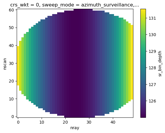
BrightBand Handling#
Median Brightband Width/Height#
[28]:
# if platf == "gpm":
sr_cut = sr_cut.wrl.qual.get_bb_ratio()
display(sr_cut)
<xarray.Dataset>
Dimensions: (nswath: 1, nscan: 61, nray: 49, XYZ: 3,
nbin: 176, nNP: 4, method: 6, foreBack: 2,
nearFar: 2, nNode: 5, nbinSZP: 7, nDSD: 2,
nNUBF: 3, LS: 2)
Coordinates: (12/18)
elevation (nscan, nray, nbin) float64 nan nan ... nan nan
Latitude (nscan, nray) float32 -27.1 -27.08 ... -28.47
Longitude (nscan, nray) float32 151.4 151.4 ... 154.9
date (nscan) datetime64[ns] 2014-12-06T09:50:30.0...
x (nscan, nray) float64 -1.861e+05 ... 1.613e+05
y (nscan, nray) float64 6.695e+04 ... -8.461e+04
... ...
yp (nscan, nray, nbin) float64 nan nan ... nan nan
zp (nscan, nray, nbin) float64 nan nan ... nan nan
sr_range (nbin) float64 2.188e+04 2.175e+04 ... 0.0
range (nscan, nray, nbin) float64 nan nan ... nan nan
azimuth (nscan, nray, nbin) float64 nan nan ... nan nan
pr_dist (nscan, nray, nbin) float64 nan nan ... nan nan
Dimensions without coordinates: nswath, nscan, nray, XYZ, nbin, nNP, method,
foreBack, nearFar, nNode, nbinSZP, nDSD, nNUBF,
LS
Data variables: (12/100)
AlgorithmRuntimeInfo (nswath, nscan, nray) object nan nan ... nan
dataQuality (nscan, nray) float32 nan nan nan ... nan nan
dataWarning (nscan, nray) float32 nan nan nan ... nan nan
missing (nscan, nray) float32 nan nan nan ... nan nan
modeStatus (nscan, nray) float32 nan nan nan ... nan nan
geoError (nscan, nray) float32 nan nan nan ... nan nan
... ...
flagSensor (nscan, nray) float32 nan nan nan ... nan nan
vol_sr (nscan, nray, nbin) float64 nan nan ... nan nan
sr_bin_radius (nscan, nray, nbin) float64 nan nan ... nan nan
sr_bin_depth (nscan, nray) float32 nan nan nan ... nan nan
bb_ratio (nscan, nray, nbin) float64 nan nan ... nan nan
bb_mask (nscan, nray) bool False False ... False False
Attributes:
FileHeader: DOI=10.5067/GPM/DPR/Ku/2A/05;\nDOIauthority=http://dx....
InputRecord: InputFileNames=GPMCOR_KUR_1412060833_1006_004383_1BS_D...
NavigationRecord: LongitudeOnEquator=-27.312063;\nUTCDateTimeOnEquator=2...
FileInfo: DataFormatVersion=cn;\nTKCodeBuildVersion=1;\nMetadata...
JAXAInfo: GranuleFirstScanUTCDateTime=2014-12-06T08:33:33.292Z;\...
platform: GPM- nswath: 1
- nscan: 61
- nray: 49
- XYZ: 3
- nbin: 176
- nNP: 4
- method: 6
- foreBack: 2
- nearFar: 2
- nNode: 5
- nbinSZP: 7
- nDSD: 2
- nNUBF: 3
- LS: 2
- elevation(nscan, nray, nbin)float64nan nan nan nan ... nan nan nan nan
array([[[nan, nan, nan, ..., nan, nan, nan], [nan, nan, nan, ..., nan, nan, nan], [nan, nan, nan, ..., nan, nan, nan], ..., [nan, nan, nan, ..., nan, nan, nan], [nan, nan, nan, ..., nan, nan, nan], [nan, nan, nan, ..., nan, nan, nan]], [[nan, nan, nan, ..., nan, nan, nan], [nan, nan, nan, ..., nan, nan, nan], [nan, nan, nan, ..., nan, nan, nan], ..., [nan, nan, nan, ..., nan, nan, nan], [nan, nan, nan, ..., nan, nan, nan], [nan, nan, nan, ..., nan, nan, nan]], [[nan, nan, nan, ..., nan, nan, nan], [nan, nan, nan, ..., nan, nan, nan], [nan, nan, nan, ..., nan, nan, nan], ..., ... ..., [nan, nan, nan, ..., nan, nan, nan], [nan, nan, nan, ..., nan, nan, nan], [nan, nan, nan, ..., nan, nan, nan]], [[nan, nan, nan, ..., nan, nan, nan], [nan, nan, nan, ..., nan, nan, nan], [nan, nan, nan, ..., nan, nan, nan], ..., [nan, nan, nan, ..., nan, nan, nan], [nan, nan, nan, ..., nan, nan, nan], [nan, nan, nan, ..., nan, nan, nan]], [[nan, nan, nan, ..., nan, nan, nan], [nan, nan, nan, ..., nan, nan, nan], [nan, nan, nan, ..., nan, nan, nan], ..., [nan, nan, nan, ..., nan, nan, nan], [nan, nan, nan, ..., nan, nan, nan], [nan, nan, nan, ..., nan, nan, nan]]]) - Latitude(nscan, nray)float32-27.1 -27.08 ... -28.49 -28.47
- DimensionNames :
- nscan,nray
- Units :
- degrees
- units :
- degrees
- CodeMissingValue :
- -9999.9
array([[-27.101166, -27.078152, -27.05518 , ..., -26.126842, -26.104671, -26.082481], [-27.141512, -27.11849 , -27.095507, ..., -26.166826, -26.144648, -26.122446], [-27.181885, -27.158855, -27.135864, ..., -26.206799, -26.18461 , -26.1624 ], ..., [-29.43486 , -29.41136 , -29.3879 , ..., -28.437897, -28.415165, -28.392406], [-29.474983, -29.451473, -29.428001, ..., -28.477577, -28.454834, -28.432068], [-29.515072, -29.491552, -29.468073, ..., -28.517286, -28.494534, -28.471756]], dtype=float32) - Longitude(nscan, nray)float32151.4 151.4 151.5 ... 154.8 154.9
- DimensionNames :
- nscan,nray
- Units :
- degrees
- units :
- degrees
- CodeMissingValue :
- -9999.9
array([[151.36314, 151.41205, 151.4609 , ..., 153.48042, 153.52951, 153.57869], [151.3838 , 151.43272, 151.4816 , ..., 153.50168, 153.55077, 153.59996], [151.4045 , 151.45343, 151.50232, ..., 153.52295, 153.57205, 153.62126], ..., [152.58981, 152.63957, 152.68929, ..., 154.74254, 154.7924 , 154.84236], [152.61151, 152.66129, 152.71101, ..., 154.76485, 154.81473, 154.86469], [152.63318, 152.68297, 152.73271, ..., 154.78717, 154.83707, 154.88705]], dtype=float32) - date(nscan)datetime64[ns]2014-12-06T09:50:30.000500 ... 2...
array(['2014-12-06T09:50:30.000500000', '2014-12-06T09:50:31.000200000', '2014-12-06T09:50:31.000900000', '2014-12-06T09:50:32.000600000', '2014-12-06T09:50:33.000300000', '2014-12-06T09:50:34.000000000', '2014-12-06T09:50:34.000700000', '2014-12-06T09:50:35.000400000', '2014-12-06T09:50:36.000100000', '2014-12-06T09:50:36.000800000', '2014-12-06T09:50:37.000500000', '2014-12-06T09:50:38.000200000', '2014-12-06T09:50:38.000900000', '2014-12-06T09:50:39.000600000', '2014-12-06T09:50:40.000300000', '2014-12-06T09:50:41.000000000', '2014-12-06T09:50:41.000700000', '2014-12-06T09:50:42.000400000', '2014-12-06T09:50:43.000100000', '2014-12-06T09:50:43.000800000', '2014-12-06T09:50:44.000500000', '2014-12-06T09:50:45.000200000', '2014-12-06T09:50:45.000900000', '2014-12-06T09:50:46.000600000', '2014-12-06T09:50:47.000300000', '2014-12-06T09:50:48.000000000', '2014-12-06T09:50:48.000700000', '2014-12-06T09:50:49.000400000', '2014-12-06T09:50:50.000100000', '2014-12-06T09:50:50.000800000', '2014-12-06T09:50:51.000500000', '2014-12-06T09:50:52.000200000', '2014-12-06T09:50:52.000900000', '2014-12-06T09:50:53.000600000', '2014-12-06T09:50:54.000300000', '2014-12-06T09:50:55.000000000', '2014-12-06T09:50:55.000700000', '2014-12-06T09:50:56.000400000', '2014-12-06T09:50:57.000100000', '2014-12-06T09:50:57.000800000', '2014-12-06T09:50:58.000500000', '2014-12-06T09:50:59.000200000', '2014-12-06T09:50:59.000900000', '2014-12-06T09:51:00.000600000', '2014-12-06T09:51:01.000300000', '2014-12-06T09:51:02.000000000', '2014-12-06T09:51:02.000700000', '2014-12-06T09:51:03.000400000', '2014-12-06T09:51:04.000100000', '2014-12-06T09:51:04.000800000', '2014-12-06T09:51:05.000500000', '2014-12-06T09:51:06.000200000', '2014-12-06T09:51:06.000900000', '2014-12-06T09:51:07.000600000', '2014-12-06T09:51:08.000300000', '2014-12-06T09:51:09.000000000', '2014-12-06T09:51:09.000700000', '2014-12-06T09:51:10.000400000', '2014-12-06T09:51:11.000100000', '2014-12-06T09:51:11.000800000', '2014-12-06T09:51:12.000500000'], dtype='datetime64[ns]') - x(nscan, nray)float64-1.861e+05 -1.813e+05 ... 1.613e+05
array([[-186117.16968603, -181305.28030804, -176495.82165648, ..., 24047.25052569, 28962.67647159, 33889.14933934], [-184002.07209363, -179190.03391088, -174380.42887443, ..., 26164.19651736, 31078.33323847, 36005.04339036], [-181885.32234517, -177073.13766802, -172263.38253896, ..., 28281.18514283, 33195.55875011, 38122.50511547], ..., [ -63096.0693707 , -58280.57133685, -53467.29685492, ..., 147190.35761426, 152107.26441435, 157035.21211942], [ -60966.90277686, -56151.32532165, -51337.96859382, ..., 149320.27054283, 154237.35920682, 159163.98843144], [ -58842.32030271, -54026.66419738, -49213.22410927, ..., 151449.96341515, 156367.22861008, 161295.53182215]]) - y(nscan, nray)float646.695e+04 6.958e+04 ... -8.461e+04
array([[ 66954.186556 , 69576.76471264, 72192.70009704, ..., 176292.00877297, 178737.95818865, 181184.06782741], [ 62514.32843802, 65136.98493917, 67753.420854 , ..., 171857.94004293, 174303.91519634, 176750.46715308], [ 58071.19537879, 60693.92841949, 63310.4403647 , ..., 167424.74984815, 169870.95728909, 172317.73840756], ..., [-190436.25557751, -187806.41895225, -185183.04044706, ..., -80673.26872774, -78215.0122177 , -75755.91099028], [-194872.49152306, -192242.44091716, -189618.63750756, ..., -85098.0633245 , -82639.43830613, -80180.37445039], [-199305.34041805, -196675.07521151, -194051.26911153, ..., -89526.47535637, -87067.69442881, -84608.28612928]]) - crs_wkt()int640
- crs_wkt :
- PROJCRS["unknown",BASEGEOGCRS["unknown",DATUM["Unknown based on WGS 84 ellipsoid",ELLIPSOID["WGS 84",6378137,298.25722356049,LENGTHUNIT["metre",1,ID["EPSG",9001]]]],PRIMEM["Greenwich",0,ANGLEUNIT["degree",0.0174532925199433],ID["EPSG",8901]]],CONVERSION["unknown",METHOD["Modified Azimuthal Equidistant",ID["EPSG",9832]],PARAMETER["Latitude of natural origin",-27.7181,ANGLEUNIT["degree",0.0174532925199433],ID["EPSG",8801]],PARAMETER["Longitude of natural origin",153.240005,ANGLEUNIT["degree",0.0174532925199433],ID["EPSG",8802]],PARAMETER["False easting",0,LENGTHUNIT["metre",1],ID["EPSG",8806]],PARAMETER["False northing",0,LENGTHUNIT["metre",1],ID["EPSG",8807]]],CS[Cartesian,2],AXIS["(E)",east,ORDER[1],LENGTHUNIT["metre",1,ID["EPSG",9001]]],AXIS["(N)",north,ORDER[2],LENGTHUNIT["metre",1,ID["EPSG",9001]]]]
- semi_major_axis :
- 6378137.0
- semi_minor_axis :
- 6356752.314245
- inverse_flattening :
- 298.25722356049
- reference_ellipsoid_name :
- WGS 84
- longitude_of_prime_meridian :
- 0.0
- prime_meridian_name :
- Greenwich
- geographic_crs_name :
- unknown
- horizontal_datum_name :
- Unknown based on WGS 84 ellipsoid
- projected_crs_name :
- unknown
- grid_mapping_name :
- azimuthal_equidistant
- latitude_of_projection_origin :
- -27.7181
- longitude_of_projection_origin :
- 153.240005
- false_easting :
- 0.0
- false_northing :
- 0.0
array(0)
- sweep_mode()<U20'azimuth_surveillance'
array('azimuth_surveillance', dtype='<U20') - longitude()float64153.2
array(153.24000549)
- latitude()float64-27.72
array(-27.71809959)
- altitude()float64175.0
array(174.99999702)
- xp(nscan, nray, nbin)float64nan nan nan nan ... nan nan nan nan
array([[[nan, nan, nan, ..., nan, nan, nan], [nan, nan, nan, ..., nan, nan, nan], [nan, nan, nan, ..., nan, nan, nan], ..., [nan, nan, nan, ..., nan, nan, nan], [nan, nan, nan, ..., nan, nan, nan], [nan, nan, nan, ..., nan, nan, nan]], [[nan, nan, nan, ..., nan, nan, nan], [nan, nan, nan, ..., nan, nan, nan], [nan, nan, nan, ..., nan, nan, nan], ..., [nan, nan, nan, ..., nan, nan, nan], [nan, nan, nan, ..., nan, nan, nan], [nan, nan, nan, ..., nan, nan, nan]], [[nan, nan, nan, ..., nan, nan, nan], [nan, nan, nan, ..., nan, nan, nan], [nan, nan, nan, ..., nan, nan, nan], ..., ... ..., [nan, nan, nan, ..., nan, nan, nan], [nan, nan, nan, ..., nan, nan, nan], [nan, nan, nan, ..., nan, nan, nan]], [[nan, nan, nan, ..., nan, nan, nan], [nan, nan, nan, ..., nan, nan, nan], [nan, nan, nan, ..., nan, nan, nan], ..., [nan, nan, nan, ..., nan, nan, nan], [nan, nan, nan, ..., nan, nan, nan], [nan, nan, nan, ..., nan, nan, nan]], [[nan, nan, nan, ..., nan, nan, nan], [nan, nan, nan, ..., nan, nan, nan], [nan, nan, nan, ..., nan, nan, nan], ..., [nan, nan, nan, ..., nan, nan, nan], [nan, nan, nan, ..., nan, nan, nan], [nan, nan, nan, ..., nan, nan, nan]]]) - yp(nscan, nray, nbin)float64nan nan nan nan ... nan nan nan nan
array([[[nan, nan, nan, ..., nan, nan, nan], [nan, nan, nan, ..., nan, nan, nan], [nan, nan, nan, ..., nan, nan, nan], ..., [nan, nan, nan, ..., nan, nan, nan], [nan, nan, nan, ..., nan, nan, nan], [nan, nan, nan, ..., nan, nan, nan]], [[nan, nan, nan, ..., nan, nan, nan], [nan, nan, nan, ..., nan, nan, nan], [nan, nan, nan, ..., nan, nan, nan], ..., [nan, nan, nan, ..., nan, nan, nan], [nan, nan, nan, ..., nan, nan, nan], [nan, nan, nan, ..., nan, nan, nan]], [[nan, nan, nan, ..., nan, nan, nan], [nan, nan, nan, ..., nan, nan, nan], [nan, nan, nan, ..., nan, nan, nan], ..., ... ..., [nan, nan, nan, ..., nan, nan, nan], [nan, nan, nan, ..., nan, nan, nan], [nan, nan, nan, ..., nan, nan, nan]], [[nan, nan, nan, ..., nan, nan, nan], [nan, nan, nan, ..., nan, nan, nan], [nan, nan, nan, ..., nan, nan, nan], ..., [nan, nan, nan, ..., nan, nan, nan], [nan, nan, nan, ..., nan, nan, nan], [nan, nan, nan, ..., nan, nan, nan]], [[nan, nan, nan, ..., nan, nan, nan], [nan, nan, nan, ..., nan, nan, nan], [nan, nan, nan, ..., nan, nan, nan], ..., [nan, nan, nan, ..., nan, nan, nan], [nan, nan, nan, ..., nan, nan, nan], [nan, nan, nan, ..., nan, nan, nan]]]) - zp(nscan, nray, nbin)float64nan nan nan nan ... nan nan nan nan
array([[[nan, nan, nan, ..., nan, nan, nan], [nan, nan, nan, ..., nan, nan, nan], [nan, nan, nan, ..., nan, nan, nan], ..., [nan, nan, nan, ..., nan, nan, nan], [nan, nan, nan, ..., nan, nan, nan], [nan, nan, nan, ..., nan, nan, nan]], [[nan, nan, nan, ..., nan, nan, nan], [nan, nan, nan, ..., nan, nan, nan], [nan, nan, nan, ..., nan, nan, nan], ..., [nan, nan, nan, ..., nan, nan, nan], [nan, nan, nan, ..., nan, nan, nan], [nan, nan, nan, ..., nan, nan, nan]], [[nan, nan, nan, ..., nan, nan, nan], [nan, nan, nan, ..., nan, nan, nan], [nan, nan, nan, ..., nan, nan, nan], ..., ... ..., [nan, nan, nan, ..., nan, nan, nan], [nan, nan, nan, ..., nan, nan, nan], [nan, nan, nan, ..., nan, nan, nan]], [[nan, nan, nan, ..., nan, nan, nan], [nan, nan, nan, ..., nan, nan, nan], [nan, nan, nan, ..., nan, nan, nan], ..., [nan, nan, nan, ..., nan, nan, nan], [nan, nan, nan, ..., nan, nan, nan], [nan, nan, nan, ..., nan, nan, nan]], [[nan, nan, nan, ..., nan, nan, nan], [nan, nan, nan, ..., nan, nan, nan], [nan, nan, nan, ..., nan, nan, nan], ..., [nan, nan, nan, ..., nan, nan, nan], [nan, nan, nan, ..., nan, nan, nan], [nan, nan, nan, ..., nan, nan, nan]]]) - sr_range(nbin)float642.188e+04 2.175e+04 ... 125.0 0.0
array([21875., 21750., 21625., 21500., 21375., 21250., 21125., 21000., 20875., 20750., 20625., 20500., 20375., 20250., 20125., 20000., 19875., 19750., 19625., 19500., 19375., 19250., 19125., 19000., 18875., 18750., 18625., 18500., 18375., 18250., 18125., 18000., 17875., 17750., 17625., 17500., 17375., 17250., 17125., 17000., 16875., 16750., 16625., 16500., 16375., 16250., 16125., 16000., 15875., 15750., 15625., 15500., 15375., 15250., 15125., 15000., 14875., 14750., 14625., 14500., 14375., 14250., 14125., 14000., 13875., 13750., 13625., 13500., 13375., 13250., 13125., 13000., 12875., 12750., 12625., 12500., 12375., 12250., 12125., 12000., 11875., 11750., 11625., 11500., 11375., 11250., 11125., 11000., 10875., 10750., 10625., 10500., 10375., 10250., 10125., 10000., 9875., 9750., 9625., 9500., 9375., 9250., 9125., 9000., 8875., 8750., 8625., 8500., 8375., 8250., 8125., 8000., 7875., 7750., 7625., 7500., 7375., 7250., 7125., 7000., 6875., 6750., 6625., 6500., 6375., 6250., 6125., 6000., 5875., 5750., 5625., 5500., 5375., 5250., 5125., 5000., 4875., 4750., 4625., 4500., 4375., 4250., 4125., 4000., 3875., 3750., 3625., 3500., 3375., 3250., 3125., 3000., 2875., 2750., 2625., 2500., 2375., 2250., 2125., 2000., 1875., 1750., 1625., 1500., 1375., 1250., 1125., 1000., 875., 750., 625., 500., 375., 250., 125., 0.]) - range(nscan, nray, nbin)float64nan nan nan nan ... nan nan nan nan
array([[[nan, nan, nan, ..., nan, nan, nan], [nan, nan, nan, ..., nan, nan, nan], [nan, nan, nan, ..., nan, nan, nan], ..., [nan, nan, nan, ..., nan, nan, nan], [nan, nan, nan, ..., nan, nan, nan], [nan, nan, nan, ..., nan, nan, nan]], [[nan, nan, nan, ..., nan, nan, nan], [nan, nan, nan, ..., nan, nan, nan], [nan, nan, nan, ..., nan, nan, nan], ..., [nan, nan, nan, ..., nan, nan, nan], [nan, nan, nan, ..., nan, nan, nan], [nan, nan, nan, ..., nan, nan, nan]], [[nan, nan, nan, ..., nan, nan, nan], [nan, nan, nan, ..., nan, nan, nan], [nan, nan, nan, ..., nan, nan, nan], ..., ... ..., [nan, nan, nan, ..., nan, nan, nan], [nan, nan, nan, ..., nan, nan, nan], [nan, nan, nan, ..., nan, nan, nan]], [[nan, nan, nan, ..., nan, nan, nan], [nan, nan, nan, ..., nan, nan, nan], [nan, nan, nan, ..., nan, nan, nan], ..., [nan, nan, nan, ..., nan, nan, nan], [nan, nan, nan, ..., nan, nan, nan], [nan, nan, nan, ..., nan, nan, nan]], [[nan, nan, nan, ..., nan, nan, nan], [nan, nan, nan, ..., nan, nan, nan], [nan, nan, nan, ..., nan, nan, nan], ..., [nan, nan, nan, ..., nan, nan, nan], [nan, nan, nan, ..., nan, nan, nan], [nan, nan, nan, ..., nan, nan, nan]]]) - azimuth(nscan, nray, nbin)float64nan nan nan nan ... nan nan nan nan
array([[[nan, nan, nan, ..., nan, nan, nan], [nan, nan, nan, ..., nan, nan, nan], [nan, nan, nan, ..., nan, nan, nan], ..., [nan, nan, nan, ..., nan, nan, nan], [nan, nan, nan, ..., nan, nan, nan], [nan, nan, nan, ..., nan, nan, nan]], [[nan, nan, nan, ..., nan, nan, nan], [nan, nan, nan, ..., nan, nan, nan], [nan, nan, nan, ..., nan, nan, nan], ..., [nan, nan, nan, ..., nan, nan, nan], [nan, nan, nan, ..., nan, nan, nan], [nan, nan, nan, ..., nan, nan, nan]], [[nan, nan, nan, ..., nan, nan, nan], [nan, nan, nan, ..., nan, nan, nan], [nan, nan, nan, ..., nan, nan, nan], ..., ... ..., [nan, nan, nan, ..., nan, nan, nan], [nan, nan, nan, ..., nan, nan, nan], [nan, nan, nan, ..., nan, nan, nan]], [[nan, nan, nan, ..., nan, nan, nan], [nan, nan, nan, ..., nan, nan, nan], [nan, nan, nan, ..., nan, nan, nan], ..., [nan, nan, nan, ..., nan, nan, nan], [nan, nan, nan, ..., nan, nan, nan], [nan, nan, nan, ..., nan, nan, nan]], [[nan, nan, nan, ..., nan, nan, nan], [nan, nan, nan, ..., nan, nan, nan], [nan, nan, nan, ..., nan, nan, nan], ..., [nan, nan, nan, ..., nan, nan, nan], [nan, nan, nan, ..., nan, nan, nan], [nan, nan, nan, ..., nan, nan, nan]]]) - pr_dist(nscan, nray, nbin)float64nan nan nan nan ... nan nan nan nan
array([[[nan, nan, nan, ..., nan, nan, nan], [nan, nan, nan, ..., nan, nan, nan], [nan, nan, nan, ..., nan, nan, nan], ..., [nan, nan, nan, ..., nan, nan, nan], [nan, nan, nan, ..., nan, nan, nan], [nan, nan, nan, ..., nan, nan, nan]], [[nan, nan, nan, ..., nan, nan, nan], [nan, nan, nan, ..., nan, nan, nan], [nan, nan, nan, ..., nan, nan, nan], ..., [nan, nan, nan, ..., nan, nan, nan], [nan, nan, nan, ..., nan, nan, nan], [nan, nan, nan, ..., nan, nan, nan]], [[nan, nan, nan, ..., nan, nan, nan], [nan, nan, nan, ..., nan, nan, nan], [nan, nan, nan, ..., nan, nan, nan], ..., ... ..., [nan, nan, nan, ..., nan, nan, nan], [nan, nan, nan, ..., nan, nan, nan], [nan, nan, nan, ..., nan, nan, nan]], [[nan, nan, nan, ..., nan, nan, nan], [nan, nan, nan, ..., nan, nan, nan], [nan, nan, nan, ..., nan, nan, nan], ..., [nan, nan, nan, ..., nan, nan, nan], [nan, nan, nan, ..., nan, nan, nan], [nan, nan, nan, ..., nan, nan, nan]], [[nan, nan, nan, ..., nan, nan, nan], [nan, nan, nan, ..., nan, nan, nan], [nan, nan, nan, ..., nan, nan, nan], ..., [nan, nan, nan, ..., nan, nan, nan], [nan, nan, nan, ..., nan, nan, nan], [nan, nan, nan, ..., nan, nan, nan]]])
- AlgorithmRuntimeInfo(nswath, nscan, nray)objectnan nan nan nan ... nan nan nan nan
array([[[nan, nan, nan, ..., nan, nan, nan], [nan, nan, nan, ..., nan, nan, nan], [nan, nan, nan, ..., nan, nan, nan], ..., [nan, nan, nan, ..., nan, nan, nan], [nan, nan, nan, ..., nan, nan, nan], [nan, nan, nan, ..., nan, nan, nan]]], dtype=object) - dataQuality(nscan, nray)float32nan nan nan nan ... nan nan nan nan
- DimensionNames :
- nscan
- CodeMissingValue :
- -99
array([[nan, nan, nan, ..., nan, nan, nan], [nan, nan, nan, ..., nan, nan, nan], [nan, nan, nan, ..., nan, nan, nan], ..., [nan, nan, nan, ..., nan, nan, nan], [nan, nan, nan, ..., nan, nan, nan], [nan, nan, nan, ..., nan, nan, nan]], dtype=float32) - dataWarning(nscan, nray)float32nan nan nan nan ... nan nan nan nan
- DimensionNames :
- nscan
- CodeMissingValue :
- -99
array([[nan, nan, nan, ..., nan, nan, nan], [nan, nan, nan, ..., nan, nan, nan], [nan, nan, nan, ..., nan, nan, nan], ..., [nan, nan, nan, ..., nan, nan, nan], [nan, nan, nan, ..., nan, nan, nan], [nan, nan, nan, ..., nan, nan, nan]], dtype=float32) - missing(nscan, nray)float32nan nan nan nan ... nan nan nan nan
- DimensionNames :
- nscan
- CodeMissingValue :
- -99
array([[nan, nan, nan, ..., nan, nan, nan], [nan, nan, nan, ..., nan, nan, nan], [nan, nan, nan, ..., nan, nan, nan], ..., [nan, nan, nan, ..., nan, nan, nan], [nan, nan, nan, ..., nan, nan, nan], [nan, nan, nan, ..., nan, nan, nan]], dtype=float32) - modeStatus(nscan, nray)float32nan nan nan nan ... nan nan nan nan
- DimensionNames :
- nscan
- CodeMissingValue :
- -99
array([[nan, nan, nan, ..., nan, nan, nan], [nan, nan, nan, ..., nan, nan, nan], [nan, nan, nan, ..., nan, nan, nan], ..., [nan, nan, nan, ..., nan, nan, nan], [nan, nan, nan, ..., nan, nan, nan], [nan, nan, nan, ..., nan, nan, nan]], dtype=float32) - geoError(nscan, nray)float32nan nan nan nan ... nan nan nan nan
- DimensionNames :
- nscan
- CodeMissingValue :
- -9999
array([[nan, nan, nan, ..., nan, nan, nan], [nan, nan, nan, ..., nan, nan, nan], [nan, nan, nan, ..., nan, nan, nan], ..., [nan, nan, nan, ..., nan, nan, nan], [nan, nan, nan, ..., nan, nan, nan], [nan, nan, nan, ..., nan, nan, nan]], dtype=float32) - geoWarning(nscan, nray)float32nan nan nan nan ... nan nan nan nan
- DimensionNames :
- nscan
- CodeMissingValue :
- -9999
array([[nan, nan, nan, ..., nan, nan, nan], [nan, nan, nan, ..., nan, nan, nan], [nan, nan, nan, ..., nan, nan, nan], ..., [nan, nan, nan, ..., nan, nan, nan], [nan, nan, nan, ..., nan, nan, nan], [nan, nan, nan, ..., nan, nan, nan]], dtype=float32) - SCorientation(nscan, nray)float32nan nan nan nan ... nan nan nan nan
- DimensionNames :
- nscan
- Units :
- degrees
- units :
- degrees
- CodeMissingValue :
- -9999
array([[nan, nan, nan, ..., nan, nan, nan], [nan, nan, nan, ..., nan, nan, nan], [nan, nan, nan, ..., nan, nan, nan], ..., [nan, nan, nan, ..., nan, nan, nan], [nan, nan, nan, ..., nan, nan, nan], [nan, nan, nan, ..., nan, nan, nan]], dtype=float32) - pointingStatus(nscan, nray)float32nan nan nan nan ... nan nan nan nan
- DimensionNames :
- nscan
- CodeMissingValue :
- -9999
array([[nan, nan, nan, ..., nan, nan, nan], [nan, nan, nan, ..., nan, nan, nan], [nan, nan, nan, ..., nan, nan, nan], ..., [nan, nan, nan, ..., nan, nan, nan], [nan, nan, nan, ..., nan, nan, nan], [nan, nan, nan, ..., nan, nan, nan]], dtype=float32) - acsModeMidScan(nscan, nray)float32nan nan nan nan ... nan nan nan nan
- DimensionNames :
- nscan
- CodeMissingValue :
- -99
array([[nan, nan, nan, ..., nan, nan, nan], [nan, nan, nan, ..., nan, nan, nan], [nan, nan, nan, ..., nan, nan, nan], ..., [nan, nan, nan, ..., nan, nan, nan], [nan, nan, nan, ..., nan, nan, nan], [nan, nan, nan, ..., nan, nan, nan]], dtype=float32) - targetSelectionMidScan(nscan, nray)float32nan nan nan nan ... nan nan nan nan
- DimensionNames :
- nscan
- CodeMissingValue :
- -99
array([[nan, nan, nan, ..., nan, nan, nan], [nan, nan, nan, ..., nan, nan, nan], [nan, nan, nan, ..., nan, nan, nan], ..., [nan, nan, nan, ..., nan, nan, nan], [nan, nan, nan, ..., nan, nan, nan], [nan, nan, nan, ..., nan, nan, nan]], dtype=float32) - operationalMode(nscan, nray)float32nan nan nan nan ... nan nan nan nan
- DimensionNames :
- nscan
- CodeMissingValue :
- -99
array([[nan, nan, nan, ..., nan, nan, nan], [nan, nan, nan, ..., nan, nan, nan], [nan, nan, nan, ..., nan, nan, nan], ..., [nan, nan, nan, ..., nan, nan, nan], [nan, nan, nan, ..., nan, nan, nan], [nan, nan, nan, ..., nan, nan, nan]], dtype=float32) - limitErrorFlag(nscan, nray)float32nan nan nan nan ... nan nan nan nan
- DimensionNames :
- nscan
- CodeMissingValue :
- -99
array([[nan, nan, nan, ..., nan, nan, nan], [nan, nan, nan, ..., nan, nan, nan], [nan, nan, nan, ..., nan, nan, nan], ..., [nan, nan, nan, ..., nan, nan, nan], [nan, nan, nan, ..., nan, nan, nan], [nan, nan, nan, ..., nan, nan, nan]], dtype=float32) - FractionalGranuleNumber(nscan, nray)float64nan nan nan nan ... nan nan nan nan
- DimensionNames :
- nscan
- CodeMissingValue :
- -9999.9
array([[nan, nan, nan, ..., nan, nan, nan], [nan, nan, nan, ..., nan, nan, nan], [nan, nan, nan, ..., nan, nan, nan], ..., [nan, nan, nan, ..., nan, nan, nan], [nan, nan, nan, ..., nan, nan, nan], [nan, nan, nan, ..., nan, nan, nan]]) - scPos(nscan, XYZ, nray)float32nan nan nan nan ... nan nan nan nan
- DimensionNames :
- nscan,XYZ
- Units :
- m
- units :
- m
- CodeMissingValue :
- -9999.9
array([[[nan, nan, nan, ..., nan, nan, nan], [nan, nan, nan, ..., nan, nan, nan], [nan, nan, nan, ..., nan, nan, nan]], [[nan, nan, nan, ..., nan, nan, nan], [nan, nan, nan, ..., nan, nan, nan], [nan, nan, nan, ..., nan, nan, nan]], [[nan, nan, nan, ..., nan, nan, nan], [nan, nan, nan, ..., nan, nan, nan], [nan, nan, nan, ..., nan, nan, nan]], ..., [[nan, nan, nan, ..., nan, nan, nan], [nan, nan, nan, ..., nan, nan, nan], [nan, nan, nan, ..., nan, nan, nan]], [[nan, nan, nan, ..., nan, nan, nan], [nan, nan, nan, ..., nan, nan, nan], [nan, nan, nan, ..., nan, nan, nan]], [[nan, nan, nan, ..., nan, nan, nan], [nan, nan, nan, ..., nan, nan, nan], [nan, nan, nan, ..., nan, nan, nan]]], dtype=float32) - scVel(nscan, XYZ, nray)float32nan nan nan nan ... nan nan nan nan
- DimensionNames :
- nscan,XYZ
- Units :
- m/s
- units :
- m/s
- CodeMissingValue :
- -9999.9
array([[[nan, nan, nan, ..., nan, nan, nan], [nan, nan, nan, ..., nan, nan, nan], [nan, nan, nan, ..., nan, nan, nan]], [[nan, nan, nan, ..., nan, nan, nan], [nan, nan, nan, ..., nan, nan, nan], [nan, nan, nan, ..., nan, nan, nan]], [[nan, nan, nan, ..., nan, nan, nan], [nan, nan, nan, ..., nan, nan, nan], [nan, nan, nan, ..., nan, nan, nan]], ..., [[nan, nan, nan, ..., nan, nan, nan], [nan, nan, nan, ..., nan, nan, nan], [nan, nan, nan, ..., nan, nan, nan]], [[nan, nan, nan, ..., nan, nan, nan], [nan, nan, nan, ..., nan, nan, nan], [nan, nan, nan, ..., nan, nan, nan]], [[nan, nan, nan, ..., nan, nan, nan], [nan, nan, nan, ..., nan, nan, nan], [nan, nan, nan, ..., nan, nan, nan]]], dtype=float32) - scLat(nscan, nray)float32nan nan nan nan ... nan nan nan nan
- DimensionNames :
- nscan
- Units :
- degrees
- units :
- degrees
- CodeMissingValue :
- -9999.9
array([[nan, nan, nan, ..., nan, nan, nan], [nan, nan, nan, ..., nan, nan, nan], [nan, nan, nan, ..., nan, nan, nan], ..., [nan, nan, nan, ..., nan, nan, nan], [nan, nan, nan, ..., nan, nan, nan], [nan, nan, nan, ..., nan, nan, nan]], dtype=float32) - scLon(nscan, nray)float32nan nan nan nan ... nan nan nan nan
- DimensionNames :
- nscan
- Units :
- degrees
- units :
- degrees
- CodeMissingValue :
- -9999.9
array([[nan, nan, nan, ..., nan, nan, nan], [nan, nan, nan, ..., nan, nan, nan], [nan, nan, nan, ..., nan, nan, nan], ..., [nan, nan, nan, ..., nan, nan, nan], [nan, nan, nan, ..., nan, nan, nan], [nan, nan, nan, ..., nan, nan, nan]], dtype=float32) - scAlt(nscan, nray)float32nan nan nan nan ... nan nan nan nan
- DimensionNames :
- nscan
- Units :
- m
- units :
- m
- CodeMissingValue :
- -9999.9
array([[nan, nan, nan, ..., nan, nan, nan], [nan, nan, nan, ..., nan, nan, nan], [nan, nan, nan, ..., nan, nan, nan], ..., [nan, nan, nan, ..., nan, nan, nan], [nan, nan, nan, ..., nan, nan, nan], [nan, nan, nan, ..., nan, nan, nan]], dtype=float32) - dprAlt(nscan, nray)float32nan nan nan nan ... nan nan nan nan
- DimensionNames :
- nscan
- Units :
- m
- units :
- m
- CodeMissingValue :
- -9999.9
array([[nan, nan, nan, ..., nan, nan, nan], [nan, nan, nan, ..., nan, nan, nan], [nan, nan, nan, ..., nan, nan, nan], ..., [nan, nan, nan, ..., nan, nan, nan], [nan, nan, nan, ..., nan, nan, nan], [nan, nan, nan, ..., nan, nan, nan]], dtype=float32) - scAttRollGeoc(nscan, nray)float32nan nan nan nan ... nan nan nan nan
- DimensionNames :
- nscan
- Units :
- degrees
- units :
- degrees
- CodeMissingValue :
- -9999.9
array([[nan, nan, nan, ..., nan, nan, nan], [nan, nan, nan, ..., nan, nan, nan], [nan, nan, nan, ..., nan, nan, nan], ..., [nan, nan, nan, ..., nan, nan, nan], [nan, nan, nan, ..., nan, nan, nan], [nan, nan, nan, ..., nan, nan, nan]], dtype=float32) - scAttPitchGeoc(nscan, nray)float32nan nan nan nan ... nan nan nan nan
- DimensionNames :
- nscan
- Units :
- degrees
- units :
- degrees
- CodeMissingValue :
- -9999.9
array([[nan, nan, nan, ..., nan, nan, nan], [nan, nan, nan, ..., nan, nan, nan], [nan, nan, nan, ..., nan, nan, nan], ..., [nan, nan, nan, ..., nan, nan, nan], [nan, nan, nan, ..., nan, nan, nan], [nan, nan, nan, ..., nan, nan, nan]], dtype=float32) - scAttYawGeoc(nscan, nray)float32nan nan nan nan ... nan nan nan nan
- DimensionNames :
- nscan
- Units :
- degrees
- units :
- degrees
- CodeMissingValue :
- -9999.9
array([[nan, nan, nan, ..., nan, nan, nan], [nan, nan, nan, ..., nan, nan, nan], [nan, nan, nan, ..., nan, nan, nan], ..., [nan, nan, nan, ..., nan, nan, nan], [nan, nan, nan, ..., nan, nan, nan], [nan, nan, nan, ..., nan, nan, nan]], dtype=float32) - scAttRollGeod(nscan, nray)float32nan nan nan nan ... nan nan nan nan
- DimensionNames :
- nscan
- Units :
- degrees
- units :
- degrees
- CodeMissingValue :
- -9999.9
array([[nan, nan, nan, ..., nan, nan, nan], [nan, nan, nan, ..., nan, nan, nan], [nan, nan, nan, ..., nan, nan, nan], ..., [nan, nan, nan, ..., nan, nan, nan], [nan, nan, nan, ..., nan, nan, nan], [nan, nan, nan, ..., nan, nan, nan]], dtype=float32) - scAttPitchGeod(nscan, nray)float32nan nan nan nan ... nan nan nan nan
- DimensionNames :
- nscan
- Units :
- degrees
- units :
- degrees
- CodeMissingValue :
- -9999.9
array([[nan, nan, nan, ..., nan, nan, nan], [nan, nan, nan, ..., nan, nan, nan], [nan, nan, nan, ..., nan, nan, nan], ..., [nan, nan, nan, ..., nan, nan, nan], [nan, nan, nan, ..., nan, nan, nan], [nan, nan, nan, ..., nan, nan, nan]], dtype=float32) - scAttYawGeod(nscan, nray)float32nan nan nan nan ... nan nan nan nan
- DimensionNames :
- nscan
- Units :
- degrees
- units :
- degrees
- CodeMissingValue :
- -9999.9
array([[nan, nan, nan, ..., nan, nan, nan], [nan, nan, nan, ..., nan, nan, nan], [nan, nan, nan, ..., nan, nan, nan], ..., [nan, nan, nan, ..., nan, nan, nan], [nan, nan, nan, ..., nan, nan, nan], [nan, nan, nan, ..., nan, nan, nan]], dtype=float32) - greenHourAng(nscan, nray)float32nan nan nan nan ... nan nan nan nan
- DimensionNames :
- nscan
- Units :
- degrees
- units :
- degrees
- CodeMissingValue :
- -9999.9
array([[nan, nan, nan, ..., nan, nan, nan], [nan, nan, nan, ..., nan, nan, nan], [nan, nan, nan, ..., nan, nan, nan], ..., [nan, nan, nan, ..., nan, nan, nan], [nan, nan, nan, ..., nan, nan, nan], [nan, nan, nan, ..., nan, nan, nan]], dtype=float32) - timeMidScan(nscan, nray)float64nan nan nan nan ... nan nan nan nan
- DimensionNames :
- nscan
- Units :
- s
- units :
- s
- CodeMissingValue :
- -9999.9
array([[nan, nan, nan, ..., nan, nan, nan], [nan, nan, nan, ..., nan, nan, nan], [nan, nan, nan, ..., nan, nan, nan], ..., [nan, nan, nan, ..., nan, nan, nan], [nan, nan, nan, ..., nan, nan, nan], [nan, nan, nan, ..., nan, nan, nan]]) - timeMidScanOffset(nscan, nray)float64nan nan nan nan ... nan nan nan nan
- DimensionNames :
- nscan
- Units :
- s
- units :
- s
- CodeMissingValue :
- -9999.9
array([[nan, nan, nan, ..., nan, nan, nan], [nan, nan, nan, ..., nan, nan, nan], [nan, nan, nan, ..., nan, nan, nan], ..., [nan, nan, nan, ..., nan, nan, nan], [nan, nan, nan, ..., nan, nan, nan], [nan, nan, nan, ..., nan, nan, nan]]) - landSurfaceType(nscan, nray)float64nan nan nan nan ... nan nan nan nan
- DimensionNames :
- nscan,nray
- CodeMissingValue :
- -9999
array([[nan, nan, nan, ..., nan, nan, nan], [nan, nan, nan, ..., nan, nan, nan], [nan, nan, nan, ..., nan, nan, nan], ..., [nan, nan, nan, ..., nan, nan, nan], [nan, nan, nan, ..., nan, nan, nan], [nan, nan, nan, ..., nan, nan, nan]]) - localZenithAngle(nscan, nray)float32nan nan nan nan ... nan nan nan nan
- DimensionNames :
- nscan,nray
- Units :
- degree
- units :
- degree
- CodeMissingValue :
- -9999.9
array([[nan, nan, nan, ..., nan, nan, nan], [nan, nan, nan, ..., nan, nan, nan], [nan, nan, nan, ..., nan, nan, nan], ..., [nan, nan, nan, ..., nan, nan, nan], [nan, nan, nan, ..., nan, nan, nan], [nan, nan, nan, ..., nan, nan, nan]], dtype=float32) - flagPrecip(nscan, nray)float64nan nan nan nan ... nan nan nan nan
- DimensionNames :
- nscan,nray
- CodeMissingValue :
- -9999
array([[nan, nan, nan, ..., nan, nan, nan], [nan, nan, nan, ..., nan, nan, nan], [nan, nan, nan, ..., nan, nan, nan], ..., [nan, nan, nan, ..., nan, nan, nan], [nan, nan, nan, ..., nan, nan, nan], [nan, nan, nan, ..., nan, nan, nan]]) - flagSigmaZeroSaturation(nscan, nray)float32nan nan nan nan ... nan nan nan nan
- DimensionNames :
- nscan,nray
- CodeMissingValue :
- 99
array([[nan, nan, nan, ..., nan, nan, nan], [nan, nan, nan, ..., nan, nan, nan], [nan, nan, nan, ..., nan, nan, nan], ..., [nan, nan, nan, ..., nan, nan, nan], [nan, nan, nan, ..., nan, nan, nan], [nan, nan, nan, ..., nan, nan, nan]], dtype=float32) - binRealSurface(nscan, nray)float32nan nan nan nan ... nan nan nan nan
- DimensionNames :
- nscan,nray
- CodeMissingValue :
- -9999
array([[nan, nan, nan, ..., nan, nan, nan], [nan, nan, nan, ..., nan, nan, nan], [nan, nan, nan, ..., nan, nan, nan], ..., [nan, nan, nan, ..., nan, nan, nan], [nan, nan, nan, ..., nan, nan, nan], [nan, nan, nan, ..., nan, nan, nan]], dtype=float32) - binStormTop(nscan, nray)float32nan nan nan nan ... nan nan nan nan
- DimensionNames :
- nscan,nray
- CodeMissingValue :
- -9999
array([[nan, nan, nan, ..., nan, nan, nan], [nan, nan, nan, ..., nan, nan, nan], [nan, nan, nan, ..., nan, nan, nan], ..., [nan, nan, nan, ..., nan, nan, nan], [nan, nan, nan, ..., nan, nan, nan], [nan, nan, nan, ..., nan, nan, nan]], dtype=float32) - heightStormTop(nscan, nray)float32nan nan nan nan ... nan nan nan nan
- DimensionNames :
- nscan,nray
- Units :
- m
- units :
- m
- CodeMissingValue :
- -9999.9
array([[nan, nan, nan, ..., nan, nan, nan], [nan, nan, nan, ..., nan, nan, nan], [nan, nan, nan, ..., nan, nan, nan], ..., [nan, nan, nan, ..., nan, nan, nan], [nan, nan, nan, ..., nan, nan, nan], [nan, nan, nan, ..., nan, nan, nan]], dtype=float32) - binClutterFreeBottom(nscan, nray)float32nan nan nan nan ... nan nan nan nan
- DimensionNames :
- nscan,nray
- CodeMissingValue :
- -9999
array([[nan, nan, nan, ..., nan, nan, nan], [nan, nan, nan, ..., nan, nan, nan], [nan, nan, nan, ..., nan, nan, nan], ..., [nan, nan, nan, ..., nan, nan, nan], [nan, nan, nan, ..., nan, nan, nan], [nan, nan, nan, ..., nan, nan, nan]], dtype=float32) - sigmaZeroMeasured(nscan, nray)float32nan nan nan nan ... nan nan nan nan
- DimensionNames :
- nscan,nray
- Units :
- dB
- units :
- dB
- CodeMissingValue :
- -9999.9
array([[nan, nan, nan, ..., nan, nan, nan], [nan, nan, nan, ..., nan, nan, nan], [nan, nan, nan, ..., nan, nan, nan], ..., [nan, nan, nan, ..., nan, nan, nan], [nan, nan, nan, ..., nan, nan, nan], [nan, nan, nan, ..., nan, nan, nan]], dtype=float32) - zFactorMeasured(nscan, nray, nbin)float32nan nan nan nan ... nan nan nan nan
- DimensionNames :
- nscan,nray,nbin
- Units :
- dBZ
- units :
- dBZ
- CodeMissingValue :
- -9999.9
array([[[nan, nan, nan, ..., nan, nan, nan], [nan, nan, nan, ..., nan, nan, nan], [nan, nan, nan, ..., nan, nan, nan], ..., [nan, nan, nan, ..., nan, nan, nan], [nan, nan, nan, ..., nan, nan, nan], [nan, nan, nan, ..., nan, nan, nan]], [[nan, nan, nan, ..., nan, nan, nan], [nan, nan, nan, ..., nan, nan, nan], [nan, nan, nan, ..., nan, nan, nan], ..., [nan, nan, nan, ..., nan, nan, nan], [nan, nan, nan, ..., nan, nan, nan], [nan, nan, nan, ..., nan, nan, nan]], [[nan, nan, nan, ..., nan, nan, nan], [nan, nan, nan, ..., nan, nan, nan], [nan, nan, nan, ..., nan, nan, nan], ..., ... ..., [nan, nan, nan, ..., nan, nan, nan], [nan, nan, nan, ..., nan, nan, nan], [nan, nan, nan, ..., nan, nan, nan]], [[nan, nan, nan, ..., nan, nan, nan], [nan, nan, nan, ..., nan, nan, nan], [nan, nan, nan, ..., nan, nan, nan], ..., [nan, nan, nan, ..., nan, nan, nan], [nan, nan, nan, ..., nan, nan, nan], [nan, nan, nan, ..., nan, nan, nan]], [[nan, nan, nan, ..., nan, nan, nan], [nan, nan, nan, ..., nan, nan, nan], [nan, nan, nan, ..., nan, nan, nan], ..., [nan, nan, nan, ..., nan, nan, nan], [nan, nan, nan, ..., nan, nan, nan], [nan, nan, nan, ..., nan, nan, nan]]], dtype=float32) - ellipsoidBinOffset(nscan, nray)float32nan nan nan nan ... nan nan nan nan
- DimensionNames :
- nscan,nray
- Units :
- m
- units :
- m
- CodeMissingValue :
- -9999.9
array([[nan, nan, nan, ..., nan, nan, nan], [nan, nan, nan, ..., nan, nan, nan], [nan, nan, nan, ..., nan, nan, nan], ..., [nan, nan, nan, ..., nan, nan, nan], [nan, nan, nan, ..., nan, nan, nan], [nan, nan, nan, ..., nan, nan, nan]], dtype=float32) - snRatioAtRealSurface(nscan, nray)float32nan nan nan nan ... nan nan nan nan
- DimensionNames :
- nscan,nray
- CodeMissingValue :
- -9999.9
array([[nan, nan, nan, ..., nan, nan, nan], [nan, nan, nan, ..., nan, nan, nan], [nan, nan, nan, ..., nan, nan, nan], ..., [nan, nan, nan, ..., nan, nan, nan], [nan, nan, nan, ..., nan, nan, nan], [nan, nan, nan, ..., nan, nan, nan]], dtype=float32) - adjustFactor(nscan, nray)float32nan nan nan nan ... nan nan nan nan
- DimensionNames :
- nscan,nray
- Units :
- dB
- units :
- dB
- CodeMissingValue :
- -9999.9
array([[nan, nan, nan, ..., nan, nan, nan], [nan, nan, nan, ..., nan, nan, nan], [nan, nan, nan, ..., nan, nan, nan], ..., [nan, nan, nan, ..., nan, nan, nan], [nan, nan, nan, ..., nan, nan, nan], [nan, nan, nan, ..., nan, nan, nan]], dtype=float32) - snowIceCover(nscan, nray)float32nan nan nan nan ... nan nan nan nan
- DimensionNames :
- nscan,nray
- CodeMissingValue :
- -99
array([[nan, nan, nan, ..., nan, nan, nan], [nan, nan, nan, ..., nan, nan, nan], [nan, nan, nan, ..., nan, nan, nan], ..., [nan, nan, nan, ..., nan, nan, nan], [nan, nan, nan, ..., nan, nan, nan], [nan, nan, nan, ..., nan, nan, nan]], dtype=float32) - binZeroDeg(nscan, nray)float32nan nan nan nan ... nan nan nan nan
- DimensionNames :
- nscan,nray
- CodeMissingValue :
- -9999
array([[nan, nan, nan, ..., nan, nan, nan], [nan, nan, nan, ..., nan, nan, nan], [nan, nan, nan, ..., nan, nan, nan], ..., [nan, nan, nan, ..., nan, nan, nan], [nan, nan, nan, ..., nan, nan, nan], [nan, nan, nan, ..., nan, nan, nan]], dtype=float32) - attenuationNP(nscan, nray, nbin)float32nan nan nan nan ... nan nan nan nan
- DimensionNames :
- nscan,nray,nbin
- Units :
- dB/km
- units :
- dB/km
- CodeMissingValue :
- -9999.9
array([[[nan, nan, nan, ..., nan, nan, nan], [nan, nan, nan, ..., nan, nan, nan], [nan, nan, nan, ..., nan, nan, nan], ..., [nan, nan, nan, ..., nan, nan, nan], [nan, nan, nan, ..., nan, nan, nan], [nan, nan, nan, ..., nan, nan, nan]], [[nan, nan, nan, ..., nan, nan, nan], [nan, nan, nan, ..., nan, nan, nan], [nan, nan, nan, ..., nan, nan, nan], ..., [nan, nan, nan, ..., nan, nan, nan], [nan, nan, nan, ..., nan, nan, nan], [nan, nan, nan, ..., nan, nan, nan]], [[nan, nan, nan, ..., nan, nan, nan], [nan, nan, nan, ..., nan, nan, nan], [nan, nan, nan, ..., nan, nan, nan], ..., ... ..., [nan, nan, nan, ..., nan, nan, nan], [nan, nan, nan, ..., nan, nan, nan], [nan, nan, nan, ..., nan, nan, nan]], [[nan, nan, nan, ..., nan, nan, nan], [nan, nan, nan, ..., nan, nan, nan], [nan, nan, nan, ..., nan, nan, nan], ..., [nan, nan, nan, ..., nan, nan, nan], [nan, nan, nan, ..., nan, nan, nan], [nan, nan, nan, ..., nan, nan, nan]], [[nan, nan, nan, ..., nan, nan, nan], [nan, nan, nan, ..., nan, nan, nan], [nan, nan, nan, ..., nan, nan, nan], ..., [nan, nan, nan, ..., nan, nan, nan], [nan, nan, nan, ..., nan, nan, nan], [nan, nan, nan, ..., nan, nan, nan]]], dtype=float32) - piaNP(nscan, nray, nNP)float32nan nan nan nan ... nan nan nan nan
- DimensionNames :
- nscan,nray,nNP
- Units :
- dB
- units :
- dB
- CodeMissingValue :
- -9999.9
array([[[nan, nan, nan, nan], [nan, nan, nan, nan], [nan, nan, nan, nan], ..., [nan, nan, nan, nan], [nan, nan, nan, nan], [nan, nan, nan, nan]], [[nan, nan, nan, nan], [nan, nan, nan, nan], [nan, nan, nan, nan], ..., [nan, nan, nan, nan], [nan, nan, nan, nan], [nan, nan, nan, nan]], [[nan, nan, nan, nan], [nan, nan, nan, nan], [nan, nan, nan, nan], ..., ... ..., [nan, nan, nan, nan], [nan, nan, nan, nan], [nan, nan, nan, nan]], [[nan, nan, nan, nan], [nan, nan, nan, nan], [nan, nan, nan, nan], ..., [nan, nan, nan, nan], [nan, nan, nan, nan], [nan, nan, nan, nan]], [[nan, nan, nan, nan], [nan, nan, nan, nan], [nan, nan, nan, nan], ..., [nan, nan, nan, nan], [nan, nan, nan, nan], [nan, nan, nan, nan]]], dtype=float32) - sigmaZeroNPCorrected(nscan, nray)float32nan nan nan nan ... nan nan nan nan
- DimensionNames :
- nscan,nray
- Units :
- dB
- units :
- dB
- CodeMissingValue :
- -9999.9
array([[nan, nan, nan, ..., nan, nan, nan], [nan, nan, nan, ..., nan, nan, nan], [nan, nan, nan, ..., nan, nan, nan], ..., [nan, nan, nan, ..., nan, nan, nan], [nan, nan, nan, ..., nan, nan, nan], [nan, nan, nan, ..., nan, nan, nan]], dtype=float32) - heightZeroDeg(nscan, nray)float32nan nan nan nan ... nan nan nan nan
- DimensionNames :
- nscan,nray
- Units :
- m
- units :
- m
- CodeMissingValue :
- -9999.9
array([[nan, nan, nan, ..., nan, nan, nan], [nan, nan, nan, ..., nan, nan, nan], [nan, nan, nan, ..., nan, nan, nan], ..., [nan, nan, nan, ..., nan, nan, nan], [nan, nan, nan, ..., nan, nan, nan], [nan, nan, nan, ..., nan, nan, nan]], dtype=float32) - flagBB(nscan, nray)float64nan nan nan nan ... nan nan nan nan
- DimensionNames :
- nscan,nray
- CodeMissingValue :
- -9999
array([[nan, nan, nan, ..., nan, nan, nan], [nan, nan, nan, ..., nan, nan, nan], [nan, nan, nan, ..., nan, nan, nan], ..., [nan, nan, nan, ..., nan, nan, nan], [nan, nan, nan, ..., nan, nan, nan], [nan, nan, nan, ..., nan, nan, nan]]) - binBBPeak(nscan, nray)float32nan nan nan nan ... nan nan nan nan
- DimensionNames :
- nscan,nray
- CodeMissingValue :
- -9999
array([[nan, nan, nan, ..., nan, nan, nan], [nan, nan, nan, ..., nan, nan, nan], [nan, nan, nan, ..., nan, nan, nan], ..., [nan, nan, nan, ..., nan, nan, nan], [nan, nan, nan, ..., nan, nan, nan], [nan, nan, nan, ..., nan, nan, nan]], dtype=float32) - binBBTop(nscan, nray)float32nan nan nan nan ... nan nan nan nan
- DimensionNames :
- nscan,nray
- CodeMissingValue :
- -9999
array([[nan, nan, nan, ..., nan, nan, nan], [nan, nan, nan, ..., nan, nan, nan], [nan, nan, nan, ..., nan, nan, nan], ..., [nan, nan, nan, ..., nan, nan, nan], [nan, nan, nan, ..., nan, nan, nan], [nan, nan, nan, ..., nan, nan, nan]], dtype=float32) - binBBBottom(nscan, nray)float32nan nan nan nan ... nan nan nan nan
- DimensionNames :
- nscan,nray
- CodeMissingValue :
- -9999
array([[nan, nan, nan, ..., nan, nan, nan], [nan, nan, nan, ..., nan, nan, nan], [nan, nan, nan, ..., nan, nan, nan], ..., [nan, nan, nan, ..., nan, nan, nan], [nan, nan, nan, ..., nan, nan, nan], [nan, nan, nan, ..., nan, nan, nan]], dtype=float32) - heightBB(nscan, nray)float32nan nan nan nan ... nan nan nan nan
- DimensionNames :
- nscan,nray
- Units :
- m
- units :
- m
- CodeMissingValue :
- -9999.9
array([[nan, nan, nan, ..., nan, nan, nan], [nan, nan, nan, ..., nan, nan, nan], [nan, nan, nan, ..., nan, nan, nan], ..., [nan, nan, nan, ..., nan, nan, nan], [nan, nan, nan, ..., nan, nan, nan], [nan, nan, nan, ..., nan, nan, nan]], dtype=float32) - widthBB(nscan, nray)float32nan nan nan nan ... nan nan nan nan
- DimensionNames :
- nscan,nray
- Units :
- m
- units :
- m
- CodeMissingValue :
- -9999.9
array([[nan, nan, nan, ..., nan, nan, nan], [nan, nan, nan, ..., nan, nan, nan], [nan, nan, nan, ..., nan, nan, nan], ..., [nan, nan, nan, ..., nan, nan, nan], [nan, nan, nan, ..., nan, nan, nan], [nan, nan, nan, ..., nan, nan, nan]], dtype=float32) - qualityBB(nscan, nray)float64nan nan nan nan ... nan nan nan nan
- DimensionNames :
- nscan,nray
- CodeMissingValue :
- -9999
array([[nan, nan, nan, ..., nan, nan, nan], [nan, nan, nan, ..., nan, nan, nan], [nan, nan, nan, ..., nan, nan, nan], ..., [nan, nan, nan, ..., nan, nan, nan], [nan, nan, nan, ..., nan, nan, nan], [nan, nan, nan, ..., nan, nan, nan]]) - typePrecip(nscan, nray)float64nan nan nan nan ... nan nan nan nan
- DimensionNames :
- nscan,nray
- CodeMissingValue :
- -9999
array([[nan, nan, nan, ..., nan, nan, nan], [nan, nan, nan, ..., nan, nan, nan], [nan, nan, nan, ..., nan, nan, nan], ..., [nan, nan, nan, ..., nan, nan, nan], [nan, nan, nan, ..., nan, nan, nan], [nan, nan, nan, ..., nan, nan, nan]]) - qualityTypePrecip(nscan, nray)float64nan nan nan nan ... nan nan nan nan
- DimensionNames :
- nscan,nray
- CodeMissingValue :
- -9999
array([[nan, nan, nan, ..., nan, nan, nan], [nan, nan, nan, ..., nan, nan, nan], [nan, nan, nan, ..., nan, nan, nan], ..., [nan, nan, nan, ..., nan, nan, nan], [nan, nan, nan, ..., nan, nan, nan], [nan, nan, nan, ..., nan, nan, nan]]) - flagShallowRain(nscan, nray)float64nan nan nan nan ... nan nan nan nan
- DimensionNames :
- nscan,nray
- CodeMissingValue :
- -9999
array([[nan, nan, nan, ..., nan, nan, nan], [nan, nan, nan, ..., nan, nan, nan], [nan, nan, nan, ..., nan, nan, nan], ..., [nan, nan, nan, ..., nan, nan, nan], [nan, nan, nan, ..., nan, nan, nan], [nan, nan, nan, ..., nan, nan, nan]]) - flagHeavyIcePrecip(nscan, nray)float32nan nan nan nan ... nan nan nan nan
- DimensionNames :
- nscan,nray
- CodeMissingValue :
- -99
array([[nan, nan, nan, ..., nan, nan, nan], [nan, nan, nan, ..., nan, nan, nan], [nan, nan, nan, ..., nan, nan, nan], ..., [nan, nan, nan, ..., nan, nan, nan], [nan, nan, nan, ..., nan, nan, nan], [nan, nan, nan, ..., nan, nan, nan]], dtype=float32) - flagAnvil(nscan, nray)float32nan nan nan nan ... nan nan nan nan
- DimensionNames :
- nscan,nray
- CodeMissingValue :
- -99
array([[nan, nan, nan, ..., nan, nan, nan], [nan, nan, nan, ..., nan, nan, nan], [nan, nan, nan, ..., nan, nan, nan], ..., [nan, nan, nan, ..., nan, nan, nan], [nan, nan, nan, ..., nan, nan, nan], [nan, nan, nan, ..., nan, nan, nan]], dtype=float32) - PIAalt(nscan, nray, method)float32nan nan nan nan ... nan nan nan nan
- DimensionNames :
- nscan,nray,method
- Units :
- dB
- units :
- dB
- CodeMissingValue :
- -9999.9
array([[[nan, nan, nan, nan, nan, nan], [nan, nan, nan, nan, nan, nan], [nan, nan, nan, nan, nan, nan], ..., [nan, nan, nan, nan, nan, nan], [nan, nan, nan, nan, nan, nan], [nan, nan, nan, nan, nan, nan]], [[nan, nan, nan, nan, nan, nan], [nan, nan, nan, nan, nan, nan], [nan, nan, nan, nan, nan, nan], ..., [nan, nan, nan, nan, nan, nan], [nan, nan, nan, nan, nan, nan], [nan, nan, nan, nan, nan, nan]], [[nan, nan, nan, nan, nan, nan], [nan, nan, nan, nan, nan, nan], [nan, nan, nan, nan, nan, nan], ..., ... ..., [nan, nan, nan, nan, nan, nan], [nan, nan, nan, nan, nan, nan], [nan, nan, nan, nan, nan, nan]], [[nan, nan, nan, nan, nan, nan], [nan, nan, nan, nan, nan, nan], [nan, nan, nan, nan, nan, nan], ..., [nan, nan, nan, nan, nan, nan], [nan, nan, nan, nan, nan, nan], [nan, nan, nan, nan, nan, nan]], [[nan, nan, nan, nan, nan, nan], [nan, nan, nan, nan, nan, nan], [nan, nan, nan, nan, nan, nan], ..., [nan, nan, nan, nan, nan, nan], [nan, nan, nan, nan, nan, nan], [nan, nan, nan, nan, nan, nan]]], dtype=float32) - RFactorAlt(nscan, nray, method)float32nan nan nan nan ... nan nan nan nan
- DimensionNames :
- nscan,nray,method
- CodeMissingValue :
- -9999.9
array([[[nan, nan, nan, nan, nan, nan], [nan, nan, nan, nan, nan, nan], [nan, nan, nan, nan, nan, nan], ..., [nan, nan, nan, nan, nan, nan], [nan, nan, nan, nan, nan, nan], [nan, nan, nan, nan, nan, nan]], [[nan, nan, nan, nan, nan, nan], [nan, nan, nan, nan, nan, nan], [nan, nan, nan, nan, nan, nan], ..., [nan, nan, nan, nan, nan, nan], [nan, nan, nan, nan, nan, nan], [nan, nan, nan, nan, nan, nan]], [[nan, nan, nan, nan, nan, nan], [nan, nan, nan, nan, nan, nan], [nan, nan, nan, nan, nan, nan], ..., ... ..., [nan, nan, nan, nan, nan, nan], [nan, nan, nan, nan, nan, nan], [nan, nan, nan, nan, nan, nan]], [[nan, nan, nan, nan, nan, nan], [nan, nan, nan, nan, nan, nan], [nan, nan, nan, nan, nan, nan], ..., [nan, nan, nan, nan, nan, nan], [nan, nan, nan, nan, nan, nan], [nan, nan, nan, nan, nan, nan]], [[nan, nan, nan, nan, nan, nan], [nan, nan, nan, nan, nan, nan], [nan, nan, nan, nan, nan, nan], ..., [nan, nan, nan, nan, nan, nan], [nan, nan, nan, nan, nan, nan], [nan, nan, nan, nan, nan, nan]]], dtype=float32) - PIAweight(nscan, nray, method)float32nan nan nan nan ... nan nan nan nan
- DimensionNames :
- nscan,nray,method
- CodeMissingValue :
- -9999.9
array([[[nan, nan, nan, nan, nan, nan], [nan, nan, nan, nan, nan, nan], [nan, nan, nan, nan, nan, nan], ..., [nan, nan, nan, nan, nan, nan], [nan, nan, nan, nan, nan, nan], [nan, nan, nan, nan, nan, nan]], [[nan, nan, nan, nan, nan, nan], [nan, nan, nan, nan, nan, nan], [nan, nan, nan, nan, nan, nan], ..., [nan, nan, nan, nan, nan, nan], [nan, nan, nan, nan, nan, nan], [nan, nan, nan, nan, nan, nan]], [[nan, nan, nan, nan, nan, nan], [nan, nan, nan, nan, nan, nan], [nan, nan, nan, nan, nan, nan], ..., ... ..., [nan, nan, nan, nan, nan, nan], [nan, nan, nan, nan, nan, nan], [nan, nan, nan, nan, nan, nan]], [[nan, nan, nan, nan, nan, nan], [nan, nan, nan, nan, nan, nan], [nan, nan, nan, nan, nan, nan], ..., [nan, nan, nan, nan, nan, nan], [nan, nan, nan, nan, nan, nan], [nan, nan, nan, nan, nan, nan]], [[nan, nan, nan, nan, nan, nan], [nan, nan, nan, nan, nan, nan], [nan, nan, nan, nan, nan, nan], ..., [nan, nan, nan, nan, nan, nan], [nan, nan, nan, nan, nan, nan], [nan, nan, nan, nan, nan, nan]]], dtype=float32) - pathAtten(nscan, nray)float32nan nan nan nan ... nan nan nan nan
- DimensionNames :
- nscan,nray
- Units :
- dB
- units :
- dB
- CodeMissingValue :
- -9999.9
array([[nan, nan, nan, ..., nan, nan, nan], [nan, nan, nan, ..., nan, nan, nan], [nan, nan, nan, ..., nan, nan, nan], ..., [nan, nan, nan, ..., nan, nan, nan], [nan, nan, nan, ..., nan, nan, nan], [nan, nan, nan, ..., nan, nan, nan]], dtype=float32) - reliabFactor(nscan, nray)float32nan nan nan nan ... nan nan nan nan
- DimensionNames :
- nscan,nray
- CodeMissingValue :
- -9999.9
array([[nan, nan, nan, ..., nan, nan, nan], [nan, nan, nan, ..., nan, nan, nan], [nan, nan, nan, ..., nan, nan, nan], ..., [nan, nan, nan, ..., nan, nan, nan], [nan, nan, nan, ..., nan, nan, nan], [nan, nan, nan, ..., nan, nan, nan]], dtype=float32) - reliabFlag(nscan, nray)float32nan nan nan nan ... nan nan nan nan
- DimensionNames :
- nscan,nray
- CodeMissingValue :
- -9999
array([[nan, nan, nan, ..., nan, nan, nan], [nan, nan, nan, ..., nan, nan, nan], [nan, nan, nan, ..., nan, nan, nan], ..., [nan, nan, nan, ..., nan, nan, nan], [nan, nan, nan, ..., nan, nan, nan], [nan, nan, nan, ..., nan, nan, nan]], dtype=float32) - refScanID(nscan, nray, foreBack, nearFar)float32nan nan nan nan ... nan nan nan nan
- DimensionNames :
- nscan,nray,foreBack,nearFar
- CodeMissingValue :
- -9999
array([[[[nan, nan], [nan, nan]], [[nan, nan], [nan, nan]], [[nan, nan], [nan, nan]], ..., [[nan, nan], [nan, nan]], [[nan, nan], [nan, nan]], [[nan, nan], [nan, nan]]], ... [[[nan, nan], [nan, nan]], [[nan, nan], [nan, nan]], [[nan, nan], [nan, nan]], ..., [[nan, nan], [nan, nan]], [[nan, nan], [nan, nan]], [[nan, nan], [nan, nan]]]], dtype=float32) - phase(nscan, nray, nbin)float32nan nan nan nan ... nan nan nan nan
- DimensionNames :
- nscan,nray,nbin
- CodeMissingValue :
- 255
array([[[nan, nan, nan, ..., nan, nan, nan], [nan, nan, nan, ..., nan, nan, nan], [nan, nan, nan, ..., nan, nan, nan], ..., [nan, nan, nan, ..., nan, nan, nan], [nan, nan, nan, ..., nan, nan, nan], [nan, nan, nan, ..., nan, nan, nan]], [[nan, nan, nan, ..., nan, nan, nan], [nan, nan, nan, ..., nan, nan, nan], [nan, nan, nan, ..., nan, nan, nan], ..., [nan, nan, nan, ..., nan, nan, nan], [nan, nan, nan, ..., nan, nan, nan], [nan, nan, nan, ..., nan, nan, nan]], [[nan, nan, nan, ..., nan, nan, nan], [nan, nan, nan, ..., nan, nan, nan], [nan, nan, nan, ..., nan, nan, nan], ..., ... ..., [nan, nan, nan, ..., nan, nan, nan], [nan, nan, nan, ..., nan, nan, nan], [nan, nan, nan, ..., nan, nan, nan]], [[nan, nan, nan, ..., nan, nan, nan], [nan, nan, nan, ..., nan, nan, nan], [nan, nan, nan, ..., nan, nan, nan], ..., [nan, nan, nan, ..., nan, nan, nan], [nan, nan, nan, ..., nan, nan, nan], [nan, nan, nan, ..., nan, nan, nan]], [[nan, nan, nan, ..., nan, nan, nan], [nan, nan, nan, ..., nan, nan, nan], [nan, nan, nan, ..., nan, nan, nan], ..., [nan, nan, nan, ..., nan, nan, nan], [nan, nan, nan, ..., nan, nan, nan], [nan, nan, nan, ..., nan, nan, nan]]], dtype=float32) - binNode(nscan, nray, nNode)float32nan nan nan nan ... nan nan nan nan
- DimensionNames :
- nscan,nray,nNode
- CodeMissingValue :
- -9999
array([[[nan, nan, nan, nan, nan], [nan, nan, nan, nan, nan], [nan, nan, nan, nan, nan], ..., [nan, nan, nan, nan, nan], [nan, nan, nan, nan, nan], [nan, nan, nan, nan, nan]], [[nan, nan, nan, nan, nan], [nan, nan, nan, nan, nan], [nan, nan, nan, nan, nan], ..., [nan, nan, nan, nan, nan], [nan, nan, nan, nan, nan], [nan, nan, nan, nan, nan]], [[nan, nan, nan, nan, nan], [nan, nan, nan, nan, nan], [nan, nan, nan, nan, nan], ..., ... ..., [nan, nan, nan, nan, nan], [nan, nan, nan, nan, nan], [nan, nan, nan, nan, nan]], [[nan, nan, nan, nan, nan], [nan, nan, nan, nan, nan], [nan, nan, nan, nan, nan], ..., [nan, nan, nan, nan, nan], [nan, nan, nan, nan, nan], [nan, nan, nan, nan, nan]], [[nan, nan, nan, nan, nan], [nan, nan, nan, nan, nan], [nan, nan, nan, nan, nan], ..., [nan, nan, nan, nan, nan], [nan, nan, nan, nan, nan], [nan, nan, nan, nan, nan]]], dtype=float32) - precipRateESurface2(nscan, nray)float32nan nan nan nan ... nan nan nan nan
- DimensionNames :
- nscan,nray
- Units :
- mm/hr
- units :
- mm/hr
- CodeMissingValue :
- -9999.9
array([[nan, nan, nan, ..., nan, nan, nan], [nan, nan, nan, ..., nan, nan, nan], [nan, nan, nan, ..., nan, nan, nan], ..., [nan, nan, nan, ..., nan, nan, nan], [nan, nan, nan, ..., nan, nan, nan], [nan, nan, nan, ..., nan, nan, nan]], dtype=float32) - precipRateESurface2Status(nscan, nray)float32nan nan nan nan ... nan nan nan nan
- DimensionNames :
- nscan,nray
- CodeMissingValue :
- 255
array([[nan, nan, nan, ..., nan, nan, nan], [nan, nan, nan, ..., nan, nan, nan], [nan, nan, nan, ..., nan, nan, nan], ..., [nan, nan, nan, ..., nan, nan, nan], [nan, nan, nan, ..., nan, nan, nan], [nan, nan, nan, ..., nan, nan, nan]], dtype=float32) - sigmaZeroProfile(nscan, nray, nbinSZP)float32nan nan nan nan ... nan nan nan nan
- DimensionNames :
- nscan,nray,nbinSZP
- Units :
- dB
- units :
- dB
- CodeMissingValue :
- -9999.9
array([[[nan, nan, nan, ..., nan, nan, nan], [nan, nan, nan, ..., nan, nan, nan], [nan, nan, nan, ..., nan, nan, nan], ..., [nan, nan, nan, ..., nan, nan, nan], [nan, nan, nan, ..., nan, nan, nan], [nan, nan, nan, ..., nan, nan, nan]], [[nan, nan, nan, ..., nan, nan, nan], [nan, nan, nan, ..., nan, nan, nan], [nan, nan, nan, ..., nan, nan, nan], ..., [nan, nan, nan, ..., nan, nan, nan], [nan, nan, nan, ..., nan, nan, nan], [nan, nan, nan, ..., nan, nan, nan]], [[nan, nan, nan, ..., nan, nan, nan], [nan, nan, nan, ..., nan, nan, nan], [nan, nan, nan, ..., nan, nan, nan], ..., ... ..., [nan, nan, nan, ..., nan, nan, nan], [nan, nan, nan, ..., nan, nan, nan], [nan, nan, nan, ..., nan, nan, nan]], [[nan, nan, nan, ..., nan, nan, nan], [nan, nan, nan, ..., nan, nan, nan], [nan, nan, nan, ..., nan, nan, nan], ..., [nan, nan, nan, ..., nan, nan, nan], [nan, nan, nan, ..., nan, nan, nan], [nan, nan, nan, ..., nan, nan, nan]], [[nan, nan, nan, ..., nan, nan, nan], [nan, nan, nan, ..., nan, nan, nan], [nan, nan, nan, ..., nan, nan, nan], ..., [nan, nan, nan, ..., nan, nan, nan], [nan, nan, nan, ..., nan, nan, nan], [nan, nan, nan, ..., nan, nan, nan]]], dtype=float32) - binDEML2(nscan, nray)float32nan nan nan nan ... nan nan nan nan
- DimensionNames :
- nscan,nray
- CodeMissingValue :
- -9999
array([[nan, nan, nan, ..., nan, nan, nan], [nan, nan, nan, ..., nan, nan, nan], [nan, nan, nan, ..., nan, nan, nan], ..., [nan, nan, nan, ..., nan, nan, nan], [nan, nan, nan, ..., nan, nan, nan], [nan, nan, nan, ..., nan, nan, nan]], dtype=float32) - seaIceConcentration(nscan, nray)float32nan nan nan nan ... nan nan nan nan
- DimensionNames :
- nscan,nray
- Units :
- percent
- units :
- percent
- CodeMissingValue :
- -9999.9
array([[nan, nan, nan, ..., nan, nan, nan], [nan, nan, nan, ..., nan, nan, nan], [nan, nan, nan, ..., nan, nan, nan], ..., [nan, nan, nan, ..., nan, nan, nan], [nan, nan, nan, ..., nan, nan, nan], [nan, nan, nan, ..., nan, nan, nan]], dtype=float32) - flagSLV(nscan, nray, nbin)float32nan nan nan nan ... nan nan nan nan
- DimensionNames :
- nscan,nray,nbin
- CodeMissingValue :
- -99
array([[[nan, nan, nan, ..., nan, nan, nan], [nan, nan, nan, ..., nan, nan, nan], [nan, nan, nan, ..., nan, nan, nan], ..., [nan, nan, nan, ..., nan, nan, nan], [nan, nan, nan, ..., nan, nan, nan], [nan, nan, nan, ..., nan, nan, nan]], [[nan, nan, nan, ..., nan, nan, nan], [nan, nan, nan, ..., nan, nan, nan], [nan, nan, nan, ..., nan, nan, nan], ..., [nan, nan, nan, ..., nan, nan, nan], [nan, nan, nan, ..., nan, nan, nan], [nan, nan, nan, ..., nan, nan, nan]], [[nan, nan, nan, ..., nan, nan, nan], [nan, nan, nan, ..., nan, nan, nan], [nan, nan, nan, ..., nan, nan, nan], ..., ... ..., [nan, nan, nan, ..., nan, nan, nan], [nan, nan, nan, ..., nan, nan, nan], [nan, nan, nan, ..., nan, nan, nan]], [[nan, nan, nan, ..., nan, nan, nan], [nan, nan, nan, ..., nan, nan, nan], [nan, nan, nan, ..., nan, nan, nan], ..., [nan, nan, nan, ..., nan, nan, nan], [nan, nan, nan, ..., nan, nan, nan], [nan, nan, nan, ..., nan, nan, nan]], [[nan, nan, nan, ..., nan, nan, nan], [nan, nan, nan, ..., nan, nan, nan], [nan, nan, nan, ..., nan, nan, nan], ..., [nan, nan, nan, ..., nan, nan, nan], [nan, nan, nan, ..., nan, nan, nan], [nan, nan, nan, ..., nan, nan, nan]]], dtype=float32) - paramDSD(nscan, nray, nbin, nDSD)float32nan nan nan nan ... nan nan nan nan
- DimensionNames :
- nscan,nray,nbin,nDSD
- CodeMissingValue :
- -9999.9
array([[[[nan, nan], [nan, nan], [nan, nan], ..., [nan, nan], [nan, nan], [nan, nan]], [[nan, nan], [nan, nan], [nan, nan], ..., [nan, nan], [nan, nan], [nan, nan]], [[nan, nan], [nan, nan], [nan, nan], ..., ... ..., [nan, nan], [nan, nan], [nan, nan]], [[nan, nan], [nan, nan], [nan, nan], ..., [nan, nan], [nan, nan], [nan, nan]], [[nan, nan], [nan, nan], [nan, nan], ..., [nan, nan], [nan, nan], [nan, nan]]]], dtype=float32) - binEchoBottom(nscan, nray)float32nan nan nan nan ... nan nan nan nan
- DimensionNames :
- nscan,nray
- CodeMissingValue :
- -9999
array([[nan, nan, nan, ..., nan, nan, nan], [nan, nan, nan, ..., nan, nan, nan], [nan, nan, nan, ..., nan, nan, nan], ..., [nan, nan, nan, ..., nan, nan, nan], [nan, nan, nan, ..., nan, nan, nan], [nan, nan, nan, ..., nan, nan, nan]], dtype=float32) - piaFinal(nscan, nray)float32nan nan nan nan ... nan nan nan nan
- DimensionNames :
- nscan,nray
- Units :
- dB
- units :
- dB
- CodeMissingValue :
- -9999.9
array([[nan, nan, nan, ..., nan, nan, nan], [nan, nan, nan, ..., nan, nan, nan], [nan, nan, nan, ..., nan, nan, nan], ..., [nan, nan, nan, ..., nan, nan, nan], [nan, nan, nan, ..., nan, nan, nan], [nan, nan, nan, ..., nan, nan, nan]], dtype=float32) - sigmaZeroCorrected(nscan, nray)float32nan nan nan nan ... nan nan nan nan
- DimensionNames :
- nscan,nray
- Units :
- dB
- units :
- dB
- CodeMissingValue :
- -9999.9
array([[nan, nan, nan, ..., nan, nan, nan], [nan, nan, nan, ..., nan, nan, nan], [nan, nan, nan, ..., nan, nan, nan], ..., [nan, nan, nan, ..., nan, nan, nan], [nan, nan, nan, ..., nan, nan, nan], [nan, nan, nan, ..., nan, nan, nan]], dtype=float32) - zFactorCorrected(nscan, nray, nbin)float32nan nan nan nan ... nan nan nan nan
- DimensionNames :
- nscan,nray,nbin
- Units :
- dBZ
- units :
- dBZ
- CodeMissingValue :
- -9999.9
array([[[nan, nan, nan, ..., nan, nan, nan], [nan, nan, nan, ..., nan, nan, nan], [nan, nan, nan, ..., nan, nan, nan], ..., [nan, nan, nan, ..., nan, nan, nan], [nan, nan, nan, ..., nan, nan, nan], [nan, nan, nan, ..., nan, nan, nan]], [[nan, nan, nan, ..., nan, nan, nan], [nan, nan, nan, ..., nan, nan, nan], [nan, nan, nan, ..., nan, nan, nan], ..., [nan, nan, nan, ..., nan, nan, nan], [nan, nan, nan, ..., nan, nan, nan], [nan, nan, nan, ..., nan, nan, nan]], [[nan, nan, nan, ..., nan, nan, nan], [nan, nan, nan, ..., nan, nan, nan], [nan, nan, nan, ..., nan, nan, nan], ..., ... ..., [nan, nan, nan, ..., nan, nan, nan], [nan, nan, nan, ..., nan, nan, nan], [nan, nan, nan, ..., nan, nan, nan]], [[nan, nan, nan, ..., nan, nan, nan], [nan, nan, nan, ..., nan, nan, nan], [nan, nan, nan, ..., nan, nan, nan], ..., [nan, nan, nan, ..., nan, nan, nan], [nan, nan, nan, ..., nan, nan, nan], [nan, nan, nan, ..., nan, nan, nan]], [[nan, nan, nan, ..., nan, nan, nan], [nan, nan, nan, ..., nan, nan, nan], [nan, nan, nan, ..., nan, nan, nan], ..., [nan, nan, nan, ..., nan, nan, nan], [nan, nan, nan, ..., nan, nan, nan], [nan, nan, nan, ..., nan, nan, nan]]], dtype=float32) - zFactorCorrectedESurface(nscan, nray)float32nan nan nan nan ... nan nan nan nan
- DimensionNames :
- nscan,nray
- Units :
- dBZ
- units :
- dBZ
- CodeMissingValue :
- -9999.9
array([[nan, nan, nan, ..., nan, nan, nan], [nan, nan, nan, ..., nan, nan, nan], [nan, nan, nan, ..., nan, nan, nan], ..., [nan, nan, nan, ..., nan, nan, nan], [nan, nan, nan, ..., nan, nan, nan], [nan, nan, nan, ..., nan, nan, nan]], dtype=float32) - zFactorCorrectedNearSurface(nscan, nray)float32nan nan nan nan ... nan nan nan nan
- DimensionNames :
- nscan,nray
- Units :
- dBZ
- units :
- dBZ
- CodeMissingValue :
- -9999.9
array([[nan, nan, nan, ..., nan, nan, nan], [nan, nan, nan, ..., nan, nan, nan], [nan, nan, nan, ..., nan, nan, nan], ..., [nan, nan, nan, ..., nan, nan, nan], [nan, nan, nan, ..., nan, nan, nan], [nan, nan, nan, ..., nan, nan, nan]], dtype=float32) - paramNUBF(nscan, nray, nNUBF)float32nan nan nan nan ... nan nan nan nan
- DimensionNames :
- nscan,nray,nNUBF
- CodeMissingValue :
- -9999.9
array([[[nan, nan, nan], [nan, nan, nan], [nan, nan, nan], ..., [nan, nan, nan], [nan, nan, nan], [nan, nan, nan]], [[nan, nan, nan], [nan, nan, nan], [nan, nan, nan], ..., [nan, nan, nan], [nan, nan, nan], [nan, nan, nan]], [[nan, nan, nan], [nan, nan, nan], [nan, nan, nan], ..., ... ..., [nan, nan, nan], [nan, nan, nan], [nan, nan, nan]], [[nan, nan, nan], [nan, nan, nan], [nan, nan, nan], ..., [nan, nan, nan], [nan, nan, nan], [nan, nan, nan]], [[nan, nan, nan], [nan, nan, nan], [nan, nan, nan], ..., [nan, nan, nan], [nan, nan, nan], [nan, nan, nan]]], dtype=float32) - precipRate(nscan, nray, nbin)float32nan nan nan nan ... nan nan nan nan
- DimensionNames :
- nscan,nray,nbin
- Units :
- mm/hr
- units :
- mm/hr
- CodeMissingValue :
- -9999.9
array([[[nan, nan, nan, ..., nan, nan, nan], [nan, nan, nan, ..., nan, nan, nan], [nan, nan, nan, ..., nan, nan, nan], ..., [nan, nan, nan, ..., nan, nan, nan], [nan, nan, nan, ..., nan, nan, nan], [nan, nan, nan, ..., nan, nan, nan]], [[nan, nan, nan, ..., nan, nan, nan], [nan, nan, nan, ..., nan, nan, nan], [nan, nan, nan, ..., nan, nan, nan], ..., [nan, nan, nan, ..., nan, nan, nan], [nan, nan, nan, ..., nan, nan, nan], [nan, nan, nan, ..., nan, nan, nan]], [[nan, nan, nan, ..., nan, nan, nan], [nan, nan, nan, ..., nan, nan, nan], [nan, nan, nan, ..., nan, nan, nan], ..., ... ..., [nan, nan, nan, ..., nan, nan, nan], [nan, nan, nan, ..., nan, nan, nan], [nan, nan, nan, ..., nan, nan, nan]], [[nan, nan, nan, ..., nan, nan, nan], [nan, nan, nan, ..., nan, nan, nan], [nan, nan, nan, ..., nan, nan, nan], ..., [nan, nan, nan, ..., nan, nan, nan], [nan, nan, nan, ..., nan, nan, nan], [nan, nan, nan, ..., nan, nan, nan]], [[nan, nan, nan, ..., nan, nan, nan], [nan, nan, nan, ..., nan, nan, nan], [nan, nan, nan, ..., nan, nan, nan], ..., [nan, nan, nan, ..., nan, nan, nan], [nan, nan, nan, ..., nan, nan, nan], [nan, nan, nan, ..., nan, nan, nan]]], dtype=float32) - precipWaterIntegrated(nscan, nray, LS)float32nan nan nan nan ... nan nan nan nan
- DimensionNames :
- nscan,nray,LS
- Units :
- g/m^2
- units :
- g/m^2
- CodeMissingValue :
- -9999.9
array([[[nan, nan], [nan, nan], [nan, nan], ..., [nan, nan], [nan, nan], [nan, nan]], [[nan, nan], [nan, nan], [nan, nan], ..., [nan, nan], [nan, nan], [nan, nan]], [[nan, nan], [nan, nan], [nan, nan], ..., ... ..., [nan, nan], [nan, nan], [nan, nan]], [[nan, nan], [nan, nan], [nan, nan], ..., [nan, nan], [nan, nan], [nan, nan]], [[nan, nan], [nan, nan], [nan, nan], ..., [nan, nan], [nan, nan], [nan, nan]]], dtype=float32) - qualitySLV(nscan, nray)float64nan nan nan nan ... nan nan nan nan
- DimensionNames :
- nscan,nray
- CodeMissingValue :
- -9999
array([[nan, nan, nan, ..., nan, nan, nan], [nan, nan, nan, ..., nan, nan, nan], [nan, nan, nan, ..., nan, nan, nan], ..., [nan, nan, nan, ..., nan, nan, nan], [nan, nan, nan, ..., nan, nan, nan], [nan, nan, nan, ..., nan, nan, nan]]) - precipRateNearSurface(nscan, nray)float32nan nan nan nan ... nan nan nan nan
- DimensionNames :
- nscan,nray
- Units :
- mm/hr
- units :
- mm/hr
- CodeMissingValue :
- -9999.9
array([[nan, nan, nan, ..., nan, nan, nan], [nan, nan, nan, ..., nan, nan, nan], [nan, nan, nan, ..., nan, nan, nan], ..., [nan, nan, nan, ..., nan, nan, nan], [nan, nan, nan, ..., nan, nan, nan], [nan, nan, nan, ..., nan, nan, nan]], dtype=float32) - precipRateESurface(nscan, nray)float32nan nan nan nan ... nan nan nan nan
- DimensionNames :
- nscan,nray
- Units :
- mm/hr
- units :
- mm/hr
- CodeMissingValue :
- -9999.9
array([[nan, nan, nan, ..., nan, nan, nan], [nan, nan, nan, ..., nan, nan, nan], [nan, nan, nan, ..., nan, nan, nan], ..., [nan, nan, nan, ..., nan, nan, nan], [nan, nan, nan, ..., nan, nan, nan], [nan, nan, nan, ..., nan, nan, nan]], dtype=float32) - precipRateAve24(nscan, nray)float32nan nan nan nan ... nan nan nan nan
- DimensionNames :
- nscan,nray
- Units :
- mm/hr
- units :
- mm/hr
- CodeMissingValue :
- -9999.9
array([[nan, nan, nan, ..., nan, nan, nan], [nan, nan, nan, ..., nan, nan, nan], [nan, nan, nan, ..., nan, nan, nan], ..., [nan, nan, nan, ..., nan, nan, nan], [nan, nan, nan, ..., nan, nan, nan], [nan, nan, nan, ..., nan, nan, nan]], dtype=float32) - phaseNearSurface(nscan, nray)float32nan nan nan nan ... nan nan nan nan
- DimensionNames :
- nscan,nray
- CodeMissingValue :
- 255
array([[nan, nan, nan, ..., nan, nan, nan], [nan, nan, nan, ..., nan, nan, nan], [nan, nan, nan, ..., nan, nan, nan], ..., [nan, nan, nan, ..., nan, nan, nan], [nan, nan, nan, ..., nan, nan, nan], [nan, nan, nan, ..., nan, nan, nan]], dtype=float32) - epsilon(nscan, nray, nbin)float32nan nan nan nan ... nan nan nan nan
- DimensionNames :
- nscan,nray,nbin
- CodeMissingValue :
- -9999.9
array([[[nan, nan, nan, ..., nan, nan, nan], [nan, nan, nan, ..., nan, nan, nan], [nan, nan, nan, ..., nan, nan, nan], ..., [nan, nan, nan, ..., nan, nan, nan], [nan, nan, nan, ..., nan, nan, nan], [nan, nan, nan, ..., nan, nan, nan]], [[nan, nan, nan, ..., nan, nan, nan], [nan, nan, nan, ..., nan, nan, nan], [nan, nan, nan, ..., nan, nan, nan], ..., [nan, nan, nan, ..., nan, nan, nan], [nan, nan, nan, ..., nan, nan, nan], [nan, nan, nan, ..., nan, nan, nan]], [[nan, nan, nan, ..., nan, nan, nan], [nan, nan, nan, ..., nan, nan, nan], [nan, nan, nan, ..., nan, nan, nan], ..., ... ..., [nan, nan, nan, ..., nan, nan, nan], [nan, nan, nan, ..., nan, nan, nan], [nan, nan, nan, ..., nan, nan, nan]], [[nan, nan, nan, ..., nan, nan, nan], [nan, nan, nan, ..., nan, nan, nan], [nan, nan, nan, ..., nan, nan, nan], ..., [nan, nan, nan, ..., nan, nan, nan], [nan, nan, nan, ..., nan, nan, nan], [nan, nan, nan, ..., nan, nan, nan]], [[nan, nan, nan, ..., nan, nan, nan], [nan, nan, nan, ..., nan, nan, nan], [nan, nan, nan, ..., nan, nan, nan], ..., [nan, nan, nan, ..., nan, nan, nan], [nan, nan, nan, ..., nan, nan, nan], [nan, nan, nan, ..., nan, nan, nan]]], dtype=float32) - flagEcho(nscan, nray, nbin)float32nan nan nan nan ... nan nan nan nan
- DimensionNames :
- nscan,nray,nbin
- CodeMissingValue :
- -99
array([[[nan, nan, nan, ..., nan, nan, nan], [nan, nan, nan, ..., nan, nan, nan], [nan, nan, nan, ..., nan, nan, nan], ..., [nan, nan, nan, ..., nan, nan, nan], [nan, nan, nan, ..., nan, nan, nan], [nan, nan, nan, ..., nan, nan, nan]], [[nan, nan, nan, ..., nan, nan, nan], [nan, nan, nan, ..., nan, nan, nan], [nan, nan, nan, ..., nan, nan, nan], ..., [nan, nan, nan, ..., nan, nan, nan], [nan, nan, nan, ..., nan, nan, nan], [nan, nan, nan, ..., nan, nan, nan]], [[nan, nan, nan, ..., nan, nan, nan], [nan, nan, nan, ..., nan, nan, nan], [nan, nan, nan, ..., nan, nan, nan], ..., ... ..., [nan, nan, nan, ..., nan, nan, nan], [nan, nan, nan, ..., nan, nan, nan], [nan, nan, nan, ..., nan, nan, nan]], [[nan, nan, nan, ..., nan, nan, nan], [nan, nan, nan, ..., nan, nan, nan], [nan, nan, nan, ..., nan, nan, nan], ..., [nan, nan, nan, ..., nan, nan, nan], [nan, nan, nan, ..., nan, nan, nan], [nan, nan, nan, ..., nan, nan, nan]], [[nan, nan, nan, ..., nan, nan, nan], [nan, nan, nan, ..., nan, nan, nan], [nan, nan, nan, ..., nan, nan, nan], ..., [nan, nan, nan, ..., nan, nan, nan], [nan, nan, nan, ..., nan, nan, nan], [nan, nan, nan, ..., nan, nan, nan]]], dtype=float32) - qualityData(nscan, nray)float64nan nan nan nan ... nan nan nan nan
- DimensionNames :
- nscan,nray
- CodeMissingValue :
- -9999
array([[nan, nan, nan, ..., nan, nan, nan], [nan, nan, nan, ..., nan, nan, nan], [nan, nan, nan, ..., nan, nan, nan], ..., [nan, nan, nan, ..., nan, nan, nan], [nan, nan, nan, ..., nan, nan, nan], [nan, nan, nan, ..., nan, nan, nan]]) - qualityFlag(nscan, nray)float32nan nan nan nan ... nan nan nan nan
- DimensionNames :
- nscan,nray
- CodeMissingValue :
- -99
array([[nan, nan, nan, ..., nan, nan, nan], [nan, nan, nan, ..., nan, nan, nan], [nan, nan, nan, ..., nan, nan, nan], ..., [nan, nan, nan, ..., nan, nan, nan], [nan, nan, nan, ..., nan, nan, nan], [nan, nan, nan, ..., nan, nan, nan]], dtype=float32) - flagSensor(nscan, nray)float32nan nan nan nan ... nan nan nan nan
- DimensionNames :
- nscan
- CodeMissingValue :
- -99
array([[nan, nan, nan, ..., nan, nan, nan], [nan, nan, nan, ..., nan, nan, nan], [nan, nan, nan, ..., nan, nan, nan], ..., [nan, nan, nan, ..., nan, nan, nan], [nan, nan, nan, ..., nan, nan, nan], [nan, nan, nan, ..., nan, nan, nan]], dtype=float32) - vol_sr(nscan, nray, nbin)float64nan nan nan nan ... nan nan nan nan
array([[[nan, nan, nan, ..., nan, nan, nan], [nan, nan, nan, ..., nan, nan, nan], [nan, nan, nan, ..., nan, nan, nan], ..., [nan, nan, nan, ..., nan, nan, nan], [nan, nan, nan, ..., nan, nan, nan], [nan, nan, nan, ..., nan, nan, nan]], [[nan, nan, nan, ..., nan, nan, nan], [nan, nan, nan, ..., nan, nan, nan], [nan, nan, nan, ..., nan, nan, nan], ..., [nan, nan, nan, ..., nan, nan, nan], [nan, nan, nan, ..., nan, nan, nan], [nan, nan, nan, ..., nan, nan, nan]], [[nan, nan, nan, ..., nan, nan, nan], [nan, nan, nan, ..., nan, nan, nan], [nan, nan, nan, ..., nan, nan, nan], ..., ... ..., [nan, nan, nan, ..., nan, nan, nan], [nan, nan, nan, ..., nan, nan, nan], [nan, nan, nan, ..., nan, nan, nan]], [[nan, nan, nan, ..., nan, nan, nan], [nan, nan, nan, ..., nan, nan, nan], [nan, nan, nan, ..., nan, nan, nan], ..., [nan, nan, nan, ..., nan, nan, nan], [nan, nan, nan, ..., nan, nan, nan], [nan, nan, nan, ..., nan, nan, nan]], [[nan, nan, nan, ..., nan, nan, nan], [nan, nan, nan, ..., nan, nan, nan], [nan, nan, nan, ..., nan, nan, nan], ..., [nan, nan, nan, ..., nan, nan, nan], [nan, nan, nan, ..., nan, nan, nan], [nan, nan, nan, ..., nan, nan, nan]]]) - sr_bin_radius(nscan, nray, nbin)float64nan nan nan nan ... nan nan nan nan
array([[[nan, nan, nan, ..., nan, nan, nan], [nan, nan, nan, ..., nan, nan, nan], [nan, nan, nan, ..., nan, nan, nan], ..., [nan, nan, nan, ..., nan, nan, nan], [nan, nan, nan, ..., nan, nan, nan], [nan, nan, nan, ..., nan, nan, nan]], [[nan, nan, nan, ..., nan, nan, nan], [nan, nan, nan, ..., nan, nan, nan], [nan, nan, nan, ..., nan, nan, nan], ..., [nan, nan, nan, ..., nan, nan, nan], [nan, nan, nan, ..., nan, nan, nan], [nan, nan, nan, ..., nan, nan, nan]], [[nan, nan, nan, ..., nan, nan, nan], [nan, nan, nan, ..., nan, nan, nan], [nan, nan, nan, ..., nan, nan, nan], ..., ... ..., [nan, nan, nan, ..., nan, nan, nan], [nan, nan, nan, ..., nan, nan, nan], [nan, nan, nan, ..., nan, nan, nan]], [[nan, nan, nan, ..., nan, nan, nan], [nan, nan, nan, ..., nan, nan, nan], [nan, nan, nan, ..., nan, nan, nan], ..., [nan, nan, nan, ..., nan, nan, nan], [nan, nan, nan, ..., nan, nan, nan], [nan, nan, nan, ..., nan, nan, nan]], [[nan, nan, nan, ..., nan, nan, nan], [nan, nan, nan, ..., nan, nan, nan], [nan, nan, nan, ..., nan, nan, nan], ..., [nan, nan, nan, ..., nan, nan, nan], [nan, nan, nan, ..., nan, nan, nan], [nan, nan, nan, ..., nan, nan, nan]]]) - sr_bin_depth(nscan, nray)float32nan nan nan nan ... nan nan nan nan
array([[nan, nan, nan, ..., nan, nan, nan], [nan, nan, nan, ..., nan, nan, nan], [nan, nan, nan, ..., nan, nan, nan], ..., [nan, nan, nan, ..., nan, nan, nan], [nan, nan, nan, ..., nan, nan, nan], [nan, nan, nan, ..., nan, nan, nan]], dtype=float32) - bb_ratio(nscan, nray, nbin)float64nan nan nan nan ... nan nan nan nan
array([[[nan, nan, nan, ..., nan, nan, nan], [nan, nan, nan, ..., nan, nan, nan], [nan, nan, nan, ..., nan, nan, nan], ..., [nan, nan, nan, ..., nan, nan, nan], [nan, nan, nan, ..., nan, nan, nan], [nan, nan, nan, ..., nan, nan, nan]], [[nan, nan, nan, ..., nan, nan, nan], [nan, nan, nan, ..., nan, nan, nan], [nan, nan, nan, ..., nan, nan, nan], ..., [nan, nan, nan, ..., nan, nan, nan], [nan, nan, nan, ..., nan, nan, nan], [nan, nan, nan, ..., nan, nan, nan]], [[nan, nan, nan, ..., nan, nan, nan], [nan, nan, nan, ..., nan, nan, nan], [nan, nan, nan, ..., nan, nan, nan], ..., ... ..., [nan, nan, nan, ..., nan, nan, nan], [nan, nan, nan, ..., nan, nan, nan], [nan, nan, nan, ..., nan, nan, nan]], [[nan, nan, nan, ..., nan, nan, nan], [nan, nan, nan, ..., nan, nan, nan], [nan, nan, nan, ..., nan, nan, nan], ..., [nan, nan, nan, ..., nan, nan, nan], [nan, nan, nan, ..., nan, nan, nan], [nan, nan, nan, ..., nan, nan, nan]], [[nan, nan, nan, ..., nan, nan, nan], [nan, nan, nan, ..., nan, nan, nan], [nan, nan, nan, ..., nan, nan, nan], ..., [nan, nan, nan, ..., nan, nan, nan], [nan, nan, nan, ..., nan, nan, nan], [nan, nan, nan, ..., nan, nan, nan]]]) - bb_mask(nscan, nray)boolFalse False False ... False False
array([[False, False, False, ..., False, False, False], [False, False, False, ..., False, False, False], [False, False, False, ..., False, False, False], ..., [False, False, False, ..., False, False, False], [False, False, False, ..., False, False, False], [False, False, False, ..., False, False, False]])
- FileHeader :
- DOI=10.5067/GPM/DPR/Ku/2A/05; DOIauthority=http://dx.doi/org/; DOIshortName=2AKu; AlgorithmID=2AKu; AlgorithmVersion=7.20170308; FileName=2A.GPM.Ku.V7-20170308.20141206-S083332-E100603.004383.V05A.HDF5_geo; SatelliteName=GPM; InstrumentName=DPR; GenerationDateTime=2018-02-02T08:13:55.000Z; StartGranuleDateTime=2014-12-06T09:50:02.500Z; StopGranuleDateTime=2014-12-06T09:51:37.0Z; GranuleNumber=4383; NumberOfSwaths=1; NumberOfGrids=0; GranuleStart=SOUTHERNMOST_LATITUDE; TimeInterval=ORBIT; ProcessingSystem=PPS; ProductVersion=V05A; EmptyGranule=NOT_EMPTY; MissingData=0;
- InputRecord :
- InputFileNames=GPMCOR_KUR_1412060833_1006_004383_1BS_DUB_05A.h5; InputAlgorithmVersions=7.20; InputGenerationDateTimes=2017-05-15T01:41:48.000Z;
- NavigationRecord :
- LongitudeOnEquator=-27.312063; UTCDateTimeOnEquator=2014-12-06T08:56:40.045Z; MeanSolarBetaAngle=-72.401636; EphemerisFileName=; AttitudeFileName=; GeoControlFileName=; EphemerisSource=7_PVT_WITH_FALLBACK_AS_FLAGGED; AttitudeSource=1_ON_BOARD_CALCULATED_PITCH_ROLL_YAW; GeoToolkitVersion=V4.4 9.27.2016 TRMM ATTITUDE FLAG ; SensorAlignmentFirstRotationAngle=3.798850; SensorAlignmentSecondRotationAngle=0.027340; SensorAlignmentThirdRotationAngle=0.006270; SensorAlignmentFirstRotationAxis=2; SensorAlignmentSecondRotationAxis=1; SensorAlignmentThirdRotationAxis=3;
- FileInfo :
- DataFormatVersion=cn; TKCodeBuildVersion=1; MetadataVersion=cn; FormatPackage=HDF5-1.8.9; BlueprintFilename=GPM.V1.2AKu.blueprint.xml; BlueprintVersion=BV_54; TKIOVersion=3.80.26; MetadataStyle=PVL; EndianType=LITTLE_ENDIAN;
- JAXAInfo :
- GranuleFirstScanUTCDateTime=2014-12-06T08:33:33.292Z; GranuleLastScanUTCDateTime=2014-12-06T10:06:04.302Z; TotalQualityCode=Good; FirstScanLat=-65.140816; FirstScanLon=-111.389732; LastScanLat=-65.139572; LastScanLon=-134.931000; NumberOfRainPixelsNS=29990; NumberOfRainPixelsMS=-9999; NumberOfRainPixelsHS=-9999; ProcessingSubSystem=ALGORITHM; ProcessingMode=STD; LightSpeed=299792458; DielectricConstantKa=0.898900; DielectricConstantKu=0.925500;
- platform :
- GPM
[29]:
sr_cut["bb_ratio"].isel(nbin=0).plot(x="x", y="y")
[29]:
<matplotlib.collections.QuadMesh at 0x7f472eee5350>
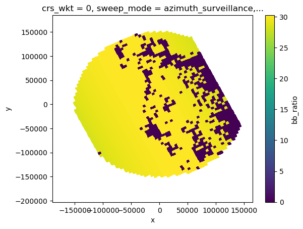
Convert SR Ku reflectivities to S-band#
Based on Cao et.al (2013)
[30]:
ref_sr = sr_cut.zFactorCorrected.isel(nfreq=0, missing_dims="ignore").copy()
# ref_sr = sr_data['refl'].filled(np.nan)
ref_sr_ss = xr.zeros_like(ref_sr) * np.nan
ref_sr_sh = xr.zeros_like(ref_sr) * np.nan
a_s, a_h = (wrl.trafo.KuBandToS.snow, wrl.trafo.KuBandToS.hail)
[31]:
# mask bb_ratio with bb_mask
ratio = sr_cut["bb_ratio"].where(sr_cut["bb_mask"])
ia = ratio >= 1
ib = ratio <= 0
im = (ratio > 0) & (ratio < 1)
ind = xr.where(im, np.round(ratio * 10), 0).astype("int")
# print(ind)
# ind = np.round(ratio[im] * 10).astype(np.int)
# ref_sr_ss = ref_sr.copy()
# ref_sr_sh = ref_sr.copy()
[32]:
ia
[32]:
<xarray.DataArray 'bb_ratio' (nscan: 61, nray: 49, nbin: 176)>
array([[[False, False, False, ..., False, False, False],
[False, False, False, ..., False, False, False],
[False, False, False, ..., False, False, False],
...,
[False, False, False, ..., False, False, False],
[False, False, False, ..., False, False, False],
[False, False, False, ..., False, False, False]],
[[False, False, False, ..., False, False, False],
[False, False, False, ..., False, False, False],
[False, False, False, ..., False, False, False],
...,
...
...,
[False, False, False, ..., False, False, False],
[False, False, False, ..., False, False, False],
[False, False, False, ..., False, False, False]],
[[False, False, False, ..., False, False, False],
[False, False, False, ..., False, False, False],
[False, False, False, ..., False, False, False],
...,
[False, False, False, ..., False, False, False],
[False, False, False, ..., False, False, False],
[False, False, False, ..., False, False, False]]])
Coordinates: (12/18)
elevation (nscan, nray, nbin) float64 nan nan nan nan ... nan nan nan nan
Latitude (nscan, nray) float32 -27.1 -27.08 -27.06 ... -28.49 -28.47
Longitude (nscan, nray) float32 151.4 151.4 151.5 ... 154.8 154.8 154.9
date (nscan) datetime64[ns] 2014-12-06T09:50:30.000500 ... 2014-12...
x (nscan, nray) float64 -1.861e+05 -1.813e+05 ... 1.613e+05
y (nscan, nray) float64 6.695e+04 6.958e+04 ... -8.461e+04
... ...
yp (nscan, nray, nbin) float64 nan nan nan nan ... nan nan nan nan
zp (nscan, nray, nbin) float64 nan nan nan nan ... nan nan nan nan
sr_range (nbin) float64 2.188e+04 2.175e+04 2.162e+04 ... 250.0 125.0 0.0
range (nscan, nray, nbin) float64 nan nan nan nan ... nan nan nan nan
azimuth (nscan, nray, nbin) float64 nan nan nan nan ... nan nan nan nan
pr_dist (nscan, nray, nbin) float64 nan nan nan nan ... nan nan nan nan
Dimensions without coordinates: nscan, nray, nbin- nscan: 61
- nray: 49
- nbin: 176
- False False False False False False ... False False False False False
array([[[False, False, False, ..., False, False, False], [False, False, False, ..., False, False, False], [False, False, False, ..., False, False, False], ..., [False, False, False, ..., False, False, False], [False, False, False, ..., False, False, False], [False, False, False, ..., False, False, False]], [[False, False, False, ..., False, False, False], [False, False, False, ..., False, False, False], [False, False, False, ..., False, False, False], ..., [False, False, False, ..., False, False, False], [False, False, False, ..., False, False, False], [False, False, False, ..., False, False, False]], [[False, False, False, ..., False, False, False], [False, False, False, ..., False, False, False], [False, False, False, ..., False, False, False], ..., ... ..., [False, False, False, ..., False, False, False], [False, False, False, ..., False, False, False], [False, False, False, ..., False, False, False]], [[False, False, False, ..., False, False, False], [False, False, False, ..., False, False, False], [False, False, False, ..., False, False, False], ..., [False, False, False, ..., False, False, False], [False, False, False, ..., False, False, False], [False, False, False, ..., False, False, False]], [[False, False, False, ..., False, False, False], [False, False, False, ..., False, False, False], [False, False, False, ..., False, False, False], ..., [False, False, False, ..., False, False, False], [False, False, False, ..., False, False, False], [False, False, False, ..., False, False, False]]]) - elevation(nscan, nray, nbin)float64nan nan nan nan ... nan nan nan nan
array([[[nan, nan, nan, ..., nan, nan, nan], [nan, nan, nan, ..., nan, nan, nan], [nan, nan, nan, ..., nan, nan, nan], ..., [nan, nan, nan, ..., nan, nan, nan], [nan, nan, nan, ..., nan, nan, nan], [nan, nan, nan, ..., nan, nan, nan]], [[nan, nan, nan, ..., nan, nan, nan], [nan, nan, nan, ..., nan, nan, nan], [nan, nan, nan, ..., nan, nan, nan], ..., [nan, nan, nan, ..., nan, nan, nan], [nan, nan, nan, ..., nan, nan, nan], [nan, nan, nan, ..., nan, nan, nan]], [[nan, nan, nan, ..., nan, nan, nan], [nan, nan, nan, ..., nan, nan, nan], [nan, nan, nan, ..., nan, nan, nan], ..., ... ..., [nan, nan, nan, ..., nan, nan, nan], [nan, nan, nan, ..., nan, nan, nan], [nan, nan, nan, ..., nan, nan, nan]], [[nan, nan, nan, ..., nan, nan, nan], [nan, nan, nan, ..., nan, nan, nan], [nan, nan, nan, ..., nan, nan, nan], ..., [nan, nan, nan, ..., nan, nan, nan], [nan, nan, nan, ..., nan, nan, nan], [nan, nan, nan, ..., nan, nan, nan]], [[nan, nan, nan, ..., nan, nan, nan], [nan, nan, nan, ..., nan, nan, nan], [nan, nan, nan, ..., nan, nan, nan], ..., [nan, nan, nan, ..., nan, nan, nan], [nan, nan, nan, ..., nan, nan, nan], [nan, nan, nan, ..., nan, nan, nan]]]) - Latitude(nscan, nray)float32-27.1 -27.08 ... -28.49 -28.47
- DimensionNames :
- nscan,nray
- Units :
- degrees
- units :
- degrees
- CodeMissingValue :
- -9999.9
array([[-27.101166, -27.078152, -27.05518 , ..., -26.126842, -26.104671, -26.082481], [-27.141512, -27.11849 , -27.095507, ..., -26.166826, -26.144648, -26.122446], [-27.181885, -27.158855, -27.135864, ..., -26.206799, -26.18461 , -26.1624 ], ..., [-29.43486 , -29.41136 , -29.3879 , ..., -28.437897, -28.415165, -28.392406], [-29.474983, -29.451473, -29.428001, ..., -28.477577, -28.454834, -28.432068], [-29.515072, -29.491552, -29.468073, ..., -28.517286, -28.494534, -28.471756]], dtype=float32) - Longitude(nscan, nray)float32151.4 151.4 151.5 ... 154.8 154.9
- DimensionNames :
- nscan,nray
- Units :
- degrees
- units :
- degrees
- CodeMissingValue :
- -9999.9
array([[151.36314, 151.41205, 151.4609 , ..., 153.48042, 153.52951, 153.57869], [151.3838 , 151.43272, 151.4816 , ..., 153.50168, 153.55077, 153.59996], [151.4045 , 151.45343, 151.50232, ..., 153.52295, 153.57205, 153.62126], ..., [152.58981, 152.63957, 152.68929, ..., 154.74254, 154.7924 , 154.84236], [152.61151, 152.66129, 152.71101, ..., 154.76485, 154.81473, 154.86469], [152.63318, 152.68297, 152.73271, ..., 154.78717, 154.83707, 154.88705]], dtype=float32) - date(nscan)datetime64[ns]2014-12-06T09:50:30.000500 ... 2...
array(['2014-12-06T09:50:30.000500000', '2014-12-06T09:50:31.000200000', '2014-12-06T09:50:31.000900000', '2014-12-06T09:50:32.000600000', '2014-12-06T09:50:33.000300000', '2014-12-06T09:50:34.000000000', '2014-12-06T09:50:34.000700000', '2014-12-06T09:50:35.000400000', '2014-12-06T09:50:36.000100000', '2014-12-06T09:50:36.000800000', '2014-12-06T09:50:37.000500000', '2014-12-06T09:50:38.000200000', '2014-12-06T09:50:38.000900000', '2014-12-06T09:50:39.000600000', '2014-12-06T09:50:40.000300000', '2014-12-06T09:50:41.000000000', '2014-12-06T09:50:41.000700000', '2014-12-06T09:50:42.000400000', '2014-12-06T09:50:43.000100000', '2014-12-06T09:50:43.000800000', '2014-12-06T09:50:44.000500000', '2014-12-06T09:50:45.000200000', '2014-12-06T09:50:45.000900000', '2014-12-06T09:50:46.000600000', '2014-12-06T09:50:47.000300000', '2014-12-06T09:50:48.000000000', '2014-12-06T09:50:48.000700000', '2014-12-06T09:50:49.000400000', '2014-12-06T09:50:50.000100000', '2014-12-06T09:50:50.000800000', '2014-12-06T09:50:51.000500000', '2014-12-06T09:50:52.000200000', '2014-12-06T09:50:52.000900000', '2014-12-06T09:50:53.000600000', '2014-12-06T09:50:54.000300000', '2014-12-06T09:50:55.000000000', '2014-12-06T09:50:55.000700000', '2014-12-06T09:50:56.000400000', '2014-12-06T09:50:57.000100000', '2014-12-06T09:50:57.000800000', '2014-12-06T09:50:58.000500000', '2014-12-06T09:50:59.000200000', '2014-12-06T09:50:59.000900000', '2014-12-06T09:51:00.000600000', '2014-12-06T09:51:01.000300000', '2014-12-06T09:51:02.000000000', '2014-12-06T09:51:02.000700000', '2014-12-06T09:51:03.000400000', '2014-12-06T09:51:04.000100000', '2014-12-06T09:51:04.000800000', '2014-12-06T09:51:05.000500000', '2014-12-06T09:51:06.000200000', '2014-12-06T09:51:06.000900000', '2014-12-06T09:51:07.000600000', '2014-12-06T09:51:08.000300000', '2014-12-06T09:51:09.000000000', '2014-12-06T09:51:09.000700000', '2014-12-06T09:51:10.000400000', '2014-12-06T09:51:11.000100000', '2014-12-06T09:51:11.000800000', '2014-12-06T09:51:12.000500000'], dtype='datetime64[ns]') - x(nscan, nray)float64-1.861e+05 -1.813e+05 ... 1.613e+05
array([[-186117.16968603, -181305.28030804, -176495.82165648, ..., 24047.25052569, 28962.67647159, 33889.14933934], [-184002.07209363, -179190.03391088, -174380.42887443, ..., 26164.19651736, 31078.33323847, 36005.04339036], [-181885.32234517, -177073.13766802, -172263.38253896, ..., 28281.18514283, 33195.55875011, 38122.50511547], ..., [ -63096.0693707 , -58280.57133685, -53467.29685492, ..., 147190.35761426, 152107.26441435, 157035.21211942], [ -60966.90277686, -56151.32532165, -51337.96859382, ..., 149320.27054283, 154237.35920682, 159163.98843144], [ -58842.32030271, -54026.66419738, -49213.22410927, ..., 151449.96341515, 156367.22861008, 161295.53182215]]) - y(nscan, nray)float646.695e+04 6.958e+04 ... -8.461e+04
array([[ 66954.186556 , 69576.76471264, 72192.70009704, ..., 176292.00877297, 178737.95818865, 181184.06782741], [ 62514.32843802, 65136.98493917, 67753.420854 , ..., 171857.94004293, 174303.91519634, 176750.46715308], [ 58071.19537879, 60693.92841949, 63310.4403647 , ..., 167424.74984815, 169870.95728909, 172317.73840756], ..., [-190436.25557751, -187806.41895225, -185183.04044706, ..., -80673.26872774, -78215.0122177 , -75755.91099028], [-194872.49152306, -192242.44091716, -189618.63750756, ..., -85098.0633245 , -82639.43830613, -80180.37445039], [-199305.34041805, -196675.07521151, -194051.26911153, ..., -89526.47535637, -87067.69442881, -84608.28612928]]) - crs_wkt()int640
- crs_wkt :
- PROJCRS["unknown",BASEGEOGCRS["unknown",DATUM["Unknown based on WGS 84 ellipsoid",ELLIPSOID["WGS 84",6378137,298.25722356049,LENGTHUNIT["metre",1,ID["EPSG",9001]]]],PRIMEM["Greenwich",0,ANGLEUNIT["degree",0.0174532925199433],ID["EPSG",8901]]],CONVERSION["unknown",METHOD["Modified Azimuthal Equidistant",ID["EPSG",9832]],PARAMETER["Latitude of natural origin",-27.7181,ANGLEUNIT["degree",0.0174532925199433],ID["EPSG",8801]],PARAMETER["Longitude of natural origin",153.240005,ANGLEUNIT["degree",0.0174532925199433],ID["EPSG",8802]],PARAMETER["False easting",0,LENGTHUNIT["metre",1],ID["EPSG",8806]],PARAMETER["False northing",0,LENGTHUNIT["metre",1],ID["EPSG",8807]]],CS[Cartesian,2],AXIS["(E)",east,ORDER[1],LENGTHUNIT["metre",1,ID["EPSG",9001]]],AXIS["(N)",north,ORDER[2],LENGTHUNIT["metre",1,ID["EPSG",9001]]]]
- semi_major_axis :
- 6378137.0
- semi_minor_axis :
- 6356752.314245
- inverse_flattening :
- 298.25722356049
- reference_ellipsoid_name :
- WGS 84
- longitude_of_prime_meridian :
- 0.0
- prime_meridian_name :
- Greenwich
- geographic_crs_name :
- unknown
- horizontal_datum_name :
- Unknown based on WGS 84 ellipsoid
- projected_crs_name :
- unknown
- grid_mapping_name :
- azimuthal_equidistant
- latitude_of_projection_origin :
- -27.7181
- longitude_of_projection_origin :
- 153.240005
- false_easting :
- 0.0
- false_northing :
- 0.0
array(0)
- sweep_mode()<U20'azimuth_surveillance'
array('azimuth_surveillance', dtype='<U20') - longitude()float64153.2
array(153.24000549)
- latitude()float64-27.72
array(-27.71809959)
- altitude()float64175.0
array(174.99999702)
- xp(nscan, nray, nbin)float64nan nan nan nan ... nan nan nan nan
array([[[nan, nan, nan, ..., nan, nan, nan], [nan, nan, nan, ..., nan, nan, nan], [nan, nan, nan, ..., nan, nan, nan], ..., [nan, nan, nan, ..., nan, nan, nan], [nan, nan, nan, ..., nan, nan, nan], [nan, nan, nan, ..., nan, nan, nan]], [[nan, nan, nan, ..., nan, nan, nan], [nan, nan, nan, ..., nan, nan, nan], [nan, nan, nan, ..., nan, nan, nan], ..., [nan, nan, nan, ..., nan, nan, nan], [nan, nan, nan, ..., nan, nan, nan], [nan, nan, nan, ..., nan, nan, nan]], [[nan, nan, nan, ..., nan, nan, nan], [nan, nan, nan, ..., nan, nan, nan], [nan, nan, nan, ..., nan, nan, nan], ..., ... ..., [nan, nan, nan, ..., nan, nan, nan], [nan, nan, nan, ..., nan, nan, nan], [nan, nan, nan, ..., nan, nan, nan]], [[nan, nan, nan, ..., nan, nan, nan], [nan, nan, nan, ..., nan, nan, nan], [nan, nan, nan, ..., nan, nan, nan], ..., [nan, nan, nan, ..., nan, nan, nan], [nan, nan, nan, ..., nan, nan, nan], [nan, nan, nan, ..., nan, nan, nan]], [[nan, nan, nan, ..., nan, nan, nan], [nan, nan, nan, ..., nan, nan, nan], [nan, nan, nan, ..., nan, nan, nan], ..., [nan, nan, nan, ..., nan, nan, nan], [nan, nan, nan, ..., nan, nan, nan], [nan, nan, nan, ..., nan, nan, nan]]]) - yp(nscan, nray, nbin)float64nan nan nan nan ... nan nan nan nan
array([[[nan, nan, nan, ..., nan, nan, nan], [nan, nan, nan, ..., nan, nan, nan], [nan, nan, nan, ..., nan, nan, nan], ..., [nan, nan, nan, ..., nan, nan, nan], [nan, nan, nan, ..., nan, nan, nan], [nan, nan, nan, ..., nan, nan, nan]], [[nan, nan, nan, ..., nan, nan, nan], [nan, nan, nan, ..., nan, nan, nan], [nan, nan, nan, ..., nan, nan, nan], ..., [nan, nan, nan, ..., nan, nan, nan], [nan, nan, nan, ..., nan, nan, nan], [nan, nan, nan, ..., nan, nan, nan]], [[nan, nan, nan, ..., nan, nan, nan], [nan, nan, nan, ..., nan, nan, nan], [nan, nan, nan, ..., nan, nan, nan], ..., ... ..., [nan, nan, nan, ..., nan, nan, nan], [nan, nan, nan, ..., nan, nan, nan], [nan, nan, nan, ..., nan, nan, nan]], [[nan, nan, nan, ..., nan, nan, nan], [nan, nan, nan, ..., nan, nan, nan], [nan, nan, nan, ..., nan, nan, nan], ..., [nan, nan, nan, ..., nan, nan, nan], [nan, nan, nan, ..., nan, nan, nan], [nan, nan, nan, ..., nan, nan, nan]], [[nan, nan, nan, ..., nan, nan, nan], [nan, nan, nan, ..., nan, nan, nan], [nan, nan, nan, ..., nan, nan, nan], ..., [nan, nan, nan, ..., nan, nan, nan], [nan, nan, nan, ..., nan, nan, nan], [nan, nan, nan, ..., nan, nan, nan]]]) - zp(nscan, nray, nbin)float64nan nan nan nan ... nan nan nan nan
array([[[nan, nan, nan, ..., nan, nan, nan], [nan, nan, nan, ..., nan, nan, nan], [nan, nan, nan, ..., nan, nan, nan], ..., [nan, nan, nan, ..., nan, nan, nan], [nan, nan, nan, ..., nan, nan, nan], [nan, nan, nan, ..., nan, nan, nan]], [[nan, nan, nan, ..., nan, nan, nan], [nan, nan, nan, ..., nan, nan, nan], [nan, nan, nan, ..., nan, nan, nan], ..., [nan, nan, nan, ..., nan, nan, nan], [nan, nan, nan, ..., nan, nan, nan], [nan, nan, nan, ..., nan, nan, nan]], [[nan, nan, nan, ..., nan, nan, nan], [nan, nan, nan, ..., nan, nan, nan], [nan, nan, nan, ..., nan, nan, nan], ..., ... ..., [nan, nan, nan, ..., nan, nan, nan], [nan, nan, nan, ..., nan, nan, nan], [nan, nan, nan, ..., nan, nan, nan]], [[nan, nan, nan, ..., nan, nan, nan], [nan, nan, nan, ..., nan, nan, nan], [nan, nan, nan, ..., nan, nan, nan], ..., [nan, nan, nan, ..., nan, nan, nan], [nan, nan, nan, ..., nan, nan, nan], [nan, nan, nan, ..., nan, nan, nan]], [[nan, nan, nan, ..., nan, nan, nan], [nan, nan, nan, ..., nan, nan, nan], [nan, nan, nan, ..., nan, nan, nan], ..., [nan, nan, nan, ..., nan, nan, nan], [nan, nan, nan, ..., nan, nan, nan], [nan, nan, nan, ..., nan, nan, nan]]]) - sr_range(nbin)float642.188e+04 2.175e+04 ... 125.0 0.0
array([21875., 21750., 21625., 21500., 21375., 21250., 21125., 21000., 20875., 20750., 20625., 20500., 20375., 20250., 20125., 20000., 19875., 19750., 19625., 19500., 19375., 19250., 19125., 19000., 18875., 18750., 18625., 18500., 18375., 18250., 18125., 18000., 17875., 17750., 17625., 17500., 17375., 17250., 17125., 17000., 16875., 16750., 16625., 16500., 16375., 16250., 16125., 16000., 15875., 15750., 15625., 15500., 15375., 15250., 15125., 15000., 14875., 14750., 14625., 14500., 14375., 14250., 14125., 14000., 13875., 13750., 13625., 13500., 13375., 13250., 13125., 13000., 12875., 12750., 12625., 12500., 12375., 12250., 12125., 12000., 11875., 11750., 11625., 11500., 11375., 11250., 11125., 11000., 10875., 10750., 10625., 10500., 10375., 10250., 10125., 10000., 9875., 9750., 9625., 9500., 9375., 9250., 9125., 9000., 8875., 8750., 8625., 8500., 8375., 8250., 8125., 8000., 7875., 7750., 7625., 7500., 7375., 7250., 7125., 7000., 6875., 6750., 6625., 6500., 6375., 6250., 6125., 6000., 5875., 5750., 5625., 5500., 5375., 5250., 5125., 5000., 4875., 4750., 4625., 4500., 4375., 4250., 4125., 4000., 3875., 3750., 3625., 3500., 3375., 3250., 3125., 3000., 2875., 2750., 2625., 2500., 2375., 2250., 2125., 2000., 1875., 1750., 1625., 1500., 1375., 1250., 1125., 1000., 875., 750., 625., 500., 375., 250., 125., 0.]) - range(nscan, nray, nbin)float64nan nan nan nan ... nan nan nan nan
array([[[nan, nan, nan, ..., nan, nan, nan], [nan, nan, nan, ..., nan, nan, nan], [nan, nan, nan, ..., nan, nan, nan], ..., [nan, nan, nan, ..., nan, nan, nan], [nan, nan, nan, ..., nan, nan, nan], [nan, nan, nan, ..., nan, nan, nan]], [[nan, nan, nan, ..., nan, nan, nan], [nan, nan, nan, ..., nan, nan, nan], [nan, nan, nan, ..., nan, nan, nan], ..., [nan, nan, nan, ..., nan, nan, nan], [nan, nan, nan, ..., nan, nan, nan], [nan, nan, nan, ..., nan, nan, nan]], [[nan, nan, nan, ..., nan, nan, nan], [nan, nan, nan, ..., nan, nan, nan], [nan, nan, nan, ..., nan, nan, nan], ..., ... ..., [nan, nan, nan, ..., nan, nan, nan], [nan, nan, nan, ..., nan, nan, nan], [nan, nan, nan, ..., nan, nan, nan]], [[nan, nan, nan, ..., nan, nan, nan], [nan, nan, nan, ..., nan, nan, nan], [nan, nan, nan, ..., nan, nan, nan], ..., [nan, nan, nan, ..., nan, nan, nan], [nan, nan, nan, ..., nan, nan, nan], [nan, nan, nan, ..., nan, nan, nan]], [[nan, nan, nan, ..., nan, nan, nan], [nan, nan, nan, ..., nan, nan, nan], [nan, nan, nan, ..., nan, nan, nan], ..., [nan, nan, nan, ..., nan, nan, nan], [nan, nan, nan, ..., nan, nan, nan], [nan, nan, nan, ..., nan, nan, nan]]]) - azimuth(nscan, nray, nbin)float64nan nan nan nan ... nan nan nan nan
array([[[nan, nan, nan, ..., nan, nan, nan], [nan, nan, nan, ..., nan, nan, nan], [nan, nan, nan, ..., nan, nan, nan], ..., [nan, nan, nan, ..., nan, nan, nan], [nan, nan, nan, ..., nan, nan, nan], [nan, nan, nan, ..., nan, nan, nan]], [[nan, nan, nan, ..., nan, nan, nan], [nan, nan, nan, ..., nan, nan, nan], [nan, nan, nan, ..., nan, nan, nan], ..., [nan, nan, nan, ..., nan, nan, nan], [nan, nan, nan, ..., nan, nan, nan], [nan, nan, nan, ..., nan, nan, nan]], [[nan, nan, nan, ..., nan, nan, nan], [nan, nan, nan, ..., nan, nan, nan], [nan, nan, nan, ..., nan, nan, nan], ..., ... ..., [nan, nan, nan, ..., nan, nan, nan], [nan, nan, nan, ..., nan, nan, nan], [nan, nan, nan, ..., nan, nan, nan]], [[nan, nan, nan, ..., nan, nan, nan], [nan, nan, nan, ..., nan, nan, nan], [nan, nan, nan, ..., nan, nan, nan], ..., [nan, nan, nan, ..., nan, nan, nan], [nan, nan, nan, ..., nan, nan, nan], [nan, nan, nan, ..., nan, nan, nan]], [[nan, nan, nan, ..., nan, nan, nan], [nan, nan, nan, ..., nan, nan, nan], [nan, nan, nan, ..., nan, nan, nan], ..., [nan, nan, nan, ..., nan, nan, nan], [nan, nan, nan, ..., nan, nan, nan], [nan, nan, nan, ..., nan, nan, nan]]]) - pr_dist(nscan, nray, nbin)float64nan nan nan nan ... nan nan nan nan
array([[[nan, nan, nan, ..., nan, nan, nan], [nan, nan, nan, ..., nan, nan, nan], [nan, nan, nan, ..., nan, nan, nan], ..., [nan, nan, nan, ..., nan, nan, nan], [nan, nan, nan, ..., nan, nan, nan], [nan, nan, nan, ..., nan, nan, nan]], [[nan, nan, nan, ..., nan, nan, nan], [nan, nan, nan, ..., nan, nan, nan], [nan, nan, nan, ..., nan, nan, nan], ..., [nan, nan, nan, ..., nan, nan, nan], [nan, nan, nan, ..., nan, nan, nan], [nan, nan, nan, ..., nan, nan, nan]], [[nan, nan, nan, ..., nan, nan, nan], [nan, nan, nan, ..., nan, nan, nan], [nan, nan, nan, ..., nan, nan, nan], ..., ... ..., [nan, nan, nan, ..., nan, nan, nan], [nan, nan, nan, ..., nan, nan, nan], [nan, nan, nan, ..., nan, nan, nan]], [[nan, nan, nan, ..., nan, nan, nan], [nan, nan, nan, ..., nan, nan, nan], [nan, nan, nan, ..., nan, nan, nan], ..., [nan, nan, nan, ..., nan, nan, nan], [nan, nan, nan, ..., nan, nan, nan], [nan, nan, nan, ..., nan, nan, nan]], [[nan, nan, nan, ..., nan, nan, nan], [nan, nan, nan, ..., nan, nan, nan], [nan, nan, nan, ..., nan, nan, nan], ..., [nan, nan, nan, ..., nan, nan, nan], [nan, nan, nan, ..., nan, nan, nan], [nan, nan, nan, ..., nan, nan, nan]]])
[33]:
fig, ((ax1, ax2), (ax3, ax4)) = plt.subplots(
nrows=2, ncols=2, figsize=(10, 10), sharey=True, sharex=True
)
hind = 146
print(sr_cut.isel(nbin=hind).sr_range.values)
ia.isel(nbin=hind).plot(x="x", y="y", ax=ax1)
ib.isel(nbin=hind).plot(x="x", y="y", ax=ax2)
im.isel(nbin=hind).plot(x="x", y="y", ax=ax3)
ratio.isel(nbin=hind).plot(x="x", y="y", ax=ax4)
# sr_cut["bb_mask"].plot(x="x", y="y", ax=ax4)
3625.0
[33]:
<matplotlib.collections.QuadMesh at 0x7f472ff29210>
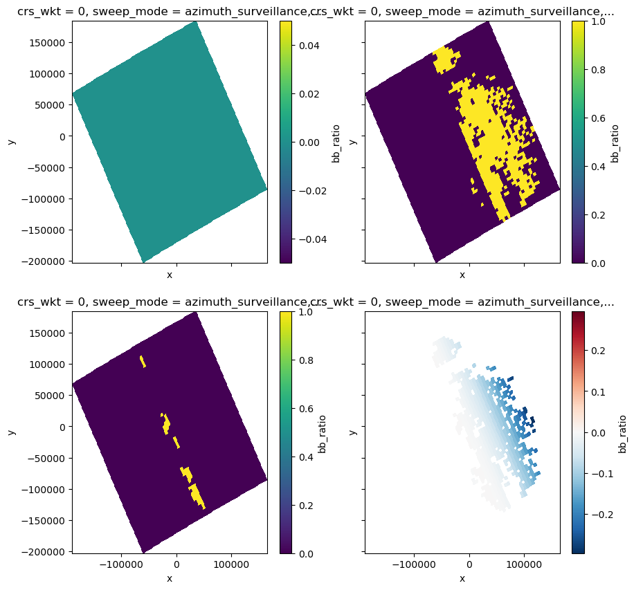
[34]:
# adding ia/ib/im in sequential order to ref_sr_ss/ref_sr/sh
# above melting layer -> no mixing only snow/hail
ref_sr_ss = xr.where(
ia, ref_sr + wrl.util.calculate_polynomial(ref_sr.copy(), a_s[:, 10]), ref_sr_ss
)
ref_sr_sh = xr.where(
ia, ref_sr + wrl.util.calculate_polynomial(ref_sr.copy(), a_h[:, 10]), ref_sr_sh
)
fig, (ax1, ax2, ax3) = plt.subplots(nrows=1, ncols=3, figsize=(15, 4), sharey=True)
ref_sr_ss.isel(nbin=hind).plot(x="x", y="y", ax=ax1)
ref_sr_sh.isel(nbin=hind).plot(x="x", y="y", ax=ax2)
(ref_sr_ss - ref_sr_sh).isel(nbin=hind).plot(x="x", y="y", ax=ax3)
[34]:
<matplotlib.collections.QuadMesh at 0x7f472fdaf110>
[35]:
# below the melting layer
ref_sr_ss = xr.where(
ib, ref_sr + wrl.util.calculate_polynomial(ref_sr.copy(), a_s[:, 0]), ref_sr_ss
)
ref_sr_sh = xr.where(
ib, ref_sr + wrl.util.calculate_polynomial(ref_sr.copy(), a_h[:, 0]), ref_sr_sh
)
fig, (ax1, ax2, ax3) = plt.subplots(nrows=1, ncols=3, figsize=(15, 4), sharey=True)
ref_sr_ss.isel(nbin=hind).plot(x="x", y="y", ax=ax1)
ref_sr_sh.isel(nbin=hind).plot(x="x", y="y", ax=ax2)
(ref_sr_ss - ref_sr_sh).isel(nbin=hind).plot(x="x", y="y", ax=ax3)
[35]:
<matplotlib.collections.QuadMesh at 0x7f472fbdbad0>

[36]:
# inside melting layer
ref_sr_ss = xr.where(
im, ref_sr + wrl.util.calculate_polynomial(ref_sr.copy(), a_s[:, ind]), ref_sr_ss
)
ref_sr_sh = xr.where(
im, ref_sr + wrl.util.calculate_polynomial(ref_sr.copy(), a_h[:, ind]), ref_sr_sh
)
fig, (ax1, ax2, ax3) = plt.subplots(nrows=1, ncols=3, figsize=(15, 4), sharey=True)
ref_sr_ss.isel(nbin=hind).plot(x="x", y="y", ax=ax1)
ref_sr_sh.isel(nbin=hind).plot(x="x", y="y", ax=ax2)
(ref_sr_ss - ref_sr_sh).isel(nbin=hind).plot(x="x", y="y", ax=ax3)
[36]:
<matplotlib.collections.QuadMesh at 0x7f473435af90>
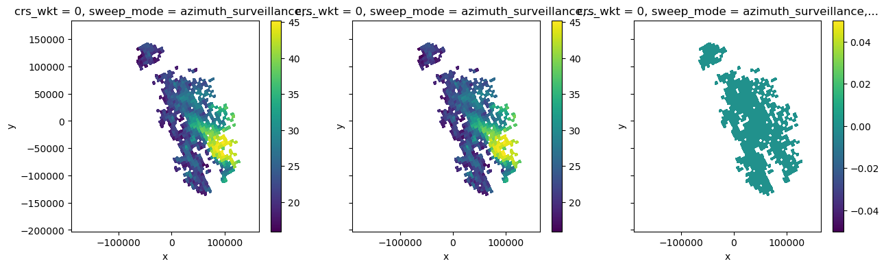
[37]:
# Jackson Tan's fix for C-band
# if gr_radar_band == 'C':
# print('SR reflectivity is converted to C-band')
# deltas = (ref_sr_ss - ref_sr) * 5.3 / 10.0
# ref_sr_ss = ref_sr + deltas
# deltah = (ref_sr_sh - ref_sr) * 5.3 / 10.0
# ref_sr_sh = ref_sr + deltah
# gr_radar_band = "S"
# if gr_radar_band == 'X':
# print('SR reflectivity is converted to X-band')
# deltas = (ref_sr_ss - ref_sr) * 3.2 / 10.0
# ref_sr_ss = ref_sr + deltas
# deltah = (ref_sr_sh - ref_sr) * 3.2 / 10.0
# ref_sr_sh = ref_sr + deltah
# ref_sr_ss = ref_sr_ss.where(ref_sr >= 0)
# ref_sr_sh = ref_sr_sh.where(ref_sr >= 0)
[38]:
if platf == "gpm":
ptype = (sr_cut.typePrecip / 1e7).astype(np.int16)
else:
ptype = sr_cut.typePrecip
display(ptype)
ptype.plot(x="x", y="y")
/home/runner/micromamba/envs/wradlib-tests/lib/python3.11/site-packages/xarray/core/duck_array_ops.py:203: RuntimeWarning: invalid value encountered in cast
return data.astype(dtype, **kwargs)
<xarray.DataArray 'typePrecip' (nscan: 61, nray: 49)>
array([[0, 0, 0, ..., 0, 0, 0],
[0, 0, 0, ..., 0, 0, 0],
[0, 0, 0, ..., 0, 0, 0],
...,
[0, 0, 0, ..., 0, 0, 0],
[0, 0, 0, ..., 0, 0, 0],
[0, 0, 0, ..., 0, 0, 0]], dtype=int16)
Coordinates:
Latitude (nscan, nray) float32 -27.1 -27.08 -27.06 ... -28.49 -28.47
Longitude (nscan, nray) float32 151.4 151.4 151.5 ... 154.8 154.8 154.9
date (nscan) datetime64[ns] 2014-12-06T09:50:30.000500 ... 2014-12...
x (nscan, nray) float64 -1.861e+05 -1.813e+05 ... 1.613e+05
y (nscan, nray) float64 6.695e+04 6.958e+04 ... -8.461e+04
crs_wkt int64 0
sweep_mode <U20 'azimuth_surveillance'
longitude float64 153.2
latitude float64 -27.72
altitude float64 175.0
Dimensions without coordinates: nscan, nray- nscan: 61
- nray: 49
- 0 0 0 0 0 0 0 0 0 0 0 0 0 0 0 0 0 ... 0 0 0 0 0 0 0 0 0 0 0 0 0 0 0 0
array([[0, 0, 0, ..., 0, 0, 0], [0, 0, 0, ..., 0, 0, 0], [0, 0, 0, ..., 0, 0, 0], ..., [0, 0, 0, ..., 0, 0, 0], [0, 0, 0, ..., 0, 0, 0], [0, 0, 0, ..., 0, 0, 0]], dtype=int16) - Latitude(nscan, nray)float32-27.1 -27.08 ... -28.49 -28.47
- DimensionNames :
- nscan,nray
- Units :
- degrees
- units :
- degrees
- CodeMissingValue :
- -9999.9
array([[-27.101166, -27.078152, -27.05518 , ..., -26.126842, -26.104671, -26.082481], [-27.141512, -27.11849 , -27.095507, ..., -26.166826, -26.144648, -26.122446], [-27.181885, -27.158855, -27.135864, ..., -26.206799, -26.18461 , -26.1624 ], ..., [-29.43486 , -29.41136 , -29.3879 , ..., -28.437897, -28.415165, -28.392406], [-29.474983, -29.451473, -29.428001, ..., -28.477577, -28.454834, -28.432068], [-29.515072, -29.491552, -29.468073, ..., -28.517286, -28.494534, -28.471756]], dtype=float32) - Longitude(nscan, nray)float32151.4 151.4 151.5 ... 154.8 154.9
- DimensionNames :
- nscan,nray
- Units :
- degrees
- units :
- degrees
- CodeMissingValue :
- -9999.9
array([[151.36314, 151.41205, 151.4609 , ..., 153.48042, 153.52951, 153.57869], [151.3838 , 151.43272, 151.4816 , ..., 153.50168, 153.55077, 153.59996], [151.4045 , 151.45343, 151.50232, ..., 153.52295, 153.57205, 153.62126], ..., [152.58981, 152.63957, 152.68929, ..., 154.74254, 154.7924 , 154.84236], [152.61151, 152.66129, 152.71101, ..., 154.76485, 154.81473, 154.86469], [152.63318, 152.68297, 152.73271, ..., 154.78717, 154.83707, 154.88705]], dtype=float32) - date(nscan)datetime64[ns]2014-12-06T09:50:30.000500 ... 2...
array(['2014-12-06T09:50:30.000500000', '2014-12-06T09:50:31.000200000', '2014-12-06T09:50:31.000900000', '2014-12-06T09:50:32.000600000', '2014-12-06T09:50:33.000300000', '2014-12-06T09:50:34.000000000', '2014-12-06T09:50:34.000700000', '2014-12-06T09:50:35.000400000', '2014-12-06T09:50:36.000100000', '2014-12-06T09:50:36.000800000', '2014-12-06T09:50:37.000500000', '2014-12-06T09:50:38.000200000', '2014-12-06T09:50:38.000900000', '2014-12-06T09:50:39.000600000', '2014-12-06T09:50:40.000300000', '2014-12-06T09:50:41.000000000', '2014-12-06T09:50:41.000700000', '2014-12-06T09:50:42.000400000', '2014-12-06T09:50:43.000100000', '2014-12-06T09:50:43.000800000', '2014-12-06T09:50:44.000500000', '2014-12-06T09:50:45.000200000', '2014-12-06T09:50:45.000900000', '2014-12-06T09:50:46.000600000', '2014-12-06T09:50:47.000300000', '2014-12-06T09:50:48.000000000', '2014-12-06T09:50:48.000700000', '2014-12-06T09:50:49.000400000', '2014-12-06T09:50:50.000100000', '2014-12-06T09:50:50.000800000', '2014-12-06T09:50:51.000500000', '2014-12-06T09:50:52.000200000', '2014-12-06T09:50:52.000900000', '2014-12-06T09:50:53.000600000', '2014-12-06T09:50:54.000300000', '2014-12-06T09:50:55.000000000', '2014-12-06T09:50:55.000700000', '2014-12-06T09:50:56.000400000', '2014-12-06T09:50:57.000100000', '2014-12-06T09:50:57.000800000', '2014-12-06T09:50:58.000500000', '2014-12-06T09:50:59.000200000', '2014-12-06T09:50:59.000900000', '2014-12-06T09:51:00.000600000', '2014-12-06T09:51:01.000300000', '2014-12-06T09:51:02.000000000', '2014-12-06T09:51:02.000700000', '2014-12-06T09:51:03.000400000', '2014-12-06T09:51:04.000100000', '2014-12-06T09:51:04.000800000', '2014-12-06T09:51:05.000500000', '2014-12-06T09:51:06.000200000', '2014-12-06T09:51:06.000900000', '2014-12-06T09:51:07.000600000', '2014-12-06T09:51:08.000300000', '2014-12-06T09:51:09.000000000', '2014-12-06T09:51:09.000700000', '2014-12-06T09:51:10.000400000', '2014-12-06T09:51:11.000100000', '2014-12-06T09:51:11.000800000', '2014-12-06T09:51:12.000500000'], dtype='datetime64[ns]') - x(nscan, nray)float64-1.861e+05 -1.813e+05 ... 1.613e+05
array([[-186117.16968603, -181305.28030804, -176495.82165648, ..., 24047.25052569, 28962.67647159, 33889.14933934], [-184002.07209363, -179190.03391088, -174380.42887443, ..., 26164.19651736, 31078.33323847, 36005.04339036], [-181885.32234517, -177073.13766802, -172263.38253896, ..., 28281.18514283, 33195.55875011, 38122.50511547], ..., [ -63096.0693707 , -58280.57133685, -53467.29685492, ..., 147190.35761426, 152107.26441435, 157035.21211942], [ -60966.90277686, -56151.32532165, -51337.96859382, ..., 149320.27054283, 154237.35920682, 159163.98843144], [ -58842.32030271, -54026.66419738, -49213.22410927, ..., 151449.96341515, 156367.22861008, 161295.53182215]]) - y(nscan, nray)float646.695e+04 6.958e+04 ... -8.461e+04
array([[ 66954.186556 , 69576.76471264, 72192.70009704, ..., 176292.00877297, 178737.95818865, 181184.06782741], [ 62514.32843802, 65136.98493917, 67753.420854 , ..., 171857.94004293, 174303.91519634, 176750.46715308], [ 58071.19537879, 60693.92841949, 63310.4403647 , ..., 167424.74984815, 169870.95728909, 172317.73840756], ..., [-190436.25557751, -187806.41895225, -185183.04044706, ..., -80673.26872774, -78215.0122177 , -75755.91099028], [-194872.49152306, -192242.44091716, -189618.63750756, ..., -85098.0633245 , -82639.43830613, -80180.37445039], [-199305.34041805, -196675.07521151, -194051.26911153, ..., -89526.47535637, -87067.69442881, -84608.28612928]]) - crs_wkt()int640
- crs_wkt :
- PROJCRS["unknown",BASEGEOGCRS["unknown",DATUM["Unknown based on WGS 84 ellipsoid",ELLIPSOID["WGS 84",6378137,298.25722356049,LENGTHUNIT["metre",1,ID["EPSG",9001]]]],PRIMEM["Greenwich",0,ANGLEUNIT["degree",0.0174532925199433],ID["EPSG",8901]]],CONVERSION["unknown",METHOD["Modified Azimuthal Equidistant",ID["EPSG",9832]],PARAMETER["Latitude of natural origin",-27.7181,ANGLEUNIT["degree",0.0174532925199433],ID["EPSG",8801]],PARAMETER["Longitude of natural origin",153.240005,ANGLEUNIT["degree",0.0174532925199433],ID["EPSG",8802]],PARAMETER["False easting",0,LENGTHUNIT["metre",1],ID["EPSG",8806]],PARAMETER["False northing",0,LENGTHUNIT["metre",1],ID["EPSG",8807]]],CS[Cartesian,2],AXIS["(E)",east,ORDER[1],LENGTHUNIT["metre",1,ID["EPSG",9001]]],AXIS["(N)",north,ORDER[2],LENGTHUNIT["metre",1,ID["EPSG",9001]]]]
- semi_major_axis :
- 6378137.0
- semi_minor_axis :
- 6356752.314245
- inverse_flattening :
- 298.25722356049
- reference_ellipsoid_name :
- WGS 84
- longitude_of_prime_meridian :
- 0.0
- prime_meridian_name :
- Greenwich
- geographic_crs_name :
- unknown
- horizontal_datum_name :
- Unknown based on WGS 84 ellipsoid
- projected_crs_name :
- unknown
- grid_mapping_name :
- azimuthal_equidistant
- latitude_of_projection_origin :
- -27.7181
- longitude_of_projection_origin :
- 153.240005
- false_easting :
- 0.0
- false_northing :
- 0.0
array(0)
- sweep_mode()<U20'azimuth_surveillance'
array('azimuth_surveillance', dtype='<U20') - longitude()float64153.2
array(153.24000549)
- latitude()float64-27.72
array(-27.71809959)
- altitude()float64175.0
array(174.99999702)
[38]:
<matplotlib.collections.QuadMesh at 0x7f472f720390>
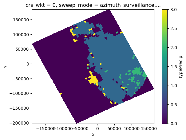
[39]:
# Combined conversion
ref_sr_com = xr.zeros_like(ref_sr_ss) * np.nan
ref_sr_com = xr.where(ptype == 1, ref_sr_ss, ref_sr_com)
ref_sr_com = xr.where(ptype == 2, ref_sr_sh, ref_sr_com)
ref_sr_com.isel(nbin=hind).plot(x="x", y="y", vmin=0, vmax=50)
[39]:
<matplotlib.collections.QuadMesh at 0x7f472f7e4490>
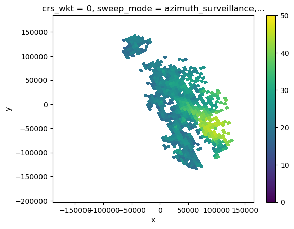
[40]:
sr_cut = sr_cut.assign(ref_sr_com=ref_sr_com, ref_sr_ss=ref_sr_ss, ref_sr_sh=ref_sr_sh)
display(sr_cut)
<xarray.Dataset>
Dimensions: (nswath: 1, nscan: 61, nray: 49, XYZ: 3,
nbin: 176, nNP: 4, method: 6, foreBack: 2,
nearFar: 2, nNode: 5, nbinSZP: 7, nDSD: 2,
nNUBF: 3, LS: 2)
Coordinates: (12/18)
elevation (nscan, nray, nbin) float64 nan nan ... nan nan
Latitude (nscan, nray) float32 -27.1 -27.08 ... -28.47
Longitude (nscan, nray) float32 151.4 151.4 ... 154.9
date (nscan) datetime64[ns] 2014-12-06T09:50:30.0...
x (nscan, nray) float64 -1.861e+05 ... 1.613e+05
y (nscan, nray) float64 6.695e+04 ... -8.461e+04
... ...
yp (nscan, nray, nbin) float64 nan nan ... nan nan
zp (nscan, nray, nbin) float64 nan nan ... nan nan
sr_range (nbin) float64 2.188e+04 2.175e+04 ... 0.0
range (nscan, nray, nbin) float64 nan nan ... nan nan
azimuth (nscan, nray, nbin) float64 nan nan ... nan nan
pr_dist (nscan, nray, nbin) float64 nan nan ... nan nan
Dimensions without coordinates: nswath, nscan, nray, XYZ, nbin, nNP, method,
foreBack, nearFar, nNode, nbinSZP, nDSD, nNUBF,
LS
Data variables: (12/103)
AlgorithmRuntimeInfo (nswath, nscan, nray) object nan nan ... nan
dataQuality (nscan, nray) float32 nan nan nan ... nan nan
dataWarning (nscan, nray) float32 nan nan nan ... nan nan
missing (nscan, nray) float32 nan nan nan ... nan nan
modeStatus (nscan, nray) float32 nan nan nan ... nan nan
geoError (nscan, nray) float32 nan nan nan ... nan nan
... ...
sr_bin_depth (nscan, nray) float32 nan nan nan ... nan nan
bb_ratio (nscan, nray, nbin) float64 nan nan ... nan nan
bb_mask (nscan, nray) bool False False ... False False
ref_sr_com (nscan, nray, nbin) float32 nan nan ... nan nan
ref_sr_ss (nscan, nray, nbin) float32 nan nan ... nan nan
ref_sr_sh (nscan, nray, nbin) float32 nan nan ... nan nan
Attributes:
FileHeader: DOI=10.5067/GPM/DPR/Ku/2A/05;\nDOIauthority=http://dx....
InputRecord: InputFileNames=GPMCOR_KUR_1412060833_1006_004383_1BS_D...
NavigationRecord: LongitudeOnEquator=-27.312063;\nUTCDateTimeOnEquator=2...
FileInfo: DataFormatVersion=cn;\nTKCodeBuildVersion=1;\nMetadata...
JAXAInfo: GranuleFirstScanUTCDateTime=2014-12-06T08:33:33.292Z;\...
platform: GPM- nswath: 1
- nscan: 61
- nray: 49
- XYZ: 3
- nbin: 176
- nNP: 4
- method: 6
- foreBack: 2
- nearFar: 2
- nNode: 5
- nbinSZP: 7
- nDSD: 2
- nNUBF: 3
- LS: 2
- elevation(nscan, nray, nbin)float64nan nan nan nan ... nan nan nan nan
array([[[nan, nan, nan, ..., nan, nan, nan], [nan, nan, nan, ..., nan, nan, nan], [nan, nan, nan, ..., nan, nan, nan], ..., [nan, nan, nan, ..., nan, nan, nan], [nan, nan, nan, ..., nan, nan, nan], [nan, nan, nan, ..., nan, nan, nan]], [[nan, nan, nan, ..., nan, nan, nan], [nan, nan, nan, ..., nan, nan, nan], [nan, nan, nan, ..., nan, nan, nan], ..., [nan, nan, nan, ..., nan, nan, nan], [nan, nan, nan, ..., nan, nan, nan], [nan, nan, nan, ..., nan, nan, nan]], [[nan, nan, nan, ..., nan, nan, nan], [nan, nan, nan, ..., nan, nan, nan], [nan, nan, nan, ..., nan, nan, nan], ..., ... ..., [nan, nan, nan, ..., nan, nan, nan], [nan, nan, nan, ..., nan, nan, nan], [nan, nan, nan, ..., nan, nan, nan]], [[nan, nan, nan, ..., nan, nan, nan], [nan, nan, nan, ..., nan, nan, nan], [nan, nan, nan, ..., nan, nan, nan], ..., [nan, nan, nan, ..., nan, nan, nan], [nan, nan, nan, ..., nan, nan, nan], [nan, nan, nan, ..., nan, nan, nan]], [[nan, nan, nan, ..., nan, nan, nan], [nan, nan, nan, ..., nan, nan, nan], [nan, nan, nan, ..., nan, nan, nan], ..., [nan, nan, nan, ..., nan, nan, nan], [nan, nan, nan, ..., nan, nan, nan], [nan, nan, nan, ..., nan, nan, nan]]]) - Latitude(nscan, nray)float32-27.1 -27.08 ... -28.49 -28.47
- DimensionNames :
- nscan,nray
- Units :
- degrees
- units :
- degrees
- CodeMissingValue :
- -9999.9
array([[-27.101166, -27.078152, -27.05518 , ..., -26.126842, -26.104671, -26.082481], [-27.141512, -27.11849 , -27.095507, ..., -26.166826, -26.144648, -26.122446], [-27.181885, -27.158855, -27.135864, ..., -26.206799, -26.18461 , -26.1624 ], ..., [-29.43486 , -29.41136 , -29.3879 , ..., -28.437897, -28.415165, -28.392406], [-29.474983, -29.451473, -29.428001, ..., -28.477577, -28.454834, -28.432068], [-29.515072, -29.491552, -29.468073, ..., -28.517286, -28.494534, -28.471756]], dtype=float32) - Longitude(nscan, nray)float32151.4 151.4 151.5 ... 154.8 154.9
- DimensionNames :
- nscan,nray
- Units :
- degrees
- units :
- degrees
- CodeMissingValue :
- -9999.9
array([[151.36314, 151.41205, 151.4609 , ..., 153.48042, 153.52951, 153.57869], [151.3838 , 151.43272, 151.4816 , ..., 153.50168, 153.55077, 153.59996], [151.4045 , 151.45343, 151.50232, ..., 153.52295, 153.57205, 153.62126], ..., [152.58981, 152.63957, 152.68929, ..., 154.74254, 154.7924 , 154.84236], [152.61151, 152.66129, 152.71101, ..., 154.76485, 154.81473, 154.86469], [152.63318, 152.68297, 152.73271, ..., 154.78717, 154.83707, 154.88705]], dtype=float32) - date(nscan)datetime64[ns]2014-12-06T09:50:30.000500 ... 2...
array(['2014-12-06T09:50:30.000500000', '2014-12-06T09:50:31.000200000', '2014-12-06T09:50:31.000900000', '2014-12-06T09:50:32.000600000', '2014-12-06T09:50:33.000300000', '2014-12-06T09:50:34.000000000', '2014-12-06T09:50:34.000700000', '2014-12-06T09:50:35.000400000', '2014-12-06T09:50:36.000100000', '2014-12-06T09:50:36.000800000', '2014-12-06T09:50:37.000500000', '2014-12-06T09:50:38.000200000', '2014-12-06T09:50:38.000900000', '2014-12-06T09:50:39.000600000', '2014-12-06T09:50:40.000300000', '2014-12-06T09:50:41.000000000', '2014-12-06T09:50:41.000700000', '2014-12-06T09:50:42.000400000', '2014-12-06T09:50:43.000100000', '2014-12-06T09:50:43.000800000', '2014-12-06T09:50:44.000500000', '2014-12-06T09:50:45.000200000', '2014-12-06T09:50:45.000900000', '2014-12-06T09:50:46.000600000', '2014-12-06T09:50:47.000300000', '2014-12-06T09:50:48.000000000', '2014-12-06T09:50:48.000700000', '2014-12-06T09:50:49.000400000', '2014-12-06T09:50:50.000100000', '2014-12-06T09:50:50.000800000', '2014-12-06T09:50:51.000500000', '2014-12-06T09:50:52.000200000', '2014-12-06T09:50:52.000900000', '2014-12-06T09:50:53.000600000', '2014-12-06T09:50:54.000300000', '2014-12-06T09:50:55.000000000', '2014-12-06T09:50:55.000700000', '2014-12-06T09:50:56.000400000', '2014-12-06T09:50:57.000100000', '2014-12-06T09:50:57.000800000', '2014-12-06T09:50:58.000500000', '2014-12-06T09:50:59.000200000', '2014-12-06T09:50:59.000900000', '2014-12-06T09:51:00.000600000', '2014-12-06T09:51:01.000300000', '2014-12-06T09:51:02.000000000', '2014-12-06T09:51:02.000700000', '2014-12-06T09:51:03.000400000', '2014-12-06T09:51:04.000100000', '2014-12-06T09:51:04.000800000', '2014-12-06T09:51:05.000500000', '2014-12-06T09:51:06.000200000', '2014-12-06T09:51:06.000900000', '2014-12-06T09:51:07.000600000', '2014-12-06T09:51:08.000300000', '2014-12-06T09:51:09.000000000', '2014-12-06T09:51:09.000700000', '2014-12-06T09:51:10.000400000', '2014-12-06T09:51:11.000100000', '2014-12-06T09:51:11.000800000', '2014-12-06T09:51:12.000500000'], dtype='datetime64[ns]') - x(nscan, nray)float64-1.861e+05 -1.813e+05 ... 1.613e+05
array([[-186117.16968603, -181305.28030804, -176495.82165648, ..., 24047.25052569, 28962.67647159, 33889.14933934], [-184002.07209363, -179190.03391088, -174380.42887443, ..., 26164.19651736, 31078.33323847, 36005.04339036], [-181885.32234517, -177073.13766802, -172263.38253896, ..., 28281.18514283, 33195.55875011, 38122.50511547], ..., [ -63096.0693707 , -58280.57133685, -53467.29685492, ..., 147190.35761426, 152107.26441435, 157035.21211942], [ -60966.90277686, -56151.32532165, -51337.96859382, ..., 149320.27054283, 154237.35920682, 159163.98843144], [ -58842.32030271, -54026.66419738, -49213.22410927, ..., 151449.96341515, 156367.22861008, 161295.53182215]]) - y(nscan, nray)float646.695e+04 6.958e+04 ... -8.461e+04
array([[ 66954.186556 , 69576.76471264, 72192.70009704, ..., 176292.00877297, 178737.95818865, 181184.06782741], [ 62514.32843802, 65136.98493917, 67753.420854 , ..., 171857.94004293, 174303.91519634, 176750.46715308], [ 58071.19537879, 60693.92841949, 63310.4403647 , ..., 167424.74984815, 169870.95728909, 172317.73840756], ..., [-190436.25557751, -187806.41895225, -185183.04044706, ..., -80673.26872774, -78215.0122177 , -75755.91099028], [-194872.49152306, -192242.44091716, -189618.63750756, ..., -85098.0633245 , -82639.43830613, -80180.37445039], [-199305.34041805, -196675.07521151, -194051.26911153, ..., -89526.47535637, -87067.69442881, -84608.28612928]]) - crs_wkt()int640
- crs_wkt :
- PROJCRS["unknown",BASEGEOGCRS["unknown",DATUM["Unknown based on WGS 84 ellipsoid",ELLIPSOID["WGS 84",6378137,298.25722356049,LENGTHUNIT["metre",1,ID["EPSG",9001]]]],PRIMEM["Greenwich",0,ANGLEUNIT["degree",0.0174532925199433],ID["EPSG",8901]]],CONVERSION["unknown",METHOD["Modified Azimuthal Equidistant",ID["EPSG",9832]],PARAMETER["Latitude of natural origin",-27.7181,ANGLEUNIT["degree",0.0174532925199433],ID["EPSG",8801]],PARAMETER["Longitude of natural origin",153.240005,ANGLEUNIT["degree",0.0174532925199433],ID["EPSG",8802]],PARAMETER["False easting",0,LENGTHUNIT["metre",1],ID["EPSG",8806]],PARAMETER["False northing",0,LENGTHUNIT["metre",1],ID["EPSG",8807]]],CS[Cartesian,2],AXIS["(E)",east,ORDER[1],LENGTHUNIT["metre",1,ID["EPSG",9001]]],AXIS["(N)",north,ORDER[2],LENGTHUNIT["metre",1,ID["EPSG",9001]]]]
- semi_major_axis :
- 6378137.0
- semi_minor_axis :
- 6356752.314245
- inverse_flattening :
- 298.25722356049
- reference_ellipsoid_name :
- WGS 84
- longitude_of_prime_meridian :
- 0.0
- prime_meridian_name :
- Greenwich
- geographic_crs_name :
- unknown
- horizontal_datum_name :
- Unknown based on WGS 84 ellipsoid
- projected_crs_name :
- unknown
- grid_mapping_name :
- azimuthal_equidistant
- latitude_of_projection_origin :
- -27.7181
- longitude_of_projection_origin :
- 153.240005
- false_easting :
- 0.0
- false_northing :
- 0.0
array(0)
- sweep_mode()<U20'azimuth_surveillance'
array('azimuth_surveillance', dtype='<U20') - longitude()float64153.2
array(153.24000549)
- latitude()float64-27.72
array(-27.71809959)
- altitude()float64175.0
array(174.99999702)
- xp(nscan, nray, nbin)float64nan nan nan nan ... nan nan nan nan
array([[[nan, nan, nan, ..., nan, nan, nan], [nan, nan, nan, ..., nan, nan, nan], [nan, nan, nan, ..., nan, nan, nan], ..., [nan, nan, nan, ..., nan, nan, nan], [nan, nan, nan, ..., nan, nan, nan], [nan, nan, nan, ..., nan, nan, nan]], [[nan, nan, nan, ..., nan, nan, nan], [nan, nan, nan, ..., nan, nan, nan], [nan, nan, nan, ..., nan, nan, nan], ..., [nan, nan, nan, ..., nan, nan, nan], [nan, nan, nan, ..., nan, nan, nan], [nan, nan, nan, ..., nan, nan, nan]], [[nan, nan, nan, ..., nan, nan, nan], [nan, nan, nan, ..., nan, nan, nan], [nan, nan, nan, ..., nan, nan, nan], ..., ... ..., [nan, nan, nan, ..., nan, nan, nan], [nan, nan, nan, ..., nan, nan, nan], [nan, nan, nan, ..., nan, nan, nan]], [[nan, nan, nan, ..., nan, nan, nan], [nan, nan, nan, ..., nan, nan, nan], [nan, nan, nan, ..., nan, nan, nan], ..., [nan, nan, nan, ..., nan, nan, nan], [nan, nan, nan, ..., nan, nan, nan], [nan, nan, nan, ..., nan, nan, nan]], [[nan, nan, nan, ..., nan, nan, nan], [nan, nan, nan, ..., nan, nan, nan], [nan, nan, nan, ..., nan, nan, nan], ..., [nan, nan, nan, ..., nan, nan, nan], [nan, nan, nan, ..., nan, nan, nan], [nan, nan, nan, ..., nan, nan, nan]]]) - yp(nscan, nray, nbin)float64nan nan nan nan ... nan nan nan nan
array([[[nan, nan, nan, ..., nan, nan, nan], [nan, nan, nan, ..., nan, nan, nan], [nan, nan, nan, ..., nan, nan, nan], ..., [nan, nan, nan, ..., nan, nan, nan], [nan, nan, nan, ..., nan, nan, nan], [nan, nan, nan, ..., nan, nan, nan]], [[nan, nan, nan, ..., nan, nan, nan], [nan, nan, nan, ..., nan, nan, nan], [nan, nan, nan, ..., nan, nan, nan], ..., [nan, nan, nan, ..., nan, nan, nan], [nan, nan, nan, ..., nan, nan, nan], [nan, nan, nan, ..., nan, nan, nan]], [[nan, nan, nan, ..., nan, nan, nan], [nan, nan, nan, ..., nan, nan, nan], [nan, nan, nan, ..., nan, nan, nan], ..., ... ..., [nan, nan, nan, ..., nan, nan, nan], [nan, nan, nan, ..., nan, nan, nan], [nan, nan, nan, ..., nan, nan, nan]], [[nan, nan, nan, ..., nan, nan, nan], [nan, nan, nan, ..., nan, nan, nan], [nan, nan, nan, ..., nan, nan, nan], ..., [nan, nan, nan, ..., nan, nan, nan], [nan, nan, nan, ..., nan, nan, nan], [nan, nan, nan, ..., nan, nan, nan]], [[nan, nan, nan, ..., nan, nan, nan], [nan, nan, nan, ..., nan, nan, nan], [nan, nan, nan, ..., nan, nan, nan], ..., [nan, nan, nan, ..., nan, nan, nan], [nan, nan, nan, ..., nan, nan, nan], [nan, nan, nan, ..., nan, nan, nan]]]) - zp(nscan, nray, nbin)float64nan nan nan nan ... nan nan nan nan
array([[[nan, nan, nan, ..., nan, nan, nan], [nan, nan, nan, ..., nan, nan, nan], [nan, nan, nan, ..., nan, nan, nan], ..., [nan, nan, nan, ..., nan, nan, nan], [nan, nan, nan, ..., nan, nan, nan], [nan, nan, nan, ..., nan, nan, nan]], [[nan, nan, nan, ..., nan, nan, nan], [nan, nan, nan, ..., nan, nan, nan], [nan, nan, nan, ..., nan, nan, nan], ..., [nan, nan, nan, ..., nan, nan, nan], [nan, nan, nan, ..., nan, nan, nan], [nan, nan, nan, ..., nan, nan, nan]], [[nan, nan, nan, ..., nan, nan, nan], [nan, nan, nan, ..., nan, nan, nan], [nan, nan, nan, ..., nan, nan, nan], ..., ... ..., [nan, nan, nan, ..., nan, nan, nan], [nan, nan, nan, ..., nan, nan, nan], [nan, nan, nan, ..., nan, nan, nan]], [[nan, nan, nan, ..., nan, nan, nan], [nan, nan, nan, ..., nan, nan, nan], [nan, nan, nan, ..., nan, nan, nan], ..., [nan, nan, nan, ..., nan, nan, nan], [nan, nan, nan, ..., nan, nan, nan], [nan, nan, nan, ..., nan, nan, nan]], [[nan, nan, nan, ..., nan, nan, nan], [nan, nan, nan, ..., nan, nan, nan], [nan, nan, nan, ..., nan, nan, nan], ..., [nan, nan, nan, ..., nan, nan, nan], [nan, nan, nan, ..., nan, nan, nan], [nan, nan, nan, ..., nan, nan, nan]]]) - sr_range(nbin)float642.188e+04 2.175e+04 ... 125.0 0.0
array([21875., 21750., 21625., 21500., 21375., 21250., 21125., 21000., 20875., 20750., 20625., 20500., 20375., 20250., 20125., 20000., 19875., 19750., 19625., 19500., 19375., 19250., 19125., 19000., 18875., 18750., 18625., 18500., 18375., 18250., 18125., 18000., 17875., 17750., 17625., 17500., 17375., 17250., 17125., 17000., 16875., 16750., 16625., 16500., 16375., 16250., 16125., 16000., 15875., 15750., 15625., 15500., 15375., 15250., 15125., 15000., 14875., 14750., 14625., 14500., 14375., 14250., 14125., 14000., 13875., 13750., 13625., 13500., 13375., 13250., 13125., 13000., 12875., 12750., 12625., 12500., 12375., 12250., 12125., 12000., 11875., 11750., 11625., 11500., 11375., 11250., 11125., 11000., 10875., 10750., 10625., 10500., 10375., 10250., 10125., 10000., 9875., 9750., 9625., 9500., 9375., 9250., 9125., 9000., 8875., 8750., 8625., 8500., 8375., 8250., 8125., 8000., 7875., 7750., 7625., 7500., 7375., 7250., 7125., 7000., 6875., 6750., 6625., 6500., 6375., 6250., 6125., 6000., 5875., 5750., 5625., 5500., 5375., 5250., 5125., 5000., 4875., 4750., 4625., 4500., 4375., 4250., 4125., 4000., 3875., 3750., 3625., 3500., 3375., 3250., 3125., 3000., 2875., 2750., 2625., 2500., 2375., 2250., 2125., 2000., 1875., 1750., 1625., 1500., 1375., 1250., 1125., 1000., 875., 750., 625., 500., 375., 250., 125., 0.]) - range(nscan, nray, nbin)float64nan nan nan nan ... nan nan nan nan
array([[[nan, nan, nan, ..., nan, nan, nan], [nan, nan, nan, ..., nan, nan, nan], [nan, nan, nan, ..., nan, nan, nan], ..., [nan, nan, nan, ..., nan, nan, nan], [nan, nan, nan, ..., nan, nan, nan], [nan, nan, nan, ..., nan, nan, nan]], [[nan, nan, nan, ..., nan, nan, nan], [nan, nan, nan, ..., nan, nan, nan], [nan, nan, nan, ..., nan, nan, nan], ..., [nan, nan, nan, ..., nan, nan, nan], [nan, nan, nan, ..., nan, nan, nan], [nan, nan, nan, ..., nan, nan, nan]], [[nan, nan, nan, ..., nan, nan, nan], [nan, nan, nan, ..., nan, nan, nan], [nan, nan, nan, ..., nan, nan, nan], ..., ... ..., [nan, nan, nan, ..., nan, nan, nan], [nan, nan, nan, ..., nan, nan, nan], [nan, nan, nan, ..., nan, nan, nan]], [[nan, nan, nan, ..., nan, nan, nan], [nan, nan, nan, ..., nan, nan, nan], [nan, nan, nan, ..., nan, nan, nan], ..., [nan, nan, nan, ..., nan, nan, nan], [nan, nan, nan, ..., nan, nan, nan], [nan, nan, nan, ..., nan, nan, nan]], [[nan, nan, nan, ..., nan, nan, nan], [nan, nan, nan, ..., nan, nan, nan], [nan, nan, nan, ..., nan, nan, nan], ..., [nan, nan, nan, ..., nan, nan, nan], [nan, nan, nan, ..., nan, nan, nan], [nan, nan, nan, ..., nan, nan, nan]]]) - azimuth(nscan, nray, nbin)float64nan nan nan nan ... nan nan nan nan
array([[[nan, nan, nan, ..., nan, nan, nan], [nan, nan, nan, ..., nan, nan, nan], [nan, nan, nan, ..., nan, nan, nan], ..., [nan, nan, nan, ..., nan, nan, nan], [nan, nan, nan, ..., nan, nan, nan], [nan, nan, nan, ..., nan, nan, nan]], [[nan, nan, nan, ..., nan, nan, nan], [nan, nan, nan, ..., nan, nan, nan], [nan, nan, nan, ..., nan, nan, nan], ..., [nan, nan, nan, ..., nan, nan, nan], [nan, nan, nan, ..., nan, nan, nan], [nan, nan, nan, ..., nan, nan, nan]], [[nan, nan, nan, ..., nan, nan, nan], [nan, nan, nan, ..., nan, nan, nan], [nan, nan, nan, ..., nan, nan, nan], ..., ... ..., [nan, nan, nan, ..., nan, nan, nan], [nan, nan, nan, ..., nan, nan, nan], [nan, nan, nan, ..., nan, nan, nan]], [[nan, nan, nan, ..., nan, nan, nan], [nan, nan, nan, ..., nan, nan, nan], [nan, nan, nan, ..., nan, nan, nan], ..., [nan, nan, nan, ..., nan, nan, nan], [nan, nan, nan, ..., nan, nan, nan], [nan, nan, nan, ..., nan, nan, nan]], [[nan, nan, nan, ..., nan, nan, nan], [nan, nan, nan, ..., nan, nan, nan], [nan, nan, nan, ..., nan, nan, nan], ..., [nan, nan, nan, ..., nan, nan, nan], [nan, nan, nan, ..., nan, nan, nan], [nan, nan, nan, ..., nan, nan, nan]]]) - pr_dist(nscan, nray, nbin)float64nan nan nan nan ... nan nan nan nan
array([[[nan, nan, nan, ..., nan, nan, nan], [nan, nan, nan, ..., nan, nan, nan], [nan, nan, nan, ..., nan, nan, nan], ..., [nan, nan, nan, ..., nan, nan, nan], [nan, nan, nan, ..., nan, nan, nan], [nan, nan, nan, ..., nan, nan, nan]], [[nan, nan, nan, ..., nan, nan, nan], [nan, nan, nan, ..., nan, nan, nan], [nan, nan, nan, ..., nan, nan, nan], ..., [nan, nan, nan, ..., nan, nan, nan], [nan, nan, nan, ..., nan, nan, nan], [nan, nan, nan, ..., nan, nan, nan]], [[nan, nan, nan, ..., nan, nan, nan], [nan, nan, nan, ..., nan, nan, nan], [nan, nan, nan, ..., nan, nan, nan], ..., ... ..., [nan, nan, nan, ..., nan, nan, nan], [nan, nan, nan, ..., nan, nan, nan], [nan, nan, nan, ..., nan, nan, nan]], [[nan, nan, nan, ..., nan, nan, nan], [nan, nan, nan, ..., nan, nan, nan], [nan, nan, nan, ..., nan, nan, nan], ..., [nan, nan, nan, ..., nan, nan, nan], [nan, nan, nan, ..., nan, nan, nan], [nan, nan, nan, ..., nan, nan, nan]], [[nan, nan, nan, ..., nan, nan, nan], [nan, nan, nan, ..., nan, nan, nan], [nan, nan, nan, ..., nan, nan, nan], ..., [nan, nan, nan, ..., nan, nan, nan], [nan, nan, nan, ..., nan, nan, nan], [nan, nan, nan, ..., nan, nan, nan]]])
- AlgorithmRuntimeInfo(nswath, nscan, nray)objectnan nan nan nan ... nan nan nan nan
array([[[nan, nan, nan, ..., nan, nan, nan], [nan, nan, nan, ..., nan, nan, nan], [nan, nan, nan, ..., nan, nan, nan], ..., [nan, nan, nan, ..., nan, nan, nan], [nan, nan, nan, ..., nan, nan, nan], [nan, nan, nan, ..., nan, nan, nan]]], dtype=object) - dataQuality(nscan, nray)float32nan nan nan nan ... nan nan nan nan
- DimensionNames :
- nscan
- CodeMissingValue :
- -99
array([[nan, nan, nan, ..., nan, nan, nan], [nan, nan, nan, ..., nan, nan, nan], [nan, nan, nan, ..., nan, nan, nan], ..., [nan, nan, nan, ..., nan, nan, nan], [nan, nan, nan, ..., nan, nan, nan], [nan, nan, nan, ..., nan, nan, nan]], dtype=float32) - dataWarning(nscan, nray)float32nan nan nan nan ... nan nan nan nan
- DimensionNames :
- nscan
- CodeMissingValue :
- -99
array([[nan, nan, nan, ..., nan, nan, nan], [nan, nan, nan, ..., nan, nan, nan], [nan, nan, nan, ..., nan, nan, nan], ..., [nan, nan, nan, ..., nan, nan, nan], [nan, nan, nan, ..., nan, nan, nan], [nan, nan, nan, ..., nan, nan, nan]], dtype=float32) - missing(nscan, nray)float32nan nan nan nan ... nan nan nan nan
- DimensionNames :
- nscan
- CodeMissingValue :
- -99
array([[nan, nan, nan, ..., nan, nan, nan], [nan, nan, nan, ..., nan, nan, nan], [nan, nan, nan, ..., nan, nan, nan], ..., [nan, nan, nan, ..., nan, nan, nan], [nan, nan, nan, ..., nan, nan, nan], [nan, nan, nan, ..., nan, nan, nan]], dtype=float32) - modeStatus(nscan, nray)float32nan nan nan nan ... nan nan nan nan
- DimensionNames :
- nscan
- CodeMissingValue :
- -99
array([[nan, nan, nan, ..., nan, nan, nan], [nan, nan, nan, ..., nan, nan, nan], [nan, nan, nan, ..., nan, nan, nan], ..., [nan, nan, nan, ..., nan, nan, nan], [nan, nan, nan, ..., nan, nan, nan], [nan, nan, nan, ..., nan, nan, nan]], dtype=float32) - geoError(nscan, nray)float32nan nan nan nan ... nan nan nan nan
- DimensionNames :
- nscan
- CodeMissingValue :
- -9999
array([[nan, nan, nan, ..., nan, nan, nan], [nan, nan, nan, ..., nan, nan, nan], [nan, nan, nan, ..., nan, nan, nan], ..., [nan, nan, nan, ..., nan, nan, nan], [nan, nan, nan, ..., nan, nan, nan], [nan, nan, nan, ..., nan, nan, nan]], dtype=float32) - geoWarning(nscan, nray)float32nan nan nan nan ... nan nan nan nan
- DimensionNames :
- nscan
- CodeMissingValue :
- -9999
array([[nan, nan, nan, ..., nan, nan, nan], [nan, nan, nan, ..., nan, nan, nan], [nan, nan, nan, ..., nan, nan, nan], ..., [nan, nan, nan, ..., nan, nan, nan], [nan, nan, nan, ..., nan, nan, nan], [nan, nan, nan, ..., nan, nan, nan]], dtype=float32) - SCorientation(nscan, nray)float32nan nan nan nan ... nan nan nan nan
- DimensionNames :
- nscan
- Units :
- degrees
- units :
- degrees
- CodeMissingValue :
- -9999
array([[nan, nan, nan, ..., nan, nan, nan], [nan, nan, nan, ..., nan, nan, nan], [nan, nan, nan, ..., nan, nan, nan], ..., [nan, nan, nan, ..., nan, nan, nan], [nan, nan, nan, ..., nan, nan, nan], [nan, nan, nan, ..., nan, nan, nan]], dtype=float32) - pointingStatus(nscan, nray)float32nan nan nan nan ... nan nan nan nan
- DimensionNames :
- nscan
- CodeMissingValue :
- -9999
array([[nan, nan, nan, ..., nan, nan, nan], [nan, nan, nan, ..., nan, nan, nan], [nan, nan, nan, ..., nan, nan, nan], ..., [nan, nan, nan, ..., nan, nan, nan], [nan, nan, nan, ..., nan, nan, nan], [nan, nan, nan, ..., nan, nan, nan]], dtype=float32) - acsModeMidScan(nscan, nray)float32nan nan nan nan ... nan nan nan nan
- DimensionNames :
- nscan
- CodeMissingValue :
- -99
array([[nan, nan, nan, ..., nan, nan, nan], [nan, nan, nan, ..., nan, nan, nan], [nan, nan, nan, ..., nan, nan, nan], ..., [nan, nan, nan, ..., nan, nan, nan], [nan, nan, nan, ..., nan, nan, nan], [nan, nan, nan, ..., nan, nan, nan]], dtype=float32) - targetSelectionMidScan(nscan, nray)float32nan nan nan nan ... nan nan nan nan
- DimensionNames :
- nscan
- CodeMissingValue :
- -99
array([[nan, nan, nan, ..., nan, nan, nan], [nan, nan, nan, ..., nan, nan, nan], [nan, nan, nan, ..., nan, nan, nan], ..., [nan, nan, nan, ..., nan, nan, nan], [nan, nan, nan, ..., nan, nan, nan], [nan, nan, nan, ..., nan, nan, nan]], dtype=float32) - operationalMode(nscan, nray)float32nan nan nan nan ... nan nan nan nan
- DimensionNames :
- nscan
- CodeMissingValue :
- -99
array([[nan, nan, nan, ..., nan, nan, nan], [nan, nan, nan, ..., nan, nan, nan], [nan, nan, nan, ..., nan, nan, nan], ..., [nan, nan, nan, ..., nan, nan, nan], [nan, nan, nan, ..., nan, nan, nan], [nan, nan, nan, ..., nan, nan, nan]], dtype=float32) - limitErrorFlag(nscan, nray)float32nan nan nan nan ... nan nan nan nan
- DimensionNames :
- nscan
- CodeMissingValue :
- -99
array([[nan, nan, nan, ..., nan, nan, nan], [nan, nan, nan, ..., nan, nan, nan], [nan, nan, nan, ..., nan, nan, nan], ..., [nan, nan, nan, ..., nan, nan, nan], [nan, nan, nan, ..., nan, nan, nan], [nan, nan, nan, ..., nan, nan, nan]], dtype=float32) - FractionalGranuleNumber(nscan, nray)float64nan nan nan nan ... nan nan nan nan
- DimensionNames :
- nscan
- CodeMissingValue :
- -9999.9
array([[nan, nan, nan, ..., nan, nan, nan], [nan, nan, nan, ..., nan, nan, nan], [nan, nan, nan, ..., nan, nan, nan], ..., [nan, nan, nan, ..., nan, nan, nan], [nan, nan, nan, ..., nan, nan, nan], [nan, nan, nan, ..., nan, nan, nan]]) - scPos(nscan, XYZ, nray)float32nan nan nan nan ... nan nan nan nan
- DimensionNames :
- nscan,XYZ
- Units :
- m
- units :
- m
- CodeMissingValue :
- -9999.9
array([[[nan, nan, nan, ..., nan, nan, nan], [nan, nan, nan, ..., nan, nan, nan], [nan, nan, nan, ..., nan, nan, nan]], [[nan, nan, nan, ..., nan, nan, nan], [nan, nan, nan, ..., nan, nan, nan], [nan, nan, nan, ..., nan, nan, nan]], [[nan, nan, nan, ..., nan, nan, nan], [nan, nan, nan, ..., nan, nan, nan], [nan, nan, nan, ..., nan, nan, nan]], ..., [[nan, nan, nan, ..., nan, nan, nan], [nan, nan, nan, ..., nan, nan, nan], [nan, nan, nan, ..., nan, nan, nan]], [[nan, nan, nan, ..., nan, nan, nan], [nan, nan, nan, ..., nan, nan, nan], [nan, nan, nan, ..., nan, nan, nan]], [[nan, nan, nan, ..., nan, nan, nan], [nan, nan, nan, ..., nan, nan, nan], [nan, nan, nan, ..., nan, nan, nan]]], dtype=float32) - scVel(nscan, XYZ, nray)float32nan nan nan nan ... nan nan nan nan
- DimensionNames :
- nscan,XYZ
- Units :
- m/s
- units :
- m/s
- CodeMissingValue :
- -9999.9
array([[[nan, nan, nan, ..., nan, nan, nan], [nan, nan, nan, ..., nan, nan, nan], [nan, nan, nan, ..., nan, nan, nan]], [[nan, nan, nan, ..., nan, nan, nan], [nan, nan, nan, ..., nan, nan, nan], [nan, nan, nan, ..., nan, nan, nan]], [[nan, nan, nan, ..., nan, nan, nan], [nan, nan, nan, ..., nan, nan, nan], [nan, nan, nan, ..., nan, nan, nan]], ..., [[nan, nan, nan, ..., nan, nan, nan], [nan, nan, nan, ..., nan, nan, nan], [nan, nan, nan, ..., nan, nan, nan]], [[nan, nan, nan, ..., nan, nan, nan], [nan, nan, nan, ..., nan, nan, nan], [nan, nan, nan, ..., nan, nan, nan]], [[nan, nan, nan, ..., nan, nan, nan], [nan, nan, nan, ..., nan, nan, nan], [nan, nan, nan, ..., nan, nan, nan]]], dtype=float32) - scLat(nscan, nray)float32nan nan nan nan ... nan nan nan nan
- DimensionNames :
- nscan
- Units :
- degrees
- units :
- degrees
- CodeMissingValue :
- -9999.9
array([[nan, nan, nan, ..., nan, nan, nan], [nan, nan, nan, ..., nan, nan, nan], [nan, nan, nan, ..., nan, nan, nan], ..., [nan, nan, nan, ..., nan, nan, nan], [nan, nan, nan, ..., nan, nan, nan], [nan, nan, nan, ..., nan, nan, nan]], dtype=float32) - scLon(nscan, nray)float32nan nan nan nan ... nan nan nan nan
- DimensionNames :
- nscan
- Units :
- degrees
- units :
- degrees
- CodeMissingValue :
- -9999.9
array([[nan, nan, nan, ..., nan, nan, nan], [nan, nan, nan, ..., nan, nan, nan], [nan, nan, nan, ..., nan, nan, nan], ..., [nan, nan, nan, ..., nan, nan, nan], [nan, nan, nan, ..., nan, nan, nan], [nan, nan, nan, ..., nan, nan, nan]], dtype=float32) - scAlt(nscan, nray)float32nan nan nan nan ... nan nan nan nan
- DimensionNames :
- nscan
- Units :
- m
- units :
- m
- CodeMissingValue :
- -9999.9
array([[nan, nan, nan, ..., nan, nan, nan], [nan, nan, nan, ..., nan, nan, nan], [nan, nan, nan, ..., nan, nan, nan], ..., [nan, nan, nan, ..., nan, nan, nan], [nan, nan, nan, ..., nan, nan, nan], [nan, nan, nan, ..., nan, nan, nan]], dtype=float32) - dprAlt(nscan, nray)float32nan nan nan nan ... nan nan nan nan
- DimensionNames :
- nscan
- Units :
- m
- units :
- m
- CodeMissingValue :
- -9999.9
array([[nan, nan, nan, ..., nan, nan, nan], [nan, nan, nan, ..., nan, nan, nan], [nan, nan, nan, ..., nan, nan, nan], ..., [nan, nan, nan, ..., nan, nan, nan], [nan, nan, nan, ..., nan, nan, nan], [nan, nan, nan, ..., nan, nan, nan]], dtype=float32) - scAttRollGeoc(nscan, nray)float32nan nan nan nan ... nan nan nan nan
- DimensionNames :
- nscan
- Units :
- degrees
- units :
- degrees
- CodeMissingValue :
- -9999.9
array([[nan, nan, nan, ..., nan, nan, nan], [nan, nan, nan, ..., nan, nan, nan], [nan, nan, nan, ..., nan, nan, nan], ..., [nan, nan, nan, ..., nan, nan, nan], [nan, nan, nan, ..., nan, nan, nan], [nan, nan, nan, ..., nan, nan, nan]], dtype=float32) - scAttPitchGeoc(nscan, nray)float32nan nan nan nan ... nan nan nan nan
- DimensionNames :
- nscan
- Units :
- degrees
- units :
- degrees
- CodeMissingValue :
- -9999.9
array([[nan, nan, nan, ..., nan, nan, nan], [nan, nan, nan, ..., nan, nan, nan], [nan, nan, nan, ..., nan, nan, nan], ..., [nan, nan, nan, ..., nan, nan, nan], [nan, nan, nan, ..., nan, nan, nan], [nan, nan, nan, ..., nan, nan, nan]], dtype=float32) - scAttYawGeoc(nscan, nray)float32nan nan nan nan ... nan nan nan nan
- DimensionNames :
- nscan
- Units :
- degrees
- units :
- degrees
- CodeMissingValue :
- -9999.9
array([[nan, nan, nan, ..., nan, nan, nan], [nan, nan, nan, ..., nan, nan, nan], [nan, nan, nan, ..., nan, nan, nan], ..., [nan, nan, nan, ..., nan, nan, nan], [nan, nan, nan, ..., nan, nan, nan], [nan, nan, nan, ..., nan, nan, nan]], dtype=float32) - scAttRollGeod(nscan, nray)float32nan nan nan nan ... nan nan nan nan
- DimensionNames :
- nscan
- Units :
- degrees
- units :
- degrees
- CodeMissingValue :
- -9999.9
array([[nan, nan, nan, ..., nan, nan, nan], [nan, nan, nan, ..., nan, nan, nan], [nan, nan, nan, ..., nan, nan, nan], ..., [nan, nan, nan, ..., nan, nan, nan], [nan, nan, nan, ..., nan, nan, nan], [nan, nan, nan, ..., nan, nan, nan]], dtype=float32) - scAttPitchGeod(nscan, nray)float32nan nan nan nan ... nan nan nan nan
- DimensionNames :
- nscan
- Units :
- degrees
- units :
- degrees
- CodeMissingValue :
- -9999.9
array([[nan, nan, nan, ..., nan, nan, nan], [nan, nan, nan, ..., nan, nan, nan], [nan, nan, nan, ..., nan, nan, nan], ..., [nan, nan, nan, ..., nan, nan, nan], [nan, nan, nan, ..., nan, nan, nan], [nan, nan, nan, ..., nan, nan, nan]], dtype=float32) - scAttYawGeod(nscan, nray)float32nan nan nan nan ... nan nan nan nan
- DimensionNames :
- nscan
- Units :
- degrees
- units :
- degrees
- CodeMissingValue :
- -9999.9
array([[nan, nan, nan, ..., nan, nan, nan], [nan, nan, nan, ..., nan, nan, nan], [nan, nan, nan, ..., nan, nan, nan], ..., [nan, nan, nan, ..., nan, nan, nan], [nan, nan, nan, ..., nan, nan, nan], [nan, nan, nan, ..., nan, nan, nan]], dtype=float32) - greenHourAng(nscan, nray)float32nan nan nan nan ... nan nan nan nan
- DimensionNames :
- nscan
- Units :
- degrees
- units :
- degrees
- CodeMissingValue :
- -9999.9
array([[nan, nan, nan, ..., nan, nan, nan], [nan, nan, nan, ..., nan, nan, nan], [nan, nan, nan, ..., nan, nan, nan], ..., [nan, nan, nan, ..., nan, nan, nan], [nan, nan, nan, ..., nan, nan, nan], [nan, nan, nan, ..., nan, nan, nan]], dtype=float32) - timeMidScan(nscan, nray)float64nan nan nan nan ... nan nan nan nan
- DimensionNames :
- nscan
- Units :
- s
- units :
- s
- CodeMissingValue :
- -9999.9
array([[nan, nan, nan, ..., nan, nan, nan], [nan, nan, nan, ..., nan, nan, nan], [nan, nan, nan, ..., nan, nan, nan], ..., [nan, nan, nan, ..., nan, nan, nan], [nan, nan, nan, ..., nan, nan, nan], [nan, nan, nan, ..., nan, nan, nan]]) - timeMidScanOffset(nscan, nray)float64nan nan nan nan ... nan nan nan nan
- DimensionNames :
- nscan
- Units :
- s
- units :
- s
- CodeMissingValue :
- -9999.9
array([[nan, nan, nan, ..., nan, nan, nan], [nan, nan, nan, ..., nan, nan, nan], [nan, nan, nan, ..., nan, nan, nan], ..., [nan, nan, nan, ..., nan, nan, nan], [nan, nan, nan, ..., nan, nan, nan], [nan, nan, nan, ..., nan, nan, nan]]) - landSurfaceType(nscan, nray)float64nan nan nan nan ... nan nan nan nan
- DimensionNames :
- nscan,nray
- CodeMissingValue :
- -9999
array([[nan, nan, nan, ..., nan, nan, nan], [nan, nan, nan, ..., nan, nan, nan], [nan, nan, nan, ..., nan, nan, nan], ..., [nan, nan, nan, ..., nan, nan, nan], [nan, nan, nan, ..., nan, nan, nan], [nan, nan, nan, ..., nan, nan, nan]]) - localZenithAngle(nscan, nray)float32nan nan nan nan ... nan nan nan nan
- DimensionNames :
- nscan,nray
- Units :
- degree
- units :
- degree
- CodeMissingValue :
- -9999.9
array([[nan, nan, nan, ..., nan, nan, nan], [nan, nan, nan, ..., nan, nan, nan], [nan, nan, nan, ..., nan, nan, nan], ..., [nan, nan, nan, ..., nan, nan, nan], [nan, nan, nan, ..., nan, nan, nan], [nan, nan, nan, ..., nan, nan, nan]], dtype=float32) - flagPrecip(nscan, nray)float64nan nan nan nan ... nan nan nan nan
- DimensionNames :
- nscan,nray
- CodeMissingValue :
- -9999
array([[nan, nan, nan, ..., nan, nan, nan], [nan, nan, nan, ..., nan, nan, nan], [nan, nan, nan, ..., nan, nan, nan], ..., [nan, nan, nan, ..., nan, nan, nan], [nan, nan, nan, ..., nan, nan, nan], [nan, nan, nan, ..., nan, nan, nan]]) - flagSigmaZeroSaturation(nscan, nray)float32nan nan nan nan ... nan nan nan nan
- DimensionNames :
- nscan,nray
- CodeMissingValue :
- 99
array([[nan, nan, nan, ..., nan, nan, nan], [nan, nan, nan, ..., nan, nan, nan], [nan, nan, nan, ..., nan, nan, nan], ..., [nan, nan, nan, ..., nan, nan, nan], [nan, nan, nan, ..., nan, nan, nan], [nan, nan, nan, ..., nan, nan, nan]], dtype=float32) - binRealSurface(nscan, nray)float32nan nan nan nan ... nan nan nan nan
- DimensionNames :
- nscan,nray
- CodeMissingValue :
- -9999
array([[nan, nan, nan, ..., nan, nan, nan], [nan, nan, nan, ..., nan, nan, nan], [nan, nan, nan, ..., nan, nan, nan], ..., [nan, nan, nan, ..., nan, nan, nan], [nan, nan, nan, ..., nan, nan, nan], [nan, nan, nan, ..., nan, nan, nan]], dtype=float32) - binStormTop(nscan, nray)float32nan nan nan nan ... nan nan nan nan
- DimensionNames :
- nscan,nray
- CodeMissingValue :
- -9999
array([[nan, nan, nan, ..., nan, nan, nan], [nan, nan, nan, ..., nan, nan, nan], [nan, nan, nan, ..., nan, nan, nan], ..., [nan, nan, nan, ..., nan, nan, nan], [nan, nan, nan, ..., nan, nan, nan], [nan, nan, nan, ..., nan, nan, nan]], dtype=float32) - heightStormTop(nscan, nray)float32nan nan nan nan ... nan nan nan nan
- DimensionNames :
- nscan,nray
- Units :
- m
- units :
- m
- CodeMissingValue :
- -9999.9
array([[nan, nan, nan, ..., nan, nan, nan], [nan, nan, nan, ..., nan, nan, nan], [nan, nan, nan, ..., nan, nan, nan], ..., [nan, nan, nan, ..., nan, nan, nan], [nan, nan, nan, ..., nan, nan, nan], [nan, nan, nan, ..., nan, nan, nan]], dtype=float32) - binClutterFreeBottom(nscan, nray)float32nan nan nan nan ... nan nan nan nan
- DimensionNames :
- nscan,nray
- CodeMissingValue :
- -9999
array([[nan, nan, nan, ..., nan, nan, nan], [nan, nan, nan, ..., nan, nan, nan], [nan, nan, nan, ..., nan, nan, nan], ..., [nan, nan, nan, ..., nan, nan, nan], [nan, nan, nan, ..., nan, nan, nan], [nan, nan, nan, ..., nan, nan, nan]], dtype=float32) - sigmaZeroMeasured(nscan, nray)float32nan nan nan nan ... nan nan nan nan
- DimensionNames :
- nscan,nray
- Units :
- dB
- units :
- dB
- CodeMissingValue :
- -9999.9
array([[nan, nan, nan, ..., nan, nan, nan], [nan, nan, nan, ..., nan, nan, nan], [nan, nan, nan, ..., nan, nan, nan], ..., [nan, nan, nan, ..., nan, nan, nan], [nan, nan, nan, ..., nan, nan, nan], [nan, nan, nan, ..., nan, nan, nan]], dtype=float32) - zFactorMeasured(nscan, nray, nbin)float32nan nan nan nan ... nan nan nan nan
- DimensionNames :
- nscan,nray,nbin
- Units :
- dBZ
- units :
- dBZ
- CodeMissingValue :
- -9999.9
array([[[nan, nan, nan, ..., nan, nan, nan], [nan, nan, nan, ..., nan, nan, nan], [nan, nan, nan, ..., nan, nan, nan], ..., [nan, nan, nan, ..., nan, nan, nan], [nan, nan, nan, ..., nan, nan, nan], [nan, nan, nan, ..., nan, nan, nan]], [[nan, nan, nan, ..., nan, nan, nan], [nan, nan, nan, ..., nan, nan, nan], [nan, nan, nan, ..., nan, nan, nan], ..., [nan, nan, nan, ..., nan, nan, nan], [nan, nan, nan, ..., nan, nan, nan], [nan, nan, nan, ..., nan, nan, nan]], [[nan, nan, nan, ..., nan, nan, nan], [nan, nan, nan, ..., nan, nan, nan], [nan, nan, nan, ..., nan, nan, nan], ..., ... ..., [nan, nan, nan, ..., nan, nan, nan], [nan, nan, nan, ..., nan, nan, nan], [nan, nan, nan, ..., nan, nan, nan]], [[nan, nan, nan, ..., nan, nan, nan], [nan, nan, nan, ..., nan, nan, nan], [nan, nan, nan, ..., nan, nan, nan], ..., [nan, nan, nan, ..., nan, nan, nan], [nan, nan, nan, ..., nan, nan, nan], [nan, nan, nan, ..., nan, nan, nan]], [[nan, nan, nan, ..., nan, nan, nan], [nan, nan, nan, ..., nan, nan, nan], [nan, nan, nan, ..., nan, nan, nan], ..., [nan, nan, nan, ..., nan, nan, nan], [nan, nan, nan, ..., nan, nan, nan], [nan, nan, nan, ..., nan, nan, nan]]], dtype=float32) - ellipsoidBinOffset(nscan, nray)float32nan nan nan nan ... nan nan nan nan
- DimensionNames :
- nscan,nray
- Units :
- m
- units :
- m
- CodeMissingValue :
- -9999.9
array([[nan, nan, nan, ..., nan, nan, nan], [nan, nan, nan, ..., nan, nan, nan], [nan, nan, nan, ..., nan, nan, nan], ..., [nan, nan, nan, ..., nan, nan, nan], [nan, nan, nan, ..., nan, nan, nan], [nan, nan, nan, ..., nan, nan, nan]], dtype=float32) - snRatioAtRealSurface(nscan, nray)float32nan nan nan nan ... nan nan nan nan
- DimensionNames :
- nscan,nray
- CodeMissingValue :
- -9999.9
array([[nan, nan, nan, ..., nan, nan, nan], [nan, nan, nan, ..., nan, nan, nan], [nan, nan, nan, ..., nan, nan, nan], ..., [nan, nan, nan, ..., nan, nan, nan], [nan, nan, nan, ..., nan, nan, nan], [nan, nan, nan, ..., nan, nan, nan]], dtype=float32) - adjustFactor(nscan, nray)float32nan nan nan nan ... nan nan nan nan
- DimensionNames :
- nscan,nray
- Units :
- dB
- units :
- dB
- CodeMissingValue :
- -9999.9
array([[nan, nan, nan, ..., nan, nan, nan], [nan, nan, nan, ..., nan, nan, nan], [nan, nan, nan, ..., nan, nan, nan], ..., [nan, nan, nan, ..., nan, nan, nan], [nan, nan, nan, ..., nan, nan, nan], [nan, nan, nan, ..., nan, nan, nan]], dtype=float32) - snowIceCover(nscan, nray)float32nan nan nan nan ... nan nan nan nan
- DimensionNames :
- nscan,nray
- CodeMissingValue :
- -99
array([[nan, nan, nan, ..., nan, nan, nan], [nan, nan, nan, ..., nan, nan, nan], [nan, nan, nan, ..., nan, nan, nan], ..., [nan, nan, nan, ..., nan, nan, nan], [nan, nan, nan, ..., nan, nan, nan], [nan, nan, nan, ..., nan, nan, nan]], dtype=float32) - binZeroDeg(nscan, nray)float32nan nan nan nan ... nan nan nan nan
- DimensionNames :
- nscan,nray
- CodeMissingValue :
- -9999
array([[nan, nan, nan, ..., nan, nan, nan], [nan, nan, nan, ..., nan, nan, nan], [nan, nan, nan, ..., nan, nan, nan], ..., [nan, nan, nan, ..., nan, nan, nan], [nan, nan, nan, ..., nan, nan, nan], [nan, nan, nan, ..., nan, nan, nan]], dtype=float32) - attenuationNP(nscan, nray, nbin)float32nan nan nan nan ... nan nan nan nan
- DimensionNames :
- nscan,nray,nbin
- Units :
- dB/km
- units :
- dB/km
- CodeMissingValue :
- -9999.9
array([[[nan, nan, nan, ..., nan, nan, nan], [nan, nan, nan, ..., nan, nan, nan], [nan, nan, nan, ..., nan, nan, nan], ..., [nan, nan, nan, ..., nan, nan, nan], [nan, nan, nan, ..., nan, nan, nan], [nan, nan, nan, ..., nan, nan, nan]], [[nan, nan, nan, ..., nan, nan, nan], [nan, nan, nan, ..., nan, nan, nan], [nan, nan, nan, ..., nan, nan, nan], ..., [nan, nan, nan, ..., nan, nan, nan], [nan, nan, nan, ..., nan, nan, nan], [nan, nan, nan, ..., nan, nan, nan]], [[nan, nan, nan, ..., nan, nan, nan], [nan, nan, nan, ..., nan, nan, nan], [nan, nan, nan, ..., nan, nan, nan], ..., ... ..., [nan, nan, nan, ..., nan, nan, nan], [nan, nan, nan, ..., nan, nan, nan], [nan, nan, nan, ..., nan, nan, nan]], [[nan, nan, nan, ..., nan, nan, nan], [nan, nan, nan, ..., nan, nan, nan], [nan, nan, nan, ..., nan, nan, nan], ..., [nan, nan, nan, ..., nan, nan, nan], [nan, nan, nan, ..., nan, nan, nan], [nan, nan, nan, ..., nan, nan, nan]], [[nan, nan, nan, ..., nan, nan, nan], [nan, nan, nan, ..., nan, nan, nan], [nan, nan, nan, ..., nan, nan, nan], ..., [nan, nan, nan, ..., nan, nan, nan], [nan, nan, nan, ..., nan, nan, nan], [nan, nan, nan, ..., nan, nan, nan]]], dtype=float32) - piaNP(nscan, nray, nNP)float32nan nan nan nan ... nan nan nan nan
- DimensionNames :
- nscan,nray,nNP
- Units :
- dB
- units :
- dB
- CodeMissingValue :
- -9999.9
array([[[nan, nan, nan, nan], [nan, nan, nan, nan], [nan, nan, nan, nan], ..., [nan, nan, nan, nan], [nan, nan, nan, nan], [nan, nan, nan, nan]], [[nan, nan, nan, nan], [nan, nan, nan, nan], [nan, nan, nan, nan], ..., [nan, nan, nan, nan], [nan, nan, nan, nan], [nan, nan, nan, nan]], [[nan, nan, nan, nan], [nan, nan, nan, nan], [nan, nan, nan, nan], ..., ... ..., [nan, nan, nan, nan], [nan, nan, nan, nan], [nan, nan, nan, nan]], [[nan, nan, nan, nan], [nan, nan, nan, nan], [nan, nan, nan, nan], ..., [nan, nan, nan, nan], [nan, nan, nan, nan], [nan, nan, nan, nan]], [[nan, nan, nan, nan], [nan, nan, nan, nan], [nan, nan, nan, nan], ..., [nan, nan, nan, nan], [nan, nan, nan, nan], [nan, nan, nan, nan]]], dtype=float32) - sigmaZeroNPCorrected(nscan, nray)float32nan nan nan nan ... nan nan nan nan
- DimensionNames :
- nscan,nray
- Units :
- dB
- units :
- dB
- CodeMissingValue :
- -9999.9
array([[nan, nan, nan, ..., nan, nan, nan], [nan, nan, nan, ..., nan, nan, nan], [nan, nan, nan, ..., nan, nan, nan], ..., [nan, nan, nan, ..., nan, nan, nan], [nan, nan, nan, ..., nan, nan, nan], [nan, nan, nan, ..., nan, nan, nan]], dtype=float32) - heightZeroDeg(nscan, nray)float32nan nan nan nan ... nan nan nan nan
- DimensionNames :
- nscan,nray
- Units :
- m
- units :
- m
- CodeMissingValue :
- -9999.9
array([[nan, nan, nan, ..., nan, nan, nan], [nan, nan, nan, ..., nan, nan, nan], [nan, nan, nan, ..., nan, nan, nan], ..., [nan, nan, nan, ..., nan, nan, nan], [nan, nan, nan, ..., nan, nan, nan], [nan, nan, nan, ..., nan, nan, nan]], dtype=float32) - flagBB(nscan, nray)float64nan nan nan nan ... nan nan nan nan
- DimensionNames :
- nscan,nray
- CodeMissingValue :
- -9999
array([[nan, nan, nan, ..., nan, nan, nan], [nan, nan, nan, ..., nan, nan, nan], [nan, nan, nan, ..., nan, nan, nan], ..., [nan, nan, nan, ..., nan, nan, nan], [nan, nan, nan, ..., nan, nan, nan], [nan, nan, nan, ..., nan, nan, nan]]) - binBBPeak(nscan, nray)float32nan nan nan nan ... nan nan nan nan
- DimensionNames :
- nscan,nray
- CodeMissingValue :
- -9999
array([[nan, nan, nan, ..., nan, nan, nan], [nan, nan, nan, ..., nan, nan, nan], [nan, nan, nan, ..., nan, nan, nan], ..., [nan, nan, nan, ..., nan, nan, nan], [nan, nan, nan, ..., nan, nan, nan], [nan, nan, nan, ..., nan, nan, nan]], dtype=float32) - binBBTop(nscan, nray)float32nan nan nan nan ... nan nan nan nan
- DimensionNames :
- nscan,nray
- CodeMissingValue :
- -9999
array([[nan, nan, nan, ..., nan, nan, nan], [nan, nan, nan, ..., nan, nan, nan], [nan, nan, nan, ..., nan, nan, nan], ..., [nan, nan, nan, ..., nan, nan, nan], [nan, nan, nan, ..., nan, nan, nan], [nan, nan, nan, ..., nan, nan, nan]], dtype=float32) - binBBBottom(nscan, nray)float32nan nan nan nan ... nan nan nan nan
- DimensionNames :
- nscan,nray
- CodeMissingValue :
- -9999
array([[nan, nan, nan, ..., nan, nan, nan], [nan, nan, nan, ..., nan, nan, nan], [nan, nan, nan, ..., nan, nan, nan], ..., [nan, nan, nan, ..., nan, nan, nan], [nan, nan, nan, ..., nan, nan, nan], [nan, nan, nan, ..., nan, nan, nan]], dtype=float32) - heightBB(nscan, nray)float32nan nan nan nan ... nan nan nan nan
- DimensionNames :
- nscan,nray
- Units :
- m
- units :
- m
- CodeMissingValue :
- -9999.9
array([[nan, nan, nan, ..., nan, nan, nan], [nan, nan, nan, ..., nan, nan, nan], [nan, nan, nan, ..., nan, nan, nan], ..., [nan, nan, nan, ..., nan, nan, nan], [nan, nan, nan, ..., nan, nan, nan], [nan, nan, nan, ..., nan, nan, nan]], dtype=float32) - widthBB(nscan, nray)float32nan nan nan nan ... nan nan nan nan
- DimensionNames :
- nscan,nray
- Units :
- m
- units :
- m
- CodeMissingValue :
- -9999.9
array([[nan, nan, nan, ..., nan, nan, nan], [nan, nan, nan, ..., nan, nan, nan], [nan, nan, nan, ..., nan, nan, nan], ..., [nan, nan, nan, ..., nan, nan, nan], [nan, nan, nan, ..., nan, nan, nan], [nan, nan, nan, ..., nan, nan, nan]], dtype=float32) - qualityBB(nscan, nray)float64nan nan nan nan ... nan nan nan nan
- DimensionNames :
- nscan,nray
- CodeMissingValue :
- -9999
array([[nan, nan, nan, ..., nan, nan, nan], [nan, nan, nan, ..., nan, nan, nan], [nan, nan, nan, ..., nan, nan, nan], ..., [nan, nan, nan, ..., nan, nan, nan], [nan, nan, nan, ..., nan, nan, nan], [nan, nan, nan, ..., nan, nan, nan]]) - typePrecip(nscan, nray)float64nan nan nan nan ... nan nan nan nan
- DimensionNames :
- nscan,nray
- CodeMissingValue :
- -9999
array([[nan, nan, nan, ..., nan, nan, nan], [nan, nan, nan, ..., nan, nan, nan], [nan, nan, nan, ..., nan, nan, nan], ..., [nan, nan, nan, ..., nan, nan, nan], [nan, nan, nan, ..., nan, nan, nan], [nan, nan, nan, ..., nan, nan, nan]]) - qualityTypePrecip(nscan, nray)float64nan nan nan nan ... nan nan nan nan
- DimensionNames :
- nscan,nray
- CodeMissingValue :
- -9999
array([[nan, nan, nan, ..., nan, nan, nan], [nan, nan, nan, ..., nan, nan, nan], [nan, nan, nan, ..., nan, nan, nan], ..., [nan, nan, nan, ..., nan, nan, nan], [nan, nan, nan, ..., nan, nan, nan], [nan, nan, nan, ..., nan, nan, nan]]) - flagShallowRain(nscan, nray)float64nan nan nan nan ... nan nan nan nan
- DimensionNames :
- nscan,nray
- CodeMissingValue :
- -9999
array([[nan, nan, nan, ..., nan, nan, nan], [nan, nan, nan, ..., nan, nan, nan], [nan, nan, nan, ..., nan, nan, nan], ..., [nan, nan, nan, ..., nan, nan, nan], [nan, nan, nan, ..., nan, nan, nan], [nan, nan, nan, ..., nan, nan, nan]]) - flagHeavyIcePrecip(nscan, nray)float32nan nan nan nan ... nan nan nan nan
- DimensionNames :
- nscan,nray
- CodeMissingValue :
- -99
array([[nan, nan, nan, ..., nan, nan, nan], [nan, nan, nan, ..., nan, nan, nan], [nan, nan, nan, ..., nan, nan, nan], ..., [nan, nan, nan, ..., nan, nan, nan], [nan, nan, nan, ..., nan, nan, nan], [nan, nan, nan, ..., nan, nan, nan]], dtype=float32) - flagAnvil(nscan, nray)float32nan nan nan nan ... nan nan nan nan
- DimensionNames :
- nscan,nray
- CodeMissingValue :
- -99
array([[nan, nan, nan, ..., nan, nan, nan], [nan, nan, nan, ..., nan, nan, nan], [nan, nan, nan, ..., nan, nan, nan], ..., [nan, nan, nan, ..., nan, nan, nan], [nan, nan, nan, ..., nan, nan, nan], [nan, nan, nan, ..., nan, nan, nan]], dtype=float32) - PIAalt(nscan, nray, method)float32nan nan nan nan ... nan nan nan nan
- DimensionNames :
- nscan,nray,method
- Units :
- dB
- units :
- dB
- CodeMissingValue :
- -9999.9
array([[[nan, nan, nan, nan, nan, nan], [nan, nan, nan, nan, nan, nan], [nan, nan, nan, nan, nan, nan], ..., [nan, nan, nan, nan, nan, nan], [nan, nan, nan, nan, nan, nan], [nan, nan, nan, nan, nan, nan]], [[nan, nan, nan, nan, nan, nan], [nan, nan, nan, nan, nan, nan], [nan, nan, nan, nan, nan, nan], ..., [nan, nan, nan, nan, nan, nan], [nan, nan, nan, nan, nan, nan], [nan, nan, nan, nan, nan, nan]], [[nan, nan, nan, nan, nan, nan], [nan, nan, nan, nan, nan, nan], [nan, nan, nan, nan, nan, nan], ..., ... ..., [nan, nan, nan, nan, nan, nan], [nan, nan, nan, nan, nan, nan], [nan, nan, nan, nan, nan, nan]], [[nan, nan, nan, nan, nan, nan], [nan, nan, nan, nan, nan, nan], [nan, nan, nan, nan, nan, nan], ..., [nan, nan, nan, nan, nan, nan], [nan, nan, nan, nan, nan, nan], [nan, nan, nan, nan, nan, nan]], [[nan, nan, nan, nan, nan, nan], [nan, nan, nan, nan, nan, nan], [nan, nan, nan, nan, nan, nan], ..., [nan, nan, nan, nan, nan, nan], [nan, nan, nan, nan, nan, nan], [nan, nan, nan, nan, nan, nan]]], dtype=float32) - RFactorAlt(nscan, nray, method)float32nan nan nan nan ... nan nan nan nan
- DimensionNames :
- nscan,nray,method
- CodeMissingValue :
- -9999.9
array([[[nan, nan, nan, nan, nan, nan], [nan, nan, nan, nan, nan, nan], [nan, nan, nan, nan, nan, nan], ..., [nan, nan, nan, nan, nan, nan], [nan, nan, nan, nan, nan, nan], [nan, nan, nan, nan, nan, nan]], [[nan, nan, nan, nan, nan, nan], [nan, nan, nan, nan, nan, nan], [nan, nan, nan, nan, nan, nan], ..., [nan, nan, nan, nan, nan, nan], [nan, nan, nan, nan, nan, nan], [nan, nan, nan, nan, nan, nan]], [[nan, nan, nan, nan, nan, nan], [nan, nan, nan, nan, nan, nan], [nan, nan, nan, nan, nan, nan], ..., ... ..., [nan, nan, nan, nan, nan, nan], [nan, nan, nan, nan, nan, nan], [nan, nan, nan, nan, nan, nan]], [[nan, nan, nan, nan, nan, nan], [nan, nan, nan, nan, nan, nan], [nan, nan, nan, nan, nan, nan], ..., [nan, nan, nan, nan, nan, nan], [nan, nan, nan, nan, nan, nan], [nan, nan, nan, nan, nan, nan]], [[nan, nan, nan, nan, nan, nan], [nan, nan, nan, nan, nan, nan], [nan, nan, nan, nan, nan, nan], ..., [nan, nan, nan, nan, nan, nan], [nan, nan, nan, nan, nan, nan], [nan, nan, nan, nan, nan, nan]]], dtype=float32) - PIAweight(nscan, nray, method)float32nan nan nan nan ... nan nan nan nan
- DimensionNames :
- nscan,nray,method
- CodeMissingValue :
- -9999.9
array([[[nan, nan, nan, nan, nan, nan], [nan, nan, nan, nan, nan, nan], [nan, nan, nan, nan, nan, nan], ..., [nan, nan, nan, nan, nan, nan], [nan, nan, nan, nan, nan, nan], [nan, nan, nan, nan, nan, nan]], [[nan, nan, nan, nan, nan, nan], [nan, nan, nan, nan, nan, nan], [nan, nan, nan, nan, nan, nan], ..., [nan, nan, nan, nan, nan, nan], [nan, nan, nan, nan, nan, nan], [nan, nan, nan, nan, nan, nan]], [[nan, nan, nan, nan, nan, nan], [nan, nan, nan, nan, nan, nan], [nan, nan, nan, nan, nan, nan], ..., ... ..., [nan, nan, nan, nan, nan, nan], [nan, nan, nan, nan, nan, nan], [nan, nan, nan, nan, nan, nan]], [[nan, nan, nan, nan, nan, nan], [nan, nan, nan, nan, nan, nan], [nan, nan, nan, nan, nan, nan], ..., [nan, nan, nan, nan, nan, nan], [nan, nan, nan, nan, nan, nan], [nan, nan, nan, nan, nan, nan]], [[nan, nan, nan, nan, nan, nan], [nan, nan, nan, nan, nan, nan], [nan, nan, nan, nan, nan, nan], ..., [nan, nan, nan, nan, nan, nan], [nan, nan, nan, nan, nan, nan], [nan, nan, nan, nan, nan, nan]]], dtype=float32) - pathAtten(nscan, nray)float32nan nan nan nan ... nan nan nan nan
- DimensionNames :
- nscan,nray
- Units :
- dB
- units :
- dB
- CodeMissingValue :
- -9999.9
array([[nan, nan, nan, ..., nan, nan, nan], [nan, nan, nan, ..., nan, nan, nan], [nan, nan, nan, ..., nan, nan, nan], ..., [nan, nan, nan, ..., nan, nan, nan], [nan, nan, nan, ..., nan, nan, nan], [nan, nan, nan, ..., nan, nan, nan]], dtype=float32) - reliabFactor(nscan, nray)float32nan nan nan nan ... nan nan nan nan
- DimensionNames :
- nscan,nray
- CodeMissingValue :
- -9999.9
array([[nan, nan, nan, ..., nan, nan, nan], [nan, nan, nan, ..., nan, nan, nan], [nan, nan, nan, ..., nan, nan, nan], ..., [nan, nan, nan, ..., nan, nan, nan], [nan, nan, nan, ..., nan, nan, nan], [nan, nan, nan, ..., nan, nan, nan]], dtype=float32) - reliabFlag(nscan, nray)float32nan nan nan nan ... nan nan nan nan
- DimensionNames :
- nscan,nray
- CodeMissingValue :
- -9999
array([[nan, nan, nan, ..., nan, nan, nan], [nan, nan, nan, ..., nan, nan, nan], [nan, nan, nan, ..., nan, nan, nan], ..., [nan, nan, nan, ..., nan, nan, nan], [nan, nan, nan, ..., nan, nan, nan], [nan, nan, nan, ..., nan, nan, nan]], dtype=float32) - refScanID(nscan, nray, foreBack, nearFar)float32nan nan nan nan ... nan nan nan nan
- DimensionNames :
- nscan,nray,foreBack,nearFar
- CodeMissingValue :
- -9999
array([[[[nan, nan], [nan, nan]], [[nan, nan], [nan, nan]], [[nan, nan], [nan, nan]], ..., [[nan, nan], [nan, nan]], [[nan, nan], [nan, nan]], [[nan, nan], [nan, nan]]], ... [[[nan, nan], [nan, nan]], [[nan, nan], [nan, nan]], [[nan, nan], [nan, nan]], ..., [[nan, nan], [nan, nan]], [[nan, nan], [nan, nan]], [[nan, nan], [nan, nan]]]], dtype=float32) - phase(nscan, nray, nbin)float32nan nan nan nan ... nan nan nan nan
- DimensionNames :
- nscan,nray,nbin
- CodeMissingValue :
- 255
array([[[nan, nan, nan, ..., nan, nan, nan], [nan, nan, nan, ..., nan, nan, nan], [nan, nan, nan, ..., nan, nan, nan], ..., [nan, nan, nan, ..., nan, nan, nan], [nan, nan, nan, ..., nan, nan, nan], [nan, nan, nan, ..., nan, nan, nan]], [[nan, nan, nan, ..., nan, nan, nan], [nan, nan, nan, ..., nan, nan, nan], [nan, nan, nan, ..., nan, nan, nan], ..., [nan, nan, nan, ..., nan, nan, nan], [nan, nan, nan, ..., nan, nan, nan], [nan, nan, nan, ..., nan, nan, nan]], [[nan, nan, nan, ..., nan, nan, nan], [nan, nan, nan, ..., nan, nan, nan], [nan, nan, nan, ..., nan, nan, nan], ..., ... ..., [nan, nan, nan, ..., nan, nan, nan], [nan, nan, nan, ..., nan, nan, nan], [nan, nan, nan, ..., nan, nan, nan]], [[nan, nan, nan, ..., nan, nan, nan], [nan, nan, nan, ..., nan, nan, nan], [nan, nan, nan, ..., nan, nan, nan], ..., [nan, nan, nan, ..., nan, nan, nan], [nan, nan, nan, ..., nan, nan, nan], [nan, nan, nan, ..., nan, nan, nan]], [[nan, nan, nan, ..., nan, nan, nan], [nan, nan, nan, ..., nan, nan, nan], [nan, nan, nan, ..., nan, nan, nan], ..., [nan, nan, nan, ..., nan, nan, nan], [nan, nan, nan, ..., nan, nan, nan], [nan, nan, nan, ..., nan, nan, nan]]], dtype=float32) - binNode(nscan, nray, nNode)float32nan nan nan nan ... nan nan nan nan
- DimensionNames :
- nscan,nray,nNode
- CodeMissingValue :
- -9999
array([[[nan, nan, nan, nan, nan], [nan, nan, nan, nan, nan], [nan, nan, nan, nan, nan], ..., [nan, nan, nan, nan, nan], [nan, nan, nan, nan, nan], [nan, nan, nan, nan, nan]], [[nan, nan, nan, nan, nan], [nan, nan, nan, nan, nan], [nan, nan, nan, nan, nan], ..., [nan, nan, nan, nan, nan], [nan, nan, nan, nan, nan], [nan, nan, nan, nan, nan]], [[nan, nan, nan, nan, nan], [nan, nan, nan, nan, nan], [nan, nan, nan, nan, nan], ..., ... ..., [nan, nan, nan, nan, nan], [nan, nan, nan, nan, nan], [nan, nan, nan, nan, nan]], [[nan, nan, nan, nan, nan], [nan, nan, nan, nan, nan], [nan, nan, nan, nan, nan], ..., [nan, nan, nan, nan, nan], [nan, nan, nan, nan, nan], [nan, nan, nan, nan, nan]], [[nan, nan, nan, nan, nan], [nan, nan, nan, nan, nan], [nan, nan, nan, nan, nan], ..., [nan, nan, nan, nan, nan], [nan, nan, nan, nan, nan], [nan, nan, nan, nan, nan]]], dtype=float32) - precipRateESurface2(nscan, nray)float32nan nan nan nan ... nan nan nan nan
- DimensionNames :
- nscan,nray
- Units :
- mm/hr
- units :
- mm/hr
- CodeMissingValue :
- -9999.9
array([[nan, nan, nan, ..., nan, nan, nan], [nan, nan, nan, ..., nan, nan, nan], [nan, nan, nan, ..., nan, nan, nan], ..., [nan, nan, nan, ..., nan, nan, nan], [nan, nan, nan, ..., nan, nan, nan], [nan, nan, nan, ..., nan, nan, nan]], dtype=float32) - precipRateESurface2Status(nscan, nray)float32nan nan nan nan ... nan nan nan nan
- DimensionNames :
- nscan,nray
- CodeMissingValue :
- 255
array([[nan, nan, nan, ..., nan, nan, nan], [nan, nan, nan, ..., nan, nan, nan], [nan, nan, nan, ..., nan, nan, nan], ..., [nan, nan, nan, ..., nan, nan, nan], [nan, nan, nan, ..., nan, nan, nan], [nan, nan, nan, ..., nan, nan, nan]], dtype=float32) - sigmaZeroProfile(nscan, nray, nbinSZP)float32nan nan nan nan ... nan nan nan nan
- DimensionNames :
- nscan,nray,nbinSZP
- Units :
- dB
- units :
- dB
- CodeMissingValue :
- -9999.9
array([[[nan, nan, nan, ..., nan, nan, nan], [nan, nan, nan, ..., nan, nan, nan], [nan, nan, nan, ..., nan, nan, nan], ..., [nan, nan, nan, ..., nan, nan, nan], [nan, nan, nan, ..., nan, nan, nan], [nan, nan, nan, ..., nan, nan, nan]], [[nan, nan, nan, ..., nan, nan, nan], [nan, nan, nan, ..., nan, nan, nan], [nan, nan, nan, ..., nan, nan, nan], ..., [nan, nan, nan, ..., nan, nan, nan], [nan, nan, nan, ..., nan, nan, nan], [nan, nan, nan, ..., nan, nan, nan]], [[nan, nan, nan, ..., nan, nan, nan], [nan, nan, nan, ..., nan, nan, nan], [nan, nan, nan, ..., nan, nan, nan], ..., ... ..., [nan, nan, nan, ..., nan, nan, nan], [nan, nan, nan, ..., nan, nan, nan], [nan, nan, nan, ..., nan, nan, nan]], [[nan, nan, nan, ..., nan, nan, nan], [nan, nan, nan, ..., nan, nan, nan], [nan, nan, nan, ..., nan, nan, nan], ..., [nan, nan, nan, ..., nan, nan, nan], [nan, nan, nan, ..., nan, nan, nan], [nan, nan, nan, ..., nan, nan, nan]], [[nan, nan, nan, ..., nan, nan, nan], [nan, nan, nan, ..., nan, nan, nan], [nan, nan, nan, ..., nan, nan, nan], ..., [nan, nan, nan, ..., nan, nan, nan], [nan, nan, nan, ..., nan, nan, nan], [nan, nan, nan, ..., nan, nan, nan]]], dtype=float32) - binDEML2(nscan, nray)float32nan nan nan nan ... nan nan nan nan
- DimensionNames :
- nscan,nray
- CodeMissingValue :
- -9999
array([[nan, nan, nan, ..., nan, nan, nan], [nan, nan, nan, ..., nan, nan, nan], [nan, nan, nan, ..., nan, nan, nan], ..., [nan, nan, nan, ..., nan, nan, nan], [nan, nan, nan, ..., nan, nan, nan], [nan, nan, nan, ..., nan, nan, nan]], dtype=float32) - seaIceConcentration(nscan, nray)float32nan nan nan nan ... nan nan nan nan
- DimensionNames :
- nscan,nray
- Units :
- percent
- units :
- percent
- CodeMissingValue :
- -9999.9
array([[nan, nan, nan, ..., nan, nan, nan], [nan, nan, nan, ..., nan, nan, nan], [nan, nan, nan, ..., nan, nan, nan], ..., [nan, nan, nan, ..., nan, nan, nan], [nan, nan, nan, ..., nan, nan, nan], [nan, nan, nan, ..., nan, nan, nan]], dtype=float32) - flagSLV(nscan, nray, nbin)float32nan nan nan nan ... nan nan nan nan
- DimensionNames :
- nscan,nray,nbin
- CodeMissingValue :
- -99
array([[[nan, nan, nan, ..., nan, nan, nan], [nan, nan, nan, ..., nan, nan, nan], [nan, nan, nan, ..., nan, nan, nan], ..., [nan, nan, nan, ..., nan, nan, nan], [nan, nan, nan, ..., nan, nan, nan], [nan, nan, nan, ..., nan, nan, nan]], [[nan, nan, nan, ..., nan, nan, nan], [nan, nan, nan, ..., nan, nan, nan], [nan, nan, nan, ..., nan, nan, nan], ..., [nan, nan, nan, ..., nan, nan, nan], [nan, nan, nan, ..., nan, nan, nan], [nan, nan, nan, ..., nan, nan, nan]], [[nan, nan, nan, ..., nan, nan, nan], [nan, nan, nan, ..., nan, nan, nan], [nan, nan, nan, ..., nan, nan, nan], ..., ... ..., [nan, nan, nan, ..., nan, nan, nan], [nan, nan, nan, ..., nan, nan, nan], [nan, nan, nan, ..., nan, nan, nan]], [[nan, nan, nan, ..., nan, nan, nan], [nan, nan, nan, ..., nan, nan, nan], [nan, nan, nan, ..., nan, nan, nan], ..., [nan, nan, nan, ..., nan, nan, nan], [nan, nan, nan, ..., nan, nan, nan], [nan, nan, nan, ..., nan, nan, nan]], [[nan, nan, nan, ..., nan, nan, nan], [nan, nan, nan, ..., nan, nan, nan], [nan, nan, nan, ..., nan, nan, nan], ..., [nan, nan, nan, ..., nan, nan, nan], [nan, nan, nan, ..., nan, nan, nan], [nan, nan, nan, ..., nan, nan, nan]]], dtype=float32) - paramDSD(nscan, nray, nbin, nDSD)float32nan nan nan nan ... nan nan nan nan
- DimensionNames :
- nscan,nray,nbin,nDSD
- CodeMissingValue :
- -9999.9
array([[[[nan, nan], [nan, nan], [nan, nan], ..., [nan, nan], [nan, nan], [nan, nan]], [[nan, nan], [nan, nan], [nan, nan], ..., [nan, nan], [nan, nan], [nan, nan]], [[nan, nan], [nan, nan], [nan, nan], ..., ... ..., [nan, nan], [nan, nan], [nan, nan]], [[nan, nan], [nan, nan], [nan, nan], ..., [nan, nan], [nan, nan], [nan, nan]], [[nan, nan], [nan, nan], [nan, nan], ..., [nan, nan], [nan, nan], [nan, nan]]]], dtype=float32) - binEchoBottom(nscan, nray)float32nan nan nan nan ... nan nan nan nan
- DimensionNames :
- nscan,nray
- CodeMissingValue :
- -9999
array([[nan, nan, nan, ..., nan, nan, nan], [nan, nan, nan, ..., nan, nan, nan], [nan, nan, nan, ..., nan, nan, nan], ..., [nan, nan, nan, ..., nan, nan, nan], [nan, nan, nan, ..., nan, nan, nan], [nan, nan, nan, ..., nan, nan, nan]], dtype=float32) - piaFinal(nscan, nray)float32nan nan nan nan ... nan nan nan nan
- DimensionNames :
- nscan,nray
- Units :
- dB
- units :
- dB
- CodeMissingValue :
- -9999.9
array([[nan, nan, nan, ..., nan, nan, nan], [nan, nan, nan, ..., nan, nan, nan], [nan, nan, nan, ..., nan, nan, nan], ..., [nan, nan, nan, ..., nan, nan, nan], [nan, nan, nan, ..., nan, nan, nan], [nan, nan, nan, ..., nan, nan, nan]], dtype=float32) - sigmaZeroCorrected(nscan, nray)float32nan nan nan nan ... nan nan nan nan
- DimensionNames :
- nscan,nray
- Units :
- dB
- units :
- dB
- CodeMissingValue :
- -9999.9
array([[nan, nan, nan, ..., nan, nan, nan], [nan, nan, nan, ..., nan, nan, nan], [nan, nan, nan, ..., nan, nan, nan], ..., [nan, nan, nan, ..., nan, nan, nan], [nan, nan, nan, ..., nan, nan, nan], [nan, nan, nan, ..., nan, nan, nan]], dtype=float32) - zFactorCorrected(nscan, nray, nbin)float32nan nan nan nan ... nan nan nan nan
- DimensionNames :
- nscan,nray,nbin
- Units :
- dBZ
- units :
- dBZ
- CodeMissingValue :
- -9999.9
array([[[nan, nan, nan, ..., nan, nan, nan], [nan, nan, nan, ..., nan, nan, nan], [nan, nan, nan, ..., nan, nan, nan], ..., [nan, nan, nan, ..., nan, nan, nan], [nan, nan, nan, ..., nan, nan, nan], [nan, nan, nan, ..., nan, nan, nan]], [[nan, nan, nan, ..., nan, nan, nan], [nan, nan, nan, ..., nan, nan, nan], [nan, nan, nan, ..., nan, nan, nan], ..., [nan, nan, nan, ..., nan, nan, nan], [nan, nan, nan, ..., nan, nan, nan], [nan, nan, nan, ..., nan, nan, nan]], [[nan, nan, nan, ..., nan, nan, nan], [nan, nan, nan, ..., nan, nan, nan], [nan, nan, nan, ..., nan, nan, nan], ..., ... ..., [nan, nan, nan, ..., nan, nan, nan], [nan, nan, nan, ..., nan, nan, nan], [nan, nan, nan, ..., nan, nan, nan]], [[nan, nan, nan, ..., nan, nan, nan], [nan, nan, nan, ..., nan, nan, nan], [nan, nan, nan, ..., nan, nan, nan], ..., [nan, nan, nan, ..., nan, nan, nan], [nan, nan, nan, ..., nan, nan, nan], [nan, nan, nan, ..., nan, nan, nan]], [[nan, nan, nan, ..., nan, nan, nan], [nan, nan, nan, ..., nan, nan, nan], [nan, nan, nan, ..., nan, nan, nan], ..., [nan, nan, nan, ..., nan, nan, nan], [nan, nan, nan, ..., nan, nan, nan], [nan, nan, nan, ..., nan, nan, nan]]], dtype=float32) - zFactorCorrectedESurface(nscan, nray)float32nan nan nan nan ... nan nan nan nan
- DimensionNames :
- nscan,nray
- Units :
- dBZ
- units :
- dBZ
- CodeMissingValue :
- -9999.9
array([[nan, nan, nan, ..., nan, nan, nan], [nan, nan, nan, ..., nan, nan, nan], [nan, nan, nan, ..., nan, nan, nan], ..., [nan, nan, nan, ..., nan, nan, nan], [nan, nan, nan, ..., nan, nan, nan], [nan, nan, nan, ..., nan, nan, nan]], dtype=float32) - zFactorCorrectedNearSurface(nscan, nray)float32nan nan nan nan ... nan nan nan nan
- DimensionNames :
- nscan,nray
- Units :
- dBZ
- units :
- dBZ
- CodeMissingValue :
- -9999.9
array([[nan, nan, nan, ..., nan, nan, nan], [nan, nan, nan, ..., nan, nan, nan], [nan, nan, nan, ..., nan, nan, nan], ..., [nan, nan, nan, ..., nan, nan, nan], [nan, nan, nan, ..., nan, nan, nan], [nan, nan, nan, ..., nan, nan, nan]], dtype=float32) - paramNUBF(nscan, nray, nNUBF)float32nan nan nan nan ... nan nan nan nan
- DimensionNames :
- nscan,nray,nNUBF
- CodeMissingValue :
- -9999.9
array([[[nan, nan, nan], [nan, nan, nan], [nan, nan, nan], ..., [nan, nan, nan], [nan, nan, nan], [nan, nan, nan]], [[nan, nan, nan], [nan, nan, nan], [nan, nan, nan], ..., [nan, nan, nan], [nan, nan, nan], [nan, nan, nan]], [[nan, nan, nan], [nan, nan, nan], [nan, nan, nan], ..., ... ..., [nan, nan, nan], [nan, nan, nan], [nan, nan, nan]], [[nan, nan, nan], [nan, nan, nan], [nan, nan, nan], ..., [nan, nan, nan], [nan, nan, nan], [nan, nan, nan]], [[nan, nan, nan], [nan, nan, nan], [nan, nan, nan], ..., [nan, nan, nan], [nan, nan, nan], [nan, nan, nan]]], dtype=float32) - precipRate(nscan, nray, nbin)float32nan nan nan nan ... nan nan nan nan
- DimensionNames :
- nscan,nray,nbin
- Units :
- mm/hr
- units :
- mm/hr
- CodeMissingValue :
- -9999.9
array([[[nan, nan, nan, ..., nan, nan, nan], [nan, nan, nan, ..., nan, nan, nan], [nan, nan, nan, ..., nan, nan, nan], ..., [nan, nan, nan, ..., nan, nan, nan], [nan, nan, nan, ..., nan, nan, nan], [nan, nan, nan, ..., nan, nan, nan]], [[nan, nan, nan, ..., nan, nan, nan], [nan, nan, nan, ..., nan, nan, nan], [nan, nan, nan, ..., nan, nan, nan], ..., [nan, nan, nan, ..., nan, nan, nan], [nan, nan, nan, ..., nan, nan, nan], [nan, nan, nan, ..., nan, nan, nan]], [[nan, nan, nan, ..., nan, nan, nan], [nan, nan, nan, ..., nan, nan, nan], [nan, nan, nan, ..., nan, nan, nan], ..., ... ..., [nan, nan, nan, ..., nan, nan, nan], [nan, nan, nan, ..., nan, nan, nan], [nan, nan, nan, ..., nan, nan, nan]], [[nan, nan, nan, ..., nan, nan, nan], [nan, nan, nan, ..., nan, nan, nan], [nan, nan, nan, ..., nan, nan, nan], ..., [nan, nan, nan, ..., nan, nan, nan], [nan, nan, nan, ..., nan, nan, nan], [nan, nan, nan, ..., nan, nan, nan]], [[nan, nan, nan, ..., nan, nan, nan], [nan, nan, nan, ..., nan, nan, nan], [nan, nan, nan, ..., nan, nan, nan], ..., [nan, nan, nan, ..., nan, nan, nan], [nan, nan, nan, ..., nan, nan, nan], [nan, nan, nan, ..., nan, nan, nan]]], dtype=float32) - precipWaterIntegrated(nscan, nray, LS)float32nan nan nan nan ... nan nan nan nan
- DimensionNames :
- nscan,nray,LS
- Units :
- g/m^2
- units :
- g/m^2
- CodeMissingValue :
- -9999.9
array([[[nan, nan], [nan, nan], [nan, nan], ..., [nan, nan], [nan, nan], [nan, nan]], [[nan, nan], [nan, nan], [nan, nan], ..., [nan, nan], [nan, nan], [nan, nan]], [[nan, nan], [nan, nan], [nan, nan], ..., ... ..., [nan, nan], [nan, nan], [nan, nan]], [[nan, nan], [nan, nan], [nan, nan], ..., [nan, nan], [nan, nan], [nan, nan]], [[nan, nan], [nan, nan], [nan, nan], ..., [nan, nan], [nan, nan], [nan, nan]]], dtype=float32) - qualitySLV(nscan, nray)float64nan nan nan nan ... nan nan nan nan
- DimensionNames :
- nscan,nray
- CodeMissingValue :
- -9999
array([[nan, nan, nan, ..., nan, nan, nan], [nan, nan, nan, ..., nan, nan, nan], [nan, nan, nan, ..., nan, nan, nan], ..., [nan, nan, nan, ..., nan, nan, nan], [nan, nan, nan, ..., nan, nan, nan], [nan, nan, nan, ..., nan, nan, nan]]) - precipRateNearSurface(nscan, nray)float32nan nan nan nan ... nan nan nan nan
- DimensionNames :
- nscan,nray
- Units :
- mm/hr
- units :
- mm/hr
- CodeMissingValue :
- -9999.9
array([[nan, nan, nan, ..., nan, nan, nan], [nan, nan, nan, ..., nan, nan, nan], [nan, nan, nan, ..., nan, nan, nan], ..., [nan, nan, nan, ..., nan, nan, nan], [nan, nan, nan, ..., nan, nan, nan], [nan, nan, nan, ..., nan, nan, nan]], dtype=float32) - precipRateESurface(nscan, nray)float32nan nan nan nan ... nan nan nan nan
- DimensionNames :
- nscan,nray
- Units :
- mm/hr
- units :
- mm/hr
- CodeMissingValue :
- -9999.9
array([[nan, nan, nan, ..., nan, nan, nan], [nan, nan, nan, ..., nan, nan, nan], [nan, nan, nan, ..., nan, nan, nan], ..., [nan, nan, nan, ..., nan, nan, nan], [nan, nan, nan, ..., nan, nan, nan], [nan, nan, nan, ..., nan, nan, nan]], dtype=float32) - precipRateAve24(nscan, nray)float32nan nan nan nan ... nan nan nan nan
- DimensionNames :
- nscan,nray
- Units :
- mm/hr
- units :
- mm/hr
- CodeMissingValue :
- -9999.9
array([[nan, nan, nan, ..., nan, nan, nan], [nan, nan, nan, ..., nan, nan, nan], [nan, nan, nan, ..., nan, nan, nan], ..., [nan, nan, nan, ..., nan, nan, nan], [nan, nan, nan, ..., nan, nan, nan], [nan, nan, nan, ..., nan, nan, nan]], dtype=float32) - phaseNearSurface(nscan, nray)float32nan nan nan nan ... nan nan nan nan
- DimensionNames :
- nscan,nray
- CodeMissingValue :
- 255
array([[nan, nan, nan, ..., nan, nan, nan], [nan, nan, nan, ..., nan, nan, nan], [nan, nan, nan, ..., nan, nan, nan], ..., [nan, nan, nan, ..., nan, nan, nan], [nan, nan, nan, ..., nan, nan, nan], [nan, nan, nan, ..., nan, nan, nan]], dtype=float32) - epsilon(nscan, nray, nbin)float32nan nan nan nan ... nan nan nan nan
- DimensionNames :
- nscan,nray,nbin
- CodeMissingValue :
- -9999.9
array([[[nan, nan, nan, ..., nan, nan, nan], [nan, nan, nan, ..., nan, nan, nan], [nan, nan, nan, ..., nan, nan, nan], ..., [nan, nan, nan, ..., nan, nan, nan], [nan, nan, nan, ..., nan, nan, nan], [nan, nan, nan, ..., nan, nan, nan]], [[nan, nan, nan, ..., nan, nan, nan], [nan, nan, nan, ..., nan, nan, nan], [nan, nan, nan, ..., nan, nan, nan], ..., [nan, nan, nan, ..., nan, nan, nan], [nan, nan, nan, ..., nan, nan, nan], [nan, nan, nan, ..., nan, nan, nan]], [[nan, nan, nan, ..., nan, nan, nan], [nan, nan, nan, ..., nan, nan, nan], [nan, nan, nan, ..., nan, nan, nan], ..., ... ..., [nan, nan, nan, ..., nan, nan, nan], [nan, nan, nan, ..., nan, nan, nan], [nan, nan, nan, ..., nan, nan, nan]], [[nan, nan, nan, ..., nan, nan, nan], [nan, nan, nan, ..., nan, nan, nan], [nan, nan, nan, ..., nan, nan, nan], ..., [nan, nan, nan, ..., nan, nan, nan], [nan, nan, nan, ..., nan, nan, nan], [nan, nan, nan, ..., nan, nan, nan]], [[nan, nan, nan, ..., nan, nan, nan], [nan, nan, nan, ..., nan, nan, nan], [nan, nan, nan, ..., nan, nan, nan], ..., [nan, nan, nan, ..., nan, nan, nan], [nan, nan, nan, ..., nan, nan, nan], [nan, nan, nan, ..., nan, nan, nan]]], dtype=float32) - flagEcho(nscan, nray, nbin)float32nan nan nan nan ... nan nan nan nan
- DimensionNames :
- nscan,nray,nbin
- CodeMissingValue :
- -99
array([[[nan, nan, nan, ..., nan, nan, nan], [nan, nan, nan, ..., nan, nan, nan], [nan, nan, nan, ..., nan, nan, nan], ..., [nan, nan, nan, ..., nan, nan, nan], [nan, nan, nan, ..., nan, nan, nan], [nan, nan, nan, ..., nan, nan, nan]], [[nan, nan, nan, ..., nan, nan, nan], [nan, nan, nan, ..., nan, nan, nan], [nan, nan, nan, ..., nan, nan, nan], ..., [nan, nan, nan, ..., nan, nan, nan], [nan, nan, nan, ..., nan, nan, nan], [nan, nan, nan, ..., nan, nan, nan]], [[nan, nan, nan, ..., nan, nan, nan], [nan, nan, nan, ..., nan, nan, nan], [nan, nan, nan, ..., nan, nan, nan], ..., ... ..., [nan, nan, nan, ..., nan, nan, nan], [nan, nan, nan, ..., nan, nan, nan], [nan, nan, nan, ..., nan, nan, nan]], [[nan, nan, nan, ..., nan, nan, nan], [nan, nan, nan, ..., nan, nan, nan], [nan, nan, nan, ..., nan, nan, nan], ..., [nan, nan, nan, ..., nan, nan, nan], [nan, nan, nan, ..., nan, nan, nan], [nan, nan, nan, ..., nan, nan, nan]], [[nan, nan, nan, ..., nan, nan, nan], [nan, nan, nan, ..., nan, nan, nan], [nan, nan, nan, ..., nan, nan, nan], ..., [nan, nan, nan, ..., nan, nan, nan], [nan, nan, nan, ..., nan, nan, nan], [nan, nan, nan, ..., nan, nan, nan]]], dtype=float32) - qualityData(nscan, nray)float64nan nan nan nan ... nan nan nan nan
- DimensionNames :
- nscan,nray
- CodeMissingValue :
- -9999
array([[nan, nan, nan, ..., nan, nan, nan], [nan, nan, nan, ..., nan, nan, nan], [nan, nan, nan, ..., nan, nan, nan], ..., [nan, nan, nan, ..., nan, nan, nan], [nan, nan, nan, ..., nan, nan, nan], [nan, nan, nan, ..., nan, nan, nan]]) - qualityFlag(nscan, nray)float32nan nan nan nan ... nan nan nan nan
- DimensionNames :
- nscan,nray
- CodeMissingValue :
- -99
array([[nan, nan, nan, ..., nan, nan, nan], [nan, nan, nan, ..., nan, nan, nan], [nan, nan, nan, ..., nan, nan, nan], ..., [nan, nan, nan, ..., nan, nan, nan], [nan, nan, nan, ..., nan, nan, nan], [nan, nan, nan, ..., nan, nan, nan]], dtype=float32) - flagSensor(nscan, nray)float32nan nan nan nan ... nan nan nan nan
- DimensionNames :
- nscan
- CodeMissingValue :
- -99
array([[nan, nan, nan, ..., nan, nan, nan], [nan, nan, nan, ..., nan, nan, nan], [nan, nan, nan, ..., nan, nan, nan], ..., [nan, nan, nan, ..., nan, nan, nan], [nan, nan, nan, ..., nan, nan, nan], [nan, nan, nan, ..., nan, nan, nan]], dtype=float32) - vol_sr(nscan, nray, nbin)float64nan nan nan nan ... nan nan nan nan
array([[[nan, nan, nan, ..., nan, nan, nan], [nan, nan, nan, ..., nan, nan, nan], [nan, nan, nan, ..., nan, nan, nan], ..., [nan, nan, nan, ..., nan, nan, nan], [nan, nan, nan, ..., nan, nan, nan], [nan, nan, nan, ..., nan, nan, nan]], [[nan, nan, nan, ..., nan, nan, nan], [nan, nan, nan, ..., nan, nan, nan], [nan, nan, nan, ..., nan, nan, nan], ..., [nan, nan, nan, ..., nan, nan, nan], [nan, nan, nan, ..., nan, nan, nan], [nan, nan, nan, ..., nan, nan, nan]], [[nan, nan, nan, ..., nan, nan, nan], [nan, nan, nan, ..., nan, nan, nan], [nan, nan, nan, ..., nan, nan, nan], ..., ... ..., [nan, nan, nan, ..., nan, nan, nan], [nan, nan, nan, ..., nan, nan, nan], [nan, nan, nan, ..., nan, nan, nan]], [[nan, nan, nan, ..., nan, nan, nan], [nan, nan, nan, ..., nan, nan, nan], [nan, nan, nan, ..., nan, nan, nan], ..., [nan, nan, nan, ..., nan, nan, nan], [nan, nan, nan, ..., nan, nan, nan], [nan, nan, nan, ..., nan, nan, nan]], [[nan, nan, nan, ..., nan, nan, nan], [nan, nan, nan, ..., nan, nan, nan], [nan, nan, nan, ..., nan, nan, nan], ..., [nan, nan, nan, ..., nan, nan, nan], [nan, nan, nan, ..., nan, nan, nan], [nan, nan, nan, ..., nan, nan, nan]]]) - sr_bin_radius(nscan, nray, nbin)float64nan nan nan nan ... nan nan nan nan
array([[[nan, nan, nan, ..., nan, nan, nan], [nan, nan, nan, ..., nan, nan, nan], [nan, nan, nan, ..., nan, nan, nan], ..., [nan, nan, nan, ..., nan, nan, nan], [nan, nan, nan, ..., nan, nan, nan], [nan, nan, nan, ..., nan, nan, nan]], [[nan, nan, nan, ..., nan, nan, nan], [nan, nan, nan, ..., nan, nan, nan], [nan, nan, nan, ..., nan, nan, nan], ..., [nan, nan, nan, ..., nan, nan, nan], [nan, nan, nan, ..., nan, nan, nan], [nan, nan, nan, ..., nan, nan, nan]], [[nan, nan, nan, ..., nan, nan, nan], [nan, nan, nan, ..., nan, nan, nan], [nan, nan, nan, ..., nan, nan, nan], ..., ... ..., [nan, nan, nan, ..., nan, nan, nan], [nan, nan, nan, ..., nan, nan, nan], [nan, nan, nan, ..., nan, nan, nan]], [[nan, nan, nan, ..., nan, nan, nan], [nan, nan, nan, ..., nan, nan, nan], [nan, nan, nan, ..., nan, nan, nan], ..., [nan, nan, nan, ..., nan, nan, nan], [nan, nan, nan, ..., nan, nan, nan], [nan, nan, nan, ..., nan, nan, nan]], [[nan, nan, nan, ..., nan, nan, nan], [nan, nan, nan, ..., nan, nan, nan], [nan, nan, nan, ..., nan, nan, nan], ..., [nan, nan, nan, ..., nan, nan, nan], [nan, nan, nan, ..., nan, nan, nan], [nan, nan, nan, ..., nan, nan, nan]]]) - sr_bin_depth(nscan, nray)float32nan nan nan nan ... nan nan nan nan
array([[nan, nan, nan, ..., nan, nan, nan], [nan, nan, nan, ..., nan, nan, nan], [nan, nan, nan, ..., nan, nan, nan], ..., [nan, nan, nan, ..., nan, nan, nan], [nan, nan, nan, ..., nan, nan, nan], [nan, nan, nan, ..., nan, nan, nan]], dtype=float32) - bb_ratio(nscan, nray, nbin)float64nan nan nan nan ... nan nan nan nan
array([[[nan, nan, nan, ..., nan, nan, nan], [nan, nan, nan, ..., nan, nan, nan], [nan, nan, nan, ..., nan, nan, nan], ..., [nan, nan, nan, ..., nan, nan, nan], [nan, nan, nan, ..., nan, nan, nan], [nan, nan, nan, ..., nan, nan, nan]], [[nan, nan, nan, ..., nan, nan, nan], [nan, nan, nan, ..., nan, nan, nan], [nan, nan, nan, ..., nan, nan, nan], ..., [nan, nan, nan, ..., nan, nan, nan], [nan, nan, nan, ..., nan, nan, nan], [nan, nan, nan, ..., nan, nan, nan]], [[nan, nan, nan, ..., nan, nan, nan], [nan, nan, nan, ..., nan, nan, nan], [nan, nan, nan, ..., nan, nan, nan], ..., ... ..., [nan, nan, nan, ..., nan, nan, nan], [nan, nan, nan, ..., nan, nan, nan], [nan, nan, nan, ..., nan, nan, nan]], [[nan, nan, nan, ..., nan, nan, nan], [nan, nan, nan, ..., nan, nan, nan], [nan, nan, nan, ..., nan, nan, nan], ..., [nan, nan, nan, ..., nan, nan, nan], [nan, nan, nan, ..., nan, nan, nan], [nan, nan, nan, ..., nan, nan, nan]], [[nan, nan, nan, ..., nan, nan, nan], [nan, nan, nan, ..., nan, nan, nan], [nan, nan, nan, ..., nan, nan, nan], ..., [nan, nan, nan, ..., nan, nan, nan], [nan, nan, nan, ..., nan, nan, nan], [nan, nan, nan, ..., nan, nan, nan]]]) - bb_mask(nscan, nray)boolFalse False False ... False False
array([[False, False, False, ..., False, False, False], [False, False, False, ..., False, False, False], [False, False, False, ..., False, False, False], ..., [False, False, False, ..., False, False, False], [False, False, False, ..., False, False, False], [False, False, False, ..., False, False, False]]) - ref_sr_com(nscan, nray, nbin)float32nan nan nan nan ... nan nan nan nan
array([[[nan, nan, nan, ..., nan, nan, nan], [nan, nan, nan, ..., nan, nan, nan], [nan, nan, nan, ..., nan, nan, nan], ..., [nan, nan, nan, ..., nan, nan, nan], [nan, nan, nan, ..., nan, nan, nan], [nan, nan, nan, ..., nan, nan, nan]], [[nan, nan, nan, ..., nan, nan, nan], [nan, nan, nan, ..., nan, nan, nan], [nan, nan, nan, ..., nan, nan, nan], ..., [nan, nan, nan, ..., nan, nan, nan], [nan, nan, nan, ..., nan, nan, nan], [nan, nan, nan, ..., nan, nan, nan]], [[nan, nan, nan, ..., nan, nan, nan], [nan, nan, nan, ..., nan, nan, nan], [nan, nan, nan, ..., nan, nan, nan], ..., ... ..., [nan, nan, nan, ..., nan, nan, nan], [nan, nan, nan, ..., nan, nan, nan], [nan, nan, nan, ..., nan, nan, nan]], [[nan, nan, nan, ..., nan, nan, nan], [nan, nan, nan, ..., nan, nan, nan], [nan, nan, nan, ..., nan, nan, nan], ..., [nan, nan, nan, ..., nan, nan, nan], [nan, nan, nan, ..., nan, nan, nan], [nan, nan, nan, ..., nan, nan, nan]], [[nan, nan, nan, ..., nan, nan, nan], [nan, nan, nan, ..., nan, nan, nan], [nan, nan, nan, ..., nan, nan, nan], ..., [nan, nan, nan, ..., nan, nan, nan], [nan, nan, nan, ..., nan, nan, nan], [nan, nan, nan, ..., nan, nan, nan]]], dtype=float32) - ref_sr_ss(nscan, nray, nbin)float32nan nan nan nan ... nan nan nan nan
array([[[nan, nan, nan, ..., nan, nan, nan], [nan, nan, nan, ..., nan, nan, nan], [nan, nan, nan, ..., nan, nan, nan], ..., [nan, nan, nan, ..., nan, nan, nan], [nan, nan, nan, ..., nan, nan, nan], [nan, nan, nan, ..., nan, nan, nan]], [[nan, nan, nan, ..., nan, nan, nan], [nan, nan, nan, ..., nan, nan, nan], [nan, nan, nan, ..., nan, nan, nan], ..., [nan, nan, nan, ..., nan, nan, nan], [nan, nan, nan, ..., nan, nan, nan], [nan, nan, nan, ..., nan, nan, nan]], [[nan, nan, nan, ..., nan, nan, nan], [nan, nan, nan, ..., nan, nan, nan], [nan, nan, nan, ..., nan, nan, nan], ..., ... ..., [nan, nan, nan, ..., nan, nan, nan], [nan, nan, nan, ..., nan, nan, nan], [nan, nan, nan, ..., nan, nan, nan]], [[nan, nan, nan, ..., nan, nan, nan], [nan, nan, nan, ..., nan, nan, nan], [nan, nan, nan, ..., nan, nan, nan], ..., [nan, nan, nan, ..., nan, nan, nan], [nan, nan, nan, ..., nan, nan, nan], [nan, nan, nan, ..., nan, nan, nan]], [[nan, nan, nan, ..., nan, nan, nan], [nan, nan, nan, ..., nan, nan, nan], [nan, nan, nan, ..., nan, nan, nan], ..., [nan, nan, nan, ..., nan, nan, nan], [nan, nan, nan, ..., nan, nan, nan], [nan, nan, nan, ..., nan, nan, nan]]], dtype=float32) - ref_sr_sh(nscan, nray, nbin)float32nan nan nan nan ... nan nan nan nan
array([[[nan, nan, nan, ..., nan, nan, nan], [nan, nan, nan, ..., nan, nan, nan], [nan, nan, nan, ..., nan, nan, nan], ..., [nan, nan, nan, ..., nan, nan, nan], [nan, nan, nan, ..., nan, nan, nan], [nan, nan, nan, ..., nan, nan, nan]], [[nan, nan, nan, ..., nan, nan, nan], [nan, nan, nan, ..., nan, nan, nan], [nan, nan, nan, ..., nan, nan, nan], ..., [nan, nan, nan, ..., nan, nan, nan], [nan, nan, nan, ..., nan, nan, nan], [nan, nan, nan, ..., nan, nan, nan]], [[nan, nan, nan, ..., nan, nan, nan], [nan, nan, nan, ..., nan, nan, nan], [nan, nan, nan, ..., nan, nan, nan], ..., ... ..., [nan, nan, nan, ..., nan, nan, nan], [nan, nan, nan, ..., nan, nan, nan], [nan, nan, nan, ..., nan, nan, nan]], [[nan, nan, nan, ..., nan, nan, nan], [nan, nan, nan, ..., nan, nan, nan], [nan, nan, nan, ..., nan, nan, nan], ..., [nan, nan, nan, ..., nan, nan, nan], [nan, nan, nan, ..., nan, nan, nan], [nan, nan, nan, ..., nan, nan, nan]], [[nan, nan, nan, ..., nan, nan, nan], [nan, nan, nan, ..., nan, nan, nan], [nan, nan, nan, ..., nan, nan, nan], ..., [nan, nan, nan, ..., nan, nan, nan], [nan, nan, nan, ..., nan, nan, nan], [nan, nan, nan, ..., nan, nan, nan]]], dtype=float32)
- FileHeader :
- DOI=10.5067/GPM/DPR/Ku/2A/05; DOIauthority=http://dx.doi/org/; DOIshortName=2AKu; AlgorithmID=2AKu; AlgorithmVersion=7.20170308; FileName=2A.GPM.Ku.V7-20170308.20141206-S083332-E100603.004383.V05A.HDF5_geo; SatelliteName=GPM; InstrumentName=DPR; GenerationDateTime=2018-02-02T08:13:55.000Z; StartGranuleDateTime=2014-12-06T09:50:02.500Z; StopGranuleDateTime=2014-12-06T09:51:37.0Z; GranuleNumber=4383; NumberOfSwaths=1; NumberOfGrids=0; GranuleStart=SOUTHERNMOST_LATITUDE; TimeInterval=ORBIT; ProcessingSystem=PPS; ProductVersion=V05A; EmptyGranule=NOT_EMPTY; MissingData=0;
- InputRecord :
- InputFileNames=GPMCOR_KUR_1412060833_1006_004383_1BS_DUB_05A.h5; InputAlgorithmVersions=7.20; InputGenerationDateTimes=2017-05-15T01:41:48.000Z;
- NavigationRecord :
- LongitudeOnEquator=-27.312063; UTCDateTimeOnEquator=2014-12-06T08:56:40.045Z; MeanSolarBetaAngle=-72.401636; EphemerisFileName=; AttitudeFileName=; GeoControlFileName=; EphemerisSource=7_PVT_WITH_FALLBACK_AS_FLAGGED; AttitudeSource=1_ON_BOARD_CALCULATED_PITCH_ROLL_YAW; GeoToolkitVersion=V4.4 9.27.2016 TRMM ATTITUDE FLAG ; SensorAlignmentFirstRotationAngle=3.798850; SensorAlignmentSecondRotationAngle=0.027340; SensorAlignmentThirdRotationAngle=0.006270; SensorAlignmentFirstRotationAxis=2; SensorAlignmentSecondRotationAxis=1; SensorAlignmentThirdRotationAxis=3;
- FileInfo :
- DataFormatVersion=cn; TKCodeBuildVersion=1; MetadataVersion=cn; FormatPackage=HDF5-1.8.9; BlueprintFilename=GPM.V1.2AKu.blueprint.xml; BlueprintVersion=BV_54; TKIOVersion=3.80.26; MetadataStyle=PVL; EndianType=LITTLE_ENDIAN;
- JAXAInfo :
- GranuleFirstScanUTCDateTime=2014-12-06T08:33:33.292Z; GranuleLastScanUTCDateTime=2014-12-06T10:06:04.302Z; TotalQualityCode=Good; FirstScanLat=-65.140816; FirstScanLon=-111.389732; LastScanLat=-65.139572; LastScanLon=-134.931000; NumberOfRainPixelsNS=29990; NumberOfRainPixelsMS=-9999; NumberOfRainPixelsHS=-9999; ProcessingSubSystem=ALGORITHM; ProcessingMode=STD; LightSpeed=299792458; DielectricConstantKa=0.898900; DielectricConstantKu=0.925500;
- platform :
- GPM
Convert S-band GR reflectivities to Ku-band#
Using the method of Liao and Meneghini (2009)
[41]:
ref_gr = swp["DBZH"].copy()
# Convert S-band GR reflectivities to Ku-band using method of Liao and Meneghini (2009)
ref_gr2sr = np.zeros_like(ref_gr) * np.nan
# Which zbb value should we take here???
# Q'n'Dirty: just take the mean of all SR profiles
# TODO: Consider zbb for each profile during the matching process
zbb = sr_cut["heightBB"]
# Snow
ia = swp.z >= np.nanmean(zbb)
ref_gr2sr = xr.where(
ia, wrl.util.calculate_polynomial(ref_gr, wrl.trafo.SBandToKu.snow), ref_gr2sr
)
# Rain
ib = swp.z < np.nanmean(zbb)
ref_gr2sr = xr.where(
ib, wrl.util.calculate_polynomial(ref_gr, wrl.trafo.SBandToKu.rain), ref_gr2sr
)
# # Jackson Tan's fix for C-band
# is_cband = False
# if is_cband:
# delta = (ref_gr_ku - ref_gr) * 3.2 / 10.0
# ref_gr_ku = ref_gr + delta
[42]:
display(ref_gr2sr)
<xarray.DataArray (azimuth: 360, range: 600)>
array([[ nan, nan, -9.540176 , ..., 5.2066708,
0.185074 , 5.2066708],
[ nan, nan, -7.9344153, ..., 4.20992 ,
1.1969619, 4.20992 ],
[ nan, nan, -7.9344153, ..., 2.2050655,
1.1969619, 2.2050655],
...,
[ nan, nan, -11.145192 , ..., 6.1996374,
7.18882 , 8.174218 ],
[ nan, nan, -11.145192 , ..., 7.18882 ,
6.1996374, 2.2050655],
[ nan, nan, -33.537273 , ..., 6.1996374,
4.20992 , 4.20992 ]], dtype=float32)
Coordinates: (12/17)
elevation (azimuth) float32 1.3 1.3 1.3 1.3 1.3 ... 1.3 1.3 1.3 1.3 1.3
time (azimuth) datetime64[ns] 2014-12-06T09:49:31.036111104 ... 20...
* range (range) float32 125.0 375.0 625.0 ... 1.496e+05 1.499e+05
sweep_mode <U20 'azimuth_surveillance'
longitude float64 153.2
latitude float64 -27.72
... ...
gr (azimuth, range) float32 125.0 374.9 ... 1.495e+05 1.498e+05
rays (azimuth, range) float32 0.5 0.5 0.5 0.5 ... 359.5 359.5 359.5
bins (azimuth, range) float32 125.0 375.0 ... 1.496e+05 1.499e+05
crs_wkt int64 0
lon (azimuth, range) float64 153.2 153.2 153.2 ... 153.2 153.2 153.2
lat (azimuth, range) float64 -27.72 -27.71 -27.71 ... -26.37 -26.37- azimuth: 360
- range: 600
- nan nan -9.54 -3.113 -6.328 0.6422 ... 2.205 2.205 4.21 6.2 4.21 4.21
array([[ nan, nan, -9.540176 , ..., 5.2066708, 0.185074 , 5.2066708], [ nan, nan, -7.9344153, ..., 4.20992 , 1.1969619, 4.20992 ], [ nan, nan, -7.9344153, ..., 2.2050655, 1.1969619, 2.2050655], ..., [ nan, nan, -11.145192 , ..., 6.1996374, 7.18882 , 8.174218 ], [ nan, nan, -11.145192 , ..., 7.18882 , 6.1996374, 2.2050655], [ nan, nan, -33.537273 , ..., 6.1996374, 4.20992 , 4.20992 ]], dtype=float32) - elevation(azimuth)float321.3 1.3 1.3 1.3 ... 1.3 1.3 1.3 1.3
array([1.3, 1.3, 1.3, 1.3, 1.3, 1.3, 1.3, 1.3, 1.3, 1.3, 1.3, 1.3, 1.3, 1.3, 1.3, 1.3, 1.3, 1.3, 1.3, 1.3, 1.3, 1.3, 1.3, 1.3, 1.3, 1.3, 1.3, 1.3, 1.3, 1.3, 1.3, 1.3, 1.3, 1.3, 1.3, 1.3, 1.3, 1.3, 1.3, 1.3, 1.3, 1.3, 1.3, 1.3, 1.3, 1.3, 1.3, 1.3, 1.3, 1.3, 1.3, 1.3, 1.3, 1.3, 1.3, 1.3, 1.3, 1.3, 1.3, 1.3, 1.3, 1.3, 1.3, 1.3, 1.3, 1.3, 1.3, 1.3, 1.3, 1.3, 1.3, 1.3, 1.3, 1.3, 1.3, 1.3, 1.3, 1.3, 1.3, 1.3, 1.3, 1.3, 1.3, 1.3, 1.3, 1.3, 1.3, 1.3, 1.3, 1.3, 1.3, 1.3, 1.3, 1.3, 1.3, 1.3, 1.3, 1.3, 1.3, 1.3, 1.3, 1.3, 1.3, 1.3, 1.3, 1.3, 1.3, 1.3, 1.3, 1.3, 1.3, 1.3, 1.3, 1.3, 1.3, 1.3, 1.3, 1.3, 1.3, 1.3, 1.3, 1.3, 1.3, 1.3, 1.3, 1.3, 1.3, 1.3, 1.3, 1.3, 1.3, 1.3, 1.3, 1.3, 1.3, 1.3, 1.3, 1.3, 1.3, 1.3, 1.3, 1.3, 1.3, 1.3, 1.3, 1.3, 1.3, 1.3, 1.3, 1.3, 1.3, 1.3, 1.3, 1.3, 1.3, 1.3, 1.3, 1.3, 1.3, 1.3, 1.3, 1.3, 1.3, 1.3, 1.3, 1.3, 1.3, 1.3, 1.3, 1.3, 1.3, 1.3, 1.3, 1.3, 1.3, 1.3, 1.3, 1.3, 1.3, 1.3, 1.3, 1.3, 1.3, 1.3, 1.3, 1.3, 1.3, 1.3, 1.3, 1.3, 1.3, 1.3, 1.3, 1.3, 1.3, 1.3, 1.3, 1.3, 1.3, 1.3, 1.3, 1.3, 1.3, 1.3, 1.3, 1.3, 1.3, 1.3, 1.3, 1.3, 1.3, 1.3, 1.3, 1.3, 1.3, 1.3, 1.3, 1.3, 1.3, 1.3, 1.3, 1.3, 1.3, 1.3, 1.3, 1.3, 1.3, 1.3, 1.3, 1.3, 1.3, 1.3, 1.3, 1.3, 1.3, 1.3, 1.3, 1.3, 1.3, 1.3, 1.3, 1.3, 1.3, 1.3, 1.3, 1.3, 1.3, 1.3, 1.3, 1.3, 1.3, 1.3, 1.3, 1.3, 1.3, 1.3, 1.3, 1.3, 1.3, 1.3, 1.3, 1.3, 1.3, 1.3, 1.3, 1.3, 1.3, 1.3, 1.3, 1.3, 1.3, 1.3, 1.3, 1.3, 1.3, 1.3, 1.3, 1.3, 1.3, 1.3, 1.3, 1.3, 1.3, 1.3, 1.3, 1.3, 1.3, 1.3, 1.3, 1.3, 1.3, 1.3, 1.3, 1.3, 1.3, 1.3, 1.3, 1.3, 1.3, 1.3, 1.3, 1.3, 1.3, 1.3, 1.3, 1.3, 1.3, 1.3, 1.3, 1.3, 1.3, 1.3, 1.3, 1.3, 1.3, 1.3, 1.3, 1.3, 1.3, 1.3, 1.3, 1.3, 1.3, 1.3, 1.3, 1.3, 1.3, 1.3, 1.3, 1.3, 1.3, 1.3, 1.3, 1.3, 1.3, 1.3, 1.3, 1.3, 1.3, 1.3, 1.3, 1.3, 1.3, 1.3, 1.3, 1.3, 1.3, 1.3, 1.3, 1.3, 1.3, 1.3, 1.3, 1.3, 1.3, 1.3, 1.3, 1.3, 1.3, 1.3], dtype=float32) - time(azimuth)datetime64[ns]2014-12-06T09:49:31.036111104 .....
array(['2014-12-06T09:49:31.036111104', '2014-12-06T09:49:31.108333312', '2014-12-06T09:49:31.180555520', '2014-12-06T09:49:31.252777728', '2014-12-06T09:49:31.324999936', '2014-12-06T09:49:31.397222400', '2014-12-06T09:49:31.469444608', '2014-12-06T09:49:31.541666816', '2014-12-06T09:49:31.613889024', '2014-12-06T09:49:31.686111232', '2014-12-06T09:49:31.758333440', '2014-12-06T09:49:31.830555648', '2014-12-06T09:49:31.902777856', '2014-12-06T09:49:31.975000064', '2014-12-06T09:49:32.047222272', '2014-12-06T09:49:32.119444736', '2014-12-06T09:49:32.191666944', '2014-12-06T09:49:32.263889152', '2014-12-06T09:49:32.336111360', '2014-12-06T09:49:32.408333568', '2014-12-06T09:49:32.480555776', '2014-12-06T09:49:32.552777984', '2014-12-06T09:49:32.625000192', '2014-12-06T09:49:32.697222400', '2014-12-06T09:49:32.769444608', '2014-12-06T09:49:32.841666816', '2014-12-06T09:49:32.913889280', '2014-12-06T09:49:32.986111488', '2014-12-06T09:49:33.058333696', '2014-12-06T09:49:33.130555904', '2014-12-06T09:49:33.202778112', '2014-12-06T09:49:33.275000320', '2014-12-06T09:49:33.347222528', '2014-12-06T09:49:33.419444736', '2014-12-06T09:49:33.491666944', '2014-12-06T09:49:33.563889152', '2014-12-06T09:49:33.636111616', '2014-12-06T09:49:33.708333824', '2014-12-06T09:49:33.780556032', '2014-12-06T09:49:33.852778240', ... '2014-12-06T09:49:54.291670016', '2014-12-06T09:49:54.363892224', '2014-12-06T09:49:54.436114432', '2014-12-06T09:49:54.508336896', '2014-12-06T09:49:54.580559104', '2014-12-06T09:49:54.652781312', '2014-12-06T09:49:54.725003520', '2014-12-06T09:49:54.797225728', '2014-12-06T09:49:54.869447936', '2014-12-06T09:49:54.941670144', '2014-12-06T09:49:55.013892352', '2014-12-06T09:49:55.086114560', '2014-12-06T09:49:55.158336768', '2014-12-06T09:49:55.230559232', '2014-12-06T09:49:55.302781440', '2014-12-06T09:49:55.375003648', '2014-12-06T09:49:55.447225856', '2014-12-06T09:49:55.519448064', '2014-12-06T09:49:55.591670272', '2014-12-06T09:49:55.663892480', '2014-12-06T09:49:55.736114688', '2014-12-06T09:49:55.808336896', '2014-12-06T09:49:55.880559104', '2014-12-06T09:49:55.952781312', '2014-12-06T09:49:56.025003776', '2014-12-06T09:49:56.097225984', '2014-12-06T09:49:56.169448192', '2014-12-06T09:49:56.241670400', '2014-12-06T09:49:56.313892608', '2014-12-06T09:49:56.386114816', '2014-12-06T09:49:56.458337024', '2014-12-06T09:49:56.530559232', '2014-12-06T09:49:56.602781440', '2014-12-06T09:49:56.675003648', '2014-12-06T09:49:56.747226112', '2014-12-06T09:49:56.819448320', '2014-12-06T09:49:56.891670528', '2014-12-06T09:49:56.963892736'], dtype='datetime64[ns]') - range(range)float32125.0 375.0 ... 1.496e+05 1.499e+05
array([1.25000e+02, 3.75000e+02, 6.25000e+02, ..., 1.49375e+05, 1.49625e+05, 1.49875e+05], dtype=float32) - sweep_mode()<U20'azimuth_surveillance'
array('azimuth_surveillance', dtype='<U20') - longitude()float64153.2
array(153.24000549)
- latitude()float64-27.72
array(-27.71809959)
- altitude()float64175.0
array(174.99999702)
- azimuth(azimuth)float320.5 1.5 2.5 ... 357.5 358.5 359.5
array([ 0.5, 1.5, 2.5, ..., 357.5, 358.5, 359.5], dtype=float32)
- x(azimuth, range)float321.091 3.272 ... -1.307e+03
array([[ 1.0905166e+00, 3.2715478e+00, 5.4525766e+00, ..., 1.3025145e+03, 1.3046931e+03, 1.3068716e+03], [ 3.2712135e+00, 9.8136349e+00, 1.6356049e+01, ..., 3.9071423e+03, 3.9136770e+03, 3.9202119e+03], [ 5.4509144e+00, 1.6352734e+01, 2.7254539e+01, ..., 6.5105796e+03, 6.5214688e+03, 6.5323579e+03], ..., [-5.4509335e+00, -1.6352791e+01, -2.7254635e+01, ..., -6.5106025e+03, -6.5214917e+03, -6.5323809e+03], [-3.2711880e+00, -9.8135586e+00, -1.6355921e+01, ..., -3.9071116e+03, -3.9136465e+03, -3.9201812e+03], [-1.0905056e+00, -3.2715151e+00, -5.4525218e+00, ..., -1.3025015e+03, -1.3046799e+03, -1.3068585e+03]], dtype=float32) - y(azimuth, range)float32125.0 374.9 ... 1.495e+05 1.498e+05
array([[1.24960449e+02, 3.74881134e+02, 6.24801514e+02, ..., 1.49252938e+05, 1.49502578e+05, 1.49752203e+05], [1.24922386e+02, 3.74766937e+02, 6.24611206e+02, ..., 1.49207484e+05, 1.49457031e+05, 1.49706594e+05], [1.24846275e+02, 3.74538605e+02, 6.24230652e+02, ..., 1.49116562e+05, 1.49365969e+05, 1.49615375e+05], ..., [1.24846275e+02, 3.74538605e+02, 6.24230652e+02, ..., 1.49116562e+05, 1.49365969e+05, 1.49615375e+05], [1.24922386e+02, 3.74766937e+02, 6.24611206e+02, ..., 1.49207484e+05, 1.49457031e+05, 1.49706594e+05], [1.24960449e+02, 3.74881134e+02, 6.24801514e+02, ..., 1.49252938e+05, 1.49502578e+05, 1.49752203e+05]], dtype=float32) - z(azimuth, range)float32178.0 183.0 ... 4.885e+03 4.895e+03
array([[ 178., 183., 189., ..., 4875., 4885., 4895.], [ 178., 183., 189., ..., 4875., 4885., 4895.], [ 178., 183., 189., ..., 4875., 4885., 4895.], ..., [ 178., 183., 189., ..., 4875., 4885., 4895.], [ 178., 183., 189., ..., 4875., 4885., 4895.], [ 178., 183., 189., ..., 4875., 4885., 4895.]], dtype=float32) - gr(azimuth, range)float32125.0 374.9 ... 1.495e+05 1.498e+05
array([[1.2496521e+02, 3.7489542e+02, 6.2482532e+02, ..., 1.4925862e+05, 1.4950827e+05, 1.4975791e+05], [1.2496521e+02, 3.7489542e+02, 6.2482532e+02, ..., 1.4925864e+05, 1.4950827e+05, 1.4975792e+05], [1.2496522e+02, 3.7489542e+02, 6.2482538e+02, ..., 1.4925862e+05, 1.4950827e+05, 1.4975792e+05], ..., [1.2496522e+02, 3.7489542e+02, 6.2482538e+02, ..., 1.4925862e+05, 1.4950828e+05, 1.4975792e+05], [1.2496520e+02, 3.7489542e+02, 6.2482532e+02, ..., 1.4925864e+05, 1.4950827e+05, 1.4975792e+05], [1.2496521e+02, 3.7489542e+02, 6.2482532e+02, ..., 1.4925862e+05, 1.4950827e+05, 1.4975791e+05]], dtype=float32) - rays(azimuth, range)float320.5 0.5 0.5 ... 359.5 359.5 359.5
array([[ 0.5, 0.5, 0.5, ..., 0.5, 0.5, 0.5], [ 1.5, 1.5, 1.5, ..., 1.5, 1.5, 1.5], [ 2.5, 2.5, 2.5, ..., 2.5, 2.5, 2.5], ..., [357.5, 357.5, 357.5, ..., 357.5, 357.5, 357.5], [358.5, 358.5, 358.5, ..., 358.5, 358.5, 358.5], [359.5, 359.5, 359.5, ..., 359.5, 359.5, 359.5]], dtype=float32) - bins(azimuth, range)float32125.0 375.0 ... 1.496e+05 1.499e+05
array([[1.25000e+02, 3.75000e+02, 6.25000e+02, ..., 1.49375e+05, 1.49625e+05, 1.49875e+05], [1.25000e+02, 3.75000e+02, 6.25000e+02, ..., 1.49375e+05, 1.49625e+05, 1.49875e+05], [1.25000e+02, 3.75000e+02, 6.25000e+02, ..., 1.49375e+05, 1.49625e+05, 1.49875e+05], ..., [1.25000e+02, 3.75000e+02, 6.25000e+02, ..., 1.49375e+05, 1.49625e+05, 1.49875e+05], [1.25000e+02, 3.75000e+02, 6.25000e+02, ..., 1.49375e+05, 1.49625e+05, 1.49875e+05], [1.25000e+02, 3.75000e+02, 6.25000e+02, ..., 1.49375e+05, 1.49625e+05, 1.49875e+05]], dtype=float32) - crs_wkt()int640
array(0)
- lon(azimuth, range)float64153.2 153.2 153.2 ... 153.2 153.2
array([[153.24001606, 153.24003817, 153.24006029, ..., 153.25305491, 153.25307648, 153.25309805], [153.24003817, 153.24010451, 153.24017085, ..., 153.27915086, 153.27921556, 153.27928026], [153.24006027, 153.24017082, 153.24028135, ..., 153.3052353 , 153.30534311, 153.30545092], ..., [153.23994973, 153.23983918, 153.23972864, ..., 153.17477447, 153.17466666, 153.17455885], [153.23997183, 153.23990549, 153.23983915, ..., 153.20085945, 153.20079475, 153.20073005], [153.23999394, 153.23997183, 153.23994971, ..., 153.22695522, 153.22693365, 153.22691208]]) - lat(azimuth, range)float64-27.72 -27.71 ... -26.37 -26.37
array([[-27.71697235, -27.71471705, -27.71246175, ..., -26.37110291, -26.36884971, -26.36659665], [-27.71697269, -27.71471808, -27.71246347, ..., -26.37150826, -26.36925588, -26.36700337], [-27.71697338, -27.71472014, -27.71246691, ..., -26.37231909, -26.37006796, -26.36781682], ..., [-27.71697338, -27.71472014, -27.71246691, ..., -26.37231909, -26.37006796, -26.36781682], [-27.71697269, -27.71471808, -27.71246347, ..., -26.37150826, -26.36925588, -26.36700337], [-27.71697235, -27.71471705, -27.71246175, ..., -26.37110291, -26.36884971, -26.36659665]])
- rangePandasIndex
PandasIndex(Index([ 125.0, 375.0, 625.0, 875.0, 1125.0, 1375.0, 1625.0, 1875.0, 2125.0, 2375.0, ... 147625.0, 147875.0, 148125.0, 148375.0, 148625.0, 148875.0, 149125.0, 149375.0, 149625.0, 149875.0], dtype='float32', name='range', length=600)) - azimuthPandasIndex
PandasIndex(Index([  0.5,   1.5,   2.5,   3.5,   4.5,   5.5,   6.5,   7.5,   8.5,   9.5,
       ...
       350.5, 351.5, 352.5, 353.5, 354.5, 355.5, 356.5, 357.5, 358.5, 359.5],
      dtype='float32', name='azimuth', length=360))
[43]:
fig = plt.figure(figsize=(8, 6))
ax1 = fig.add_subplot(111)
ref_gr2sr.plot(x="x", y="y", ax=ax1, cmap="turbo", vmin=0, vmax=50)
[43]:
<matplotlib.collections.QuadMesh at 0x7f473813cf10>
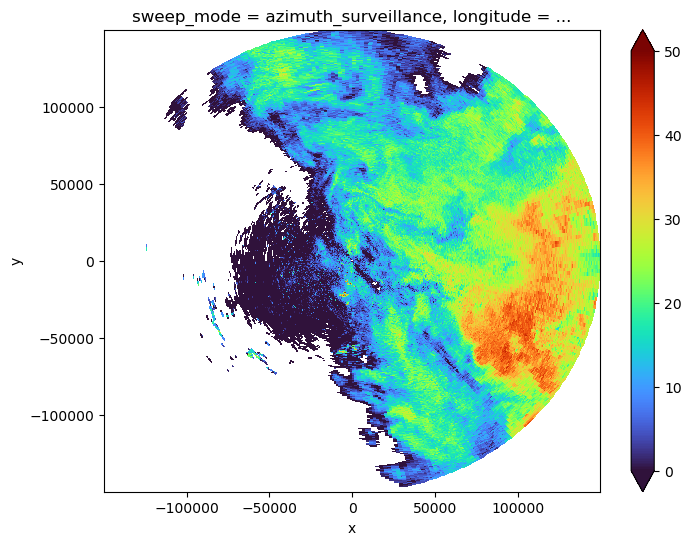
Matching SR/GR#
Identify which SR rays actually intersect with the GR sweep#
Based on the above criteria (in radar range, precipitating SR profile) and based on SR elevation angle (with regard to GR).
This will only keep the wanted value in sr_match.
sr_cut contains all satellite reflectivities we need. ref_sr_ss, ref_sr_sh, ref_sr_com, zFactorCorrected.
[44]:
sr_match = sr_cut.reset_coords(["xp", "yp", "zp"])
sr_match = sr_match.where(precip_mask).where(
(sr_match.elevation >= (swp.sweep_fixed_angle - bw_gr / 2.0))
& (sr_match.elevation <= (swp.sweep_fixed_angle + bw_gr / 2.0))
)
[45]:
# calculate nbeams
sr_match_mean = sr_match.mean("nbin")
xyzp_sr = xr.concat(
[sr_match_mean.xp, sr_match_mean.yp, sr_match_mean.zp], dim="ncoord"
).transpose(..., "ncoord")
xyzp_sr = (
xyzp_sr.stack(nbeams=("nscan", "nray"))
.transpose("nbeams", "ncoord", ...)
.dropna(
dim="nbeams",
)
)
nbeams = xyzp_sr.nbeams
nbeams
[45]:
<xarray.DataArray 'nbeams' (nbeams: 1218)>
array([(0, 26), (0, 27), (0, 28), ..., (60, 27), (60, 28), (60, 29)],
dtype=object)
Coordinates: (12/13)
Latitude (nbeams) float32 -26.55 -26.52 -26.5 ... -28.93 -28.9 -28.88
Longitude (nbeams) float32 152.6 152.6 152.6 152.7 ... 153.9 153.9 154.0
date (nbeams) datetime64[ns] 2014-12-06T09:50:30.000500 ... 2014-1...
x (nbeams) float64 -6.779e+04 -6.337e+04 ... 6.846e+04 7.292e+04
y (nbeams) float64 1.298e+05 1.32e+05 ... -1.317e+05 -1.294e+05
crs_wkt int64 0
... ...
longitude float64 153.2
latitude float64 -27.72
altitude float64 175.0
* nbeams (nbeams) object MultiIndex
* nscan (nbeams) int64 0 0 0 0 0 0 0 1 1 ... 59 59 59 59 59 59 60 60 60
* nray (nbeams) int64 26 27 28 29 30 31 32 24 ... 28 29 35 36 27 28 29- nbeams: 1218
- MultiIndex
array([(0, 26), (0, 27), (0, 28), ..., (60, 27), (60, 28), (60, 29)], dtype=object) - Latitude(nbeams)float32-26.55 -26.52 ... -28.9 -28.88
- DimensionNames :
- nscan,nray
- Units :
- degrees
- units :
- degrees
- CodeMissingValue :
- -9999.9
array([-26.545311, -26.524946, -26.504398, ..., -28.925497, -28.904446, -28.883429], dtype=float32) - Longitude(nbeams)float32152.6 152.6 152.6 ... 153.9 154.0
- DimensionNames :
- nscan,nray
- Units :
- degrees
- units :
- degrees
- CodeMissingValue :
- -9999.9
array([152.55975, 152.60423, 152.64912, ..., 153.89622, 153.94188, 153.98752], dtype=float32) - date(nbeams)datetime64[ns]2014-12-06T09:50:30.000500 ... 2...
array(['2014-12-06T09:50:30.000500000', '2014-12-06T09:50:30.000500000', '2014-12-06T09:50:30.000500000', ..., '2014-12-06T09:51:12.000500000', '2014-12-06T09:51:12.000500000', '2014-12-06T09:51:12.000500000'], dtype='datetime64[ns]') - x(nbeams)float64-6.779e+04 -6.337e+04 ... 7.292e+04
array([-67792.10477565, -63370.78583652, -58906.88991347, ..., 63991.55173439, 68457.14680696, 72922.98860669]) - y(nbeams)float641.298e+05 1.32e+05 ... -1.294e+05
array([ 129766.8608038 , 132046.5789815 , 134345.19055428, ..., -133982.12171816, -131673.76631035, -129370.88469283]) - crs_wkt()int640
- crs_wkt :
- PROJCRS["unknown",BASEGEOGCRS["unknown",DATUM["Unknown based on WGS 84 ellipsoid",ELLIPSOID["WGS 84",6378137,298.25722356049,LENGTHUNIT["metre",1,ID["EPSG",9001]]]],PRIMEM["Greenwich",0,ANGLEUNIT["degree",0.0174532925199433],ID["EPSG",8901]]],CONVERSION["unknown",METHOD["Modified Azimuthal Equidistant",ID["EPSG",9832]],PARAMETER["Latitude of natural origin",-27.7181,ANGLEUNIT["degree",0.0174532925199433],ID["EPSG",8801]],PARAMETER["Longitude of natural origin",153.240005,ANGLEUNIT["degree",0.0174532925199433],ID["EPSG",8802]],PARAMETER["False easting",0,LENGTHUNIT["metre",1],ID["EPSG",8806]],PARAMETER["False northing",0,LENGTHUNIT["metre",1],ID["EPSG",8807]]],CS[Cartesian,2],AXIS["(E)",east,ORDER[1],LENGTHUNIT["metre",1,ID["EPSG",9001]]],AXIS["(N)",north,ORDER[2],LENGTHUNIT["metre",1,ID["EPSG",9001]]]]
- semi_major_axis :
- 6378137.0
- semi_minor_axis :
- 6356752.314245
- inverse_flattening :
- 298.25722356049
- reference_ellipsoid_name :
- WGS 84
- longitude_of_prime_meridian :
- 0.0
- prime_meridian_name :
- Greenwich
- geographic_crs_name :
- unknown
- horizontal_datum_name :
- Unknown based on WGS 84 ellipsoid
- projected_crs_name :
- unknown
- grid_mapping_name :
- azimuthal_equidistant
- latitude_of_projection_origin :
- -27.7181
- longitude_of_projection_origin :
- 153.240005
- false_easting :
- 0.0
- false_northing :
- 0.0
array(0)
- sweep_mode()<U20'azimuth_surveillance'
array('azimuth_surveillance', dtype='<U20') - longitude()float64153.2
array(153.24000549)
- latitude()float64-27.72
array(-27.71809959)
- altitude()float64175.0
array(174.99999702)
- nbeams(nbeams)objectMultiIndex
array([(0, 26), (0, 27), (0, 28), ..., (60, 27), (60, 28), (60, 29)], dtype=object) - nscan(nbeams)int640 0 0 0 0 0 0 ... 59 59 59 60 60 60
array([ 0, 0, 0, ..., 60, 60, 60])
- nray(nbeams)int6426 27 28 29 30 ... 35 36 27 28 29
array([26, 27, 28, ..., 27, 28, 29])
- nbeams
nscan
nrayPandasMultiIndexPandasIndex(MultiIndex([( 0, 26), ( 0, 27), ( 0, 28), ( 0, 29), ( 0, 30), ( 0, 31), ( 0, 32), ( 1, 24), ( 1, 28), ( 1, 29), ... (59, 25), (59, 26), (59, 27), (59, 28), (59, 29), (59, 35), (59, 36), (60, 27), (60, 28), (60, 29)], name='nbeams', length=1218))
[46]:
xyzp_sr
[46]:
<xarray.DataArray 'xp' (nbeams: 1218, ncoord: 3)>
array([[ -67901.44637496, 129710.27794381, 4748.40432405],
[ -63535.20030327, 131961.59839865, 4746.39302492],
[ -59126.88967667, 134231.58639525, 4743.54226887],
...,
[ 63822.93724828, -134069.59598245, 4871.29781395],
[ 68231.52652476, -131790.70883022, 4868.37203801],
[ 72640.46603565, -129517.17047977, 4864.60766941]])
Coordinates: (12/13)
Latitude (nbeams) float32 -26.55 -26.52 -26.5 ... -28.93 -28.9 -28.88
Longitude (nbeams) float32 152.6 152.6 152.6 152.7 ... 153.9 153.9 154.0
date (nbeams) datetime64[ns] 2014-12-06T09:50:30.000500 ... 2014-1...
x (nbeams) float64 -6.779e+04 -6.337e+04 ... 6.846e+04 7.292e+04
y (nbeams) float64 1.298e+05 1.32e+05 ... -1.317e+05 -1.294e+05
crs_wkt int64 0
... ...
longitude float64 153.2
latitude float64 -27.72
altitude float64 175.0
* nbeams (nbeams) object MultiIndex
* nscan (nbeams) int64 0 0 0 0 0 0 0 1 1 ... 59 59 59 59 59 59 60 60 60
* nray (nbeams) int64 26 27 28 29 30 31 32 24 ... 28 29 35 36 27 28 29
Dimensions without coordinates: ncoord- nbeams: 1218
- ncoord: 3
- -6.79e+04 1.297e+05 4.748e+03 ... 7.264e+04 -1.295e+05 4.865e+03
array([[ -67901.44637496, 129710.27794381, 4748.40432405], [ -63535.20030327, 131961.59839865, 4746.39302492], [ -59126.88967667, 134231.58639525, 4743.54226887], ..., [ 63822.93724828, -134069.59598245, 4871.29781395], [ 68231.52652476, -131790.70883022, 4868.37203801], [ 72640.46603565, -129517.17047977, 4864.60766941]]) - Latitude(nbeams)float32-26.55 -26.52 ... -28.9 -28.88
- DimensionNames :
- nscan,nray
- Units :
- degrees
- units :
- degrees
- CodeMissingValue :
- -9999.9
array([-26.545311, -26.524946, -26.504398, ..., -28.925497, -28.904446, -28.883429], dtype=float32) - Longitude(nbeams)float32152.6 152.6 152.6 ... 153.9 154.0
- DimensionNames :
- nscan,nray
- Units :
- degrees
- units :
- degrees
- CodeMissingValue :
- -9999.9
array([152.55975, 152.60423, 152.64912, ..., 153.89622, 153.94188, 153.98752], dtype=float32) - date(nbeams)datetime64[ns]2014-12-06T09:50:30.000500 ... 2...
array(['2014-12-06T09:50:30.000500000', '2014-12-06T09:50:30.000500000', '2014-12-06T09:50:30.000500000', ..., '2014-12-06T09:51:12.000500000', '2014-12-06T09:51:12.000500000', '2014-12-06T09:51:12.000500000'], dtype='datetime64[ns]') - x(nbeams)float64-6.779e+04 -6.337e+04 ... 7.292e+04
array([-67792.10477565, -63370.78583652, -58906.88991347, ..., 63991.55173439, 68457.14680696, 72922.98860669]) - y(nbeams)float641.298e+05 1.32e+05 ... -1.294e+05
array([ 129766.8608038 , 132046.5789815 , 134345.19055428, ..., -133982.12171816, -131673.76631035, -129370.88469283]) - crs_wkt()int640
- crs_wkt :
- PROJCRS["unknown",BASEGEOGCRS["unknown",DATUM["Unknown based on WGS 84 ellipsoid",ELLIPSOID["WGS 84",6378137,298.25722356049,LENGTHUNIT["metre",1,ID["EPSG",9001]]]],PRIMEM["Greenwich",0,ANGLEUNIT["degree",0.0174532925199433],ID["EPSG",8901]]],CONVERSION["unknown",METHOD["Modified Azimuthal Equidistant",ID["EPSG",9832]],PARAMETER["Latitude of natural origin",-27.7181,ANGLEUNIT["degree",0.0174532925199433],ID["EPSG",8801]],PARAMETER["Longitude of natural origin",153.240005,ANGLEUNIT["degree",0.0174532925199433],ID["EPSG",8802]],PARAMETER["False easting",0,LENGTHUNIT["metre",1],ID["EPSG",8806]],PARAMETER["False northing",0,LENGTHUNIT["metre",1],ID["EPSG",8807]]],CS[Cartesian,2],AXIS["(E)",east,ORDER[1],LENGTHUNIT["metre",1,ID["EPSG",9001]]],AXIS["(N)",north,ORDER[2],LENGTHUNIT["metre",1,ID["EPSG",9001]]]]
- semi_major_axis :
- 6378137.0
- semi_minor_axis :
- 6356752.314245
- inverse_flattening :
- 298.25722356049
- reference_ellipsoid_name :
- WGS 84
- longitude_of_prime_meridian :
- 0.0
- prime_meridian_name :
- Greenwich
- geographic_crs_name :
- unknown
- horizontal_datum_name :
- Unknown based on WGS 84 ellipsoid
- projected_crs_name :
- unknown
- grid_mapping_name :
- azimuthal_equidistant
- latitude_of_projection_origin :
- -27.7181
- longitude_of_projection_origin :
- 153.240005
- false_easting :
- 0.0
- false_northing :
- 0.0
array(0)
- sweep_mode()<U20'azimuth_surveillance'
array('azimuth_surveillance', dtype='<U20') - longitude()float64153.2
array(153.24000549)
- latitude()float64-27.72
array(-27.71809959)
- altitude()float64175.0
array(174.99999702)
- nbeams(nbeams)objectMultiIndex
array([(0, 26), (0, 27), (0, 28), ..., (60, 27), (60, 28), (60, 29)], dtype=object) - nscan(nbeams)int640 0 0 0 0 0 0 ... 59 59 59 60 60 60
array([ 0, 0, 0, ..., 60, 60, 60])
- nray(nbeams)int6426 27 28 29 30 ... 35 36 27 28 29
array([26, 27, 28, ..., 27, 28, 29])
- nbeams
nscan
nrayPandasMultiIndexPandasIndex(MultiIndex([( 0, 26), ( 0, 27), ( 0, 28), ( 0, 29), ( 0, 30), ( 0, 31), ( 0, 32), ( 1, 24), ( 1, 28), ( 1, 29), ... (59, 25), (59, 26), (59, 27), (59, 28), (59, 29), (59, 35), (59, 36), (60, 27), (60, 28), (60, 29)], name='nbeams', length=1218))
New version matching#
[47]:
sr_match2 = sr_match.stack(nbeams=("nscan", "nray")).where(nbeams)
display(sr_match2)
<xarray.Dataset>
Dimensions: (nswath: 1, nbin: 176, nbeams: 1218, XYZ: 3,
nNP: 4, method: 6, foreBack: 2, nearFar: 2,
nNode: 5, nbinSZP: 7, nDSD: 2, nNUBF: 3, LS: 2)
Coordinates: (12/18)
* nbeams (nbeams) object MultiIndex
* nscan (nbeams) int64 0 0 0 0 0 0 ... 59 59 60 60 60
* nray (nbeams) int64 26 27 28 29 30 ... 36 27 28 29
elevation (nbin, nbeams) float64 7.923 7.918 ... -0.5684
Latitude (nbeams) float32 -26.55 -26.52 ... -28.9 -28.88
Longitude (nbeams) float32 152.6 152.6 ... 153.9 154.0
... ...
latitude float64 -27.72
altitude float64 175.0
sr_range (nbin) float64 2.188e+04 2.175e+04 ... 0.0
range (nbin, nbeams) float64 1.482e+05 ... 1.485e+05
azimuth (nbin, nbeams) float64 332.2 334.0 ... 150.6
pr_dist (nbin, nbeams) float64 3.826e+05 ... 4.057e+05
Dimensions without coordinates: nswath, nbin, XYZ, nNP, method, foreBack,
nearFar, nNode, nbinSZP, nDSD, nNUBF, LS
Data variables: (12/106)
AlgorithmRuntimeInfo (nswath, nbin, nbeams) object nan nan ... nan
dataQuality (nbin, nbeams) float32 nan nan nan ... nan nan
dataWarning (nbin, nbeams) float32 nan nan nan ... nan nan
missing (nbin, nbeams) float32 nan nan nan ... nan nan
modeStatus (nbin, nbeams) float32 nan nan nan ... nan nan
geoError (nbin, nbeams) float32 nan nan nan ... nan nan
... ...
sr_bin_depth (nbin, nbeams) float32 nan nan nan ... nan nan
bb_ratio (nbin, nbeams) float64 nan nan nan ... nan nan
bb_mask (nbin, nbeams) float64 nan nan nan ... nan nan
ref_sr_com (nbin, nbeams) float32 nan nan nan ... nan nan
ref_sr_ss (nbin, nbeams) float32 nan nan nan ... nan nan
ref_sr_sh (nbin, nbeams) float32 nan nan nan ... nan nan
Attributes:
FileHeader: DOI=10.5067/GPM/DPR/Ku/2A/05;\nDOIauthority=http://dx....
InputRecord: InputFileNames=GPMCOR_KUR_1412060833_1006_004383_1BS_D...
NavigationRecord: LongitudeOnEquator=-27.312063;\nUTCDateTimeOnEquator=2...
FileInfo: DataFormatVersion=cn;\nTKCodeBuildVersion=1;\nMetadata...
JAXAInfo: GranuleFirstScanUTCDateTime=2014-12-06T08:33:33.292Z;\...
platform: GPM- nswath: 1
- nbin: 176
- nbeams: 1218
- XYZ: 3
- nNP: 4
- method: 6
- foreBack: 2
- nearFar: 2
- nNode: 5
- nbinSZP: 7
- nDSD: 2
- nNUBF: 3
- LS: 2
- nbeams(nbeams)objectMultiIndex
array([(0, 26), (0, 27), (0, 28), ..., (60, 27), (60, 28), (60, 29)], dtype=object) - nscan(nbeams)int640 0 0 0 0 0 0 ... 59 59 59 60 60 60
array([ 0, 0, 0, ..., 60, 60, 60])
- nray(nbeams)int6426 27 28 29 30 ... 35 36 27 28 29
array([26, 27, 28, ..., 27, 28, 29])
- elevation(nbin, nbeams)float647.923 7.918 ... -0.5681 -0.5684
array([[ 7.92305352, 7.91760615, 7.90171019, ..., 7.79518823, 7.79614094, 7.78655659], [ 7.87532015, 7.86989359, 7.85406689, ..., 7.74812992, 7.74907046, 7.73952289], [ 7.82757435, 7.82216871, 7.80641148, ..., 7.70105958, 7.70198803, 7.69247742], ..., [-0.46443706, -0.46468409, -0.46555099, ..., -0.47187478, -0.47166999, -0.47210554], [-0.5133363 , -0.51354391, -0.51430701, ..., -0.5200707 , -0.51986141, -0.52022778], [-0.56223623, -0.56240433, -0.56306344, ..., -0.5682674 , -0.56805351, -0.56835052]]) - Latitude(nbeams)float32-26.55 -26.52 ... -28.9 -28.88
- DimensionNames :
- nscan,nray
- Units :
- degrees
- units :
- degrees
- CodeMissingValue :
- -9999.9
array([-26.545311, -26.524946, -26.504398, ..., -28.925497, -28.904446, -28.883429], dtype=float32) - Longitude(nbeams)float32152.6 152.6 152.6 ... 153.9 154.0
- DimensionNames :
- nscan,nray
- Units :
- degrees
- units :
- degrees
- CodeMissingValue :
- -9999.9
array([152.55975, 152.60423, 152.64912, ..., 153.89622, 153.94188, 153.98752], dtype=float32) - date(nbeams)datetime64[ns]2014-12-06T09:50:30.000500 ... 2...
array(['2014-12-06T09:50:30.000500000', '2014-12-06T09:50:30.000500000', '2014-12-06T09:50:30.000500000', ..., '2014-12-06T09:51:12.000500000', '2014-12-06T09:51:12.000500000', '2014-12-06T09:51:12.000500000'], dtype='datetime64[ns]') - x(nbeams)float64-6.779e+04 -6.337e+04 ... 7.292e+04
array([-67792.10477565, -63370.78583652, -58906.88991347, ..., 63991.55173439, 68457.14680696, 72922.98860669]) - y(nbeams)float641.298e+05 1.32e+05 ... -1.294e+05
array([ 129766.8608038 , 132046.5789815 , 134345.19055428, ..., -133982.12171816, -131673.76631035, -129370.88469283]) - crs_wkt()int640
- crs_wkt :
- PROJCRS["unknown",BASEGEOGCRS["unknown",DATUM["Unknown based on WGS 84 ellipsoid",ELLIPSOID["WGS 84",6378137,298.25722356049,LENGTHUNIT["metre",1,ID["EPSG",9001]]]],PRIMEM["Greenwich",0,ANGLEUNIT["degree",0.0174532925199433],ID["EPSG",8901]]],CONVERSION["unknown",METHOD["Modified Azimuthal Equidistant",ID["EPSG",9832]],PARAMETER["Latitude of natural origin",-27.7181,ANGLEUNIT["degree",0.0174532925199433],ID["EPSG",8801]],PARAMETER["Longitude of natural origin",153.240005,ANGLEUNIT["degree",0.0174532925199433],ID["EPSG",8802]],PARAMETER["False easting",0,LENGTHUNIT["metre",1],ID["EPSG",8806]],PARAMETER["False northing",0,LENGTHUNIT["metre",1],ID["EPSG",8807]]],CS[Cartesian,2],AXIS["(E)",east,ORDER[1],LENGTHUNIT["metre",1,ID["EPSG",9001]]],AXIS["(N)",north,ORDER[2],LENGTHUNIT["metre",1,ID["EPSG",9001]]]]
- semi_major_axis :
- 6378137.0
- semi_minor_axis :
- 6356752.314245
- inverse_flattening :
- 298.25722356049
- reference_ellipsoid_name :
- WGS 84
- longitude_of_prime_meridian :
- 0.0
- prime_meridian_name :
- Greenwich
- geographic_crs_name :
- unknown
- horizontal_datum_name :
- Unknown based on WGS 84 ellipsoid
- projected_crs_name :
- unknown
- grid_mapping_name :
- azimuthal_equidistant
- latitude_of_projection_origin :
- -27.7181
- longitude_of_projection_origin :
- 153.240005
- false_easting :
- 0.0
- false_northing :
- 0.0
array(0)
- sweep_mode()<U20'azimuth_surveillance'
array('azimuth_surveillance', dtype='<U20') - longitude()float64153.2
array(153.24000549)
- latitude()float64-27.72
array(-27.71809959)
- altitude()float64175.0
array(174.99999702)
- sr_range(nbin)float642.188e+04 2.175e+04 ... 125.0 0.0
array([21875., 21750., 21625., 21500., 21375., 21250., 21125., 21000., 20875., 20750., 20625., 20500., 20375., 20250., 20125., 20000., 19875., 19750., 19625., 19500., 19375., 19250., 19125., 19000., 18875., 18750., 18625., 18500., 18375., 18250., 18125., 18000., 17875., 17750., 17625., 17500., 17375., 17250., 17125., 17000., 16875., 16750., 16625., 16500., 16375., 16250., 16125., 16000., 15875., 15750., 15625., 15500., 15375., 15250., 15125., 15000., 14875., 14750., 14625., 14500., 14375., 14250., 14125., 14000., 13875., 13750., 13625., 13500., 13375., 13250., 13125., 13000., 12875., 12750., 12625., 12500., 12375., 12250., 12125., 12000., 11875., 11750., 11625., 11500., 11375., 11250., 11125., 11000., 10875., 10750., 10625., 10500., 10375., 10250., 10125., 10000., 9875., 9750., 9625., 9500., 9375., 9250., 9125., 9000., 8875., 8750., 8625., 8500., 8375., 8250., 8125., 8000., 7875., 7750., 7625., 7500., 7375., 7250., 7125., 7000., 6875., 6750., 6625., 6500., 6375., 6250., 6125., 6000., 5875., 5750., 5625., 5500., 5375., 5250., 5125., 5000., 4875., 4750., 4625., 4500., 4375., 4250., 4125., 4000., 3875., 3750., 3625., 3500., 3375., 3250., 3125., 3000., 2875., 2750., 2625., 2500., 2375., 2250., 2125., 2000., 1875., 1750., 1625., 1500., 1375., 1250., 1125., 1000., 875., 750., 625., 500., 375., 250., 125., 0.]) - range(nbin, nbeams)float641.482e+05 1.482e+05 ... 1.485e+05
array([[148195.2685455 , 148225.35310379, 148403.30015389, ..., 150273.13432807, 150171.1493916 , 150223.08079372], [148175.94002558, 148206.18366232, 148384.41831723, ..., 150253.89631422, 150152.06756816, 150204.28441151], [148156.71444765, 148187.11717918, 148365.63938192, ..., 150234.75984669, 150133.08739573, 150185.5897098 ], ..., [146409.57018776, 146467.12290302, 146693.40899966, ..., 148481.54740738, 148407.89545492, 148509.13157608], [146408.47007151, 146466.17947984, 146692.73341532, ..., 148480.28455514, 148406.8024497 , 148508.32002203], [146407.4766701 , 146465.34272692, 146692.16433134, ..., 148479.12693056, 148405.81472188, 148507.61366855]]) - azimuth(nbin, nbeams)float64332.2 334.0 335.9 ... 152.5 150.6
array([[332.19489917, 334.02974426, 335.87910884, ..., 154.79893703, 152.97033321, 151.14178149], [332.19616701, 334.03164929, 335.88165103, ..., 154.79705933, 152.96781763, 151.13863432], [332.19743484, 334.03355432, 335.88419321, ..., 154.79518163, 152.96530205, 151.13548715], ..., [332.41423966, 334.35926637, 336.31871276, ..., 154.47402739, 152.53512515, 150.59747031], [332.41550755, 334.36117081, 336.32125263, ..., 154.47214893, 152.53260947, 150.59432498], [332.41677544, 334.36307526, 336.32379249, ..., 154.47027046, 152.53009379, 150.59117965]]) - pr_dist(nbin, nbeams)float643.826e+05 3.828e+05 ... 4.057e+05
array([[382626.45553278, 382791.29164683, 383022.8238303 , ..., 383311.69547025, 383543.51742622, 383841.85018793], [382751.45553278, 382916.29164683, 383147.8238303 , ..., 383436.69547025, 383668.51742622, 383966.85018793], [382876.45553278, 383041.29164683, 383272.8238303 , ..., 383561.69547025, 383793.51742622, 384091.85018793], ..., [404251.45553278, 404416.29164683, 404647.8238303 , ..., 404936.69547025, 405168.51742622, 405466.85018793], [404376.45553278, 404541.29164683, 404772.8238303 , ..., 405061.69547025, 405293.51742622, 405591.85018793], [404501.45553278, 404666.29164683, 404897.8238303 , ..., 405186.69547025, 405418.51742622, 405716.85018793]])
- AlgorithmRuntimeInfo(nswath, nbin, nbeams)objectnan nan nan nan ... nan nan nan nan
array([[[nan, nan, nan, ..., nan, nan, nan], [nan, nan, nan, ..., nan, nan, nan], [nan, nan, nan, ..., nan, nan, nan], ..., [nan, nan, nan, ..., nan, nan, nan], [nan, nan, nan, ..., nan, nan, nan], [nan, nan, nan, ..., nan, nan, nan]]], dtype=object) - dataQuality(nbin, nbeams)float32nan nan nan nan ... nan nan nan nan
- DimensionNames :
- nscan
- CodeMissingValue :
- -99
array([[nan, nan, nan, ..., nan, nan, nan], [nan, nan, nan, ..., nan, nan, nan], [nan, nan, nan, ..., nan, nan, nan], ..., [nan, nan, nan, ..., nan, nan, nan], [nan, nan, nan, ..., nan, nan, nan], [nan, nan, nan, ..., nan, nan, nan]], dtype=float32) - dataWarning(nbin, nbeams)float32nan nan nan nan ... nan nan nan nan
- DimensionNames :
- nscan
- CodeMissingValue :
- -99
array([[nan, nan, nan, ..., nan, nan, nan], [nan, nan, nan, ..., nan, nan, nan], [nan, nan, nan, ..., nan, nan, nan], ..., [nan, nan, nan, ..., nan, nan, nan], [nan, nan, nan, ..., nan, nan, nan], [nan, nan, nan, ..., nan, nan, nan]], dtype=float32) - missing(nbin, nbeams)float32nan nan nan nan ... nan nan nan nan
- DimensionNames :
- nscan
- CodeMissingValue :
- -99
array([[nan, nan, nan, ..., nan, nan, nan], [nan, nan, nan, ..., nan, nan, nan], [nan, nan, nan, ..., nan, nan, nan], ..., [nan, nan, nan, ..., nan, nan, nan], [nan, nan, nan, ..., nan, nan, nan], [nan, nan, nan, ..., nan, nan, nan]], dtype=float32) - modeStatus(nbin, nbeams)float32nan nan nan nan ... nan nan nan nan
- DimensionNames :
- nscan
- CodeMissingValue :
- -99
array([[nan, nan, nan, ..., nan, nan, nan], [nan, nan, nan, ..., nan, nan, nan], [nan, nan, nan, ..., nan, nan, nan], ..., [nan, nan, nan, ..., nan, nan, nan], [nan, nan, nan, ..., nan, nan, nan], [nan, nan, nan, ..., nan, nan, nan]], dtype=float32) - geoError(nbin, nbeams)float32nan nan nan nan ... nan nan nan nan
- DimensionNames :
- nscan
- CodeMissingValue :
- -9999
array([[nan, nan, nan, ..., nan, nan, nan], [nan, nan, nan, ..., nan, nan, nan], [nan, nan, nan, ..., nan, nan, nan], ..., [nan, nan, nan, ..., nan, nan, nan], [nan, nan, nan, ..., nan, nan, nan], [nan, nan, nan, ..., nan, nan, nan]], dtype=float32) - geoWarning(nbin, nbeams)float32nan nan nan nan ... nan nan nan nan
- DimensionNames :
- nscan
- CodeMissingValue :
- -9999
array([[nan, nan, nan, ..., nan, nan, nan], [nan, nan, nan, ..., nan, nan, nan], [nan, nan, nan, ..., nan, nan, nan], ..., [nan, nan, nan, ..., nan, nan, nan], [nan, nan, nan, ..., nan, nan, nan], [nan, nan, nan, ..., nan, nan, nan]], dtype=float32) - SCorientation(nbin, nbeams)float32nan nan nan nan ... nan nan nan nan
- DimensionNames :
- nscan
- Units :
- degrees
- units :
- degrees
- CodeMissingValue :
- -9999
array([[nan, nan, nan, ..., nan, nan, nan], [nan, nan, nan, ..., nan, nan, nan], [nan, nan, nan, ..., nan, nan, nan], ..., [nan, nan, nan, ..., nan, nan, nan], [nan, nan, nan, ..., nan, nan, nan], [nan, nan, nan, ..., nan, nan, nan]], dtype=float32) - pointingStatus(nbin, nbeams)float32nan nan nan nan ... nan nan nan nan
- DimensionNames :
- nscan
- CodeMissingValue :
- -9999
array([[nan, nan, nan, ..., nan, nan, nan], [nan, nan, nan, ..., nan, nan, nan], [nan, nan, nan, ..., nan, nan, nan], ..., [nan, nan, nan, ..., nan, nan, nan], [nan, nan, nan, ..., nan, nan, nan], [nan, nan, nan, ..., nan, nan, nan]], dtype=float32) - acsModeMidScan(nbin, nbeams)float32nan nan nan nan ... nan nan nan nan
- DimensionNames :
- nscan
- CodeMissingValue :
- -99
array([[nan, nan, nan, ..., nan, nan, nan], [nan, nan, nan, ..., nan, nan, nan], [nan, nan, nan, ..., nan, nan, nan], ..., [nan, nan, nan, ..., nan, nan, nan], [nan, nan, nan, ..., nan, nan, nan], [nan, nan, nan, ..., nan, nan, nan]], dtype=float32) - targetSelectionMidScan(nbin, nbeams)float32nan nan nan nan ... nan nan nan nan
- DimensionNames :
- nscan
- CodeMissingValue :
- -99
array([[nan, nan, nan, ..., nan, nan, nan], [nan, nan, nan, ..., nan, nan, nan], [nan, nan, nan, ..., nan, nan, nan], ..., [nan, nan, nan, ..., nan, nan, nan], [nan, nan, nan, ..., nan, nan, nan], [nan, nan, nan, ..., nan, nan, nan]], dtype=float32) - operationalMode(nbin, nbeams)float32nan nan nan nan ... nan nan nan nan
- DimensionNames :
- nscan
- CodeMissingValue :
- -99
array([[nan, nan, nan, ..., nan, nan, nan], [nan, nan, nan, ..., nan, nan, nan], [nan, nan, nan, ..., nan, nan, nan], ..., [nan, nan, nan, ..., nan, nan, nan], [nan, nan, nan, ..., nan, nan, nan], [nan, nan, nan, ..., nan, nan, nan]], dtype=float32) - limitErrorFlag(nbin, nbeams)float32nan nan nan nan ... nan nan nan nan
- DimensionNames :
- nscan
- CodeMissingValue :
- -99
array([[nan, nan, nan, ..., nan, nan, nan], [nan, nan, nan, ..., nan, nan, nan], [nan, nan, nan, ..., nan, nan, nan], ..., [nan, nan, nan, ..., nan, nan, nan], [nan, nan, nan, ..., nan, nan, nan], [nan, nan, nan, ..., nan, nan, nan]], dtype=float32) - FractionalGranuleNumber(nbin, nbeams)float64nan nan nan nan ... nan nan nan nan
- DimensionNames :
- nscan
- CodeMissingValue :
- -9999.9
array([[nan, nan, nan, ..., nan, nan, nan], [nan, nan, nan, ..., nan, nan, nan], [nan, nan, nan, ..., nan, nan, nan], ..., [nan, nan, nan, ..., nan, nan, nan], [nan, nan, nan, ..., nan, nan, nan], [nan, nan, nan, ..., nan, nan, nan]]) - scPos(XYZ, nbin, nbeams)float32nan nan nan nan ... nan nan nan nan
- DimensionNames :
- nscan,XYZ
- Units :
- m
- units :
- m
- CodeMissingValue :
- -9999.9
array([[[nan, nan, nan, ..., nan, nan, nan], [nan, nan, nan, ..., nan, nan, nan], [nan, nan, nan, ..., nan, nan, nan], ..., [nan, nan, nan, ..., nan, nan, nan], [nan, nan, nan, ..., nan, nan, nan], [nan, nan, nan, ..., nan, nan, nan]], [[nan, nan, nan, ..., nan, nan, nan], [nan, nan, nan, ..., nan, nan, nan], [nan, nan, nan, ..., nan, nan, nan], ..., [nan, nan, nan, ..., nan, nan, nan], [nan, nan, nan, ..., nan, nan, nan], [nan, nan, nan, ..., nan, nan, nan]], [[nan, nan, nan, ..., nan, nan, nan], [nan, nan, nan, ..., nan, nan, nan], [nan, nan, nan, ..., nan, nan, nan], ..., [nan, nan, nan, ..., nan, nan, nan], [nan, nan, nan, ..., nan, nan, nan], [nan, nan, nan, ..., nan, nan, nan]]], dtype=float32) - scVel(XYZ, nbin, nbeams)float32nan nan nan nan ... nan nan nan nan
- DimensionNames :
- nscan,XYZ
- Units :
- m/s
- units :
- m/s
- CodeMissingValue :
- -9999.9
array([[[nan, nan, nan, ..., nan, nan, nan], [nan, nan, nan, ..., nan, nan, nan], [nan, nan, nan, ..., nan, nan, nan], ..., [nan, nan, nan, ..., nan, nan, nan], [nan, nan, nan, ..., nan, nan, nan], [nan, nan, nan, ..., nan, nan, nan]], [[nan, nan, nan, ..., nan, nan, nan], [nan, nan, nan, ..., nan, nan, nan], [nan, nan, nan, ..., nan, nan, nan], ..., [nan, nan, nan, ..., nan, nan, nan], [nan, nan, nan, ..., nan, nan, nan], [nan, nan, nan, ..., nan, nan, nan]], [[nan, nan, nan, ..., nan, nan, nan], [nan, nan, nan, ..., nan, nan, nan], [nan, nan, nan, ..., nan, nan, nan], ..., [nan, nan, nan, ..., nan, nan, nan], [nan, nan, nan, ..., nan, nan, nan], [nan, nan, nan, ..., nan, nan, nan]]], dtype=float32) - scLat(nbin, nbeams)float32nan nan nan nan ... nan nan nan nan
- DimensionNames :
- nscan
- Units :
- degrees
- units :
- degrees
- CodeMissingValue :
- -9999.9
array([[nan, nan, nan, ..., nan, nan, nan], [nan, nan, nan, ..., nan, nan, nan], [nan, nan, nan, ..., nan, nan, nan], ..., [nan, nan, nan, ..., nan, nan, nan], [nan, nan, nan, ..., nan, nan, nan], [nan, nan, nan, ..., nan, nan, nan]], dtype=float32) - scLon(nbin, nbeams)float32nan nan nan nan ... nan nan nan nan
- DimensionNames :
- nscan
- Units :
- degrees
- units :
- degrees
- CodeMissingValue :
- -9999.9
array([[nan, nan, nan, ..., nan, nan, nan], [nan, nan, nan, ..., nan, nan, nan], [nan, nan, nan, ..., nan, nan, nan], ..., [nan, nan, nan, ..., nan, nan, nan], [nan, nan, nan, ..., nan, nan, nan], [nan, nan, nan, ..., nan, nan, nan]], dtype=float32) - scAlt(nbin, nbeams)float32nan nan nan nan ... nan nan nan nan
- DimensionNames :
- nscan
- Units :
- m
- units :
- m
- CodeMissingValue :
- -9999.9
array([[nan, nan, nan, ..., nan, nan, nan], [nan, nan, nan, ..., nan, nan, nan], [nan, nan, nan, ..., nan, nan, nan], ..., [nan, nan, nan, ..., nan, nan, nan], [nan, nan, nan, ..., nan, nan, nan], [nan, nan, nan, ..., nan, nan, nan]], dtype=float32) - dprAlt(nbin, nbeams)float32nan nan nan nan ... nan nan nan nan
- DimensionNames :
- nscan
- Units :
- m
- units :
- m
- CodeMissingValue :
- -9999.9
array([[nan, nan, nan, ..., nan, nan, nan], [nan, nan, nan, ..., nan, nan, nan], [nan, nan, nan, ..., nan, nan, nan], ..., [nan, nan, nan, ..., nan, nan, nan], [nan, nan, nan, ..., nan, nan, nan], [nan, nan, nan, ..., nan, nan, nan]], dtype=float32) - scAttRollGeoc(nbin, nbeams)float32nan nan nan nan ... nan nan nan nan
- DimensionNames :
- nscan
- Units :
- degrees
- units :
- degrees
- CodeMissingValue :
- -9999.9
array([[nan, nan, nan, ..., nan, nan, nan], [nan, nan, nan, ..., nan, nan, nan], [nan, nan, nan, ..., nan, nan, nan], ..., [nan, nan, nan, ..., nan, nan, nan], [nan, nan, nan, ..., nan, nan, nan], [nan, nan, nan, ..., nan, nan, nan]], dtype=float32) - scAttPitchGeoc(nbin, nbeams)float32nan nan nan nan ... nan nan nan nan
- DimensionNames :
- nscan
- Units :
- degrees
- units :
- degrees
- CodeMissingValue :
- -9999.9
array([[nan, nan, nan, ..., nan, nan, nan], [nan, nan, nan, ..., nan, nan, nan], [nan, nan, nan, ..., nan, nan, nan], ..., [nan, nan, nan, ..., nan, nan, nan], [nan, nan, nan, ..., nan, nan, nan], [nan, nan, nan, ..., nan, nan, nan]], dtype=float32) - scAttYawGeoc(nbin, nbeams)float32nan nan nan nan ... nan nan nan nan
- DimensionNames :
- nscan
- Units :
- degrees
- units :
- degrees
- CodeMissingValue :
- -9999.9
array([[nan, nan, nan, ..., nan, nan, nan], [nan, nan, nan, ..., nan, nan, nan], [nan, nan, nan, ..., nan, nan, nan], ..., [nan, nan, nan, ..., nan, nan, nan], [nan, nan, nan, ..., nan, nan, nan], [nan, nan, nan, ..., nan, nan, nan]], dtype=float32) - scAttRollGeod(nbin, nbeams)float32nan nan nan nan ... nan nan nan nan
- DimensionNames :
- nscan
- Units :
- degrees
- units :
- degrees
- CodeMissingValue :
- -9999.9
array([[nan, nan, nan, ..., nan, nan, nan], [nan, nan, nan, ..., nan, nan, nan], [nan, nan, nan, ..., nan, nan, nan], ..., [nan, nan, nan, ..., nan, nan, nan], [nan, nan, nan, ..., nan, nan, nan], [nan, nan, nan, ..., nan, nan, nan]], dtype=float32) - scAttPitchGeod(nbin, nbeams)float32nan nan nan nan ... nan nan nan nan
- DimensionNames :
- nscan
- Units :
- degrees
- units :
- degrees
- CodeMissingValue :
- -9999.9
array([[nan, nan, nan, ..., nan, nan, nan], [nan, nan, nan, ..., nan, nan, nan], [nan, nan, nan, ..., nan, nan, nan], ..., [nan, nan, nan, ..., nan, nan, nan], [nan, nan, nan, ..., nan, nan, nan], [nan, nan, nan, ..., nan, nan, nan]], dtype=float32) - scAttYawGeod(nbin, nbeams)float32nan nan nan nan ... nan nan nan nan
- DimensionNames :
- nscan
- Units :
- degrees
- units :
- degrees
- CodeMissingValue :
- -9999.9
array([[nan, nan, nan, ..., nan, nan, nan], [nan, nan, nan, ..., nan, nan, nan], [nan, nan, nan, ..., nan, nan, nan], ..., [nan, nan, nan, ..., nan, nan, nan], [nan, nan, nan, ..., nan, nan, nan], [nan, nan, nan, ..., nan, nan, nan]], dtype=float32) - greenHourAng(nbin, nbeams)float32nan nan nan nan ... nan nan nan nan
- DimensionNames :
- nscan
- Units :
- degrees
- units :
- degrees
- CodeMissingValue :
- -9999.9
array([[nan, nan, nan, ..., nan, nan, nan], [nan, nan, nan, ..., nan, nan, nan], [nan, nan, nan, ..., nan, nan, nan], ..., [nan, nan, nan, ..., nan, nan, nan], [nan, nan, nan, ..., nan, nan, nan], [nan, nan, nan, ..., nan, nan, nan]], dtype=float32) - timeMidScan(nbin, nbeams)float64nan nan nan nan ... nan nan nan nan
- DimensionNames :
- nscan
- Units :
- s
- units :
- s
- CodeMissingValue :
- -9999.9
array([[nan, nan, nan, ..., nan, nan, nan], [nan, nan, nan, ..., nan, nan, nan], [nan, nan, nan, ..., nan, nan, nan], ..., [nan, nan, nan, ..., nan, nan, nan], [nan, nan, nan, ..., nan, nan, nan], [nan, nan, nan, ..., nan, nan, nan]]) - timeMidScanOffset(nbin, nbeams)float64nan nan nan nan ... nan nan nan nan
- DimensionNames :
- nscan
- Units :
- s
- units :
- s
- CodeMissingValue :
- -9999.9
array([[nan, nan, nan, ..., nan, nan, nan], [nan, nan, nan, ..., nan, nan, nan], [nan, nan, nan, ..., nan, nan, nan], ..., [nan, nan, nan, ..., nan, nan, nan], [nan, nan, nan, ..., nan, nan, nan], [nan, nan, nan, ..., nan, nan, nan]]) - landSurfaceType(nbin, nbeams)float64nan nan nan nan ... nan nan nan nan
- DimensionNames :
- nscan,nray
- CodeMissingValue :
- -9999
array([[nan, nan, nan, ..., nan, nan, nan], [nan, nan, nan, ..., nan, nan, nan], [nan, nan, nan, ..., nan, nan, nan], ..., [nan, nan, nan, ..., nan, nan, nan], [nan, nan, nan, ..., nan, nan, nan], [nan, nan, nan, ..., nan, nan, nan]]) - localZenithAngle(nbin, nbeams)float32nan nan nan nan ... nan nan nan nan
- DimensionNames :
- nscan,nray
- Units :
- degree
- units :
- degree
- CodeMissingValue :
- -9999.9
array([[nan, nan, nan, ..., nan, nan, nan], [nan, nan, nan, ..., nan, nan, nan], [nan, nan, nan, ..., nan, nan, nan], ..., [nan, nan, nan, ..., nan, nan, nan], [nan, nan, nan, ..., nan, nan, nan], [nan, nan, nan, ..., nan, nan, nan]], dtype=float32) - flagPrecip(nbin, nbeams)float64nan nan nan nan ... nan nan nan nan
- DimensionNames :
- nscan,nray
- CodeMissingValue :
- -9999
array([[nan, nan, nan, ..., nan, nan, nan], [nan, nan, nan, ..., nan, nan, nan], [nan, nan, nan, ..., nan, nan, nan], ..., [nan, nan, nan, ..., nan, nan, nan], [nan, nan, nan, ..., nan, nan, nan], [nan, nan, nan, ..., nan, nan, nan]]) - flagSigmaZeroSaturation(nbin, nbeams)float32nan nan nan nan ... nan nan nan nan
- DimensionNames :
- nscan,nray
- CodeMissingValue :
- 99
array([[nan, nan, nan, ..., nan, nan, nan], [nan, nan, nan, ..., nan, nan, nan], [nan, nan, nan, ..., nan, nan, nan], ..., [nan, nan, nan, ..., nan, nan, nan], [nan, nan, nan, ..., nan, nan, nan], [nan, nan, nan, ..., nan, nan, nan]], dtype=float32) - binRealSurface(nbin, nbeams)float32nan nan nan nan ... nan nan nan nan
- DimensionNames :
- nscan,nray
- CodeMissingValue :
- -9999
array([[nan, nan, nan, ..., nan, nan, nan], [nan, nan, nan, ..., nan, nan, nan], [nan, nan, nan, ..., nan, nan, nan], ..., [nan, nan, nan, ..., nan, nan, nan], [nan, nan, nan, ..., nan, nan, nan], [nan, nan, nan, ..., nan, nan, nan]], dtype=float32) - binStormTop(nbin, nbeams)float32nan nan nan nan ... nan nan nan nan
- DimensionNames :
- nscan,nray
- CodeMissingValue :
- -9999
array([[nan, nan, nan, ..., nan, nan, nan], [nan, nan, nan, ..., nan, nan, nan], [nan, nan, nan, ..., nan, nan, nan], ..., [nan, nan, nan, ..., nan, nan, nan], [nan, nan, nan, ..., nan, nan, nan], [nan, nan, nan, ..., nan, nan, nan]], dtype=float32) - heightStormTop(nbin, nbeams)float32nan nan nan nan ... nan nan nan nan
- DimensionNames :
- nscan,nray
- Units :
- m
- units :
- m
- CodeMissingValue :
- -9999.9
array([[nan, nan, nan, ..., nan, nan, nan], [nan, nan, nan, ..., nan, nan, nan], [nan, nan, nan, ..., nan, nan, nan], ..., [nan, nan, nan, ..., nan, nan, nan], [nan, nan, nan, ..., nan, nan, nan], [nan, nan, nan, ..., nan, nan, nan]], dtype=float32) - binClutterFreeBottom(nbin, nbeams)float32nan nan nan nan ... nan nan nan nan
- DimensionNames :
- nscan,nray
- CodeMissingValue :
- -9999
array([[nan, nan, nan, ..., nan, nan, nan], [nan, nan, nan, ..., nan, nan, nan], [nan, nan, nan, ..., nan, nan, nan], ..., [nan, nan, nan, ..., nan, nan, nan], [nan, nan, nan, ..., nan, nan, nan], [nan, nan, nan, ..., nan, nan, nan]], dtype=float32) - sigmaZeroMeasured(nbin, nbeams)float32nan nan nan nan ... nan nan nan nan
- DimensionNames :
- nscan,nray
- Units :
- dB
- units :
- dB
- CodeMissingValue :
- -9999.9
array([[nan, nan, nan, ..., nan, nan, nan], [nan, nan, nan, ..., nan, nan, nan], [nan, nan, nan, ..., nan, nan, nan], ..., [nan, nan, nan, ..., nan, nan, nan], [nan, nan, nan, ..., nan, nan, nan], [nan, nan, nan, ..., nan, nan, nan]], dtype=float32) - zFactorMeasured(nbin, nbeams)float32nan nan nan nan ... nan nan nan nan
- DimensionNames :
- nscan,nray,nbin
- Units :
- dBZ
- units :
- dBZ
- CodeMissingValue :
- -9999.9
array([[nan, nan, nan, ..., nan, nan, nan], [nan, nan, nan, ..., nan, nan, nan], [nan, nan, nan, ..., nan, nan, nan], ..., [nan, nan, nan, ..., nan, nan, nan], [nan, nan, nan, ..., nan, nan, nan], [nan, nan, nan, ..., nan, nan, nan]], dtype=float32) - ellipsoidBinOffset(nbin, nbeams)float32nan nan nan nan ... nan nan nan nan
- DimensionNames :
- nscan,nray
- Units :
- m
- units :
- m
- CodeMissingValue :
- -9999.9
array([[nan, nan, nan, ..., nan, nan, nan], [nan, nan, nan, ..., nan, nan, nan], [nan, nan, nan, ..., nan, nan, nan], ..., [nan, nan, nan, ..., nan, nan, nan], [nan, nan, nan, ..., nan, nan, nan], [nan, nan, nan, ..., nan, nan, nan]], dtype=float32) - snRatioAtRealSurface(nbin, nbeams)float32nan nan nan nan ... nan nan nan nan
- DimensionNames :
- nscan,nray
- CodeMissingValue :
- -9999.9
array([[nan, nan, nan, ..., nan, nan, nan], [nan, nan, nan, ..., nan, nan, nan], [nan, nan, nan, ..., nan, nan, nan], ..., [nan, nan, nan, ..., nan, nan, nan], [nan, nan, nan, ..., nan, nan, nan], [nan, nan, nan, ..., nan, nan, nan]], dtype=float32) - adjustFactor(nbin, nbeams)float32nan nan nan nan ... nan nan nan nan
- DimensionNames :
- nscan,nray
- Units :
- dB
- units :
- dB
- CodeMissingValue :
- -9999.9
array([[nan, nan, nan, ..., nan, nan, nan], [nan, nan, nan, ..., nan, nan, nan], [nan, nan, nan, ..., nan, nan, nan], ..., [nan, nan, nan, ..., nan, nan, nan], [nan, nan, nan, ..., nan, nan, nan], [nan, nan, nan, ..., nan, nan, nan]], dtype=float32) - snowIceCover(nbin, nbeams)float32nan nan nan nan ... nan nan nan nan
- DimensionNames :
- nscan,nray
- CodeMissingValue :
- -99
array([[nan, nan, nan, ..., nan, nan, nan], [nan, nan, nan, ..., nan, nan, nan], [nan, nan, nan, ..., nan, nan, nan], ..., [nan, nan, nan, ..., nan, nan, nan], [nan, nan, nan, ..., nan, nan, nan], [nan, nan, nan, ..., nan, nan, nan]], dtype=float32) - binZeroDeg(nbin, nbeams)float32nan nan nan nan ... nan nan nan nan
- DimensionNames :
- nscan,nray
- CodeMissingValue :
- -9999
array([[nan, nan, nan, ..., nan, nan, nan], [nan, nan, nan, ..., nan, nan, nan], [nan, nan, nan, ..., nan, nan, nan], ..., [nan, nan, nan, ..., nan, nan, nan], [nan, nan, nan, ..., nan, nan, nan], [nan, nan, nan, ..., nan, nan, nan]], dtype=float32) - attenuationNP(nbin, nbeams)float32nan nan nan nan ... nan nan nan nan
- DimensionNames :
- nscan,nray,nbin
- Units :
- dB/km
- units :
- dB/km
- CodeMissingValue :
- -9999.9
array([[nan, nan, nan, ..., nan, nan, nan], [nan, nan, nan, ..., nan, nan, nan], [nan, nan, nan, ..., nan, nan, nan], ..., [nan, nan, nan, ..., nan, nan, nan], [nan, nan, nan, ..., nan, nan, nan], [nan, nan, nan, ..., nan, nan, nan]], dtype=float32) - piaNP(nNP, nbin, nbeams)float32nan nan nan nan ... nan nan nan nan
- DimensionNames :
- nscan,nray,nNP
- Units :
- dB
- units :
- dB
- CodeMissingValue :
- -9999.9
array([[[nan, nan, nan, ..., nan, nan, nan], [nan, nan, nan, ..., nan, nan, nan], [nan, nan, nan, ..., nan, nan, nan], ..., [nan, nan, nan, ..., nan, nan, nan], [nan, nan, nan, ..., nan, nan, nan], [nan, nan, nan, ..., nan, nan, nan]], [[nan, nan, nan, ..., nan, nan, nan], [nan, nan, nan, ..., nan, nan, nan], [nan, nan, nan, ..., nan, nan, nan], ..., [nan, nan, nan, ..., nan, nan, nan], [nan, nan, nan, ..., nan, nan, nan], [nan, nan, nan, ..., nan, nan, nan]], [[nan, nan, nan, ..., nan, nan, nan], [nan, nan, nan, ..., nan, nan, nan], [nan, nan, nan, ..., nan, nan, nan], ..., [nan, nan, nan, ..., nan, nan, nan], [nan, nan, nan, ..., nan, nan, nan], [nan, nan, nan, ..., nan, nan, nan]], [[nan, nan, nan, ..., nan, nan, nan], [nan, nan, nan, ..., nan, nan, nan], [nan, nan, nan, ..., nan, nan, nan], ..., [nan, nan, nan, ..., nan, nan, nan], [nan, nan, nan, ..., nan, nan, nan], [nan, nan, nan, ..., nan, nan, nan]]], dtype=float32) - sigmaZeroNPCorrected(nbin, nbeams)float32nan nan nan nan ... nan nan nan nan
- DimensionNames :
- nscan,nray
- Units :
- dB
- units :
- dB
- CodeMissingValue :
- -9999.9
array([[nan, nan, nan, ..., nan, nan, nan], [nan, nan, nan, ..., nan, nan, nan], [nan, nan, nan, ..., nan, nan, nan], ..., [nan, nan, nan, ..., nan, nan, nan], [nan, nan, nan, ..., nan, nan, nan], [nan, nan, nan, ..., nan, nan, nan]], dtype=float32) - heightZeroDeg(nbin, nbeams)float32nan nan nan nan ... nan nan nan nan
- DimensionNames :
- nscan,nray
- Units :
- m
- units :
- m
- CodeMissingValue :
- -9999.9
array([[nan, nan, nan, ..., nan, nan, nan], [nan, nan, nan, ..., nan, nan, nan], [nan, nan, nan, ..., nan, nan, nan], ..., [nan, nan, nan, ..., nan, nan, nan], [nan, nan, nan, ..., nan, nan, nan], [nan, nan, nan, ..., nan, nan, nan]], dtype=float32) - flagBB(nbin, nbeams)float64nan nan nan nan ... nan nan nan nan
- DimensionNames :
- nscan,nray
- CodeMissingValue :
- -9999
array([[nan, nan, nan, ..., nan, nan, nan], [nan, nan, nan, ..., nan, nan, nan], [nan, nan, nan, ..., nan, nan, nan], ..., [nan, nan, nan, ..., nan, nan, nan], [nan, nan, nan, ..., nan, nan, nan], [nan, nan, nan, ..., nan, nan, nan]]) - binBBPeak(nbin, nbeams)float32nan nan nan nan ... nan nan nan nan
- DimensionNames :
- nscan,nray
- CodeMissingValue :
- -9999
array([[nan, nan, nan, ..., nan, nan, nan], [nan, nan, nan, ..., nan, nan, nan], [nan, nan, nan, ..., nan, nan, nan], ..., [nan, nan, nan, ..., nan, nan, nan], [nan, nan, nan, ..., nan, nan, nan], [nan, nan, nan, ..., nan, nan, nan]], dtype=float32) - binBBTop(nbin, nbeams)float32nan nan nan nan ... nan nan nan nan
- DimensionNames :
- nscan,nray
- CodeMissingValue :
- -9999
array([[nan, nan, nan, ..., nan, nan, nan], [nan, nan, nan, ..., nan, nan, nan], [nan, nan, nan, ..., nan, nan, nan], ..., [nan, nan, nan, ..., nan, nan, nan], [nan, nan, nan, ..., nan, nan, nan], [nan, nan, nan, ..., nan, nan, nan]], dtype=float32) - binBBBottom(nbin, nbeams)float32nan nan nan nan ... nan nan nan nan
- DimensionNames :
- nscan,nray
- CodeMissingValue :
- -9999
array([[nan, nan, nan, ..., nan, nan, nan], [nan, nan, nan, ..., nan, nan, nan], [nan, nan, nan, ..., nan, nan, nan], ..., [nan, nan, nan, ..., nan, nan, nan], [nan, nan, nan, ..., nan, nan, nan], [nan, nan, nan, ..., nan, nan, nan]], dtype=float32) - heightBB(nbin, nbeams)float32nan nan nan nan ... nan nan nan nan
- DimensionNames :
- nscan,nray
- Units :
- m
- units :
- m
- CodeMissingValue :
- -9999.9
array([[nan, nan, nan, ..., nan, nan, nan], [nan, nan, nan, ..., nan, nan, nan], [nan, nan, nan, ..., nan, nan, nan], ..., [nan, nan, nan, ..., nan, nan, nan], [nan, nan, nan, ..., nan, nan, nan], [nan, nan, nan, ..., nan, nan, nan]], dtype=float32) - widthBB(nbin, nbeams)float32nan nan nan nan ... nan nan nan nan
- DimensionNames :
- nscan,nray
- Units :
- m
- units :
- m
- CodeMissingValue :
- -9999.9
array([[nan, nan, nan, ..., nan, nan, nan], [nan, nan, nan, ..., nan, nan, nan], [nan, nan, nan, ..., nan, nan, nan], ..., [nan, nan, nan, ..., nan, nan, nan], [nan, nan, nan, ..., nan, nan, nan], [nan, nan, nan, ..., nan, nan, nan]], dtype=float32) - qualityBB(nbin, nbeams)float64nan nan nan nan ... nan nan nan nan
- DimensionNames :
- nscan,nray
- CodeMissingValue :
- -9999
array([[nan, nan, nan, ..., nan, nan, nan], [nan, nan, nan, ..., nan, nan, nan], [nan, nan, nan, ..., nan, nan, nan], ..., [nan, nan, nan, ..., nan, nan, nan], [nan, nan, nan, ..., nan, nan, nan], [nan, nan, nan, ..., nan, nan, nan]]) - typePrecip(nbin, nbeams)float64nan nan nan nan ... nan nan nan nan
- DimensionNames :
- nscan,nray
- CodeMissingValue :
- -9999
array([[nan, nan, nan, ..., nan, nan, nan], [nan, nan, nan, ..., nan, nan, nan], [nan, nan, nan, ..., nan, nan, nan], ..., [nan, nan, nan, ..., nan, nan, nan], [nan, nan, nan, ..., nan, nan, nan], [nan, nan, nan, ..., nan, nan, nan]]) - qualityTypePrecip(nbin, nbeams)float64nan nan nan nan ... nan nan nan nan
- DimensionNames :
- nscan,nray
- CodeMissingValue :
- -9999
array([[nan, nan, nan, ..., nan, nan, nan], [nan, nan, nan, ..., nan, nan, nan], [nan, nan, nan, ..., nan, nan, nan], ..., [nan, nan, nan, ..., nan, nan, nan], [nan, nan, nan, ..., nan, nan, nan], [nan, nan, nan, ..., nan, nan, nan]]) - flagShallowRain(nbin, nbeams)float64nan nan nan nan ... nan nan nan nan
- DimensionNames :
- nscan,nray
- CodeMissingValue :
- -9999
array([[nan, nan, nan, ..., nan, nan, nan], [nan, nan, nan, ..., nan, nan, nan], [nan, nan, nan, ..., nan, nan, nan], ..., [nan, nan, nan, ..., nan, nan, nan], [nan, nan, nan, ..., nan, nan, nan], [nan, nan, nan, ..., nan, nan, nan]]) - flagHeavyIcePrecip(nbin, nbeams)float32nan nan nan nan ... nan nan nan nan
- DimensionNames :
- nscan,nray
- CodeMissingValue :
- -99
array([[nan, nan, nan, ..., nan, nan, nan], [nan, nan, nan, ..., nan, nan, nan], [nan, nan, nan, ..., nan, nan, nan], ..., [nan, nan, nan, ..., nan, nan, nan], [nan, nan, nan, ..., nan, nan, nan], [nan, nan, nan, ..., nan, nan, nan]], dtype=float32) - flagAnvil(nbin, nbeams)float32nan nan nan nan ... nan nan nan nan
- DimensionNames :
- nscan,nray
- CodeMissingValue :
- -99
array([[nan, nan, nan, ..., nan, nan, nan], [nan, nan, nan, ..., nan, nan, nan], [nan, nan, nan, ..., nan, nan, nan], ..., [nan, nan, nan, ..., nan, nan, nan], [nan, nan, nan, ..., nan, nan, nan], [nan, nan, nan, ..., nan, nan, nan]], dtype=float32) - PIAalt(method, nbin, nbeams)float32nan nan nan nan ... nan nan nan nan
- DimensionNames :
- nscan,nray,method
- Units :
- dB
- units :
- dB
- CodeMissingValue :
- -9999.9
array([[[nan, nan, nan, ..., nan, nan, nan], [nan, nan, nan, ..., nan, nan, nan], [nan, nan, nan, ..., nan, nan, nan], ..., [nan, nan, nan, ..., nan, nan, nan], [nan, nan, nan, ..., nan, nan, nan], [nan, nan, nan, ..., nan, nan, nan]], [[nan, nan, nan, ..., nan, nan, nan], [nan, nan, nan, ..., nan, nan, nan], [nan, nan, nan, ..., nan, nan, nan], ..., [nan, nan, nan, ..., nan, nan, nan], [nan, nan, nan, ..., nan, nan, nan], [nan, nan, nan, ..., nan, nan, nan]], [[nan, nan, nan, ..., nan, nan, nan], [nan, nan, nan, ..., nan, nan, nan], [nan, nan, nan, ..., nan, nan, nan], ..., ... ..., [nan, nan, nan, ..., nan, nan, nan], [nan, nan, nan, ..., nan, nan, nan], [nan, nan, nan, ..., nan, nan, nan]], [[nan, nan, nan, ..., nan, nan, nan], [nan, nan, nan, ..., nan, nan, nan], [nan, nan, nan, ..., nan, nan, nan], ..., [nan, nan, nan, ..., nan, nan, nan], [nan, nan, nan, ..., nan, nan, nan], [nan, nan, nan, ..., nan, nan, nan]], [[nan, nan, nan, ..., nan, nan, nan], [nan, nan, nan, ..., nan, nan, nan], [nan, nan, nan, ..., nan, nan, nan], ..., [nan, nan, nan, ..., nan, nan, nan], [nan, nan, nan, ..., nan, nan, nan], [nan, nan, nan, ..., nan, nan, nan]]], dtype=float32) - RFactorAlt(method, nbin, nbeams)float32nan nan nan nan ... nan nan nan nan
- DimensionNames :
- nscan,nray,method
- CodeMissingValue :
- -9999.9
array([[[nan, nan, nan, ..., nan, nan, nan], [nan, nan, nan, ..., nan, nan, nan], [nan, nan, nan, ..., nan, nan, nan], ..., [nan, nan, nan, ..., nan, nan, nan], [nan, nan, nan, ..., nan, nan, nan], [nan, nan, nan, ..., nan, nan, nan]], [[nan, nan, nan, ..., nan, nan, nan], [nan, nan, nan, ..., nan, nan, nan], [nan, nan, nan, ..., nan, nan, nan], ..., [nan, nan, nan, ..., nan, nan, nan], [nan, nan, nan, ..., nan, nan, nan], [nan, nan, nan, ..., nan, nan, nan]], [[nan, nan, nan, ..., nan, nan, nan], [nan, nan, nan, ..., nan, nan, nan], [nan, nan, nan, ..., nan, nan, nan], ..., ... ..., [nan, nan, nan, ..., nan, nan, nan], [nan, nan, nan, ..., nan, nan, nan], [nan, nan, nan, ..., nan, nan, nan]], [[nan, nan, nan, ..., nan, nan, nan], [nan, nan, nan, ..., nan, nan, nan], [nan, nan, nan, ..., nan, nan, nan], ..., [nan, nan, nan, ..., nan, nan, nan], [nan, nan, nan, ..., nan, nan, nan], [nan, nan, nan, ..., nan, nan, nan]], [[nan, nan, nan, ..., nan, nan, nan], [nan, nan, nan, ..., nan, nan, nan], [nan, nan, nan, ..., nan, nan, nan], ..., [nan, nan, nan, ..., nan, nan, nan], [nan, nan, nan, ..., nan, nan, nan], [nan, nan, nan, ..., nan, nan, nan]]], dtype=float32) - PIAweight(method, nbin, nbeams)float32nan nan nan nan ... nan nan nan nan
- DimensionNames :
- nscan,nray,method
- CodeMissingValue :
- -9999.9
array([[[nan, nan, nan, ..., nan, nan, nan], [nan, nan, nan, ..., nan, nan, nan], [nan, nan, nan, ..., nan, nan, nan], ..., [nan, nan, nan, ..., nan, nan, nan], [nan, nan, nan, ..., nan, nan, nan], [nan, nan, nan, ..., nan, nan, nan]], [[nan, nan, nan, ..., nan, nan, nan], [nan, nan, nan, ..., nan, nan, nan], [nan, nan, nan, ..., nan, nan, nan], ..., [nan, nan, nan, ..., nan, nan, nan], [nan, nan, nan, ..., nan, nan, nan], [nan, nan, nan, ..., nan, nan, nan]], [[nan, nan, nan, ..., nan, nan, nan], [nan, nan, nan, ..., nan, nan, nan], [nan, nan, nan, ..., nan, nan, nan], ..., ... ..., [nan, nan, nan, ..., nan, nan, nan], [nan, nan, nan, ..., nan, nan, nan], [nan, nan, nan, ..., nan, nan, nan]], [[nan, nan, nan, ..., nan, nan, nan], [nan, nan, nan, ..., nan, nan, nan], [nan, nan, nan, ..., nan, nan, nan], ..., [nan, nan, nan, ..., nan, nan, nan], [nan, nan, nan, ..., nan, nan, nan], [nan, nan, nan, ..., nan, nan, nan]], [[nan, nan, nan, ..., nan, nan, nan], [nan, nan, nan, ..., nan, nan, nan], [nan, nan, nan, ..., nan, nan, nan], ..., [nan, nan, nan, ..., nan, nan, nan], [nan, nan, nan, ..., nan, nan, nan], [nan, nan, nan, ..., nan, nan, nan]]], dtype=float32) - pathAtten(nbin, nbeams)float32nan nan nan nan ... nan nan nan nan
- DimensionNames :
- nscan,nray
- Units :
- dB
- units :
- dB
- CodeMissingValue :
- -9999.9
array([[nan, nan, nan, ..., nan, nan, nan], [nan, nan, nan, ..., nan, nan, nan], [nan, nan, nan, ..., nan, nan, nan], ..., [nan, nan, nan, ..., nan, nan, nan], [nan, nan, nan, ..., nan, nan, nan], [nan, nan, nan, ..., nan, nan, nan]], dtype=float32) - reliabFactor(nbin, nbeams)float32nan nan nan nan ... nan nan nan nan
- DimensionNames :
- nscan,nray
- CodeMissingValue :
- -9999.9
array([[nan, nan, nan, ..., nan, nan, nan], [nan, nan, nan, ..., nan, nan, nan], [nan, nan, nan, ..., nan, nan, nan], ..., [nan, nan, nan, ..., nan, nan, nan], [nan, nan, nan, ..., nan, nan, nan], [nan, nan, nan, ..., nan, nan, nan]], dtype=float32) - reliabFlag(nbin, nbeams)float32nan nan nan nan ... nan nan nan nan
- DimensionNames :
- nscan,nray
- CodeMissingValue :
- -9999
array([[nan, nan, nan, ..., nan, nan, nan], [nan, nan, nan, ..., nan, nan, nan], [nan, nan, nan, ..., nan, nan, nan], ..., [nan, nan, nan, ..., nan, nan, nan], [nan, nan, nan, ..., nan, nan, nan], [nan, nan, nan, ..., nan, nan, nan]], dtype=float32) - refScanID(foreBack, nearFar, nbin, nbeams)float32nan nan nan nan ... nan nan nan nan
- DimensionNames :
- nscan,nray,foreBack,nearFar
- CodeMissingValue :
- -9999
array([[[[nan, nan, nan, ..., nan, nan, nan], [nan, nan, nan, ..., nan, nan, nan], [nan, nan, nan, ..., nan, nan, nan], ..., [nan, nan, nan, ..., nan, nan, nan], [nan, nan, nan, ..., nan, nan, nan], [nan, nan, nan, ..., nan, nan, nan]], [[nan, nan, nan, ..., nan, nan, nan], [nan, nan, nan, ..., nan, nan, nan], [nan, nan, nan, ..., nan, nan, nan], ..., [nan, nan, nan, ..., nan, nan, nan], [nan, nan, nan, ..., nan, nan, nan], [nan, nan, nan, ..., nan, nan, nan]]], [[[nan, nan, nan, ..., nan, nan, nan], [nan, nan, nan, ..., nan, nan, nan], [nan, nan, nan, ..., nan, nan, nan], ..., [nan, nan, nan, ..., nan, nan, nan], [nan, nan, nan, ..., nan, nan, nan], [nan, nan, nan, ..., nan, nan, nan]], [[nan, nan, nan, ..., nan, nan, nan], [nan, nan, nan, ..., nan, nan, nan], [nan, nan, nan, ..., nan, nan, nan], ..., [nan, nan, nan, ..., nan, nan, nan], [nan, nan, nan, ..., nan, nan, nan], [nan, nan, nan, ..., nan, nan, nan]]]], dtype=float32) - phase(nbin, nbeams)float32nan nan nan nan ... nan nan nan nan
- DimensionNames :
- nscan,nray,nbin
- CodeMissingValue :
- 255
array([[nan, nan, nan, ..., nan, nan, nan], [nan, nan, nan, ..., nan, nan, nan], [nan, nan, nan, ..., nan, nan, nan], ..., [nan, nan, nan, ..., nan, nan, nan], [nan, nan, nan, ..., nan, nan, nan], [nan, nan, nan, ..., nan, nan, nan]], dtype=float32) - binNode(nNode, nbin, nbeams)float32nan nan nan nan ... nan nan nan nan
- DimensionNames :
- nscan,nray,nNode
- CodeMissingValue :
- -9999
array([[[nan, nan, nan, ..., nan, nan, nan], [nan, nan, nan, ..., nan, nan, nan], [nan, nan, nan, ..., nan, nan, nan], ..., [nan, nan, nan, ..., nan, nan, nan], [nan, nan, nan, ..., nan, nan, nan], [nan, nan, nan, ..., nan, nan, nan]], [[nan, nan, nan, ..., nan, nan, nan], [nan, nan, nan, ..., nan, nan, nan], [nan, nan, nan, ..., nan, nan, nan], ..., [nan, nan, nan, ..., nan, nan, nan], [nan, nan, nan, ..., nan, nan, nan], [nan, nan, nan, ..., nan, nan, nan]], [[nan, nan, nan, ..., nan, nan, nan], [nan, nan, nan, ..., nan, nan, nan], [nan, nan, nan, ..., nan, nan, nan], ..., [nan, nan, nan, ..., nan, nan, nan], [nan, nan, nan, ..., nan, nan, nan], [nan, nan, nan, ..., nan, nan, nan]], [[nan, nan, nan, ..., nan, nan, nan], [nan, nan, nan, ..., nan, nan, nan], [nan, nan, nan, ..., nan, nan, nan], ..., [nan, nan, nan, ..., nan, nan, nan], [nan, nan, nan, ..., nan, nan, nan], [nan, nan, nan, ..., nan, nan, nan]], [[nan, nan, nan, ..., nan, nan, nan], [nan, nan, nan, ..., nan, nan, nan], [nan, nan, nan, ..., nan, nan, nan], ..., [nan, nan, nan, ..., nan, nan, nan], [nan, nan, nan, ..., nan, nan, nan], [nan, nan, nan, ..., nan, nan, nan]]], dtype=float32) - precipRateESurface2(nbin, nbeams)float32nan nan nan nan ... nan nan nan nan
- DimensionNames :
- nscan,nray
- Units :
- mm/hr
- units :
- mm/hr
- CodeMissingValue :
- -9999.9
array([[nan, nan, nan, ..., nan, nan, nan], [nan, nan, nan, ..., nan, nan, nan], [nan, nan, nan, ..., nan, nan, nan], ..., [nan, nan, nan, ..., nan, nan, nan], [nan, nan, nan, ..., nan, nan, nan], [nan, nan, nan, ..., nan, nan, nan]], dtype=float32) - precipRateESurface2Status(nbin, nbeams)float32nan nan nan nan ... nan nan nan nan
- DimensionNames :
- nscan,nray
- CodeMissingValue :
- 255
array([[nan, nan, nan, ..., nan, nan, nan], [nan, nan, nan, ..., nan, nan, nan], [nan, nan, nan, ..., nan, nan, nan], ..., [nan, nan, nan, ..., nan, nan, nan], [nan, nan, nan, ..., nan, nan, nan], [nan, nan, nan, ..., nan, nan, nan]], dtype=float32) - sigmaZeroProfile(nbinSZP, nbin, nbeams)float32nan nan nan nan ... nan nan nan nan
- DimensionNames :
- nscan,nray,nbinSZP
- Units :
- dB
- units :
- dB
- CodeMissingValue :
- -9999.9
array([[[nan, nan, nan, ..., nan, nan, nan], [nan, nan, nan, ..., nan, nan, nan], [nan, nan, nan, ..., nan, nan, nan], ..., [nan, nan, nan, ..., nan, nan, nan], [nan, nan, nan, ..., nan, nan, nan], [nan, nan, nan, ..., nan, nan, nan]], [[nan, nan, nan, ..., nan, nan, nan], [nan, nan, nan, ..., nan, nan, nan], [nan, nan, nan, ..., nan, nan, nan], ..., [nan, nan, nan, ..., nan, nan, nan], [nan, nan, nan, ..., nan, nan, nan], [nan, nan, nan, ..., nan, nan, nan]], [[nan, nan, nan, ..., nan, nan, nan], [nan, nan, nan, ..., nan, nan, nan], [nan, nan, nan, ..., nan, nan, nan], ..., ... ..., [nan, nan, nan, ..., nan, nan, nan], [nan, nan, nan, ..., nan, nan, nan], [nan, nan, nan, ..., nan, nan, nan]], [[nan, nan, nan, ..., nan, nan, nan], [nan, nan, nan, ..., nan, nan, nan], [nan, nan, nan, ..., nan, nan, nan], ..., [nan, nan, nan, ..., nan, nan, nan], [nan, nan, nan, ..., nan, nan, nan], [nan, nan, nan, ..., nan, nan, nan]], [[nan, nan, nan, ..., nan, nan, nan], [nan, nan, nan, ..., nan, nan, nan], [nan, nan, nan, ..., nan, nan, nan], ..., [nan, nan, nan, ..., nan, nan, nan], [nan, nan, nan, ..., nan, nan, nan], [nan, nan, nan, ..., nan, nan, nan]]], dtype=float32) - binDEML2(nbin, nbeams)float32nan nan nan nan ... nan nan nan nan
- DimensionNames :
- nscan,nray
- CodeMissingValue :
- -9999
array([[nan, nan, nan, ..., nan, nan, nan], [nan, nan, nan, ..., nan, nan, nan], [nan, nan, nan, ..., nan, nan, nan], ..., [nan, nan, nan, ..., nan, nan, nan], [nan, nan, nan, ..., nan, nan, nan], [nan, nan, nan, ..., nan, nan, nan]], dtype=float32) - seaIceConcentration(nbin, nbeams)float32nan nan nan nan ... nan nan nan nan
- DimensionNames :
- nscan,nray
- Units :
- percent
- units :
- percent
- CodeMissingValue :
- -9999.9
array([[nan, nan, nan, ..., nan, nan, nan], [nan, nan, nan, ..., nan, nan, nan], [nan, nan, nan, ..., nan, nan, nan], ..., [nan, nan, nan, ..., nan, nan, nan], [nan, nan, nan, ..., nan, nan, nan], [nan, nan, nan, ..., nan, nan, nan]], dtype=float32) - flagSLV(nbin, nbeams)float32nan nan nan nan ... nan nan nan nan
- DimensionNames :
- nscan,nray,nbin
- CodeMissingValue :
- -99
array([[nan, nan, nan, ..., nan, nan, nan], [nan, nan, nan, ..., nan, nan, nan], [nan, nan, nan, ..., nan, nan, nan], ..., [nan, nan, nan, ..., nan, nan, nan], [nan, nan, nan, ..., nan, nan, nan], [nan, nan, nan, ..., nan, nan, nan]], dtype=float32) - paramDSD(nbin, nDSD, nbeams)float32nan nan nan nan ... nan nan nan nan
- DimensionNames :
- nscan,nray,nbin,nDSD
- CodeMissingValue :
- -9999.9
array([[[nan, nan, nan, ..., nan, nan, nan], [nan, nan, nan, ..., nan, nan, nan]], [[nan, nan, nan, ..., nan, nan, nan], [nan, nan, nan, ..., nan, nan, nan]], [[nan, nan, nan, ..., nan, nan, nan], [nan, nan, nan, ..., nan, nan, nan]], ..., [[nan, nan, nan, ..., nan, nan, nan], [nan, nan, nan, ..., nan, nan, nan]], [[nan, nan, nan, ..., nan, nan, nan], [nan, nan, nan, ..., nan, nan, nan]], [[nan, nan, nan, ..., nan, nan, nan], [nan, nan, nan, ..., nan, nan, nan]]], dtype=float32) - binEchoBottom(nbin, nbeams)float32nan nan nan nan ... nan nan nan nan
- DimensionNames :
- nscan,nray
- CodeMissingValue :
- -9999
array([[nan, nan, nan, ..., nan, nan, nan], [nan, nan, nan, ..., nan, nan, nan], [nan, nan, nan, ..., nan, nan, nan], ..., [nan, nan, nan, ..., nan, nan, nan], [nan, nan, nan, ..., nan, nan, nan], [nan, nan, nan, ..., nan, nan, nan]], dtype=float32) - piaFinal(nbin, nbeams)float32nan nan nan nan ... nan nan nan nan
- DimensionNames :
- nscan,nray
- Units :
- dB
- units :
- dB
- CodeMissingValue :
- -9999.9
array([[nan, nan, nan, ..., nan, nan, nan], [nan, nan, nan, ..., nan, nan, nan], [nan, nan, nan, ..., nan, nan, nan], ..., [nan, nan, nan, ..., nan, nan, nan], [nan, nan, nan, ..., nan, nan, nan], [nan, nan, nan, ..., nan, nan, nan]], dtype=float32) - sigmaZeroCorrected(nbin, nbeams)float32nan nan nan nan ... nan nan nan nan
- DimensionNames :
- nscan,nray
- Units :
- dB
- units :
- dB
- CodeMissingValue :
- -9999.9
array([[nan, nan, nan, ..., nan, nan, nan], [nan, nan, nan, ..., nan, nan, nan], [nan, nan, nan, ..., nan, nan, nan], ..., [nan, nan, nan, ..., nan, nan, nan], [nan, nan, nan, ..., nan, nan, nan], [nan, nan, nan, ..., nan, nan, nan]], dtype=float32) - zFactorCorrected(nbin, nbeams)float32nan nan nan nan ... nan nan nan nan
- DimensionNames :
- nscan,nray,nbin
- Units :
- dBZ
- units :
- dBZ
- CodeMissingValue :
- -9999.9
array([[nan, nan, nan, ..., nan, nan, nan], [nan, nan, nan, ..., nan, nan, nan], [nan, nan, nan, ..., nan, nan, nan], ..., [nan, nan, nan, ..., nan, nan, nan], [nan, nan, nan, ..., nan, nan, nan], [nan, nan, nan, ..., nan, nan, nan]], dtype=float32) - zFactorCorrectedESurface(nbin, nbeams)float32nan nan nan nan ... nan nan nan nan
- DimensionNames :
- nscan,nray
- Units :
- dBZ
- units :
- dBZ
- CodeMissingValue :
- -9999.9
array([[nan, nan, nan, ..., nan, nan, nan], [nan, nan, nan, ..., nan, nan, nan], [nan, nan, nan, ..., nan, nan, nan], ..., [nan, nan, nan, ..., nan, nan, nan], [nan, nan, nan, ..., nan, nan, nan], [nan, nan, nan, ..., nan, nan, nan]], dtype=float32) - zFactorCorrectedNearSurface(nbin, nbeams)float32nan nan nan nan ... nan nan nan nan
- DimensionNames :
- nscan,nray
- Units :
- dBZ
- units :
- dBZ
- CodeMissingValue :
- -9999.9
array([[nan, nan, nan, ..., nan, nan, nan], [nan, nan, nan, ..., nan, nan, nan], [nan, nan, nan, ..., nan, nan, nan], ..., [nan, nan, nan, ..., nan, nan, nan], [nan, nan, nan, ..., nan, nan, nan], [nan, nan, nan, ..., nan, nan, nan]], dtype=float32) - paramNUBF(nNUBF, nbin, nbeams)float32nan nan nan nan ... nan nan nan nan
- DimensionNames :
- nscan,nray,nNUBF
- CodeMissingValue :
- -9999.9
array([[[nan, nan, nan, ..., nan, nan, nan], [nan, nan, nan, ..., nan, nan, nan], [nan, nan, nan, ..., nan, nan, nan], ..., [nan, nan, nan, ..., nan, nan, nan], [nan, nan, nan, ..., nan, nan, nan], [nan, nan, nan, ..., nan, nan, nan]], [[nan, nan, nan, ..., nan, nan, nan], [nan, nan, nan, ..., nan, nan, nan], [nan, nan, nan, ..., nan, nan, nan], ..., [nan, nan, nan, ..., nan, nan, nan], [nan, nan, nan, ..., nan, nan, nan], [nan, nan, nan, ..., nan, nan, nan]], [[nan, nan, nan, ..., nan, nan, nan], [nan, nan, nan, ..., nan, nan, nan], [nan, nan, nan, ..., nan, nan, nan], ..., [nan, nan, nan, ..., nan, nan, nan], [nan, nan, nan, ..., nan, nan, nan], [nan, nan, nan, ..., nan, nan, nan]]], dtype=float32) - precipRate(nbin, nbeams)float32nan nan nan nan ... nan nan nan nan
- DimensionNames :
- nscan,nray,nbin
- Units :
- mm/hr
- units :
- mm/hr
- CodeMissingValue :
- -9999.9
array([[nan, nan, nan, ..., nan, nan, nan], [nan, nan, nan, ..., nan, nan, nan], [nan, nan, nan, ..., nan, nan, nan], ..., [nan, nan, nan, ..., nan, nan, nan], [nan, nan, nan, ..., nan, nan, nan], [nan, nan, nan, ..., nan, nan, nan]], dtype=float32) - precipWaterIntegrated(LS, nbin, nbeams)float32nan nan nan nan ... nan nan nan nan
- DimensionNames :
- nscan,nray,LS
- Units :
- g/m^2
- units :
- g/m^2
- CodeMissingValue :
- -9999.9
array([[[nan, nan, nan, ..., nan, nan, nan], [nan, nan, nan, ..., nan, nan, nan], [nan, nan, nan, ..., nan, nan, nan], ..., [nan, nan, nan, ..., nan, nan, nan], [nan, nan, nan, ..., nan, nan, nan], [nan, nan, nan, ..., nan, nan, nan]], [[nan, nan, nan, ..., nan, nan, nan], [nan, nan, nan, ..., nan, nan, nan], [nan, nan, nan, ..., nan, nan, nan], ..., [nan, nan, nan, ..., nan, nan, nan], [nan, nan, nan, ..., nan, nan, nan], [nan, nan, nan, ..., nan, nan, nan]]], dtype=float32) - qualitySLV(nbin, nbeams)float64nan nan nan nan ... nan nan nan nan
- DimensionNames :
- nscan,nray
- CodeMissingValue :
- -9999
array([[nan, nan, nan, ..., nan, nan, nan], [nan, nan, nan, ..., nan, nan, nan], [nan, nan, nan, ..., nan, nan, nan], ..., [nan, nan, nan, ..., nan, nan, nan], [nan, nan, nan, ..., nan, nan, nan], [nan, nan, nan, ..., nan, nan, nan]]) - precipRateNearSurface(nbin, nbeams)float32nan nan nan nan ... nan nan nan nan
- DimensionNames :
- nscan,nray
- Units :
- mm/hr
- units :
- mm/hr
- CodeMissingValue :
- -9999.9
array([[nan, nan, nan, ..., nan, nan, nan], [nan, nan, nan, ..., nan, nan, nan], [nan, nan, nan, ..., nan, nan, nan], ..., [nan, nan, nan, ..., nan, nan, nan], [nan, nan, nan, ..., nan, nan, nan], [nan, nan, nan, ..., nan, nan, nan]], dtype=float32) - precipRateESurface(nbin, nbeams)float32nan nan nan nan ... nan nan nan nan
- DimensionNames :
- nscan,nray
- Units :
- mm/hr
- units :
- mm/hr
- CodeMissingValue :
- -9999.9
array([[nan, nan, nan, ..., nan, nan, nan], [nan, nan, nan, ..., nan, nan, nan], [nan, nan, nan, ..., nan, nan, nan], ..., [nan, nan, nan, ..., nan, nan, nan], [nan, nan, nan, ..., nan, nan, nan], [nan, nan, nan, ..., nan, nan, nan]], dtype=float32) - precipRateAve24(nbin, nbeams)float32nan nan nan nan ... nan nan nan nan
- DimensionNames :
- nscan,nray
- Units :
- mm/hr
- units :
- mm/hr
- CodeMissingValue :
- -9999.9
array([[nan, nan, nan, ..., nan, nan, nan], [nan, nan, nan, ..., nan, nan, nan], [nan, nan, nan, ..., nan, nan, nan], ..., [nan, nan, nan, ..., nan, nan, nan], [nan, nan, nan, ..., nan, nan, nan], [nan, nan, nan, ..., nan, nan, nan]], dtype=float32) - phaseNearSurface(nbin, nbeams)float32nan nan nan nan ... nan nan nan nan
- DimensionNames :
- nscan,nray
- CodeMissingValue :
- 255
array([[nan, nan, nan, ..., nan, nan, nan], [nan, nan, nan, ..., nan, nan, nan], [nan, nan, nan, ..., nan, nan, nan], ..., [nan, nan, nan, ..., nan, nan, nan], [nan, nan, nan, ..., nan, nan, nan], [nan, nan, nan, ..., nan, nan, nan]], dtype=float32) - epsilon(nbin, nbeams)float32nan nan nan nan ... nan nan nan nan
- DimensionNames :
- nscan,nray,nbin
- CodeMissingValue :
- -9999.9
array([[nan, nan, nan, ..., nan, nan, nan], [nan, nan, nan, ..., nan, nan, nan], [nan, nan, nan, ..., nan, nan, nan], ..., [nan, nan, nan, ..., nan, nan, nan], [nan, nan, nan, ..., nan, nan, nan], [nan, nan, nan, ..., nan, nan, nan]], dtype=float32) - flagEcho(nbin, nbeams)float32nan nan nan nan ... nan nan nan nan
- DimensionNames :
- nscan,nray,nbin
- CodeMissingValue :
- -99
array([[nan, nan, nan, ..., nan, nan, nan], [nan, nan, nan, ..., nan, nan, nan], [nan, nan, nan, ..., nan, nan, nan], ..., [nan, nan, nan, ..., nan, nan, nan], [nan, nan, nan, ..., nan, nan, nan], [nan, nan, nan, ..., nan, nan, nan]], dtype=float32) - qualityData(nbin, nbeams)float64nan nan nan nan ... nan nan nan nan
- DimensionNames :
- nscan,nray
- CodeMissingValue :
- -9999
array([[nan, nan, nan, ..., nan, nan, nan], [nan, nan, nan, ..., nan, nan, nan], [nan, nan, nan, ..., nan, nan, nan], ..., [nan, nan, nan, ..., nan, nan, nan], [nan, nan, nan, ..., nan, nan, nan], [nan, nan, nan, ..., nan, nan, nan]]) - qualityFlag(nbin, nbeams)float32nan nan nan nan ... nan nan nan nan
- DimensionNames :
- nscan,nray
- CodeMissingValue :
- -99
array([[nan, nan, nan, ..., nan, nan, nan], [nan, nan, nan, ..., nan, nan, nan], [nan, nan, nan, ..., nan, nan, nan], ..., [nan, nan, nan, ..., nan, nan, nan], [nan, nan, nan, ..., nan, nan, nan], [nan, nan, nan, ..., nan, nan, nan]], dtype=float32) - flagSensor(nbin, nbeams)float32nan nan nan nan ... nan nan nan nan
- DimensionNames :
- nscan
- CodeMissingValue :
- -99
array([[nan, nan, nan, ..., nan, nan, nan], [nan, nan, nan, ..., nan, nan, nan], [nan, nan, nan, ..., nan, nan, nan], ..., [nan, nan, nan, ..., nan, nan, nan], [nan, nan, nan, ..., nan, nan, nan], [nan, nan, nan, ..., nan, nan, nan]], dtype=float32) - xp(nbin, nbeams)float64nan nan nan nan ... nan nan nan nan
array([[nan, nan, nan, ..., nan, nan, nan], [nan, nan, nan, ..., nan, nan, nan], [nan, nan, nan, ..., nan, nan, nan], ..., [nan, nan, nan, ..., nan, nan, nan], [nan, nan, nan, ..., nan, nan, nan], [nan, nan, nan, ..., nan, nan, nan]]) - yp(nbin, nbeams)float64nan nan nan nan ... nan nan nan nan
array([[nan, nan, nan, ..., nan, nan, nan], [nan, nan, nan, ..., nan, nan, nan], [nan, nan, nan, ..., nan, nan, nan], ..., [nan, nan, nan, ..., nan, nan, nan], [nan, nan, nan, ..., nan, nan, nan], [nan, nan, nan, ..., nan, nan, nan]]) - zp(nbin, nbeams)float64nan nan nan nan ... nan nan nan nan
array([[nan, nan, nan, ..., nan, nan, nan], [nan, nan, nan, ..., nan, nan, nan], [nan, nan, nan, ..., nan, nan, nan], ..., [nan, nan, nan, ..., nan, nan, nan], [nan, nan, nan, ..., nan, nan, nan], [nan, nan, nan, ..., nan, nan, nan]]) - vol_sr(nbin, nbeams)float64nan nan nan nan ... nan nan nan nan
array([[nan, nan, nan, ..., nan, nan, nan], [nan, nan, nan, ..., nan, nan, nan], [nan, nan, nan, ..., nan, nan, nan], ..., [nan, nan, nan, ..., nan, nan, nan], [nan, nan, nan, ..., nan, nan, nan], [nan, nan, nan, ..., nan, nan, nan]]) - sr_bin_radius(nbin, nbeams)float64nan nan nan nan ... nan nan nan nan
array([[nan, nan, nan, ..., nan, nan, nan], [nan, nan, nan, ..., nan, nan, nan], [nan, nan, nan, ..., nan, nan, nan], ..., [nan, nan, nan, ..., nan, nan, nan], [nan, nan, nan, ..., nan, nan, nan], [nan, nan, nan, ..., nan, nan, nan]]) - sr_bin_depth(nbin, nbeams)float32nan nan nan nan ... nan nan nan nan
array([[nan, nan, nan, ..., nan, nan, nan], [nan, nan, nan, ..., nan, nan, nan], [nan, nan, nan, ..., nan, nan, nan], ..., [nan, nan, nan, ..., nan, nan, nan], [nan, nan, nan, ..., nan, nan, nan], [nan, nan, nan, ..., nan, nan, nan]], dtype=float32) - bb_ratio(nbin, nbeams)float64nan nan nan nan ... nan nan nan nan
array([[nan, nan, nan, ..., nan, nan, nan], [nan, nan, nan, ..., nan, nan, nan], [nan, nan, nan, ..., nan, nan, nan], ..., [nan, nan, nan, ..., nan, nan, nan], [nan, nan, nan, ..., nan, nan, nan], [nan, nan, nan, ..., nan, nan, nan]]) - bb_mask(nbin, nbeams)float64nan nan nan nan ... nan nan nan nan
array([[nan, nan, nan, ..., nan, nan, nan], [nan, nan, nan, ..., nan, nan, nan], [nan, nan, nan, ..., nan, nan, nan], ..., [nan, nan, nan, ..., nan, nan, nan], [nan, nan, nan, ..., nan, nan, nan], [nan, nan, nan, ..., nan, nan, nan]]) - ref_sr_com(nbin, nbeams)float32nan nan nan nan ... nan nan nan nan
array([[nan, nan, nan, ..., nan, nan, nan], [nan, nan, nan, ..., nan, nan, nan], [nan, nan, nan, ..., nan, nan, nan], ..., [nan, nan, nan, ..., nan, nan, nan], [nan, nan, nan, ..., nan, nan, nan], [nan, nan, nan, ..., nan, nan, nan]], dtype=float32) - ref_sr_ss(nbin, nbeams)float32nan nan nan nan ... nan nan nan nan
array([[nan, nan, nan, ..., nan, nan, nan], [nan, nan, nan, ..., nan, nan, nan], [nan, nan, nan, ..., nan, nan, nan], ..., [nan, nan, nan, ..., nan, nan, nan], [nan, nan, nan, ..., nan, nan, nan], [nan, nan, nan, ..., nan, nan, nan]], dtype=float32) - ref_sr_sh(nbin, nbeams)float32nan nan nan nan ... nan nan nan nan
array([[nan, nan, nan, ..., nan, nan, nan], [nan, nan, nan, ..., nan, nan, nan], [nan, nan, nan, ..., nan, nan, nan], ..., [nan, nan, nan, ..., nan, nan, nan], [nan, nan, nan, ..., nan, nan, nan], [nan, nan, nan, ..., nan, nan, nan]], dtype=float32)
- nbeams
nscan
nrayPandasMultiIndexPandasIndex(MultiIndex([( 0, 26), ( 0, 27), ( 0, 28), ( 0, 29), ( 0, 30), ( 0, 31), ( 0, 32), ( 1, 24), ( 1, 28), ( 1, 29), ... (59, 25), (59, 26), (59, 27), (59, 28), (59, 29), (59, 35), (59, 36), (60, 27), (60, 28), (60, 29)], name='nbeams', length=1218))
- FileHeader :
- DOI=10.5067/GPM/DPR/Ku/2A/05; DOIauthority=http://dx.doi/org/; DOIshortName=2AKu; AlgorithmID=2AKu; AlgorithmVersion=7.20170308; FileName=2A.GPM.Ku.V7-20170308.20141206-S083332-E100603.004383.V05A.HDF5_geo; SatelliteName=GPM; InstrumentName=DPR; GenerationDateTime=2018-02-02T08:13:55.000Z; StartGranuleDateTime=2014-12-06T09:50:02.500Z; StopGranuleDateTime=2014-12-06T09:51:37.0Z; GranuleNumber=4383; NumberOfSwaths=1; NumberOfGrids=0; GranuleStart=SOUTHERNMOST_LATITUDE; TimeInterval=ORBIT; ProcessingSystem=PPS; ProductVersion=V05A; EmptyGranule=NOT_EMPTY; MissingData=0;
- InputRecord :
- InputFileNames=GPMCOR_KUR_1412060833_1006_004383_1BS_DUB_05A.h5; InputAlgorithmVersions=7.20; InputGenerationDateTimes=2017-05-15T01:41:48.000Z;
- NavigationRecord :
- LongitudeOnEquator=-27.312063; UTCDateTimeOnEquator=2014-12-06T08:56:40.045Z; MeanSolarBetaAngle=-72.401636; EphemerisFileName=; AttitudeFileName=; GeoControlFileName=; EphemerisSource=7_PVT_WITH_FALLBACK_AS_FLAGGED; AttitudeSource=1_ON_BOARD_CALCULATED_PITCH_ROLL_YAW; GeoToolkitVersion=V4.4 9.27.2016 TRMM ATTITUDE FLAG ; SensorAlignmentFirstRotationAngle=3.798850; SensorAlignmentSecondRotationAngle=0.027340; SensorAlignmentThirdRotationAngle=0.006270; SensorAlignmentFirstRotationAxis=2; SensorAlignmentSecondRotationAxis=1; SensorAlignmentThirdRotationAxis=3;
- FileInfo :
- DataFormatVersion=cn; TKCodeBuildVersion=1; MetadataVersion=cn; FormatPackage=HDF5-1.8.9; BlueprintFilename=GPM.V1.2AKu.blueprint.xml; BlueprintVersion=BV_54; TKIOVersion=3.80.26; MetadataStyle=PVL; EndianType=LITTLE_ENDIAN;
- JAXAInfo :
- GranuleFirstScanUTCDateTime=2014-12-06T08:33:33.292Z; GranuleLastScanUTCDateTime=2014-12-06T10:06:04.302Z; TotalQualityCode=Good; FirstScanLat=-65.140816; FirstScanLon=-111.389732; LastScanLat=-65.139572; LastScanLon=-134.931000; NumberOfRainPixelsNS=29990; NumberOfRainPixelsMS=-9999; NumberOfRainPixelsHS=-9999; ProcessingSubSystem=ALGORITHM; ProcessingMode=STD; LightSpeed=299792458; DielectricConstantKa=0.898900; DielectricConstantKu=0.925500;
- platform :
- GPM
[48]:
# mean along nbin
sr_match_mean = sr_match.mean(dim="nbin")
sr_match2_mean = sr_match2.mean(dim="nbin")
sr_match_mean.zFactorCorrected.plot(x="x", y="y", cmap="turbo", vmin=0, vmax=40)
plt.figure()
plt.scatter(
sr_match2_mean.x.values,
sr_match2_mean.y.values,
c=sr_match2_mean.zFactorCorrected.values,
s=30,
cmap="turbo",
vmin=0,
vmax=40,
)
plt.gca().set_xlabel("x")
plt.gca().set_ylabel("y")
plt.colorbar(label="zFactorCorrected")
[48]:
<matplotlib.colorbar.Colorbar at 0x7f472f4316d0>
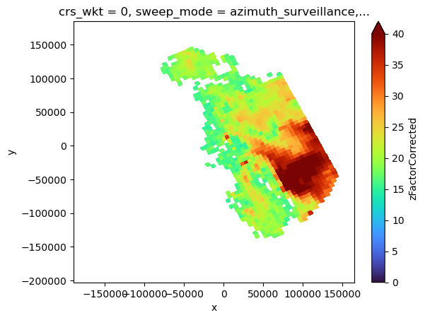
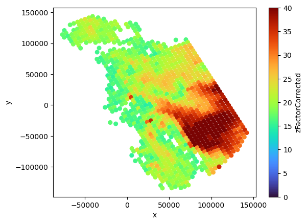
[49]:
# max along nbin, approximate Rs
sr_match_max = sr_match.max(dim="nbin")
sr_match2_max = sr_match2.max(dim="nbin")
sr_match_max.sr_bin_radius.plot(x="x", y="y", cmap="turbo")
plt.figure()
plt.scatter(
sr_match2_max.x.values,
sr_match2_max.y.values,
c=sr_match2_max.sr_bin_radius.values,
s=30,
cmap="turbo",
)
plt.gca().set_xlabel("x")
plt.gca().set_ylabel("y")
plt.colorbar(label="sr_bin_radius")
[49]:
<matplotlib.colorbar.Colorbar at 0x7f472f2392d0>
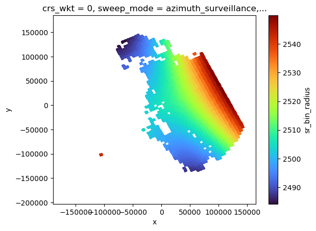
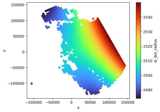
[50]:
# sum along nbin
# approximate Ds and Vs
sr_match_sum = sr_match.sum(dim="nbin", skipna=True)
sr_match2_sum = sr_match2.sum(dim="nbin", skipna=True)
display(sr_match_sum)
sr_match_sum.sr_bin_depth.plot(x="x", y="y", cmap="turbo")
plt.figure()
plt.scatter(
sr_match2_sum.x.values,
sr_match2_sum.y.values,
c=sr_match2_sum.sr_bin_depth.values,
s=30,
cmap="turbo",
)
plt.gca().set_xlabel("x")
plt.gca().set_ylabel("y")
plt.colorbar(label="sr_bin_depth")
<xarray.Dataset>
Dimensions: (nscan: 61, nray: 49, XYZ: 3, nNP: 4,
method: 6, foreBack: 2, nearFar: 2, nNode: 5,
nbinSZP: 7, nDSD: 2, nNUBF: 3, LS: 2)
Coordinates:
Latitude (nscan, nray) float32 -27.1 -27.08 ... -28.47
Longitude (nscan, nray) float32 151.4 151.4 ... 154.9
date (nscan) datetime64[ns] 2014-12-06T09:50:30.0...
x (nscan, nray) float64 -1.861e+05 ... 1.613e+05
y (nscan, nray) float64 6.695e+04 ... -8.461e+04
crs_wkt int64 0
sweep_mode <U20 'azimuth_surveillance'
longitude float64 153.2
latitude float64 -27.72
altitude float64 175.0
Dimensions without coordinates: nscan, nray, XYZ, nNP, method, foreBack,
nearFar, nNode, nbinSZP, nDSD, nNUBF, LS
Data variables: (12/105)
dataQuality (nscan, nray) float32 0.0 0.0 0.0 ... 0.0 0.0
dataWarning (nscan, nray) float32 0.0 0.0 0.0 ... 0.0 0.0
missing (nscan, nray) float32 0.0 0.0 0.0 ... 0.0 0.0
modeStatus (nscan, nray) float32 0.0 0.0 0.0 ... 0.0 0.0
geoError (nscan, nray) float32 0.0 0.0 0.0 ... 0.0 0.0
geoWarning (nscan, nray) float32 0.0 0.0 0.0 ... 0.0 0.0
... ...
sr_bin_depth (nscan, nray) float32 0.0 0.0 0.0 ... 0.0 0.0
bb_ratio (nscan, nray) float64 0.0 0.0 0.0 ... 0.0 0.0
bb_mask (nscan, nray) float64 0.0 0.0 0.0 ... 0.0 0.0
ref_sr_com (nscan, nray) float32 0.0 0.0 0.0 ... 0.0 0.0
ref_sr_ss (nscan, nray) float32 0.0 0.0 0.0 ... 0.0 0.0
ref_sr_sh (nscan, nray) float32 0.0 0.0 0.0 ... 0.0 0.0- nscan: 61
- nray: 49
- XYZ: 3
- nNP: 4
- method: 6
- foreBack: 2
- nearFar: 2
- nNode: 5
- nbinSZP: 7
- nDSD: 2
- nNUBF: 3
- LS: 2
- Latitude(nscan, nray)float32-27.1 -27.08 ... -28.49 -28.47
- DimensionNames :
- nscan,nray
- Units :
- degrees
- units :
- degrees
- CodeMissingValue :
- -9999.9
array([[-27.101166, -27.078152, -27.05518 , ..., -26.126842, -26.104671, -26.082481], [-27.141512, -27.11849 , -27.095507, ..., -26.166826, -26.144648, -26.122446], [-27.181885, -27.158855, -27.135864, ..., -26.206799, -26.18461 , -26.1624 ], ..., [-29.43486 , -29.41136 , -29.3879 , ..., -28.437897, -28.415165, -28.392406], [-29.474983, -29.451473, -29.428001, ..., -28.477577, -28.454834, -28.432068], [-29.515072, -29.491552, -29.468073, ..., -28.517286, -28.494534, -28.471756]], dtype=float32) - Longitude(nscan, nray)float32151.4 151.4 151.5 ... 154.8 154.9
- DimensionNames :
- nscan,nray
- Units :
- degrees
- units :
- degrees
- CodeMissingValue :
- -9999.9
array([[151.36314, 151.41205, 151.4609 , ..., 153.48042, 153.52951, 153.57869], [151.3838 , 151.43272, 151.4816 , ..., 153.50168, 153.55077, 153.59996], [151.4045 , 151.45343, 151.50232, ..., 153.52295, 153.57205, 153.62126], ..., [152.58981, 152.63957, 152.68929, ..., 154.74254, 154.7924 , 154.84236], [152.61151, 152.66129, 152.71101, ..., 154.76485, 154.81473, 154.86469], [152.63318, 152.68297, 152.73271, ..., 154.78717, 154.83707, 154.88705]], dtype=float32) - date(nscan)datetime64[ns]2014-12-06T09:50:30.000500 ... 2...
array(['2014-12-06T09:50:30.000500000', '2014-12-06T09:50:31.000200000', '2014-12-06T09:50:31.000900000', '2014-12-06T09:50:32.000600000', '2014-12-06T09:50:33.000300000', '2014-12-06T09:50:34.000000000', '2014-12-06T09:50:34.000700000', '2014-12-06T09:50:35.000400000', '2014-12-06T09:50:36.000100000', '2014-12-06T09:50:36.000800000', '2014-12-06T09:50:37.000500000', '2014-12-06T09:50:38.000200000', '2014-12-06T09:50:38.000900000', '2014-12-06T09:50:39.000600000', '2014-12-06T09:50:40.000300000', '2014-12-06T09:50:41.000000000', '2014-12-06T09:50:41.000700000', '2014-12-06T09:50:42.000400000', '2014-12-06T09:50:43.000100000', '2014-12-06T09:50:43.000800000', '2014-12-06T09:50:44.000500000', '2014-12-06T09:50:45.000200000', '2014-12-06T09:50:45.000900000', '2014-12-06T09:50:46.000600000', '2014-12-06T09:50:47.000300000', '2014-12-06T09:50:48.000000000', '2014-12-06T09:50:48.000700000', '2014-12-06T09:50:49.000400000', '2014-12-06T09:50:50.000100000', '2014-12-06T09:50:50.000800000', '2014-12-06T09:50:51.000500000', '2014-12-06T09:50:52.000200000', '2014-12-06T09:50:52.000900000', '2014-12-06T09:50:53.000600000', '2014-12-06T09:50:54.000300000', '2014-12-06T09:50:55.000000000', '2014-12-06T09:50:55.000700000', '2014-12-06T09:50:56.000400000', '2014-12-06T09:50:57.000100000', '2014-12-06T09:50:57.000800000', '2014-12-06T09:50:58.000500000', '2014-12-06T09:50:59.000200000', '2014-12-06T09:50:59.000900000', '2014-12-06T09:51:00.000600000', '2014-12-06T09:51:01.000300000', '2014-12-06T09:51:02.000000000', '2014-12-06T09:51:02.000700000', '2014-12-06T09:51:03.000400000', '2014-12-06T09:51:04.000100000', '2014-12-06T09:51:04.000800000', '2014-12-06T09:51:05.000500000', '2014-12-06T09:51:06.000200000', '2014-12-06T09:51:06.000900000', '2014-12-06T09:51:07.000600000', '2014-12-06T09:51:08.000300000', '2014-12-06T09:51:09.000000000', '2014-12-06T09:51:09.000700000', '2014-12-06T09:51:10.000400000', '2014-12-06T09:51:11.000100000', '2014-12-06T09:51:11.000800000', '2014-12-06T09:51:12.000500000'], dtype='datetime64[ns]') - x(nscan, nray)float64-1.861e+05 -1.813e+05 ... 1.613e+05
array([[-186117.16968603, -181305.28030804, -176495.82165648, ..., 24047.25052569, 28962.67647159, 33889.14933934], [-184002.07209363, -179190.03391088, -174380.42887443, ..., 26164.19651736, 31078.33323847, 36005.04339036], [-181885.32234517, -177073.13766802, -172263.38253896, ..., 28281.18514283, 33195.55875011, 38122.50511547], ..., [ -63096.0693707 , -58280.57133685, -53467.29685492, ..., 147190.35761426, 152107.26441435, 157035.21211942], [ -60966.90277686, -56151.32532165, -51337.96859382, ..., 149320.27054283, 154237.35920682, 159163.98843144], [ -58842.32030271, -54026.66419738, -49213.22410927, ..., 151449.96341515, 156367.22861008, 161295.53182215]]) - y(nscan, nray)float646.695e+04 6.958e+04 ... -8.461e+04
array([[ 66954.186556 , 69576.76471264, 72192.70009704, ..., 176292.00877297, 178737.95818865, 181184.06782741], [ 62514.32843802, 65136.98493917, 67753.420854 , ..., 171857.94004293, 174303.91519634, 176750.46715308], [ 58071.19537879, 60693.92841949, 63310.4403647 , ..., 167424.74984815, 169870.95728909, 172317.73840756], ..., [-190436.25557751, -187806.41895225, -185183.04044706, ..., -80673.26872774, -78215.0122177 , -75755.91099028], [-194872.49152306, -192242.44091716, -189618.63750756, ..., -85098.0633245 , -82639.43830613, -80180.37445039], [-199305.34041805, -196675.07521151, -194051.26911153, ..., -89526.47535637, -87067.69442881, -84608.28612928]]) - crs_wkt()int640
- crs_wkt :
- PROJCRS["unknown",BASEGEOGCRS["unknown",DATUM["Unknown based on WGS 84 ellipsoid",ELLIPSOID["WGS 84",6378137,298.25722356049,LENGTHUNIT["metre",1,ID["EPSG",9001]]]],PRIMEM["Greenwich",0,ANGLEUNIT["degree",0.0174532925199433],ID["EPSG",8901]]],CONVERSION["unknown",METHOD["Modified Azimuthal Equidistant",ID["EPSG",9832]],PARAMETER["Latitude of natural origin",-27.7181,ANGLEUNIT["degree",0.0174532925199433],ID["EPSG",8801]],PARAMETER["Longitude of natural origin",153.240005,ANGLEUNIT["degree",0.0174532925199433],ID["EPSG",8802]],PARAMETER["False easting",0,LENGTHUNIT["metre",1],ID["EPSG",8806]],PARAMETER["False northing",0,LENGTHUNIT["metre",1],ID["EPSG",8807]]],CS[Cartesian,2],AXIS["(E)",east,ORDER[1],LENGTHUNIT["metre",1,ID["EPSG",9001]]],AXIS["(N)",north,ORDER[2],LENGTHUNIT["metre",1,ID["EPSG",9001]]]]
- semi_major_axis :
- 6378137.0
- semi_minor_axis :
- 6356752.314245
- inverse_flattening :
- 298.25722356049
- reference_ellipsoid_name :
- WGS 84
- longitude_of_prime_meridian :
- 0.0
- prime_meridian_name :
- Greenwich
- geographic_crs_name :
- unknown
- horizontal_datum_name :
- Unknown based on WGS 84 ellipsoid
- projected_crs_name :
- unknown
- grid_mapping_name :
- azimuthal_equidistant
- latitude_of_projection_origin :
- -27.7181
- longitude_of_projection_origin :
- 153.240005
- false_easting :
- 0.0
- false_northing :
- 0.0
array(0)
- sweep_mode()<U20'azimuth_surveillance'
array('azimuth_surveillance', dtype='<U20') - longitude()float64153.2
array(153.24000549)
- latitude()float64-27.72
array(-27.71809959)
- altitude()float64175.0
array(174.99999702)
- dataQuality(nscan, nray)float320.0 0.0 0.0 0.0 ... 0.0 0.0 0.0 0.0
array([[0., 0., 0., ..., 0., 0., 0.], [0., 0., 0., ..., 0., 0., 0.], [0., 0., 0., ..., 0., 0., 0.], ..., [0., 0., 0., ..., 0., 0., 0.], [0., 0., 0., ..., 0., 0., 0.], [0., 0., 0., ..., 0., 0., 0.]], dtype=float32) - dataWarning(nscan, nray)float320.0 0.0 0.0 0.0 ... 0.0 0.0 0.0 0.0
array([[0., 0., 0., ..., 0., 0., 0.], [0., 0., 0., ..., 0., 0., 0.], [0., 0., 0., ..., 0., 0., 0.], ..., [0., 0., 0., ..., 0., 0., 0.], [0., 0., 0., ..., 0., 0., 0.], [0., 0., 0., ..., 0., 0., 0.]], dtype=float32) - missing(nscan, nray)float320.0 0.0 0.0 0.0 ... 0.0 0.0 0.0 0.0
array([[0., 0., 0., ..., 0., 0., 0.], [0., 0., 0., ..., 0., 0., 0.], [0., 0., 0., ..., 0., 0., 0.], ..., [0., 0., 0., ..., 0., 0., 0.], [0., 0., 0., ..., 0., 0., 0.], [0., 0., 0., ..., 0., 0., 0.]], dtype=float32) - modeStatus(nscan, nray)float320.0 0.0 0.0 0.0 ... 0.0 0.0 0.0 0.0
array([[0., 0., 0., ..., 0., 0., 0.], [0., 0., 0., ..., 0., 0., 0.], [0., 0., 0., ..., 0., 0., 0.], ..., [0., 0., 0., ..., 0., 0., 0.], [0., 0., 0., ..., 0., 0., 0.], [0., 0., 0., ..., 0., 0., 0.]], dtype=float32) - geoError(nscan, nray)float320.0 0.0 0.0 0.0 ... 0.0 0.0 0.0 0.0
array([[0., 0., 0., ..., 0., 0., 0.], [0., 0., 0., ..., 0., 0., 0.], [0., 0., 0., ..., 0., 0., 0.], ..., [0., 0., 0., ..., 0., 0., 0.], [0., 0., 0., ..., 0., 0., 0.], [0., 0., 0., ..., 0., 0., 0.]], dtype=float32) - geoWarning(nscan, nray)float320.0 0.0 0.0 0.0 ... 0.0 0.0 0.0 0.0
array([[0., 0., 0., ..., 0., 0., 0.], [0., 0., 0., ..., 0., 0., 0.], [0., 0., 0., ..., 0., 0., 0.], ..., [0., 0., 0., ..., 0., 0., 0.], [0., 0., 0., ..., 0., 0., 0.], [0., 0., 0., ..., 0., 0., 0.]], dtype=float32) - SCorientation(nscan, nray)float320.0 0.0 0.0 0.0 ... 0.0 0.0 0.0 0.0
array([[0., 0., 0., ..., 0., 0., 0.], [0., 0., 0., ..., 0., 0., 0.], [0., 0., 0., ..., 0., 0., 0.], ..., [0., 0., 0., ..., 0., 0., 0.], [0., 0., 0., ..., 0., 0., 0.], [0., 0., 0., ..., 0., 0., 0.]], dtype=float32) - pointingStatus(nscan, nray)float320.0 0.0 0.0 0.0 ... 0.0 0.0 0.0 0.0
array([[0., 0., 0., ..., 0., 0., 0.], [0., 0., 0., ..., 0., 0., 0.], [0., 0., 0., ..., 0., 0., 0.], ..., [0., 0., 0., ..., 0., 0., 0.], [0., 0., 0., ..., 0., 0., 0.], [0., 0., 0., ..., 0., 0., 0.]], dtype=float32) - acsModeMidScan(nscan, nray)float320.0 0.0 0.0 0.0 ... 0.0 0.0 0.0 0.0
array([[0., 0., 0., ..., 0., 0., 0.], [0., 0., 0., ..., 0., 0., 0.], [0., 0., 0., ..., 0., 0., 0.], ..., [0., 0., 0., ..., 0., 0., 0.], [0., 0., 0., ..., 0., 0., 0.], [0., 0., 0., ..., 0., 0., 0.]], dtype=float32) - targetSelectionMidScan(nscan, nray)float320.0 0.0 0.0 0.0 ... 0.0 0.0 0.0 0.0
array([[0., 0., 0., ..., 0., 0., 0.], [0., 0., 0., ..., 0., 0., 0.], [0., 0., 0., ..., 0., 0., 0.], ..., [0., 0., 0., ..., 0., 0., 0.], [0., 0., 0., ..., 0., 0., 0.], [0., 0., 0., ..., 0., 0., 0.]], dtype=float32) - operationalMode(nscan, nray)float320.0 0.0 0.0 0.0 ... 0.0 0.0 0.0 0.0
array([[0., 0., 0., ..., 0., 0., 0.], [0., 0., 0., ..., 0., 0., 0.], [0., 0., 0., ..., 0., 0., 0.], ..., [0., 0., 0., ..., 0., 0., 0.], [0., 0., 0., ..., 0., 0., 0.], [0., 0., 0., ..., 0., 0., 0.]], dtype=float32) - limitErrorFlag(nscan, nray)float320.0 0.0 0.0 0.0 ... 0.0 0.0 0.0 0.0
array([[0., 0., 0., ..., 0., 0., 0.], [0., 0., 0., ..., 0., 0., 0.], [0., 0., 0., ..., 0., 0., 0.], ..., [0., 0., 0., ..., 0., 0., 0.], [0., 0., 0., ..., 0., 0., 0.], [0., 0., 0., ..., 0., 0., 0.]], dtype=float32) - FractionalGranuleNumber(nscan, nray)float640.0 0.0 0.0 0.0 ... 0.0 0.0 0.0 0.0
array([[0., 0., 0., ..., 0., 0., 0.], [0., 0., 0., ..., 0., 0., 0.], [0., 0., 0., ..., 0., 0., 0.], ..., [0., 0., 0., ..., 0., 0., 0.], [0., 0., 0., ..., 0., 0., 0.], [0., 0., 0., ..., 0., 0., 0.]]) - scPos(nscan, XYZ, nray)float320.0 0.0 0.0 0.0 ... 0.0 0.0 0.0 0.0
array([[[0., 0., 0., ..., 0., 0., 0.], [0., 0., 0., ..., 0., 0., 0.], [0., 0., 0., ..., 0., 0., 0.]], [[0., 0., 0., ..., 0., 0., 0.], [0., 0., 0., ..., 0., 0., 0.], [0., 0., 0., ..., 0., 0., 0.]], [[0., 0., 0., ..., 0., 0., 0.], [0., 0., 0., ..., 0., 0., 0.], [0., 0., 0., ..., 0., 0., 0.]], ..., [[0., 0., 0., ..., 0., 0., 0.], [0., 0., 0., ..., 0., 0., 0.], [0., 0., 0., ..., 0., 0., 0.]], [[0., 0., 0., ..., 0., 0., 0.], [0., 0., 0., ..., 0., 0., 0.], [0., 0., 0., ..., 0., 0., 0.]], [[0., 0., 0., ..., 0., 0., 0.], [0., 0., 0., ..., 0., 0., 0.], [0., 0., 0., ..., 0., 0., 0.]]], dtype=float32) - scVel(nscan, XYZ, nray)float320.0 0.0 0.0 0.0 ... 0.0 0.0 0.0 0.0
array([[[0., 0., 0., ..., 0., 0., 0.], [0., 0., 0., ..., 0., 0., 0.], [0., 0., 0., ..., 0., 0., 0.]], [[0., 0., 0., ..., 0., 0., 0.], [0., 0., 0., ..., 0., 0., 0.], [0., 0., 0., ..., 0., 0., 0.]], [[0., 0., 0., ..., 0., 0., 0.], [0., 0., 0., ..., 0., 0., 0.], [0., 0., 0., ..., 0., 0., 0.]], ..., [[0., 0., 0., ..., 0., 0., 0.], [0., 0., 0., ..., 0., 0., 0.], [0., 0., 0., ..., 0., 0., 0.]], [[0., 0., 0., ..., 0., 0., 0.], [0., 0., 0., ..., 0., 0., 0.], [0., 0., 0., ..., 0., 0., 0.]], [[0., 0., 0., ..., 0., 0., 0.], [0., 0., 0., ..., 0., 0., 0.], [0., 0., 0., ..., 0., 0., 0.]]], dtype=float32) - scLat(nscan, nray)float320.0 0.0 0.0 0.0 ... 0.0 0.0 0.0 0.0
array([[0., 0., 0., ..., 0., 0., 0.], [0., 0., 0., ..., 0., 0., 0.], [0., 0., 0., ..., 0., 0., 0.], ..., [0., 0., 0., ..., 0., 0., 0.], [0., 0., 0., ..., 0., 0., 0.], [0., 0., 0., ..., 0., 0., 0.]], dtype=float32) - scLon(nscan, nray)float320.0 0.0 0.0 0.0 ... 0.0 0.0 0.0 0.0
array([[0., 0., 0., ..., 0., 0., 0.], [0., 0., 0., ..., 0., 0., 0.], [0., 0., 0., ..., 0., 0., 0.], ..., [0., 0., 0., ..., 0., 0., 0.], [0., 0., 0., ..., 0., 0., 0.], [0., 0., 0., ..., 0., 0., 0.]], dtype=float32) - scAlt(nscan, nray)float320.0 0.0 0.0 0.0 ... 0.0 0.0 0.0 0.0
array([[0., 0., 0., ..., 0., 0., 0.], [0., 0., 0., ..., 0., 0., 0.], [0., 0., 0., ..., 0., 0., 0.], ..., [0., 0., 0., ..., 0., 0., 0.], [0., 0., 0., ..., 0., 0., 0.], [0., 0., 0., ..., 0., 0., 0.]], dtype=float32) - dprAlt(nscan, nray)float320.0 0.0 0.0 0.0 ... 0.0 0.0 0.0 0.0
array([[0., 0., 0., ..., 0., 0., 0.], [0., 0., 0., ..., 0., 0., 0.], [0., 0., 0., ..., 0., 0., 0.], ..., [0., 0., 0., ..., 0., 0., 0.], [0., 0., 0., ..., 0., 0., 0.], [0., 0., 0., ..., 0., 0., 0.]], dtype=float32) - scAttRollGeoc(nscan, nray)float320.0 0.0 0.0 0.0 ... 0.0 0.0 0.0 0.0
array([[0., 0., 0., ..., 0., 0., 0.], [0., 0., 0., ..., 0., 0., 0.], [0., 0., 0., ..., 0., 0., 0.], ..., [0., 0., 0., ..., 0., 0., 0.], [0., 0., 0., ..., 0., 0., 0.], [0., 0., 0., ..., 0., 0., 0.]], dtype=float32) - scAttPitchGeoc(nscan, nray)float320.0 0.0 0.0 0.0 ... 0.0 0.0 0.0 0.0
array([[0., 0., 0., ..., 0., 0., 0.], [0., 0., 0., ..., 0., 0., 0.], [0., 0., 0., ..., 0., 0., 0.], ..., [0., 0., 0., ..., 0., 0., 0.], [0., 0., 0., ..., 0., 0., 0.], [0., 0., 0., ..., 0., 0., 0.]], dtype=float32) - scAttYawGeoc(nscan, nray)float320.0 0.0 0.0 0.0 ... 0.0 0.0 0.0 0.0
array([[0., 0., 0., ..., 0., 0., 0.], [0., 0., 0., ..., 0., 0., 0.], [0., 0., 0., ..., 0., 0., 0.], ..., [0., 0., 0., ..., 0., 0., 0.], [0., 0., 0., ..., 0., 0., 0.], [0., 0., 0., ..., 0., 0., 0.]], dtype=float32) - scAttRollGeod(nscan, nray)float320.0 0.0 0.0 0.0 ... 0.0 0.0 0.0 0.0
array([[0., 0., 0., ..., 0., 0., 0.], [0., 0., 0., ..., 0., 0., 0.], [0., 0., 0., ..., 0., 0., 0.], ..., [0., 0., 0., ..., 0., 0., 0.], [0., 0., 0., ..., 0., 0., 0.], [0., 0., 0., ..., 0., 0., 0.]], dtype=float32) - scAttPitchGeod(nscan, nray)float320.0 0.0 0.0 0.0 ... 0.0 0.0 0.0 0.0
array([[0., 0., 0., ..., 0., 0., 0.], [0., 0., 0., ..., 0., 0., 0.], [0., 0., 0., ..., 0., 0., 0.], ..., [0., 0., 0., ..., 0., 0., 0.], [0., 0., 0., ..., 0., 0., 0.], [0., 0., 0., ..., 0., 0., 0.]], dtype=float32) - scAttYawGeod(nscan, nray)float320.0 0.0 0.0 0.0 ... 0.0 0.0 0.0 0.0
array([[0., 0., 0., ..., 0., 0., 0.], [0., 0., 0., ..., 0., 0., 0.], [0., 0., 0., ..., 0., 0., 0.], ..., [0., 0., 0., ..., 0., 0., 0.], [0., 0., 0., ..., 0., 0., 0.], [0., 0., 0., ..., 0., 0., 0.]], dtype=float32) - greenHourAng(nscan, nray)float320.0 0.0 0.0 0.0 ... 0.0 0.0 0.0 0.0
array([[0., 0., 0., ..., 0., 0., 0.], [0., 0., 0., ..., 0., 0., 0.], [0., 0., 0., ..., 0., 0., 0.], ..., [0., 0., 0., ..., 0., 0., 0.], [0., 0., 0., ..., 0., 0., 0.], [0., 0., 0., ..., 0., 0., 0.]], dtype=float32) - timeMidScan(nscan, nray)float640.0 0.0 0.0 0.0 ... 0.0 0.0 0.0 0.0
array([[0., 0., 0., ..., 0., 0., 0.], [0., 0., 0., ..., 0., 0., 0.], [0., 0., 0., ..., 0., 0., 0.], ..., [0., 0., 0., ..., 0., 0., 0.], [0., 0., 0., ..., 0., 0., 0.], [0., 0., 0., ..., 0., 0., 0.]]) - timeMidScanOffset(nscan, nray)float640.0 0.0 0.0 0.0 ... 0.0 0.0 0.0 0.0
array([[0., 0., 0., ..., 0., 0., 0.], [0., 0., 0., ..., 0., 0., 0.], [0., 0., 0., ..., 0., 0., 0.], ..., [0., 0., 0., ..., 0., 0., 0.], [0., 0., 0., ..., 0., 0., 0.], [0., 0., 0., ..., 0., 0., 0.]]) - landSurfaceType(nscan, nray)float640.0 0.0 0.0 0.0 ... 0.0 0.0 0.0 0.0
array([[0., 0., 0., ..., 0., 0., 0.], [0., 0., 0., ..., 0., 0., 0.], [0., 0., 0., ..., 0., 0., 0.], ..., [0., 0., 0., ..., 0., 0., 0.], [0., 0., 0., ..., 0., 0., 0.], [0., 0., 0., ..., 0., 0., 0.]]) - localZenithAngle(nscan, nray)float320.0 0.0 0.0 0.0 ... 0.0 0.0 0.0 0.0
array([[0., 0., 0., ..., 0., 0., 0.], [0., 0., 0., ..., 0., 0., 0.], [0., 0., 0., ..., 0., 0., 0.], ..., [0., 0., 0., ..., 0., 0., 0.], [0., 0., 0., ..., 0., 0., 0.], [0., 0., 0., ..., 0., 0., 0.]], dtype=float32) - flagPrecip(nscan, nray)float640.0 0.0 0.0 0.0 ... 0.0 0.0 0.0 0.0
array([[0., 0., 0., ..., 0., 0., 0.], [0., 0., 0., ..., 0., 0., 0.], [0., 0., 0., ..., 0., 0., 0.], ..., [0., 0., 0., ..., 0., 0., 0.], [0., 0., 0., ..., 0., 0., 0.], [0., 0., 0., ..., 0., 0., 0.]]) - flagSigmaZeroSaturation(nscan, nray)float320.0 0.0 0.0 0.0 ... 0.0 0.0 0.0 0.0
array([[0., 0., 0., ..., 0., 0., 0.], [0., 0., 0., ..., 0., 0., 0.], [0., 0., 0., ..., 0., 0., 0.], ..., [0., 0., 0., ..., 0., 0., 0.], [0., 0., 0., ..., 0., 0., 0.], [0., 0., 0., ..., 0., 0., 0.]], dtype=float32) - binRealSurface(nscan, nray)float320.0 0.0 0.0 0.0 ... 0.0 0.0 0.0 0.0
array([[0., 0., 0., ..., 0., 0., 0.], [0., 0., 0., ..., 0., 0., 0.], [0., 0., 0., ..., 0., 0., 0.], ..., [0., 0., 0., ..., 0., 0., 0.], [0., 0., 0., ..., 0., 0., 0.], [0., 0., 0., ..., 0., 0., 0.]], dtype=float32) - binStormTop(nscan, nray)float320.0 0.0 0.0 0.0 ... 0.0 0.0 0.0 0.0
array([[0., 0., 0., ..., 0., 0., 0.], [0., 0., 0., ..., 0., 0., 0.], [0., 0., 0., ..., 0., 0., 0.], ..., [0., 0., 0., ..., 0., 0., 0.], [0., 0., 0., ..., 0., 0., 0.], [0., 0., 0., ..., 0., 0., 0.]], dtype=float32) - heightStormTop(nscan, nray)float320.0 0.0 0.0 0.0 ... 0.0 0.0 0.0 0.0
array([[0., 0., 0., ..., 0., 0., 0.], [0., 0., 0., ..., 0., 0., 0.], [0., 0., 0., ..., 0., 0., 0.], ..., [0., 0., 0., ..., 0., 0., 0.], [0., 0., 0., ..., 0., 0., 0.], [0., 0., 0., ..., 0., 0., 0.]], dtype=float32) - binClutterFreeBottom(nscan, nray)float320.0 0.0 0.0 0.0 ... 0.0 0.0 0.0 0.0
array([[0., 0., 0., ..., 0., 0., 0.], [0., 0., 0., ..., 0., 0., 0.], [0., 0., 0., ..., 0., 0., 0.], ..., [0., 0., 0., ..., 0., 0., 0.], [0., 0., 0., ..., 0., 0., 0.], [0., 0., 0., ..., 0., 0., 0.]], dtype=float32) - sigmaZeroMeasured(nscan, nray)float320.0 0.0 0.0 0.0 ... 0.0 0.0 0.0 0.0
array([[0., 0., 0., ..., 0., 0., 0.], [0., 0., 0., ..., 0., 0., 0.], [0., 0., 0., ..., 0., 0., 0.], ..., [0., 0., 0., ..., 0., 0., 0.], [0., 0., 0., ..., 0., 0., 0.], [0., 0., 0., ..., 0., 0., 0.]], dtype=float32) - zFactorMeasured(nscan, nray)float320.0 0.0 0.0 0.0 ... 0.0 0.0 0.0 0.0
array([[0., 0., 0., ..., 0., 0., 0.], [0., 0., 0., ..., 0., 0., 0.], [0., 0., 0., ..., 0., 0., 0.], ..., [0., 0., 0., ..., 0., 0., 0.], [0., 0., 0., ..., 0., 0., 0.], [0., 0., 0., ..., 0., 0., 0.]], dtype=float32) - ellipsoidBinOffset(nscan, nray)float320.0 0.0 0.0 0.0 ... 0.0 0.0 0.0 0.0
array([[0., 0., 0., ..., 0., 0., 0.], [0., 0., 0., ..., 0., 0., 0.], [0., 0., 0., ..., 0., 0., 0.], ..., [0., 0., 0., ..., 0., 0., 0.], [0., 0., 0., ..., 0., 0., 0.], [0., 0., 0., ..., 0., 0., 0.]], dtype=float32) - snRatioAtRealSurface(nscan, nray)float320.0 0.0 0.0 0.0 ... 0.0 0.0 0.0 0.0
array([[0., 0., 0., ..., 0., 0., 0.], [0., 0., 0., ..., 0., 0., 0.], [0., 0., 0., ..., 0., 0., 0.], ..., [0., 0., 0., ..., 0., 0., 0.], [0., 0., 0., ..., 0., 0., 0.], [0., 0., 0., ..., 0., 0., 0.]], dtype=float32) - adjustFactor(nscan, nray)float320.0 0.0 0.0 0.0 ... 0.0 0.0 0.0 0.0
array([[0., 0., 0., ..., 0., 0., 0.], [0., 0., 0., ..., 0., 0., 0.], [0., 0., 0., ..., 0., 0., 0.], ..., [0., 0., 0., ..., 0., 0., 0.], [0., 0., 0., ..., 0., 0., 0.], [0., 0., 0., ..., 0., 0., 0.]], dtype=float32) - snowIceCover(nscan, nray)float320.0 0.0 0.0 0.0 ... 0.0 0.0 0.0 0.0
array([[0., 0., 0., ..., 0., 0., 0.], [0., 0., 0., ..., 0., 0., 0.], [0., 0., 0., ..., 0., 0., 0.], ..., [0., 0., 0., ..., 0., 0., 0.], [0., 0., 0., ..., 0., 0., 0.], [0., 0., 0., ..., 0., 0., 0.]], dtype=float32) - binZeroDeg(nscan, nray)float320.0 0.0 0.0 0.0 ... 0.0 0.0 0.0 0.0
array([[0., 0., 0., ..., 0., 0., 0.], [0., 0., 0., ..., 0., 0., 0.], [0., 0., 0., ..., 0., 0., 0.], ..., [0., 0., 0., ..., 0., 0., 0.], [0., 0., 0., ..., 0., 0., 0.], [0., 0., 0., ..., 0., 0., 0.]], dtype=float32) - attenuationNP(nscan, nray)float320.0 0.0 0.0 0.0 ... 0.0 0.0 0.0 0.0
array([[0., 0., 0., ..., 0., 0., 0.], [0., 0., 0., ..., 0., 0., 0.], [0., 0., 0., ..., 0., 0., 0.], ..., [0., 0., 0., ..., 0., 0., 0.], [0., 0., 0., ..., 0., 0., 0.], [0., 0., 0., ..., 0., 0., 0.]], dtype=float32) - piaNP(nscan, nray, nNP)float320.0 0.0 0.0 0.0 ... 0.0 0.0 0.0 0.0
array([[[0., 0., 0., 0.], [0., 0., 0., 0.], [0., 0., 0., 0.], ..., [0., 0., 0., 0.], [0., 0., 0., 0.], [0., 0., 0., 0.]], [[0., 0., 0., 0.], [0., 0., 0., 0.], [0., 0., 0., 0.], ..., [0., 0., 0., 0.], [0., 0., 0., 0.], [0., 0., 0., 0.]], [[0., 0., 0., 0.], [0., 0., 0., 0.], [0., 0., 0., 0.], ..., ... ..., [0., 0., 0., 0.], [0., 0., 0., 0.], [0., 0., 0., 0.]], [[0., 0., 0., 0.], [0., 0., 0., 0.], [0., 0., 0., 0.], ..., [0., 0., 0., 0.], [0., 0., 0., 0.], [0., 0., 0., 0.]], [[0., 0., 0., 0.], [0., 0., 0., 0.], [0., 0., 0., 0.], ..., [0., 0., 0., 0.], [0., 0., 0., 0.], [0., 0., 0., 0.]]], dtype=float32) - sigmaZeroNPCorrected(nscan, nray)float320.0 0.0 0.0 0.0 ... 0.0 0.0 0.0 0.0
array([[0., 0., 0., ..., 0., 0., 0.], [0., 0., 0., ..., 0., 0., 0.], [0., 0., 0., ..., 0., 0., 0.], ..., [0., 0., 0., ..., 0., 0., 0.], [0., 0., 0., ..., 0., 0., 0.], [0., 0., 0., ..., 0., 0., 0.]], dtype=float32) - heightZeroDeg(nscan, nray)float320.0 0.0 0.0 0.0 ... 0.0 0.0 0.0 0.0
array([[0., 0., 0., ..., 0., 0., 0.], [0., 0., 0., ..., 0., 0., 0.], [0., 0., 0., ..., 0., 0., 0.], ..., [0., 0., 0., ..., 0., 0., 0.], [0., 0., 0., ..., 0., 0., 0.], [0., 0., 0., ..., 0., 0., 0.]], dtype=float32) - flagBB(nscan, nray)float640.0 0.0 0.0 0.0 ... 0.0 0.0 0.0 0.0
array([[0., 0., 0., ..., 0., 0., 0.], [0., 0., 0., ..., 0., 0., 0.], [0., 0., 0., ..., 0., 0., 0.], ..., [0., 0., 0., ..., 0., 0., 0.], [0., 0., 0., ..., 0., 0., 0.], [0., 0., 0., ..., 0., 0., 0.]]) - binBBPeak(nscan, nray)float320.0 0.0 0.0 0.0 ... 0.0 0.0 0.0 0.0
array([[0., 0., 0., ..., 0., 0., 0.], [0., 0., 0., ..., 0., 0., 0.], [0., 0., 0., ..., 0., 0., 0.], ..., [0., 0., 0., ..., 0., 0., 0.], [0., 0., 0., ..., 0., 0., 0.], [0., 0., 0., ..., 0., 0., 0.]], dtype=float32) - binBBTop(nscan, nray)float320.0 0.0 0.0 0.0 ... 0.0 0.0 0.0 0.0
array([[0., 0., 0., ..., 0., 0., 0.], [0., 0., 0., ..., 0., 0., 0.], [0., 0., 0., ..., 0., 0., 0.], ..., [0., 0., 0., ..., 0., 0., 0.], [0., 0., 0., ..., 0., 0., 0.], [0., 0., 0., ..., 0., 0., 0.]], dtype=float32) - binBBBottom(nscan, nray)float320.0 0.0 0.0 0.0 ... 0.0 0.0 0.0 0.0
array([[0., 0., 0., ..., 0., 0., 0.], [0., 0., 0., ..., 0., 0., 0.], [0., 0., 0., ..., 0., 0., 0.], ..., [0., 0., 0., ..., 0., 0., 0.], [0., 0., 0., ..., 0., 0., 0.], [0., 0., 0., ..., 0., 0., 0.]], dtype=float32) - heightBB(nscan, nray)float320.0 0.0 0.0 0.0 ... 0.0 0.0 0.0 0.0
array([[0., 0., 0., ..., 0., 0., 0.], [0., 0., 0., ..., 0., 0., 0.], [0., 0., 0., ..., 0., 0., 0.], ..., [0., 0., 0., ..., 0., 0., 0.], [0., 0., 0., ..., 0., 0., 0.], [0., 0., 0., ..., 0., 0., 0.]], dtype=float32) - widthBB(nscan, nray)float320.0 0.0 0.0 0.0 ... 0.0 0.0 0.0 0.0
array([[0., 0., 0., ..., 0., 0., 0.], [0., 0., 0., ..., 0., 0., 0.], [0., 0., 0., ..., 0., 0., 0.], ..., [0., 0., 0., ..., 0., 0., 0.], [0., 0., 0., ..., 0., 0., 0.], [0., 0., 0., ..., 0., 0., 0.]], dtype=float32) - qualityBB(nscan, nray)float640.0 0.0 0.0 0.0 ... 0.0 0.0 0.0 0.0
array([[0., 0., 0., ..., 0., 0., 0.], [0., 0., 0., ..., 0., 0., 0.], [0., 0., 0., ..., 0., 0., 0.], ..., [0., 0., 0., ..., 0., 0., 0.], [0., 0., 0., ..., 0., 0., 0.], [0., 0., 0., ..., 0., 0., 0.]]) - typePrecip(nscan, nray)float640.0 0.0 0.0 0.0 ... 0.0 0.0 0.0 0.0
array([[0., 0., 0., ..., 0., 0., 0.], [0., 0., 0., ..., 0., 0., 0.], [0., 0., 0., ..., 0., 0., 0.], ..., [0., 0., 0., ..., 0., 0., 0.], [0., 0., 0., ..., 0., 0., 0.], [0., 0., 0., ..., 0., 0., 0.]]) - qualityTypePrecip(nscan, nray)float640.0 0.0 0.0 0.0 ... 0.0 0.0 0.0 0.0
array([[0., 0., 0., ..., 0., 0., 0.], [0., 0., 0., ..., 0., 0., 0.], [0., 0., 0., ..., 0., 0., 0.], ..., [0., 0., 0., ..., 0., 0., 0.], [0., 0., 0., ..., 0., 0., 0.], [0., 0., 0., ..., 0., 0., 0.]]) - flagShallowRain(nscan, nray)float640.0 0.0 0.0 0.0 ... 0.0 0.0 0.0 0.0
array([[0., 0., 0., ..., 0., 0., 0.], [0., 0., 0., ..., 0., 0., 0.], [0., 0., 0., ..., 0., 0., 0.], ..., [0., 0., 0., ..., 0., 0., 0.], [0., 0., 0., ..., 0., 0., 0.], [0., 0., 0., ..., 0., 0., 0.]]) - flagHeavyIcePrecip(nscan, nray)float320.0 0.0 0.0 0.0 ... 0.0 0.0 0.0 0.0
array([[0., 0., 0., ..., 0., 0., 0.], [0., 0., 0., ..., 0., 0., 0.], [0., 0., 0., ..., 0., 0., 0.], ..., [0., 0., 0., ..., 0., 0., 0.], [0., 0., 0., ..., 0., 0., 0.], [0., 0., 0., ..., 0., 0., 0.]], dtype=float32) - flagAnvil(nscan, nray)float320.0 0.0 0.0 0.0 ... 0.0 0.0 0.0 0.0
array([[0., 0., 0., ..., 0., 0., 0.], [0., 0., 0., ..., 0., 0., 0.], [0., 0., 0., ..., 0., 0., 0.], ..., [0., 0., 0., ..., 0., 0., 0.], [0., 0., 0., ..., 0., 0., 0.], [0., 0., 0., ..., 0., 0., 0.]], dtype=float32) - PIAalt(nscan, nray, method)float320.0 0.0 0.0 0.0 ... 0.0 0.0 0.0 0.0
array([[[0., 0., 0., 0., 0., 0.], [0., 0., 0., 0., 0., 0.], [0., 0., 0., 0., 0., 0.], ..., [0., 0., 0., 0., 0., 0.], [0., 0., 0., 0., 0., 0.], [0., 0., 0., 0., 0., 0.]], [[0., 0., 0., 0., 0., 0.], [0., 0., 0., 0., 0., 0.], [0., 0., 0., 0., 0., 0.], ..., [0., 0., 0., 0., 0., 0.], [0., 0., 0., 0., 0., 0.], [0., 0., 0., 0., 0., 0.]], [[0., 0., 0., 0., 0., 0.], [0., 0., 0., 0., 0., 0.], [0., 0., 0., 0., 0., 0.], ..., ... ..., [0., 0., 0., 0., 0., 0.], [0., 0., 0., 0., 0., 0.], [0., 0., 0., 0., 0., 0.]], [[0., 0., 0., 0., 0., 0.], [0., 0., 0., 0., 0., 0.], [0., 0., 0., 0., 0., 0.], ..., [0., 0., 0., 0., 0., 0.], [0., 0., 0., 0., 0., 0.], [0., 0., 0., 0., 0., 0.]], [[0., 0., 0., 0., 0., 0.], [0., 0., 0., 0., 0., 0.], [0., 0., 0., 0., 0., 0.], ..., [0., 0., 0., 0., 0., 0.], [0., 0., 0., 0., 0., 0.], [0., 0., 0., 0., 0., 0.]]], dtype=float32) - RFactorAlt(nscan, nray, method)float320.0 0.0 0.0 0.0 ... 0.0 0.0 0.0 0.0
array([[[0., 0., 0., 0., 0., 0.], [0., 0., 0., 0., 0., 0.], [0., 0., 0., 0., 0., 0.], ..., [0., 0., 0., 0., 0., 0.], [0., 0., 0., 0., 0., 0.], [0., 0., 0., 0., 0., 0.]], [[0., 0., 0., 0., 0., 0.], [0., 0., 0., 0., 0., 0.], [0., 0., 0., 0., 0., 0.], ..., [0., 0., 0., 0., 0., 0.], [0., 0., 0., 0., 0., 0.], [0., 0., 0., 0., 0., 0.]], [[0., 0., 0., 0., 0., 0.], [0., 0., 0., 0., 0., 0.], [0., 0., 0., 0., 0., 0.], ..., ... ..., [0., 0., 0., 0., 0., 0.], [0., 0., 0., 0., 0., 0.], [0., 0., 0., 0., 0., 0.]], [[0., 0., 0., 0., 0., 0.], [0., 0., 0., 0., 0., 0.], [0., 0., 0., 0., 0., 0.], ..., [0., 0., 0., 0., 0., 0.], [0., 0., 0., 0., 0., 0.], [0., 0., 0., 0., 0., 0.]], [[0., 0., 0., 0., 0., 0.], [0., 0., 0., 0., 0., 0.], [0., 0., 0., 0., 0., 0.], ..., [0., 0., 0., 0., 0., 0.], [0., 0., 0., 0., 0., 0.], [0., 0., 0., 0., 0., 0.]]], dtype=float32) - PIAweight(nscan, nray, method)float320.0 0.0 0.0 0.0 ... 0.0 0.0 0.0 0.0
array([[[0., 0., 0., 0., 0., 0.], [0., 0., 0., 0., 0., 0.], [0., 0., 0., 0., 0., 0.], ..., [0., 0., 0., 0., 0., 0.], [0., 0., 0., 0., 0., 0.], [0., 0., 0., 0., 0., 0.]], [[0., 0., 0., 0., 0., 0.], [0., 0., 0., 0., 0., 0.], [0., 0., 0., 0., 0., 0.], ..., [0., 0., 0., 0., 0., 0.], [0., 0., 0., 0., 0., 0.], [0., 0., 0., 0., 0., 0.]], [[0., 0., 0., 0., 0., 0.], [0., 0., 0., 0., 0., 0.], [0., 0., 0., 0., 0., 0.], ..., ... ..., [0., 0., 0., 0., 0., 0.], [0., 0., 0., 0., 0., 0.], [0., 0., 0., 0., 0., 0.]], [[0., 0., 0., 0., 0., 0.], [0., 0., 0., 0., 0., 0.], [0., 0., 0., 0., 0., 0.], ..., [0., 0., 0., 0., 0., 0.], [0., 0., 0., 0., 0., 0.], [0., 0., 0., 0., 0., 0.]], [[0., 0., 0., 0., 0., 0.], [0., 0., 0., 0., 0., 0.], [0., 0., 0., 0., 0., 0.], ..., [0., 0., 0., 0., 0., 0.], [0., 0., 0., 0., 0., 0.], [0., 0., 0., 0., 0., 0.]]], dtype=float32) - pathAtten(nscan, nray)float320.0 0.0 0.0 0.0 ... 0.0 0.0 0.0 0.0
array([[0., 0., 0., ..., 0., 0., 0.], [0., 0., 0., ..., 0., 0., 0.], [0., 0., 0., ..., 0., 0., 0.], ..., [0., 0., 0., ..., 0., 0., 0.], [0., 0., 0., ..., 0., 0., 0.], [0., 0., 0., ..., 0., 0., 0.]], dtype=float32) - reliabFactor(nscan, nray)float320.0 0.0 0.0 0.0 ... 0.0 0.0 0.0 0.0
array([[0., 0., 0., ..., 0., 0., 0.], [0., 0., 0., ..., 0., 0., 0.], [0., 0., 0., ..., 0., 0., 0.], ..., [0., 0., 0., ..., 0., 0., 0.], [0., 0., 0., ..., 0., 0., 0.], [0., 0., 0., ..., 0., 0., 0.]], dtype=float32) - reliabFlag(nscan, nray)float320.0 0.0 0.0 0.0 ... 0.0 0.0 0.0 0.0
array([[0., 0., 0., ..., 0., 0., 0.], [0., 0., 0., ..., 0., 0., 0.], [0., 0., 0., ..., 0., 0., 0.], ..., [0., 0., 0., ..., 0., 0., 0.], [0., 0., 0., ..., 0., 0., 0.], [0., 0., 0., ..., 0., 0., 0.]], dtype=float32) - refScanID(nscan, nray, foreBack, nearFar)float320.0 0.0 0.0 0.0 ... 0.0 0.0 0.0 0.0
array([[[[0., 0.], [0., 0.]], [[0., 0.], [0., 0.]], [[0., 0.], [0., 0.]], ..., [[0., 0.], [0., 0.]], [[0., 0.], [0., 0.]], [[0., 0.], [0., 0.]]], ... [[[0., 0.], [0., 0.]], [[0., 0.], [0., 0.]], [[0., 0.], [0., 0.]], ..., [[0., 0.], [0., 0.]], [[0., 0.], [0., 0.]], [[0., 0.], [0., 0.]]]], dtype=float32) - phase(nscan, nray)float320.0 0.0 0.0 0.0 ... 0.0 0.0 0.0 0.0
array([[0., 0., 0., ..., 0., 0., 0.], [0., 0., 0., ..., 0., 0., 0.], [0., 0., 0., ..., 0., 0., 0.], ..., [0., 0., 0., ..., 0., 0., 0.], [0., 0., 0., ..., 0., 0., 0.], [0., 0., 0., ..., 0., 0., 0.]], dtype=float32) - binNode(nscan, nray, nNode)float320.0 0.0 0.0 0.0 ... 0.0 0.0 0.0 0.0
array([[[0., 0., 0., 0., 0.], [0., 0., 0., 0., 0.], [0., 0., 0., 0., 0.], ..., [0., 0., 0., 0., 0.], [0., 0., 0., 0., 0.], [0., 0., 0., 0., 0.]], [[0., 0., 0., 0., 0.], [0., 0., 0., 0., 0.], [0., 0., 0., 0., 0.], ..., [0., 0., 0., 0., 0.], [0., 0., 0., 0., 0.], [0., 0., 0., 0., 0.]], [[0., 0., 0., 0., 0.], [0., 0., 0., 0., 0.], [0., 0., 0., 0., 0.], ..., ... ..., [0., 0., 0., 0., 0.], [0., 0., 0., 0., 0.], [0., 0., 0., 0., 0.]], [[0., 0., 0., 0., 0.], [0., 0., 0., 0., 0.], [0., 0., 0., 0., 0.], ..., [0., 0., 0., 0., 0.], [0., 0., 0., 0., 0.], [0., 0., 0., 0., 0.]], [[0., 0., 0., 0., 0.], [0., 0., 0., 0., 0.], [0., 0., 0., 0., 0.], ..., [0., 0., 0., 0., 0.], [0., 0., 0., 0., 0.], [0., 0., 0., 0., 0.]]], dtype=float32) - precipRateESurface2(nscan, nray)float320.0 0.0 0.0 0.0 ... 0.0 0.0 0.0 0.0
array([[0., 0., 0., ..., 0., 0., 0.], [0., 0., 0., ..., 0., 0., 0.], [0., 0., 0., ..., 0., 0., 0.], ..., [0., 0., 0., ..., 0., 0., 0.], [0., 0., 0., ..., 0., 0., 0.], [0., 0., 0., ..., 0., 0., 0.]], dtype=float32) - precipRateESurface2Status(nscan, nray)float320.0 0.0 0.0 0.0 ... 0.0 0.0 0.0 0.0
array([[0., 0., 0., ..., 0., 0., 0.], [0., 0., 0., ..., 0., 0., 0.], [0., 0., 0., ..., 0., 0., 0.], ..., [0., 0., 0., ..., 0., 0., 0.], [0., 0., 0., ..., 0., 0., 0.], [0., 0., 0., ..., 0., 0., 0.]], dtype=float32) - sigmaZeroProfile(nscan, nray, nbinSZP)float320.0 0.0 0.0 0.0 ... 0.0 0.0 0.0 0.0
array([[[0., 0., 0., ..., 0., 0., 0.], [0., 0., 0., ..., 0., 0., 0.], [0., 0., 0., ..., 0., 0., 0.], ..., [0., 0., 0., ..., 0., 0., 0.], [0., 0., 0., ..., 0., 0., 0.], [0., 0., 0., ..., 0., 0., 0.]], [[0., 0., 0., ..., 0., 0., 0.], [0., 0., 0., ..., 0., 0., 0.], [0., 0., 0., ..., 0., 0., 0.], ..., [0., 0., 0., ..., 0., 0., 0.], [0., 0., 0., ..., 0., 0., 0.], [0., 0., 0., ..., 0., 0., 0.]], [[0., 0., 0., ..., 0., 0., 0.], [0., 0., 0., ..., 0., 0., 0.], [0., 0., 0., ..., 0., 0., 0.], ..., ... ..., [0., 0., 0., ..., 0., 0., 0.], [0., 0., 0., ..., 0., 0., 0.], [0., 0., 0., ..., 0., 0., 0.]], [[0., 0., 0., ..., 0., 0., 0.], [0., 0., 0., ..., 0., 0., 0.], [0., 0., 0., ..., 0., 0., 0.], ..., [0., 0., 0., ..., 0., 0., 0.], [0., 0., 0., ..., 0., 0., 0.], [0., 0., 0., ..., 0., 0., 0.]], [[0., 0., 0., ..., 0., 0., 0.], [0., 0., 0., ..., 0., 0., 0.], [0., 0., 0., ..., 0., 0., 0.], ..., [0., 0., 0., ..., 0., 0., 0.], [0., 0., 0., ..., 0., 0., 0.], [0., 0., 0., ..., 0., 0., 0.]]], dtype=float32) - binDEML2(nscan, nray)float320.0 0.0 0.0 0.0 ... 0.0 0.0 0.0 0.0
array([[0., 0., 0., ..., 0., 0., 0.], [0., 0., 0., ..., 0., 0., 0.], [0., 0., 0., ..., 0., 0., 0.], ..., [0., 0., 0., ..., 0., 0., 0.], [0., 0., 0., ..., 0., 0., 0.], [0., 0., 0., ..., 0., 0., 0.]], dtype=float32) - seaIceConcentration(nscan, nray)float320.0 0.0 0.0 0.0 ... 0.0 0.0 0.0 0.0
array([[0., 0., 0., ..., 0., 0., 0.], [0., 0., 0., ..., 0., 0., 0.], [0., 0., 0., ..., 0., 0., 0.], ..., [0., 0., 0., ..., 0., 0., 0.], [0., 0., 0., ..., 0., 0., 0.], [0., 0., 0., ..., 0., 0., 0.]], dtype=float32) - flagSLV(nscan, nray)float320.0 0.0 0.0 0.0 ... 0.0 0.0 0.0 0.0
array([[0., 0., 0., ..., 0., 0., 0.], [0., 0., 0., ..., 0., 0., 0.], [0., 0., 0., ..., 0., 0., 0.], ..., [0., 0., 0., ..., 0., 0., 0.], [0., 0., 0., ..., 0., 0., 0.], [0., 0., 0., ..., 0., 0., 0.]], dtype=float32) - paramDSD(nscan, nray, nDSD)float320.0 0.0 0.0 0.0 ... 0.0 0.0 0.0 0.0
array([[[0., 0.], [0., 0.], [0., 0.], ..., [0., 0.], [0., 0.], [0., 0.]], [[0., 0.], [0., 0.], [0., 0.], ..., [0., 0.], [0., 0.], [0., 0.]], [[0., 0.], [0., 0.], [0., 0.], ..., ... ..., [0., 0.], [0., 0.], [0., 0.]], [[0., 0.], [0., 0.], [0., 0.], ..., [0., 0.], [0., 0.], [0., 0.]], [[0., 0.], [0., 0.], [0., 0.], ..., [0., 0.], [0., 0.], [0., 0.]]], dtype=float32) - binEchoBottom(nscan, nray)float320.0 0.0 0.0 0.0 ... 0.0 0.0 0.0 0.0
array([[0., 0., 0., ..., 0., 0., 0.], [0., 0., 0., ..., 0., 0., 0.], [0., 0., 0., ..., 0., 0., 0.], ..., [0., 0., 0., ..., 0., 0., 0.], [0., 0., 0., ..., 0., 0., 0.], [0., 0., 0., ..., 0., 0., 0.]], dtype=float32) - piaFinal(nscan, nray)float320.0 0.0 0.0 0.0 ... 0.0 0.0 0.0 0.0
array([[0., 0., 0., ..., 0., 0., 0.], [0., 0., 0., ..., 0., 0., 0.], [0., 0., 0., ..., 0., 0., 0.], ..., [0., 0., 0., ..., 0., 0., 0.], [0., 0., 0., ..., 0., 0., 0.], [0., 0., 0., ..., 0., 0., 0.]], dtype=float32) - sigmaZeroCorrected(nscan, nray)float320.0 0.0 0.0 0.0 ... 0.0 0.0 0.0 0.0
array([[0., 0., 0., ..., 0., 0., 0.], [0., 0., 0., ..., 0., 0., 0.], [0., 0., 0., ..., 0., 0., 0.], ..., [0., 0., 0., ..., 0., 0., 0.], [0., 0., 0., ..., 0., 0., 0.], [0., 0., 0., ..., 0., 0., 0.]], dtype=float32) - zFactorCorrected(nscan, nray)float320.0 0.0 0.0 0.0 ... 0.0 0.0 0.0 0.0
array([[0., 0., 0., ..., 0., 0., 0.], [0., 0., 0., ..., 0., 0., 0.], [0., 0., 0., ..., 0., 0., 0.], ..., [0., 0., 0., ..., 0., 0., 0.], [0., 0., 0., ..., 0., 0., 0.], [0., 0., 0., ..., 0., 0., 0.]], dtype=float32) - zFactorCorrectedESurface(nscan, nray)float320.0 0.0 0.0 0.0 ... 0.0 0.0 0.0 0.0
array([[0., 0., 0., ..., 0., 0., 0.], [0., 0., 0., ..., 0., 0., 0.], [0., 0., 0., ..., 0., 0., 0.], ..., [0., 0., 0., ..., 0., 0., 0.], [0., 0., 0., ..., 0., 0., 0.], [0., 0., 0., ..., 0., 0., 0.]], dtype=float32) - zFactorCorrectedNearSurface(nscan, nray)float320.0 0.0 0.0 0.0 ... 0.0 0.0 0.0 0.0
array([[0., 0., 0., ..., 0., 0., 0.], [0., 0., 0., ..., 0., 0., 0.], [0., 0., 0., ..., 0., 0., 0.], ..., [0., 0., 0., ..., 0., 0., 0.], [0., 0., 0., ..., 0., 0., 0.], [0., 0., 0., ..., 0., 0., 0.]], dtype=float32) - paramNUBF(nscan, nray, nNUBF)float320.0 0.0 0.0 0.0 ... 0.0 0.0 0.0 0.0
array([[[0., 0., 0.], [0., 0., 0.], [0., 0., 0.], ..., [0., 0., 0.], [0., 0., 0.], [0., 0., 0.]], [[0., 0., 0.], [0., 0., 0.], [0., 0., 0.], ..., [0., 0., 0.], [0., 0., 0.], [0., 0., 0.]], [[0., 0., 0.], [0., 0., 0.], [0., 0., 0.], ..., ... ..., [0., 0., 0.], [0., 0., 0.], [0., 0., 0.]], [[0., 0., 0.], [0., 0., 0.], [0., 0., 0.], ..., [0., 0., 0.], [0., 0., 0.], [0., 0., 0.]], [[0., 0., 0.], [0., 0., 0.], [0., 0., 0.], ..., [0., 0., 0.], [0., 0., 0.], [0., 0., 0.]]], dtype=float32) - precipRate(nscan, nray)float320.0 0.0 0.0 0.0 ... 0.0 0.0 0.0 0.0
array([[0., 0., 0., ..., 0., 0., 0.], [0., 0., 0., ..., 0., 0., 0.], [0., 0., 0., ..., 0., 0., 0.], ..., [0., 0., 0., ..., 0., 0., 0.], [0., 0., 0., ..., 0., 0., 0.], [0., 0., 0., ..., 0., 0., 0.]], dtype=float32) - precipWaterIntegrated(nscan, nray, LS)float320.0 0.0 0.0 0.0 ... 0.0 0.0 0.0 0.0
array([[[0., 0.], [0., 0.], [0., 0.], ..., [0., 0.], [0., 0.], [0., 0.]], [[0., 0.], [0., 0.], [0., 0.], ..., [0., 0.], [0., 0.], [0., 0.]], [[0., 0.], [0., 0.], [0., 0.], ..., ... ..., [0., 0.], [0., 0.], [0., 0.]], [[0., 0.], [0., 0.], [0., 0.], ..., [0., 0.], [0., 0.], [0., 0.]], [[0., 0.], [0., 0.], [0., 0.], ..., [0., 0.], [0., 0.], [0., 0.]]], dtype=float32) - qualitySLV(nscan, nray)float640.0 0.0 0.0 0.0 ... 0.0 0.0 0.0 0.0
array([[0., 0., 0., ..., 0., 0., 0.], [0., 0., 0., ..., 0., 0., 0.], [0., 0., 0., ..., 0., 0., 0.], ..., [0., 0., 0., ..., 0., 0., 0.], [0., 0., 0., ..., 0., 0., 0.], [0., 0., 0., ..., 0., 0., 0.]]) - precipRateNearSurface(nscan, nray)float320.0 0.0 0.0 0.0 ... 0.0 0.0 0.0 0.0
array([[0., 0., 0., ..., 0., 0., 0.], [0., 0., 0., ..., 0., 0., 0.], [0., 0., 0., ..., 0., 0., 0.], ..., [0., 0., 0., ..., 0., 0., 0.], [0., 0., 0., ..., 0., 0., 0.], [0., 0., 0., ..., 0., 0., 0.]], dtype=float32) - precipRateESurface(nscan, nray)float320.0 0.0 0.0 0.0 ... 0.0 0.0 0.0 0.0
array([[0., 0., 0., ..., 0., 0., 0.], [0., 0., 0., ..., 0., 0., 0.], [0., 0., 0., ..., 0., 0., 0.], ..., [0., 0., 0., ..., 0., 0., 0.], [0., 0., 0., ..., 0., 0., 0.], [0., 0., 0., ..., 0., 0., 0.]], dtype=float32) - precipRateAve24(nscan, nray)float320.0 0.0 0.0 0.0 ... 0.0 0.0 0.0 0.0
array([[0., 0., 0., ..., 0., 0., 0.], [0., 0., 0., ..., 0., 0., 0.], [0., 0., 0., ..., 0., 0., 0.], ..., [0., 0., 0., ..., 0., 0., 0.], [0., 0., 0., ..., 0., 0., 0.], [0., 0., 0., ..., 0., 0., 0.]], dtype=float32) - phaseNearSurface(nscan, nray)float320.0 0.0 0.0 0.0 ... 0.0 0.0 0.0 0.0
array([[0., 0., 0., ..., 0., 0., 0.], [0., 0., 0., ..., 0., 0., 0.], [0., 0., 0., ..., 0., 0., 0.], ..., [0., 0., 0., ..., 0., 0., 0.], [0., 0., 0., ..., 0., 0., 0.], [0., 0., 0., ..., 0., 0., 0.]], dtype=float32) - epsilon(nscan, nray)float320.0 0.0 0.0 0.0 ... 0.0 0.0 0.0 0.0
array([[0., 0., 0., ..., 0., 0., 0.], [0., 0., 0., ..., 0., 0., 0.], [0., 0., 0., ..., 0., 0., 0.], ..., [0., 0., 0., ..., 0., 0., 0.], [0., 0., 0., ..., 0., 0., 0.], [0., 0., 0., ..., 0., 0., 0.]], dtype=float32) - flagEcho(nscan, nray)float320.0 0.0 0.0 0.0 ... 0.0 0.0 0.0 0.0
array([[0., 0., 0., ..., 0., 0., 0.], [0., 0., 0., ..., 0., 0., 0.], [0., 0., 0., ..., 0., 0., 0.], ..., [0., 0., 0., ..., 0., 0., 0.], [0., 0., 0., ..., 0., 0., 0.], [0., 0., 0., ..., 0., 0., 0.]], dtype=float32) - qualityData(nscan, nray)float640.0 0.0 0.0 0.0 ... 0.0 0.0 0.0 0.0
array([[0., 0., 0., ..., 0., 0., 0.], [0., 0., 0., ..., 0., 0., 0.], [0., 0., 0., ..., 0., 0., 0.], ..., [0., 0., 0., ..., 0., 0., 0.], [0., 0., 0., ..., 0., 0., 0.], [0., 0., 0., ..., 0., 0., 0.]]) - qualityFlag(nscan, nray)float320.0 0.0 0.0 0.0 ... 0.0 0.0 0.0 0.0
array([[0., 0., 0., ..., 0., 0., 0.], [0., 0., 0., ..., 0., 0., 0.], [0., 0., 0., ..., 0., 0., 0.], ..., [0., 0., 0., ..., 0., 0., 0.], [0., 0., 0., ..., 0., 0., 0.], [0., 0., 0., ..., 0., 0., 0.]], dtype=float32) - flagSensor(nscan, nray)float320.0 0.0 0.0 0.0 ... 0.0 0.0 0.0 0.0
array([[0., 0., 0., ..., 0., 0., 0.], [0., 0., 0., ..., 0., 0., 0.], [0., 0., 0., ..., 0., 0., 0.], ..., [0., 0., 0., ..., 0., 0., 0.], [0., 0., 0., ..., 0., 0., 0.], [0., 0., 0., ..., 0., 0., 0.]], dtype=float32) - xp(nscan, nray)float640.0 0.0 0.0 0.0 ... 0.0 0.0 0.0 0.0
array([[0., 0., 0., ..., 0., 0., 0.], [0., 0., 0., ..., 0., 0., 0.], [0., 0., 0., ..., 0., 0., 0.], ..., [0., 0., 0., ..., 0., 0., 0.], [0., 0., 0., ..., 0., 0., 0.], [0., 0., 0., ..., 0., 0., 0.]]) - yp(nscan, nray)float640.0 0.0 0.0 0.0 ... 0.0 0.0 0.0 0.0
array([[0., 0., 0., ..., 0., 0., 0.], [0., 0., 0., ..., 0., 0., 0.], [0., 0., 0., ..., 0., 0., 0.], ..., [0., 0., 0., ..., 0., 0., 0.], [0., 0., 0., ..., 0., 0., 0.], [0., 0., 0., ..., 0., 0., 0.]]) - zp(nscan, nray)float640.0 0.0 0.0 0.0 ... 0.0 0.0 0.0 0.0
array([[0., 0., 0., ..., 0., 0., 0.], [0., 0., 0., ..., 0., 0., 0.], [0., 0., 0., ..., 0., 0., 0.], ..., [0., 0., 0., ..., 0., 0., 0.], [0., 0., 0., ..., 0., 0., 0.], [0., 0., 0., ..., 0., 0., 0.]]) - vol_sr(nscan, nray)float640.0 0.0 0.0 0.0 ... 0.0 0.0 0.0 0.0
array([[0., 0., 0., ..., 0., 0., 0.], [0., 0., 0., ..., 0., 0., 0.], [0., 0., 0., ..., 0., 0., 0.], ..., [0., 0., 0., ..., 0., 0., 0.], [0., 0., 0., ..., 0., 0., 0.], [0., 0., 0., ..., 0., 0., 0.]]) - sr_bin_radius(nscan, nray)float640.0 0.0 0.0 0.0 ... 0.0 0.0 0.0 0.0
array([[0., 0., 0., ..., 0., 0., 0.], [0., 0., 0., ..., 0., 0., 0.], [0., 0., 0., ..., 0., 0., 0.], ..., [0., 0., 0., ..., 0., 0., 0.], [0., 0., 0., ..., 0., 0., 0.], [0., 0., 0., ..., 0., 0., 0.]]) - sr_bin_depth(nscan, nray)float320.0 0.0 0.0 0.0 ... 0.0 0.0 0.0 0.0
array([[0., 0., 0., ..., 0., 0., 0.], [0., 0., 0., ..., 0., 0., 0.], [0., 0., 0., ..., 0., 0., 0.], ..., [0., 0., 0., ..., 0., 0., 0.], [0., 0., 0., ..., 0., 0., 0.], [0., 0., 0., ..., 0., 0., 0.]], dtype=float32) - bb_ratio(nscan, nray)float640.0 0.0 0.0 0.0 ... 0.0 0.0 0.0 0.0
array([[0., 0., 0., ..., 0., 0., 0.], [0., 0., 0., ..., 0., 0., 0.], [0., 0., 0., ..., 0., 0., 0.], ..., [0., 0., 0., ..., 0., 0., 0.], [0., 0., 0., ..., 0., 0., 0.], [0., 0., 0., ..., 0., 0., 0.]]) - bb_mask(nscan, nray)float640.0 0.0 0.0 0.0 ... 0.0 0.0 0.0 0.0
array([[0., 0., 0., ..., 0., 0., 0.], [0., 0., 0., ..., 0., 0., 0.], [0., 0., 0., ..., 0., 0., 0.], ..., [0., 0., 0., ..., 0., 0., 0.], [0., 0., 0., ..., 0., 0., 0.], [0., 0., 0., ..., 0., 0., 0.]]) - ref_sr_com(nscan, nray)float320.0 0.0 0.0 0.0 ... 0.0 0.0 0.0 0.0
array([[0., 0., 0., ..., 0., 0., 0.], [0., 0., 0., ..., 0., 0., 0.], [0., 0., 0., ..., 0., 0., 0.], ..., [0., 0., 0., ..., 0., 0., 0.], [0., 0., 0., ..., 0., 0., 0.], [0., 0., 0., ..., 0., 0., 0.]], dtype=float32) - ref_sr_ss(nscan, nray)float320.0 0.0 0.0 0.0 ... 0.0 0.0 0.0 0.0
array([[0., 0., 0., ..., 0., 0., 0.], [0., 0., 0., ..., 0., 0., 0.], [0., 0., 0., ..., 0., 0., 0.], ..., [0., 0., 0., ..., 0., 0., 0.], [0., 0., 0., ..., 0., 0., 0.], [0., 0., 0., ..., 0., 0., 0.]], dtype=float32) - ref_sr_sh(nscan, nray)float320.0 0.0 0.0 0.0 ... 0.0 0.0 0.0 0.0
array([[0., 0., 0., ..., 0., 0., 0.], [0., 0., 0., ..., 0., 0., 0.], [0., 0., 0., ..., 0., 0., 0.], ..., [0., 0., 0., ..., 0., 0., 0.], [0., 0., 0., ..., 0., 0., 0.], [0., 0., 0., ..., 0., 0., 0.]], dtype=float32)
[50]:
<matplotlib.colorbar.Colorbar at 0x7f472f1dc310>
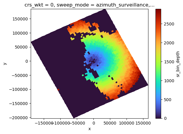
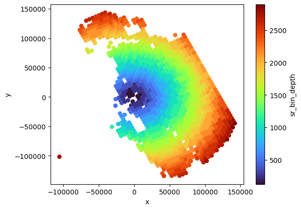
[51]:
sr_match_sum.vol_sr.plot(x="x", y="y", cmap="turbo")
plt.figure()
plt.scatter(
sr_match2_sum.x.values,
sr_match2_sum.y.values,
c=sr_match2_sum.vol_sr.values,
s=30,
cmap="turbo",
)
plt.gca().set_xlabel("x")
plt.gca().set_ylabel("y")
plt.colorbar(label="vol_sr")
[51]:
<matplotlib.colorbar.Colorbar at 0x7f4723122210>
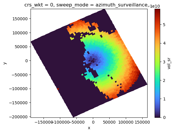
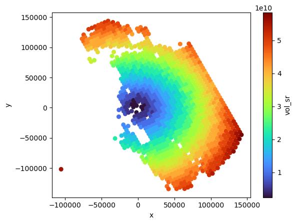
Identify which GR bins actually intersect with the SR footprint#
[52]:
sr_match2_mean
[52]:
<xarray.Dataset>
Dimensions: (nbeams: 1218, XYZ: 3, nNP: 4, method: 6,
foreBack: 2, nearFar: 2, nNode: 5,
nbinSZP: 7, nDSD: 2, nNUBF: 3, LS: 2)
Coordinates: (12/13)
* nbeams (nbeams) object MultiIndex
* nscan (nbeams) int64 0 0 0 0 0 0 ... 59 59 60 60 60
* nray (nbeams) int64 26 27 28 29 30 ... 36 27 28 29
Latitude (nbeams) float32 -26.55 -26.52 ... -28.9 -28.88
Longitude (nbeams) float32 152.6 152.6 ... 153.9 154.0
date (nbeams) datetime64[ns] 2014-12-06T09:50:30....
... ...
y (nbeams) float64 1.298e+05 ... -1.294e+05
crs_wkt int64 0
sweep_mode <U20 'azimuth_surveillance'
longitude float64 153.2
latitude float64 -27.72
altitude float64 175.0
Dimensions without coordinates: XYZ, nNP, method, foreBack, nearFar, nNode,
nbinSZP, nDSD, nNUBF, LS
Data variables: (12/105)
dataQuality (nbeams) float32 0.0 0.0 0.0 ... 0.0 0.0 0.0
dataWarning (nbeams) float32 0.0 0.0 0.0 ... 0.0 0.0 0.0
missing (nbeams) float32 0.0 0.0 0.0 ... 0.0 0.0 0.0
modeStatus (nbeams) float32 0.0 0.0 0.0 ... 0.0 0.0 0.0
geoError (nbeams) float32 0.0 0.0 0.0 ... 0.0 0.0 0.0
geoWarning (nbeams) float32 0.0 0.0 0.0 ... 0.0 0.0 0.0
... ...
sr_bin_depth (nbeams) float32 125.0 125.1 ... 125.2 125.3
bb_ratio (nbeams) float64 0.0 1.858 1.853 ... 0.0 2.054
bb_mask (nbeams) float64 0.0 1.0 1.0 ... 1.0 0.0 1.0
ref_sr_com (nbeams) float32 nan 18.38 20.71 ... nan 19.8
ref_sr_ss (nbeams) float32 nan 18.38 20.71 ... nan 19.8
ref_sr_sh (nbeams) float32 nan 18.81 21.13 ... nan 20.03- nbeams: 1218
- XYZ: 3
- nNP: 4
- method: 6
- foreBack: 2
- nearFar: 2
- nNode: 5
- nbinSZP: 7
- nDSD: 2
- nNUBF: 3
- LS: 2
- nbeams(nbeams)objectMultiIndex
array([(0, 26), (0, 27), (0, 28), ..., (60, 27), (60, 28), (60, 29)], dtype=object) - nscan(nbeams)int640 0 0 0 0 0 0 ... 59 59 59 60 60 60
array([ 0, 0, 0, ..., 60, 60, 60])
- nray(nbeams)int6426 27 28 29 30 ... 35 36 27 28 29
array([26, 27, 28, ..., 27, 28, 29])
- Latitude(nbeams)float32-26.55 -26.52 ... -28.9 -28.88
- DimensionNames :
- nscan,nray
- Units :
- degrees
- units :
- degrees
- CodeMissingValue :
- -9999.9
array([-26.545311, -26.524946, -26.504398, ..., -28.925497, -28.904446, -28.883429], dtype=float32) - Longitude(nbeams)float32152.6 152.6 152.6 ... 153.9 154.0
- DimensionNames :
- nscan,nray
- Units :
- degrees
- units :
- degrees
- CodeMissingValue :
- -9999.9
array([152.55975, 152.60423, 152.64912, ..., 153.89622, 153.94188, 153.98752], dtype=float32) - date(nbeams)datetime64[ns]2014-12-06T09:50:30.000500 ... 2...
array(['2014-12-06T09:50:30.000500000', '2014-12-06T09:50:30.000500000', '2014-12-06T09:50:30.000500000', ..., '2014-12-06T09:51:12.000500000', '2014-12-06T09:51:12.000500000', '2014-12-06T09:51:12.000500000'], dtype='datetime64[ns]') - x(nbeams)float64-6.779e+04 -6.337e+04 ... 7.292e+04
array([-67792.10477565, -63370.78583652, -58906.88991347, ..., 63991.55173439, 68457.14680696, 72922.98860669]) - y(nbeams)float641.298e+05 1.32e+05 ... -1.294e+05
array([ 129766.8608038 , 132046.5789815 , 134345.19055428, ..., -133982.12171816, -131673.76631035, -129370.88469283]) - crs_wkt()int640
- crs_wkt :
- PROJCRS["unknown",BASEGEOGCRS["unknown",DATUM["Unknown based on WGS 84 ellipsoid",ELLIPSOID["WGS 84",6378137,298.25722356049,LENGTHUNIT["metre",1,ID["EPSG",9001]]]],PRIMEM["Greenwich",0,ANGLEUNIT["degree",0.0174532925199433],ID["EPSG",8901]]],CONVERSION["unknown",METHOD["Modified Azimuthal Equidistant",ID["EPSG",9832]],PARAMETER["Latitude of natural origin",-27.7181,ANGLEUNIT["degree",0.0174532925199433],ID["EPSG",8801]],PARAMETER["Longitude of natural origin",153.240005,ANGLEUNIT["degree",0.0174532925199433],ID["EPSG",8802]],PARAMETER["False easting",0,LENGTHUNIT["metre",1],ID["EPSG",8806]],PARAMETER["False northing",0,LENGTHUNIT["metre",1],ID["EPSG",8807]]],CS[Cartesian,2],AXIS["(E)",east,ORDER[1],LENGTHUNIT["metre",1,ID["EPSG",9001]]],AXIS["(N)",north,ORDER[2],LENGTHUNIT["metre",1,ID["EPSG",9001]]]]
- semi_major_axis :
- 6378137.0
- semi_minor_axis :
- 6356752.314245
- inverse_flattening :
- 298.25722356049
- reference_ellipsoid_name :
- WGS 84
- longitude_of_prime_meridian :
- 0.0
- prime_meridian_name :
- Greenwich
- geographic_crs_name :
- unknown
- horizontal_datum_name :
- Unknown based on WGS 84 ellipsoid
- projected_crs_name :
- unknown
- grid_mapping_name :
- azimuthal_equidistant
- latitude_of_projection_origin :
- -27.7181
- longitude_of_projection_origin :
- 153.240005
- false_easting :
- 0.0
- false_northing :
- 0.0
array(0)
- sweep_mode()<U20'azimuth_surveillance'
array('azimuth_surveillance', dtype='<U20') - longitude()float64153.2
array(153.24000549)
- latitude()float64-27.72
array(-27.71809959)
- altitude()float64175.0
array(174.99999702)
- dataQuality(nbeams)float320.0 0.0 0.0 0.0 ... 0.0 0.0 0.0 0.0
array([0., 0., 0., ..., 0., 0., 0.], dtype=float32)
- dataWarning(nbeams)float320.0 0.0 0.0 0.0 ... 0.0 0.0 0.0 0.0
array([0., 0., 0., ..., 0., 0., 0.], dtype=float32)
- missing(nbeams)float320.0 0.0 0.0 0.0 ... 0.0 0.0 0.0 0.0
array([0., 0., 0., ..., 0., 0., 0.], dtype=float32)
- modeStatus(nbeams)float320.0 0.0 0.0 0.0 ... 0.0 0.0 0.0 0.0
array([0., 0., 0., ..., 0., 0., 0.], dtype=float32)
- geoError(nbeams)float320.0 0.0 0.0 0.0 ... 0.0 0.0 0.0 0.0
array([0., 0., 0., ..., 0., 0., 0.], dtype=float32)
- geoWarning(nbeams)float320.0 0.0 0.0 0.0 ... 0.0 0.0 0.0 0.0
array([0., 0., 0., ..., 0., 0., 0.], dtype=float32)
- SCorientation(nbeams)float32180.0 180.0 180.0 ... 180.0 180.0
array([180., 180., 180., ..., 180., 180., 180.], dtype=float32)
- pointingStatus(nbeams)float320.0 0.0 0.0 0.0 ... 0.0 0.0 0.0 0.0
array([0., 0., 0., ..., 0., 0., 0.], dtype=float32)
- acsModeMidScan(nbeams)float324.0 4.0 4.0 4.0 ... 4.0 4.0 4.0 4.0
array([4., 4., 4., ..., 4., 4., 4.], dtype=float32)
- targetSelectionMidScan(nbeams)float323.0 3.0 3.0 3.0 ... 3.0 3.0 3.0 3.0
array([3., 3., 3., ..., 3., 3., 3.], dtype=float32)
- operationalMode(nbeams)float321.0 1.0 1.0 1.0 ... 1.0 1.0 1.0 1.0
array([1., 1., 1., ..., 1., 1., 1.], dtype=float32)
- limitErrorFlag(nbeams)float320.0 0.0 0.0 0.0 ... 0.0 0.0 0.0 0.0
array([0., 0., 0., ..., 0., 0., 0.], dtype=float32)
- FractionalGranuleNumber(nbeams)float644.384e+03 4.384e+03 ... 4.384e+03
array([4383.83170384, 4383.83170384, 4383.83170384, ..., 4383.83926875, 4383.83926875, 4383.83926875]) - scPos(XYZ, nbeams)float32-5.382e+06 ... -3.268e+06
array([[-5382185.5, -5382185.5, -5382185.5, ..., -5326018.5, -5326018.5, -5326018.5], [ 2805566. , 2805566. , 2805566. , ..., 2625585.5, 2625585.5, 2625585.5], [-3017569.2, -3017569.2, -3017569.2, ..., -3268312. , -3268312. , -3268312. ]], dtype=float32) - scVel(XYZ, nbeams)float321.207e+03 1.207e+03 ... -5.885e+03
array([[ 1206.8702, 1206.8702, 1206.8702, ..., 1466.7172, 1466.7172, 1466.7172], [-4207.8604, -4207.8604, -4207.8604, ..., -4361.2915, -4361.2915, -4361.2915], [-6053.46 , -6053.46 , -6053.46 , ..., -5884.763 , -5884.763 , -5884.763 ]], dtype=float32) - scLat(nbeams)float32-26.58 -26.58 ... -28.98 -28.98
array([-26.57959 , -26.57959 , -26.57959 , ..., -28.981655, -28.981655, -28.981655], dtype=float32) - scLon(nbeams)float32152.5 152.5 152.5 ... 153.8 153.8
array([152.46837, 152.46837, 152.46837, ..., 153.7579 , 153.7579 , 153.7579 ], dtype=float32) - scAlt(nbeams)float324.044e+05 4.044e+05 ... 4.049e+05
array([404380. , 404380. , 404380. , ..., 404907.8, 404907.8, 404907.8], dtype=float32) - dprAlt(nbeams)float324.044e+05 4.044e+05 ... 4.049e+05
array([404370., 404370., 404370., ..., 404890., 404890., 404890.], dtype=float32) - scAttRollGeoc(nbeams)float32-0.06808 -0.06808 ... -0.07365
array([-0.0680813, -0.0680813, -0.0680813, ..., -0.0736523, -0.0736523, -0.0736523], dtype=float32) - scAttPitchGeoc(nbeams)float320.1276 0.1276 ... 0.1344 0.1344
array([0.12756324, 0.12756324, 0.12756324, ..., 0.13435382, 0.13435382, 0.13435382], dtype=float32) - scAttYawGeoc(nbeams)float32180.0 180.0 180.0 ... 180.0 180.0
array([179.99986, 179.99986, 179.99986, ..., 179.99995, 179.99995, 179.99995], dtype=float32) - scAttRollGeod(nbeams)float322.701e-05 2.701e-05 ... 0.0001056
array([2.7009917e-05, 2.7009917e-05, 2.7009917e-05, ..., 1.0556465e-04, 1.0556465e-04, 1.0556465e-04], dtype=float32) - scAttPitchGeod(nbeams)float320.0001868 0.0001868 ... 0.0002653
array([0.00018677, 0.00018677, 0.00018677, ..., 0.00026527, 0.00026527, 0.00026527], dtype=float32) - scAttYawGeod(nbeams)float32180.0 180.0 180.0 ... 180.0 180.0
array([179.99997, 179.99997, 179.99997, ..., 180.00009, 180.00009, 180.00009], dtype=float32) - greenHourAng(nbeams)float32222.7 222.7 222.7 ... 222.9 222.9
array([222.73518, 222.73518, 222.73518, ..., 222.91069, 222.91069, 222.91069], dtype=float32) - timeMidScan(nbeams)float641.102e+09 1.102e+09 ... 1.102e+09
array([1.10189465e+09, 1.10189465e+09, 1.10189465e+09, ..., 1.10189469e+09, 1.10189469e+09, 1.10189469e+09]) - timeMidScanOffset(nbeams)float640.3432 0.3432 ... 0.3432 0.3432
array([0.34323001, 0.34323001, 0.34323001, ..., 0.34323001, 0.34323001, 0.34323001]) - landSurfaceType(nbeams)float64113.0 113.0 113.0 ... 0.0 0.0 0.0
array([113., 113., 113., ..., 0., 0., 0.])
- localZenithAngle(nbeams)float321.485 2.233 2.988 ... 2.988 3.742
array([1.4852079, 2.2330241, 2.987973 , ..., 2.2330933, 2.9880931, 3.741854 ], dtype=float32) - flagPrecip(nbeams)float641.0 1.0 1.0 1.0 ... 1.0 1.0 1.0 1.0
array([1., 1., 1., ..., 1., 1., 1.])
- flagSigmaZeroSaturation(nbeams)float320.0 0.0 0.0 0.0 ... 0.0 0.0 0.0 0.0
array([0., 0., 0., ..., 0., 0., 0.], dtype=float32)
- binRealSurface(nbeams)float32175.0 174.0 174.0 ... 176.0 176.0
array([175., 174., 174., ..., 176., 176., 176.], dtype=float32)
- binStormTop(nbeams)float32142.0 121.0 130.0 ... 134.0 136.0
array([142., 121., 130., ..., 131., 134., 136.], dtype=float32)
- heightStormTop(nbeams)float324.306e+03 6.901e+03 ... 5.009e+03
array([4305.5874, 6900.7983, 5750.482 , ..., 5682.8413, 5283.544 , 5009.1587], dtype=float32) - binClutterFreeBottom(nbeams)float32166.0 167.0 167.0 ... 169.0 167.0
array([166., 167., 167., ..., 169., 169., 167.], dtype=float32)
- sigmaZeroMeasured(nbeams)float328.318 3.351 -4.316 ... 12.94 12.08
array([ 8.317774 , 3.3514724, -4.315786 , ..., 13.370577 , 12.94476 , 12.076472 ], dtype=float32) - zFactorMeasured(nbeams)float3214.12 17.46 ... 15.58 15.57
array([ 14.121904, 17.461905, -1356.6748 , ..., 16.550476, 15.58 , 15.571428], dtype=float32) - ellipsoidBinOffset(nbeams)float3251.48 22.06 0.7959 ... 33.88 13.33
array([51.479836 , 22.057804 , 0.79590845, ..., 54.80966 , 33.875767 , 13.325678 ], dtype=float32) - snRatioAtRealSurface(nbeams)float3255.21 49.69 41.5 ... 60.04 58.32
array([55.210003, 49.69 , 41.500008, ..., 60.92 , 60.039993, 58.32 ], dtype=float32) - adjustFactor(nbeams)float32-0.02 -0.01 -0.03 ... -0.03 -0.03
array([-0.02, -0.01, -0.03, ..., -0.01, -0.03, -0.03], dtype=float32)
- snowIceCover(nbeams)float321.0 1.0 1.0 1.0 ... 0.0 0.0 0.0 0.0
array([1., 1., 1., ..., 0., 0., 0.], dtype=float32)
- binZeroDeg(nbeams)float32143.0 143.0 143.0 ... 145.0 144.0
array([143., 143., 143., ..., 145., 145., 144.], dtype=float32)
- attenuationNP(nbeams)float320.01124 0.01143 ... 0.01067 0.01124
array([0.0112381 , 0.01142857, 0.01309524, ..., 0.01047619, 0.01066667, 0.0112381 ], dtype=float32) - piaNP(nNP, nbeams)float320.3327 0.3352 ... 0.03334 0.03826
array([[0.33271593, 0.33520514, 0.3529013 , ..., 0.33307362, 0.33494386, 0.3415743 ], [0.22550352, 0.22833616, 0.23057668, ..., 0.22128282, 0.22330536, 0.22530317], [0.07853958, 0.07813708, 0.07784598, ..., 0.07857883, 0.07829417, 0.07801481], [0.02867284, 0.02873187, 0.04447866, ..., 0.03321198, 0.03334429, 0.03825633]], dtype=float32) - sigmaZeroNPCorrected(nbeams)float328.65 3.687 -3.963 ... 13.28 12.42
array([ 8.65049 , 3.6866775, -3.962885 , ..., 13.7036495, 13.279704 , 12.418047 ], dtype=float32) - heightZeroDeg(nbeams)float324.207e+03 4.209e+03 ... 4.034e+03
array([4207.427 , 4209.253 , 4211.1035, ..., 4030.8347, 4032.2976, 4033.8347], dtype=float32) - flagBB(nbeams)float640.0 1.0 1.0 1.0 ... 1.0 1.0 0.0 1.0
array([0., 1., 1., ..., 1., 0., 1.])
- binBBPeak(nbeams)float320.0 143.0 144.0 ... 145.0 0.0 146.0
array([ 0., 143., 144., ..., 145., 0., 146.], dtype=float32)
- binBBTop(nbeams)float320.0 137.0 141.0 ... 143.0 0.0 144.0
array([ 0., 137., 141., ..., 143., 0., 144.], dtype=float32)
- binBBBottom(nbeams)float320.0 147.0 147.0 ... 147.0 0.0 149.0
array([ 0., 147., 147., ..., 147., 0., 149.], dtype=float32)
- heightBB(nbeams)float320.0 4.144e+03 ... 0.0 3.755e+03
array([ 0. , 4143.908 , 3995.3567, ..., 3926.8252, 0. , 3755.3032], dtype=float32) - widthBB(nbeams)float320.0 1.191e+03 670.7 ... 0.0 525.6
array([ 0. , 1190.5608 , 670.68445, ..., 441.12845, 0. , 525.5666 ], dtype=float32) - qualityBB(nbeams)float640.0 1.0 1.0 1.0 ... 1.0 1.0 0.0 1.0
array([0., 1., 1., ..., 1., 0., 1.])
- typePrecip(nbeams)float641.003e+07 1.001e+07 ... 1.001e+07
array([10031000., 10011100., 10011100., ..., 10011100., 10031000., 10011100.]) - qualityTypePrecip(nbeams)float641.0 1.0 1.0 1.0 ... 1.0 1.0 1.0 1.0
array([1., 1., 1., ..., 1., 1., 1.])
- flagShallowRain(nbeams)float640.0 0.0 0.0 0.0 ... 0.0 0.0 0.0 0.0
array([0., 0., 0., ..., 0., 0., 0.])
- flagHeavyIcePrecip(nbeams)float320.0 0.0 0.0 0.0 ... 0.0 0.0 0.0 0.0
array([0., 0., 0., ..., 0., 0., 0.], dtype=float32)
- flagAnvil(nbeams)float320.0 0.0 0.0 0.0 ... 0.0 0.0 0.0 0.0
array([0., 0., 0., ..., 0., 0., 0.], dtype=float32)
- PIAalt(method, nbeams)float32-11.69 -6.24 2.539 ... nan nan nan
array([[-11.692607 , -6.239689 , 2.539287 , ..., 0.02296925, 0.3547573 , 1.7412425 ], [ -9.976695 , -4.8162613 , 0.908834 , ..., -1.1388235 , -0.9440365 , -0.46711636], [ nan, nan, nan, ..., 0.0958395 , 0.25253963, 0.8103189 ], [ nan, nan, nan, ..., -1.1043596 , -0.73055935, 0.02544975], [-10.172932 , -6.4097357 , 0.04464769, ..., -0.5203848 , -0.11233902, 0.75521183], [ nan, nan, nan, ..., nan, nan, nan]], dtype=float32) - RFactorAlt(method, nbeams)float32-3.001 -5.009 2.229 ... nan nan nan
array([[-3.0014212 , -5.009084 , 2.228597 , ..., 0.10189774, 0.661812 , 2.7617667 ], [-2.6796358 , -1.0471308 , nan, ..., -3.4415584 , -1.5178882 , -0.67867553], [ nan, nan, nan, ..., 0.13705838, 0.36115247, 1.1588228 ], [ nan, nan, nan, ..., -1.0176693 , -0.6732117 , 0.02345199], [-2.4616666 , -1.7474601 , 0.01413033, ..., -0.48257437, -0.11852771, 0.79198104], [ nan, nan, nan, ..., nan, nan, nan]], dtype=float32) - PIAweight(method, nbeams)float320.3352 0.8413 0.8849 ... nan nan
array([[0.33517805, 0.84127027, 0.88492674, ..., 0.6042999 , 0.3455004 , 0.29182 ], [0.36696312, 0.06170587, nan, ..., 0.28042346, 0.2566516 , 0.24486905], [ nan, nan, nan, ..., 0.06279701, 0.20303184, 0.23723659], [ nan, nan, nan, ..., 0.02607409, 0.08430132, 0.09850354], [0.29785886, 0.09702398, 0.11507325, ..., 0.02640561, 0.11051482, 0.12757087], [ nan, nan, nan, ..., nan, nan, nan]], dtype=float32) - pathAtten(nbeams)float32-10.61 -6.168 ... -0.1424 0.6848
array([-10.610281 , -6.1683526 , 2.2522209 , ..., -0.34199032, -0.14244835, 0.68483424], dtype=float32) - reliabFactor(nbeams)float32-4.704 -5.399 ... -0.4521 2.011
array([-4.704406 , -5.398795 , 2.1012468 , ..., -1.9516656 , -0.45210204, 2.0107388 ], dtype=float32) - reliabFlag(nbeams)float323.0 3.0 2.0 3.0 ... 2.0 3.0 3.0 2.0
array([3., 3., 2., ..., 3., 3., 2.], dtype=float32)
- refScanID(foreBack, nearFar, nbeams)float325.0 5.0 7.0 ... -18.0 -30.0 -31.0
array([[[ 5., 5., 7., ..., 137., 136., 123.], [ 15., 17., 16., ..., 144., 146., 140.]], [[ -1., -1., -8., ..., -1., -12., -13.], [ -13., -16., -512., ..., -18., -30., -31.]]], dtype=float32) - phase(nbeams)float32125.0 125.7 118.0 ... 109.3 102.1
array([125.04762 , 125.666664, 118. , ..., 106.71429 , 109.28571 , 102.14286 ], dtype=float32) - binNode(nNode, nbeams)float32142.0 121.0 130.0 ... 176.0 176.0
array([[142., 121., 130., ..., 131., 134., 136.], [143., 137., 141., ..., 143., 145., 144.], [143., 143., 144., ..., 145., 145., 146.], [143., 147., 147., ..., 147., 145., 149.], [175., 174., 174., ..., 176., 176., 176.]], dtype=float32) - precipRateESurface2(nbeams)float320.0 0.0 0.3612 ... 0.1942 0.301
array([0. , 0. , 0.36118543, ..., 0.2188895 , 0.19422063, 0.300957 ], dtype=float32) - precipRateESurface2Status(nbeams)float320.0 0.0 10.0 ... 10.0 10.0 10.0
array([ 0., 0., 10., ..., 10., 10., 10.], dtype=float32)
- sigmaZeroProfile(nbinSZP, nbeams)float32-26.15 -16.63 ... -14.57 -10.95
array([[-26.153477 , -16.632727 , -31.316784 , ..., -31.85423 , -15.6385 , -5.164462 ], [-12.345656 , -13.176982 , -18.80089 , ..., -5.5860953 , 2.967937 , 6.209384 ], [ -8.201733 , -1.1218103 , -8.1096115 , ..., 9.217377 , 11.571367 , 11.372938 ], ..., [ 1.7947496 , -1.805429 , -7.062664 , ..., 9.553769 , 8.478141 , 7.95 ], [ 8.317774 , -12.143724 , -14.29175 , ..., -1.0931189 , -0.83855855, 0.38345492], [ 4.2007284 , -23.501465 , -24.638363 , ..., -16.583303 , -14.567502 , -10.954213 ]], dtype=float32) - binDEML2(nbeams)float32173.0 174.0 174.0 ... 176.0 176.0
array([173., 174., 174., ..., 176., 176., 176.], dtype=float32)
- seaIceConcentration(nbeams)float320.0 0.0 0.0 0.0 ... 0.0 0.0 0.0 0.0
array([0., 0., 0., ..., 0., 0., 0.], dtype=float32)
- flagSLV(nbeams)float322.333 6.333 6.333 ... 4.667 4.0
array([2.3333333, 6.3333335, 6.3333335, ..., 5.6666665, 4.6666665, 4. ], dtype=float32) - paramDSD(nDSD, nbeams)float3231.75 31.23 32.32 ... 1.025 1.023
array([[31.75 , 31.232101 , 32.320526 , ..., 31.701767 , 31.994282 , 32.008335 ], [ 1.0042856 , 0.98157895, 1.0505263 , ..., 0.9852942 , 1.025 , 1.0225 ]], dtype=float32) - binEchoBottom(nbeams)float32166.0 167.0 167.0 ... 169.0 167.0
array([166., 167., 167., ..., 169., 169., 167.], dtype=float32)
- piaFinal(nbeams)float320.01092 0.04358 ... 0.05829 0.1005
array([0.01091896, 0.04358029, 0.12152463, ..., 0.05672546, 0.05829066, 0.1004837 ], dtype=float32) - sigmaZeroCorrected(nbeams)float328.661 3.73 -3.841 ... 13.34 12.52
array([ 8.661409, 3.730258, -3.84136 , ..., 13.760374, 13.337994, 12.51853 ], dtype=float32) - zFactorCorrected(nbeams)float3217.12 18.01 20.36 ... 17.92 19.4
array([17.122858, 18.013159, 20.361578, ..., 17.518234, 17.922857, 19.397501], dtype=float32) - zFactorCorrectedESurface(nbeams)float32nan nan 18.49 ... 14.98 14.27 17.37
array([ nan, nan, 18.486084, ..., 14.979892, 14.265118, 17.373379], dtype=float32) - zFactorCorrectedNearSurface(nbeams)float32nan nan 18.5 ... 14.96 14.25 17.37
array([ nan, nan, 18.504059, ..., 14.964489, 14.250263, 17.365042], dtype=float32) - paramNUBF(nNUBF, nbeams)float32nan 0.2439 0.06329 ... 1.0 1.0 1.0
array([[ nan, 0.24394698, 0.06328893, ..., 0.17711842, 0.10391452, 0.17876929], [0. , 0.24394703, 0.06328893, ..., 0.17711842, 0.1039145 , 0.17876935], [1. , 1. , 1. , ..., 1. , 1. , 1. ]], dtype=float32) - precipRate(nbeams)float320.1024 0.2238 ... 0.2405 0.2057
array([0.10238095, 0.22380951, 0.41761908, ..., 0.22761904, 0.2404762 , 0.2057143 ], dtype=float32) - precipWaterIntegrated(LS, nbeams)float3215.2 10.73 100.0 ... 32.75 83.27
array([[ 15.203677 , 10.728947 , 100.04906 , ..., 63.52964 , 71.241875 , 100.08554 ], [ 1.8158947, 109.025696 , 125.96203 , ..., 85.69331 , 32.748466 , 83.27174 ]], dtype=float32) - qualitySLV(nbeams)float649.83e+05 9.856e+05 ... 1.184e+08
array([9.83043000e+05, 9.85603000e+05, 8.46095390e+07, ..., 1.18163971e+08, 1.18426115e+08, 1.18426115e+08]) - precipRateNearSurface(nbeams)float320.0 0.0 0.3575 ... 0.1737 0.2924
array([0. , 0. , 0.35747528, ..., 0.19577399, 0.17371026, 0.292365 ], dtype=float32) - precipRateESurface(nbeams)float320.0 0.0 0.3511 ... 0.1714 0.287
array([0. , 0. , 0.35107732, ..., 0.19321238, 0.17139278, 0.2870019 ], dtype=float32) - precipRateAve24(nbeams)float320.0642 0.1104 ... 0.2967 0.5674
array([0.06420098, 0.11043292, 0.5343267 , ..., 0.26826608, 0.2967103 , 0.5673702 ], dtype=float32) - phaseNearSurface(nbeams)float32215.0 216.0 216.0 ... 217.0 216.0
array([215., 216., 216., ..., 217., 217., 216.], dtype=float32)
- epsilon(nbeams)float320.93 0.92 0.95 ... 0.94 0.94 0.94
array([0.92999995, 0.91999996, 0.95000005, ..., 0.94 , 0.94 , 0.94 ], dtype=float32) - flagEcho(nbeams)float322.619 4.524 4.524 ... 3.333 2.857
array([2.6190476, 4.5238094, 4.5238094, ..., 4.285714 , 3.3333333, 2.857143 ], dtype=float32) - qualityData(nbeams)float640.0 0.0 0.0 0.0 ... 0.0 0.0 0.0 0.0
array([0., 0., 0., ..., 0., 0., 0.])
- qualityFlag(nbeams)float320.0 0.0 0.0 0.0 ... 0.0 0.0 0.0 0.0
array([0., 0., 0., ..., 0., 0., 0.], dtype=float32)
- flagSensor(nbeams)float320.0 0.0 0.0 0.0 ... 0.0 0.0 0.0 0.0
array([0., 0., 0., ..., 0., 0., 0.], dtype=float32)
- xp(nbeams)float64-6.79e+04 -6.354e+04 ... 7.264e+04
array([-67901.44637496, -63535.20030327, -59126.88967667, ..., 63822.93724828, 68231.52652476, 72640.46603565]) - yp(nbeams)float641.297e+05 1.32e+05 ... -1.295e+05
array([ 129710.27794381, 131961.59839865, 134231.58639525, ..., -134069.59598245, -131790.70883022, -129517.17047977]) - zp(nbeams)float644.748e+03 4.746e+03 ... 4.865e+03
array([4748.40432405, 4746.39302492, 4743.54226887, ..., 4871.29781395, 4868.37203801, 4864.60766941]) - vol_sr(nbeams)float642.409e+09 2.411e+09 ... 2.422e+09
array([2.40915147e+09, 2.41113868e+09, 2.41393135e+09, ..., 2.41590889e+09, 2.41870781e+09, 2.42231215e+09]) - sr_bin_radius(nbeams)float642.476e+03 2.477e+03 ... 2.481e+03
array([2476.44324375, 2476.93979024, 2477.62990056, ..., 2479.3887814 , 2480.0798029 , 2480.9681928 ]) - sr_bin_depth(nbeams)float32125.0 125.1 125.2 ... 125.2 125.3
array([125.042015, 125.09499 , 125.17018 , ..., 125.09499 , 125.17019 , 125.267044], dtype=float32) - bb_ratio(nbeams)float640.0 1.858 1.853 ... 2.065 0.0 2.054
array([0. , 1.85804119, 1.85332106, ..., 2.06485194, 0. , 2.05377475]) - bb_mask(nbeams)float640.0 1.0 1.0 1.0 ... 1.0 1.0 0.0 1.0
array([0., 1., 1., ..., 1., 0., 1.])
- ref_sr_com(nbeams)float32nan 18.38 20.71 ... 17.89 nan 19.8
array([ nan, 18.376291, 20.706018, ..., 17.887337, nan, 19.800957], dtype=float32) - ref_sr_ss(nbeams)float32nan 18.38 20.71 ... 17.89 nan 19.8
array([ nan, 18.376291, 20.706018, ..., 17.887337, nan, 19.800957], dtype=float32) - ref_sr_sh(nbeams)float32nan 18.81 21.13 ... 18.26 nan 20.03
array([ nan, 18.808296, 21.130777, ..., 18.259407, nan, 20.03222 ], dtype=float32)
- nbeams
nscan
nrayPandasMultiIndexPandasIndex(MultiIndex([( 0, 26), ( 0, 27), ( 0, 28), ( 0, 29), ( 0, 30), ( 0, 31), ( 0, 32), ( 1, 24), ( 1, 28), ( 1, 29), ... (59, 25), (59, 26), (59, 27), (59, 28), (59, 29), (59, 35), (59, 36), (60, 27), (60, 28), (60, 29)], name='nbeams', length=1218))
[53]:
%%time
## Create Zonal Data Source of matching SR profiles
xyp_sr = np.stack([sr_match2_mean.xp, sr_match2_mean.yp], axis=-1)
zds = wrl.io.VectorSource(xyp_sr, trg_crs=rad)
CPU times: user 20.5 ms, sys: 12.1 ms, total: 32.6 ms
Wall time: 32.4 ms
[54]:
%%time
## Create SR beam polygons using sr_bin_radius Rs
tmp_trg_lyr = zds.ds.GetLayer()
trg_poly = []
for i, feat in enumerate(tmp_trg_lyr):
geom = feat.GetGeometryRef().Buffer(sr_match2_max.sr_bin_radius.values[i])
poly = wrl.georef.ogr_to_numpy(geom)
trg_poly.append(poly)
CPU times: user 1.33 s, sys: 10.4 ms, total: 1.34 s
Wall time: 1.34 s
[55]:
gr_poly.shape
[55]:
(360, 600, 5, 3)
[56]:
%%time
## Create ZonalDataPoly for GR and SR profiles
print("Create ZonalDataPoly for GR and SR profiles.")
print("This process can take a few seconds... ")
zdp = wrl.zonalstats.ZonalDataPoly(
gr_poly[..., 0:2].reshape(-1, 5, 2), trg=trg_poly, crs=rad
)
Create ZonalDataPoly for GR and SR profiles.
This process can take a few seconds...
CPU times: user 10.2 s, sys: 1.37 s, total: 11.5 s
Wall time: 11.6 s
[57]:
%%time
# dump zonal data
zdp.dump_vector("m3d_zonal_poly_{0}".format(platf))
CPU times: user 979 ms, sys: 692 ms, total: 1.67 s
Wall time: 1.67 s
[58]:
# %%time
print("loading")
obj3 = wrl.zonalstats.ZonalStatsPoly("m3d_zonal_poly_{0}".format(platf))
loading
[59]:
## Average GR volume and reflectivity
volgr1 = np.array(
[
np.sum(vol_gr.values.ravel()[obj3.ix[i]])
for i in np.arange(len(obj3.ix))[~obj3.check_empty()]
]
)
SR Reflectivity matched#
[60]:
# converted for stratiform
ref_sr2gr_m = sr_match2.ref_sr_com.copy()
ref_sr2gr_m = wrl.trafo.idecibel(ref_sr2gr_m)
ref_sr2gr_m = ref_sr2gr_m.mean(dim="nbin", skipna=True)
ref_sr2gr_m = wrl.trafo.decibel(ref_sr2gr_m)
display(ref_sr2gr_m)
<xarray.DataArray 'ref_sr_com' (nbeams: 1218)>
array([ nan, 19.49539 , 23.312458, ..., 18.637308, nan,
21.192059], dtype=float32)
Coordinates: (12/13)
* nbeams (nbeams) object MultiIndex
* nscan (nbeams) int64 0 0 0 0 0 0 0 1 1 ... 59 59 59 59 59 59 60 60 60
* nray (nbeams) int64 26 27 28 29 30 31 32 24 ... 28 29 35 36 27 28 29
Latitude (nbeams) float32 -26.55 -26.52 -26.5 ... -28.93 -28.9 -28.88
Longitude (nbeams) float32 152.6 152.6 152.6 152.7 ... 153.9 153.9 154.0
date (nbeams) datetime64[ns] 2014-12-06T09:50:30.000500 ... 2014-1...
... ...
y (nbeams) float64 1.298e+05 1.32e+05 ... -1.317e+05 -1.294e+05
crs_wkt int64 0
sweep_mode <U20 'azimuth_surveillance'
longitude float64 153.2
latitude float64 -27.72
altitude float64 175.0- nbeams: 1218
- nan 19.5 23.31 24.33 26.46 22.51 ... 23.82 26.15 31.39 18.64 nan 21.19
array([ nan, 19.49539 , 23.312458, ..., 18.637308, nan, 21.192059], dtype=float32) - nbeams(nbeams)objectMultiIndex
array([(0, 26), (0, 27), (0, 28), ..., (60, 27), (60, 28), (60, 29)], dtype=object) - nscan(nbeams)int640 0 0 0 0 0 0 ... 59 59 59 60 60 60
array([ 0, 0, 0, ..., 60, 60, 60])
- nray(nbeams)int6426 27 28 29 30 ... 35 36 27 28 29
array([26, 27, 28, ..., 27, 28, 29])
- Latitude(nbeams)float32-26.55 -26.52 ... -28.9 -28.88
- DimensionNames :
- nscan,nray
- Units :
- degrees
- units :
- degrees
- CodeMissingValue :
- -9999.9
array([-26.545311, -26.524946, -26.504398, ..., -28.925497, -28.904446, -28.883429], dtype=float32) - Longitude(nbeams)float32152.6 152.6 152.6 ... 153.9 154.0
- DimensionNames :
- nscan,nray
- Units :
- degrees
- units :
- degrees
- CodeMissingValue :
- -9999.9
array([152.55975, 152.60423, 152.64912, ..., 153.89622, 153.94188, 153.98752], dtype=float32) - date(nbeams)datetime64[ns]2014-12-06T09:50:30.000500 ... 2...
array(['2014-12-06T09:50:30.000500000', '2014-12-06T09:50:30.000500000', '2014-12-06T09:50:30.000500000', ..., '2014-12-06T09:51:12.000500000', '2014-12-06T09:51:12.000500000', '2014-12-06T09:51:12.000500000'], dtype='datetime64[ns]') - x(nbeams)float64-6.779e+04 -6.337e+04 ... 7.292e+04
array([-67792.10477565, -63370.78583652, -58906.88991347, ..., 63991.55173439, 68457.14680696, 72922.98860669]) - y(nbeams)float641.298e+05 1.32e+05 ... -1.294e+05
array([ 129766.8608038 , 132046.5789815 , 134345.19055428, ..., -133982.12171816, -131673.76631035, -129370.88469283]) - crs_wkt()int640
- crs_wkt :
- PROJCRS["unknown",BASEGEOGCRS["unknown",DATUM["Unknown based on WGS 84 ellipsoid",ELLIPSOID["WGS 84",6378137,298.25722356049,LENGTHUNIT["metre",1,ID["EPSG",9001]]]],PRIMEM["Greenwich",0,ANGLEUNIT["degree",0.0174532925199433],ID["EPSG",8901]]],CONVERSION["unknown",METHOD["Modified Azimuthal Equidistant",ID["EPSG",9832]],PARAMETER["Latitude of natural origin",-27.7181,ANGLEUNIT["degree",0.0174532925199433],ID["EPSG",8801]],PARAMETER["Longitude of natural origin",153.240005,ANGLEUNIT["degree",0.0174532925199433],ID["EPSG",8802]],PARAMETER["False easting",0,LENGTHUNIT["metre",1],ID["EPSG",8806]],PARAMETER["False northing",0,LENGTHUNIT["metre",1],ID["EPSG",8807]]],CS[Cartesian,2],AXIS["(E)",east,ORDER[1],LENGTHUNIT["metre",1,ID["EPSG",9001]]],AXIS["(N)",north,ORDER[2],LENGTHUNIT["metre",1,ID["EPSG",9001]]]]
- semi_major_axis :
- 6378137.0
- semi_minor_axis :
- 6356752.314245
- inverse_flattening :
- 298.25722356049
- reference_ellipsoid_name :
- WGS 84
- longitude_of_prime_meridian :
- 0.0
- prime_meridian_name :
- Greenwich
- geographic_crs_name :
- unknown
- horizontal_datum_name :
- Unknown based on WGS 84 ellipsoid
- projected_crs_name :
- unknown
- grid_mapping_name :
- azimuthal_equidistant
- latitude_of_projection_origin :
- -27.7181
- longitude_of_projection_origin :
- 153.240005
- false_easting :
- 0.0
- false_northing :
- 0.0
array(0)
- sweep_mode()<U20'azimuth_surveillance'
array('azimuth_surveillance', dtype='<U20') - longitude()float64153.2
array(153.24000549)
- latitude()float64-27.72
array(-27.71809959)
- altitude()float64175.0
array(174.99999702)
- nbeams
nscan
nrayPandasMultiIndexPandasIndex(MultiIndex([( 0, 26), ( 0, 27), ( 0, 28), ( 0, 29), ( 0, 30), ( 0, 31), ( 0, 32), ( 1, 24), ( 1, 28), ( 1, 29), ... (59, 25), (59, 26), (59, 27), (59, 28), (59, 29), (59, 35), (59, 36), (60, 27), (60, 28), (60, 29)], name='nbeams', length=1218))
[61]:
ref_sr_m = wrl.trafo.idecibel(sr_match2.zFactorCorrected)
ref_sr_m = ref_sr_m.mean(dim="nbin", skipna=True)
ref_sr_m = wrl.trafo.decibel(ref_sr_m)
display(ref_sr_m)
<xarray.DataArray 'zFactorCorrected' (nbeams: 1218)>
array([17.571447, 18.82063 , 22.596802, ..., 18.239641, 18.275768,
20.90188 ], dtype=float32)
Coordinates: (12/13)
* nbeams (nbeams) object MultiIndex
* nscan (nbeams) int64 0 0 0 0 0 0 0 1 1 ... 59 59 59 59 59 59 60 60 60
* nray (nbeams) int64 26 27 28 29 30 31 32 24 ... 28 29 35 36 27 28 29
Latitude (nbeams) float32 -26.55 -26.52 -26.5 ... -28.93 -28.9 -28.88
Longitude (nbeams) float32 152.6 152.6 152.6 152.7 ... 153.9 153.9 154.0
date (nbeams) datetime64[ns] 2014-12-06T09:50:30.000500 ... 2014-1...
... ...
y (nbeams) float64 1.298e+05 1.32e+05 ... -1.317e+05 -1.294e+05
crs_wkt int64 0
sweep_mode <U20 'azimuth_surveillance'
longitude float64 153.2
latitude float64 -27.72
altitude float64 175.0- nbeams: 1218
- 17.57 18.82 22.6 23.53 25.52 21.81 ... 26.09 30.85 18.24 18.28 20.9
array([17.571447, 18.82063 , 22.596802, ..., 18.239641, 18.275768, 20.90188 ], dtype=float32) - nbeams(nbeams)objectMultiIndex
array([(0, 26), (0, 27), (0, 28), ..., (60, 27), (60, 28), (60, 29)], dtype=object) - nscan(nbeams)int640 0 0 0 0 0 0 ... 59 59 59 60 60 60
array([ 0, 0, 0, ..., 60, 60, 60])
- nray(nbeams)int6426 27 28 29 30 ... 35 36 27 28 29
array([26, 27, 28, ..., 27, 28, 29])
- Latitude(nbeams)float32-26.55 -26.52 ... -28.9 -28.88
- DimensionNames :
- nscan,nray
- Units :
- degrees
- units :
- degrees
- CodeMissingValue :
- -9999.9
array([-26.545311, -26.524946, -26.504398, ..., -28.925497, -28.904446, -28.883429], dtype=float32) - Longitude(nbeams)float32152.6 152.6 152.6 ... 153.9 154.0
- DimensionNames :
- nscan,nray
- Units :
- degrees
- units :
- degrees
- CodeMissingValue :
- -9999.9
array([152.55975, 152.60423, 152.64912, ..., 153.89622, 153.94188, 153.98752], dtype=float32) - date(nbeams)datetime64[ns]2014-12-06T09:50:30.000500 ... 2...
array(['2014-12-06T09:50:30.000500000', '2014-12-06T09:50:30.000500000', '2014-12-06T09:50:30.000500000', ..., '2014-12-06T09:51:12.000500000', '2014-12-06T09:51:12.000500000', '2014-12-06T09:51:12.000500000'], dtype='datetime64[ns]') - x(nbeams)float64-6.779e+04 -6.337e+04 ... 7.292e+04
array([-67792.10477565, -63370.78583652, -58906.88991347, ..., 63991.55173439, 68457.14680696, 72922.98860669]) - y(nbeams)float641.298e+05 1.32e+05 ... -1.294e+05
array([ 129766.8608038 , 132046.5789815 , 134345.19055428, ..., -133982.12171816, -131673.76631035, -129370.88469283]) - crs_wkt()int640
- crs_wkt :
- PROJCRS["unknown",BASEGEOGCRS["unknown",DATUM["Unknown based on WGS 84 ellipsoid",ELLIPSOID["WGS 84",6378137,298.25722356049,LENGTHUNIT["metre",1,ID["EPSG",9001]]]],PRIMEM["Greenwich",0,ANGLEUNIT["degree",0.0174532925199433],ID["EPSG",8901]]],CONVERSION["unknown",METHOD["Modified Azimuthal Equidistant",ID["EPSG",9832]],PARAMETER["Latitude of natural origin",-27.7181,ANGLEUNIT["degree",0.0174532925199433],ID["EPSG",8801]],PARAMETER["Longitude of natural origin",153.240005,ANGLEUNIT["degree",0.0174532925199433],ID["EPSG",8802]],PARAMETER["False easting",0,LENGTHUNIT["metre",1],ID["EPSG",8806]],PARAMETER["False northing",0,LENGTHUNIT["metre",1],ID["EPSG",8807]]],CS[Cartesian,2],AXIS["(E)",east,ORDER[1],LENGTHUNIT["metre",1,ID["EPSG",9001]]],AXIS["(N)",north,ORDER[2],LENGTHUNIT["metre",1,ID["EPSG",9001]]]]
- semi_major_axis :
- 6378137.0
- semi_minor_axis :
- 6356752.314245
- inverse_flattening :
- 298.25722356049
- reference_ellipsoid_name :
- WGS 84
- longitude_of_prime_meridian :
- 0.0
- prime_meridian_name :
- Greenwich
- geographic_crs_name :
- unknown
- horizontal_datum_name :
- Unknown based on WGS 84 ellipsoid
- projected_crs_name :
- unknown
- grid_mapping_name :
- azimuthal_equidistant
- latitude_of_projection_origin :
- -27.7181
- longitude_of_projection_origin :
- 153.240005
- false_easting :
- 0.0
- false_northing :
- 0.0
array(0)
- sweep_mode()<U20'azimuth_surveillance'
array('azimuth_surveillance', dtype='<U20') - longitude()float64153.2
array(153.24000549)
- latitude()float64-27.72
array(-27.71809959)
- altitude()float64175.0
array(174.99999702)
- nbeams
nscan
nrayPandasMultiIndexPandasIndex(MultiIndex([( 0, 26), ( 0, 27), ( 0, 28), ( 0, 29), ( 0, 30), ( 0, 31), ( 0, 32), ( 1, 24), ( 1, 28), ( 1, 29), ... (59, 25), (59, 26), (59, 27), (59, 28), (59, 29), (59, 35), (59, 36), (60, 27), (60, 28), (60, 29)], name='nbeams', length=1218))
[62]:
def plot_matched_refl(sr_data, gr_data, xyz):
"""
Plotting unmatched SR and GR Reflectivity
# Input:
# ------
gr_data ::: graund radar sweep data
sr_data ::: satellite data
# Output:
# ------
Plot of SR Refl. and GR Refl.
"""
plt.figure(figsize=(12, 4))
plt.subplot(1, 2, 1)
plt.scatter(
xyz[..., 0],
xyz[..., 1],
c=sr_data.data,
s=10,
cmap="turbo",
vmin=0,
vmax=40,
)
cbar = plt.colorbar(ticks=np.arange(0, 42, 2))
cbar.set_label("SR Reflectivity (dBz)", fontsize=12)
cbar.ax.tick_params(labelsize=12)
plt.xlabel("Longitude (°)", fontsize=12)
plt.ylabel("Latitude (°)", fontsize=12)
a = plt.xticks(fontsize=12)
a = plt.yticks(fontsize=12)
plt.title("Satellite Radar", fontsize=12, loc="left")
plt.grid(lw=0.25, color="grey")
plt.subplot(1, 2, 2)
plt.scatter(
xyz[..., 0], xyz[..., 1], c=gr_data, s=10, cmap="turbo", vmin=0, vmax=40
)
cbar = plt.colorbar(ticks=np.arange(0, 42, 2))
cbar.set_label("GR Reflectivity (dBz)", fontsize=12)
cbar.ax.tick_params(labelsize=12)
plt.xlabel("x (km)", fontsize=12)
plt.ylabel("y (km)", fontsize=12)
a = plt.xticks(fontsize=12)
a = plt.yticks(fontsize=12)
plt.title("Ground Radar", fontsize=12, loc="left")
plt.grid(lw=0.25, color="grey")
plt.tight_layout()
Ground Radar Reflectivity matched#
[63]:
mean = obj3.mean(wrl.trafo.idecibel(swp.DBZH).values.ravel())
obj3.zdata.trg.geo["mean"] = wrl.trafo.decibel(mean)
ref_gr_m = obj3.zdata.trg.geo["mean"]
[64]:
mean = obj3.mean(wrl.trafo.idecibel(ref_gr2sr).values.ravel())
obj3.zdata.trg.geo["mean"] = wrl.trafo.decibel(mean)
ref_gr2sr_m = obj3.zdata.trg.geo["mean"]
[65]:
# todo: title fig.suptitle("GR vs SR (to_gr)") etc
[66]:
plot_matched_refl(ref_sr2gr_m, ref_gr_m, xyp_sr)
plt.suptitle("GR vs SR (to_gr)")
[66]:
Text(0.5, 0.98, 'GR vs SR (to_gr)')
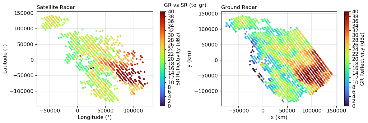
[67]:
plot_matched_refl(ref_sr_m, ref_gr2sr_m, xyp_sr)
plt.suptitle("GR (to_sr) vs SR")
[67]:
Text(0.5, 0.98, 'GR (to_sr) vs SR')
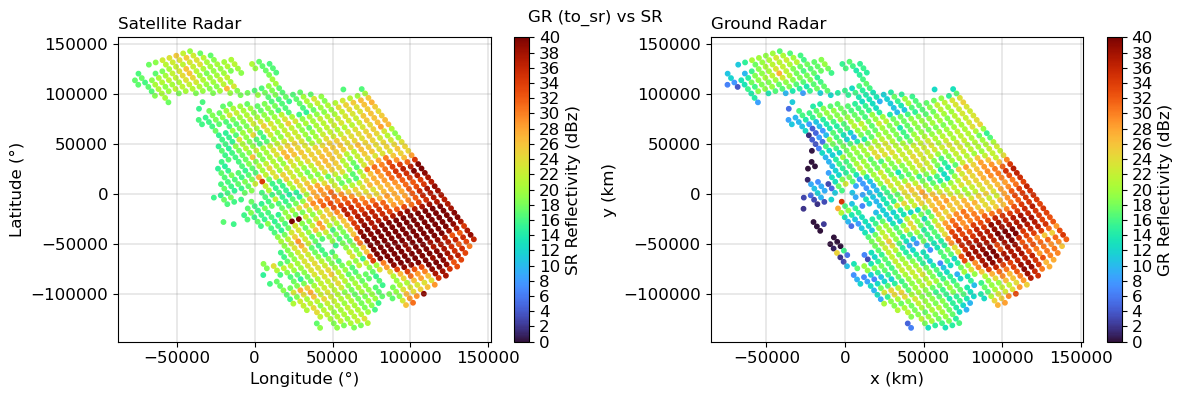
Diagnostic Plots#
[68]:
volcol = sr_match2_sum.vol_sr
[69]:
fig = plt.figure(figsize=(12, 5))
ax = fig.add_subplot(121, aspect="equal")
plt.scatter(
ref_gr_m.values, ref_sr2gr_m.values.ravel(), marker="+", c=volcol, cmap="turbo"
)
plt.colorbar(label="Matching Volume [m³]")
plt.plot([0, 60], [0, 60], linestyle="solid", color="black")
plt.xlim(10, 50)
plt.ylim(10, 50)
plt.xlabel("GR reflectivity (dBZ)")
plt.ylabel("SR reflectivity (dBZ)")
plt.title(f"Offset GR-SR: {np.nanmedian(ref_gr_m.values - ref_sr2gr_m.values.ravel())}")
ax = fig.add_subplot(122)
plt.hist(
ref_gr_m[ref_gr_m > 10], bins=np.arange(-10, 50, 5), edgecolor="None", label="GR"
)
plt.hist(
ref_sr2gr_m[ref_sr2gr_m > -10],
bins=np.arange(-10, 50, 5),
edgecolor="red",
facecolor="None",
label="SR",
)
plt.xlabel("Reflectivity (dBZ)")
plt.legend()
fig.suptitle("GR vs SR (to_gr)")
[69]:
Text(0.5, 0.98, 'GR vs SR (to_gr)')
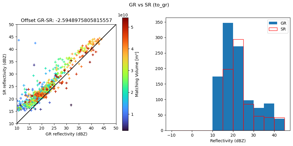
[70]:
fig = plt.figure(figsize=(12, 5))
ax = fig.add_subplot(121, aspect="equal")
plt.scatter(ref_gr2sr_m, ref_sr_m, marker="+", c=volcol, cmap="turbo")
plt.colorbar(label="Matching Volume [m³]")
plt.plot([0, 60], [0, 60], linestyle="solid", color="black")
plt.xlim(10, 50)
plt.ylim(10, 50)
plt.xlabel("GR reflectivity (dBZ)")
plt.ylabel("SR reflectivity (dBZ)")
plt.title(f"Offset GR-SR: {np.nanmedian(ref_gr2sr_m.values - ref_sr_m.values.ravel())}")
ax = fig.add_subplot(122)
plt.hist(
ref_gr2sr_m[ref_gr2sr_m > 10],
bins=np.arange(-10, 50, 5),
edgecolor="None",
label="GR",
)
plt.hist(
ref_sr_m[ref_sr_m > -10],
bins=np.arange(-10, 50, 5),
edgecolor="red",
facecolor="None",
label="SR",
)
plt.xlabel("Reflectivity (dBZ)")
plt.legend()
fig.suptitle("GR (to_sr) vs SR")
[70]:
Text(0.5, 0.98, 'GR (to_sr) vs SR')